| 
| |
|
|
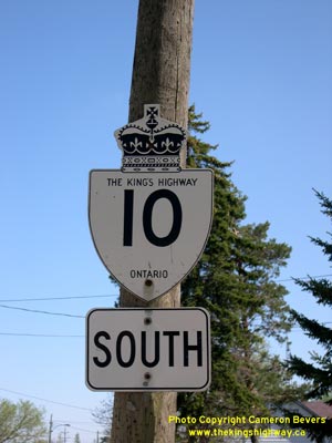
History of King's Highway 10:
King's Highway 10 is a major arterial highway which links the Greater Toronto Area with Orangeville and Owen Sound. The highway traverses a mostly rural portion of
Southern Ontario, occasionally passing through some cities and small towns. The principal towns located along the highway are Caledon, Orangeville, Shelburne, Dundalk,
Flesherton, Markdale, Chatsworth and Owen Sound. The history of Highway 10 dates back to 1920, when the Department of Public Highways of Ontario (DPHO) assumed the
Cooksville-Chatsworth Road as a new Provincial Highway. Preliminary Route Plans were prepared in June and August 1920, showing the proposed route of the new
Provincial Highway in Peel, Dufferin and Grey Counties. The DPHO acquired the route in Dufferin County on July 8, 1920, when the existing road from Orangeville to
Shelburne and part of the Sydenham Road from Shelburne to the Grey County Boundary was assumed as a new Provincial Highway. On July 22, 1920, the DPHO assumed a section
of Hurontario Street between Cooksville and Orangeville as a Provincial Highway. The remaining section of the Sydenham Road within Grey County from north of Shelburne
to Chatsworth was assumed by the DPHO on October 6, 1920. The new Cooksville-Chatsworth Highway was extended south to Port Credit the following year. A Preliminary
Route Plan was prepared on February 11, 1921, showing an extension of the Provincial Highway from Cooksville to Port Credit. The DPHO assumed ownership of Hurontario
Street between Cooksville and Port Credit on March 16, 1921. Sections of the road passing through Port Credit, Brampton, Orangeville, Shelburne, Flesherton, Markdale
and Chatsworth were not assumed by the DPHO and thus those sections of the route remained under municipal jurisdiction. The entire Port Credit-Chatsworth Highway was designated as Provincial Highway 10 when route numbers were first assigned in Ontario in 1925. The route of Highway 10 was also signed concurrently with Highway 6 between Chatsworth and Owen Sound. This resulted in an overlapped route of these two highways for a distance of approximately 13 km. It is also believed that the routes of Highway 7 and Highway 10 were signed concurrently between Port Credit and Brampton briefly in the mid-1920s, although this has not yet been confirmed. If it did exist, the overlapped route of Highway 7 and Highway 10 from Brampton to Port Credit was very short-lived, since Highway 7 was extended from Brampton easterly to Highway 12 in Brooklin in 1927. The route of Highway 10 was originally 105 miles (169 km) in length. Provincial Highway 10 was renamed King's Highway 10 in 1930. At the time of assumption in 1920-1921, Highway 10 was a gravel-surfaced highway for its entire length. Paving work began on Highway 10 in 1923, when the section of the highway from Port Credit to Cooksville was paved along with the section from Chatsworth to Owen Sound. Paving was completed between Cooksville and Brampton in 1925. Paving operations generally progressed northwards from Brampton throughout the latter half of the 1920s. The final gaps in the pavement near Caledon and Orangeville were paved in 1929, which completed a continuous paved highway from Port Credit to Dundalk. Paving the section of Highway 10 from Dundalk to Chatsworth began in 1931. The final gravel section on Highway 10 was paved over in 1938, when a 4 1/2 mile section of concrete pavement was constructed between Holland Centre and Chatsworth. Canada's first grade-separated full cloverleaf interchange was completed in Port Credit at the junction of Highway 10 and the Middle Road Highway (later known as the Queen Elizabeth Way) in 1937. The route of Highway 10 changed very little throughout most of the 20th Century. Several small diversions were built to bypass dangerous curves in a few locations and to eliminate unnecessary at-grade railway crossings. The route of Highway 6 & Highway 10 was changed through Owen Sound over the years. Originally, Highway 6 & Highway 10 entered Owen Sound along 9th Avenue, then turned west onto 6th Street, and then turned north again on 2nd Avenue. The two highways then ended at 10th Street (Highway 21 & Highway 26). Starting in 1947, the Ontario Official Road Map began to show the route of Highway 6 & Highway 10 via 3rd Avenue. It is believed that this may have been part of a signed truck route, as Highway 6 & Highway 10 was still being signed via 2nd Avenue until the least the late 1950s. Ontario Motor League publications also showed Highway 6 & Highway 10 via 2nd Avenue right up until the 1960s. This rather circuitous downtown route of Highway 6 & Highway 10 was eliminated in 1967, when the highways were rerouted along 9th Avenue, right up to 10th Street. The new route for Highway 6 & Highway 10 along 9th Avenue provided a more direct connection to Highway 26. A bypass was built around Orangeville in the early 1970s. The old route of Highway 10 through Downtown Orangeville via Broadway and First Avenue became Highway 10B for a number of years. Several sections of Highway 10 were transferred to the Cities of Mississauga and Brampton during the 1970s and 1980s. On April 1, 1970, the section of Highway 10 from the Port Credit Railway Subway (the former limits of the Town of Port Credit) northerly to Burnhamthorpe Road was transferred to the City of Mississauga. This was followed by the transfer of Highway 10 from Steeles Avenue to Etobicoke Creek to the City of Brampton on December 10, 1970. The rest of the route of Highway 10 within the City of Mississauga was transferred during the 1980s. The section of Highway 10 from Burnhamthorpe Road northerly to the Highway 401 Interchange was transferred on April 22, 1982. The remainder of Highway 10 within the City of Mississauga from the Highway 401 Interchange northerly to Steeles Avenue was transferred on February 7, 1986. Highway 10 was also transferred from the former Town of Brampton Limits near Williams Parkway northerly to the Highway 7 (Bovaird Drive) Junction on February 7, 1986. The final provincially-owned section of Highway 10 lying within the City of Brampton from Highway 7 (Bovaird Drive) northerly to the City Limits near Snelgrove was transferred to the City of Brampton effective December 4, 1996. As a result of these highway transfers, the route of Highway 10 was reduced in length by approximately 29 km. The former sections of Highway 10 through Brampton and Mississauga are now known as Hurontario Street. The highway currently ends at the Highway 410 Interchange just north of Brampton. The southern section of Highway 10 from Brampton to Orangeville is now a continuous four-lane undivided highway. The last two-lane section between Caledon Village and Highway 9 was widened to four lanes during a major reconstruction project carried out in 2008 and 2009. Highway 10 is a four-lane undivided highway from Orangeville northerly for about 10 km to Camilla and from Primrose to Shelburne The remaining section of Highway 10 from Shelburne to Owen Sound is generally two lanes, with some short undivided four-lane sections near towns. Passing lanes appear periodically along Highway 10 from Orangeville to Owen Sound. Services along Highway 10 are generally quite plentiful, except in some of the rural areas between Shelburne and Owen Sound, where services are somewhat scarce outside of communities. The speed limit on Highway 10 is 80 km/h (50 mph), unless posted otherwise. Please visit the Highway 10 Mileage Chart page for a list of mileage reference points along Highway 10. Winter Driving Tip: The northern sections of Highway 10 are known for poor winter road conditions. The highway is sometimes closed during periods of poor winter weather between Shelburne and Owen Sound, due to blowing and drifting snow. Blowing snow will often result in zero-visibility conditions. The weather conditions on this highway can deteriorate very rapidly when snowsqualls blow in from nearby Lake Huron and Georgian Bay. On cold, windy days, it is a good idea to check the Ontario Ministry of Transportation's Winter Road Conditions and Road Closures reported on the Ontario 511 website before using Highway 10 between Shelburne and Owen Sound. 
 |
|---|
Additional Information About King's Highway 10:
King's Highway 10 - Route Information (At Scott Steeves' website: asphaltplanet.ca)
King's Highway 10 - A Virtual Tour (At Scott Steeves' website: asphaltplanet.ca) |
|---|
Links to Adjacent King's Highway Pages: 


Website contents, photos & text © 2002-2025, Cameron
Bevers (Webmaster) - All Rights Reserved / Contact Me |
|---|