History of King's Highway 17A (Alt.)
During the 1940s, the Department of Highways of Ontario (DHO) identified significant deficiencies on the existing route of Highway 17 between Ottawa and the Quebec
Boundary. The old highway was narrow, with some winding sections and steep grades. This highway was the only through route between Ottawa and Montreal at the time and
it was decided that a new highway corridor would be needed in the near future. In addition, the proposed Carillon Hydro Dam near Hawkesbury was going to flood a
portion of existing Highway 17 between Hawkesbury and Point Fortune, and thus that section would need to be rebuilt anyway. Work began in the 1940s on two separate
projects to build the road that would ultimately form Highway 17A (Alt.). In 1946, construction began on the Lougueuil Diversion, which would provide a bypass for
Highway 17 on the western approach to L'Orignal. This diversion was completed and paved in 1947. In 1948, construction began on the western section of King's Highway
17A (Alt). This work was essentially a relocation of existing Highway 17 from Green's Creek, located 3 km east of Ottawa, easterly to the Ontario-Quebec Boundary. The
new highway was built on a new alignment wherever possible in order to minimize entrances and thereby create a limited-access highway. Grading work was 85% completed
by the end of 1948 between Green's Creek and a point just east of Orleans. In 1949, construction work was extended past Orleans on the relocation of Highway 17. The
18 km diversion of Highway 17 was completed from Green's Creek to Cumberland in late 1949. In 1950, work on the relocated Highway 17 was continued easterly from
Cumberland to Rockland. By 1951, grading work on the Highway 17 Diversion had commenced between Rockland and Plantagenet and the new Highway 17 Diversion was
completed from Cumberland to Rockland. The entire Highway 17 Diversion was paved from Green's Creek to Rockland in 1952 and from Rockland to Wendover in 1953. By the
end of 1953, about 40 km of Highway 17 had been relocated between Ottawa and Plantagenet. By the end of 1954, the completed length of the relocated Highway 17 was
61.5 km. This work included the new Plantagenet Bypass which was completed in 1954.
The existing route of Highway 17 between Plantagenet and L'Orignal was fairly direct, so it was decided that a change in the alignment of this section of Highway 17
was not necessary. However, the Carillon Hydro Dam development at Point Fortune was proceeding quickly by the mid-1950s, and it was deemed necessary to realign the
rest of Highway 17 from L'Orignal to the Ontario-Quebec Boundary. Construction began on the relocation of Highway 17 near Hawkesbury in 1953. The new Highway 17
Diversion strategically bypassed Hawkesbury and L'Orignal. Paving was completed on the Highway 17 Diversion between L'Orignal and the Ontario-Quebec Boundary in 1956.
The completion of the Hawkesbury Bypass was the final project in the relocation of Highway 17 that had begun in 1946. The new highway provided a safer, more direct
limited-access route between Ottawa and Montreal.
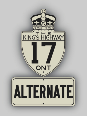
It is not certain if this road was ever signed as Highway 17A. It is possible that the DHO signed this highway as "Highway 17" with an "ALT" or "Alternate" tab below
a Highway 17 route marker. The DHO did however make the distinction between the two routes on the Official Ontario Road Maps issued between 1955 and 1960. In addition,
DHO highway mileage tables and construction bulletins issued in the late 1950s make reference to both highways, which suggests that both routes were independently
signed. Reference to the Highway 17A (Alt.) designation first appeared in road construction bulletins issued by the DHO in April, 1955. However, it is possible that
the route number had been in use prior to that time. In 1955, Highway 17A (Alt.) had a reported mileage of 61.5 km. When the completion of the new extension into
Quebec (the Hawkesbury Bypass) in 1956, the relocated Highway 17 had a total length of 108.4 km. In 1960, the Trans-Canada Highway route was officially completed
across Ontario. To resolve the confusing highway numbering in Eastern Ontario, the DHO decided to renumber the route of Highway 17A (Alt.). The route was renumbered as
Highway 17. However, the old bypassed sections of Highway 17 were kept in the provincial highway system for several years thereafter. It is possible that the old
sections of Highway 17 were renumbered as Highway 17A (Alt.), which meant that the two roads essentially just swapped designations. This has not been confirmed,
however. The post-1960 length of Old Highway 17 was reported as being 92.1 km. This mileage is believed to include a section of Old Highway 17 that was bypassed by
the Ottawa Queensway in 1960. On April 1, 1969, all remaining portions of Old Highway 17 that were bypassed by Highway 17A (Alt.) were formally decommissioned. The new
through route constructed in the late 1940s and 1950s now forms the present day Highway 17. The original route of Highway 17 from Green's Creek to the Ontario-Quebec
Boundary is now known as Ottawa Road 34 (St. Joseph Boulevard), Old Montreal Road, McTeer Road, De La Baie Road, Laurier Street, Old Highway 17, Principale Street,
Prescott & Russell Road 26, Villeneuve Street, Prescott & Russell Road 4 (Main Street & Front Road) and Des Outaouais Road.

|