| 
| |
|
|
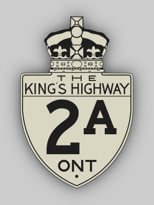
History of King's Highway 2A (Windsor):
King's Highway 2A was an alternate route to Highway 2 in Essex County that existed from 1929 until 1938. The route began very modestly in 1929, as a result of a route
renumbering. During 1929, a new cut-off route for Highway 2 was completed west of Maidstone, in order to provide a more direct connection to Windsor. Up until 1929,
Highway 2 turned south for 1.9 km at Maidstone and then turned right and ran westerly towards Windsor via Talbot Road, concurrently with Highway 3. The Highway 2
designation was briefly assigned to the new cut-off route between Maidstone and Windsor, while the short section of bypassed highway through Maidstone which lay
between the new Highway 2 cut-off and the existing route of Highway 3 became known as Highway 2A
(See Map). In 1930, another new provincial highway was commissioned in the Windsor area. This new highway between Tilbury and Windsor was initially known as Highway 18, which was first assumed by the province on June 11, 1930. This new highway was intended to serve as an alternate route to Highway 2 between Tilbury and Windsor. However, the new route of Highway 18 was far more direct than Highway 2. The Department of Highways of Ontario (DHO) quickly decided to renumber Highway 18. On December 16, 1931, a new route for Highway 18 was established from Windsor southerly to Amherstburg and easterly to Leamington. A major route renumbering of the two Windsor-Tilbury Highways immediately ensued. The original route of Highway 18 was renumbered as Highway 2, and the old route of Highway 2 became Highway 2A (See Map). The old route of Highway 2A through Maidstone was in turn renumbered as Highway 3A. The new route of Highway 2A was 55 km in length. It was somewhat longer than the new Highway 2 route from Windsor to Tilbury. Following the 1931 highway renumbering in Essex County, the route of Highway 2A approached Windsor on Middle Road (today's Provincial Road). At Division Road, Highway 2A merged with Highway 2 and the two highways continued on a concurrent route up to Howard Avenue. Originally, Highway 2 & Highway 2A continued northwesterly along Howard Avenue into the City of Windsor. At Tecumseh Road, Highway 2 & Highway 2A turned left and then turned right onto Ouellette Avenue, concurrently with Highway 3B. These three highways all ended at the Detroit-Windsor Tunnel in Downtown Windsor. A slight change was made to the route of Highway 2A approaching Windsor in 1937. In an apparent effort to balance out traffic on the various highways entering Windsor, the DHO assumed jurisdiction over the Michigan Central Side Road (today's South Cameron Boulevard) between Howard Avenue and Dougall Avenue (Highway 3B). A Preliminary Route Plan was prepared by the DHO in June 1937, which showed the proposed assumption of the existing Michigan Central Side Road as a new King's Highway. The DHO acquired jurisdiction over the Michigan Central Side Road on August 25, 1937, and designated the road as a new route for Highway 2A. Following the assumption of the Michigan Central Side Road, Highway 2A parted ways with Highway 2 at Howard Avenue & Division Road, turned left (south) onto Howard Avenue and crossed the Michigan Central Railway. Highway 2A then turned right onto Michigan Central Side Road (today's South Cameron Boulevard) and joined Highway 3B at Dougall Avenue, just south of the City of Windsor limits. The former junction of Highway 2A and Highway 3B was largely obliterated during construction of the E.C. Row Expressway in the 1970s and early 1980s. Highway 2A then continued northwesterly into the City of Windsor via Dougall Avenue, concurrently with Highway 3B. The revised route of Highway 2A reconnected to Highway 2 at the intersection of Tecumseh Road & Ouellette Avenue. In order to further simplify highway numbering in the Windsor area, the DHO decided to renumber the entire route of Highway 2A from Windsor to Tilbury as Highway 98 during 1938 (See Map). The Highway 2A designation was removed from service, although a different, unrelated Highway 2A was established east of Toronto in 1947.  |
|---|
Links to Adjacent King's Highway Pages: 


Website contents, photos & text © 2002-2025, Cameron
Bevers (Webmaster) - All Rights Reserved / Contact Me |
|---|