| 
| |
|
|
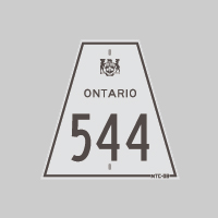
History of Secondary Highway 544:
Secondary Highway 544 was at one time the Sudbury area's most important and longest secondary highway. Highway 544 once connected several mining communities northwest
of Sudbury to Highway 17 & Highway 69 in Downtown Sudbury. The Sudbury-Levack Road and the Cartier Road were first designated as Highway 544 by an
Order-in-Council dated May 9, 1956. A Preliminary Route Plan was prepared by the Department of Highways of Ontario (DHO) in May 1956, which showed the 56-mile (90 km)
route of Highway 544 from Sudbury to the Geneva Lake Mine, located north of Cartier. Along the way, Highway 544 passed through Azilda, Chelmsford, Dowling, Onaping
and Cartier. A short spur highway branched off of Highway 544 near Onaping which led into Levack. It is believed that this short spur to Levack was originally signed
as Highway 544, but the spur highway was later renumbered as Highway 544A. Significant portions of the
route of Highway 544 were incorporated into the present-day route of Highway 144. The majority of Highway 544 was already paved at the time the route was designated
in the 1950s. Highway 544 was paved from the Highway 17 Junction in Downtown Sudbury to Larchwood even prior to the highway's designation in 1956. Highway 544 was
paved from Larchwood to Levack in 1958. Substantial sections of Highway 544 were relocated over the years. As originally designated, Highway 544 departed from Sudbury on Spruce Street and extended northwesterly across the International Nickel Company (INCO) property towards Murray Mine. A fairly substantial diversion was constructed from a point southeast of Murray Mine to Azilda in the late 1950s. The new Murray Mine-Azilda Diversion was completed in 1957 and was paved in 1958. The old route of Highway 544 leading into Murray Mine (today's Holmes Avenue) and the now-abandoned highway from Murray Mine to the eastern end of Gagnon Street in Azilda was legally closed by an Order-in-Council, effective December 21, 1960. The section of Old Highway 544 via Gagnon Street was kept open to traffic, as it served as an access route to a small community along the railway immediately east of Azilda. Jurisdiction over Gagnon Street (Old Highway 544) was transferred from the DHO to the Township of Rayside, effective April 1, 1964. As originally designated in 1956, the entire route of Highway 544 lying west of the western limits of Sudbury was under the jurisdiction of the DHO. However, the section of Highway 544 lying east of the Sudbury City Limits at Gilman Street was under municipal jurisdiction. During the mid-1960s, the City of Sudbury expanded its municipal limits by annexing several neighbouring townships, including the Township of McKim. As a result of this expansion, jurisdiction over the section of Highway 544 lying within the former Township of McKim was transferred from the DHO to the City of Sudbury, effective April 1, 1966. This transferred section extended from where Highway 544 crossed the old city limits at Spruce Street and Gilman Street to the new city limits at the Snider-McKim Township Boundary, northwest of Murray Mine. The non-assumed section of Highway 544 within the City of Sudbury was designated as a Municipal Connecting Link by an Order-in-Council, effective June 23, 1966. The Municipal Connecting Link Route entered Sudbury on Spruce Street, turned north briefly at Regent Street, and then continued into Downtown Sudbury via Elm Street. Highway 544 ended at the intersection of Lorne Street and Elm Street (Highway 17 & Highway 69). During the 1970s, the municipality carried out an extensive relocation of the non-assumed portion of the highway northwest of Sudbury and constructed a new interchange at LaSalle Boulevard. Due to ongoing mining operations in the area, the route of Highway 544 between Sudbury and Azilda, as it existed during DHO's period of ownership from 1956 to 1966, has now been almost entirely bypassed or abandoned. Only 3 km of the original highway lying immediately east of Azilda is still in use today, along with the short sections of the former highway which passed through the built-up areas immediately west of Downtown Sudbury (Regent Street, Elm Street and Spruce Street). Between Azilda and Cartier, a handful of significant diversions were built along Highway 544, along with a few short diversions at curves and bridges. A fairly significant diversion was built southwest of Dowling in 1957, which bypassed a section of the original route of Highway 544. Jurisdiction over a former loop of Highway 544 through Dowling (Main Street West) and a now-abandoned section of the highway lying southwest of Dowling were both transferred from the DHO to the Township of Dowling, effective April 1, 1963. A new diversion was built for Highway 544 around Onaping and from Windy Lake to Cartier during the 1960s. Jurisdiction over a former loop of Highway 544 through Onaping (today's Onaping Drive) was transferred from the DHO to the Corporation of the Improvement District of Onaping, effective October 19, 1968. An old section of Highway 544 (Old Cartier Road) northwest of Windy Lake was also bypassed once the new Windy Lake-Cartier Diversion was completed and opened to traffic in 1964. In 1964, construction got underway on the new Sudbury-Timmins Highway. This new highway was originally anticipated to be an extension of Highway 544, but during the Summer of 1965, the DHO decided that the route would be designated as a King's Highway known as Highway 144. On November 18, 1965, an Order-in-Council was signed which legally re-designated the existing route of Highway 544 from the Snider-McKim Township Boundary (the revised Sudbury City Limits) to the small railside community of Benny as Highway 144. The rest of the proposed Sudbury-Timmins Highway from Benny northerly to the Highway 101 Junction near Timmins was also designated as Highway 144. As a result of the highway renumbering, other area highways also had their route numbers changed. Rather than retire the Highway 544 route number, the existing route of the Levack Spur (Highway 544A) between the Highway 144 Junction and Levack was renumbered as Highway 544. Once this route number change had been made, the DHO sought to remove the Highway 544 designation from other bypassed loops of Highway 544 lying northwest of Onaping. The old route of Highway 544 from the junction of the proposed Sudbury-Timmins Highway near Benny to the Geneva Lake Mine was legally closed to traffic by an Order-in-Council, effective July 27, 1965. The old route of Highway 544 (Old Cartier Road) between Windy Lake and Cartier was assigned an unposted 7000-series designation (Highway 7044). The bypassed section of Highway 544 leading into Benny was also assigned an unposted 7000-series designation (Highway 7140). The old Highway 544 loop through Cartier via Main Street, Spencer Avenue and Centre Street had its provincial highway designation revoked by an Order-in-Council, effective June 1, 1972. The former route of Highway 544 through Cartier is now maintained by a Local Roads Board. The 3.4 km Levack Spur Highway was operated by the DHO as Highway 544 for a few years following the completion of the Sudbury-Timmins Highway. The unassumed section of Highway 544 within the municipal limits of Levack was designated as a Municipal Connecting Link by an Order-in-Council, effective November 18, 1971. The Municipal Connecting Link Route of Highway 544 began at the town limits south of the Onaping River Bridge and continued north along Nickel Street to 3rd Avenue. At 3rd Avenue, Highway 544 turned right and ended at Main Street (today's Levack Drive). The revised route of Highway 544 existed up until 1974, when the entire highway was transferred to the newly-formed Regional Municipality of Sudbury on May 1, 1974. The road is known today as Sudbury Road 8. |
|---|
Links to Adjacent Secondary Highway Pages: Website contents, photos & text © 2002-2025, Cameron
Bevers (Webmaster) - All Rights Reserved / Contact Me |
|---|