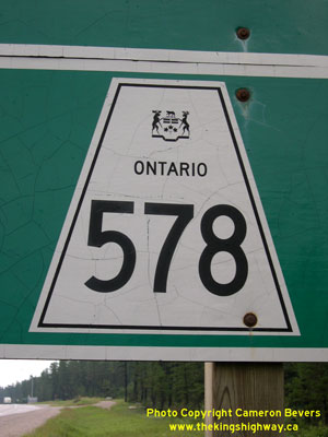
History of Secondary Highway 578:
Secondary Highway 578 was a local highway in the District of Cochrane that linked Highway 11 at Nellie Lake with Iroquois Falls. Highway 578 was first designated by
an Order-in-Council dated May 9, 1956. The route, which had been known previously as the Nellie Lake Road, was first depicted on a Preliminary Route Plan prepared by
the Department of Highways of Ontario (DHO) in May 1956. The highway was gravel-surfaced at the time of designation in 1956, but a primed bituminous surface was
constructed along the entire length of Highway 578 during 1958. Initially, Highway 578 was 5 miles (8.1 km) in length. The route began at Highway 11 at Nellie Lake
and ended at the western limits of the Town of Iroquois Falls.
As originally assumed in 1956, the DHO did not own the section of Highway 578 through Iroquois Falls via Montrock Road (today's Anson Drive). This section of the
route remained under municipal jurisdiction. A Municipal Connecting Link was established for Highway 578 through the Township of Calvert and Town of Iroquois Falls in
1959. From the end of Highway 67 (Cambridge Avenue), Highway 578 extended west via Montrock Road (today's Anson Drive) to join the assumed section of Highway 578 at
the western town limits. This route was officially designated as a Municipal Connecting Link by an Order-in-Council, effective August 27, 1959. The Municipal
Connecting Link was modified slightly in the early 1970s, after the section of Highway 578 from Victoria Road westerly for 1/4 mile was transferred from the province
to the Township of Calvert, effective April 1, 1970. This transferred section of Highway 578 was added to the Municipal Connecting Link through Iroquois Falls,
effective June 11, 1970. The Municipal Connecting Link through Iroquois Falls remained in existence up until the late 1990s, when it was revoked by a Minister's
Order, effective November 9, 1998.
Apart from some minor realignments, the route of Highway 578 did not change significantly until the late 1990s. On March 31, 1997, the entire provincially-owned
section of Highway 578 between the Highway 11 Junction at Nellie Lake and the urbanized limits of Iroquois Falls was transferred to the Town of Iroquois Falls. This
8.3 km decommissioned section of Highway 578 was survived briefly by the Municipal Connecting Link section of Highway 578 through Iroquois Falls, which remained
designated until late 1998. Since that time, Highway 578 has been known as Jacobs Hill Road and Anson Drive. Trucks are prohibited on Former Highway 578 between
Nellie Lake and Iroquois Falls. Unless posted otherwise, the speed limit on Highway 578 is 90 km/h (55 mph). Services are available in Iroquois Falls.
|