History of Secondary Highway 655:
Secondary Highway 655 provides an important access route between Timmins and Smooth Rock Falls. The highway was opened in several stages over a 14-year
period. On May 20, 1965, a 7 km section of the road leading north from Highway 101 towards the Texas Gulf Mine was designated as Highway 655. On September
29, 1966, the remainder of the access road leading up to the Texas Gulf Mine was designated as Highway 655 as well. The highway was then 21 km long, a
length which it retained for a number of years. In the 1970s, the Ministry of Transportation made plans to build an extension of Highway 655 from the Texas
Gulf Mine up to Highway 11 at Driftwood. Construction began on this highway in 1975, and it was completed and opened to traffic in 1978. The highway is
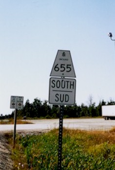
presently 75 km long. Unless posted otherwise, the speed limit on Highway 655 is 90 km/h (55 mph). Highway 655 is the only Secondary Highway in Ontario to
have a speed limit in excess of 80 km/h. Warning: There are no gas stations along Highway 655.
|