Hwy 69B Sign Graphic Hwy 69B Title Graphic Hwy 69B Sign Graphic   

Ontario Highway 69B Quick Facts:
  • Years in Existence: 1961-1989
  • Current Status: Decommissioned
  • Current Names: Bowes Street, Seguin Street, Church Street & Joseph Street
  • Location: Central Ontario
  • Districts Served: Parry Sound
  • Towns Served: Parry Sound
  • Southern Terminus: Hwy 69 - South of Parry Sound
  • Northern Terminus: Hwy 69 - North of Parry Sound
  • Length in 1989: 4.5 km / 2.8 miles
HWY 69B ROUTE MARKER
King's Highway 69B Sign
(Image © Josh Anderchek)

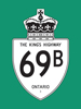
History of King's Highway 69B:

King's Highway 69B was created when the first Parry Sound Bypass across Mill Lake Narrows was opened to traffic in 1961. The old alignment of Highway 69 through Downtown Parry Sound became Highway 69B. The highway was 4.5 km in length. Most of this route was under municipal jurisdiction. During the late 1980s, construction began on a relocation of Highway 69 between Mill Lake Narrows and Nobel. Once this new Highway 69 route was completed, the old alignment of Highway 69 via Parry Sound Drive was going to be decommissioned as well. It was determined that the Highway 69B business loop was obsolete, since the highway's northern terminus would be discontinuous once the relocation of Highway 69 was completed in 1992. Accordingly, Highway 69B was decommissioned in 1989. Jurisdiction over the final provincially-owned section of Highway 69B south of Parry Sound (Bowes Street) was transferred to the Town of Parry Sound, effective September 18, 1989.


HYPERLINK TO HWY 69B ROUTE MAP PAGE - © Cameron Bevers             HYPERLINK TO HWY 69B PHOTOGRAPHS PAGE - © Cameron Bevers


Links to Adjacent King's Highway Pages:


HYPERLINK TO HWY 69 PAGE - © Cameron Bevers             HYPERLINK TO MAIN MENU PAGE - © Cameron Bevers             HYPERLINK TO HWY 70 (#1) PAGE - © Cameron Bevers


Website contents, photos & text © 2002-2023, Cameron Bevers (Webmaster) - All Rights Reserved  /  Contact Me


Valid HTML 4.01!   Valid CSS!