
| 
| |
|
|
This page contains historical and present day photos of Ontario's King's Highway 11B (North Bay Business Route). All
photographs displayed on this page were taken by the Webmaster (Cameron Bevers), unless specifically noted otherwise. Historical photographs are arranged in
approximate chronological order, while present day photographs (Year 2010 to date) are arranged by location from south to north. Click on any thumbnail to see a
larger image!
Please note that all photographs displayed on this
website are protected by copyright. These photographs must not be reproduced, published,
electronically stored or copied, distributed, or posted onto other websites without
my written permission. If you want to use photos from this website, please
email me first for permission. Thank-you!
|
|---|
|
Historical King's Highway 11B (North Bay) Photographs

Above - Overhead guide signs at the Hwy 11 & Hwy 11B Junction between Callander and North Bay in 1958. This overhead sign was installed at the southern end
of the North Bay Bypass, where motorists were presented with the choice of either bypassing North Bay or following the old route of Hwy 11 (the Hwy 11B Business Route)
through Downtown North Bay. It is believed that this was the very first overhead sign structure built by the Department of Highways of Ontario (DHO) in Northern
Ontario. See an Enlarged Photo Here. Photo taken on October 10, 1958. (Photo courtesy of Ontario Ministry of Transportation - © King's Printer for Ontario, 1958) 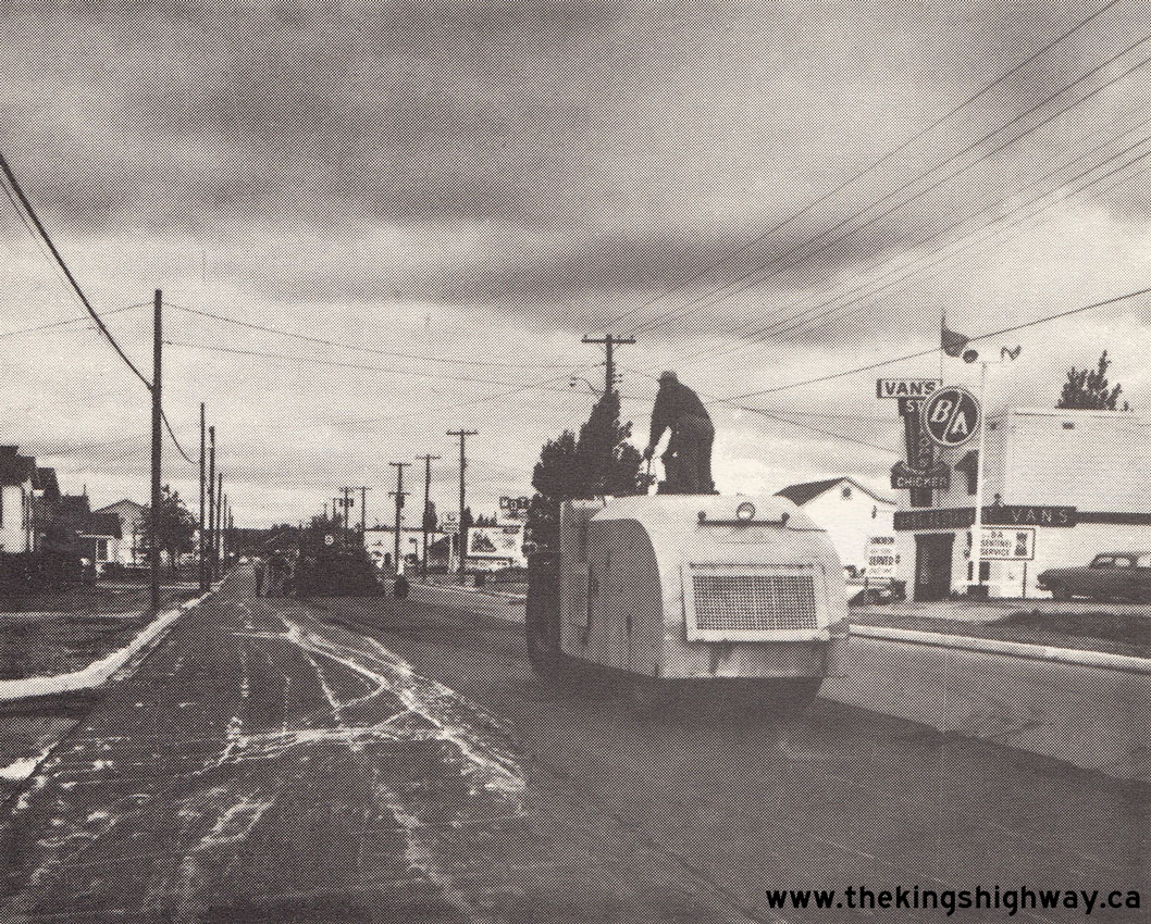
Above - Reconstruction and widening of Hwy 11B (Lakeshore Drive) approaching North Bay north of Jessop's Creek, Contract #1962-233. See an
Enlarged Photo Here. Photo taken in 1963. (Photo courtesy of Ontario Ministry of Transportation - © King's Printer for Ontario, 1963) 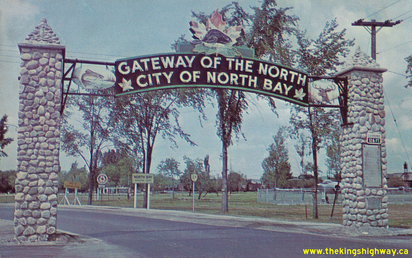
  Left - Circa 1963 postcard view of the North Bay Welcome Arch on Hwy 11B approaching Downtown North Bay. See an
Enlarged Photo Here. Left - Circa 1963 postcard view of the North Bay Welcome Arch on Hwy 11B approaching Downtown North Bay. See an
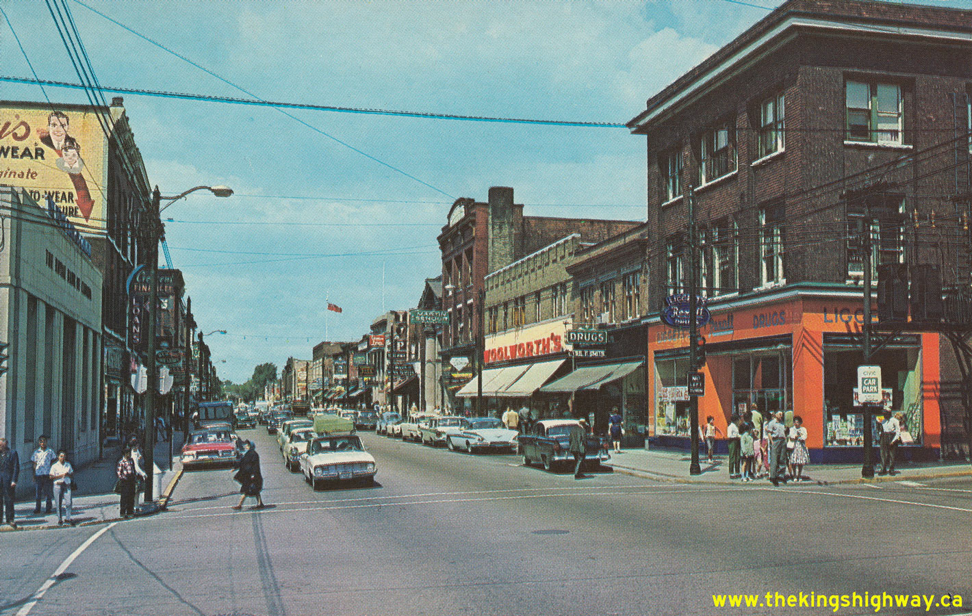
Enlarged Photo Here.(Photo courtesy of Len Leiffer) Right - Circa 1964 postcard view of Main Street (Hwy 11B & Hwy 17B), facing north from Ferguson Street in Downtown North Bay. See an
Enlarged Photo Here.(Photo courtesy of William R. Forder) 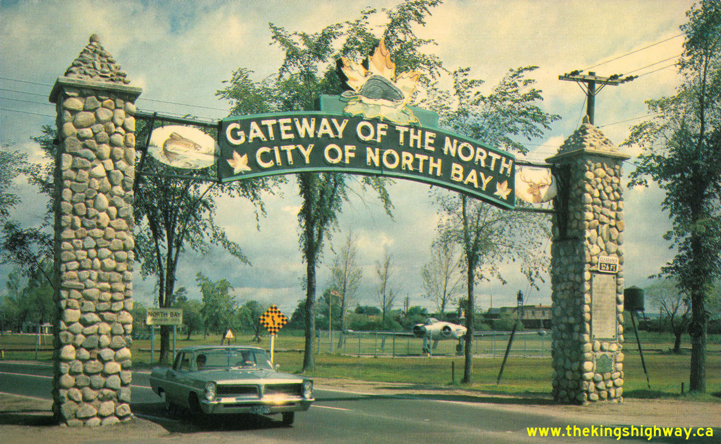
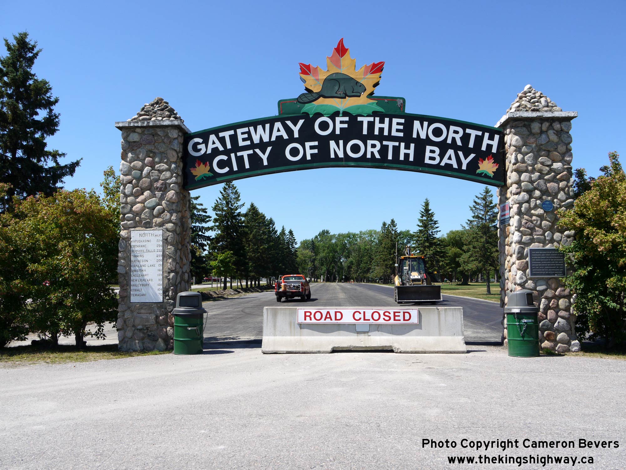
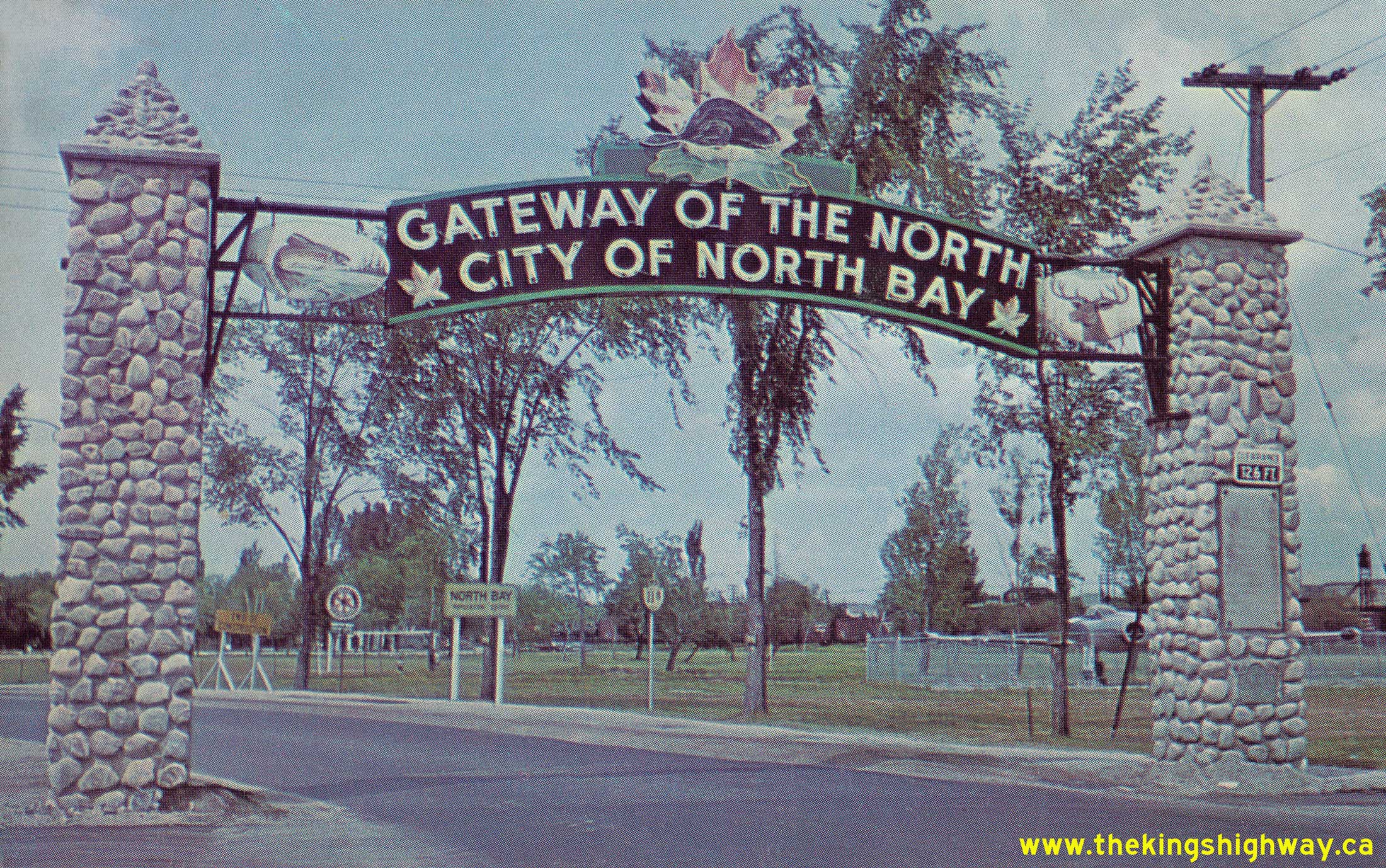
Left - North Bay Welcome Arch on Hwy 11B approaching Downtown North Bay in 1965. The overhead sign on the welcome arch reads "GATEWAY OF THE NORTH - CITY OF
NORTH BAY". At one time, all traffic entering North Bay from the south via Hwy 11 (later known as Hwy 11B) passed below this welcome arch. The arch still stands today
on an access road within Lee Park, although through traffic is now diverted around the arch on a revised alignment via Main Street. Careful observers will note that
the overhead sign forming the arch once boasted bright neon tube lettering so that the sign could be illuminated at night. See an
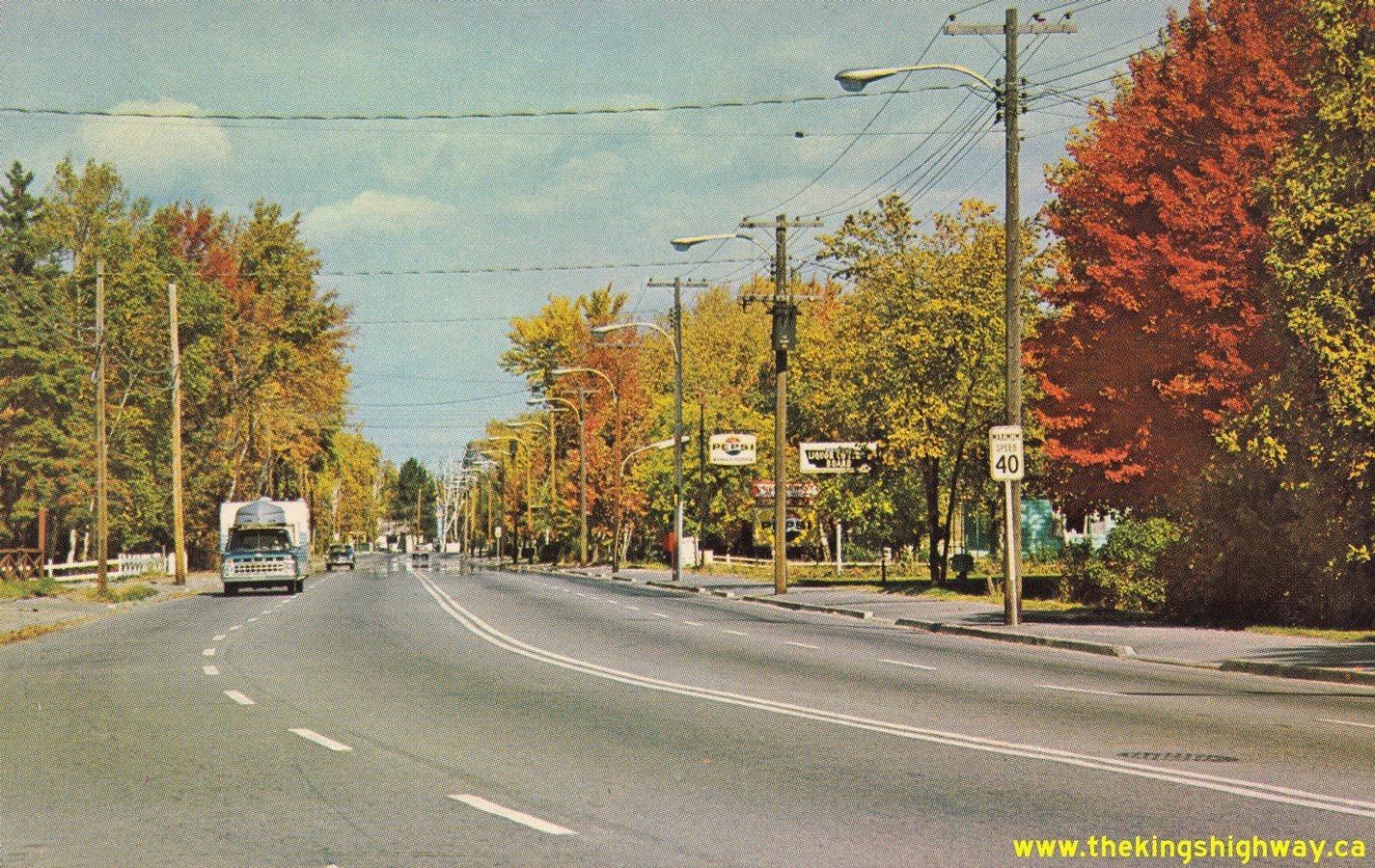
Enlarged Photo Here. Photo taken in 1965. (Photo courtesy of Preston R. Quirt) Right - Circa 1965 postcard view of a widened four-lane section of Hwy 11B (Lakeshore Drive) approaching North Bay from Callander. See an
Enlarged Photo Here.(Photo courtesy of William R. Forder) 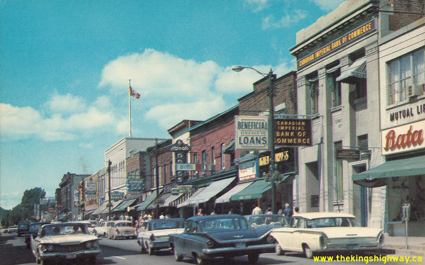 Above - Circa 1965 postcard view of Main Street (Hwy 11B & Hwy 17B) approaching Fraser Street in Downtown North Bay. During the 1970s, a new one-way street
system was introduced through the city centre, by which the route of Hwy 11B & Hwy 17B was split up by direction. Northbound traffic used McIntyre Street,
while southbound traffic used Oak Street. See an Enlarged Photo Here. Above - Circa 1965 postcard view of Main Street (Hwy 11B & Hwy 17B) approaching Fraser Street in Downtown North Bay. During the 1970s, a new one-way street
system was introduced through the city centre, by which the route of Hwy 11B & Hwy 17B was split up by direction. Northbound traffic used McIntyre Street,
while southbound traffic used Oak Street. See an Enlarged Photo Here.(Photo courtesy of Northern Toy & Novelty, Sudbury) 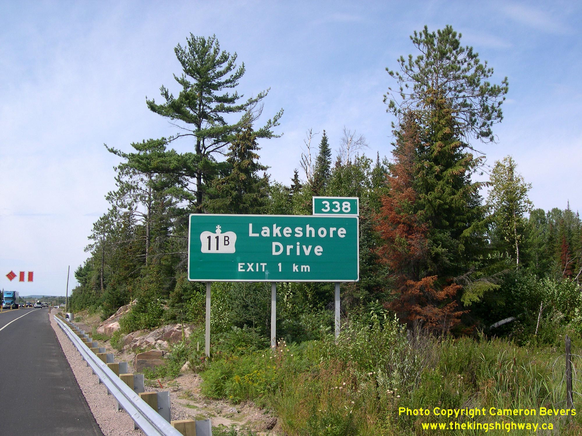
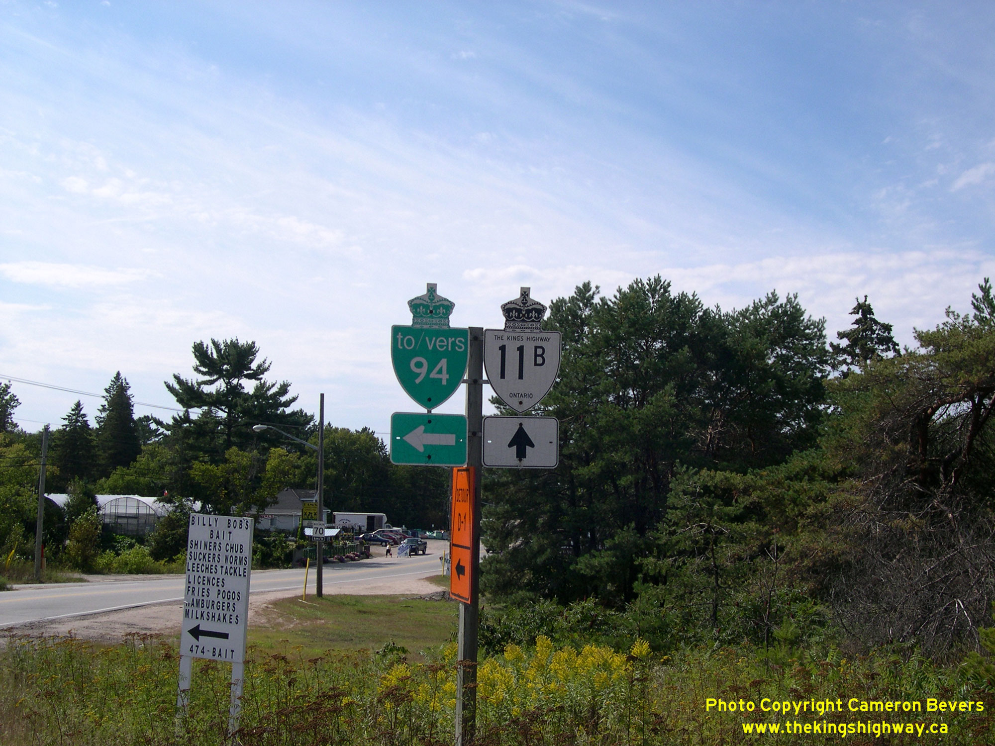
Left - Freeway guide sign marking the exit for Hwy 11B (Lakeshore Drive) on northbound Hwy 11 approaching North Bay. See an
Enlarged Photo Here. (Photograph taken on August 26, 2006 - © Cameron Bevers) Right - Hwy 11B and Hwy 94 trailblazer marker on Lakeshore Drive at Nipissing Junction between Callander and North Bay. See an
Enlarged Photo Here.(Photograph taken on August 26, 2006 - © Cameron Bevers) |
|---|
|
Present Day King's Highway 11B (North Bay) Photographs
Left - Eastern side of the Lavasse River Bridge (Site #43-104) on Hwy 11B (Lakeshore Drive) at Nipissing Junction between Callander and North Bay. See an
Enlarged Photo Here. (Photograph taken on July 20, 2012 - © Cameron Bevers) Right - Facing south along Lakeshore Drive (Hwy 11B) at the Lavasse River Bridge. The intersection lying just beyond the bridge is Pinewood Park Drive (Old Hwy 11). A bypass was constructed around North Bay in the early 1950s. When the bypass was first completed in 1953, it tied back into the original route of Hwy 11 at this intersection. In order to more clearly differentiate between the original route of Hwy 11 via Downtown North Bay and the new route of Hwy 11 via the North Bay Bypass, the DHO chose to renumber the Downtown North Bay route of Hwy 11 as Hwy 11B in 1958. Today, Lakeshore Drive meets the current freeway route of Hwy 11 at a grade-separated interchange about 350 metres ahead. See an Enlarged Photo Here. (Photograph taken on July 20, 2012 - © Cameron Bevers) 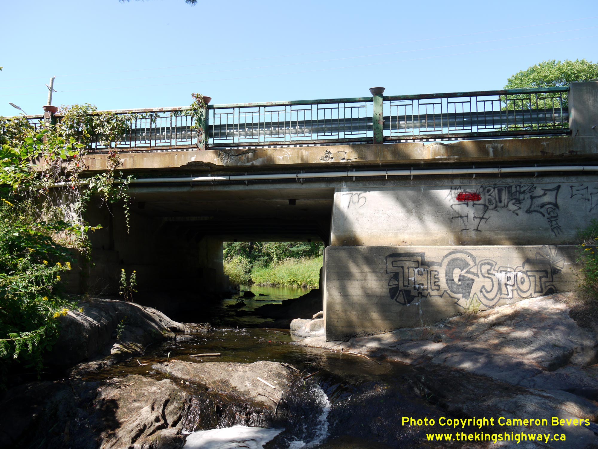
Left - Western side of the Lavasse River Bridge on Lakeshore Drive (Hwy 11B) at Nipissing Junction. Although it was initially built almost a century ago, the
Lavasse River Bridge on Hwy 11B was widened and completed to its current dimensions in 1963, under Contract #1962-142. See an
Enlarged Photo Here. (Photograph taken on July 20, 2012 - © Cameron Bevers) Right - Looking through the Lavasse River Bridge on Hwy 11B, observers will note that this bridge has been expanded several times since it was first built for the original Ferguson Highway (which later became Hwy 11) almost a century ago. These progressive expansions reflect the growing importance of the Hwy 11 corridor in the provincial highway system over the years. What started out as a winding gravel road in the 1920s has been upgraded to a four-lane divided freeway today. For early Ontario motorists, the journey from Toronto to North Bay was a full day's drive, and a rather challenging one at that. Thanks to decades of highway investments and improvements, this same journey can be completed rather comfortably today in about three hours. See an Enlarged Photo Here. (Photograph taken on July 20, 2012 - © Cameron Bevers) 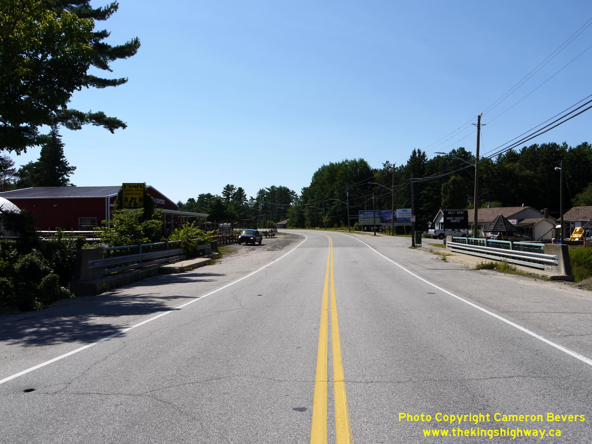
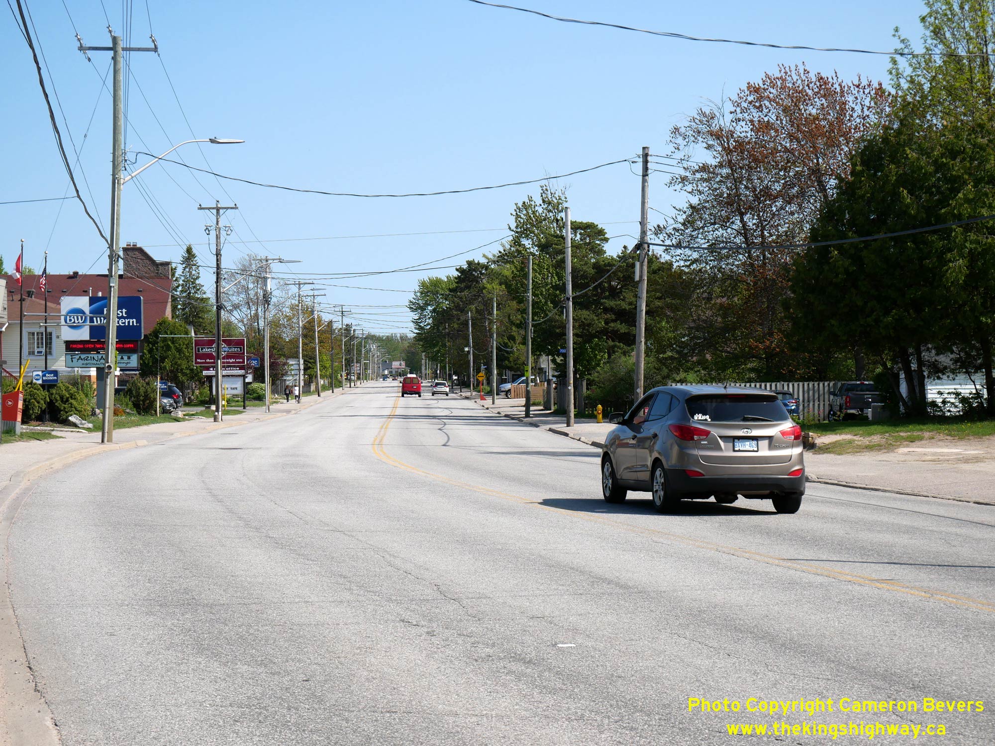
Left - Facing north along Lakeshore Drive (Hwy 11B) towards Downtown North Bay at the Lavasse River Bridge. See an
Enlarged Photo Here. (Photograph taken on July 20, 2012 - © Cameron Bevers) Right - Facing south along Lakeshore Drive (Hwy 11B) towards Callander from the Jessop's Creek Bridge. See an
Enlarged Photo Here.(Photograph taken on May 27, 2023 - © Cameron Bevers) 
 Left - Western side of the Jessop's Creek Bridge on Lakeshore Drive (Hwy 11B) in North Bay. See an
Enlarged Photo Here. Left - Western side of the Jessop's Creek Bridge on Lakeshore Drive (Hwy 11B) in North Bay. See an
Enlarged Photo Here.(Photograph taken on May 27, 2023 - © Cameron Bevers) Right - Jessop's Creek Bridge on Lakeshore Drive (Hwy 11B), facing north towards Downtown North Bay. See an
Enlarged Photo Here.(Photograph taken on May 27, 2023 - © Cameron Bevers) 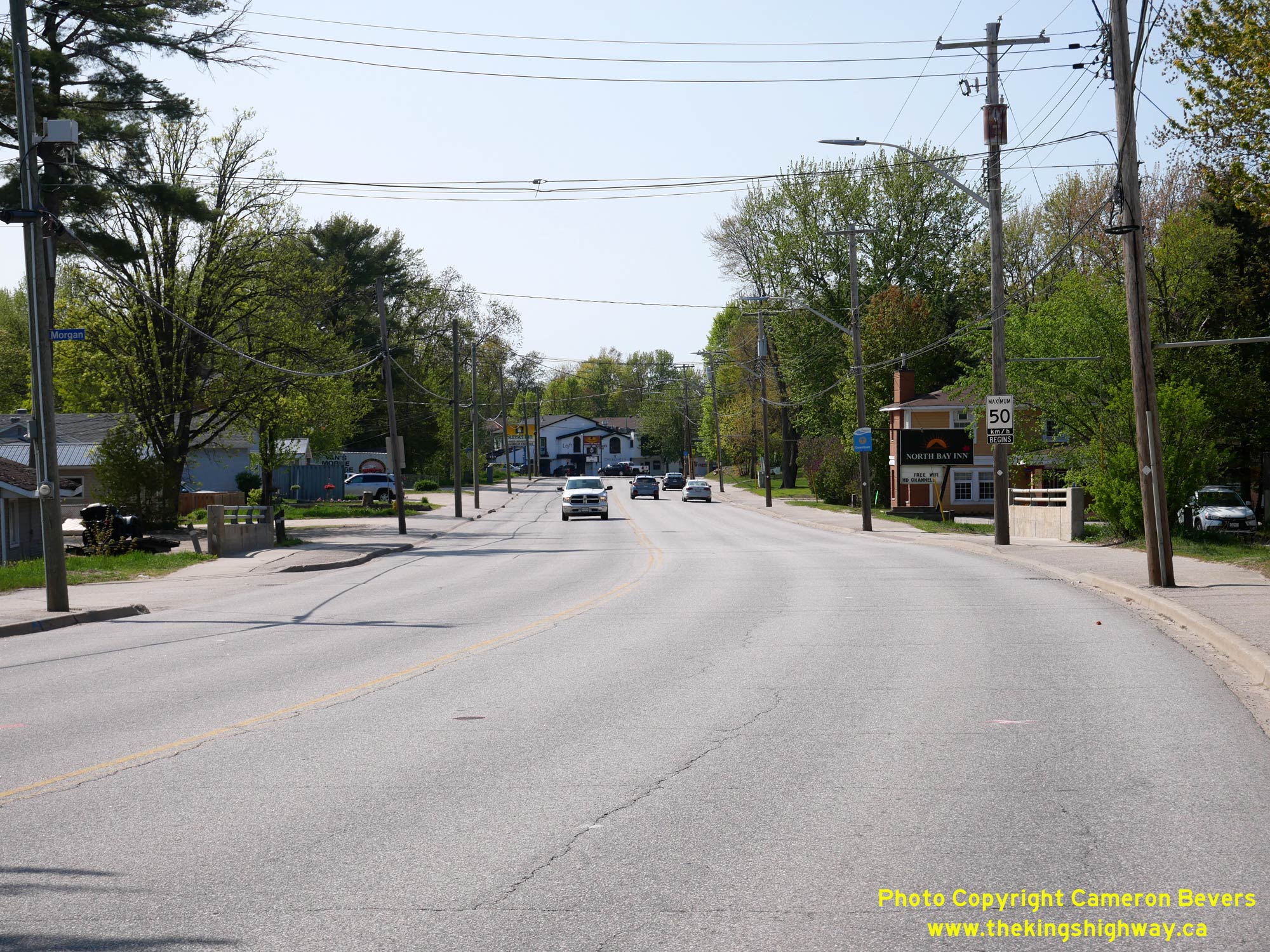
 Left - Jessop's Creek Bridge (Site #43-103), facing south along Lakeshore Drive (Hwy 11B) towards Callander. See an
Enlarged Photo Here. Left - Jessop's Creek Bridge (Site #43-103), facing south along Lakeshore Drive (Hwy 11B) towards Callander. See an
Enlarged Photo Here.(Photograph taken on May 27, 2023 - © Cameron Bevers) Right - Eastern side of the Jessop's Creek Bridge on Lakeshore Drive (Hwy 11B) in North Bay. Like other structures along this corridor, this was an older bridge
which was widened to its current dimensions during the four-lane expansion of Hwy 11B in 1962. See an
Enlarged Photo Here.(Photograph taken on May 27, 2023 - © Cameron Bevers) 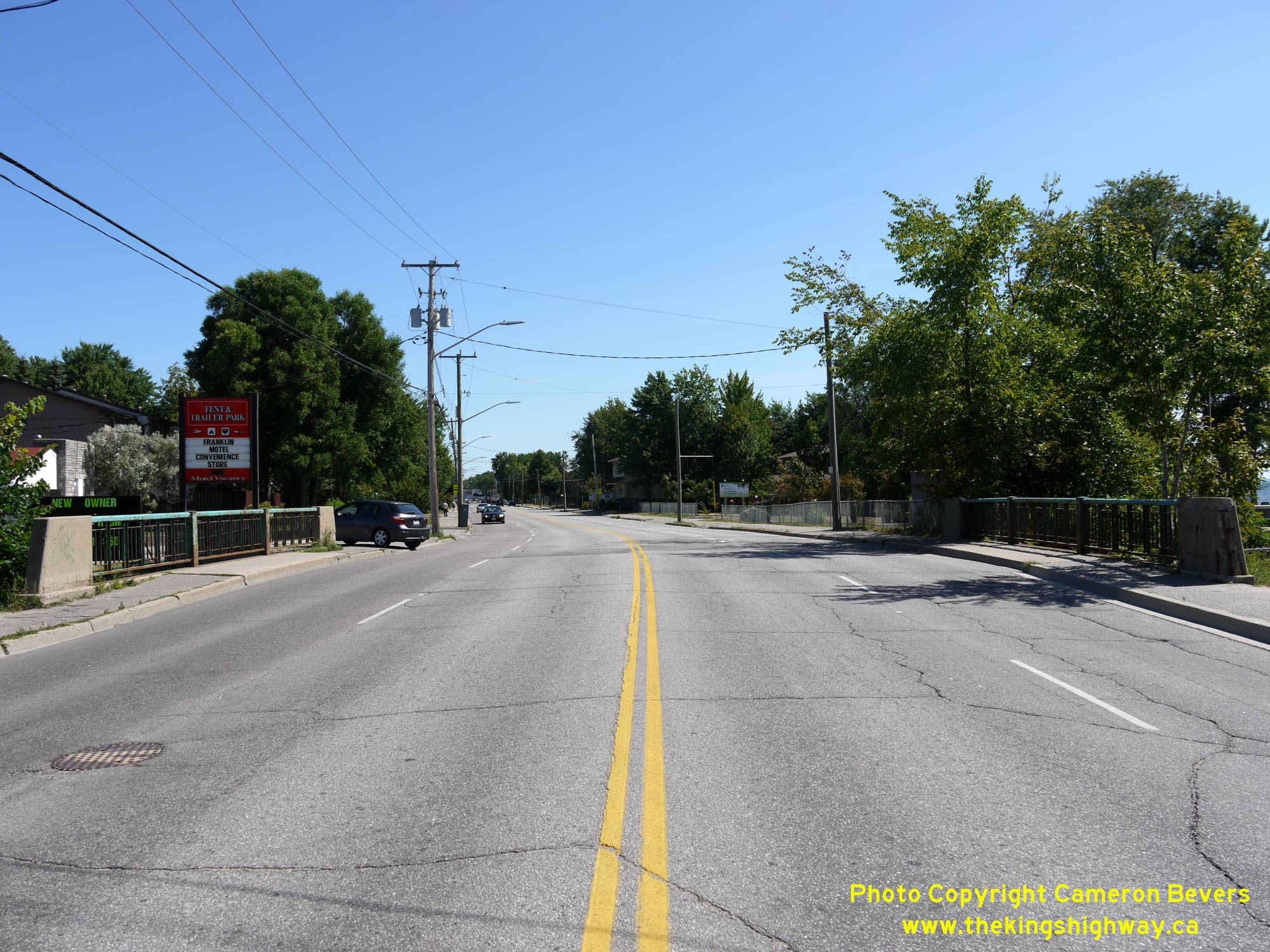
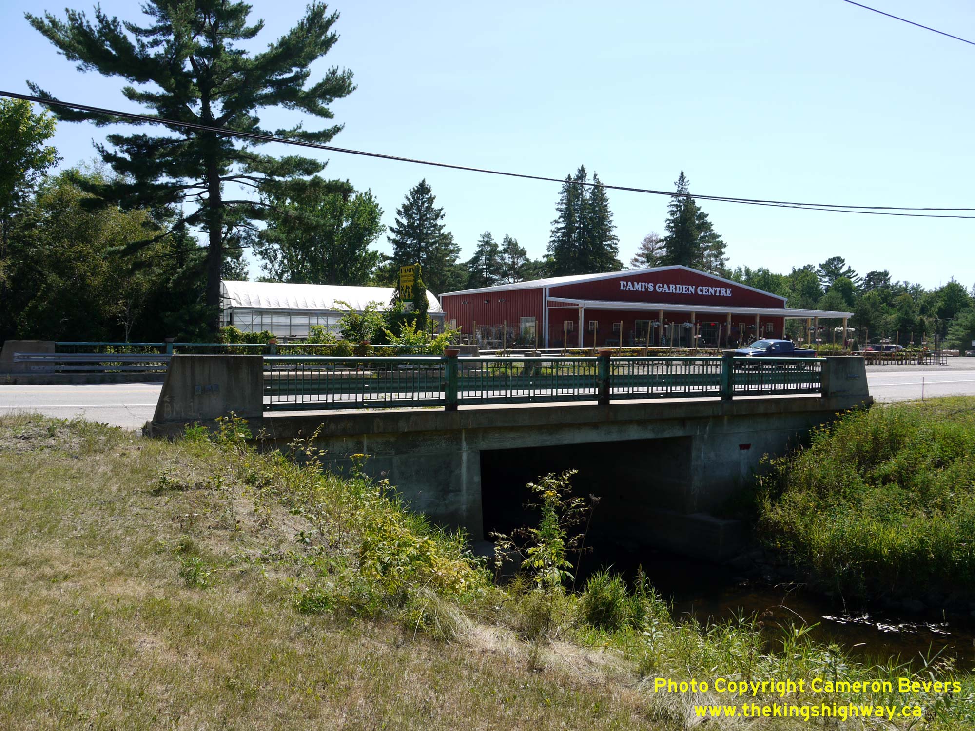
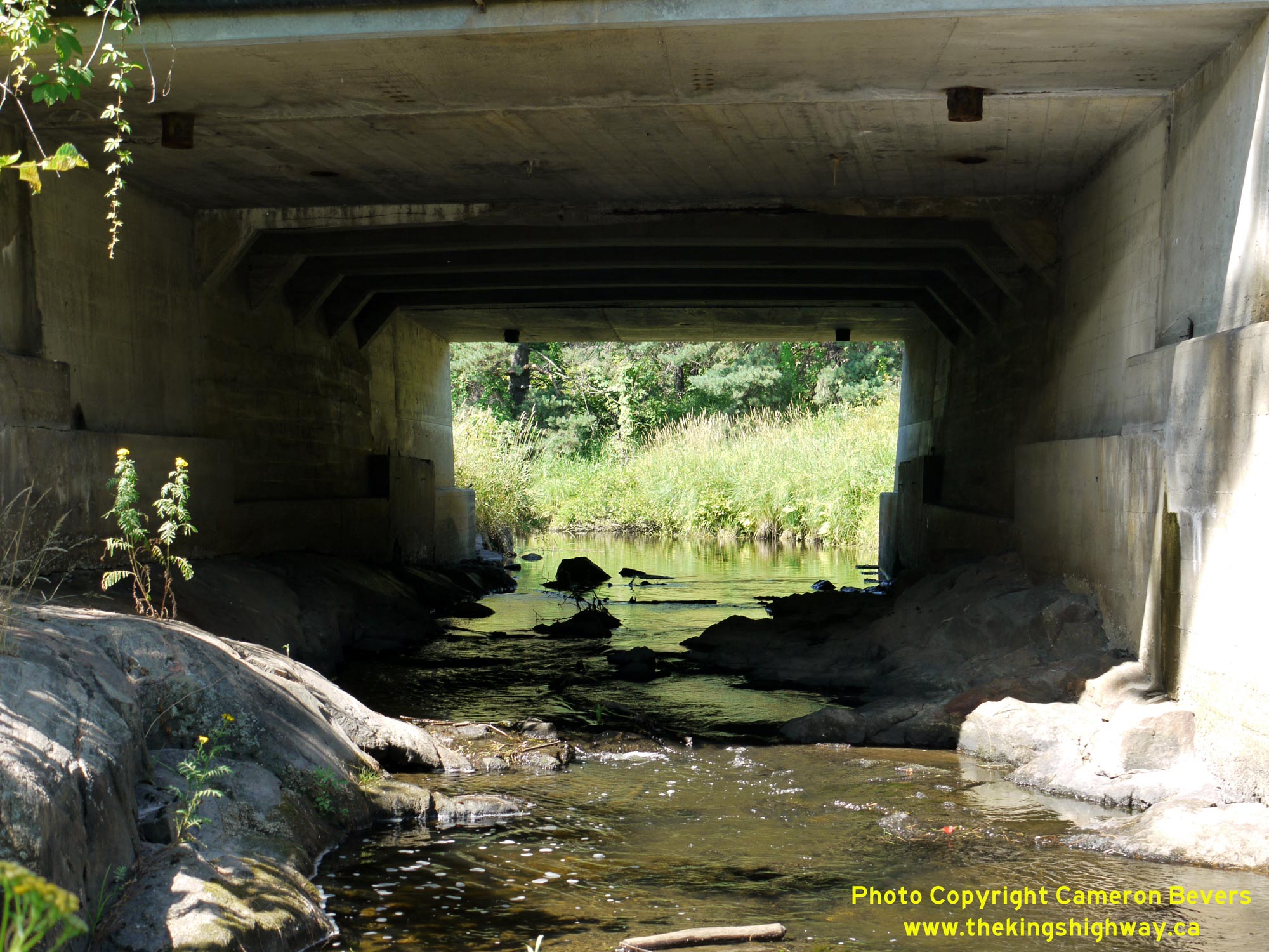
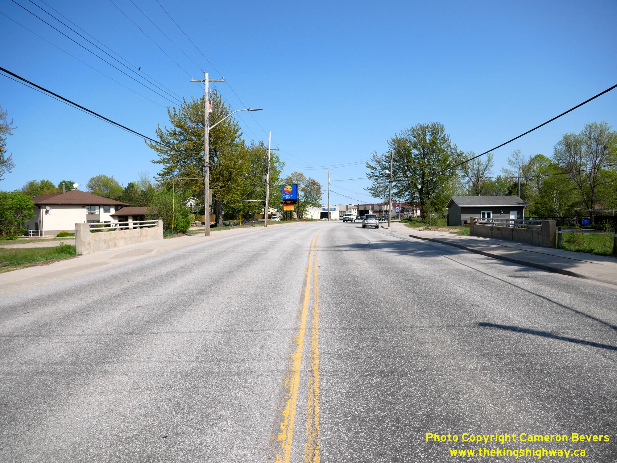
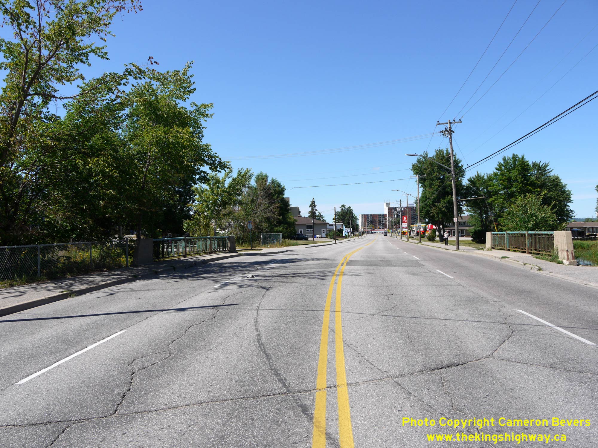
Left - Facing south along Lakeshore Drive (Hwy 11B) at the Parks Creek Bridge in North Bay. See an
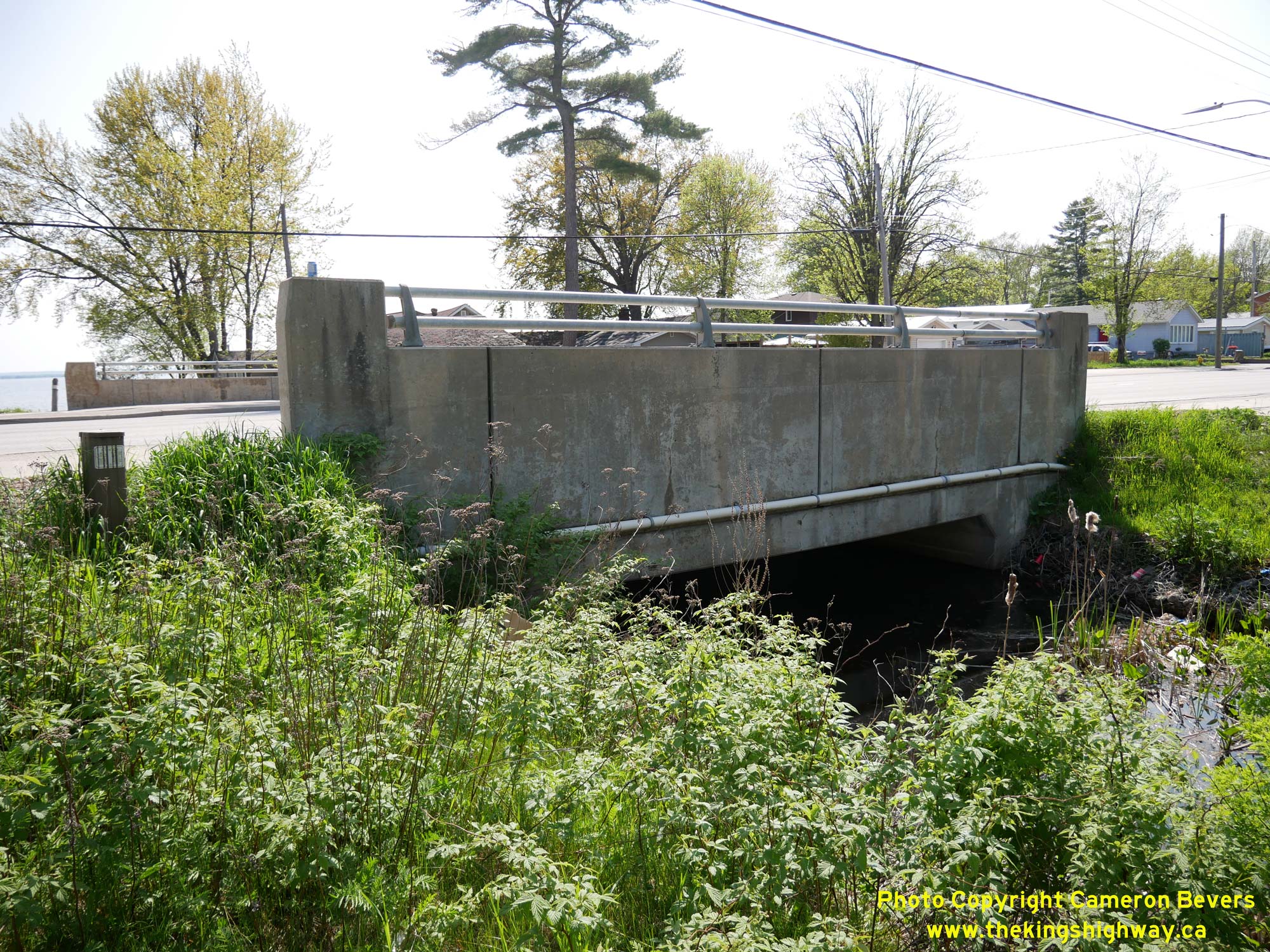
Enlarged Photo Here. (Photograph taken on July 20, 2012 - © Cameron Bevers) Right - Eastern side of the Parks Creek Bridge on Hwy 11B (Lakeshore Drive). The small concrete structure seen here is actually a widening of the original bridge built for the Ferguson Highway in the 1930s. The bridge was expanded under Contract #1962-142 when Hwy 11B was widened from two to four lanes in 1962. Note the sign mounted to the bridge advising watercraft operators of the reduced clearance ahead. Many of the Department of Northern Development's bridges were built using concrete T-beams which project below the soffit slab. See an Enlarged Photo Here. (Photograph taken on July 20, 2012 - © Cameron Bevers) 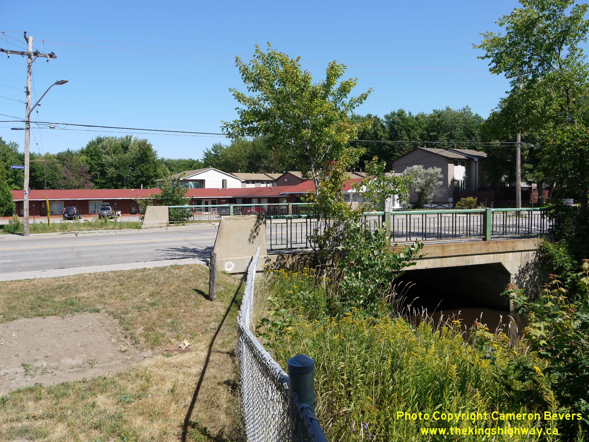
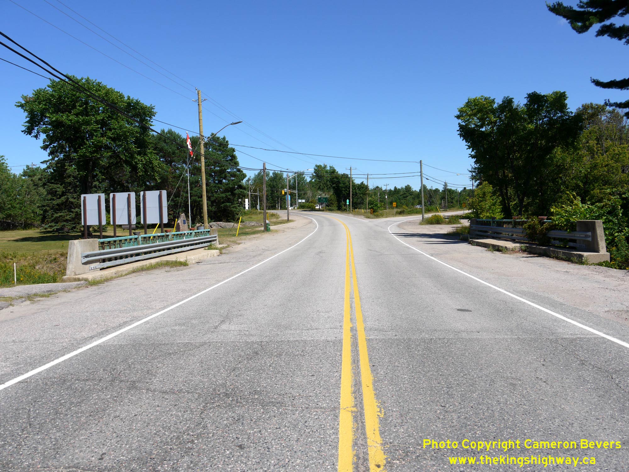
Left - Western side of the Parks Creek Bridge on Hwy 11B (Lakeshore Drive) in North Bay. This bridge is located between the intersections of
Lovell Avenue and William Street on Lakeshore Drive and was expanded to its current dimensions in 1962 when Hwy 11B was expanded from two to four lanes. See an
Enlarged Photo Here. (Photograph taken on July 20, 2012 - © Cameron Bevers) Right - Facing north along Hwy 11B (Lakeshore Drive) at the Parks Creek Bridge. See an Enlarged Photo Here. (Photograph taken on July 20, 2012 - © Cameron Bevers) 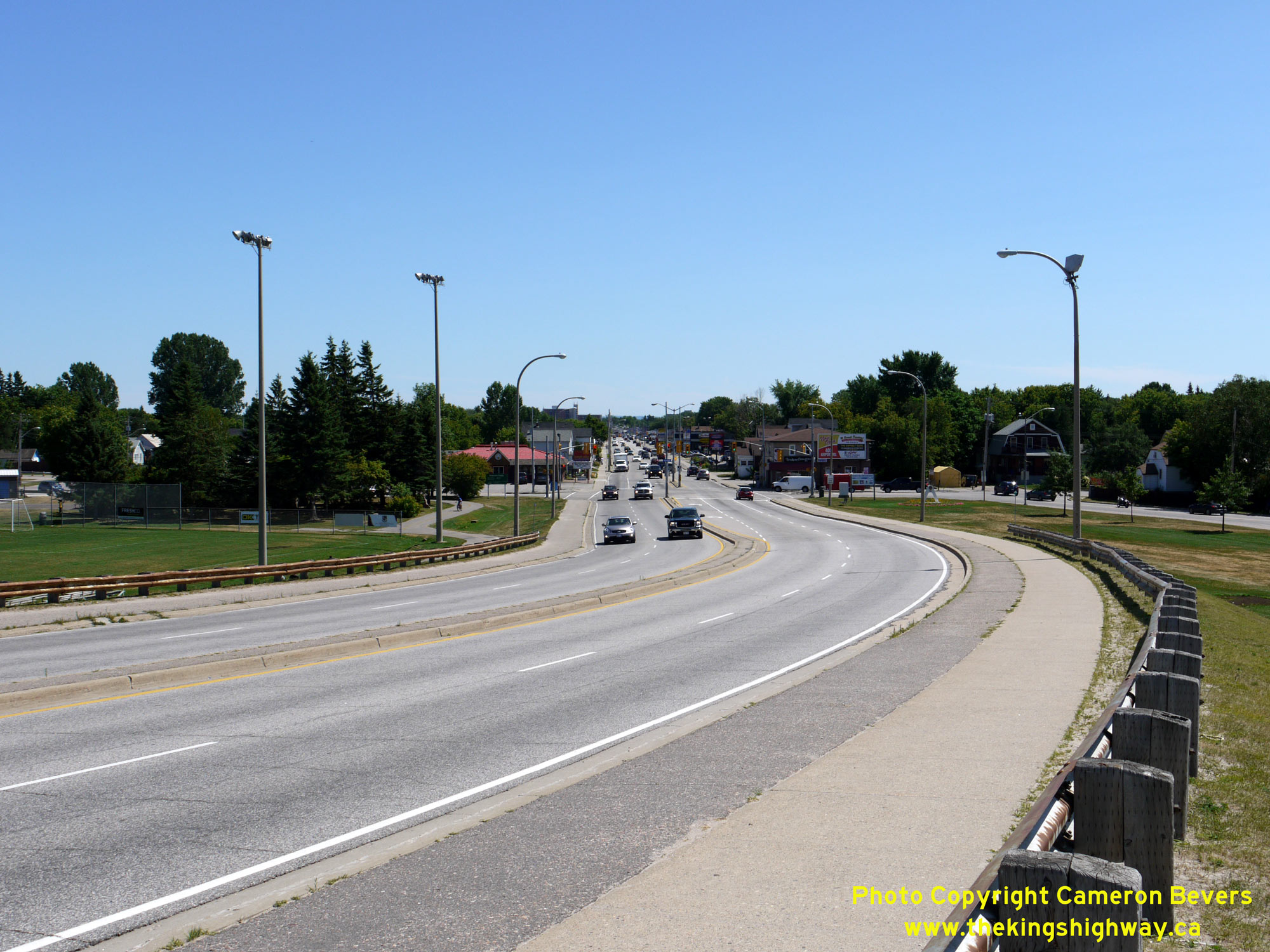
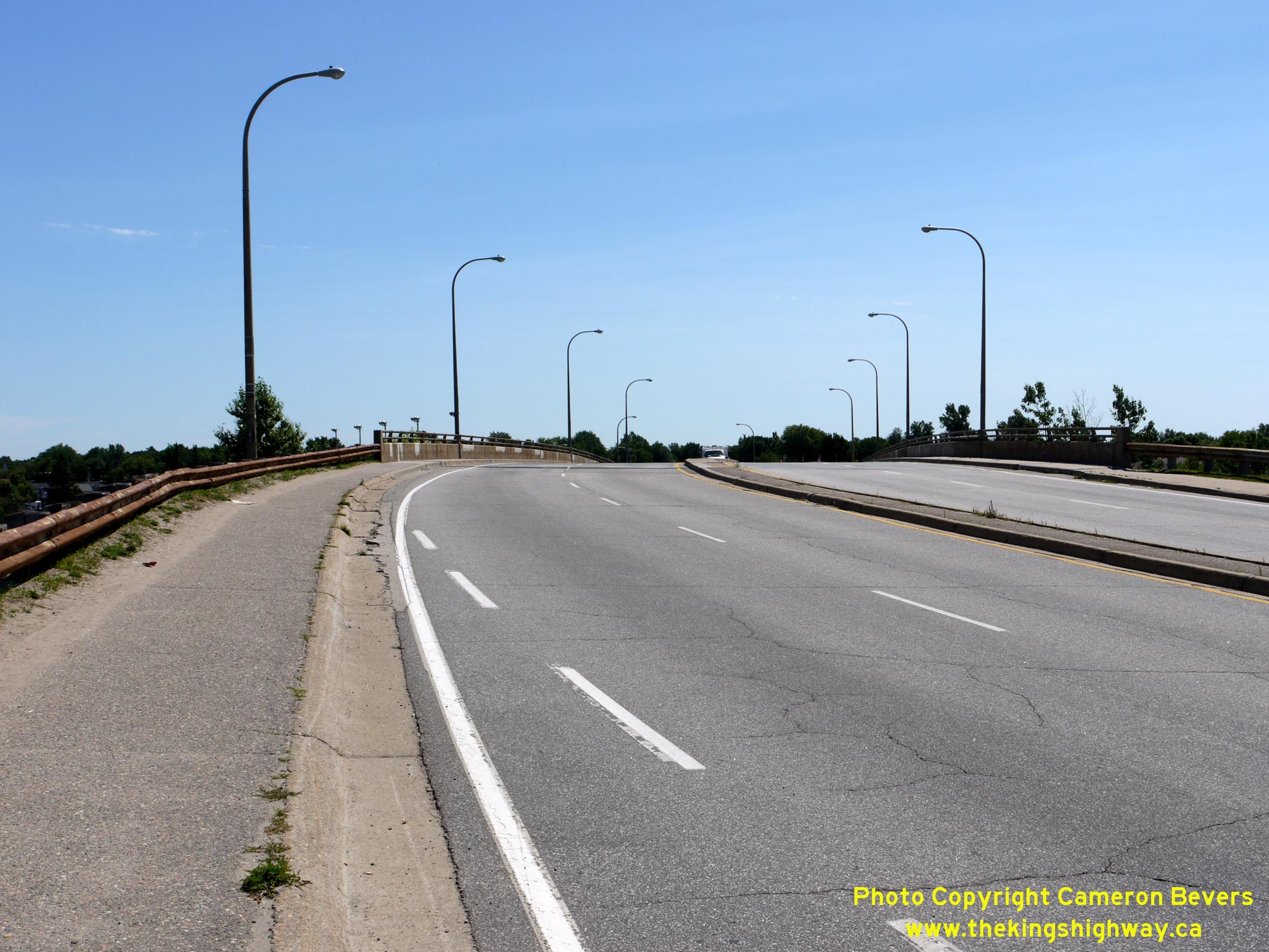
Left - Facing south along Main Street (Hwy 11B) from the North Bay Railway Overhead. Main Street becomes Lakeshore Drive at the Judge Avenue traffic signals
just ahead. Prior to the completion of the railway overhead in the late 1960s, Hwy 11B curved to the right and entered the city centre via Memorial Drive (formerly
Kennedy Avenue) and Stanley Street. See an Enlarged Photo Here. (Photograph taken on July 20, 2012 - © Cameron Bevers) Right - Facing north along Main Street (Hwy 11B) across the North Bay Railway Overhead. Geometrically speaking, this structure is actually quite complicated, with a reverse highway curve and superelevations ingeniously built into the bridge's deck. Whoever designed this structure was especially clever! See an Enlarged Photo Here. (Photograph taken on July 20, 2012 - © Cameron Bevers) 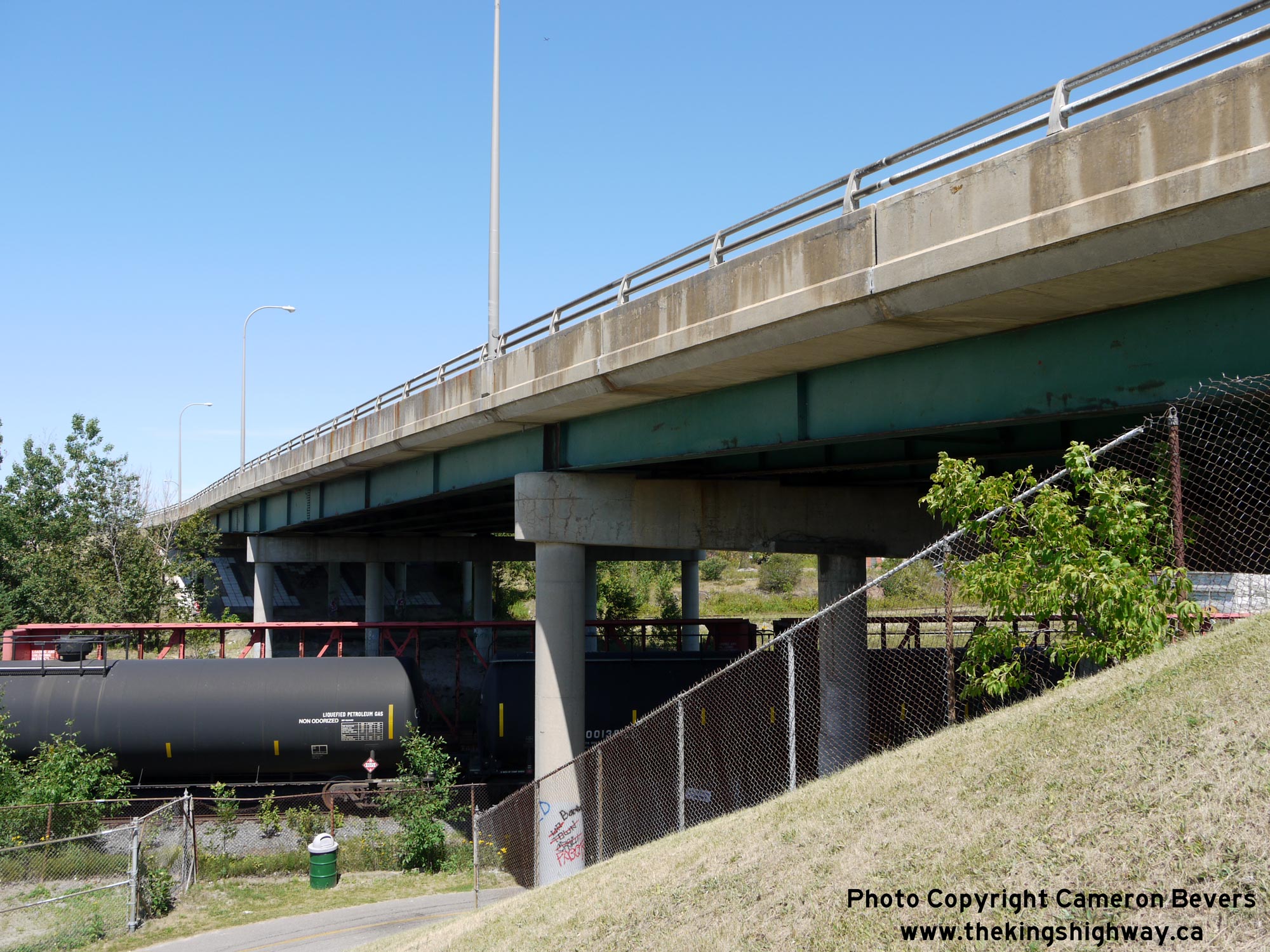

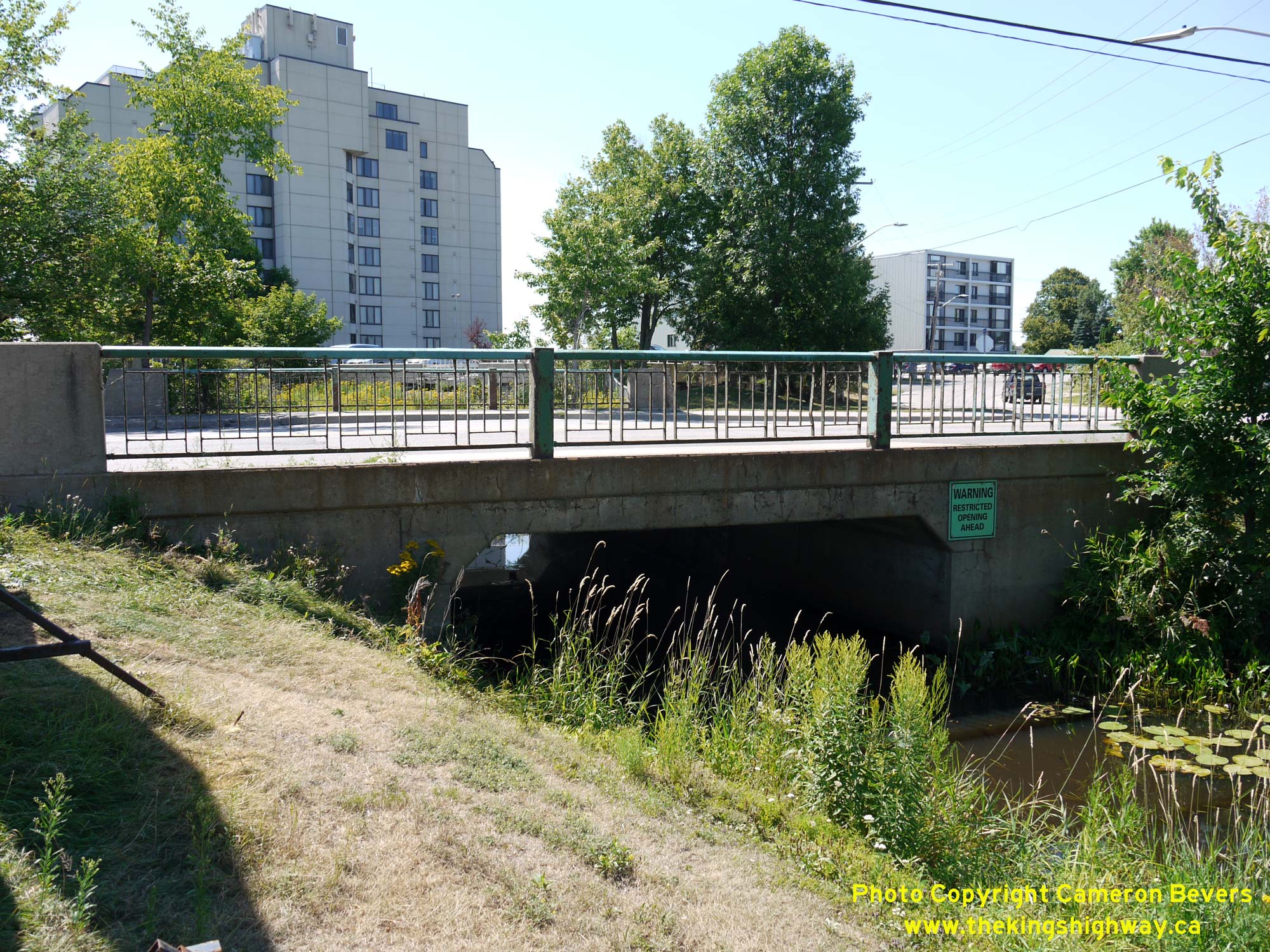
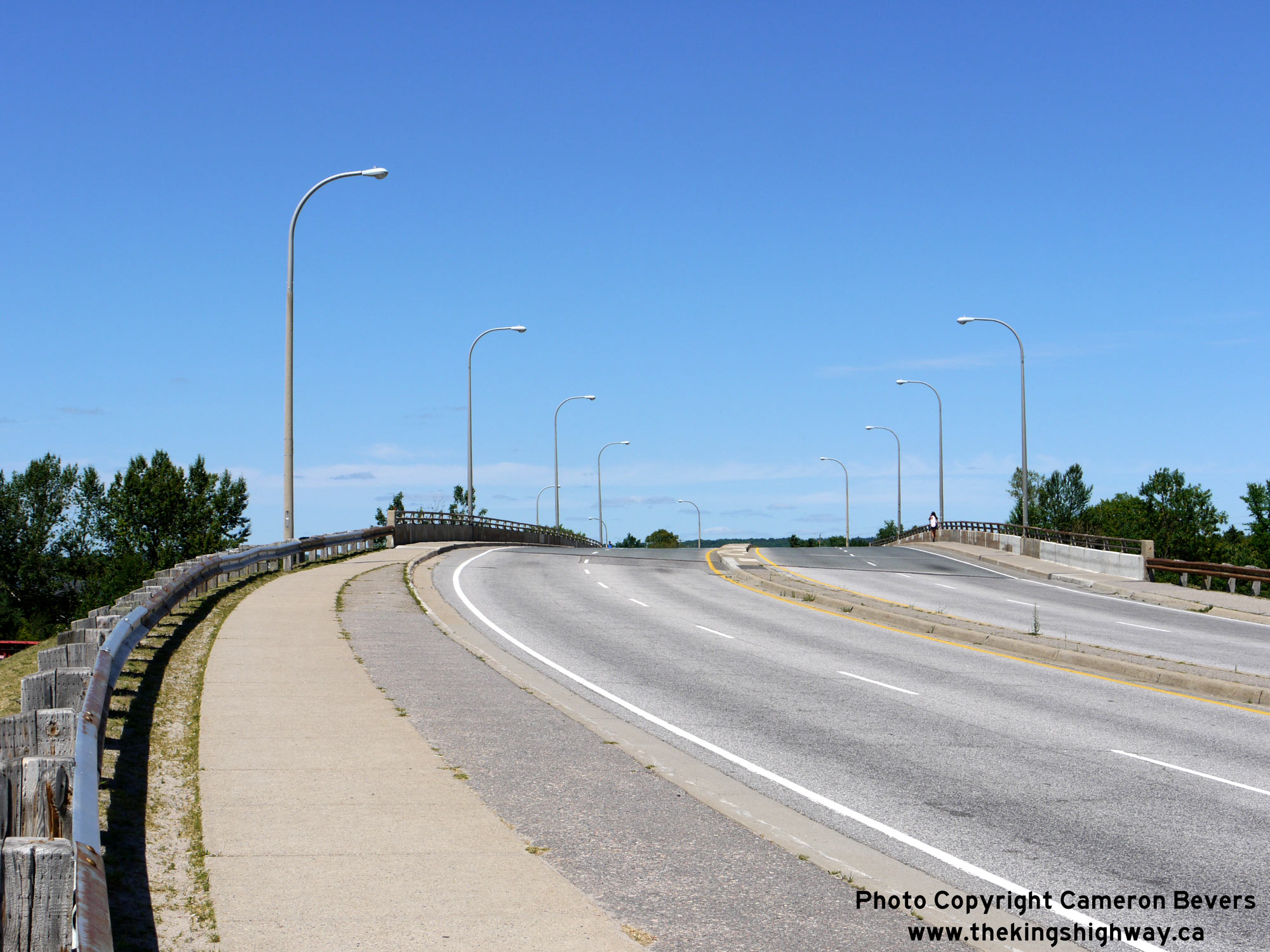
Left - Western side of the North Bay Railway Overhead on Main Street (Hwy 11B). This structure spans the Ottawa Valley Railway (OVR) and consists of four steel
plate girder spans. Originally known as the Golf Street Overpass, this structure was built in the late 1960s under a special construction agreement between the
DHO and the City of North Bay. This structure was completed in 1968. Observers can really notice the reverse curve in this structure from this vantage point by
noting the shape of the outer barrier wall which seemingly bulges outwards. See an
Enlarged Photo Here. (Photograph taken on July 20, 2012 - © Cameron Bevers) Right - The standard DHO double-rail parapet wall was used for the North Bay Railway Overhead on Main Street (Hwy 11B). See an Enlarged Photo Here. (Photograph taken on July 20, 2012 - © Cameron Bevers) 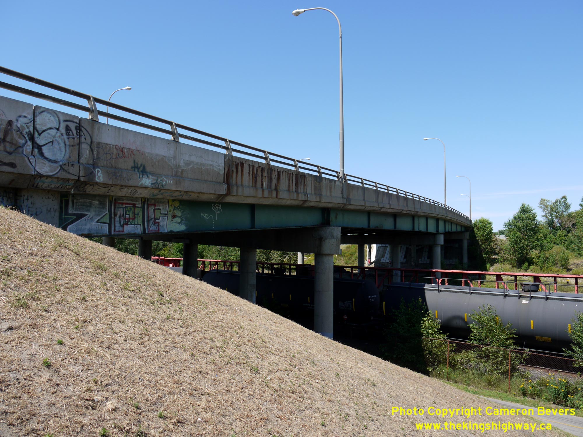
Left - Eastern side of the North Bay Railway Overhead on Main Street (Hwy 11B). Although it is a hideously ugly structure from an aesthetics point-of-view, the
engineering which went into its design is quite remarkable - particularly when one considers that engineers did not have the advantage of modern computers to assist
with all of the calculations needed for design. Prior to this structure's completion in 1968, Hwy 11B traffic crossed the railway via an at-grade railway crossing on
Stanley Street. The at-grade crossing was a major traffic bottleneck in the city, which was alleviated with the completion of this new railway grade separation. See
an Enlarged Photo Here. (Photograph taken on July 20, 2012 - © Cameron Bevers) Right - Facing south across the North Bay Railway Overhead on Main Street (Hwy 11B). See an Enlarged Photo Here. (Photograph taken on July 20, 2012 - © Cameron Bevers) 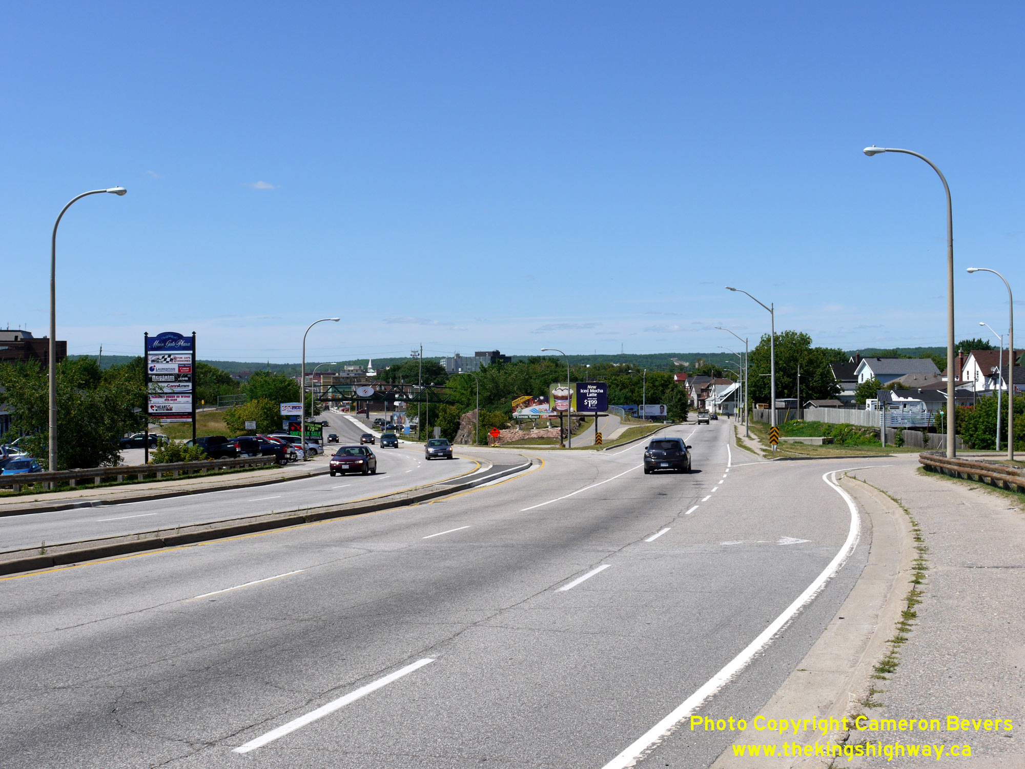
Left - Just beyond the North Bay Railway Overhead, two streets split off from one another. Main Street forks to the left, while the "through" street become
McIntyre Street. Northbound and southbound Hwy 11B followed a parallel one-way street system through Downtown North Bay. See an
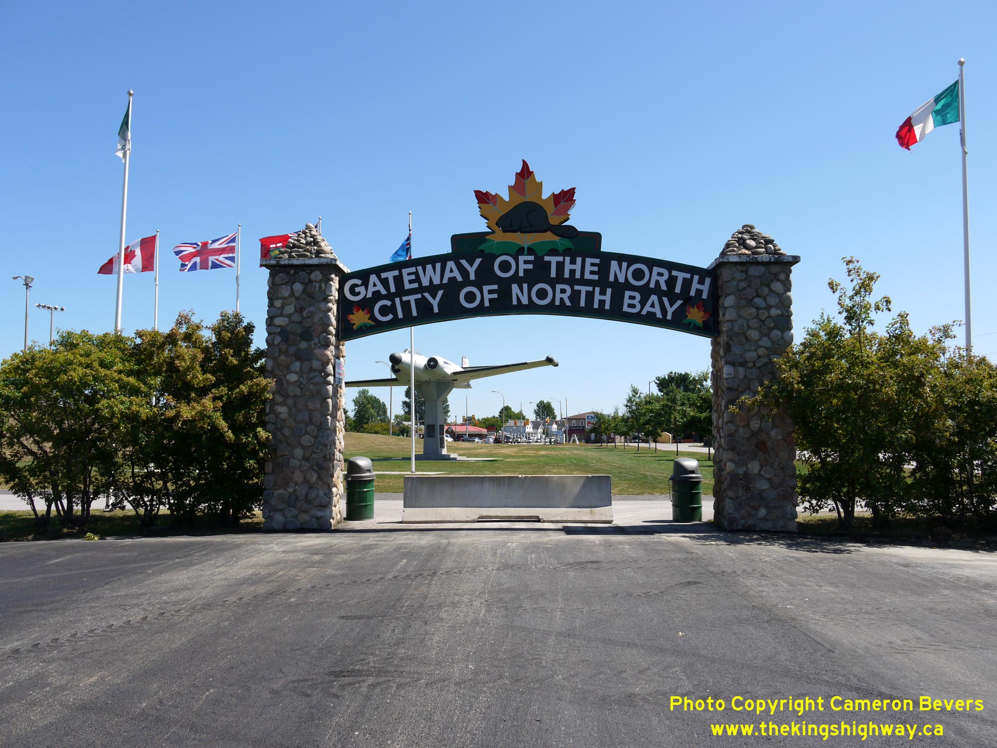
Enlarged Photo Here. (Photograph taken on July 20, 2012 - © Cameron Bevers) Right - North Bay Gateway Arch as it stands today in Lee Park. Although the arch has been modified several times since it was first erected in 1928, it still consists of the same general features as it did decades ago. However, the neon tube lettering on the sign was removed during restoration work carried out on the arch. See an Enlarged Photo Here. (Photograph taken on July 20, 2012 - © Cameron Bevers) 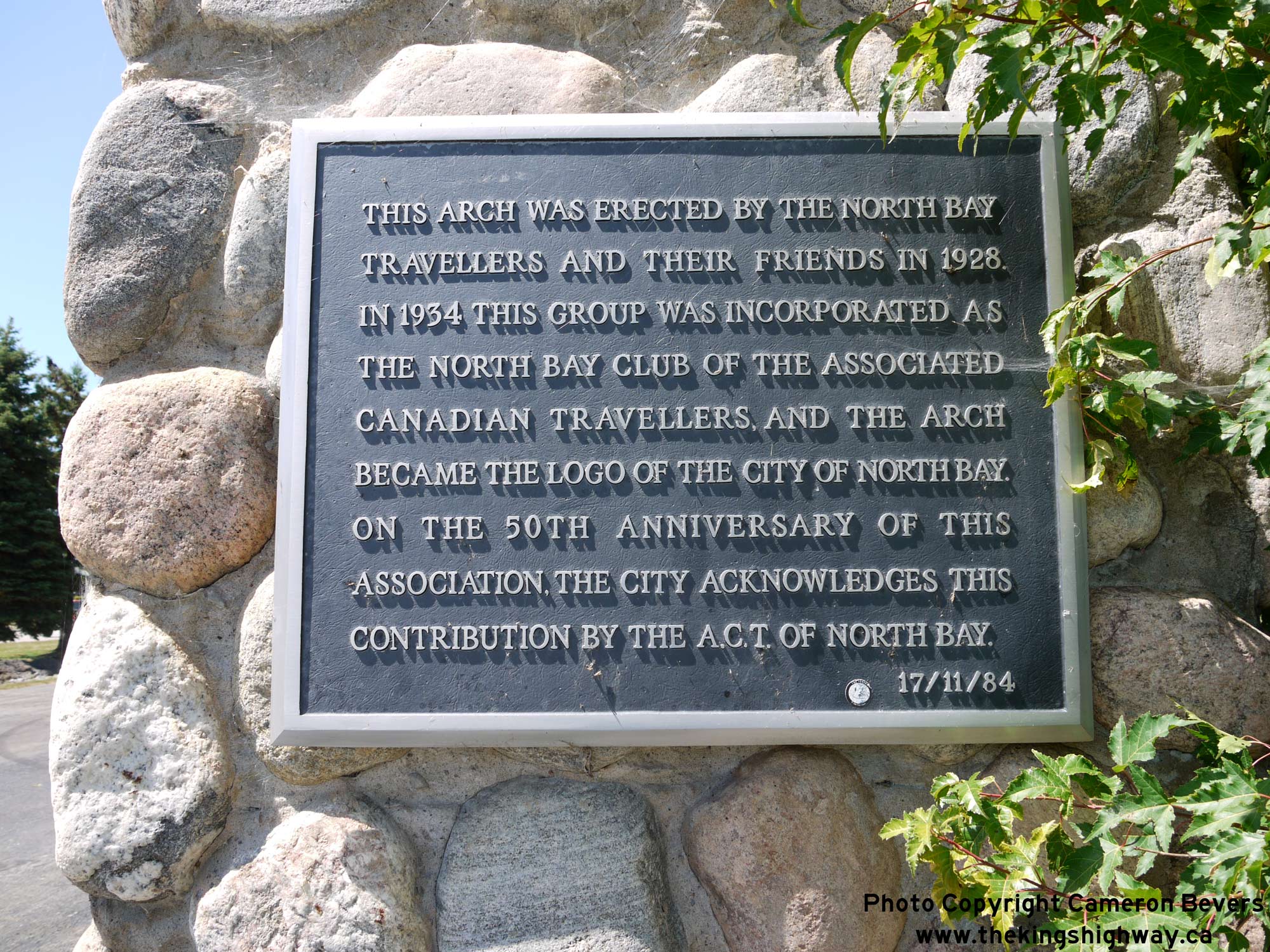
Left - Plaque commemorating the history of the North Bay Welcome Arch. See an
Enlarged Photo Here. (Photograph taken on July 20, 2012 - © Cameron Bevers) Right - Facing south through the North Bay Welcome Arch. In the background, one can see the intersection of Judge Avenue and Main Street/Lakeshore Drive. Prior to the completion of the adjacent North Bay Railway Overhead in the late 1960s, Hwy 11B continued straight ahead through the arch and tied into Lakeshore Drive in the background. See an Enlarged Photo Here. (Photograph taken on July 20, 2012 - © Cameron Bevers) 
Above - Among the most interesting features of the North Bay Welcome Arch is the historic mileage tablet incorporated into one of the arch's support columns.
The engraved tablet shows the mileage from North Bay to various Northeastern Ontario towns and cities. These mileages reflect historical 1920s road distances from
North Bay via the original route of the Ferguson Highway. Once the Ferguson Highway was assumed by the DHO as Hwy 11 in 1937, numerous improvements and highway
relocations took place. These improvements to Hwy 11 have shortened the highway distance to these destinations quite noticeably over the past century. See an
Enlarged Photo Here. (Photograph taken on July 20, 2012 - © Cameron Bevers) 
 Left - Facing south along Stanley Street towards Memorial Drive from the Chippewa Creek Bridge in North Bay. Prior to the completion of the North Bay Railway
Overhead on Main Street in the late 1960s, all Hwy 11B traffic arrived in North Bay's City Centre via Stanley Street. See an
Enlarged Photo Here. Left - Facing south along Stanley Street towards Memorial Drive from the Chippewa Creek Bridge in North Bay. Prior to the completion of the North Bay Railway
Overhead on Main Street in the late 1960s, all Hwy 11B traffic arrived in North Bay's City Centre via Stanley Street. See an
Enlarged Photo Here.(Photograph taken on May 27, 2023 - © Cameron Bevers) Right - Approaching the Chippewa Creek Bridge on Stanley Street (Old Hwy 11B). This bridge has been closed to motor vehicle traffic for several years. See an
Enlarged Photo Here.(Photograph taken on May 27, 2023 - © Cameron Bevers) 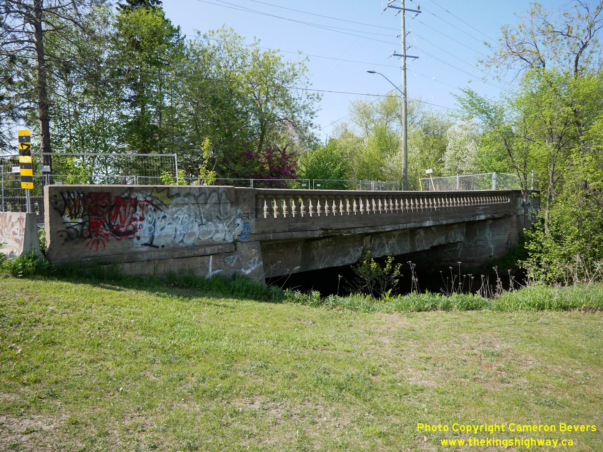
 Left - Eastern side of the Chippewa Creek Bridge on Stanley Street (Old Hwy 11B) in North Bay. This single-span concrete slab structure was completed in 1928.
Up until the late 1960s, this bridge carried virtually all traffic entering the city centre from the south via Hwy 11B. See an
Enlarged Photo Here. Left - Eastern side of the Chippewa Creek Bridge on Stanley Street (Old Hwy 11B) in North Bay. This single-span concrete slab structure was completed in 1928.
Up until the late 1960s, this bridge carried virtually all traffic entering the city centre from the south via Hwy 11B. See an
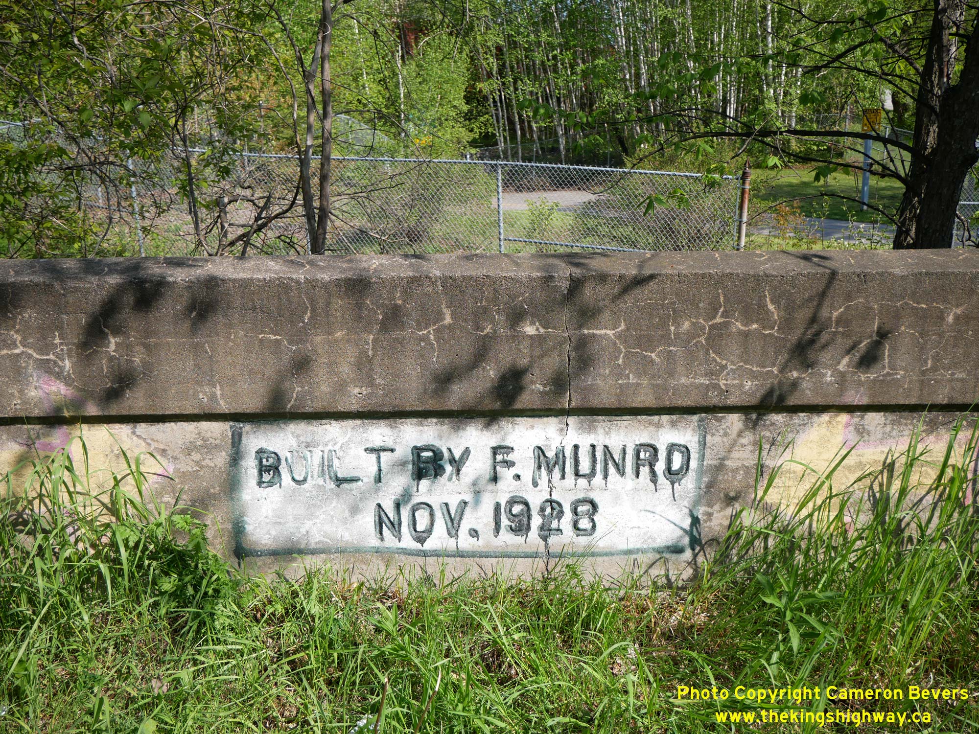
Enlarged Photo Here.(Photograph taken on May 27, 2023 - © Cameron Bevers) Right - Builder's information panel stamped into the concrete handrail of the Chippewa Creek Bridge - "BUILT BY F. MUNRO NOV. 1928". See an
Enlarged Photo Here.(Photograph taken on May 27, 2023 - © Cameron Bevers) 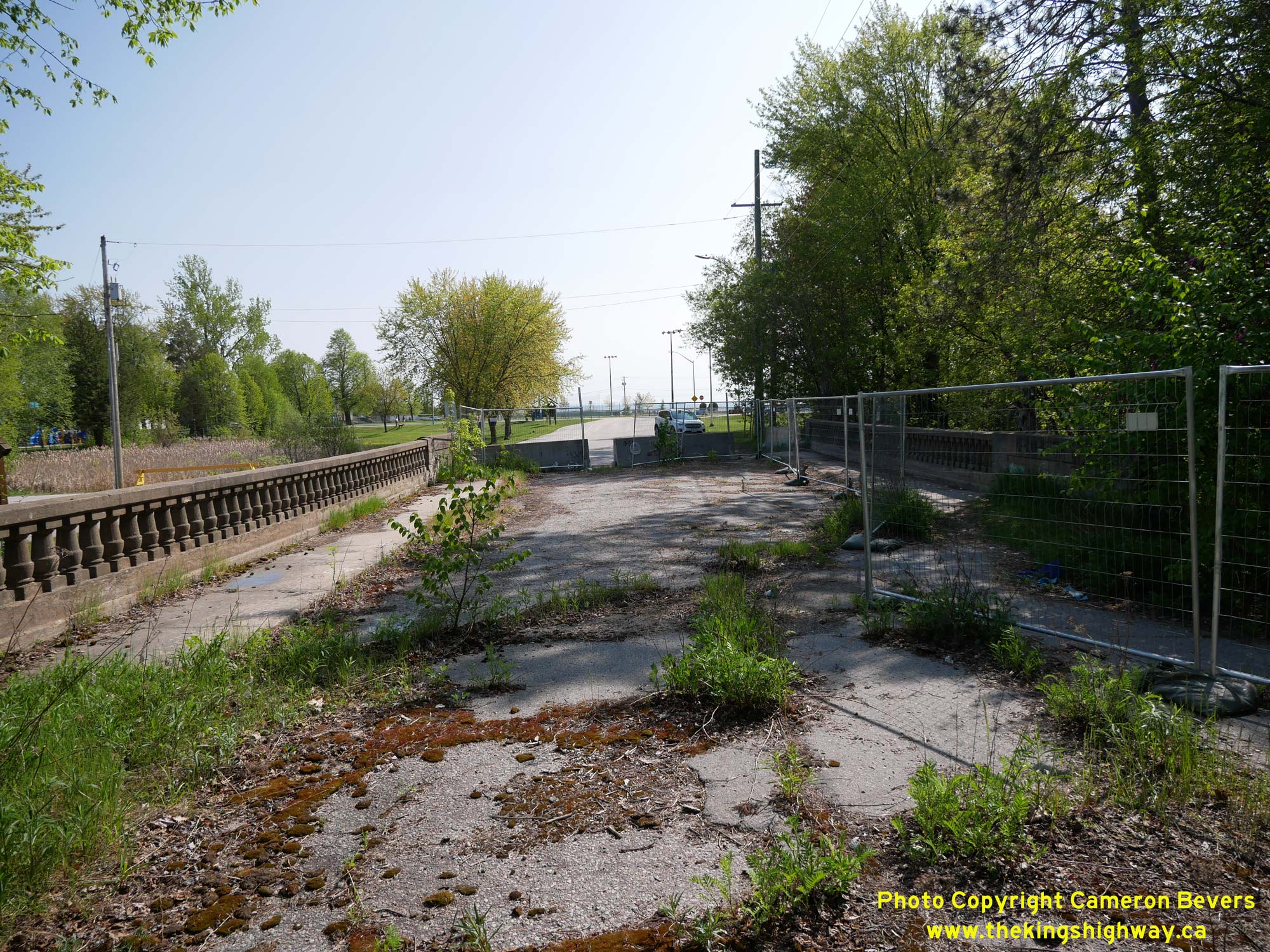
 Left - Facing south across the Stanley Street Bridge over Chippewa Creek in North Bay. Through traffic hasn't used this bridge since the late 1960s, although
the bridge was kept open to local traffic using Stanley Street for several decades after the completion of the nearby North Bay Railway Overhead on Hwy 11B (Main
Street). It is rather sad to see a historic highway structure that once served as the main entrance to the city slowly crumble away in silence. See an
Enlarged Photo Here. Left - Facing south across the Stanley Street Bridge over Chippewa Creek in North Bay. Through traffic hasn't used this bridge since the late 1960s, although
the bridge was kept open to local traffic using Stanley Street for several decades after the completion of the nearby North Bay Railway Overhead on Hwy 11B (Main
Street). It is rather sad to see a historic highway structure that once served as the main entrance to the city slowly crumble away in silence. See an
Enlarged Photo Here.(Photograph taken on May 27, 2023 - © Cameron Bevers) Right - Western side of the Chippewa Creek Bridge on Stanley Street (Old Hwy 11B) in North Bay. See an
Enlarged Photo Here.(Photograph taken on May 27, 2023 - © Cameron Bevers) 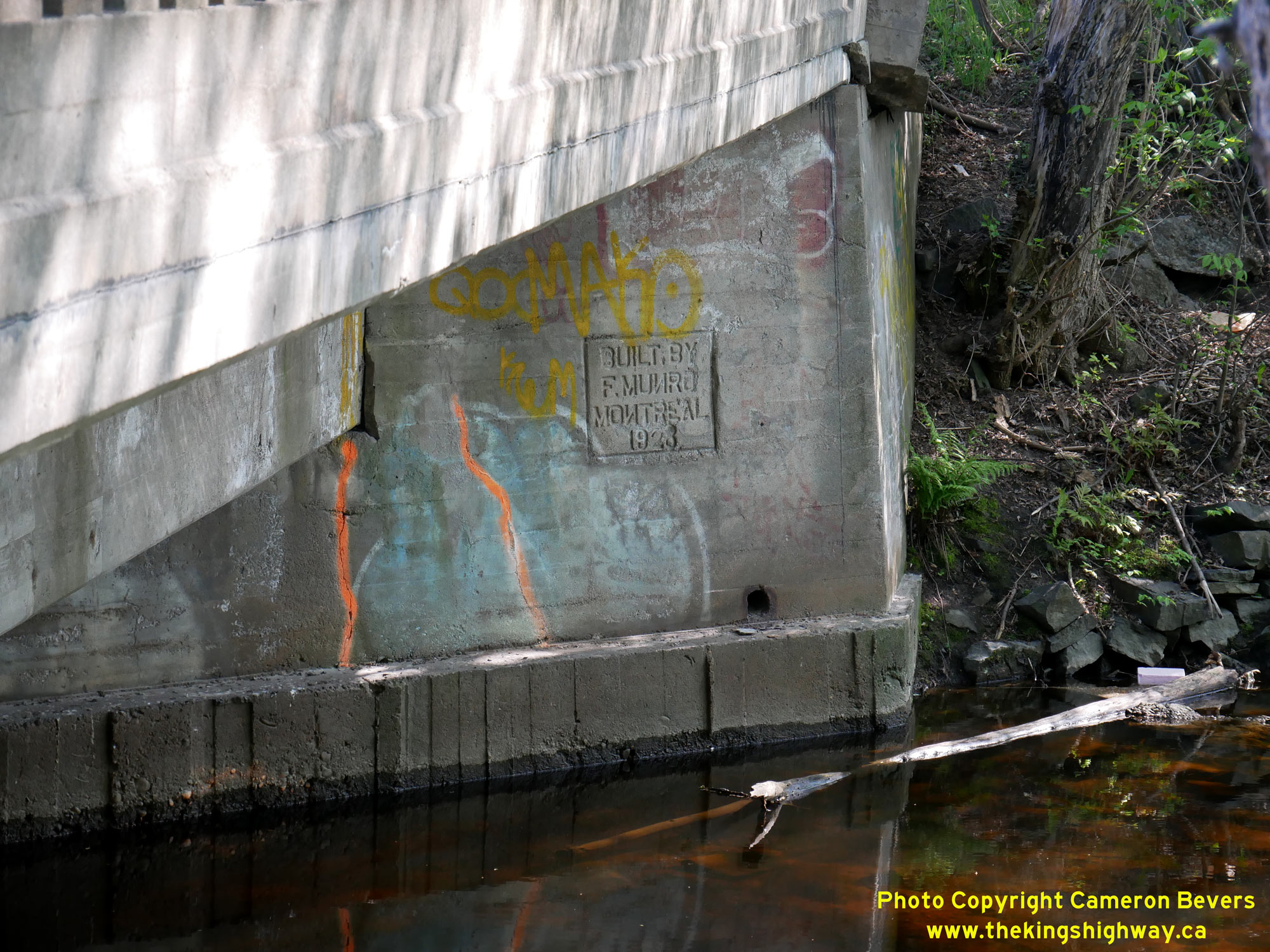
 Left - A second builder's information panel was stamped into the southwestern abutment wall of the Chippewa Creek Bridge on Stanley Street (Old Hwy 11B). While
the lettering tool set was being prepared, the toolmaker accidentally made the tool to apply the letter "N" as a "positive" (appearing forwards), rather than as a
"negative" (appearing backwards). When embossing tools such as this are being prepared, they must be manufactured so that the letter is opposite to how it will
appear on the completed structure. This error was likely the result of a moment's inattention by the toolmaker. Rather comically, the end result of that single moment
of inattention is still visible on the completed bridge almost a century later! See an
Enlarged Photo Here. Left - A second builder's information panel was stamped into the southwestern abutment wall of the Chippewa Creek Bridge on Stanley Street (Old Hwy 11B). While
the lettering tool set was being prepared, the toolmaker accidentally made the tool to apply the letter "N" as a "positive" (appearing forwards), rather than as a
"negative" (appearing backwards). When embossing tools such as this are being prepared, they must be manufactured so that the letter is opposite to how it will
appear on the completed structure. This error was likely the result of a moment's inattention by the toolmaker. Rather comically, the end result of that single moment
of inattention is still visible on the completed bridge almost a century later! See an
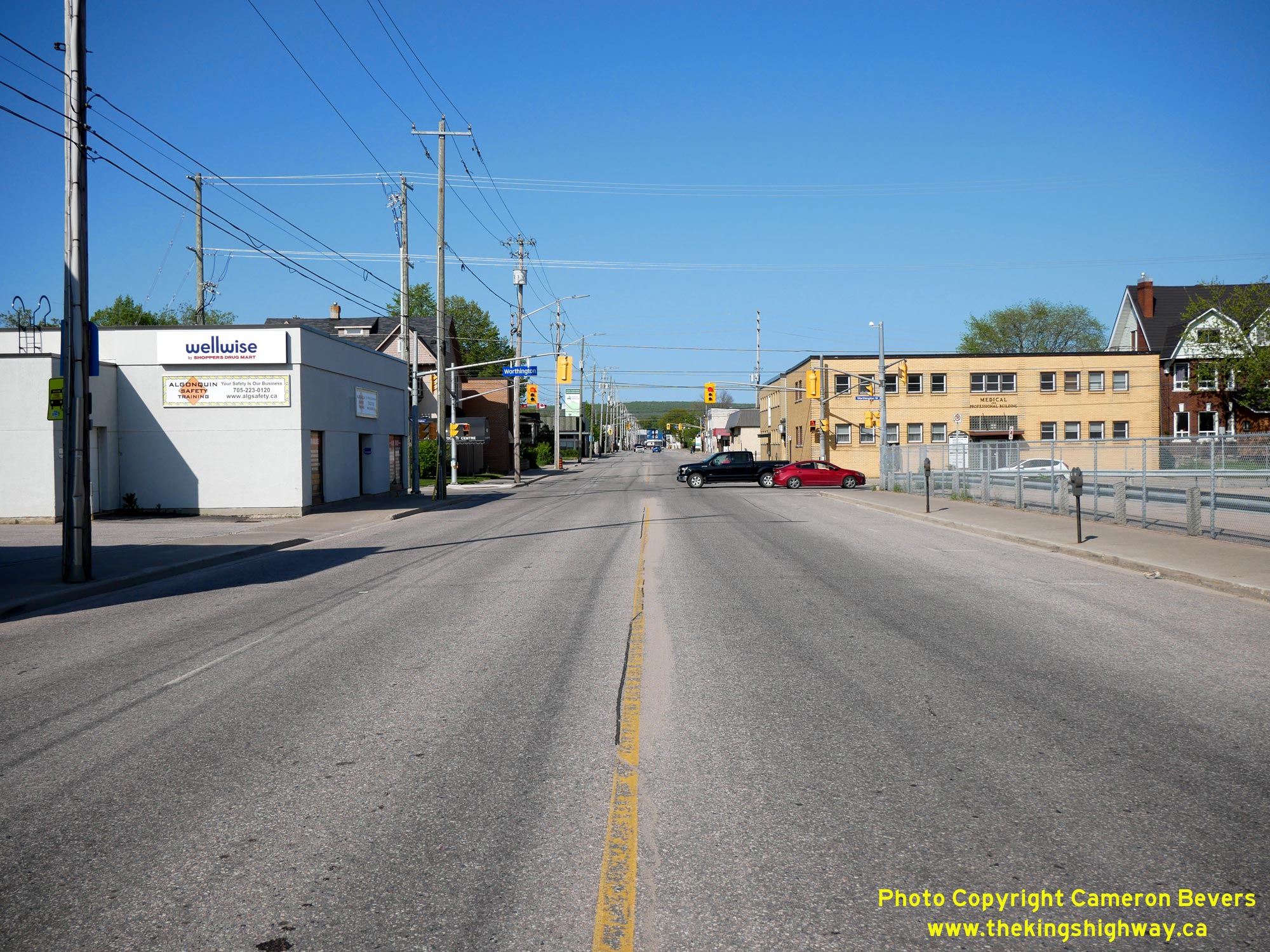
Enlarged Photo Here.(Photograph taken on May 27, 2023 - © Cameron Bevers) Right - Facing north along Cassells Street (Hwy 63) from its historical southern terminus at Main Street (Hwy 17B) in Downtown North Bay. At the northern
entrance to the city centre, Hwy 11B, Hwy 17B and Hwy 63 all interconnected within a space of two city blocks. Cassells Street (Hwy 63) intersects with the
southbound route of Hwy 11B via Algonquin Avenue just ahead. One block to the north, Hwy 63 intersects with the northbound route of Hwy 11B via McIntyre Street. See
an Enlarged Photo Here.(Photograph taken on May 27, 2023 - © Cameron Bevers) 
 Left - Historical southern terminus of Hwy 63 at the intersection of Cassells Street and Main Street (Hwy 17B) in North Bay. See an
Enlarged Photo Here. Left - Historical southern terminus of Hwy 63 at the intersection of Cassells Street and Main Street (Hwy 17B) in North Bay. See an
Enlarged Photo Here.(Photograph taken on May 27, 2023 - © Cameron Bevers) Right - Facing east along Main Street (Hwy 17B) approaching Cassells Street (Hwy 63) in North Bay. Up until the 1990s, the southbound route of Hwy 17B
continued straight ahead via Main Street, while Hwy 63 turned left and headed north towards Temiscaming, Quebec. The routes of Hwy 11B, Hwy 17B and Hwy 63
within the downtown area were still being sporadically signed by the city up until 2007, although none of these routes were designated as Municipal Connecting Links
by that time. See an Enlarged Photo Here.(Photograph taken on May 27, 2023 - © Cameron Bevers) 
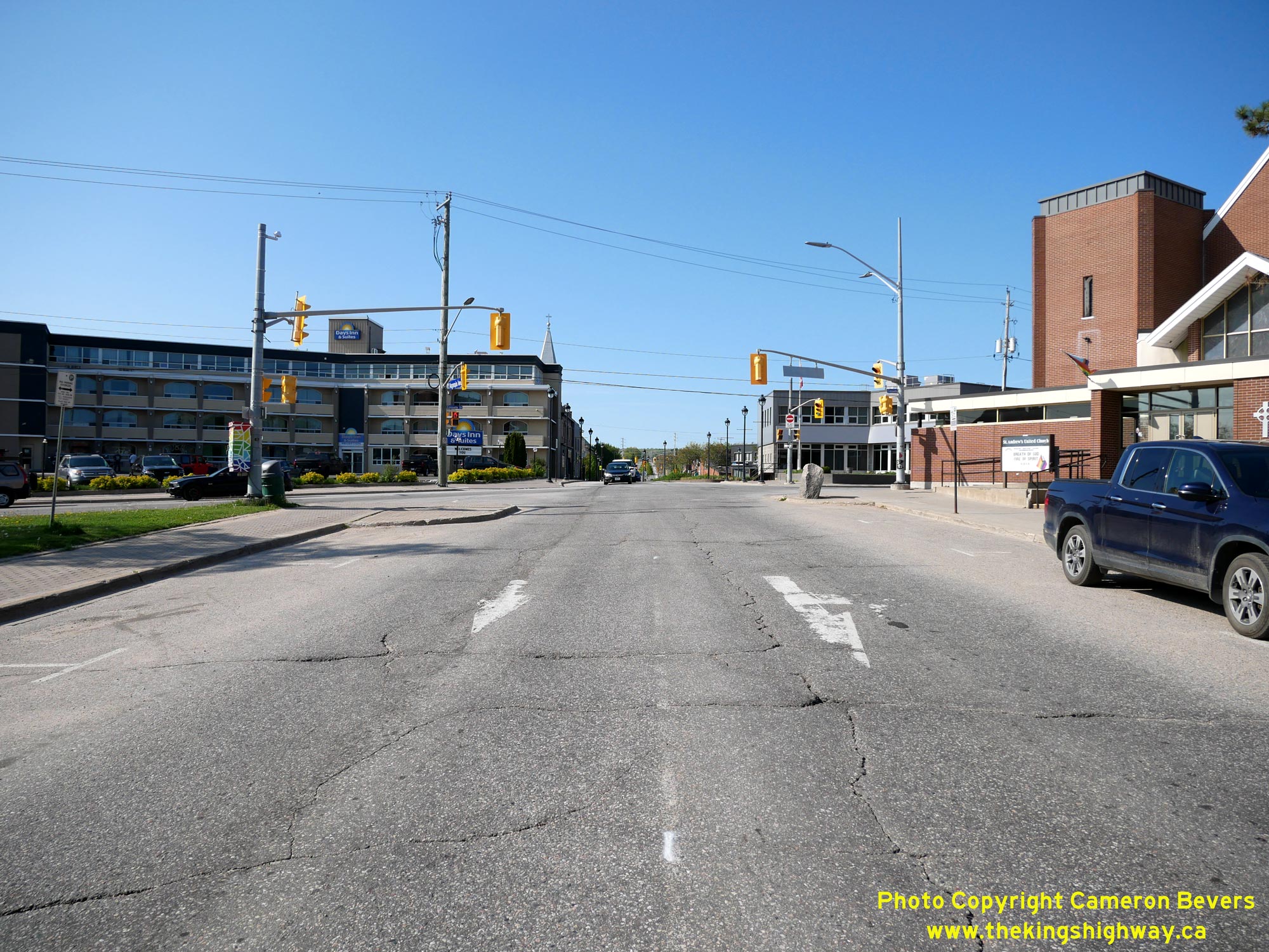
 Left - Facing west along Main Street (Hwy 17B) in North Bay approaching Cassells Street (Hwy 63). Prior to the completion of the North Bay Bypass, traffic on
Hwy 11 & Hwy 17 had to pass right through Downtown North Bay in order to access Hwy 63. The completion of the new bypass in 1953 provided an interceptor road to
redirect long distance traffic away from the downtown area. After 1953, through traffic approaching North Bay via Hwy 11 & Hwy 17 could directly access Hwy 63
from the North Bay Bypass, instead of having to go through downtown. See an Enlarged Photo Here. Left - Facing west along Main Street (Hwy 17B) in North Bay approaching Cassells Street (Hwy 63). Prior to the completion of the North Bay Bypass, traffic on
Hwy 11 & Hwy 17 had to pass right through Downtown North Bay in order to access Hwy 63. The completion of the new bypass in 1953 provided an interceptor road to
redirect long distance traffic away from the downtown area. After 1953, through traffic approaching North Bay via Hwy 11 & Hwy 17 could directly access Hwy 63
from the North Bay Bypass, instead of having to go through downtown. See an Enlarged Photo Here.(Photograph taken on May 27, 2023 - © Cameron Bevers) Right - View of Main Street (Hwy 17B) in North Bay, facing south towards the southbound route of Hwy 11B via Algonquin Avenue. Historically, both Hwy 11
& Hwy 17 followed Main Street through North Bay's City Centre. In the years following the completion of the North Bay Bypass, Hwy 11B & Hwy 17B continued to
be signed via Main Street. During the 1970s, a new one-way street system was introduced through North Bay with southbound traffic on Hwy 11B & Hwy 17B signed via
Oak Street, and northbound traffic signed via McIntyre Street. Southbound Hwy 17B turned right from Main Street onto Algonquin Avenue and ran concurrently with
Hwy 11B through the city centre. See an
Enlarged Photo Here.(Photograph taken on May 27, 2023 - © Cameron Bevers) 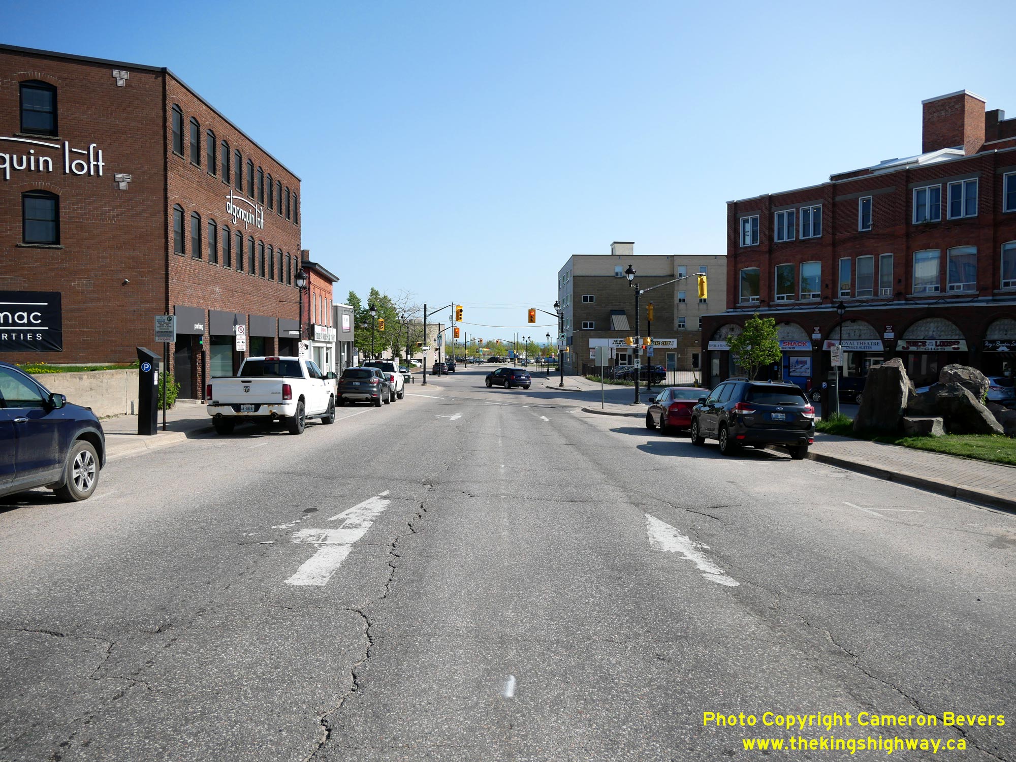
 Left - Facing south along the southbound route of Hwy 11B via Algonquin Avenue towards Main Street (Hwy 17B) in Downtown North Bay. Following the conversion
of Oak Street and McIntyre Street as a one-way bypass loop around the city centre, Hwy 11B & Hwy 17B joined together at this intersection and proceeded south for
one block to join Oak Street at the next signalized intersection. See an Enlarged Photo Here. Left - Facing south along the southbound route of Hwy 11B via Algonquin Avenue towards Main Street (Hwy 17B) in Downtown North Bay. Following the conversion
of Oak Street and McIntyre Street as a one-way bypass loop around the city centre, Hwy 11B & Hwy 17B joined together at this intersection and proceeded south for
one block to join Oak Street at the next signalized intersection. See an Enlarged Photo Here.(Photograph taken on May 27, 2023 - © Cameron Bevers) Right - Facing north along the southbound route of Hwy 11B via Algonquin Avenue towards Cassells Street (Hwy 63) in Downtown North Bay. See an
Enlarged Photo Here.(Photograph taken on May 27, 2023 - © Cameron Bevers) 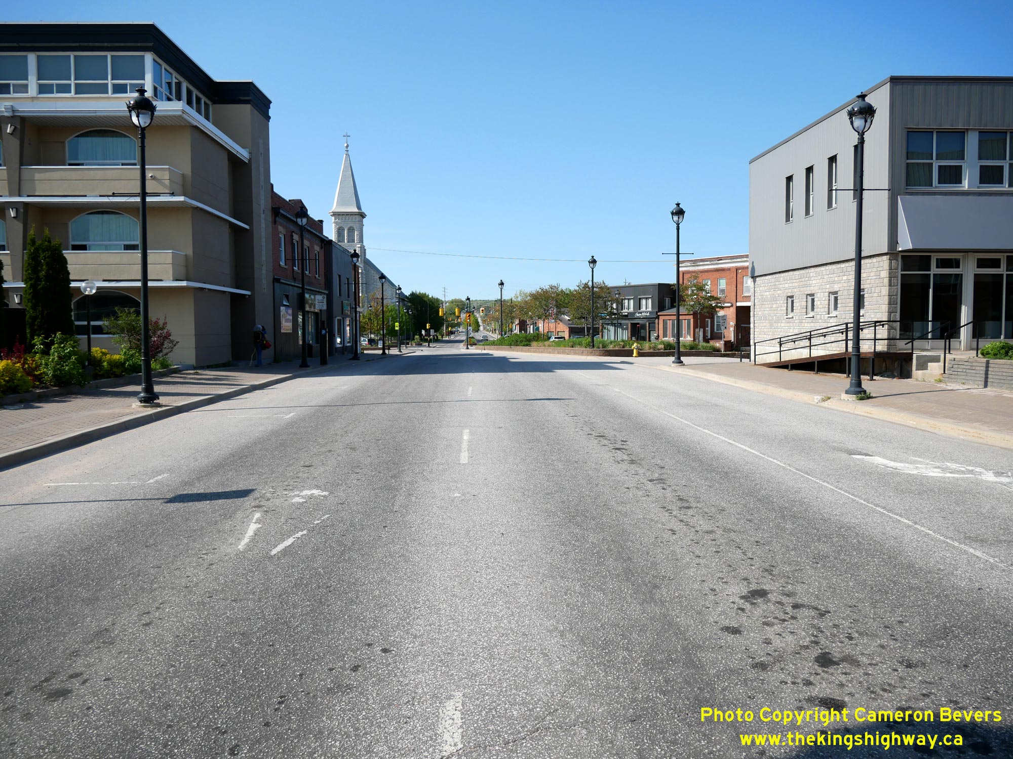
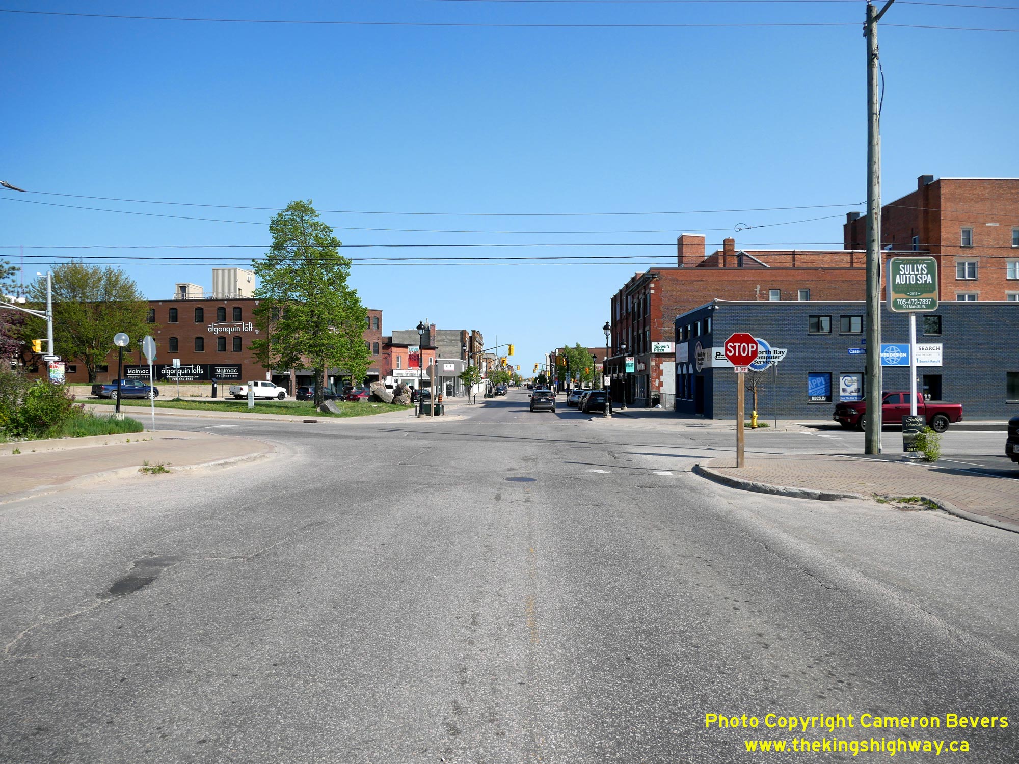
 Left - View of Algonquin Avenue, facing north from Cassells Street (Hwy 63). The one-way street system through Downtown North Bay comes to an end just ahead
beside the church, where the northbound route of Hwy 11B via McIntyre Street ties back into Algonquin Avenue. See an
Enlarged Photo Here. Left - View of Algonquin Avenue, facing north from Cassells Street (Hwy 63). The one-way street system through Downtown North Bay comes to an end just ahead
beside the church, where the northbound route of Hwy 11B via McIntyre Street ties back into Algonquin Avenue. See an
Enlarged Photo Here.(Photograph taken on May 27, 2023 - © Cameron Bevers) Right - Facing north along Cassells Street (Hwy 63) from the southbound route of Hwy 11B via Algonquin Avenue. Cassells Street intersects the northbound route
of Hwy 11B via McIntyre Street just ahead at the next traffic signal. See an Enlarged Photo Here.(Photograph taken on May 27, 2023 - © Cameron Bevers) 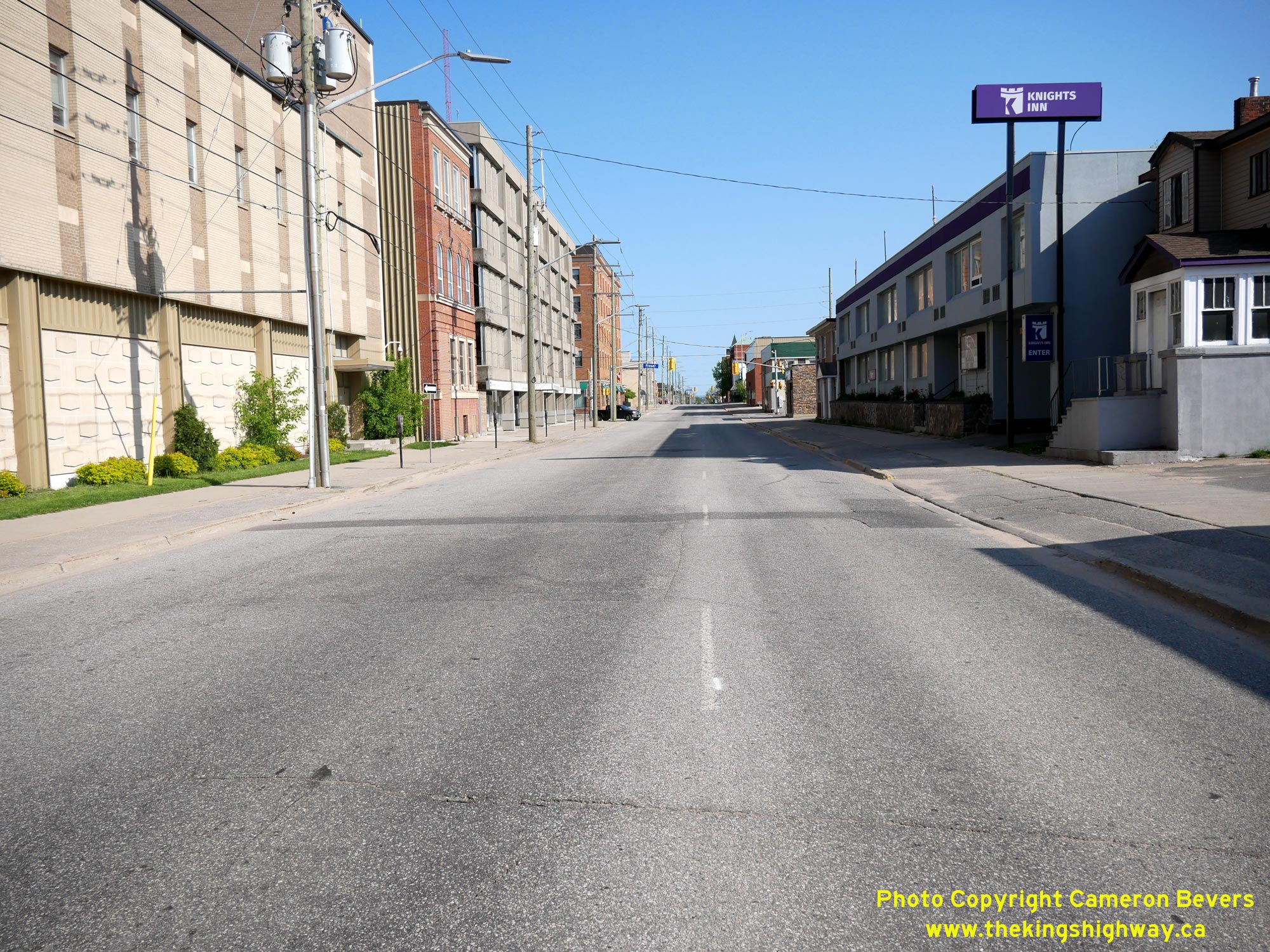
 Left - View of the northbound route of Hwy 11B & Hwy 17B via McIntyre Street, facing south from Cassells Street (Hwy 63). See an
Enlarged Photo Here. Left - View of the northbound route of Hwy 11B & Hwy 17B via McIntyre Street, facing south from Cassells Street (Hwy 63). See an
Enlarged Photo Here.(Photograph taken on May 27, 2023 - © Cameron Bevers) Right - Facing north along McIntyre Street at Cassells Street (Hwy 63). Traffic wishing to continue west along Hwy 17B can turn left onto Cassells Street and
return to Main Street, while northbound traffic on Hwy 11B continues straight ahead, where traffic merges back into Algonquin Avenue. See an
Enlarged Photo Here.(Photograph taken on May 27, 2023 - © Cameron Bevers) 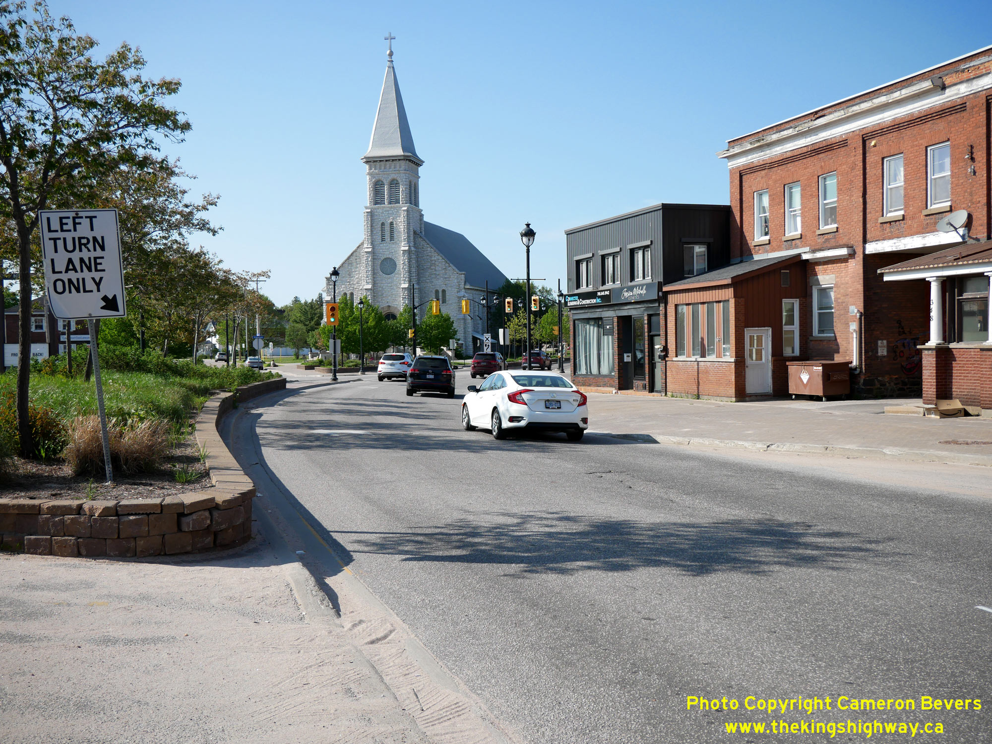
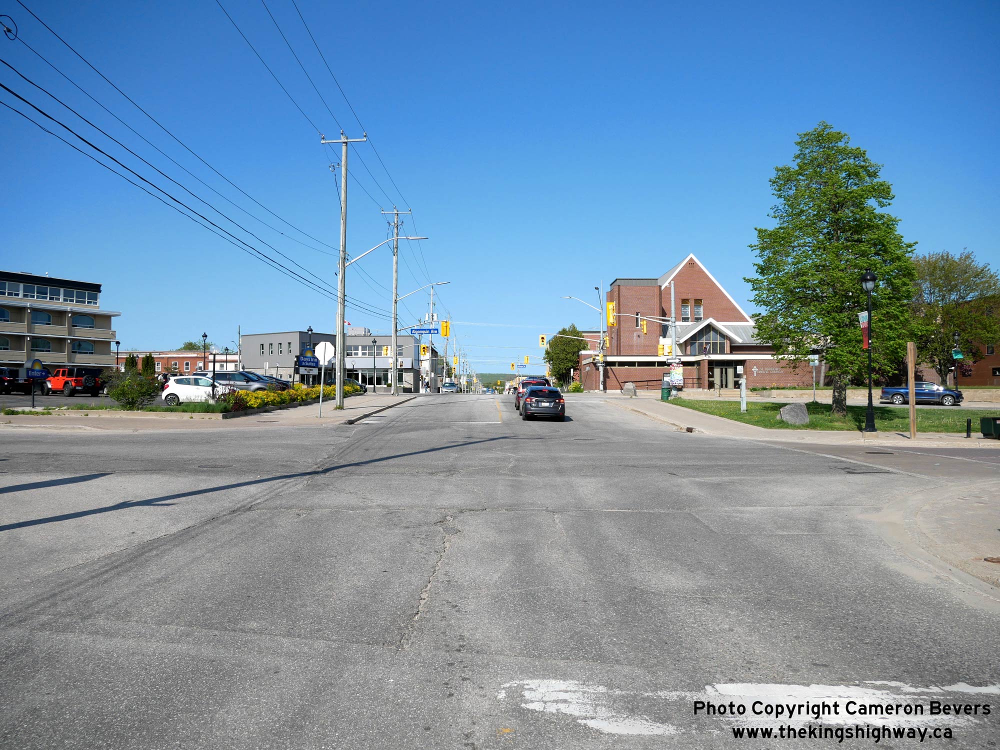
 Left - End of the one-way street system for Hwy 11B at McIntyre Street and Algonquin Avenue. Here, the northbound route of Hwy 11B converges with the
southbound route of Hwy 11B via Algonquin Avenue. The reunion of the two routes takes place immediately north of Cassells Street (Hwy 63). The route of Hwy 11B
continues north via Algonquin Avenue and returns to the North Bay Bypass, which lies about 2 km ahead. The Pro-Cathedral of the Assumption, completed in 1905, forms
a very attractive landmark at the northern entrance to the city centre. See an
Enlarged Photo Here. Left - End of the one-way street system for Hwy 11B at McIntyre Street and Algonquin Avenue. Here, the northbound route of Hwy 11B converges with the
southbound route of Hwy 11B via Algonquin Avenue. The reunion of the two routes takes place immediately north of Cassells Street (Hwy 63). The route of Hwy 11B
continues north via Algonquin Avenue and returns to the North Bay Bypass, which lies about 2 km ahead. The Pro-Cathedral of the Assumption, completed in 1905, forms
a very attractive landmark at the northern entrance to the city centre. See an
Enlarged Photo Here.(Photograph taken on May 27, 2023 - © Cameron Bevers) Right - Facing south along McIntyre Street (Hwy 11B) at Cassells Street (Hwy 63). See an
Enlarged Photo Here.(Photograph taken on May 27, 2023 - © Cameron Bevers) 
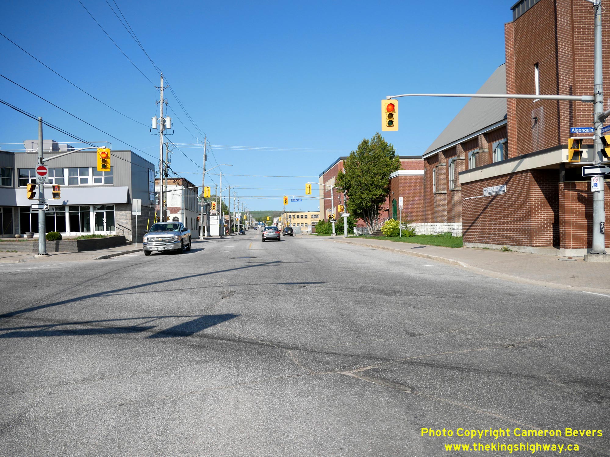
 Left - Junction of Cassells Street (Hwy 63) at the northbound route of Hwy 11B (McIntyre Street), facing south towards Algonquin Avenue and Main Street.
Traffic bound for the city centre can continue ahead and then turn left onto Algonquin Avenue at the next block, while traffic heading out of the city may either turn
right at this intersection and follow Hwy 11B via McIntyre Street or proceed two blocks ahead and turn right onto Main Street (Hwy 17B). See an
Enlarged Photo Here. Left - Junction of Cassells Street (Hwy 63) at the northbound route of Hwy 11B (McIntyre Street), facing south towards Algonquin Avenue and Main Street.
Traffic bound for the city centre can continue ahead and then turn left onto Algonquin Avenue at the next block, while traffic heading out of the city may either turn
right at this intersection and follow Hwy 11B via McIntyre Street or proceed two blocks ahead and turn right onto Main Street (Hwy 17B). See an
Enlarged Photo Here.(Photograph taken on May 27, 2023 - © Cameron Bevers) Right - Facing north along Cassells Street (Hwy 63) from the northbound route of Hwy 11B (McIntyre Street). The North Bay Bypass lies about 2 km ahead. See an Enlarged Photo Here.(Photograph taken on May 27, 2023 - © Cameron Bevers)
More King's Highway 11B Photographs Coming Soon!
|
|---|
Links to Adjacent King's Highway Photograph Pages:
Back to King's Highway 11 Photos /
King's Highway 11B (North Bay) History /
On to King's Highway 12 Photos
Ontario Highway History - Main Menu / Back to List of Highways Website contents, photos & text © 2002-2026, Cameron
Bevers (Webmaster) - All Rights Reserved / Contact Me
|
|---|