
| 
| |
|
|
This page contains historical photos of Ontario's King's Highway 11 dating from 1940 to 1949. All photographs displayed on
this page were taken by the Ontario Ministry of Transportation, unless specifically noted otherwise. Historical photographs are arranged in approximate chronological
order. Click on any thumbnail to see a larger image!
Please note that all photographs displayed on this
website are protected by copyright. These photographs must not be reproduced, published,
electronically stored or copied, distributed, or posted onto other websites without
my written permission. If you want to use photos from this website, please
email me first for permission. Thank-you!
|
|---|
|
Page 2: Historical King's Highway 11 Photographs (1940 to 1949)

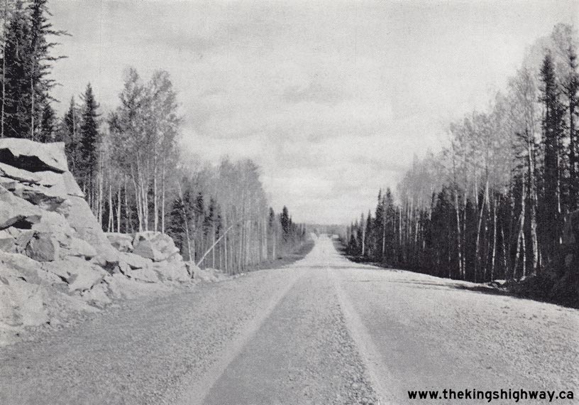
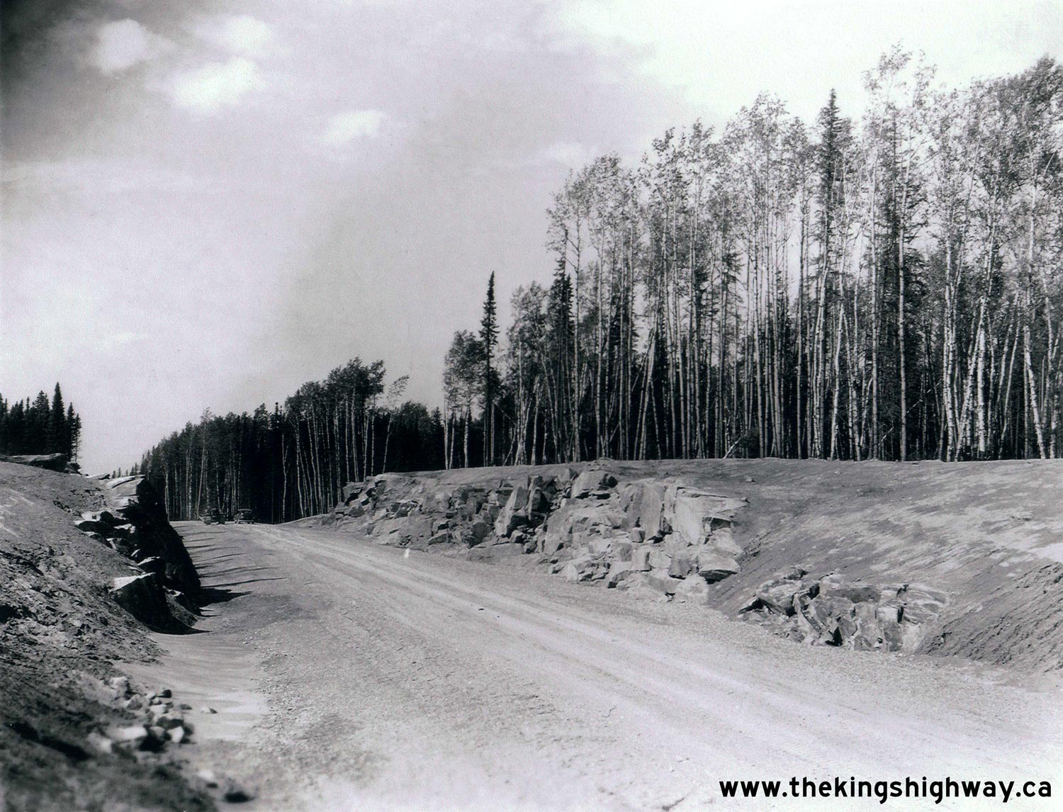
Left - Rock cuts on a completed section of the Nipigon-Geraldton Highway (Hwy 11) near Lake Helen. See an
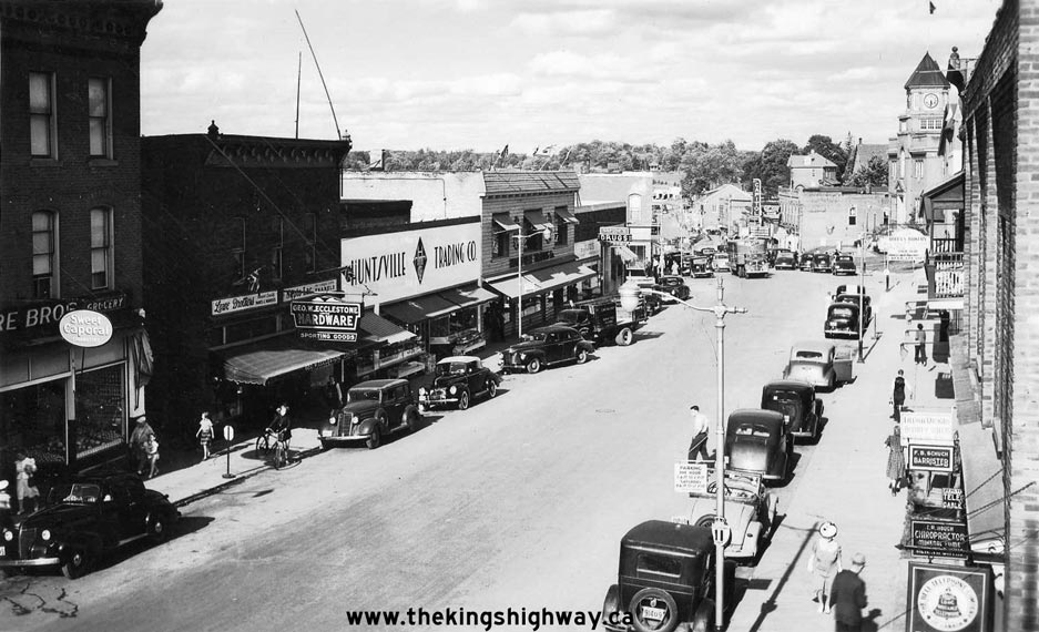
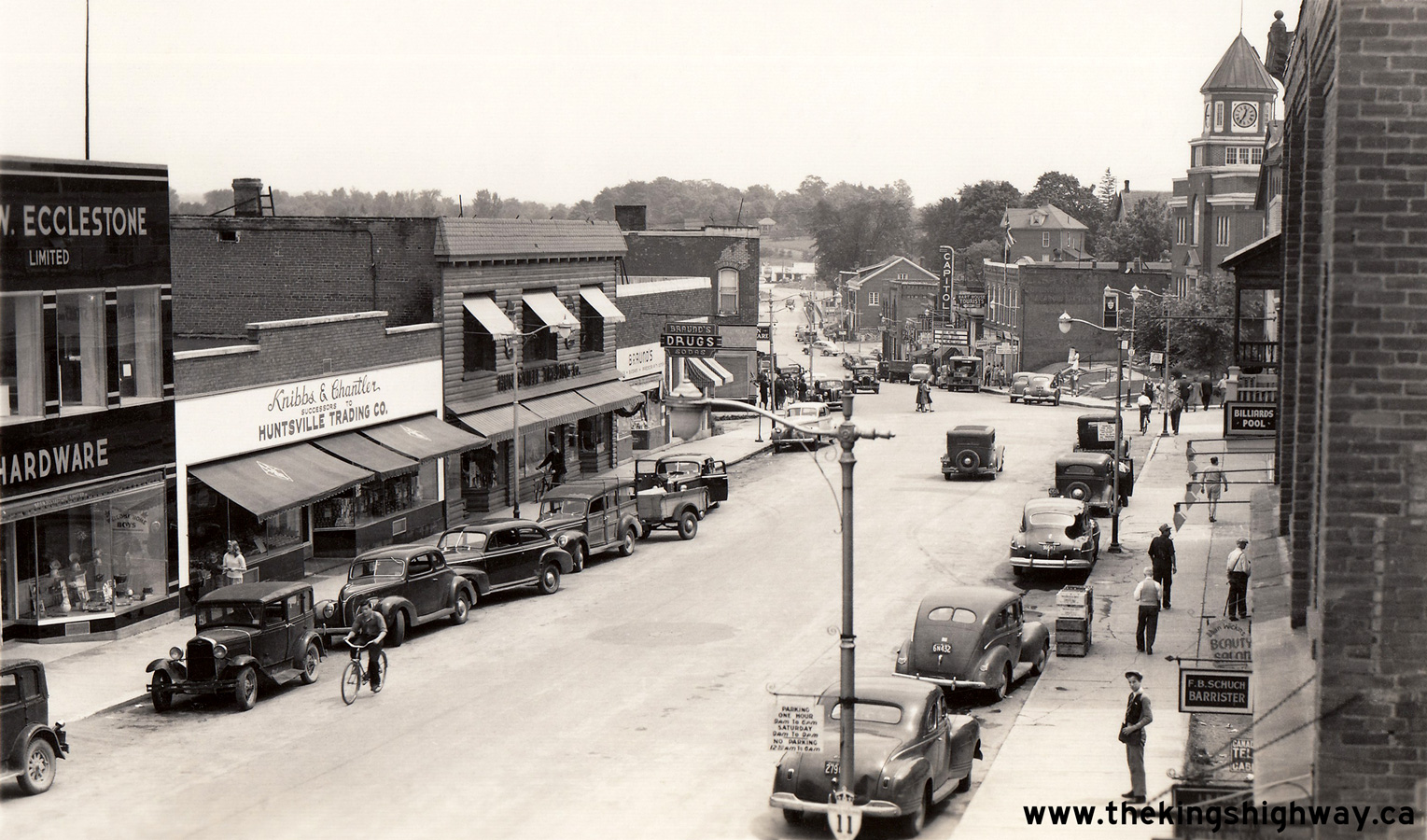
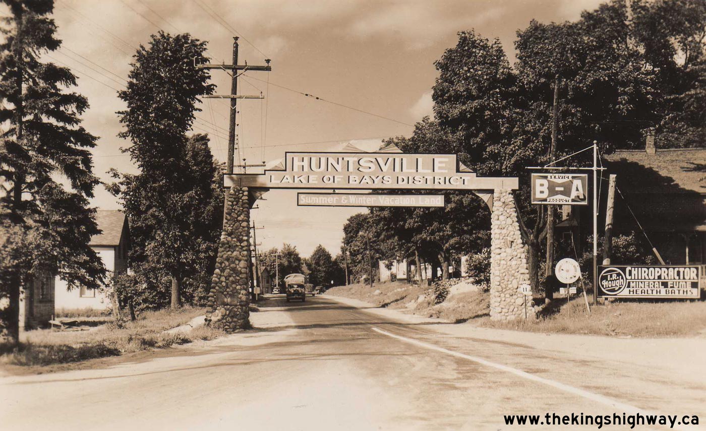
Enlarged Photo Here. Photo taken in 1940. (Photo courtesy of Ontario Ministry of Transportation - © King's Printer for Ontario, 1940) Right - Circa 1940 postcard view of Hwy 11 in Downtown Huntsville. See an Enlarged Photo Here. (Photo courtesy of Annabelle Studio) 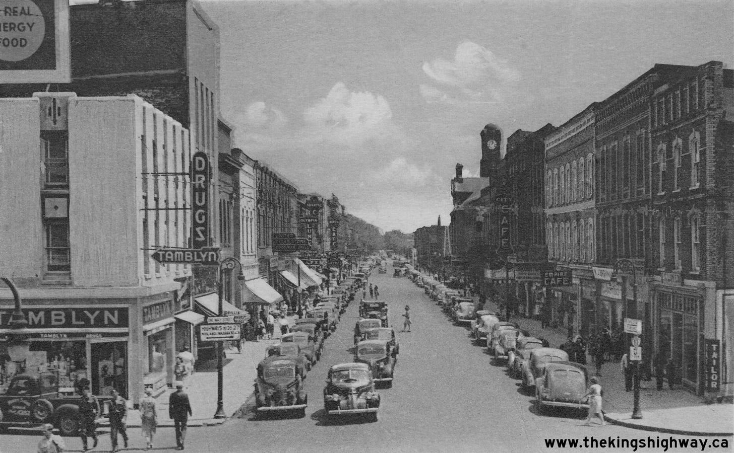

Left - Circa 1940 postcard view of Hwy 11 (Dunlop Street) in Downtown Barrie, facing east from the Hwy 26 & Hwy 27 Junction. See an
Enlarged Photo Here. (Photo courtesy of the Photogelatine Engraving Company Ltd, Ottawa)  Right - View of Hwy 11 about 33 miles north of North Bay, approaching Marten River. See an
Enlarged Photo Here. Photo taken on July 30, 1940. Right - View of Hwy 11 about 33 miles north of North Bay, approaching Marten River. See an
Enlarged Photo Here. Photo taken on July 30, 1940.(Photo courtesy of Ontario Ministry of Transportation - © King's Printer for Ontario, 1940) 
Above - Completed Jumping Caribou Lake Diversion (Hwy 11) through the Temagami Forest Reserve in 1940. The final Hwy 11 reconstruction project was completed
between Marten River and Temagami during 1940. The resulting Class "A" highway was wider, straighter and had gentler grades than those seen along the original 1927
Ferguson Highway. Between 1937 and 1940, more than 30 miles of the Old Ferguson Highway were bypassed by newly-reconstructed sections of Hwy 11 between North Bay and
Temagami. See an Enlarged Photo Here. Photo taken on July 30, 1940. (Photo courtesy of Ontario Ministry of Transportation - © King's Printer for Ontario, 1940) 
 Left - Circa 1940 postcard view of the completed grading operations along Hwy 11 near Temagami. See an
Enlarged Photo Here. Left - Circa 1940 postcard view of the completed grading operations along Hwy 11 near Temagami. See an
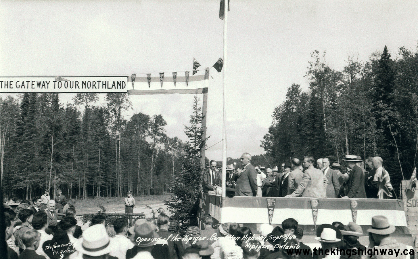
Enlarged Photo Here.(Photo courtesy of MacLean Photo) Right - Official opening ceremony for the Nipigon-Geraldton Highway (Hwy 11). The highway was officially opened to traffic by Highways Minister Thomas Baker McQuesten on September 7, 1940. However, the road was unofficially opened to traffic during the winter of 1939, when construction had progressed to a point that the entire route was traversable between Nipigon and Geraldton. See an Enlarged Photo Here. Photo taken on September 7, 1940. (Photo © Archives of Ontario - Series RG-14-162-2, Hwy 11/17 Folder)  Above - Circa 1940 postcard view of the completed Nipigon-Geraldton Highway (Hwy 11) at Talus Lake north of Nipigon. See an
Enlarged Photo Here. Above - Circa 1940 postcard view of the completed Nipigon-Geraldton Highway (Hwy 11) at Talus Lake north of Nipigon. See an
Enlarged Photo Here.(Photo courtesy of The Camera Shop, Port Arthur) 
 Left - New bridge on Hwy 11 over the Marten River in 1940, located about 35 miles north of North Bay. This steel pony truss structure was built along a
diversion of Hwy 11. The highway was built on top of a rock fill across a shallow part of the Marten River, with a Warren-type steel truss structure built across the
narrows. See an Enlarged Photo Here. Photo taken on October 2, 1940. Left - New bridge on Hwy 11 over the Marten River in 1940, located about 35 miles north of North Bay. This steel pony truss structure was built along a
diversion of Hwy 11. The highway was built on top of a rock fill across a shallow part of the Marten River, with a Warren-type steel truss structure built across the
narrows. See an Enlarged Photo Here. Photo taken on October 2, 1940.(Photo courtesy of Ontario Ministry of Transportation - © King's Printer for Ontario, 1940) Right - Department of Highways of Ontario (DHO) Roadside Park and Campground at Marten River, located 35 miles north of North Bay. See an Enlarged Photo Here. Photo taken on October 2, 1940. (Photo courtesy of Ontario Ministry of Transportation - © King's Printer for Ontario, 1940) 

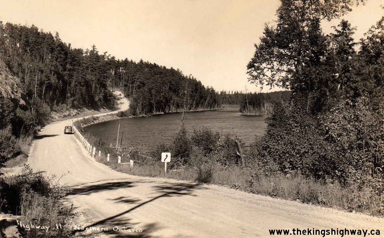
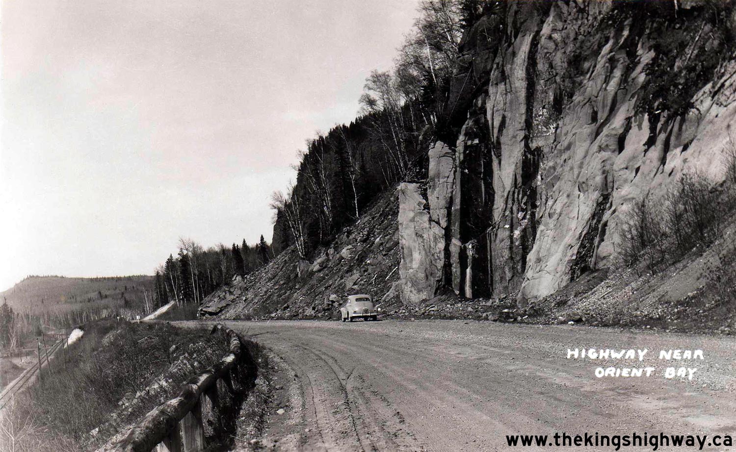
Left - Circa 1940 postcard view of Hwy 11 at Jumping Caribou Lake. See an
Enlarged Photo Here. (Photo courtesy of MacLean Photo) Right - Circa 1940 postcard view of the Nipigon-Geraldton Highway (Hwy 11) near Orient Bay. See an Enlarged Photo Here. (Photo from Cameron Bevers' historical photograph collection - Original photographer unknown) 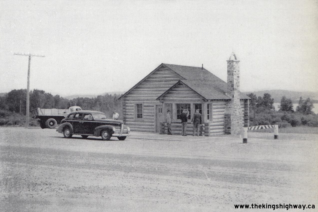
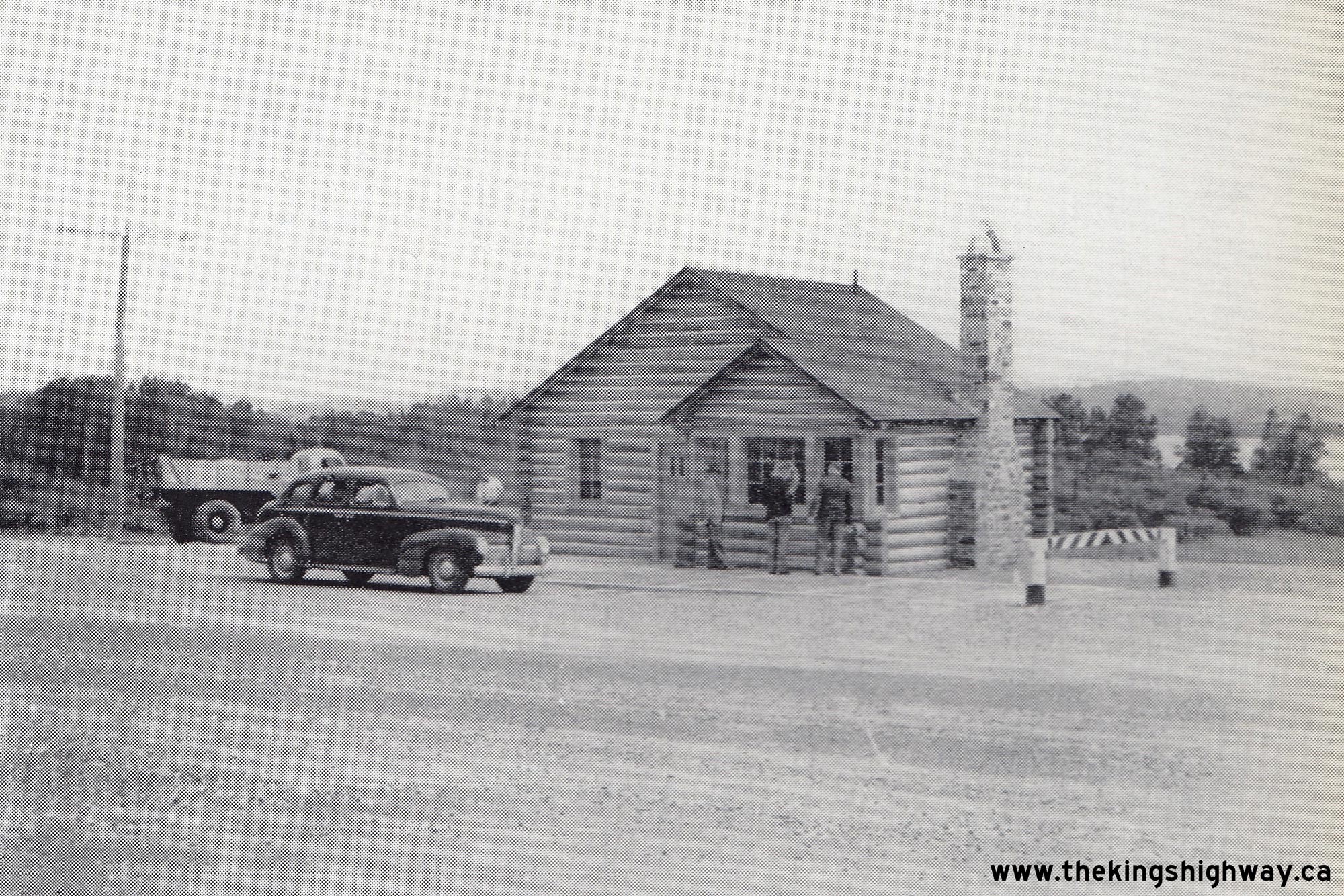
Above - New DHO Truck Weigh Scale at the Hwy 35 & Hwy 60 Junction on Hwy 11 north of Huntsville in 1941. This new truck weigh scale was constructed in 1941.
It was one of several similar facilities built at strategic points along Ontario's King's Highway System in the late 1930s and early 1940s to enforce truck loading
regulations. For many years, this building also housed an Ontario Provincial Police detachment. See an
Enlarged Photo Here. Photo taken in 1941. (Photo courtesy of Ontario Ministry of Transportation - © King's Printer for Ontario, 1941) 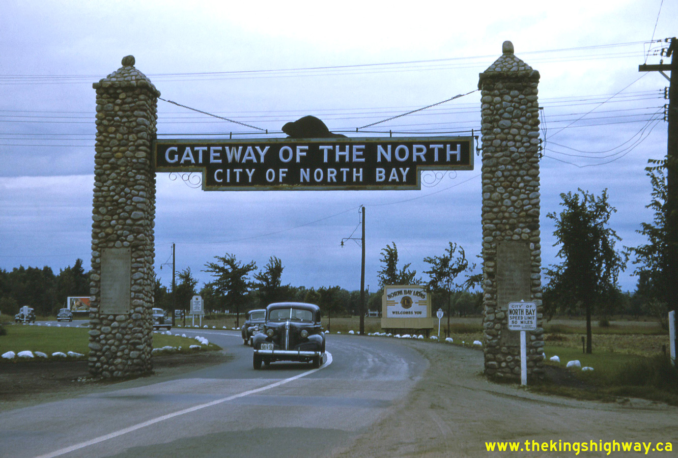
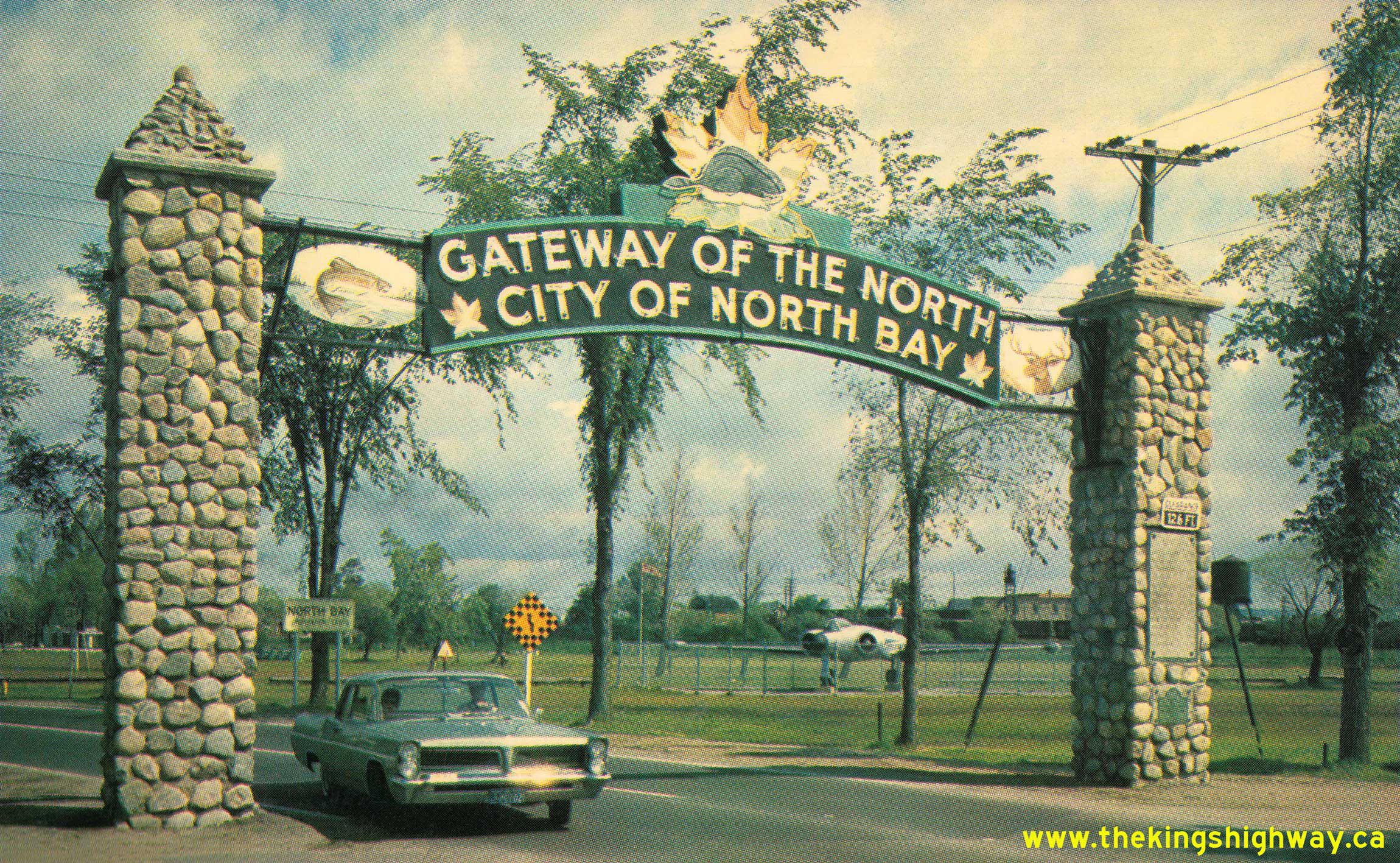
Left - View of the North Bay Welcome Arch on Hwy 11 at the southern entrance to the city in 1941. This rare colour photo was taken during World War II by an
unknown tourist during a road trip across Ontario in the Summer of 1941. Colour film was very expensive to purchase and process in the early 1940s, so colour photos
from that period are fairly rare. This early photo of the North Bay Welcome Arch shows the arch with its historical straight signboard configuration. The old
straight signboard was removed from the arch after World War II and replaced with the far more familiar
curved signboard, which appears in later photos of the welcome arch. Until Hwy 69 was completed
between Parry Sound and Sudbury in the 1950s, every motorist heading up to Northern Ontario from Toronto would have passed through this arch on Hwy 11. This arch
truly was the "Gateway of the North"! See an Enlarged Photo Here. Photo taken in July 1941. (Photo from Cameron Bevers' historical photograph collection - Original photographer unknown) Right - A partially-completed section of the Hearst-Geraldton Highway (Hwy 11) approaching the Nagagami River in 1941. Note the temporary road construction camp in the background. This was one of several temporary camps built along the highway to house engineering and construction staff during the highway's construction. See an Enlarged Photo Here. Photo taken in 1941. (Photo courtesy of Ontario Ministry of Transportation - © King's Printer for Ontario, 1941) 

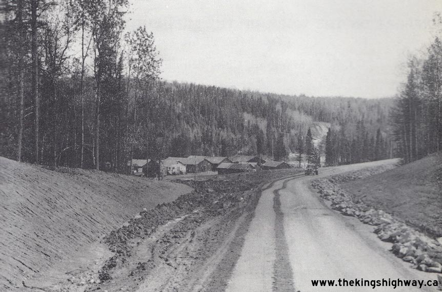
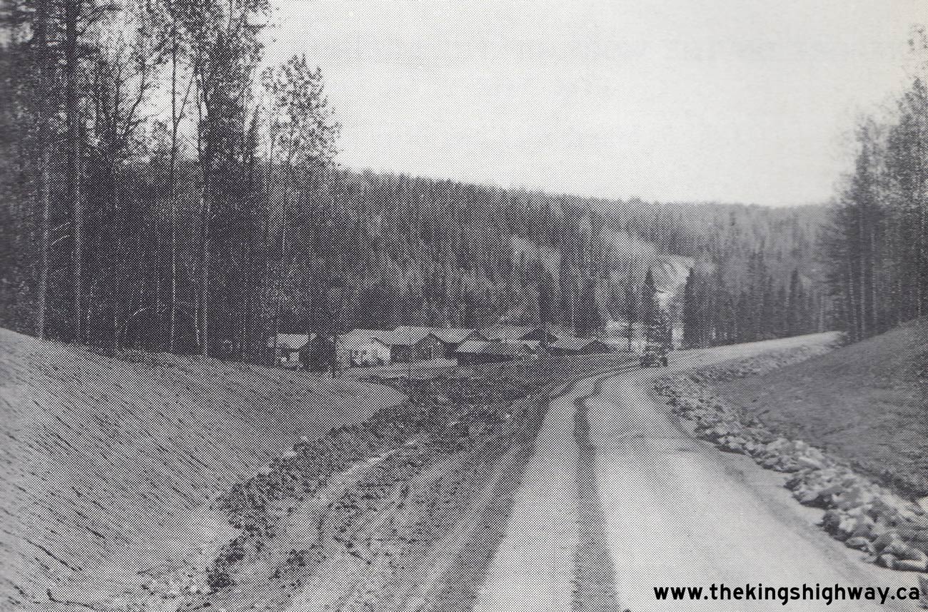
Left - Excavating muskeg along the route of the Hearst-Geraldton Highway (Hwy 11). See an
Enlarged Photo Here. Photo taken in 1941. (Photo courtesy of Ontario Ministry of Transportation - © King's Printer for Ontario, 1941) Right - Highway workers being dropped off at Savoff Station on the Canadian National Railway (CNR) west of Hearst in 1941. Savoff was the main drop-off point for personnel and supplies during the construction of the Hearst-Geraldton Highway (Hwy 11) in 1941. A tote road was built from Savoff southerly to the highway construction camps. See an Enlarged Photo Here. Photo taken in 1941. (Photo courtesy of Ontario Ministry of Transportation - © King's Printer for Ontario, 1941) 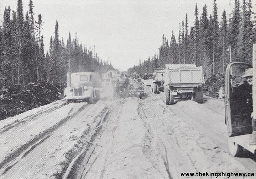
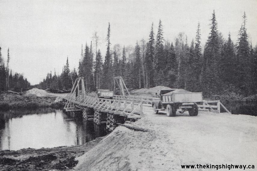
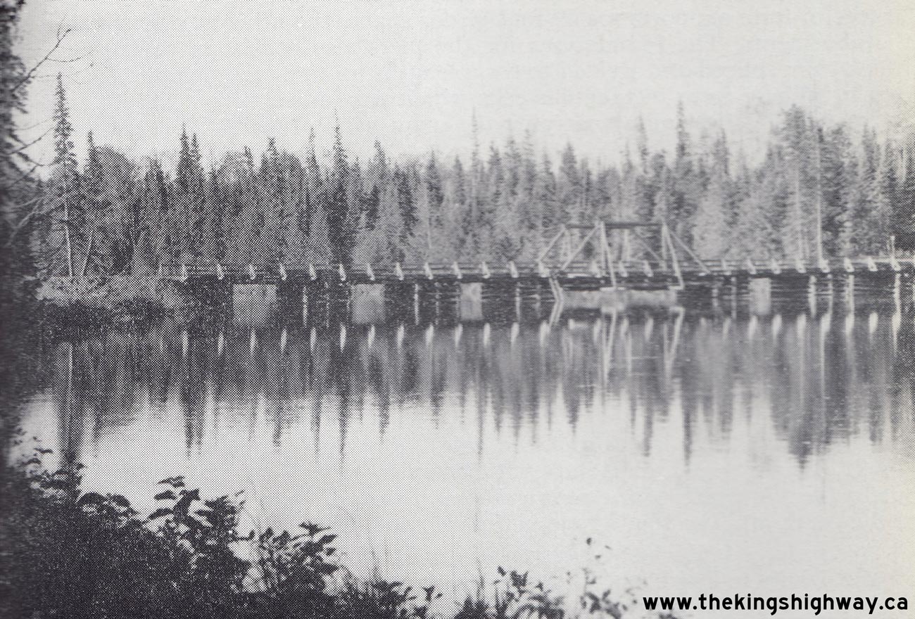
Left - Construction operations underway in 1941 on the Hearst-Geraldton Highway (Hwy 11). See an
Enlarged Photo Here. Photo taken in 1941. (Photo courtesy of Ontario Ministry of Transportation - © King's Printer for Ontario, 1941) Right - A temporary timber bridge on the Hearst-Geraldton Highway (Hwy 11) in 1941. Timber bridges proved to be invaluable during the construction of the Hearst-Geraldton Highway. Structural steel was in short supply due to World War II, and there were no local supplies of concrete near many of the proposed bridge sites. Many of these temporary timber bridges lasted until well into the 1950s, when they were finally replaced with permanent steel and concrete structures. See an Enlarged Photo Here. Photo taken in 1941. (Photo courtesy of Ontario Ministry of Transportation - © King's Printer for Ontario, 1941) 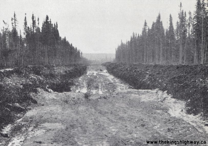
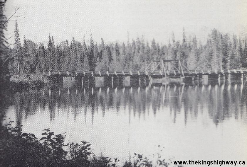
Left - Excavation and removal of muskeg along the proposed route of the new Hearst-Geraldton Highway (Hwy 11). See an
Enlarged Photo Here. Photo taken in 1941. (Photo courtesy of Ontario Ministry of Transportation - © King's Printer for Ontario, 1941) Right - Temporary timber bridge at the Shekak River on the Hearst-Geraldton Highway (Hwy 11). See an Enlarged Photo Here. Photo taken in 1941. (Photo courtesy of Ontario Ministry of Transportation - © King's Printer for Ontario, 1941) 
Above - Completed section of the new Hearst-Geraldton Highway (Hwy 11) at Mile 61.0, looking west in 1941. This section of the highway was built by Tomlinson
Construction, under Contract #1940-128. Until the completion of this first Trans-Canada Highway link between Hearst and Geraldton in 1943, it was actually not
possible to drive directly across Canada due to incomplete gaps in the Ontario highway system. Once the gap in Hwy 11 was completed, it established an all-Canadian
highway link between Eastern and Western Canada. See an Enlarged Photo Here. Photo taken in
1941. (Photo © Archives of Ontario - Series RG-14-162-2-27, Photo #7) 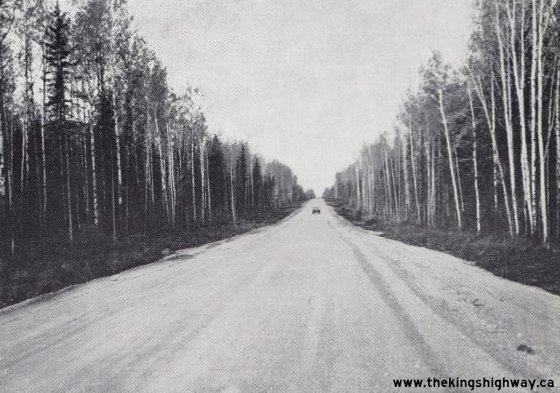

Left - Graded section of the Hearst-Geraldton Highway (Hwy 11) that had already been opened to traffic. See an
Enlarged Photo Here. Photo taken in 1941. (Photo courtesy of Ontario Ministry of Transportation - © King's Printer for Ontario, 1941) Right - Completed section of the Hearst-Geraldton Highway (Hwy 11) at Klotz Lake in 1942. See an Enlarged Photo Here. (Photo courtesy of Ontario Ministry of Transportation - © King's Printer for Ontario, 1942) 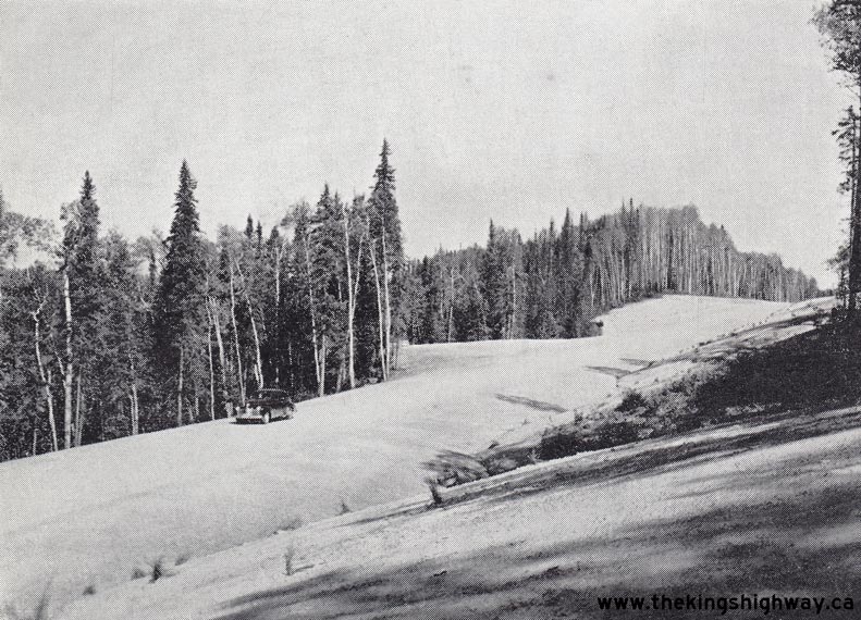
Left - Completed section of the Hearst-Geraldton Highway (Hwy 11) in 1942. See an
Enlarged Photo Here. (Photo courtesy of Ontario Ministry of Transportation - © King's Printer for Ontario, 1942) Right - Completed section of the Hearst-Geraldton Highway (Hwy 11) in 1942. See an Enlarged Photo Here. (Photo courtesy of Ontario Ministry of Transportation - © King's Printer for Ontario, 1942) 
Above - Completed section of the Hearst-Geraldton Highway (Hwy 11) in 1942. See an
Enlarged Photo Here. (Photo courtesy of Ontario Ministry of Transportation - © King's Printer for Ontario, 1942) 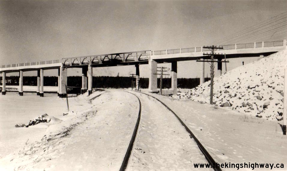
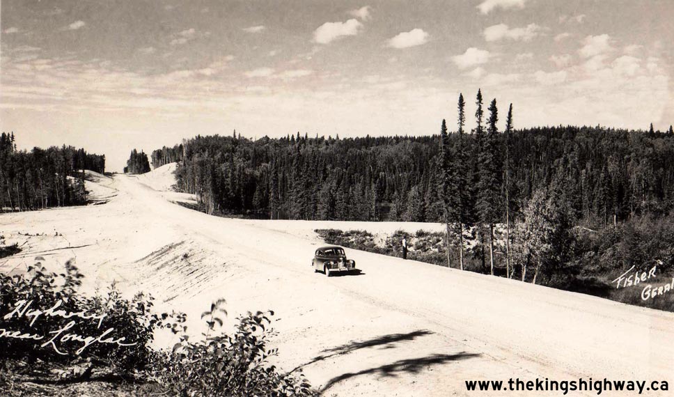
Left - Circa 1943 postcard view of the new Longlac Railway Overhead on Hwy 11 in winter. See an
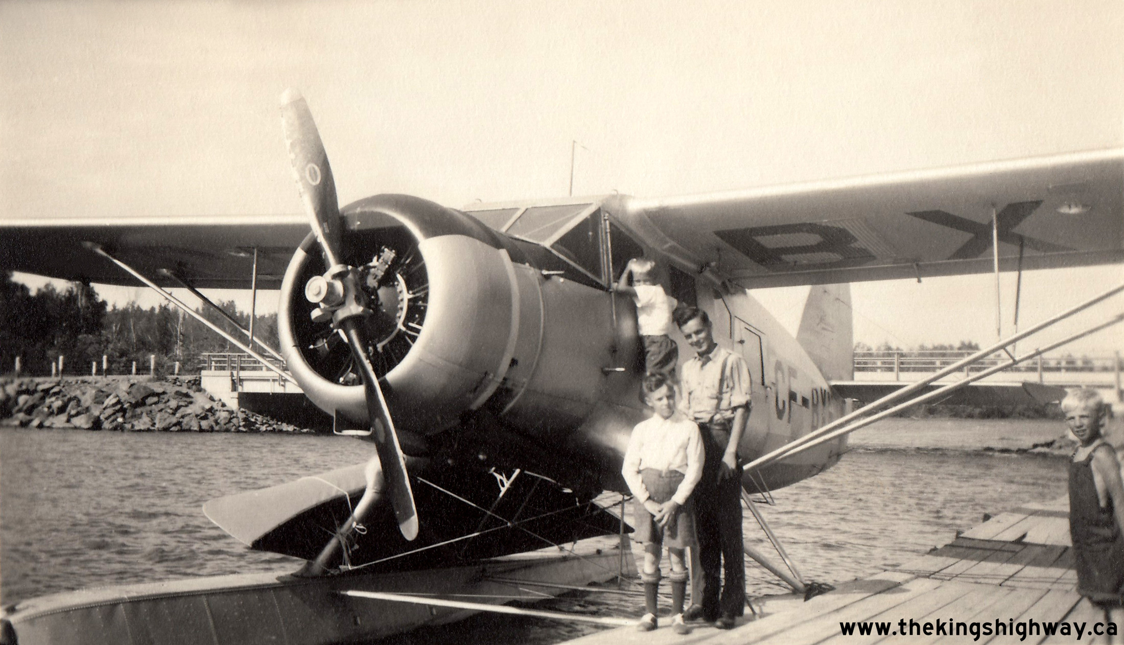
Enlarged Photo Here. (Photo from Cameron Bevers' historical photograph collection - Original photographer unknown) Right - Circa 1943 postcard view of the new Hearst-Geraldton Highway (Hwy 11). See an Enlarged Photo Here. (Photo courtesy of Fisher Studio, Geraldton)  Above - Float plane at dock with a canoe strapped to the side beside the Kenogami Lake Bridge on Hwy 11 north of Kirkland Lake. Air, water and highway
transportation are all captured in this World War II-era family photo from 1944. Although Ontario's Highway System has been developed extensively since the 1940s,
there are still many parts of the province which are inaccessible by road to this day. Float planes such as this one can provide access to some of the more remote
lakes and settlements which lie beyond the reach of the highway system. The Kenogami Lake Bridge on Hwy 11 in the background spans the Blanche River. Originally
constructed in 1937 under Contract #1937-126, the Kenogami Lake Bridge was replaced with a new structure in 1984. See an
Enlarged Photo Here. Photo taken on August 9, 1944. Above - Float plane at dock with a canoe strapped to the side beside the Kenogami Lake Bridge on Hwy 11 north of Kirkland Lake. Air, water and highway
transportation are all captured in this World War II-era family photo from 1944. Although Ontario's Highway System has been developed extensively since the 1940s,
there are still many parts of the province which are inaccessible by road to this day. Float planes such as this one can provide access to some of the more remote
lakes and settlements which lie beyond the reach of the highway system. The Kenogami Lake Bridge on Hwy 11 in the background spans the Blanche River. Originally
constructed in 1937 under Contract #1937-126, the Kenogami Lake Bridge was replaced with a new structure in 1984. See an
Enlarged Photo Here. Photo taken on August 9, 1944.(Photo from Cameron Bevers' historical photograph collection - Original photographer unknown) 
 Left - Circa 1945 postcard view of the Longlac Railway Overhead on the Hearst-Geraldton Highway (Hwy 11), as seen from Long Lake. This impressive structure
spanned both the CNR and the Kenogami River. This Wartime bridge was constructed under Contract #1940-140 and was completed in 1942. The bridge consisted of 8
concrete rigid frame approach spans, each with a length of 48 feet, 9 inches, along with a continuous steel pony truss main structure with staggered spans of 81 feet,
3 inches and 48 feet, 9 inches. This unusual structure was by far the most complex bridge constructed along the Hearst-Geraldton Highway. It formed a critical link in
the first Trans-Canada Highway route across Ontario. Until Hwy 17 was completed around Lake Superior in 1960, all Trans-Canada Highway traffic passed across this
lengthy, multi-span structure. This particular postcard was mailed from Port Arthur to a recipient in Puslinch, with a postmarked date of August 13, 1947. See an
Enlarged Photo Here. Photo taken circa 1945. Left - Circa 1945 postcard view of the Longlac Railway Overhead on the Hearst-Geraldton Highway (Hwy 11), as seen from Long Lake. This impressive structure
spanned both the CNR and the Kenogami River. This Wartime bridge was constructed under Contract #1940-140 and was completed in 1942. The bridge consisted of 8
concrete rigid frame approach spans, each with a length of 48 feet, 9 inches, along with a continuous steel pony truss main structure with staggered spans of 81 feet,
3 inches and 48 feet, 9 inches. This unusual structure was by far the most complex bridge constructed along the Hearst-Geraldton Highway. It formed a critical link in
the first Trans-Canada Highway route across Ontario. Until Hwy 17 was completed around Lake Superior in 1960, all Trans-Canada Highway traffic passed across this
lengthy, multi-span structure. This particular postcard was mailed from Port Arthur to a recipient in Puslinch, with a postmarked date of August 13, 1947. See an
Enlarged Photo Here. Photo taken circa 1945.(Photo courtesy of Fisher Studio, Geraldton) Right - Circa 1945 postcard view of Hwy 11 in Downtown Huntsville. This great view of Main Street (Hwy 11) was likely taken soon after World War II ended. When I first purchased this real photo postcard for my collection about 20 years ago, I had dated the image to roughly 1948. However, upon closer study of the photo, it became apparent that it was actually taken a few years earlier. At the Capitol Theatre in the background, the film "Till We Meet Again" was playing, which was released in 1944. Ontario passenger car license plates for the 1945 registration year were issued as single rear plates only, in order to conserve metal supplies. License plate pairs (both front and rear plates) did not return again until the 1948 registration year. Note that the front-facing vehicles on Main Street have no front license plates. Two of the parked vehicles at left still have their 1944 windshield license stickers in place. No license plates were produced for passenger cars during the 1944 registration year, so windshield stickers were used in lieu of metal license plates. Perhaps the most important clue dating this photo to about 1945 is the "Welcome Home Boys" sign in the front display window of the Ecclestone Hardware Store at left - presumably to greet soldiers as they returned home to Canada after hostilities ended overseas. Careful observers may also notice the King's Highway sign displayed in the upper-floor window of the Department of Highways' District #11 Office located in the building right beside Huntsville's Town Hall. DHO's Huntsville District Office moved from Downtown Huntsville to a new location at the south entrance to town in the 1950s. See an Enlarged Photo Here. Photo taken circa 1945. (Photo courtesy of Annabelle Studio) 
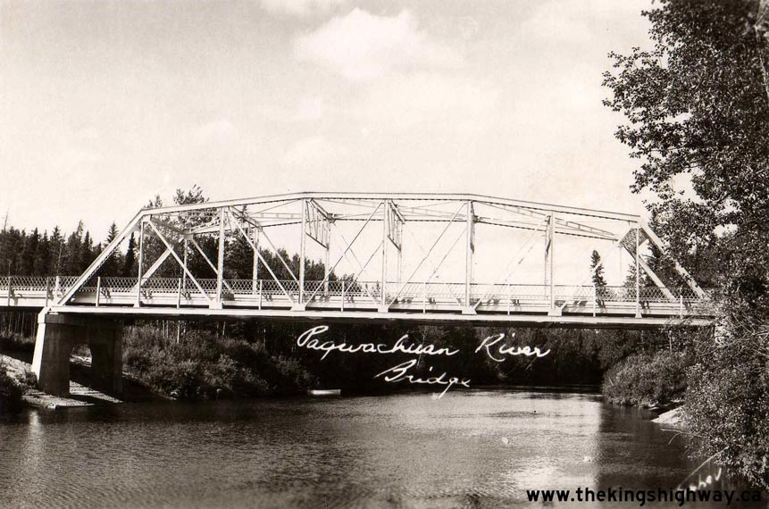
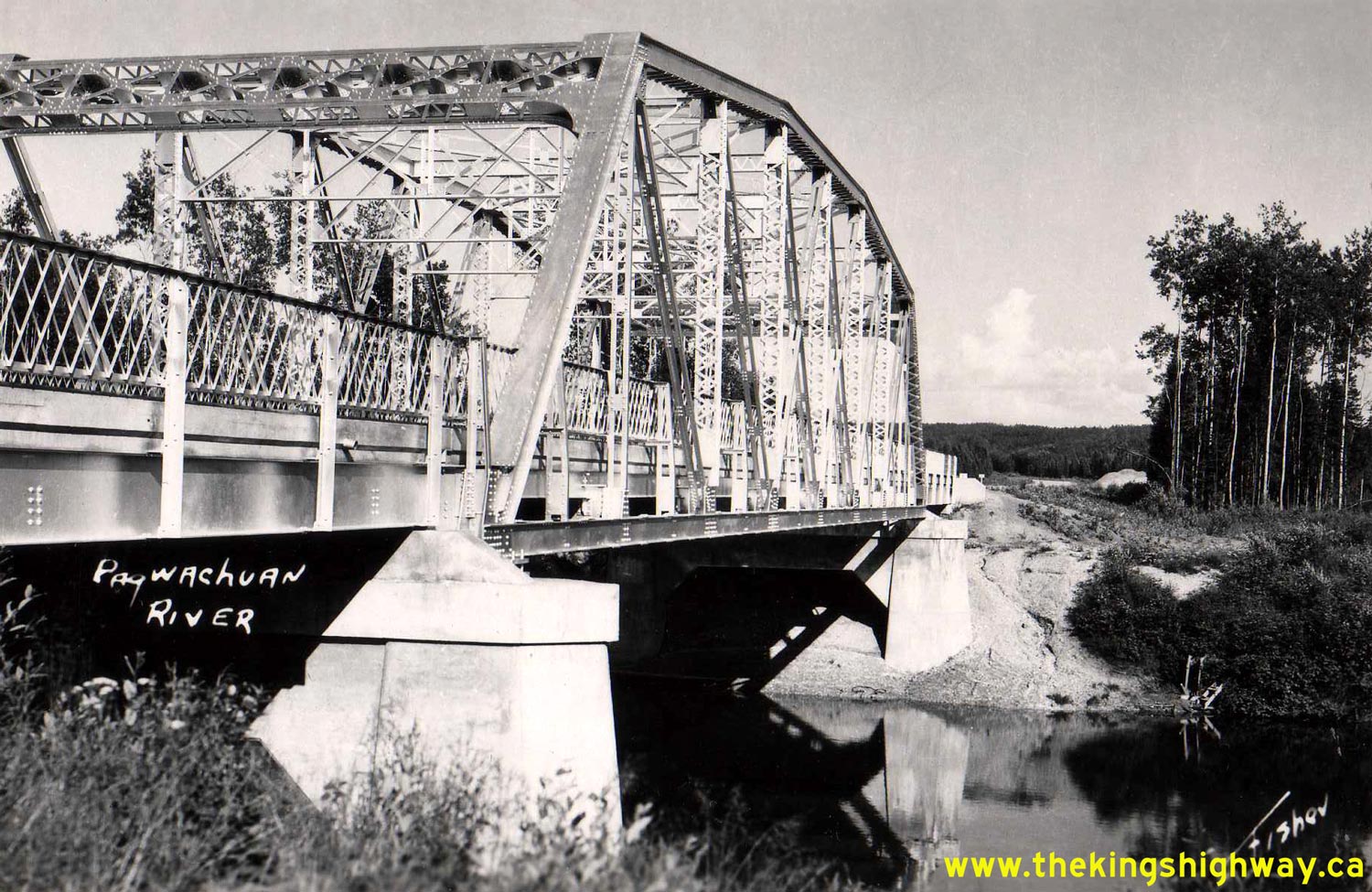
Left - Circa 1945 postcard view of the Pagwachuan River Bridge on Hwy 11 between Hearst and Longlac. This rare Wartime steel through truss bridge was
constructed under Contract #1941-45 and was completed in 1942. The DHO used its dwindling supplies of structural steel to complete a handful of permanent bridges on
the Hearst-Geraldton Highway. However, as steel supplies became scarcer as the war dragged on, it became necessary to construct temporary native timber bridges to
span rivers. The lumber used for these timber bridges was sourced locally as right-of-way clearing operations for the proposed highway advanced. See an
Enlarged Photo Here. (Photo courtesy of Fisher Studio, Geraldton) Right - Circa 1945 postcard view of the Pagwachuan River Bridge on the new Hearst-Geraldton Highway (Hwy 11), located about 59 miles east of Longlac. See an Enlarged Photo Here. (Photo courtesy of Fisher Studio, Geraldton) 

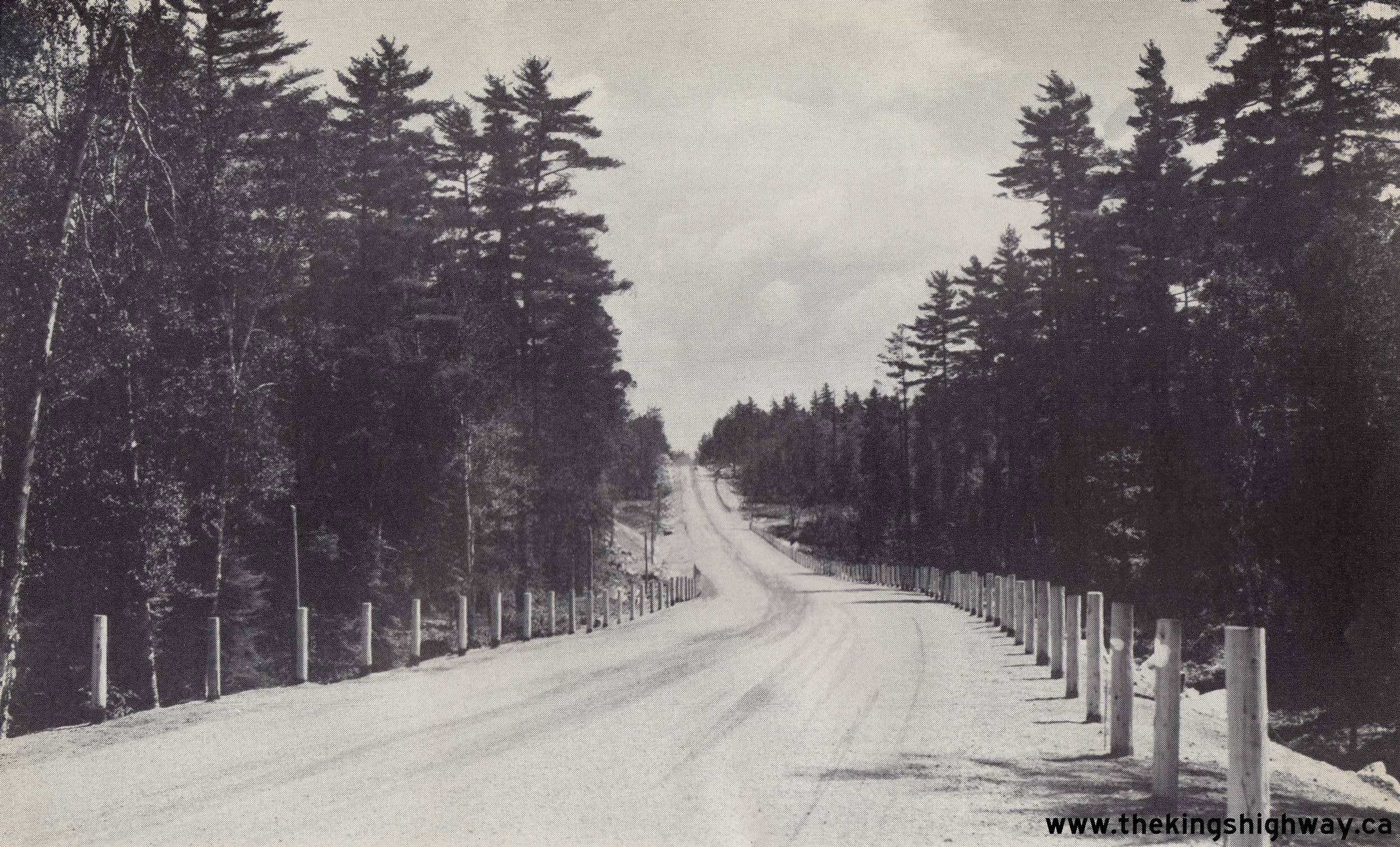
Left - Circa 1945 postcard view of a newly paved section of Hwy 11 north of Temagami. A 10-mile section of Hwy 11 was paved with hot-mix asphalt through the
Temagami area in 1945, under Contract #1945-360. This contract marked a resumption of paving operations along Hwy 11, which had to be suspended for a number of years
due to World War II. Following the completion of this paving contract, motorists could enjoy the smooth ride of an asphalt highway from the Wilson Lake area about 8
miles south of Temagami to a point about 2 miles north of Temagami. This photo was taken near the north end of the paving contract, looking south towards Temagami.
See an Enlarged Photo Here. (Photo courtesy of MacLean Photo) Right - Circa 1945 postcard view of the Huntsville Welcome Arch on Hwy 11. Like many towns in Northern Ontario, Huntsville constructed a welcome arch during the 1930s to greet tourists arriving on the highway by automobile. For over 25 years after the arch's completion in 1932, all Hwy 11 traffic passed through the Huntsville Welcome Arch. The arch was designed based on the dimensions of vehicles commonly using the Ferguson Highway (Hwy 11) in the early 1930s. However, vehicles continued to get larger over the next two decades. By the 1950s, the vertical clearance below the arch was insufficient for many trucks. About 18 months before the Huntsville Bypass was scheduled to be opened to traffic, the inevitable happened: The Huntsville Welcome Arch was destroyed when a transport truck hit the overhead sign in May 1958. Sadly, the arch was never rebuilt. See an Enlarged Photo Here. (Photo courtesy of Annabelle Studio) 

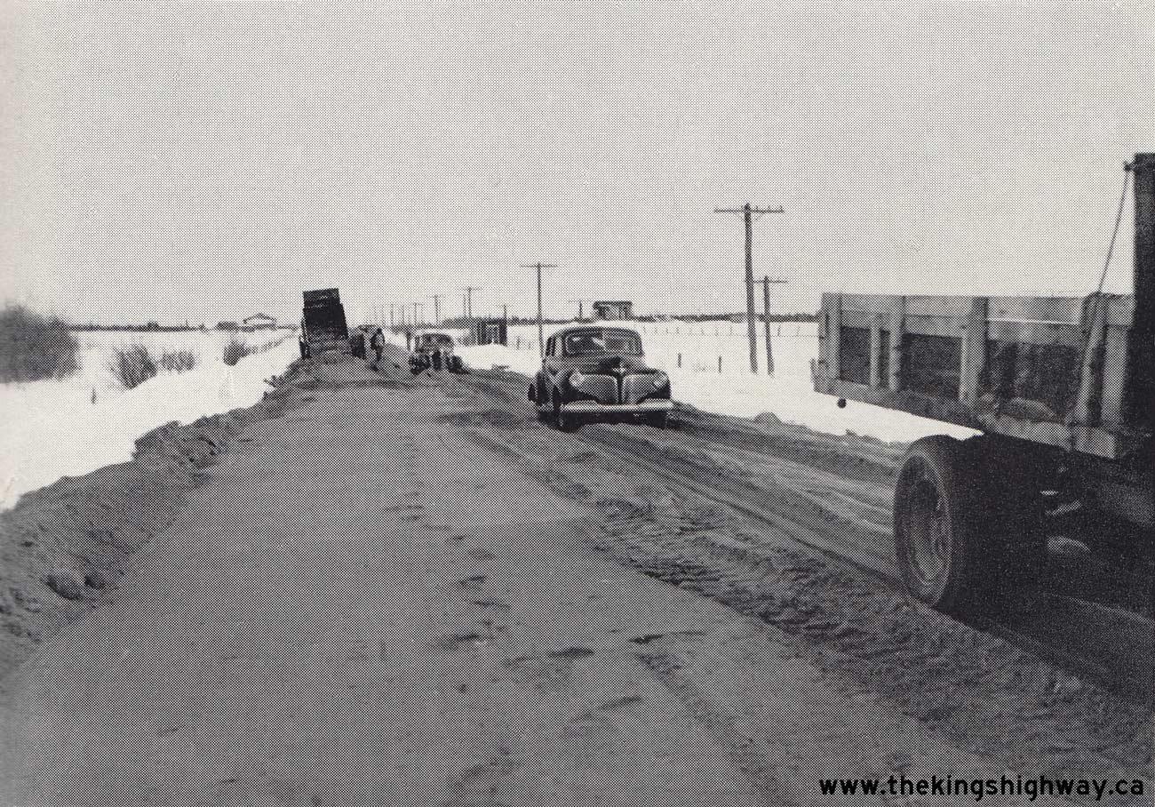
Left - Laying granular base along Hwy 11 between Fauquier and Hearst in 1946. Four contracts were called that year for the placement of granular base along
Hwy 11 between Fauquier and Hearst, in order to raise the grade of the highway and provide a more stable road base. During the Winter of 1946-1947, about 400,000
cubic yards of gravel were placed along Hwy 11. See an Enlarged Photo Here. Photo taken in
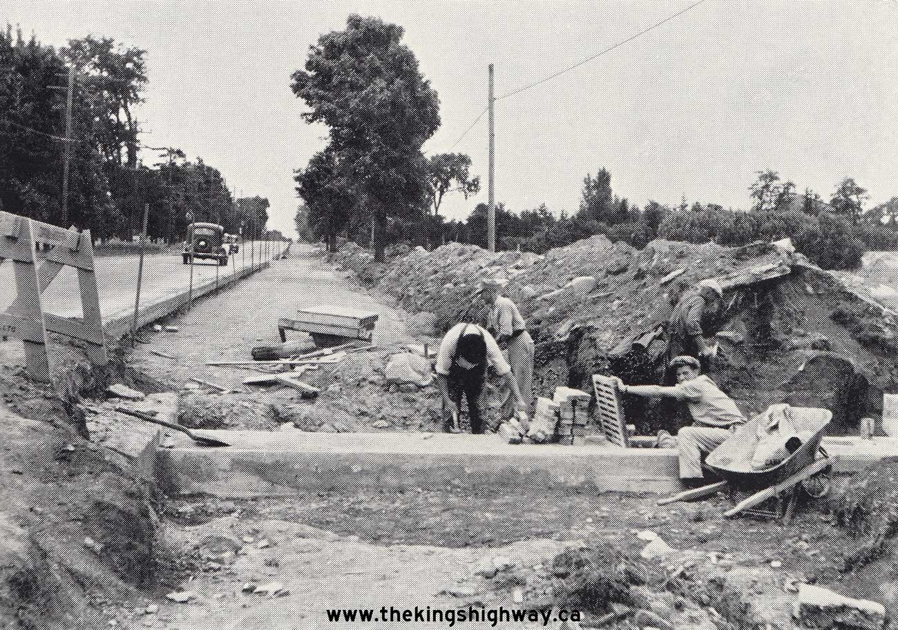
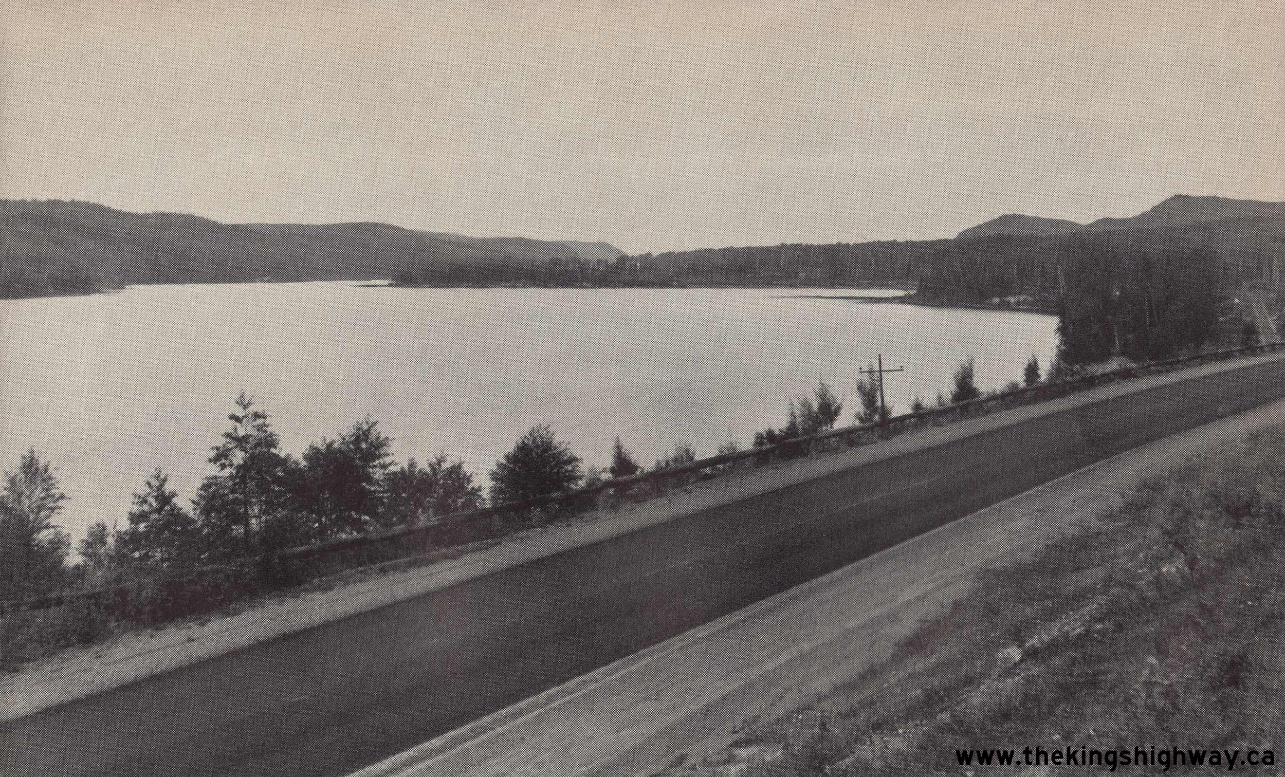
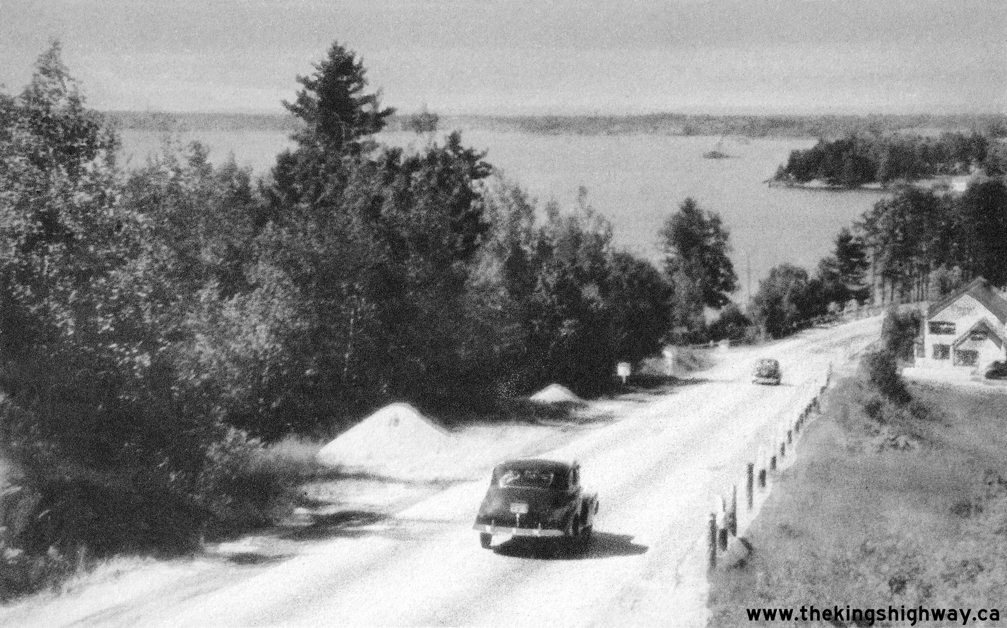
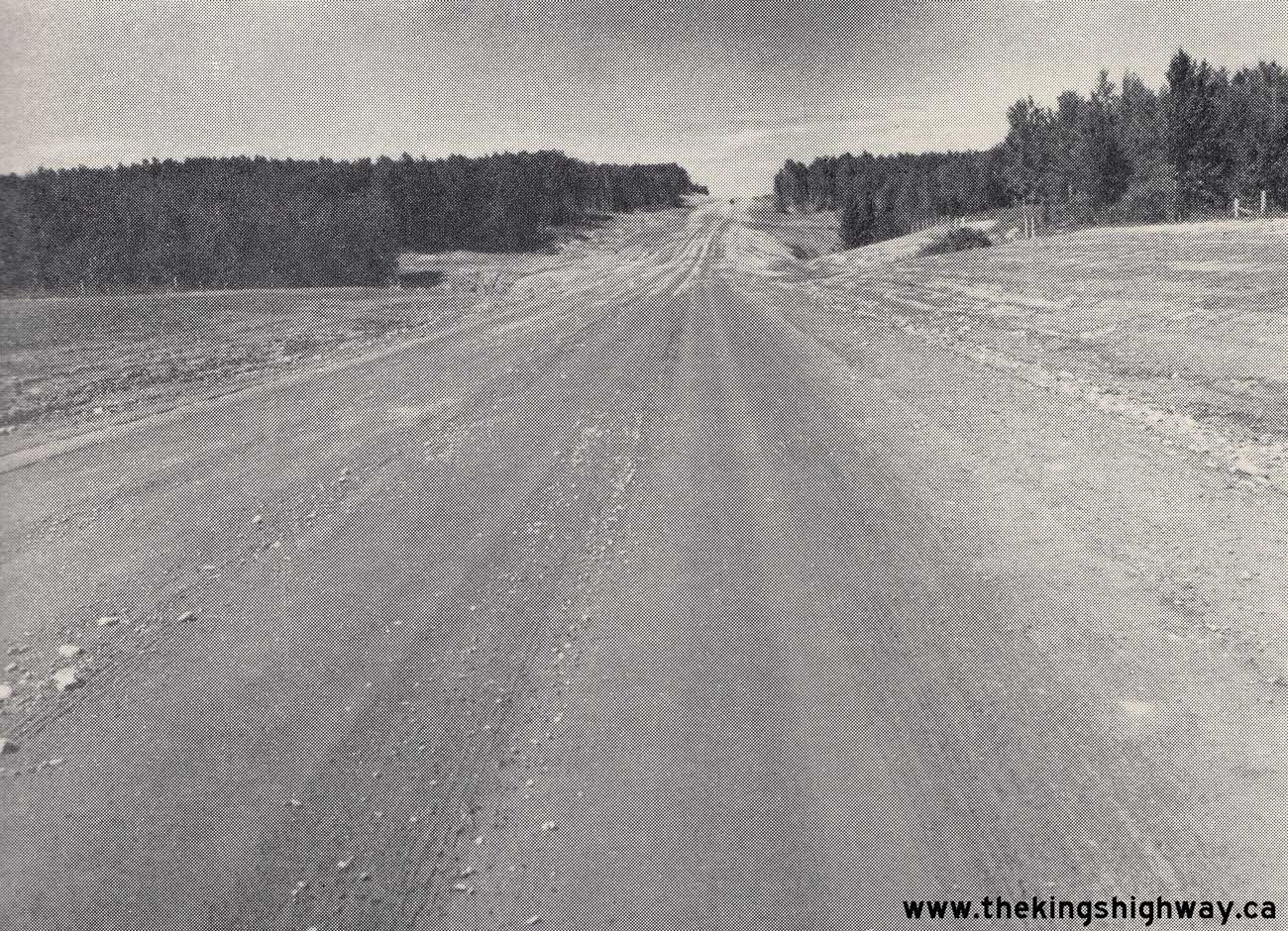
1946. (Photo courtesy of Ontario Ministry of Transportation - © King's Printer for Ontario, 1946) Right - Curran & Briggs Construction building a culvert extension at Langstaff in preparation for a widening of Hwy 11 between Steele's Corners and Richmond Hill, Contract #1946-34. Widening took place along the last remaining two-lane sections of Hwy 11 south of Richmond Hill immediately after World War II. See an Enlarged Photo Here. Photo taken on August 1, 1946. (Photo courtesy of Ontario Ministry of Transportation - © King's Printer for Ontario, 1946)  Above - Scenic view of Hwy 11 at Orient Bay (Lake Nipigon), about 21 miles south of Beardmore. See an
Enlarged Photo Here. Photo taken on September 9, 1946. Above - Scenic view of Hwy 11 at Orient Bay (Lake Nipigon), about 21 miles south of Beardmore. See an
Enlarged Photo Here. Photo taken on September 9, 1946.(Photo courtesy of Ontario Ministry of Transportation - © King's Printer for Ontario, 1946) 
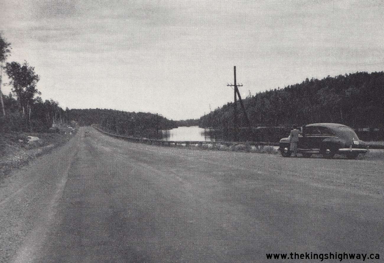
Above - Primed bituminous surface on Hwy 11 south of Beardmore. About 50 miles of bituminous material was applied along Hwy 11 between Beardmore and Nipigon
during 1946, in an effort to stabilize the highway's gravel surface until such time that the highway could be paved with asphalt. An asphalt pavement was completed
between Nipigon and Beardmore 6 years later, in 1952. See an Enlarged Photo Here. Photo
taken on September 9, 1946. (Photo courtesy of Ontario Ministry of Transportation - © King's Printer for Ontario, 1946) 
Above - Postcard view of Muskoka Road (Hwy 11 & Hwy 69) in Downtown Gravenhurst in 1947. This photo was taken shortly before the first Gravenhurst Bypass
was built in the late 1940s. At the time this photo was taken, both Hwy 11 & Hwy 69 followed Gravenhurst's Main Street. The concurrent, overlapped route between
Hwy 11 & Hwy 69 came to an end just ahead at the intersection of Muskoka Road and Bay Street. The route of Hwy 11 continued straight ahead via Muskoka Road
towards Bracebridge, while Hwy 69 turned left onto Bay Street and headed northwesterly out of Gravenhurst towards Bala, MacTier and Parry Sound. See an
Enlarged Photo Here. Photo taken in 1947. (Photo courtesy of Henry Fry) 
Above - Dual King's Highway route markers for Hwy 11 & Hwy 69 outside the Muskoka Theatre in Downtown Gravenhurst in 1947. See an
Enlarged Photo Here. (Photo © Archives of Ontario - Series RG-56-11, Photo #I-0011951) 
 Left - Circa 1947 postcard view of Hwy 11 & Hwy 69 (later known as Hwy 169) at Beaver Creek, about 4 1/2 miles south of Gravenhurst. See an
Enlarged Photo Here. Left - Circa 1947 postcard view of Hwy 11 & Hwy 69 (later known as Hwy 169) at Beaver Creek, about 4 1/2 miles south of Gravenhurst. See an
Enlarged Photo Here.(Photo courtesy of the Photogelatine Engraving Company Ltd, Toronto) Right - Circa 1947 postcard view of traffic on Hwy 11 descending Burford Hill approaching Callander. This photo of Hwy 11 was taken in the late 1940s, just
prior to the relocation of the highway at Burford Hill. The highway's grade at Burford Hill was 11 percent, which proved to be very challenging for heavy trucks to
negotiate. In 1950, a new one-mile diversion of Hwy 11 was constructed as a bypass of the original highway up Burford Hill. The Burford Hill Diversion provided a more
gradual ascent on an improved alignment. See an Enlarged Photo Here.(Photo courtesy of the Photogelatine Engraving Company Ltd, Toronto) 
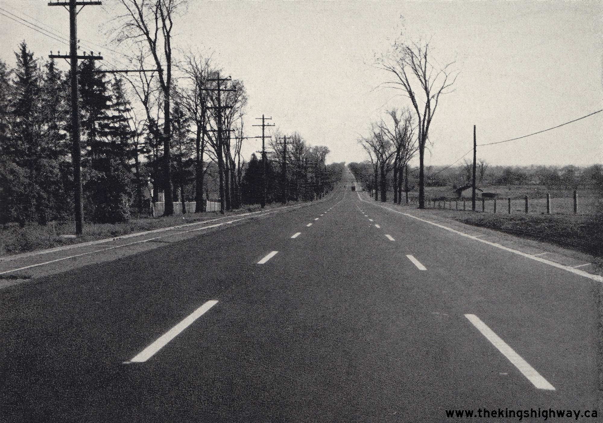
 Left - Completed widening of Hwy 11 south of Richmond Hill in 1947, showing hot-mix asphalt pavement and zone striping. Under Contract #1946-34, Hwy 11 was
widened for a distance of about 2 1/2 miles from just north of Thornhill to Richmond Hill. This highway widening work was constructed by Curran & Briggs
Construction. It continued a highway expansion program which began in the 1930s, but was interrupted by World War II. When this highway widening project wrapped up in
late 1947, Hwy 11 had been widened to a continuous 30-foot pavement from Steele's Corners south of Thornhill northerly to the Newmarket Sideroad (today's Davis
Drive). Note the old radial railway (North Yonge Railways) beside the highway at left. See an
Enlarged Photo Here. Photo taken on November 3, 1947. Left - Completed widening of Hwy 11 south of Richmond Hill in 1947, showing hot-mix asphalt pavement and zone striping. Under Contract #1946-34, Hwy 11 was
widened for a distance of about 2 1/2 miles from just north of Thornhill to Richmond Hill. This highway widening work was constructed by Curran & Briggs
Construction. It continued a highway expansion program which began in the 1930s, but was interrupted by World War II. When this highway widening project wrapped up in
late 1947, Hwy 11 had been widened to a continuous 30-foot pavement from Steele's Corners south of Thornhill northerly to the Newmarket Sideroad (today's Davis
Drive). Note the old radial railway (North Yonge Railways) beside the highway at left. See an
Enlarged Photo Here. Photo taken on November 3, 1947.(Photo courtesy of Ontario Ministry of Transportation - © King's Printer for Ontario, 1947) Right - Excavation of the Severn Bridge Rock Cut on a revised alignment of Hwy 11 & Hwy 69 south of Gravenhurst, Contract #1947-103. Once completed, the
highway was routed through the rock cut, which removed a very hazardous horizontal curve on Hwy 11 & Hwy 69 immediately north of the Severn River Bridge. See an
Enlarged Photo Here. Photo taken on April 13, 1948.(Photo courtesy of Ontario Ministry of Transportation - © King's Printer for Ontario, 1948) 
 Left - Rock cut and diversion of Hwy 11 & Hwy 69 between Washago and Gravenhurst, facing south towards the Severn River Bridge. See an
Enlarged Photo Here. Photo taken on April 13, 1948. Left - Rock cut and diversion of Hwy 11 & Hwy 69 between Washago and Gravenhurst, facing south towards the Severn River Bridge. See an
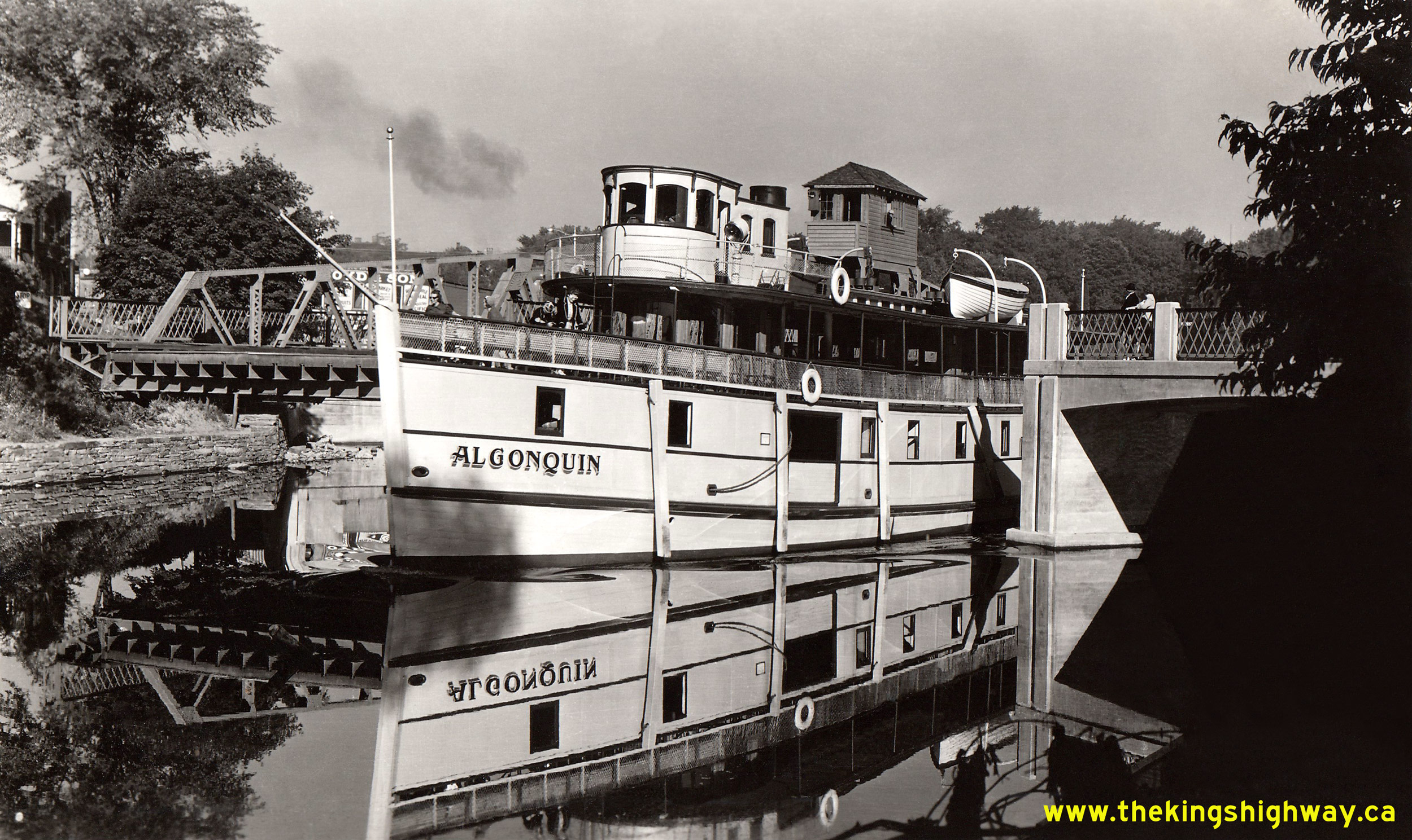
Enlarged Photo Here. Photo taken on April 13, 1948.(Photo courtesy of Ontario Ministry of Transportation - © King's Printer for Ontario, 1948) Right - New mulch asphalt pavement on a revised alignment of Hwy 11 & Hwy 69, 1 mile south of Gravenhurst. See an Enlarged Photo Here. Photo taken on July 26, 1948. (Photo courtesy of Ontario Ministry of Transportation - © King's Printer for Ontario, 1948)  Above - Circa 1948 postcard view of the steamship "Algonquin" passing through the Hwy 11 Swing Bridge in Downtown Huntsville. This opening bridge on the
Muskoka River (North Branch) allowed ships to pass between Lake Vernon and nearby Fairy Lake. For many years, it was the only road bridge to cross the Muskoka River
in the Huntsville area. When the Huntsville Bypass was completed and opened to traffic in late 1959, it provided a second highway link across the river. A third road
crossing was established in the late 1970s, when a new bridge was built across the river on a northerly extension of Huntsville's Centre Street. See an
Enlarged Photo Here. Photo taken circa 1948. Above - Circa 1948 postcard view of the steamship "Algonquin" passing through the Hwy 11 Swing Bridge in Downtown Huntsville. This opening bridge on the
Muskoka River (North Branch) allowed ships to pass between Lake Vernon and nearby Fairy Lake. For many years, it was the only road bridge to cross the Muskoka River
in the Huntsville area. When the Huntsville Bypass was completed and opened to traffic in late 1959, it provided a second highway link across the river. A third road
crossing was established in the late 1970s, when a new bridge was built across the river on a northerly extension of Huntsville's Centre Street. See an
Enlarged Photo Here. Photo taken circa 1948.(Photo courtesy of Annabelle Studio) 

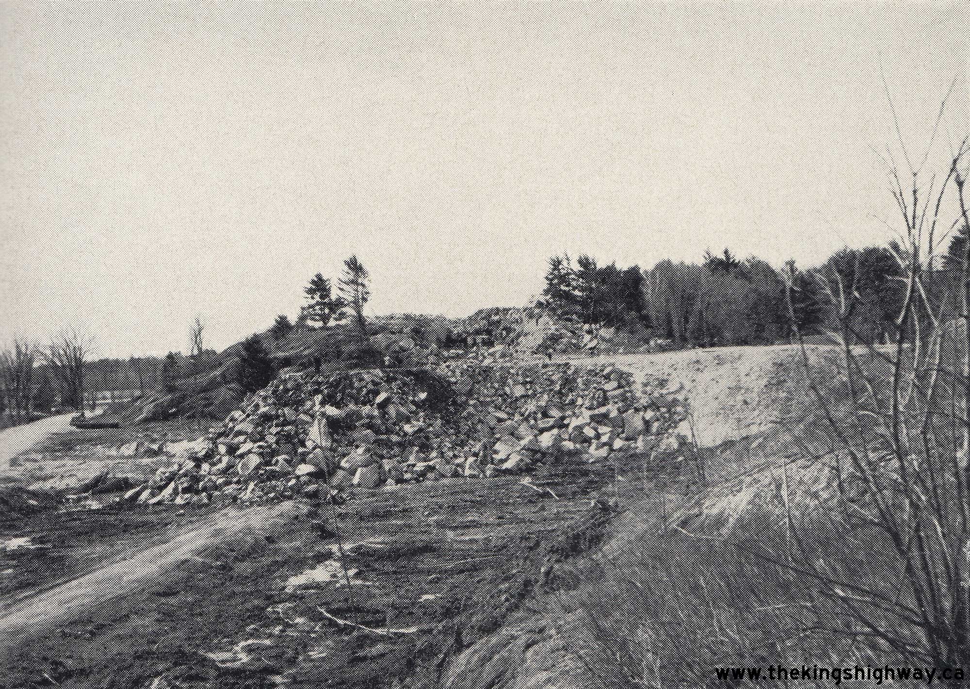
Left - Rock cut on a new Hwy 11 diversion between South River and Trout Creek, Contract #1947-83. See an
Enlarged Photo Here. Photo taken on July 29, 1948. (Photo courtesy of Ontario Ministry of Transportation - © King's Printer for Ontario, 1948) Right - Grading for a revised alignment of Hwy 11 about 6 miles north of Ramore, Contract #1947-30. See an Enlarged Photo Here. Photo taken on August 19, 1948. (Photo courtesy of Ontario Ministry of Transportation - © King's Printer for Ontario, 1948) 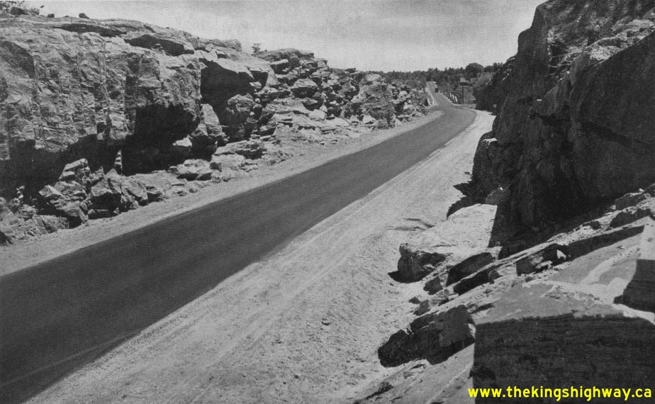
Above - View of Hwy 11 & Hwy 69 (later known as Hwy 169) facing south towards the Severn River Bridge through a new rock cut on the Severn Bridge
Diversion. During the late 1940s, a 5 1/2-mile section of Hwy 11 was reconstructed on an improved alignment between Washago and Kahshe Lake under Contract #1947-103.
See an Enlarged Photo Here. Photo taken on June 9, 1949. (Photo courtesy of Ontario Ministry of Transportation - © King's Printer for Ontario, 1949) 
Above - New junction of Hwy 11 & Hwy 69 (later known as Hwy 169) south of Gravenhurst in 1949. This photo shows the new junction of Hwy 11 and Hwy 69 on
the first Gravenhurst Bypass, which opened to traffic in 1948. The original junction of these two highways was located in Downtown Gravenhurst, at Muskoka Road and
Bay Street. The newly-built highway junction seen here was revised slightly in the ensuing years, but can still be found today just north of the current Hwy 11
Interchange, adjacent to the Gravenhurst McDonald's restaurant. Click here to see a 2005 view of
this intersection. See an Enlarged Photo Here. Photo taken on June 9, 1949. (Photo © Archives of Ontario - Series RG-14-162-5-121, Photo #327) 

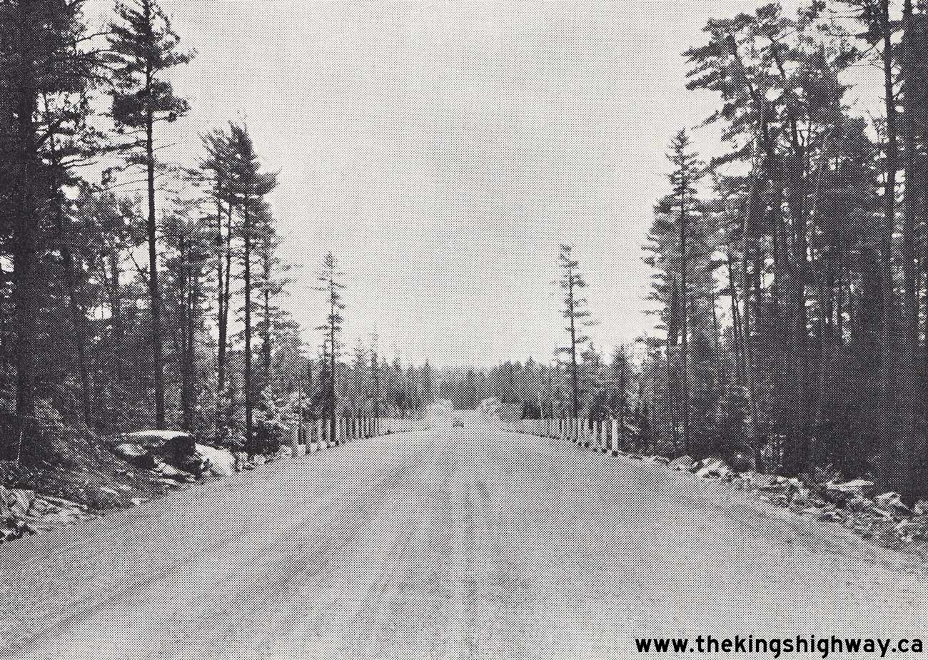
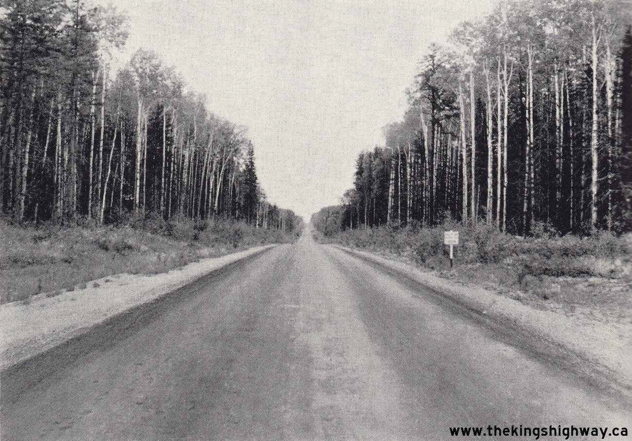
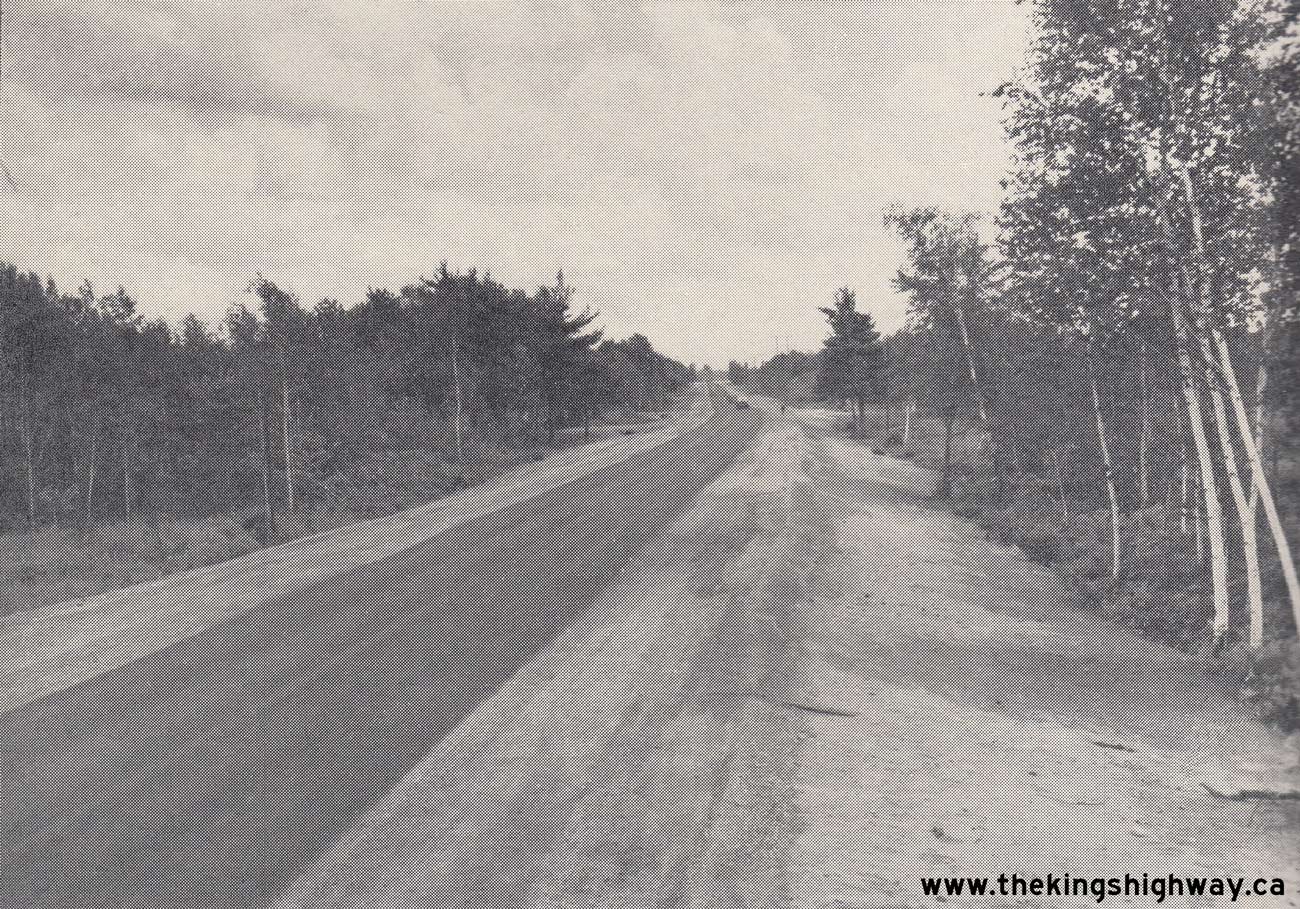
Left - Primed bituminous surface on Hwy 11 in the Temagami Provincial Forest Reserve at Angus Lake, located 12 miles south of Temagami. See an
Enlarged Photo Here. Photo taken on July 5, 1949. (Photo courtesy of Ontario Ministry of Transportation - © King's Printer for Ontario, 1949) Right - Construction of the new Frederickhouse River Bridge in 1949, Contract #1948-17. Note the old timber truss bridge at right, which carried Hwy 11 traffic across the Frederickhouse River up until the completion of the new high-level bridge. See an Enlarged Photo Here. Photo taken on July 6, 1949. (Photo courtesy of Ontario Ministry of Transportation - © King's Printer for Ontario, 1949) 
Above - View of a new diversion of Hwy 11 about 4 1/2 miles south of Huntsville in 1949. This photo shows part of a diversion of Hwy 11, about 2 3/4 miles in
length, constructed between Allensville and Huntsville in the late 1940s, under Contract #1948-31. While grading and culvert work was contracted out, the mulch
asphalt surfacing and zone striping was carried out by DHO District #11 (Huntsville District) work crews. See an
Enlarged Photo Here. Photo taken on July 22, 1949. (Photo courtesy of Ontario Ministry of Transportation - © King's Printer for Ontario, 1949)  Above - Completed Hwy 11 diversion about 2 1/2 miles south of Ramore in 1949. Under Contract #1948-32, a 4-mile section of Hwy 11 was reconstructed on an
improved alignment south of Ramore. Hot-mix asphalt was constructed along Hwy 11 for a distance of 16 miles from Wavell northerly to Matheson under Contract #1949-48,
including the section of Hwy 11 depicted here. See an Enlarged Photo Here. Photo taken on
September 2, 1949. Above - Completed Hwy 11 diversion about 2 1/2 miles south of Ramore in 1949. Under Contract #1948-32, a 4-mile section of Hwy 11 was reconstructed on an
improved alignment south of Ramore. Hot-mix asphalt was constructed along Hwy 11 for a distance of 16 miles from Wavell northerly to Matheson under Contract #1949-48,
including the section of Hwy 11 depicted here. See an Enlarged Photo Here. Photo taken on
September 2, 1949.(Photo courtesy of Ontario Ministry of Transportation - © King's Printer for Ontario, 1949)
Continue to King's Highway 11 Historical Photos from 1950 to 1959
|
|---|
Links to Adjacent King's Highway Photograph Pages:
Back to Hwy 11 - Historical Photos (1920 to 1939)
Hwy 11 Photo Index
On to Hwy 11 - Historical Photos (1950 to 1959)
Back to King's Highway 10 Photos /
King's Highway 11 History /
On to King's Highway 12 Photos
Ontario Highway History - Main Menu / Back to List of Highways Website contents, photos & text © 2002-2026, Cameron
Bevers (Webmaster) - All Rights Reserved / Contact Me
|
|---|