
| 
| |
|
|
This page contains present day photos (Year 2000 to date) of Ontario's King's Highway 12, arranged by location from Brooklin
northerly to Beaverton. All photographs displayed on this page were taken by the Webmaster (Cameron Bevers), unless specifically noted otherwise. Click on any
thumbnail to see a larger image!
Please note that all photographs displayed on this
website are protected by copyright. These photographs must not be reproduced, published,
electronically stored or copied, distributed, or posted onto other websites without
my written permission. If you want to use photos from this website, please
email me first for permission. Thank-you!
|
|---|
|
Page 5: Present Day King's Highway 12 Photographs (Brooklin to Beaverton)


Left - Facing south along Hwy 7 & Hwy 12 towards Whitby from the Hwy 7 East Junction at Sunderland Corners. The routes of Hwy 7 & Hwy 12 run
concurrently for about 40 km between Sunderland Corners and Brooklin, north of Whitby. See an
Enlarged Photo Here. (Photograph taken on October 10, 2010 - © Cameron Bevers) Right - Approaching the Hwy 7 East Junction at Sunderland Corners on Hwy 7 & Hwy 12, facing north. At this intersection, Hwy 7 ends its 40 km concurrent routing with Hwy 12 and heads east towards Lindsay and Peterborough. See an Enlarged Photo Here. (Photograph taken on October 10, 2010 - © Cameron Bevers) 

Left - The northbound turn-off to Hwy 7 East from Hwy 7 & Hwy 12 at Sunderland Corners is a channelized right turn. See an
Enlarged Photo Here. (Photograph taken on October 10, 2010 - © Cameron Bevers) Right - Guide sign marking the Hwy 7 East Junction on Hwy 7 & Hwy 12 at Sunderland Corners. (Photograph taken on October 10, 2010 - © Cameron Bevers) 

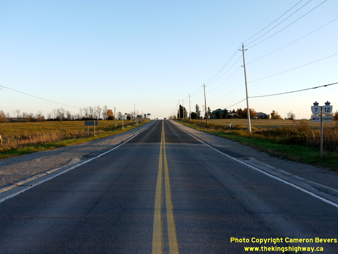
Left - Guide sign marking the Hwy 7 East Junction on Southbound Hwy 12 at Sunderland Corners. (Photograph taken on October 10, 2010 - © Cameron Bevers) Right - Facing south along Hwy 12 towards Whitby at the Hwy 7 East Junction at Sunderland Corners. At this point, Westbound Hwy 7 joins Hwy 12, beginning a 40 km concurrent routing between Sunderland Corners and Brooklin. The Trans-Canada Highway turns east towards Peterborough at this junction. However, the signs here is rather ambiguous - does the Trans-Canada Highway follow Hwy 7 or Hwy 12 from this junction? See an Enlarged Photo Here. (Photograph taken on October 10, 2010 - © Cameron Bevers) 
Above - Approaching the Hwy 7 East Junction on Southbound Hwy 12 at Sunderland Corners. See an
Enlarged Photo Here. (Photograph taken on October 10, 2010 - © Cameron Bevers) 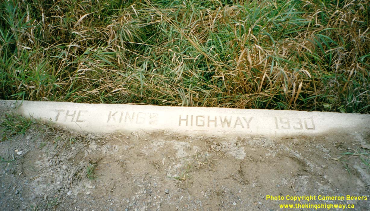

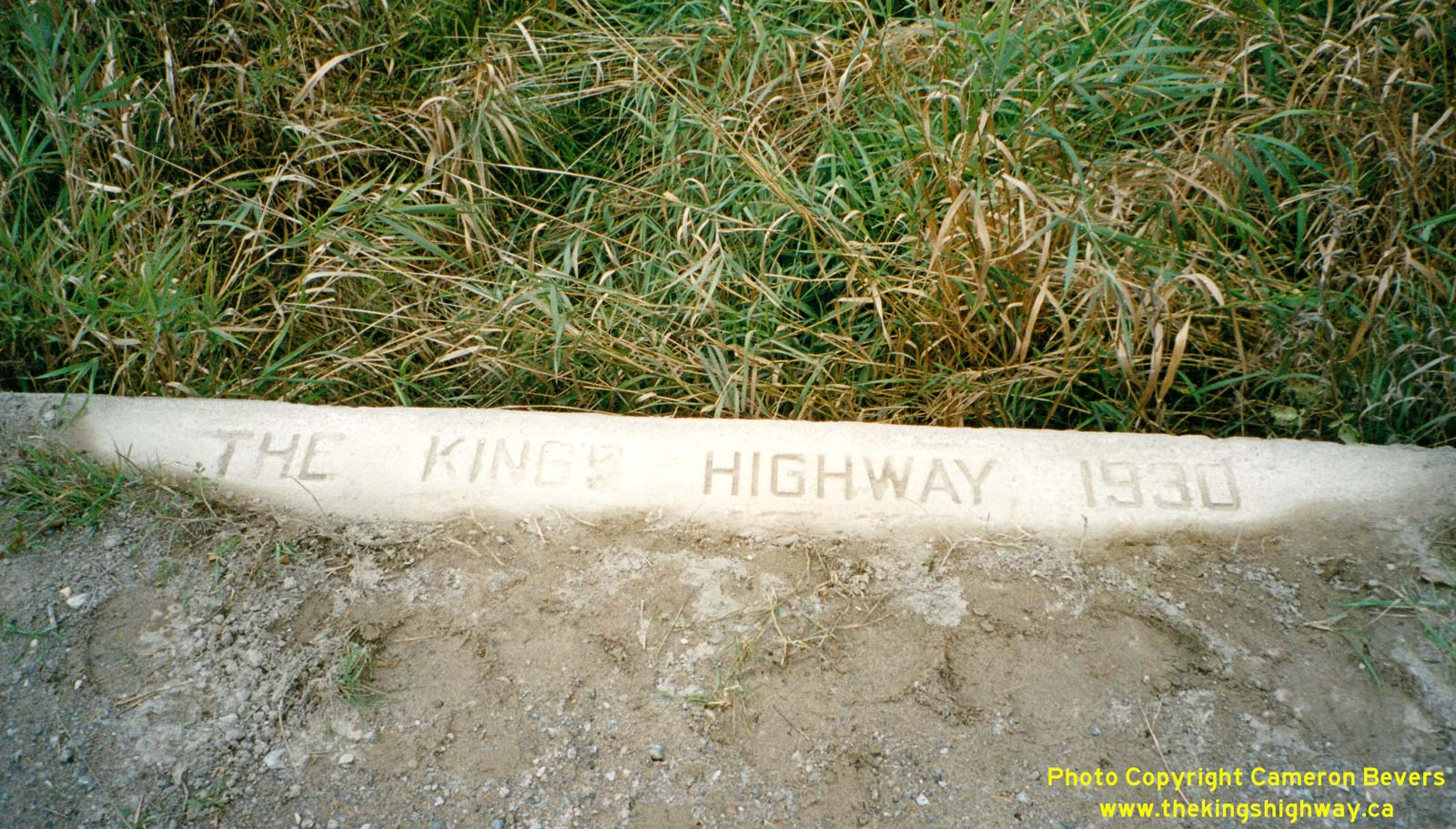
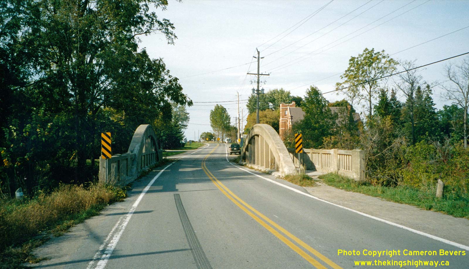
Left - Inscription on a concrete culvert on Old Hwy 12 (Hwy 48B) near Beaverton - "THE KING'S HIGHWAY 1930". See an
Enlarged Photo Here. (Photograph taken in September 2002 - © Cameron Bevers) Right - Concrete bowstring bridge over the Talbot River on Old Hwy 12 in Gamebridge. Structure completed in 1930. See an Enlarged Photo Here. (Photograph taken in September 2002 - © Cameron Bevers)
Continue on to King's Highway 12 Present Day Photos: Beaverton to Orillia
|
|---|
Links to Adjacent King's Highway Photograph Pages:
Back to King's Highway 11 Photos /
King's Highway 12 History /
On to King's Highway 14 Photos
Ontario Highway History - Main Menu / Back to List of Highways Website contents, photos & text © 2002-2026, Cameron
Bevers (Webmaster) - All Rights Reserved / Contact Me
|
|---|