
| 
| |
|
|
This page contains present day photos (Year 2000 to date) of Ontario's King's Highway 17, arranged by location from Wawa
northerly to White River. All photographs displayed on this page were taken by the Webmaster (Cameron Bevers), unless specifically noted otherwise. Click on any
thumbnail to see a larger image!
Please note that all photographs displayed on this
website are protected by copyright. These photographs must not be reproduced, published,
electronically stored or copied, distributed, or posted onto other websites without
my written permission. If you want to use photos from this website, please
email me first for permission. Thank-you!
|
|---|
|
Page 29: Present Day King's Highway 17 Photographs (Wawa to White River)


Left - Junction signs at Hwy 101 and Hwy 17 junction in Wawa. See
an Enlarged Photo Here. (Photograph taken on July 2, 2006 - © Cameron Bevers) Right - Green directional sign for Hwy 101 on Hwy 17 in Wawa. See an Enlarged Photo Here. (Photograph taken on July 2, 2006 - © Cameron Bevers) 

Left - Junction of Hwy 101 and Hwy 17 in Wawa. See
an Enlarged Photo Here. (Photograph taken on July 2, 2006 - © Cameron Bevers) Right - Approaching Hwy 17 junction along Hwy 101 west of Wawa. See an Enlarged Photo Here. (Photograph taken on July 2, 2006 - © Cameron Bevers) 

Left - Facing south along Hwy 17 towards Hwy 101 junction in Wawa. See
an Enlarged Photo Here. (Photograph taken on July 2, 2006 - © Cameron Bevers) Right - Facing north along Hwy 17 towards Hwy 101 junction in Wawa. See an Enlarged Photo Here. (Photograph taken on July 2, 2006 - © Cameron Bevers) 

Left - A directional ramp branches off of Hwy 17 North onto Hwy 101 East at Wawa. See
an Enlarged Photo Here. (Photograph taken on July 2, 2006 - © Cameron Bevers) Right - Close-up view of directional ramp to Hwy 101 East at Wawa. See an Enlarged Photo Here. (Photograph taken on July 2, 2006 - © Cameron Bevers) 

Left - Facing north towards White River along Hwy 17 from Wawa Lookout. See
an Enlarged Photo Here. (Photograph taken on July 2, 2006 - © Cameron Bevers) Right - This curve on Hwy 17 north of the Hwy 101 Junction at Wawa was featured on the cover of the 1990/91 Official Ontario Road Map. The Trans-Canada Highway was officially opened to traffic at this scenic location in September, 1960. See an Enlarged Photo Here. (Photograph taken on July 2, 2006 - © Cameron Bevers) 
Above - Lake Superior Circle Tour sign on Hwy 17 at Wawa. See
an Enlarged Photo Here. (Photograph taken on July 2, 2006 - © Cameron Bevers) 

Left - Algoma Central Railway (ACR) Overhead on Hwy 17 north of Wawa. This once-important railway spur used to carry iron ore shipments from Wawa-area mines
down to the docks at Michipicoten Harbour and coal shipments from Michipicoten Harbour into Wawa. All iron ore shipments leaving Wawa until 1960 had to be made by
ship or by rail, as Wawa did not have an external road link to the rest of Ontario. As the mines around Wawa began to close in the subsequent decades, the railway
declined in importance and was eventually abandoned altogether. The rails were lifted and the right-of-way was converted into an all-terrain vehicle trail. See
an Enlarged Photo Here. (Photograph taken on September 5, 2006 - © Cameron Bevers) Right - Eastern side of the ACR Overhead on Hwy 17. This single-span precast concrete slab structure was built under Contract #1957-219 and was completed in 1958. See an Enlarged Photo Here. (Photograph taken on September 5, 2006 - © Cameron Bevers) 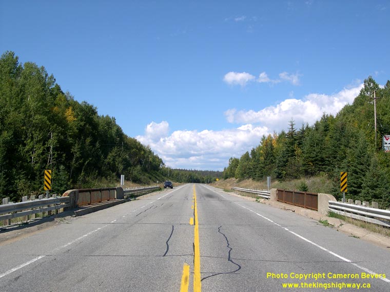

Left - Facing north along Hwy 17 towards White River at the ACR Overhead. See
an Enlarged Photo Here. (Photograph taken on September 5, 2006 - © Cameron Bevers) Right - Facing south along Hwy 17 at the ACR Overhead. See an Enlarged Photo Here. (Photograph taken on September 5, 2006 - © Cameron Bevers) 

Left - Close-up of the concrete and steel handrail design of the ACR Overhead on Hwy 17. See
an Enlarged Photo Here. (Photograph taken on September 5, 2006 - © Cameron Bevers) Right - The Magpie River site at the bottom of this vast valley north of Wawa. The town itself is situated on top of the ridge on the opposite side of the valley. See an Enlarged Photo Here. (Photograph taken on September 5, 2006 - © Cameron Bevers) 

Left - The 1,000 km distance marker along Hwy 17 on the approach to the Catfish Creek Bridge north of Wawa. While these distance markers appear at fairly
regular intervals along Hwy 17, this particular one is somewhat noteworthy in that its the first to display a four-digit distance. See an
Enlarged Photo Here. (Photograph taken on August 29, 2011 - © Cameron Bevers) Right - Facing north along Hwy 17 towards White River at the Catfish Creek Bridge, located about 18 km north of Wawa. See an Enlarged Photo Here. (Photograph taken on August 29, 2011 - © Cameron Bevers) 

Left - Facing south along Hwy 17 towards Wawa at the Catfish Creek Bridge. See an
Enlarged Photo Here. (Photograph taken on August 29, 2011 - © Cameron Bevers) Right - Side view of the Catfish Creek Bridge on Hwy 17 north of Wawa. This single-span steel girder bridge was built under Contracts #1958-273 (substructure and approaches) and #1958-274 (steel superstructure) and was completed in 1959. See an Enlarged Photo Here. (Photograph taken on August 29, 2011 - © Cameron Bevers) 

Left - A short vertical sag curve situated between two crest curves gives this section of Hwy 17 between White River and Wawa a roller-coaster appearance from
this vantage point. See an Enlarged Photo Here. (Photograph taken on September 5, 2006 - © Cameron Bevers) Right - Facing north along Hwy 17, about 30 km north of Wawa. The section of Hwy 17 from Wawa to Marathon is situated a considerable distance inland from Lake Superior, resulting in somewhat subdued topography. See an Enlarged Photo Here. (Photograph taken on September 5, 2006 - © Cameron Bevers) 

Left - Side-by-side passing lanes on Hwy 17 near Obatanga Provincial Park south of White River. See
an Enlarged Photo Here. (Photograph taken on September 5, 2006 - © Cameron Bevers) Right - Facing north along Hwy 17 near Hammer Lake, about 30 km south of White River. See an Enlarged Photo Here. (Photograph taken on September 5, 2006 - © Cameron Bevers) 

Left - Facing south along Hwy 17 towards Wawa from the Hwy 631 Junction in White River. See an
Enlarged Photo Here. (Photograph taken on August 29, 2006 - © Cameron Bevers) Right - Facing north along Hwy 17 from the Hwy 631 Junction in White River. See an Enlarged Photo Here. (Photograph taken on August 29, 2006 - © Cameron Bevers) 

Left - Facing north along Hwy 631 from the Hwy 17 Junction in White River. Hwy 631 runs north from Hwy 17 at White River towards Hornepayne.
Eventually, Hwy 631 links up with Hwy 11 between Hearst and Longlac. See an
Enlarged Photo Here. (Photograph taken on August 29, 2006 - © Cameron Bevers) Right - Junction and distance signs at the southern terminus of Hwy 631 at the Hwy 17 Junction. White River's famous thermometer sign is located just beyond the highway junction. The White River thermometer sign is a tourist attraction, proclaiming White River's unofficial title as being the coldest place in Canada. Although it wasn't an official measurement, the temperature in White River reportedly plunged to -72 Degrees Fahrenheit (-58 Degrees Celsius) on a bone-chilling winter night back in 1935. See an Enlarged Photo Here. (Photograph taken on August 29, 2006 - © Cameron Bevers) 
Above - King's Highway 17 route marker on northbound Hwy 17 in White River. See an
Enlarged Photo Here. (Photograph taken on August 29, 2006 - © Cameron Bevers)
Continue on to King's Highway 17 Photos: White River to Marathon
|
|---|
Links to Adjacent King's Highway Photograph Pages:
Back to King's Highway 16 Photos /
King's Highway 17 History /
On to King's Highway 18 Photos
Ontario Highway History - Main Menu / Back to List of Highways Website contents, photos & text © 2002-2026, Cameron
Bevers (Webmaster) - All Rights Reserved / Contact Me
|
|---|