
| 
| |
|
|
This page contains present day photos (Year 2000 to date) of Ontario's King's Highway 27, arranged by location from Kleinburg
northerly to Schomberg. All photographs displayed on this page were taken by the Webmaster (Cameron Bevers), unless specifically noted otherwise. Click
on any thumbnail to see a larger image!
Please note that all photographs displayed on this
website are protected by copyright. These photographs must not be reproduced, published,
electronically stored or copied, distributed, or posted onto other websites without
my written permission. If you want to use photos from this website, please
email me first for permission. Thank-you!
|
|---|
|
Page 4: Present Day King's Highway 27 Photographs (Kleinburg to Schomberg)


Left - Facing north along Hwy 27 towards Nashville Road (Formerly Hwy 49) in Kleinburg. See an
Enlarged Photo here. (Photograph taken on September 25, 2016 - © Cameron Bevers) Right - View of Nashville Road approaching the Hwy 27 Junction in Kleinburg, facing west. Up until the early 1960s, this route was a King's Highway under the jurisdiction of the Department of Highways of Ontario (DHO). This short King's Highway (Hwy 49) extended from Kleinburg westerly to Hwy 50 south of Bolton. See an Enlarged Photo here. (Photograph taken on September 25, 2016 - © Cameron Bevers) 

Left - Nashville Road facing east from Hwy 27 towards Kleinburg. Historically, the route of Hwy 49 ended in Downtown Kleinburg at the intersection of
Islington Avenue. See an Enlarged Photo here. (Photograph taken on September 25, 2016 - © Cameron Bevers) Right - Facing west along Nashville Road towards Bolton from the Hwy 27 Junction in Kleinburg. This route was once a King's Highway (Hwy 49). The highway existed from 1936 up until 1961, when jurisdiction over the highway was transferred from the DHO to the County of York. The Hwy 49 designation was subsequently reused for an unrelated highway southwest of Napanee. It is interesting to note that Nashville Road is known as York Regional Road 49, which matches the road's original King's Highway route number. See an Enlarged Photo here. (Photograph taken on September 25, 2016 - © Cameron Bevers) 

Left - Facing east along Nashville Road (Formerly Hwy 49) towards the Hwy 27 Junction in Kleinburg. See an
Enlarged Photo here. (Photograph taken on September 25, 2016 - © Cameron Bevers) Right - Facing south along Hwy 27 towards Nashville Road in Kleinburg. See an Enlarged Photo here. (Photograph taken on September 25, 2016 - © Cameron Bevers) 

Left - Approaching the Islington Avenue intersection on Hwy 27 in Kleinburg, facing north towards Nobleton. See an
Enlarged Photo here. (Photograph taken on September 25, 2016 - © Cameron Bevers) Right - Approaching the Islington Avenue intersection on Hwy 27, facing south towards Toronto. At one time, the DHO had considered assuming Islington Avenue through Woodbridge as an extension of Hwy 27. Fortunately, due to their uncanny foresight for the future transportation needs of this province, the DHO eventually abandoned the plans to assume Islington Avenue. Instead, the DHO decided to bypass Toronto altogether with a new route for Hwy 27. In 1936, the DHO assumed Browns Line through Etobicoke Township and began construction on an entirely new highway corridor through the Humber River Valley, via Elder Mills. This new route connected directly with the new Middle Road Highway (later known as the Queen Elizabeth Way) near Long Branch. It was envisioned that this much-improved route for Hwy 27 would intercept all through traffic bound for Barrie, Orillia, Muskoka and points north before it ever reached the built-up areas of Toronto. See an Enlarged Photo here. (Photograph taken on September 25, 2016 - © Cameron Bevers) 

Left - Facing north along Hwy 27 towards Nobleton from Islington Avenue in Kleinburg. See an
Enlarged Photo here. (Photograph taken on September 25, 2016 - © Cameron Bevers) Right - Facing north along Hwy 27 towards Kirby Road, about 2 km north of Kleinburg. The section of Hwy 27 from Schomberg southerly to the Kleinburg area was first assumed as a King's Highway by the DHO in August, 1936. Hwy 27 remained under provincial jurisdiction up until the late 1990s, when the entire route from Toronto to Barrie was transferred to the municipal tier. See an Enlarged Photo here. (Photograph taken on September 25, 2016 - © Cameron Bevers) 

Left - Facing north along Hwy 27 towards Nobleton from Kirby Road. At left, an abandoned alignment of Hwy 27 disappears off into the forest. A few short
sections of Hwy 27 were bypassed during highway improvement projects carried out between Toronto and Barrie in the 1940s and early 1950s. See an
Enlarged Photo here. (Photograph taken on September 25, 2016 - © Cameron Bevers) Right - Abandoned alignment of Hwy 27 south of Nobleton. This section of the original 1936 highway was bypassed by a new highway alignment with improved geometry in 1950. See an Enlarged Photo here. (Photograph taken on September 25, 2016 - © Cameron Bevers) 

Left - Facing south along Hwy 27 towards Kirby Road south of Nobleton. At one time, Hwy 27 curved sharply to the right. A highway improvement project carried
out in the early 1950s straightened the highway out and greatly improved the grades through this valley. See an
Enlarged Photo here. (Photograph taken on September 25, 2016 - © Cameron Bevers) Right - Facing north along Hwy 27 towards Schomberg, departing from Nobleton. See an Enlarged Photo here. (Photograph taken on September 25, 2016 - © Cameron Bevers) 

Left - Approaching Nobleton on Hwy 27, facing south. See an
Enlarged Photo here. (Photograph taken on September 25, 2016 - © Cameron Bevers) Right - Approaching 15th Sideroad north of Nobleton on Hwy 27, facing north towards Schomberg. See an Enlarged Photo here. (Photograph taken on September 25, 2016 - © Cameron Bevers) 

Left - Facing south along Hwy 27 towards Nobleton at 15th Sideroad. This junction is actually a pair of "T" intersections offset from one another. During the
1990s, the intersection was reconstructed with side-by-side left turning lanes. An overhead sign structure was positioned above the highway to alert motorists of the
unusual lane arrangement. Several offset intersections such as this one exist along Hwy 27 through King Township. See an
Enlarged Photo here. (Photograph taken on September 25, 2016 - © Cameron Bevers) Right - Facing north along Hwy 27 towards Schomberg from 15th Sideroad. See an Enlarged Photo here. (Photograph taken on September 25, 2016 - © Cameron Bevers) 

Left - Concrete retaining wall beside Hwy 27 at the St. Paul's Presbyterian Cemetery north of Nobleton. At one time, a particularly dangerous vertical crest
curve existed on the highway at this location, which did not allow motorists with sufficient view of the road ahead of them. During reconstruction of Hwy 27 in 1956,
the vertical profile of the highway was lowered substantially to improve visibility for motorists approaching the crest of the hill. Originally, the highway was at
the same elevation as the top of the slope behind the retaining wall. See an
Enlarged Photo here. (Photograph taken on September 25, 2016 - © Cameron Bevers) Right - View of the earth cut on Hwy 27 at the St. Paul's Presbyterian Cemetery north of Nobleton. See an Enlarged Photo here. (Photograph taken on September 25, 2016 - © Cameron Bevers) 

Left - Looking south through the earth cut on Hwy 27 at the St. Paul's Presbyterian Cemetery. The depth of the cut is more evident in this photo. The concrete
retaining wall was built during the reconstruction of Hwy 27 in 1956, to avoid disturbing any parts of the cemetery. See an
Enlarged Photo here. (Photograph taken on September 25, 2016 - © Cameron Bevers) Right - Approaching 16th Sideroad north of Nobleton on Hwy 27, facing north towards Schomberg. See an Enlarged Photo here. (Photograph taken on September 25, 2016 - © Cameron Bevers) 

Left - Facing south along Hwy 27 towards 16th Sideroad north of Nobleton. See an
Enlarged Photo here. (Photograph taken on September 25, 2016 - © Cameron Bevers) Right - Start of the Bell's Lake Diversion on Hwy 27, facing north towards Schomberg. In 1949, a new highway diversion was built here to bypass several sharp curves and steep grades on the original 1936 route of Hwy 27. The rusting signpost at right shows the original location of the highway. See an Enlarged Photo here. (Photograph taken on September 25, 2016 - © Cameron Bevers) 

Left - An abandoned section of Hwy 27 south of Bell's Lake. The current highway can be seen in the background. See an
Enlarged Photo here. (Photograph taken on September 25, 2016 - © Cameron Bevers) Right - This "Dead End" sign at the end of the closed portion of Hwy 27 at Bell's Lake was previously used as a warning sign for a reverse curve at another location. This old sign has likely been standing here since the 1960s. See an Enlarged Photo here. (Photograph taken on September 25, 2016 - © Cameron Bevers) 

Left - A bypassed section of Hwy 27 (Linton Lane) is still open to traffic at Bell's Lake. The road provides access to a residential property on the old
highway. See an Enlarged Photo here. (Photograph taken on September 25, 2016 - © Cameron Bevers) Right - The DHO transferred ownership of Linton Lane (Old Hwy 27) to the Township of King in 1969, many years after the completion of the Bell's Lake Diversion in 1949. The narrow width of the original highway is quite evident here. Many early King's Highways were constructed with two 10-foot traffic lanes and were often built without any gravel shoulders. See an Enlarged Photo here. (Photograph taken on September 25, 2016 - © Cameron Bevers) 

Left - An abandoned stretch of asphalt marks the former location of Hwy 27 along the western side of Bell's Lake. Before the Bell's Lake Diversion was
constructed in the late 1940s, Hwy 27 closely hugged the western shore of the lake. This resulted in several bad curves in the old highway. See an
Enlarged Photo here. (Photograph taken on September 25, 2016 - © Cameron Bevers) Right - A steel beam guide rail barrier prevents traffic from using a closed section of Hwy 27 at Bell's Lake. The relocated alignment of Hwy 27 can be seen at right. See an Enlarged Photo here. (Photograph taken on September 25, 2016 - © Cameron Bevers) 

Left - View of Bell's Lake and the Hwy 27 Diversion. Although the pavement in the foreground is now gone, the original 1936 highway used to closely follow the
edge of the lake. See an Enlarged Photo here. (Photograph taken on September 25, 2016 - © Cameron Bevers) Right - The closed section of Hwy 27 at Bell's Lake is now very overgrown. It has not been used by through traffic since the late 1940s. See an Enlarged Photo here. (Photograph taken on September 25, 2016 - © Cameron Bevers) 

Left - View of the Bell's Lake Diversion, facing south towards Nobleton. The original route of Hwy 27 curved sharply to the left here. Remnants of the old
highway are still visible today, quickly disappearing off into the forest in the background. See an
Enlarged Photo here. (Photograph taken on September 25, 2016 - © Cameron Bevers) Right - Facing north along Hwy 27 (Bell's Lake Diversion) towards Schomberg. Until 1949, Hwy 27 turned sharply to the right at the north end of Bell's Lake. The Bell's Lake Diversion eliminated several hazardous curves from the highway and greatly improved the grade of Hwy 27 approaching the lake from the north. See an Enlarged Photo here. (Photograph taken on September 25, 2016 - © Cameron Bevers) 

Left - Old meets new - Bell's Lake Road, at right, was the original route of Hwy 27 before the new diversion was built for the highway at left. See an
Enlarged Photo here. (Photograph taken on September 25, 2016 - © Cameron Bevers) Right - Bell's Lake Road (Old Hwy 27) climbs quickly from its intersection with the Hwy 27 Diversion on the north side of the lake. The old highway ties in with the existing highway at the bottom of the hill. Motorists driving Hwy 27 prior to the construction of the Bell's Lake Diversion in the 1940s would have likely been caught off-guard by the sharp, hidden curve that used to exist at the bottom of this grade. See an Enlarged Photo here. (Photograph taken on September 25, 2016 - © Cameron Bevers) 

Left - Bell's Lake Road (Old Hwy 27) facing north towards the north end of the Bell's Lake Diversion. The current highway can be seen curving in from the left
in the background. The DHO transferred ownership of Bell's Lake Road (Old Hwy 27) to the Township of King in 1969. Today, the former alignment of Hwy 27 forms a
complete loop which connects to Hwy 27 at both ends. See an Enlarged Photo here. (Photograph taken on September 25, 2016 - © Cameron Bevers) Right - Facing south along Bell's Lake Road (Old Hwy 27) from the current route of Hwy 27. About 1 km of the original 1936 highway alignment was bypassed by the Bell's Lake Diversion in 1949. This was one of several significant Hwy 27 improvements made by the DHO after World War II. See an Enlarged Photo here. (Photograph taken on September 25, 2016 - © Cameron Bevers) 

Left - Approaching the Bell's Lake Diversion on Hwy 27, facing south towards Nobleton. See an
Enlarged Photo here. (Photograph taken on September 25, 2016 - © Cameron Bevers) Right - Facing north along Hwy 27 at 17th Sideroad, showing the side-by-side left turn lane design. This was a fairly typical design used at many minor offset intersections along Hwy 27 through King Township. This type of intersection configuration will generally experience satisfactory traffic operations when left-turning traffic volumes are fairly low. However, this intersection layout can create operational problems as left-turning volumes grow, as there is some risk of the intersection "locking up" - The queue from one left turn lane can block potential gaps for traffic waiting to turn left from the opposing direction. See an Enlarged Photo here. (Photograph taken on September 25, 2016 - © Cameron Bevers) 

Left - Facing south along Hwy 27 towards Nobleton at 17th Sideroad. Offset intersections such as this can potentially experience operational problems as they
get busier. The side-by-side left turn lanes can lock up if left-turning volumes become too heavy. Although this problem can be addressed through the installation of
traffic signals, it would result in a severe degradation in overall traffic flow due to the complex signal phasing required. Realignment of the two offset "T"
intersections into a single four-leg intersection would be a more effective way to address any future left turn problems. See an
Enlarged Photo here. (Photograph taken on September 25, 2016 - © Cameron Bevers) Right - This dramatic vista appears along Hwy 27 between the 17th and 18th Sideroads, about 5 km south of Schomberg. See an Enlarged Photo here. (Photograph taken on September 25, 2016 - © Cameron Bevers) 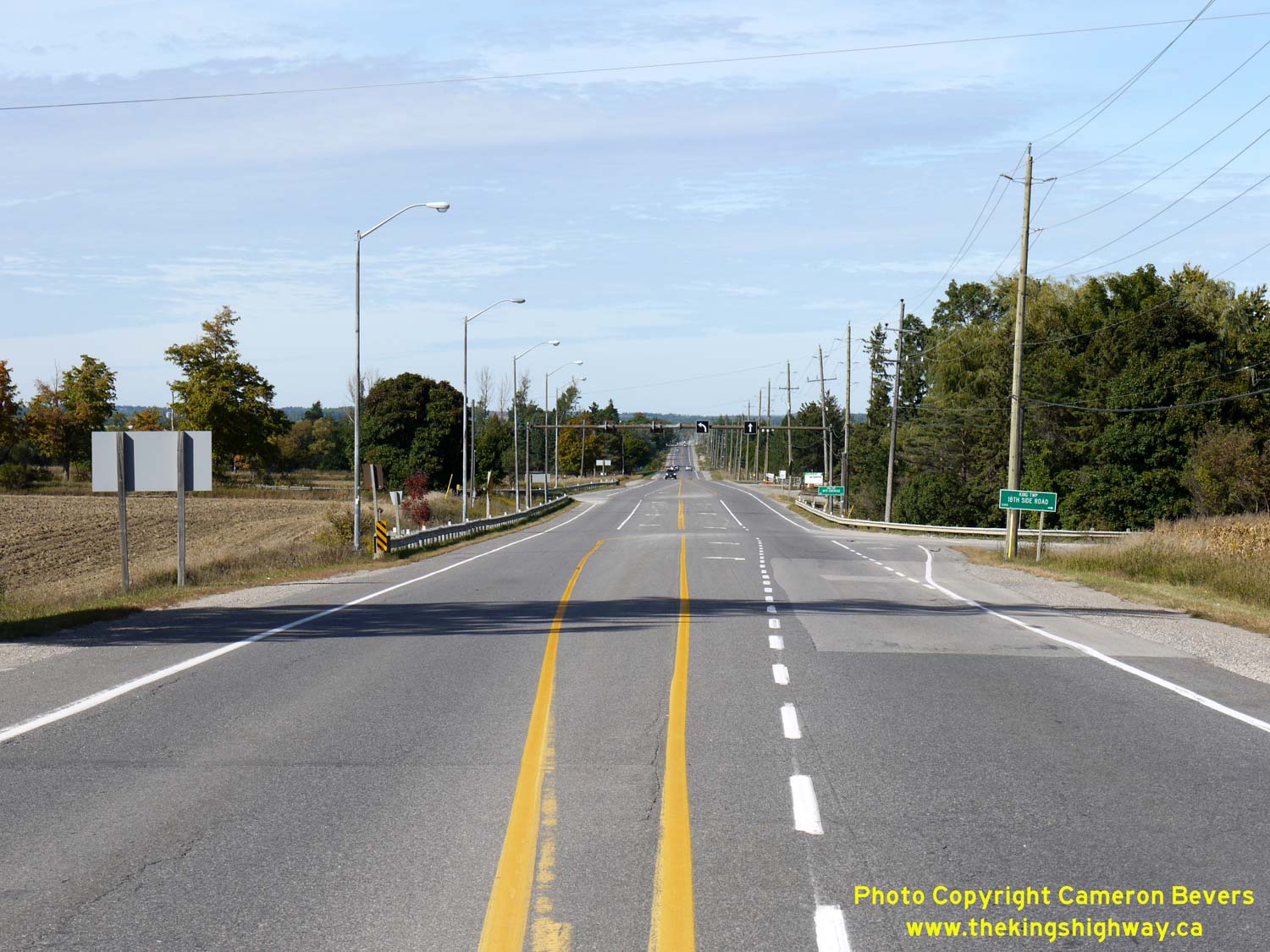

Left - Facing north along Hwy 27 at 18th Sideroad, about 3 km south of Schomberg. See an
Enlarged Photo here. (Photograph taken on September 25, 2016 - © Cameron Bevers) Right - Facing south along Hwy 27 towards Nobleton at 18th Sideroad. See an Enlarged Photo here. (Photograph taken on September 25, 2016 - © Cameron Bevers) 

Left - Facing south along Hwy 27 towards Nobleton, about 2 km south of Schomberg. See an
Enlarged Photo here. (Photograph taken on September 25, 2016 - © Cameron Bevers) Right - View of Hwy 27 approaching Lloydtown-Aurora Road, facing north towards Schomberg. See an Enlarged Photo here. (Photograph taken on September 25, 2016 - © Cameron Bevers) 

Left - Facing south along Hwy 27 towards Nobleton from Main Street in Schomberg. See an
Enlarged Photo here. (Photograph taken on September 25, 2016 - © Cameron Bevers) Right - Approaching Main Street on Hwy 27 in Schomberg, facing north towards the Hwy 9 Junction. See an Enlarged Photo here. (Photograph taken on September 25, 2016 - © Cameron Bevers)
Continue on to King's Highway 27 Photos: Schomberg to Barrie
|
|---|
Links to Adjacent King's Highway Photograph Pages:
Back to King's Highway 26 Photos /
King's Highway 27 History /
On to King's Highway 28 Photos
Ontario Highway History - Main Menu / Back to List of Highways Website contents, photos & text © 2002-2026, Cameron
Bevers (Webmaster) - All Rights Reserved / Contact Me
|
|---|