
| 
|  |
|
|
This page contains historical photos of Ontario's King's Highway 401 dating from 1970 to 1974. All photographs displayed on
this page were taken by the Ontario Ministry of Transportation, unless specifically noted otherwise. Historical photographs are arranged in approximate chronological
order. Click on any thumbnail to see a larger image!
Please note that all photographs displayed on this
website are protected by copyright. These photographs must not be reproduced, published,
electronically stored or copied, distributed, or posted onto other websites without
my written permission. If you want to use photos from this website, please
email me first for permission. Thank-you!
|
|---|
|
Page 5: Historical King's Highway 401 Photographs (1970 to 1974)


Left - At-grade railway crossing on Hwy 401 at the Pickering Canadian National Railway (CNR) spur line in 1971, facing east towards Oshawa. This industrial
spur line used to exist about half-way between Brock Road in Pickering and Church Street in Ajax. The railway line was subsequently abandoned and the at-grade
crossing seen here was removed in 1975. At one time, there were three at-grade railway crossings along Hwy 401 between Toronto and Bowmanville. The construction of
Hwy 401 immediately east of Toronto mostly took place during the early years of World War II, at a time when construction materials and structural steel needed for
bridge construction were in increasingly short supply. A decision was made to leave the industrial spur crossings at-grade in order to conserve the dwindling supplies
of materials for the construction of grade separations at busier rail crossings. See an
Enlarged Photo Here. Photo taken in April, 1971. (Photo courtesy of Ontario Ministry of Transportation - © King's Printer for Ontario, 2020) Right - Facing north along the Pickering CNR spur line from the at-grade railway crossing on Hwy 401. Although the spur line was still technically active at the time this photo was taken in 1971, use of the spur line by rail traffic was very infrequent. The spur line ran along the eastern boundary of the St. Francis de Sales Catholic Cemetery, which can be seen in the background of this photo. The spur line then followed the present-day Notion Road north from Hwy 401 and ended near Hwy 2 in Pickering. See an Enlarged Photo Here. Photo taken in April, 1971. (Photo courtesy of Ontario Ministry of Transportation - © King's Printer for Ontario, 2020) 

Left - Facing south along the Pickering CNR spur line from the at-grade railway crossing on Hwy 401. The spur line curved and connected to CNR's mainline,
which can be seen in the background running parallel to Hwy 401. When the Toronto-Oshawa Dual Highway (Hwy 401) was first planned out in the late 1930s, the highway
was deliberately situated next to the CNR mainline in order to minimize impacts to adjacent properties. See an
Enlarged Photo Here. Photo taken in April, 1971. (Photo courtesy of Ontario Ministry of Transportation - © King's Printer for Ontario, 2020) Right - Henry Street Overpass on Hwy 401 in Whitby, facing east towards the Hwy 12 (Brock Street) Interchange. The last remnants of winter snow and excessive road sanding can be seen along the shoulder of Hwy 401. The Winter of 1970-1971 was particularly ferocious. Despite its fleet of modern snow clearing equipment, the Department of Highways' Maintenance Division found itself taxed to the limit by the severe winter weather. In order to keep the highways open during the Winter of 1970-1971, 363,000 tons of de-icing chemicals and 807,000 tons of abrasives had to be applied to the King's Highway System - a far greater amount than normally required. See an Enlarged Photo Here. Photo taken in April, 1971. (Photo courtesy of Ontario Ministry of Transportation - © King's Printer for Ontario, 2020) 

Left - Approaching the Simcoe Street Interchange on Hwy 401 in Oshawa in 1971, facing east at Oshawa Creek. The original 1940s-era section of Hwy 401 seen here
was widened from four to six lanes during a multi-year reconstruction project which began in early 1978 and completed in 1980. See an
Enlarged Photo Here. Photo taken in June, 1971. (Photo courtesy of Ontario Ministry of Transportation - © King's Printer for Ontario, 2020) Right - Southern side of the Oshawa Creek Bridge on Hwy 401 west of Simcoe Street. This three-span closed-spandrel concrete arch bridge was built in 1941 and featured embossed concrete embellishments typical to bridges built during this era. Sadly, many of the original decorative features on this bridge were lost when Hwy 401 was expanded through Oshawa and the bridge was widened to its current cross-section. See an Enlarged Photo Here. Photo taken in June, 1971. (Photo courtesy of Ontario Ministry of Transportation - © King's Printer for Ontario, 2020) 
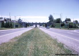
Left - Facing south across the Simcoe Street Overpass on Hwy 401 in Oshawa. See an
Enlarged Photo Here. Photo taken in June, 1971. (Photo courtesy of Ontario Ministry of Transportation - © King's Printer for Ontario, 2020) Right - Centreline view of the Simcoe Street Interchange on Hwy 401 in Oshawa in 1971, facing east. This great photo shows the original 1940s-era Simcoe Street Interchange, which had "all-moves" ramp connections between Simcoe Street and Hwy 401. During reconstruction of this interchange in 1978-1979, the westbound Hwy 401 exit ramp to Simcoe Street was permanently closed, along with the entrance ramp from Simcoe Street to eastbound Hwy 401. The adjacent exit ramp to Ritson Road was closed for construction at the time this photo was taken. Note the temporary guide sign for Ritson Road above the permanent Simcoe Street exit signs at right, informing motorists bound for Ritson Road to exit Hwy 401 early. See an Enlarged Photo Here. Photo taken in June, 1971. (Photo courtesy of Ontario Ministry of Transportation - © King's Printer for Ontario, 2020) 

Left - Short acceleration taper on the entrance ramp to eastbound Hwy 401 at the Simcoe Street Interchange in Oshawa in 1971. Like many of Ontario's early
freeway interchanges, the Simcoe Street Interchange was originally designed without full speed-change or acceleration lanes. Traffic was required to yield (or
possibly even stop) at the end of the ramp before entering the freeway. Once motorists found a gap in the traffic stream, they had to immediately merge with through
traffic on the freeway. As Hwy 401 became progressively busier, it became increasingly difficult for motorists to find safe gaps in the freeway's traffic stream. This
1940s-vintage direct taper on-ramp was closed to traffic permanently in the late 1970s when Hwy 401 was reconstructed through Oshawa. See an
Enlarged Photo Here. Photo taken in June, 1971. (Photo courtesy of Ontario Ministry of Transportation - © King's Printer for Ontario, 2020) Right - Facing east along Hwy 401 from the Simcoe Street Interchange in Oshawa in 1971. This section of Hwy 401 was built below-grade in a large earth cut, so that two intersecting city streets (Simcoe Street and Albert Street) could easily pass over Hwy 401 via a pair of grade separations, along with an adjacent railway line. The grading for this section of Hwy 401 was built during the opening years of World War II, before construction of the new highway had to be suspended due to wartime shortages of construction materials and labour. Note the pre-advance guide sign for the Harmony Road and Bloor Street Interchange at right, beside the Albert Street Overpass. See an Enlarged Photo Here. Photo taken in June, 1971. (Photo courtesy of Ontario Ministry of Transportation - © King's Printer for Ontario, 2020) 
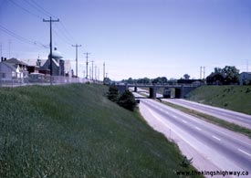
Left - Facing east along Jackson Avenue (today's Lviv Boulevard) from Simcoe Street. Jackson Avenue once acted as a service road along the north side of
Hwy 401 through the central part of Oshawa. This area of Oshawa has changed a lot since this photo was taken in 1971. Nearly all of the houses on this street have
been demolished over the years due to redevelopment. The only notable surviving building on this street is the St. George Ukrainian Catholic Church located at the
corner of Albert Street, whose distinct domed roof makes for a very prominent local landmark. See an
Enlarged Photo Here. Photo taken in June, 1971. (Photo courtesy of Ontario Ministry of Transportation - © King's Printer for Ontario, 2020) Right - Western side of the Albert Street Overpass on Hwy 401 in Oshawa. The now-closed exit ramp to Simcoe Street from westbound Hwy 401 can be seen developing on the right-hand side of the freeway, just beyond the Albert Street Overpass. See an Enlarged Photo Here. Photo taken in June, 1971. (Photo courtesy of Ontario Ministry of Transportation - © King's Printer for Ontario, 2020) 

Left - Facing east along Jackson Avenue (today's Lviv Boulevard) at Albert Street. Apart from Hwy 401 itself, the beautiful St. George Ukrainian Catholic
Church is one of the only remaining landmarks in this area that can still be found today. See an
Enlarged Photo Here. Photo taken in June, 1971. (Photo courtesy of Ontario Ministry of Transportation - © King's Printer for Ontario, 2020) Right - Albert Street Overpass on Hwy 401 in Oshawa, facing south. The street was temporarily closed for construction at the time this photo was taken. See an Enlarged Photo Here. Photo taken in June, 1971. (Photo courtesy of Ontario Ministry of Transportation - © King's Printer for Ontario, 2020) 

Left - Western side of the Oshawa CNR Overhead, located between Albert Street and Ritson Road. See an
Enlarged Photo Here. Photo taken in June, 1971. (Photo courtesy of Ontario Ministry of Transportation - © King's Printer for Ontario, 2020) Right - Facing east along Hwy 401 from the Albert Street Overpass in Oshawa in 1971. The structure in the foreground is the Oshawa CNR Overhead. Note the 70 mph speed limit sign at right, with the "Trucks 60" tab below it. One of Hwy 401's black-and-white sequential interchange number signs (Interchange 71) is also visible. See an Enlarged Photo Here. Photo taken in June, 1971. (Photo courtesy of Ontario Ministry of Transportation - © King's Printer for Ontario, 2020) 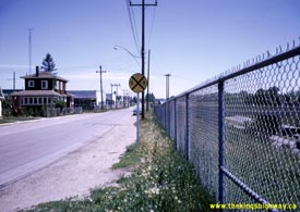
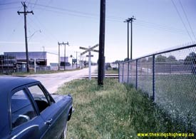
Left - Facing east along Jackson Avenue (today's Lviv Boulevard) approaching Front Street. Interestingly, all of the streets in this part of Oshawa still had
a rural cross-section, even in the early 1970s. Roads with rural cross-sections make use of granular shoulders or roadside ditches to allow storm water to run off the
road and drain away naturally. An urban cross-section refers to a road or street with curb-and-gutter, usually implemented in conjunction with a subterranean storm
sewer drainage system. Today, we take streets with urban cross-sections for granted in cities, so it is really surprising to see a city of this size with rural
cross-sections in its urban core as recently as the 1970s. See an Enlarged Photo Here. Photo
taken in June, 1971. (Photo courtesy of Ontario Ministry of Transportation - © King's Printer for Ontario, 2020) Right - View of Jackson Avenue at Front Street, facing east. Today, this street turns left and becomes Front Street. However, in 1971, the street continued east across the CNR tracks towards Ritson Road. When the ramps at the Ritson Road Interchange were reconstructed in 1978-1979, Jackson Avenue was closed off at Drew Street. The section of Jackson Avenue from Front Street to Drew Street was subsequently closed and abandoned, as a portion of this land was needed for the realigned Ritson Road on-ramp to Hwy 401. See an Enlarged Photo Here. Photo taken in June, 1971. (Photo courtesy of Ontario Ministry of Transportation - © King's Printer for Ontario, 2020) 

Left - Facing north along the CNR line from Hwy 401 in Oshawa. This railway line was ultimately abandoned and removed. The former railway right-of-way was
re-purposed as a multi-use trail. Note the proliferation of aerial television receiver towers at most of the homes along adjacent Front Street - a communication
technology that became obsolete very quickly with the introduction of cable television services in the late 1970s and early 1980s. See an
Enlarged Photo Here. Photo taken in June, 1971. (Photo courtesy of Ontario Ministry of Transportation - © King's Printer for Ontario, 2020) Right - Oshawa CNR Subway on Hwy 401, facing east from Albert Street. The earth removed from this massive cut was transported to other areas along the highway for use as fill in low-lying areas. In all likelihood, the large earth fill on Hwy 401's western approach to Oshawa Creek was constructed using material excavated from this particular earth cut. See an Enlarged Photo Here. Photo taken in June, 1971. (Photo courtesy of Ontario Ministry of Transportation - © King's Printer for Ontario, 2020) 
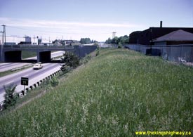
Left - Facing south across the Oshawa CNR Subway on Hwy 401. See an
Enlarged Photo Here. Photo taken in June, 1971. (Photo courtesy of Ontario Ministry of Transportation - © King's Printer for Ontario, 2020) Right - Facing east along Hwy 401 from Albert Street. The black-and-white sequential interchange number sign for Ritson Road can be seen more clearly in this photo. In 1963, all interchanges along Hwy 401 were assigned numbers that increased sequentially from Windsor to the Quebec Boundary. The sequential interchange numbering system created problems almost immediately after it was introduced, as new interchanges were built along Hwy 401 in locations where planners had not anticipated, while other proposed interchange locations which had a number reserved for them were never actually built. For a while, an alpha-numeric number was introduced to differentiate a newly-built interchange from an existing one (for example, Interchange 51 and Interchange 51A were in two different locations). Not surprisingly, this duplication of interchange numbers led to confusion amongst motorists. This numbering problem was finally resolved in 1982, when the former sequential interchange numbering system was retired and a new distance-based interchange numbering system was introduced. Since the new interchange numbers were based on their kilometric distance from Windsor, this new system ensured that there would never be two interchanges along Hwy 401 with the same number. Under the old sequential numbering system, Ritson Road was Interchange 71. Today, it is Interchange 418. See an Enlarged Photo Here. Photo taken in June, 1971. (Photo courtesy of Ontario Ministry of Transportation - © King's Printer for Ontario, 2020) 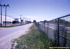

Left - View of Jackson Avenue between Front Street and Drew Street, facing east. This entire roadway was removed after being closed to through traffic at Drew
Street in 1978. The closure of this street was necessary in order to remove an at-grade intersection on the freeway entrance and exit ramps at nearby Ritson Road. See
an Enlarged Photo Here. Photo taken in June, 1971. (Photo courtesy of Ontario Ministry of Transportation - © King's Printer for Ontario, 2020) Right - View of the Ritson Road Interchange from the Oshawa CNR Subway in 1971, facing east. The entrance and exit ramps on eastbound Hwy 401 were temporarily closed for construction at the time this photo was taken, but the ramps on the westbound side of the freeway were open. When the first phase of Hwy 401 (originally known as Hwy 2A) first opened to traffic in 1947, the freeway came to an end at this interchange. All eastbound traffic had to exit the freeway and follow Ritson Road north to Hwy 2, which at the time was Ontario's main east-west highway route. An easterly extension of Hwy 401 was completed from Ritson Road to Newcastle in 1952. See an Enlarged Photo Here. Photo taken in June, 1971. (Photo courtesy of Ontario Ministry of Transportation - © King's Printer for Ontario, 2020) 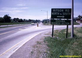

Left - Facing west along Hwy 401 towards Toronto at the Ritson Road Interchange in 1971. The ground-mounted plywood exit sign for Ritson Road may seem small,
but it was actually a typical freeway installation at the time this photo was taken. It wasn't until the mid-1970s that larger extruded aluminum signs became more
commonplace along Ontario's freeways. The ramps to and from westbound Hwy 401 actually connect to Oshawa's Drew Street. Traffic must then follow surface streets in
order to reach Ritson Road. See an Enlarged Photo Here. Photo taken in June, 1971. (Photo courtesy of Ontario Ministry of Transportation - © King's Printer for Ontario, 2020) Right - A lone motorist enters the westbound lanes of Hwy 401 at the Ritson Road Interchange in Oshawa. As one might deduce from this photo, Drew Street originally continued straight ahead (south) to Bloor Street, which lies on the opposite side of Hwy 401. The south leg of Drew Street served as access ramps to and from eastbound Hwy 401 up until the late 1970s, when the entire south leg of Drew Street was demolished in order to make way for an improved interchange at Ritson Road. Note the at-grade intersection with Jackson Avenue immediately adjacent to the westbound Hwy 401 entrance and exit ramps. This at-grade intersection was removed during a highway expansion project in 1978. See an Enlarged Photo Here. Photo taken in June, 1971. (Photo courtesy of Ontario Ministry of Transportation - © King's Printer for Ontario, 2020) 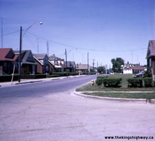
Above - Facing north along Drew Street from the Hwy 401 Interchange at Ritson Road in 1971. When Hwy 401 was expanded from four to six lanes in the late 1970s,
it triggered many improvements to the interchange ramps as well. All of the houses along Drew Street lying between Jackson Avenue in the foreground and Toronto Avenue
in the background were demolished in an effort to improve the interchange at Ritson Road. The only landmark in this photo which still survives today is the
appropriately-named Cloverleaf Motel, whose sign can be seen in the distance at the corner of Drew Street and Toronto Avenue. The improved entrance and exit ramps
from Hwy 401 now extend all the way to the motel. See an Enlarged Photo Here. Photo taken in
June, 1971. (Photo courtesy of Ontario Ministry of Transportation - © King's Printer for Ontario, 2020) 

Left - Entrance ramp to westbound Hwy 401 from Ritson Road in 1971. When the Ritson Road Interchange was first opened to traffic in the 1940s, Drew Street
merely connected with Hwy 401 at a T-intersection, similar to the Canal Road Interchange on Hwy 400 near Bradford. The channelized freeway ramps seen here were
actually constructed as part of an interchange retrofit project in 1966. Interestingly, when the
highway was originally designed through Oshawa in 1938-1939, the highway was to include an
east-oriented "Parclo A-B" Interchange at Ritson Road. This interchange was ultimately never constructed. Although the exact reasons for this change are not known, it
is quite possible that the design had to be modified during the interchange's construction in 1941, to conserve diminishing supplies of construction materials
triggered by World War II. See an Enlarged Photo Here. Photo taken in June, 1971. (Photo courtesy of Ontario Ministry of Transportation - © King's Printer for Ontario, 2020) Right - Facing south along Ritson Road towards the underpass below Hwy 401 in Oshawa. See an Enlarged Photo Here. Photo taken in June, 1971. (Photo courtesy of Ontario Ministry of Transportation - © King's Printer for Ontario, 2020) 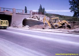

Left - Southern side of the Ritson Road Underpass below Hwy 401 in Oshawa, showing progress on the new pedestrian tunnel. Note the green-and-yellow Wink truck
on Ritson Road. Wink was a popular soft drink in the 1960s and 1970s which is no longer marketed in Ontario. See an
Enlarged Photo Here. Photo taken in June, 1971. (Photo courtesy of Ontario Ministry of Transportation - © King's Printer for Ontario, 2020) Right - Construction of a new pedestrian tunnel under Hwy 401 at Ritson Road. The completed tunnel and expanded four-lane Ritson Road can be seen in a subsequent photo dated October 1971, which can be found further down on this page. See an Enlarged Photo Here. Photo taken in June, 1971. (Photo courtesy of Ontario Ministry of Transportation - © King's Printer for Ontario, 2020) 

Left - Southern terminus of Hwy 35 & Hwy 115 at Hwy 401 near Newcastle in 1971. At the time this photo was taken, Hwy 35 & Hwy 115 was only two lanes.
Note that the divided highway ends immediately north of the Hwy 401 Interchange. A "butterfly" overhead sign structure points the way to Hwy 401 East Kingston and
Hwy 401 West Toronto. Erected in 1960, this overhead sign was installed as part of a general trend by the DHO towards the placement of overhead signs at major freeway
interchanges. See an Enlarged Photo Here. Photo taken in July, 1971. (Photo courtesy of Ontario Ministry of Transportation - © King's Printer for Ontario, 2021) Right - Facing east along Hwy 401 towards Newcastle from the Hwy 35 & Hwy 115 Interchange. See an Enlarged Photo Here. Photo taken in July, 1971. (Photo courtesy of Ontario Ministry of Transportation - © King's Printer for Ontario, 2021) 

Left - Facing east along Hwy 401 towards Newcastle at the Soper Creek Bridge near Liberty Street in Bowmanville. See an
Enlarged Photo Here. Photo taken in August, 1971. (Photo courtesy of Ontario Ministry of Transportation - © King's Printer for Ontario, 2020) Right - Henry Street Overpass on Hwy 401 in Whitby in 1971, facing north. Note the white centreline painted along Henry Street. At one time, all of Ontario's highway pavement markings were white, regardless of the application. Beginning in the 1960s, yellow line paint was introduced along the outer edge of the highway pavement on some busier Ontario Highways as a safety measure, but white line paint continued to be used for marking highway centrelines. Prior to the 1970s, the colour of highway centrelines was inconsistent between various provinces and states. Some jurisdictions including Ontario used white line paint to mark highway centrelines, while others used yellow line paint. Pavement markings across Canada and the United States were eventually standardized, so that only yellow line paint was used to mark highway centrelines. White line paint continued to be used for all other lane markings. During 1971 and 1972, Ontario switched over all of its old white highway centreline markings to yellow, in order to conform with the new North American standard. See an Enlarged Photo Here. Photo taken in August, 1971. (Photo courtesy of Ontario Ministry of Transportation - © King's Printer for Ontario, 2020) 
Above - Ritson Road Underpass on Hwy 401 in Oshawa in 1971. The original 1941 structure carrying Hwy 401 over Ritson Road was only just wide enough to
accommodate a four-lane street below the structure. When Ritson Road was widened from two to four lanes in 1971, a new pedestrian tunnel was built to carry a sidewalk
underneath Hwy 401. Photo taken in October, 1971. (Photo courtesy of Ontario Ministry of Transportation - © King's Printer for Ontario, 2013) 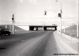

Left - Facing north along Kennedy Road towards the new underpass at Hwy 401 in 1971. When the Toronto Bypass (Hwy 401) was first built in the mid-1950s,
Kennedy Road passed over Hwy 401 at a full cloverleaf interchange. During reconstruction and widening of Hwy 401 in 1969-1970, the original 1956 Kennedy Road Interchange was
completely rebuilt. The interchange was reconfigured into a more conventional "Parclo A-4" ramp configuration and Kennedy Road was rebuilt so that is passed under
Hwy 401. Note the internally-illuminated "No Left Turn" signs mounted to the traffic signal mast arms at the Kennedy Road off-ramp from Hwy 401. Internally
illuminated black-and-white regulatory signs used to be fairly common at urban signalized intersections in Ontario, but were gradually phased out by the 1990s. Today,
regulatory signs mounted to traffic signal installations are non-illuminated reflective metal signs. See an
Enlarged Photo Here. Photo taken on November 3, 1971. (Photo courtesy of Ontario Ministry of Transportation - © King's Printer for Ontario, 2013) Right - Reconstructed section of Hwy 401 at Kennedy Road in Toronto, facing west. See an Enlarged Photo Here. Photo taken on November 3, 1971. (Photo courtesy of Ontario Ministry of Transportation - © King's Printer for Ontario, 2013) 

Left - Work crew putting on the finishing touches on the expanded Hwy 401 near the Kennedy Road Interchange in Toronto. The widening of Hwy 401 from 4 to 12
lanes was completed between Warden Avenue and Midland Avenue in late 1971. Although it isn't very clear in this photo, the overhead sign in the background marking the
Collector-to-Express Transfer reads, "401 Through - Keep Left 2 Lanes". During the early 1970s, the word "Through" was replaced by "Express" on all signs on Hwy 401.
New ground-mounted exit gore signs reading "Express Lanes" were installed at all Collector-to-Express transfer points along Hwy 401 in November, 1972. Prior to 1972,
ground-mounted exit gore signs at Collector-to-Express transfer points simply read "401". Overhead signs along Hwy 401 continued to indicate "401 Through" at
Collector-to-Express transfer points for almost two years thereafter, until they were all replaced over a six month period between February and July, 1974. The last
overhead sign referencing "401 Through" was removed from the highway at the Westbound Basketweave near Keele Street on July 2, 1974. See an
Enlarged Photo Here. Photo taken on November 3, 1971. (Photo courtesy of Ontario Ministry of Transportation - © King's Printer for Ontario, 2013) Right - Canadian Pacific Railway Overhead on Hwy 401 between Birchmount Avenue and Kennedy Road in Toronto (November 3, 1971) (Photo courtesy of Ontario Ministry of Transportation - © King's Printer for Ontario, 2013) 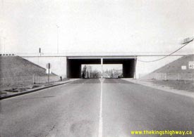
Above - New Birchmount Avenue Underpass on Hwy 401 in Toronto (November 3, 1971) (Photo courtesy of Ontario Ministry of Transportation - © King's Printer for Ontario, 2013) 

Left - Overhead sign marking the Airport Expressway Exit on Westbound Hwy 401 in Toronto in 1971. Following the construction of the new interchange at Hwy 27
in the early 1970s, traffic heading westbound on Hwy 401 had to access the Airport Expressway (now Hwy 427 North) indirectly via a temporary on-ramp from Carlingview
Drive. This sign was changed to read "Carlingview Drive" after the temporary on-ramp to the Airport Expressway near the Renforth Drive Underpass was closed in the
early 1970s. Access to Toronto International Airport from Westbound Hwy 401 was greatly improved once Hwy 409 was completed in the 1970s. Photo taken on November
19, 1971. (Photo courtesy of Ontario Ministry of Transportation - © King's Printer for Ontario, 2013) Right - Facing south along the on-ramp from Northbound Hwy 27 (now Hwy 427) to Eastbound Hwy 401 in Toronto (November 19, 1971) (Photo courtesy of Ontario Ministry of Transportation - © King's Printer for Ontario, 2013) 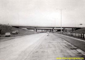

Left - Facing south along Hwy 27 towards the Hwy 401 Overpass in Toronto in 1971. Reconstruction of the Hwy 27 and Hwy 401 Interchange was a massive multi-year
project, involving multiple construction contracts spanning a four-year period between 1968 and 1972. Here, the steel beam guide rail median barrier on Hwy 27 was in
the process of being installed, as one of the interchange reconstruction contracts was nearing completion. Photo taken on November 19, 1971. (Photo courtesy of Ontario Ministry of Transportation - © King's Printer for Ontario, 2013) Right - Newly-constructed off-ramp from Westbound Hwy 401 to Southbound Hwy 27 in 1971. The construction staging for the Hwy 27 and Hwy 401 Interchange reconstruction project was extremely complicated. During some stages of the reconstruction project, this off-ramp to Southbound Hwy 27 also provided access to either Westbound Hwy 401 or the Airport Expressway, depending on the stage. Note the overhead guide sign further down the ramp, pointing to "Hwy 27 South TO QEW". Once the temporary right-hand exit from the ramp was closed off, this overhead sign became redundant and was eventually removed. The section of Hwy 27 south of the Hwy 401 Interchange was renumbered as Hwy 427 after reconstruction of the corridor was completed in 1972. Photo taken on November 19, 1971. (Photo courtesy of Ontario Ministry of Transportation - © King's Printer for Ontario, 2013) 
Above - Hwy 401 at dusk, facing west towards the Basketweave from the Keele Street Interchange in Toronto in 1972. See an
Enlarged Photo Here. (Photo courtesy of Ontario Ministry of Transportation - © King's Printer for Ontario, 2013) 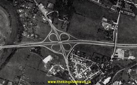
Left - Aerial view of the Hwy 8 Interchange on Hwy 401 between Kitchener and Cambridge in 1974. The Hwy 8 Interchange was originally constructed in 1960 as a
full eight-ramp cloverleaf. In 1987, the construction of the new Hwy 8 Bypass a short distance to the east resulted in a reconfiguration of the original cloverleaf
interchange. The two loop ramps on the London side of the interchange were closed off to traffic, creating a partial cloverleaf configuration as seen in this
2005 Aerial Photo. See an
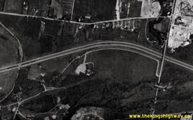
Enlarged Photo Here. Photo taken in 1974. (Photo courtesy of Ontario Ministry of Transportation - © King's Printer for Ontario, 2012) Right - Aerial view of Hwy 401 near the Speedsville Road Overpass in Cambridge. See an Enlarged Photo Here. Photo taken in 1974. (Photo courtesy of Ontario Ministry of Transportation - © King's Printer for Ontario, 2012) 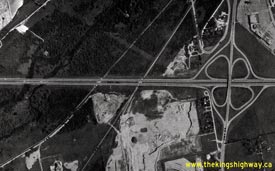

Left - Aerial view of the Hwy 24 Interchange on Hwy 401 in Cambridge in 1974. The lack of development around the interchange at that time is quite
remarkable. The Hwy 24 Interchange was originally constructed in 1960 as a full eight-ramp cloverleaf. In 1989, the widening of Hwy 401 and the twinning of the
Hwy 24 Overpass resulted in a complete reconstruction of the original cloverleaf interchange. The two far-side loop ramps were removed, creating a "Parclo A-4"
interchange. The current interchange configuration can be seen in this 2005 Aerial Photo. See
an Enlarged Photo Here. Photo taken in 1974. (Photo courtesy of Ontario Ministry of Transportation - © King's Printer for Ontario, 2012) Right - Aerial view of Hwy 401 near the Back Hespeler Road (Franklin Boulevard) Overpass in Cambridge in 1974. The current partial interchange at Franklin Boulevard was constructed in the early 1990s. See an Enlarged Photo Here. Photo taken in 1974. (Photo courtesy of Ontario Ministry of Transportation - © King's Printer for Ontario, 2012) 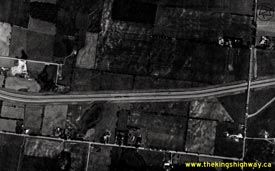

Left - Aerial view of Hwy 401 near the Townline Road Overpass in Cambridge in 1974. An interchange was constructed at Townline Road in the mid-1980s. Prior
to that time, there were no interchanges along Hwy 401 between Hwy 24 and Hwy 6. See an
Enlarged Photo Here. Photo taken in 1974. (Photo courtesy of Ontario Ministry of Transportation - © King's Printer for Ontario, 2012) Right - Aerial view of Hwy 401 between the Townline Road Overpass and the Wellington Road 32 Overpass east of Cambridge (1974) (Photo courtesy of Ontario Ministry of Transportation - © King's Printer for Ontario, 2012) 

Left - Aerial view of Hwy 401 at the Wellington Road 32 Overpass. The Cambridge Service Centres are visible at right. Photo taken in 1974. (Photo courtesy of Ontario Ministry of Transportation - © King's Printer for Ontario, 2012) Right - Aerial view of Hwy 401 between the Cambridge Service Centres and the Wellington Road 35 Overpass south of Guelph (1974) (Photo courtesy of Ontario Ministry of Transportation - © King's Printer for Ontario, 2012) 

Left - Aerial view of Hwy 401 near the Wellington Road 35 Overpass south of Guelph (1974) (Photo courtesy of Ontario Ministry of Transportation - © King's Printer for Ontario, 2012) Right - Aerial view of Hwy 401 between the Wellington Road 35 Overpass and the Hanlon Road Overpass south of Guelph (1974) (Photo courtesy of Ontario Ministry of Transportation - © King's Printer for Ontario, 2012) 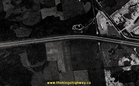

Left - Aerial view of Hwy 401 at the future site of the Hwy 6 Bypass (Hanlon Parkway) Interchange south of Guelph in 1974. Construction began on the new Hwy 6 Bypass
Interchange shortly after this photo was taken. Today's interchange would be situated on the left-hand side of this photo, just west of the Aberfoyle Creek Culvert.
See an Enlarged Photo Here. Photo taken in 1974. (Photo courtesy of Ontario Ministry of Transportation - © King's Printer for Ontario, 2012) Right - Aerial view of Hwy 401 between the Hanlon Road (Concession 7) Overpass and the Hwy 6 Interchange south of Guelph (1974) (Photo courtesy of Ontario Ministry of Transportation - © King's Printer for Ontario, 2012) 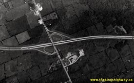

Left - Aerial view of Hwy 401 at the Hwy 6 Interchange near Morriston in 1974. This interchange was originally constructed as a four-ramp "Parclo A-2"
interchange in 1959-1960. It is interesting to note that the Hwy 6 Interchange is the only interchange along Hwy 401 between Toronto and Woodstock that has not been
reconfigured in some way or another since the highway was first built in the late 1950s and early 1960s. Photo taken in 1974. (Photo courtesy of Ontario Ministry of Transportation - © King's Printer for Ontario, 2012) Right - Aerial view of Hwy 401 near the Wellington Road 36 Overpass east of Morriston (1974) (Photo courtesy of Ontario Ministry of Transportation - © King's Printer for Ontario, 2012) 

Left - Aerial view of Hwy 401 near the Watson Road Overpass east of Morriston (1974) (Photo courtesy of Ontario Ministry of Transportation - © King's Printer for Ontario, 2012) Right - Aerial view of Hwy 401 between the Watson Road Overpass and the Wellington-Halton Boundary east of Morriston (1974) (Photo courtesy of Ontario Ministry of Transportation - © King's Printer for Ontario, 2012) 
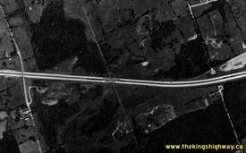
Left - Aerial view of Hwy 401 near the Wellington-Halton Boundary west of Campbellville (1974) (Photo courtesy of Ontario Ministry of Transportation - © King's Printer for Ontario, 2012) Right - Aerial view of Hwy 401 near the First Line Overpass west of Campbellville (1974) (Photo courtesy of Ontario Ministry of Transportation - © King's Printer for Ontario, 2012) 

Left - Aerial view of the Guelph Line Interchange on Hwy 401 at Campbellville in 1974. This interchange was reconfigured in 1978 and again in 2008. (Photo courtesy of Ontario Ministry of Transportation - © King's Printer for Ontario, 2012) Right - Aerial view of Hwy 401 near the Fourth Line (Walkers Line) Underpass east of Campbellville (1974) (Photo courtesy of Ontario Ministry of Transportation - © King's Printer for Ontario, 2012) 

Left - Aerial view of Hwy 401 near the Fifth Line (Appleby Line) Underpass west of Milton (1974) (Photo courtesy of Ontario Ministry of Transportation - © King's Printer for Ontario, 2012) Right - Aerial view of Hwy 401 near the Kelso Conservation Area west of Milton (1974) (Photo courtesy of Ontario Ministry of Transportation - © King's Printer for Ontario, 2012) 

Left - Aerial view of Hwy 401 between the Halton Road 22 (Tremaine Road) Overpass and the Hwy 25 Interchange in Milton (1974) (Photo courtesy of Ontario Ministry of Transportation - © King's Printer for Ontario, 2012) Right - Aerial view of the Hwy 25 Interchange on Hwy 401 in Milton in 1974. The Hwy 25 Interchange was originally constructed in 1958-1959 as a full eight-ramp cloverleaf. In 1988, the two far-side loop ramps were removed, creating a "Parclo A-4" interchange that is seen today. At the time this photo was taken, this was very much a rural interchange. Nearly all of the land around Hwy 401 in Milton has been developed over the past 20 years. See an Enlarged Photo Here. Photo taken in 1974. (Photo courtesy of Ontario Ministry of Transportation - © King's Printer for Ontario, 2012) 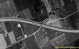

Left - Aerial view of Hwy 401 near the Steeles Avenue Overpass in Milton in 1974. See an
Enlarged Photo Here. (Photo courtesy of Ontario Ministry of Transportation - © King's Printer for Ontario, 2012) Right - Aerial view of Hwy 401 at the future site of the James Snow Parkway Interchange in Milton in 1974. The new interchange at James Snow Parkway was constructed in 1982. Today's interchange would be situated on the left-hand side of this photo, where Old Fourth Line ends at a pair of cul-de-sacs. See an Enlarged Photo Here. Photo taken in 1974. (Photo courtesy of Ontario Ministry of Transportation - © King's Printer for Ontario, 2012) 

Left - Aerial view of Hwy 401 near the Sixth Line Overpass east of Milton (1974) (Photo courtesy of Ontario Ministry of Transportation - © King's Printer for Ontario, 2012) Right - Aerial view of Hwy 401 near the Seventh Line (Trafalgar Road) Overpass north of Oakville in 1974. This interchange was originally constructed as a four-ramp "Parclo A-2" interchange in 1958. Two directional ramps were built at this interchange in 1979, converting it into a standard "Parclo A-4" configuration. Photo taken in 1974. (Photo courtesy of Ontario Ministry of Transportation - © King's Printer for Ontario, 2012) 

Left - Aerial view of Hwy 401 near the Ninth Line Overpass north of Oakville in 1974. This is the site of the Hwy 407 ETR Interchange today. (Photo courtesy of Ontario Ministry of Transportation - © King's Printer for Ontario, 2012) Right - Aerial view of Hwy 401 near the Regional Road 19 (Winston Churchill Boulevard) Overpass west of Streetsville (1974) (Photo courtesy of Ontario Ministry of Transportation - © King's Printer for Ontario, 2012) 
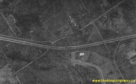
Left - Aerial view of Hwy 401 between the Winston Churchill Boulevard Overpass and Mississauga Road Interchange west of Streetsville in 1974. Note the former
sites of the Streetsville Truck Scales east of Winston Churchill Boulevard. The Streetsville Truck Scales were closed in the early 1980s and relocated further west
along Hwy 401 near Milton. See an Enlarged Photo Here. Photo taken in 1974. (Photo courtesy of Ontario Ministry of Transportation - © King's Printer for Ontario, 2012) Right - Aerial view of the Mississauga Road Interchange on Hwy 401 north of Streetsville in 1974. When the Mississauga Road Interchange was originally constructed in 1958-1959, it was built in an unusual "Parclo B-2" interchange configuration. When Hwy 401 was widened to six lanes through this area in 1977, the Mississauga Road Interchange was completely rebuilt and converted to a more conventional "Parclo A-4" interchange. See an Enlarged Photo Here. Photo taken in 1974. (Photo courtesy of Ontario Ministry of Transportation - © King's Printer for Ontario, 2012) 

Left - Aerial view of Hwy 401 near the Credit River and Creditview Road Overpass east of Streetsville in 1974. See an
Enlarged Photo Here. (Photo courtesy of Ontario Ministry of Transportation - © King's Printer for Ontario, 2012) Right - Aerial view of Hwy 401 at the future site of the Mavis Road Interchange in Mississauga in 1974. The new interchange at Mavis Road was constructed in 1999. Today's interchange would be situated in the centre of this photo, about half-way between the Second Line and First Line (McLaughlin Road) Overpasses. See an Enlarged Photo Here. Photo taken in 1974. (Photo courtesy of Ontario Ministry of Transportation - © King's Printer for Ontario, 2012) 

Left - Aerial view of the Hwy 10 Interchange on Hwy 401 between Port Credit and Brampton in 1974. The Hwy 10 Interchange was originally constructed in 1957
as a full eight-ramp cloverleaf. In 1975-1976, the two far-side loop ramps were removed, creating a "Parclo A-4" interchange that stood until 2009-2010, when the
interchange was reconstructed again. The lack of development around the interchange at the time this photo was taken is quite remarkable - it certainly doesn't look
like this today. See an Enlarged Photo Here. Photo taken in 1974. (Photo courtesy of Ontario Ministry of Transportation - © King's Printer for Ontario, 2012) Right - Aerial view of Hwy 401 at the future site of the Hwy 403 & Hwy 410 Interchange in Mississauga in 1974. The new freeway interchange was built immediately east of the First Line (Kennedy Road) Overpass. Construction got underway on the first phase of the Hwy 403 & Hwy 410 Interchange in 1974, shortly after this photo was taken. See an Enlarged Photo Here. Photo taken in 1974. (Photo courtesy of Ontario Ministry of Transportation - © King's Printer for Ontario, 2012) 
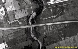
Left - Aerial view of the Dixie Road Interchange on Hwy 401 west of Toronto in 1974, before reconstruction. When the Dixie Road Interchange was originally
built in 1957-1958, it was designed as a four-ramp "A-B Parclo" with all ramps situated on the western side of the interchange. The two directional ramps on the east
side of the interchange were constructed in the late 1960s, in order to eliminate the left turn required for northbound traffic to head east along Hwy 401 into
Toronto. The construction of the new ramps also allowed for easier access to the Brampton area from Westbound Hwy 401. This interchange was completely reconstructed
in 1974-1975, in conjunction with the first phase of the Express-Collector Lane System extension on Hwy 401 and the adjacent Hwy 403 Interchange construction. See an
Enlarged Photo Here. Photo taken in 1974. (Photo courtesy of Ontario Ministry of Transportation - © King's Printer for Ontario, 2012) Right - Aerial view of Hwy 401 at Etobicoke Creek, between the Dixie Road and Renforth Drive Interchange in 1974. This photo shows the original 1950s-era highway, before it was widened into a complex freeway with separate Express and Collector Lanes. What is particularly surprising about this photo is the sheer lack of development in this area. The business parks to the south of Hwy 401 didn't start to appear until the 1980s. See an Enlarged Photo Here. Photo taken in 1974. (Photo courtesy of Ontario Ministry of Transportation - © King's Printer for Ontario, 2012) 
Above - Aerial view of Hwy 401 at the newly-completed Renforth Drive Interchange on Hwy 401 in Toronto in 1971. Of particular interest here is the abrupt
collapse of the complex freeway west of Hwy 427. At the time this photo was taken, the Express Lanes had been built, but had not yet been opened to traffic. The
westerly extension of the Express-Collector Lane System to Hwy 403 began a few years after this photo was taken. Due to the complicated staging of the project, it
took 10 years to complete the complex freeway expansion along Hwy 401 between Hwy 427 and Hwy 403. See an
Enlarged Photo Here. Photo taken in 1971. (Photo courtesy of Ontario Ministry of Transportation - © King's Printer for Ontario, 2012)
Continue on to King's Highway 401 Photos: Historical Photos (1975-1979)
|
|---|
Links to Adjacent King's Highway Photograph Pages:
Back to Hwy 401 - Historical Photos (1965-1969)
Hwy 401 Photo Index
On to Hwy 401 - Historical Photos (1975-1979)
Back to King's Highway 400 Photos /
King's Highway 401 History /
On to King's Highway 402 Photos
Ontario Highway History - Main Menu / Back to List of Highways Website contents, photos & text © 2002-2026, Cameron
Bevers (Webmaster) - All Rights Reserved / Contact Me
|
|---|