
| 
| |
|
|
This page contains present day photos (Year 2000 to date) of Ontario's King's Highway 48, arranged by location from Toronto
northerly to Beaverton. All photographs displayed on this page were taken by the Webmaster (Cameron Bevers), unless specifically noted otherwise. Click on any
thumbnail to see a larger image!
Please note that all photographs displayed on this
website are protected by copyright. These photographs must not be reproduced, published,
electronically stored or copied, distributed, or posted onto other websites without
my written permission. If you want to use photos from this website, please
email me first for permission. Thank-you!
|
|---|
|
Page 2: Present Day King's Highway 48 Photographs (Toronto to Beaverton)


Left - Aerial view of the Hwy 48 (Markham Road) Interchange on Hwy 401 in Toronto, facing south. Photograph taken on May 30, 2004 - © Cameron Bevers Right - Aerial view of Hwy 48 at Major Mackenzie Drive in Markham, facing north. Photograph taken on May 30, 2004 - © Cameron Bevers 

Left - Mount Albert Overhead on Hwy 48 at York Regional Road 13. Photograph taken on April 10, 2005 - © Cameron Bevers Right - Southwestern side of the Mount Albert Overhead on Hwy 48. Photograph taken on April 10, 2005 - © Cameron Bevers 

Left - Facing north along Hwy 48 at the York Regional Road 13 Junction at Mount Albert. The railway passes directly underneath the intersection
through a grade separation. Photograph taken on April 10, 2005 - © Cameron Bevers Right - Facing northeast along the alignment of the railway line at street level. Had it not been for the grade separation here, the railway would pass diagonally across this intersection. Originally, the two roads met at a point just north of this location. When the grade separation was completed in 1974, it eliminated both the at-grade railway crossing on Hwy 48 and the one on York Regional Road 13. Photograph taken on April 10, 2005 - © Cameron Bevers 

Left - Facing south along Hwy 48 towards York Regional Road 13 and the Mount Albert Overhead. Photograph taken on April 10, 2005 - © Cameron Bevers Right - Eastern side of the Mount Albert Creek Bridge on Hwy 48. Photograph taken on April 10, 2005 - © Cameron Bevers 

Left - Date stamp (1975) and structure identification number on the Mount Albert Creek Bridge on Hwy 48. Photograph taken on April 10, 2005 - © Cameron Bevers Right - The Mount Albert Creek Bridge is a laminated timber deck supported on timber trestle bents. The bridge superstructure, the abutments and the trestle bents were all built out of wood. Photograph taken on April 10, 2005 - © Cameron Bevers 

Left - Western side of the Mount Albert Creek Bridge on Hwy 48. Photograph taken on April 10, 2005 - © Cameron Bevers Right - Despite its relatively recent date of construction, the Mount Albert Creek Bridge is already showing signs of age and deformation. This bridge was replaced with a new structure in 2005. Photograph taken on April 10, 2005 - © Cameron Bevers 

Left - Facing north along Hwy 48 towards Sutton at the Mount Albert Creek Bridge. Photograph taken on April 10, 2005 - © Cameron Bevers Right - Facing south along Hwy 48 towards Markham at the Mount Albert Creek Bridge. Photograph taken on April 10, 2005 - © Cameron Bevers 

Left - Another view of the western side of the Mount Albert Creek Bridge on Hwy 48. Photograph taken on April 10, 2005 - © Cameron Bevers Right - Western side of the Black River Bridge on Hwy 48 north of Mount Albert. Photograph taken on April 10, 2005 - © Cameron Bevers 

Left - Eastern side of the Black River Bridge on Hwy 48 north of Mount Albert. Structure completed in 1975. Photograph taken on April 10, 2005 - © Cameron Bevers Right - The Black River Bridge is almost identical to the Mount Albert Creek Bridge in terms of its design, although the latter bridge is much shorter. The laminated timber deck and timber trestle design common to both of these bridges was seldom used in Southern Ontario, making these two structures rather peculiar anomalies for the area. The Black River Bridge was also replaced by a new structure in 2005. Photograph taken on April 10, 2005 - © Cameron Bevers 

Left - Facing north along Hwy 48 towards Sutton at the Black River Bridge near Mount Albert. Photograph taken on April 10, 2005 - © Cameron Bevers Right - Facing south along Hwy 48 towards Markham at the Black River Bridge near Mount Albert. Photograph taken on April 10, 2005 - © Cameron Bevers 

Left - Facing south along Hwy 48 at the Black River Bridge in Baldwin. Photograph taken on July 14, 2010 - © Cameron Bevers Right - Black River Bridge on Hwy 48 in Baldwin. Structure completed in 1964. Photograph taken on July 14, 2010 - © Cameron Bevers 

Left - Facing north along Hwy 48 at the Black River Bridge in Baldwin. Photograph taken on July 14, 2010 - © Cameron Bevers Right - Hwy 48 in Baldwin, facing north towards Sutton. Photograph taken on July 14, 2010 - © Cameron Bevers 

Left - Facing south along Hwy 48 towards Sutton approaching the Old Hwy 12 Junction (known today as Sideroad 17) near Port Bolster. Prior to the construction
of the Beaverton Bypass in the 1960s, Hwy 12 curved sharply to the right at this location. Once the Beaverton Bypass was completed, Hwy 12 was rerouted onto the new
eastern bypass around Beaverton. The old route of Hwy 12 through Beaverton was subsequently renumbered as Hwy 48B, while a short section of Hwy 12 near Port Bolster
became a part of Hwy 48. See an Enlarged Photo Here. (Photograph taken on September 22, 2023 - © Cameron Bevers) Right - View of Hwy 48 facing north from the Old Hwy 12 Junction at Sideroad 17. Hwy 48 continues north for about 3 km where it meets the relocated route of Hwy 12 at the Beaverton Bypass. This section of Hwy 48 between Sideroad 17 and the Beaverton Bypass was actually a part of Hwy 12 from 1927 up until 1966. See an Enlarged Photo Here. (Photograph taken on September 22, 2023 - © Cameron Bevers) 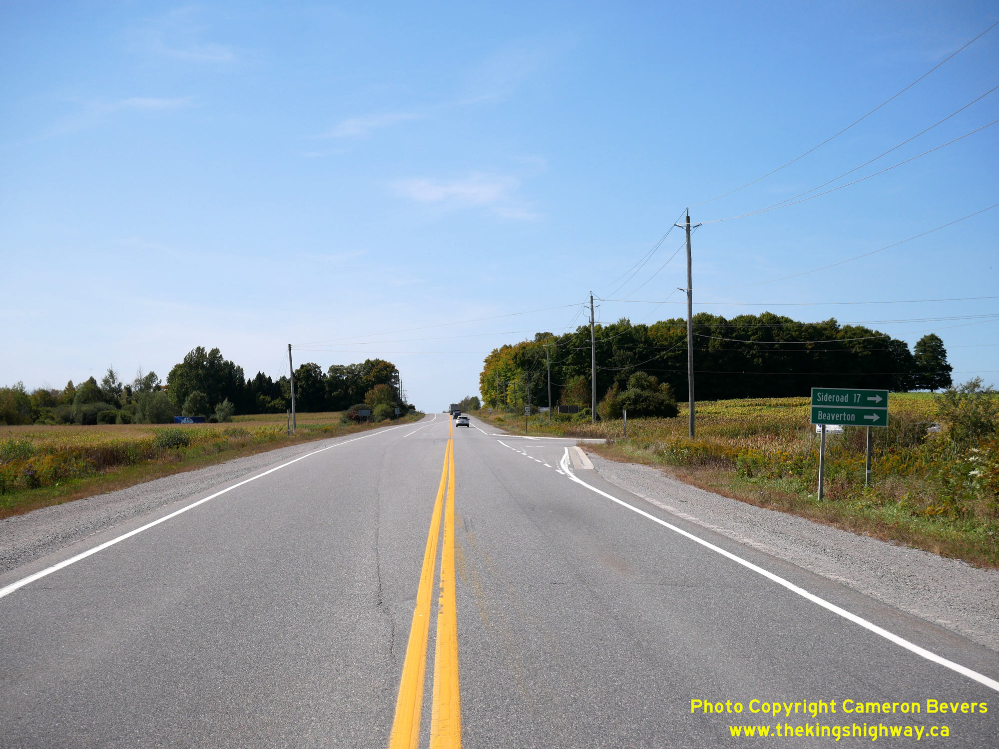
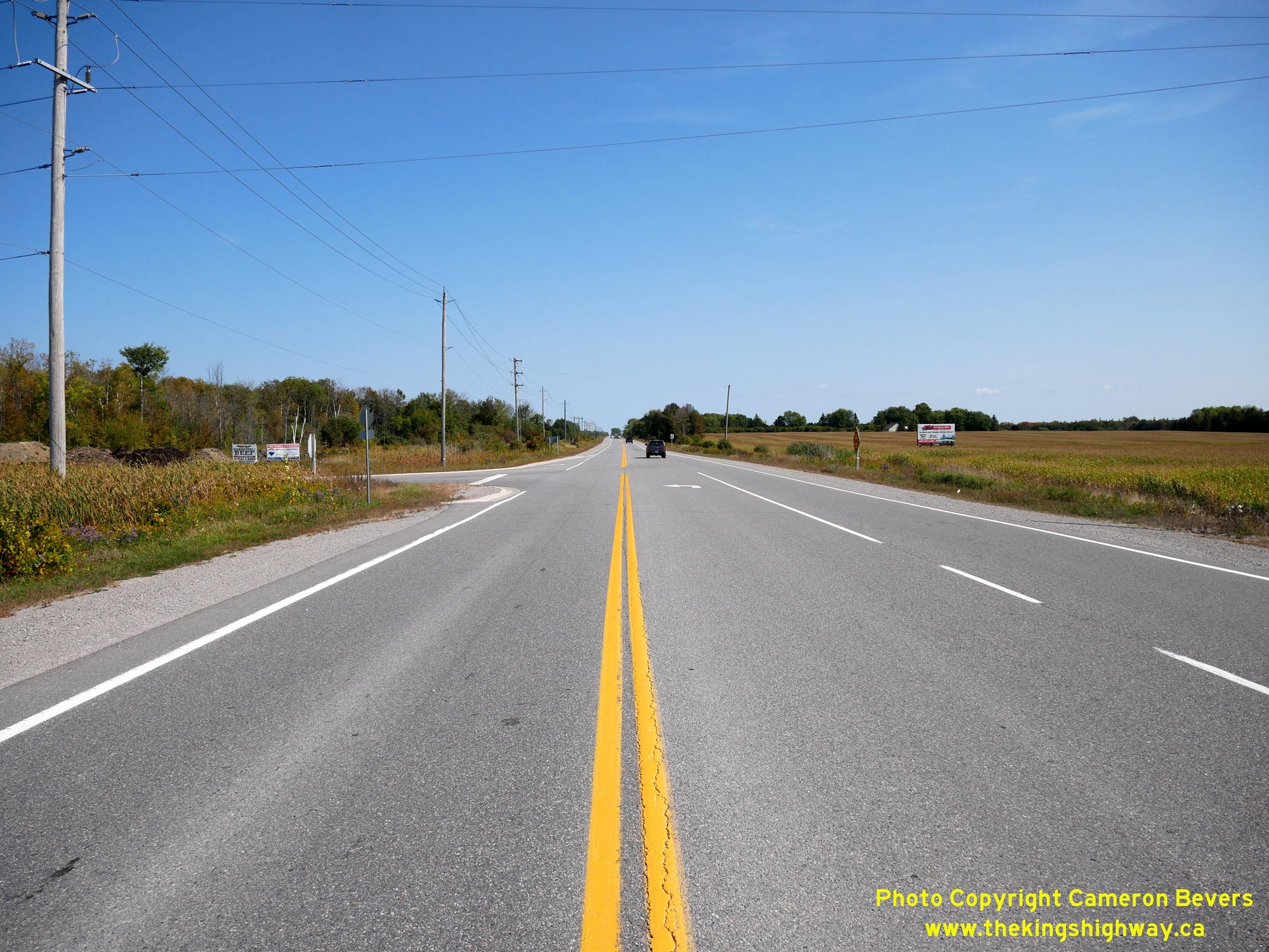
Left - Approaching the Old Hwy 12 Junction (Former Hwy 48B) on Hwy 48, facing south towards Sutton. Although it hasn't been a provincial highway since 1978,
traffic is still directed into Beaverton from Hwy 48 via Sideroad 17. It is actually a fast way to get into Beaverton from Hwy 48, as the old bypassed route of Hwy 48
passes through Port Bolster and several other small beachside communities located along Lake Simcoe's southeastern shores. See an
Enlarged Photo Here. (Photograph taken on September 22, 2023 - © Cameron Bevers) Right - Facing north along Hwy 48 at the Old Hwy 12 Junction near Port Bolster. A dedicated left-turn lane was provided along Hwy 48 for traffic turning north into Beaverton via Beaverton's Business Route (Hwy 48B). Through traffic with destinations beyond Beaverton could continue straight ahead to Hwy 12 and bypass Beaverton altogether. See an Enlarged Photo Here. (Photograph taken on September 22, 2023 - © Cameron Bevers) 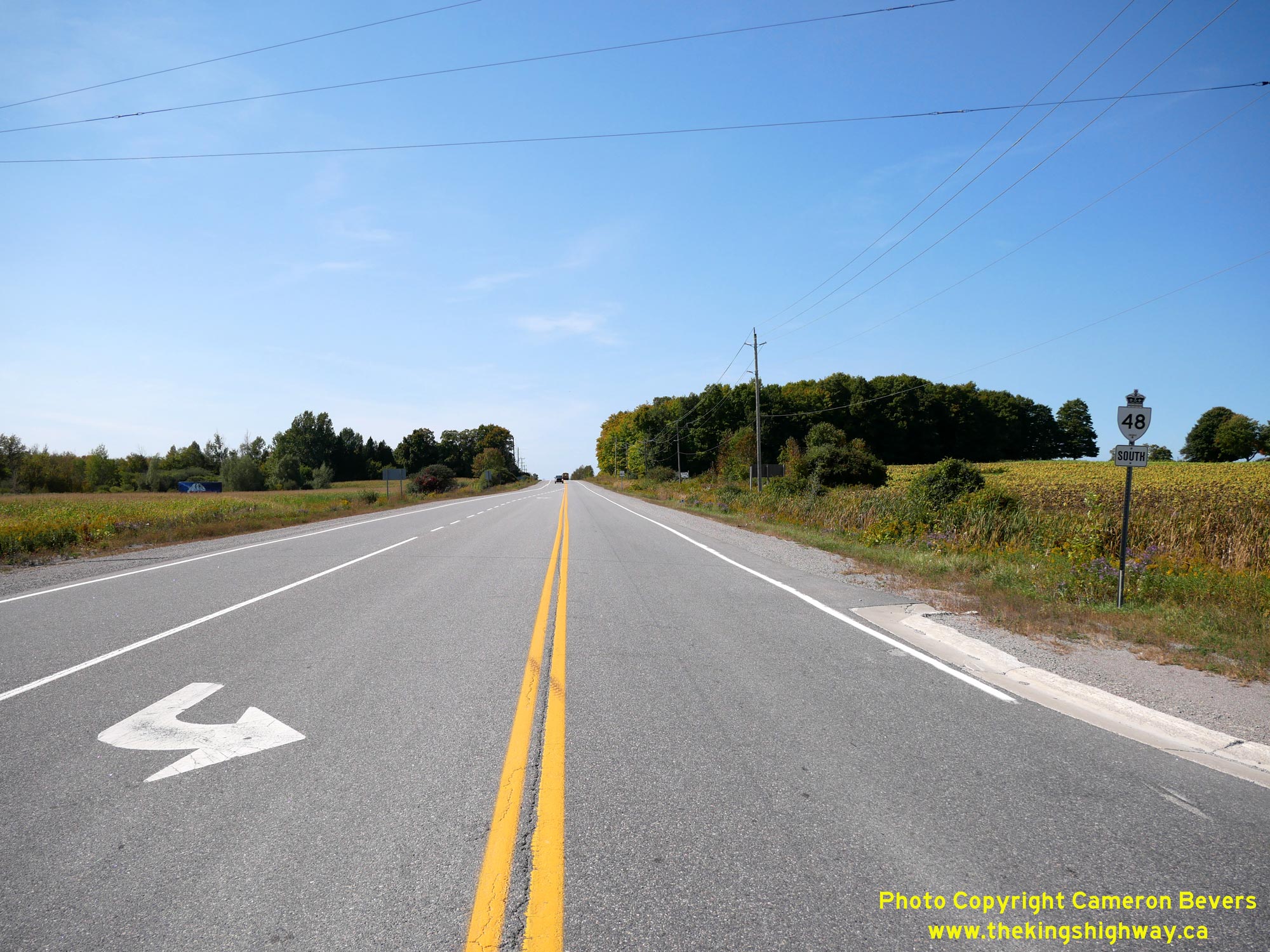
Left - Facing south along Hwy 48 towards Sutton from Sideroad 17 (Old Hwy 12). Although the road ahead is known as Hwy 48 today, this road only became a
provincial highway during the 1960s. The Department of Highways of Ontario (DHO) assumed jurisdiction and control over the Brock-Thorah Townline Road in January 1965,
as part of the proposed Beaverton Bypass and associated relocation of Hwy 48. As originally established in 1937, Hwy 48 went through nearby Port Bolster. The new
Hwy 48 Diversion from this intersection to the original route of Hwy 48 at Port Bolster was built under Contract #1965-41 and paved under Contract #1966-147. See an
Enlarged Photo Here. (Photograph taken on September 22, 2023 - © Cameron Bevers) Right - View of Hwy 48 approaching the Old Hwy 12 Junction (Sideroad 17) near Port Bolster, facing north. Although it is now part of the Regional Municipality of Durham, this area of the province was originally part of the County of Ontario. This historical county, along with the County of Lincoln on the Niagara Peninsula, both disappeared entirely as a result of municipal amalgamation and restructuring done in the 1970s. See an Enlarged Photo Here. (Photograph taken on September 22, 2023 - © Cameron Bevers) 

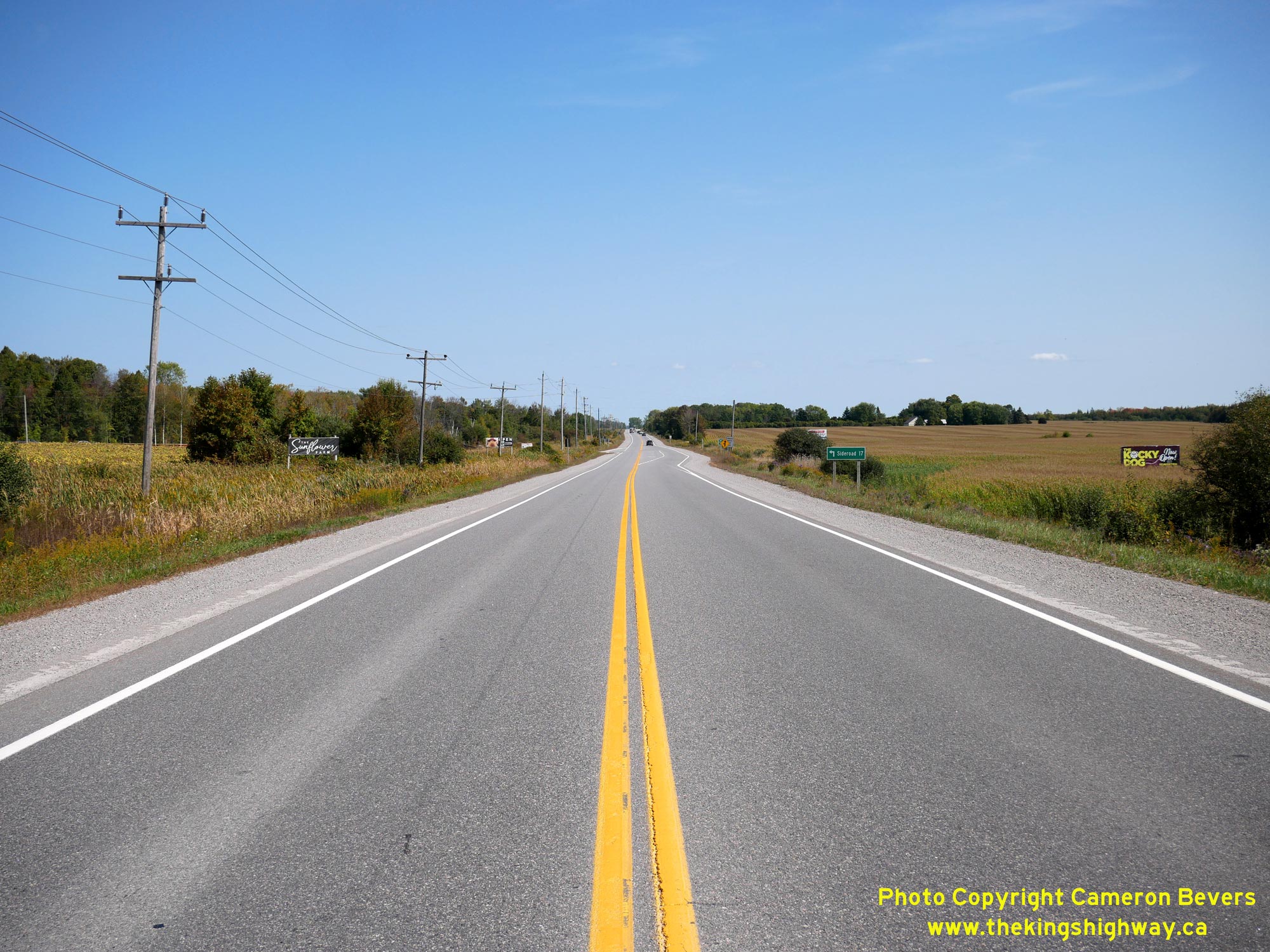
Left - Facing north along Sideroad 17 (Old Hwy 12) from the Hwy 48 Junction. In the early 1930s, a curved diversion was constructed for Hwy 12 at these corners
in order to allow through traffic to continue along the highway without having to stop. This diversion of Hwy 12 curved in from the right at the crest of this hill.
See an Enlarged Photo Here. (Photograph taken on September 22, 2023 - © Cameron Bevers) Right - Approaching the Hwy 48 Junction on Old Hwy 12, facing south. During the construction of the relocated Hwy 48 in 1965, the old 1930s curved diversion was closed and the pavement removed. This was done so that the relocated Hwy 48 intersected with this highway at a right angle. Today, there are only faint traces of grading that indicate that there ever was a curved road diversion here. See an Enlarged Photo Here. (Photograph taken on September 22, 2023 - © Cameron Bevers)
Continue on to King's Highway 48 Present Day Photos: Beaverton to Coboconk
|
|---|
Links to Adjacent King's Highway Photograph Pages:
Back to Hwy 48 - Historical Photos (1937-1999)
Hwy 48 Photo Index
On to Hwy 48 - Beaverton to Coboconk
Back to King's Highway 47 Photos /
King's Highway 48 History /
Back to King's Highway 49 Photos
Ontario Highway History - Main Menu / Back to List of Highways Website contents, photos & text © 2002-2026, Cameron
Bevers (Webmaster) - All Rights Reserved / Contact Me
|
|---|