
| 
|  |
|
|
This page contains historical photos of Ontario's King's Highway 4 dating from 1920 to 1999. All photographs displayed on
this page were taken by the Ontario Ministry of Transportation, unless specifically noted otherwise. Historical photographs are arranged in approximate chronological
order. Click on any thumbnail to see a larger image!
Please note that all photographs displayed on this
website are protected by copyright. These photographs must not be reproduced, published,
electronically stored or copied, distributed, or posted onto other websites without
my written permission. If you want to use photos from this website, please
email me first for permission. Thank-you!
|
|---|
|
Page 1: Historical King's Highway 4 Photographs

Above - Newly completed Londesborough Bridge on Hwy 4 north of Clinton (1933) (Photo courtesy of Ontario Ministry of Transportation - © King's Printer for Ontario, 1933) 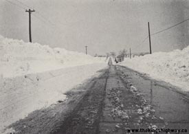

Left - Effect of de-icing chemicals applied on the surface of Hwy 4 to dissolve snow, 4 miles south of Wingham. Photo taken on February 14, 1947. (Photo courtesy of Ontario Ministry of Transportation - © King's Printer for Ontario, 1947) Right - Newly-widened section of Hwy 4 north of St. Thomas in 1948. An 11 km section of Hwy 4 was rebuilt between Lambeth and Talbotville Royal with a third lane in 1948, to allow for safer passing opportunities. Growing summer traffic volumes between London and Port Stanley prompted several major upgrades to Hwy 4 in the late 1940s and early 1950s. Photo taken on June 23, 1948. (Photo courtesy of Ontario Ministry of Transportation - © King's Printer for Ontario, 1948) 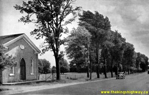
Above - View of a widened section of Hwy 4, 4 1/2 miles south of Lambeth. Photo taken on June 23, 1948. (Photo courtesy of Ontario Ministry of Transportation - © King's Printer for Ontario, 1948) 
Above - Postcard view of Hwy 4 & Hwy 6 in Downtown Durham (1950) (Photo from Cameron Bevers' historical photograph collection - Original photographer unknown) This interesting postcard photograph shows the overlapped route of Hwy 4 & Hwy 6 through Downtown Durham. This short concurrent route of Hwy 4 & Hwy 6 was discontinued in the early 1950s when a new Hwy 4 alignment was constructed at the western entrance to Durham. Double-shield King's Highway sign assemblies are visible along the street in the background. Compare the historic postcard view shown above with this present day photograph which I took from roughly the same location in 2008. See an Enlarged Photo here. 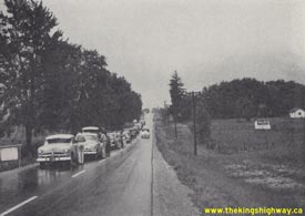

Left - Origin-Destination Traffic Survey on Hwy 4, 3 miles north of London in 1950. Roadside surveys such as this one were carried out all across Ontario
during the 1940s and 1950s by the Ontario Department of Highways, in order to get a better understanding of motorists' travel patterns across Ontario. These "O-D
Surveys" proved to be very beneficial to the Department of Highways in the planning for new highways and to prioritize expansion and reconstruction of existing
highways. (Photo courtesy of Ontario Ministry of Transportation - © King's Printer for Ontario, 1950) Right - Three lane section of Hwy 4 just north of St. Thomas in 1950. Three lane highways such as this had become relatively common by the 1950s. The intention of this highway design was to allow passing in the centre lane by vehicles travelling in either direction. Both sides of the centre passing lane were marked with dashed white lines. For many years, drivers seldom had to consider who actually had the right-of-way to use the centre lane, since traffic volumes on these highways were quite light. However, as Ontario's highways became busier, it was necessary to legally assign the right-of-way to one direction of traffic only. Beginning in the 1950s, passing lanes such as this were marked with signs conveying messages to drivers to "Pass only when centre lane is clear" or "Yield centre lane to opposing traffic". Photo taken on June 4, 1950 (Photo courtesy of Ontario Ministry of Transportation - © King's Printer for Ontario, 1950) 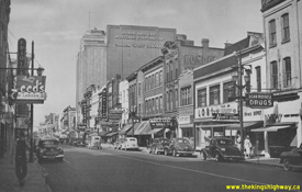
Above - View of Dundas Street (Hwy 2) in Downtown London, facing west towards the Hwy 4 & Hwy 22 Junction at Clarence Street. See an
Enlarged Photo Here. Photo taken in 1951. (Photo courtesy of Ontario Department of Travel and Publicity - © King's Printer for Ontario, 1951) 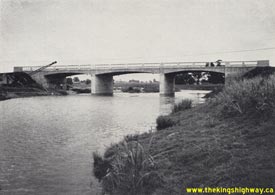
Above - New Maitland River Bridge on Hwy 4 in Wingham. Photo taken on July 18, 1951. (Photo courtesy of Ontario Ministry of Transportation - © King's Printer for Ontario, 1951) 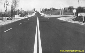
Above - Newly reconstructed intersection of Hwy 4 and Hwy 9 facing east, nine miles west of Walkerton in 1952. Note the new channelized right-turn
ramps and left turn lane from Westbound Hwy 9 onto Southbound Hwy 4. Photo taken on October 30, 1952. See an
Enlarged Photo here. (Photo courtesy of Ontario Ministry of Transportation - © King's Printer for Ontario, 1952) 
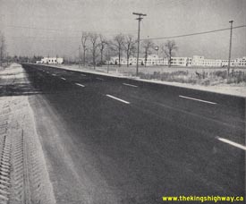
Left - Junction of Hwy 4 and Hwy 9 west of Walkerton in 1952, showing new channelized right turn ramps and zone painting. Photo taken on October 30, 1952. See an
Enlarged Photo here. (Photo courtesy of Ontario Ministry of Transportation - © King's Printer for Ontario, 1952) Right - View of a three-lane section of Hwy 4 between St. Thomas and Lambeth. Photo taken on November 5, 1952. (Photo courtesy of Ontario Ministry of Transportation - © King's Printer for Ontario, 1952) 
Above - Eastern Steel automatic salt and sand spreader at work on Hwy 4, 6 miles west of Durham. Photo taken on March 7, 1954. (Photo courtesy of Ontario Ministry of Transportation - © King's Printer for Ontario, 1954) 
Above - Postcard view of the Hwy 4 & Hwy 10 Junction in Downtown Flesherton (ca. 1955). (Photo from Cameron Bevers' historical photograph collection - Original photographer unknown) 
Above - Postcard view of Hwy 4 (Bridge Street) in Downtown Port Stanley, facing west from Colborne Street (ca. 1957). See an
Enlarged Photo here. (Photo courtesy of the Canadian Post Card Company) 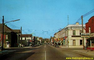
Above - Postcard view of Hwy 4 (Durham Street) in Downtown Walkerton (ca. 1968). See an
Enlarged Photo here. (Photo courtesy of Len Leiffer) 
Above - Intersection reconstruction on Hwy 2 & Hwy 4 (Wharncliffe Road) at Southdale Road in London, Contract #1974-504. See an
Enlarged Photo Here. Photo taken in 1974. (Photo courtesy of Ontario Ministry of Transportation - © King's Printer for Ontario, 1974)
Continue on to King's Highway 4 Present Day Photos: Port Stanley to London
|
|---|
Links to Adjacent King's Highway Photograph Pages:
Back to King's Highway 3 Photos /
King's Highway 4 History /
On to King's Highway 5 Photos
Ontario Highway History - Main Menu / Back to List of Highways Website contents, photos & text © 2002-2026, Cameron
Bevers (Webmaster) - All Rights Reserved / Contact Me
|
|---|