
| 
| |
|
|
This page contains present day photos (Year 2000 to date) of Ontario's King's Highway 60, arranged by location from Huntsville
easterly to the Highway 35 Junction at Dwight. All photographs displayed on this page were taken by the Webmaster (Cameron Bevers), unless specifically noted
otherwise. Click on any thumbnail to see a larger image!
Please note that all photographs displayed on this
website are protected by copyright. These photographs must not be reproduced, published,
electronically stored or copied, distributed, or posted onto other websites without
my written permission. If you want to use photos from this website, please
email me first for permission. Thank-you!
|
|---|
|
Page 2: Present Day King's Highway 60 Photographs (Huntsville to Dwight)


Left - Facing north along the Huntsville Bypass (Hwy 11) approaching the Hwy 60 Interchange. See an
Enlarged Photo Here. (Photograph taken on July 11, 2010 - © Cameron Bevers) Right - Green guide sign on northbound Hwy 11 marking the exit for Hwy 60 in Huntsville. Strangely, the control city on the sign is indicated as "Ottawa", even though most of the traffic using Hwy 60 easterly from Huntsville is bound for Algonquin Provincial Park or the Barry's Bay area. See an Enlarged Photo Here. (Photograph taken on September 19, 2008 - © Cameron Bevers) 

Left - Facing south along the Huntsville Bypass (Hwy 11) from the Hwy 60 Overpass. The ramps of the Hwy 60 Interchange are in a "Trumpet B" configuration.
Interchanges of this configuration have a loop exit ramp on the downstream side of the structure. At right, traffic from southbound Hwy 11 exits via this loop ramp to
eastbound Hwy 60. See an Enlarged Photo Here. (Photograph taken on October 8, 2021 - © Cameron Bevers) Right - View of the Hwy 60 Overpass on Hwy 11 in Huntsville, facing west. See an Enlarged Photo Here. (Photograph taken on October 8, 2021 - © Cameron Bevers) 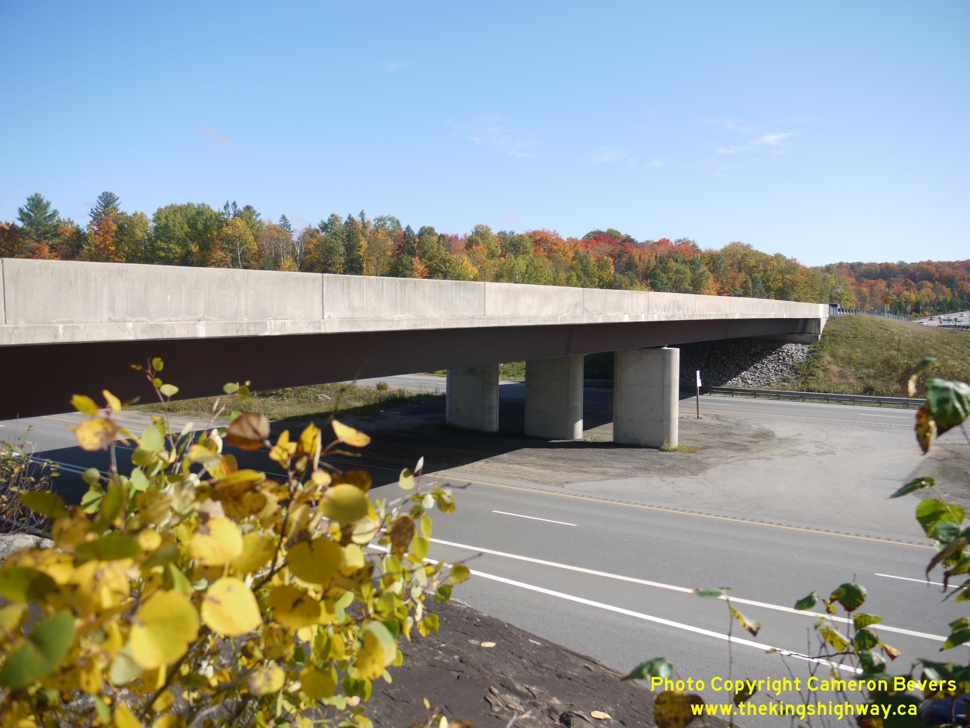
Left - Southern side of the Hwy 60 Overpass on Hwy 11. This two-span trapezoidal steel box girder structure was completed in 1990. Prior to the construction of
the grade separation and interchange at Hwy 11 & Hwy 60, these two highways met at an at-grade intersection. See an
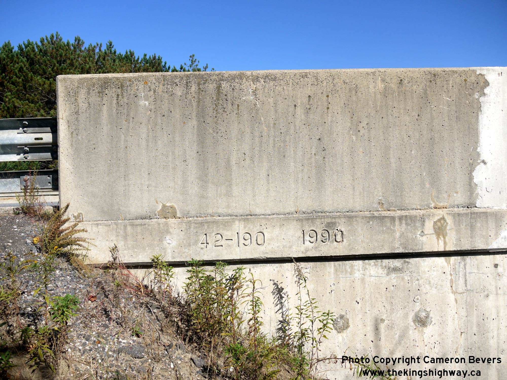
Enlarged Photo Here. (Photograph taken on October 8, 2021 - © Cameron Bevers) Right - Date stamp (1990) and structure identification number (Site #42-190) on the Hwy 60 Overpass on Hwy 11 in Huntsville. See an Enlarged Photo Here. (Photograph taken on October 8, 2021 - © Cameron Bevers) 

Left - Northern side of the Hwy 60 Overpass on the Huntsville Bypass (Hwy 11). See an
Enlarged Photo Here. (Photograph taken on October 8, 2021 - © Cameron Bevers) Right - Facing east across the Hwy 60 Overpass on Hwy 11 in Huntsville. See an Enlarged Photo Here. (Photograph taken on October 8, 2021 - © Cameron Bevers) 

Left - Facing north along the Huntsville Bypass (Hwy 11) towards North Bay from the Hwy 60 Overpass. See an
Enlarged Photo Here. (Photograph taken on October 8, 2021 - © Cameron Bevers) Right - Autumn colours at the Hwy 11 & Hwy 60 Interchange in Huntsville. See an Enlarged Photo Here. (Photograph taken on October 8, 2021 - © Cameron Bevers) 

Left - Advance green guide sign for the upcoming Hwy 60 Interchange on southbound Hwy 11 in Huntsville. This large extruded aluminum freeway sign, along with
others at this interchange, are likely the original signs dating from the Hwy 60 Interchange's completion in 1990. Although commonly seen on Ontario's early freeway
guide signs, the word "EXIT" hasn't been used on green ground-mounted freeway guide signs since the 1990s. Only the kilometric distance to the exit ramp is now shown
on newer ground-mounted signs. See an Enlarged Photo Here. (Photograph taken on July 11, 2010 - © Cameron Bevers) Right - Junction sign assembly approaching the western terminus of Hwy 60 in Huntsville. See an Enlarged Photo Here. (Photograph taken on October 8, 2021 - © Cameron Bevers) 

Left - Green guide sign for Hwy 11 North on westbound Hwy 60. Traffic bound for North Bay has to keep right to reach northbound Hwy 11. See an
Enlarged Photo Here. (Photograph taken on October 8, 2021 - © Cameron Bevers) Right - Green guide sign for Hwy 11 South on westbound Hwy 60. Toronto-bound traffic merely has to continue straight ahead to reach southbound Hwy 11, since this is the predominant traffic movement at the interchange. See an Enlarged Photo Here. (Photograph taken on October 8, 2021 - © Cameron Bevers) 
Above - Facing east along Hwy 60 from the Hwy 11 Interchange. For the first 3 km, Hwy 60 passes through an urbanized section of Huntsville. See an
Enlarged Photo Here. (Photograph taken on October 8, 2021 - © Cameron Bevers) 
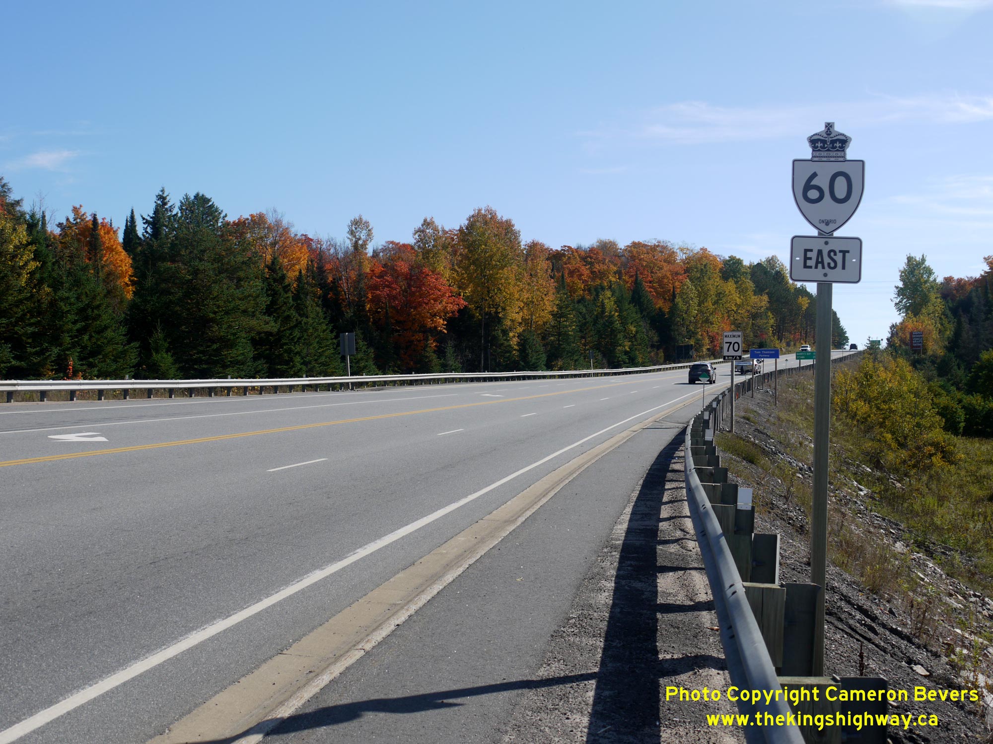
Left - Facing west along Hwy 60 approaching Centre Street and the Hwy 11 Interchange in Huntsville. See an
Enlarged Photo Here. (Photograph taken on October 8, 2021 - © Cameron Bevers) Right - Eastbound Hwy 60 route marker in Huntsville near the Hwy 11 Interchange. This long highway begins in Huntsville and traverses Algonquin Provincial Park on its route towards the Ottawa Valley. Hwy 60 was first established in 1937, when the Department of Highways of Ontario (DHO) assumed jurisdiction and control of the Algonquin Park Road. Today, Hwy 60 is more than 250 km in length. An eastbound truck climbing lane was provided along this section of Hwy 60, as the highway ascends a long grade east of the Hwy 11 Interchange. See an Enlarged Photo Here. (Photograph taken on October 8, 2021 - © Cameron Bevers) 

Left - Tom Thomson Parkway commemorative sign on eastbound Hwy 60 in Huntsville. Although not a member of Canada's famous "Group of Seven" painters, Tom
Thomson worked with and inspired the Group of Seven's founding members prior to his death in a mysterious canoeing accident in Algonquin Park in 1917. See an
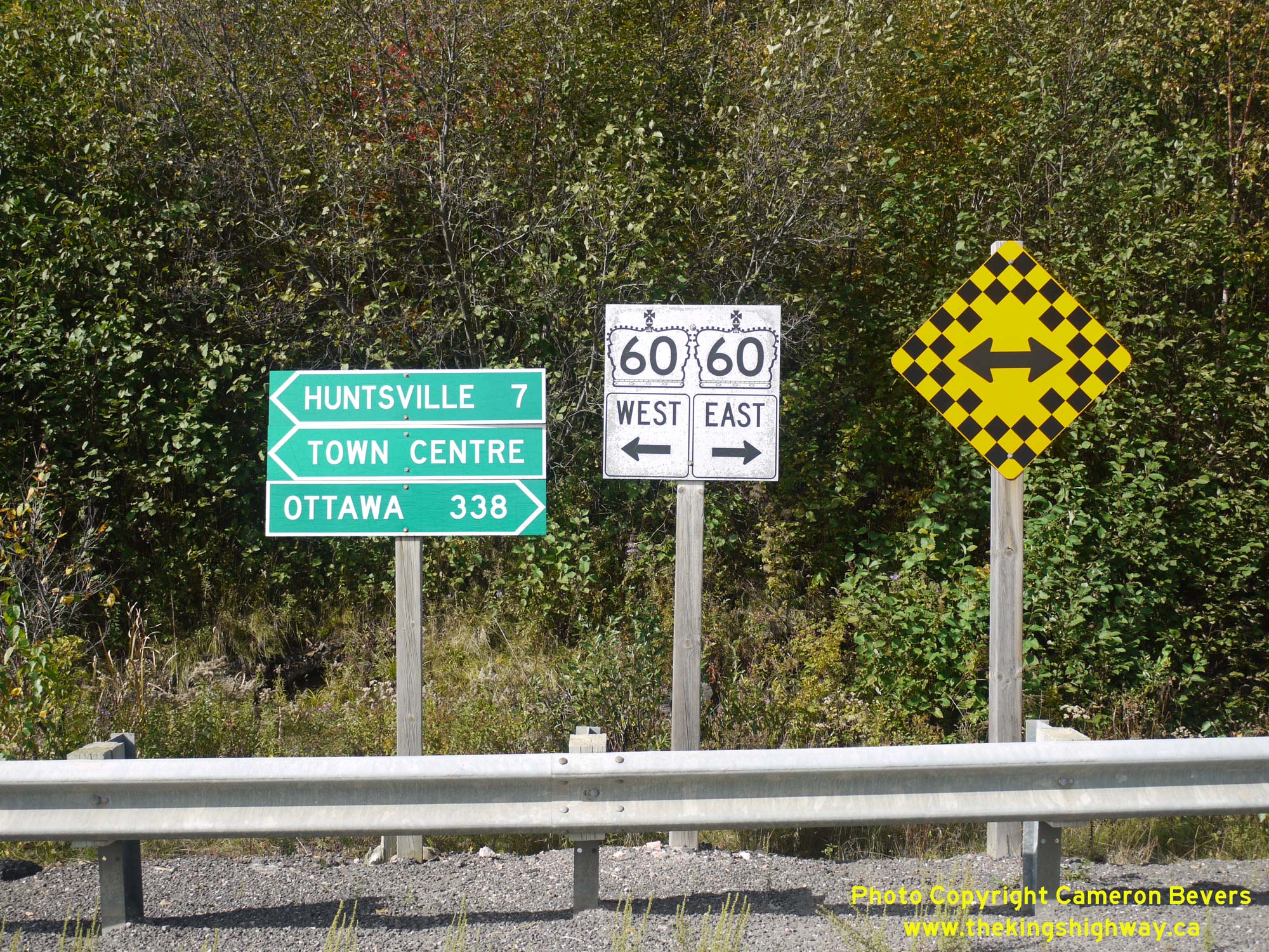
Enlarged Photo Here. (Photograph taken on October 8, 2021 - © Cameron Bevers) Right - Distance guide sign on eastbound Hwy 60 in Huntsville. Apart from Huntsville and Barry's Bay, the only other significantly-sized towns located along Hwy 60 are Eganville and Renfrew. Although Ottawa is listed as a control city on eastbound Hwy 60, the city is actually located a considerable distance from the end of Hwy 60. However, Ottawa is readily accessible from the eastern terminus of Hwy 60 at Renfrew via Hwy 17 & Hwy 417. See an Enlarged Photo Here. (Photograph taken on October 8, 2021 - © Cameron Bevers) 

Left - Scenic Fairy Lake appears on the horizon as Hwy 60 crosses over the high ridge between the current Hwy 11 Interchange and the original route of Hwy 11
(now Muskoka Road 3). The section of Hwy 60 between these two junctions is actually a newer westerly extension of the original route of Hwy 60 that was constructed
during the 1970s. See an Enlarged Photo Here. (Photograph taken on October 8, 2021 - © Cameron Bevers) Right - Facing west along Hwy 60 from the Old Hwy 11 (Muskoka Road 3) Junction in Huntsville. This section of Hwy 60 is comparatively new. It was built in 1972-1973 as a westerly extension of the original route of Hwy 60, which had previously ended at Old Hwy 11. Prior to 1973, traffic wishing to access Hwy 60 from northbound Hwy 11 had to pass through Downtown Huntsville. This new bypass around the northern side of Huntsville greatly improved access to Hwy 60 and Algonquin Provincial Park from Hwy 11. See an Enlarged Photo Here. (Photograph taken on October 8, 2021 - © Cameron Bevers) 

Left - Distance guide sign on westbound Hwy 60 in Huntsville. See an
Enlarged Photo Here. (Photograph taken on October 8, 2021 - © Cameron Bevers) Right - Approaching the Old Hwy 11 Junction (now Muskoka Road 3) on Hwy 60 in Huntsville, facing east. See an Enlarged Photo Here. (Photograph taken on October 8, 2021 - © Cameron Bevers) 

Left - Facing north along Muskoka Road 3 (Old Hwy 11) towards the Hwy 60 Junction in Huntsville. See an
Enlarged Photo Here. (Photograph taken on August 6, 2006 - © Cameron Bevers) Right - Muskoka Road 3 (Old Hwy 11) and Hwy 60 Junction in Huntsville, facing north. Compare this 2006 photo of this highway junction to this Circa 1950 Postcard View of the Hwy 11 & Hwy 60 Junction as it appeared many decades ago. See an Enlarged Photo Here. (Photograph taken on August 6, 2006 - © Cameron Bevers) 

Left - Facing north along Old Hwy 11 (now Muskoka Road 3) from the Hwy 60 Junction in Huntsville. Old Hwy 11 connects back to the current route of Hwy 11 (the
Huntsville Bypass) about 5 km ahead. About 10 km of the original route of Hwy 11 was left behind once the Huntsville Bypass was completed and opened to traffic in
1959. See an Enlarged Photo Here. (Photograph taken on October 8, 2021 - © Cameron Bevers) Right - Junction signs at the intersection of Muskoka Road 3 (Old Hwy 11) and Hwy 60 in Huntsville. During reconstruction of this highway junction many years ago, Hwy 11 was realigned so that it intersected Hwy 60 at a right angle. Originally, this intersection was a directional "Y" Junction. See an Enlarged Photo Here. (Photograph taken on October 8, 2021 - © Cameron Bevers) 

Left - Facing west towards the Hwy 60 and Muskoka Road 3 (Old Hwy 11) Junction in Huntsville. With dual left-turn lanes, two through lanes in each direction
and channelized right-turn lanes in all four quadrants, this enormous intersection looks like it would be more at home on the suburban fringes of the Greater Toronto
Area rather than Muskoka. That said, this intersection is actually quite heavily-trafficked, particularly in the summer months. This intersection also marked the
northern terminus of Hwy 35 up until 1966, as Hwy 35 & Hwy 60 once shared an overlapped concurrent route between Dwight and Huntsville. See an
Enlarged Photo Here. (Photograph taken on August 6, 2006 - © Cameron Bevers) Right - Oversized route markers on westbound Hwy 60 at Muskoka Road 3 (Old Hwy 11) in Huntsville. See an Enlarged Photo Here. (Photograph taken on August 6, 2006 - © Cameron Bevers) 
Above - An older King's Highway 60 Junction signpost with "JCT" tab near Huntsville. See an
Enlarged Photo Here. (Photograph taken on August 5, 2006 - © Cameron Bevers) 

Left - View of Hwy 60 facing east from the Muskoka Road 3 (Old Hwy 11) Junction in Huntsville. The highway seen here is actually a diversion of the original
1937 route of Hwy 60. Numerous sections of the old highway were bypassed between Huntsville and Dwight during various highway improvement projects carried out during
the 1960s. Reconstruction of Hwy 60 began at Huntsville during 1962 and progressed easterly towards Dwight over the next couple of years. See an
Enlarged Photo Here. (Photograph taken on October 8, 2021 - © Cameron Bevers) Right - Bypassed section of Hwy 60 (today's Fairyview Drive) in Huntsville, facing east. This was one of the original sections of Hwy 60 left behind after the highway was straightened and rebuilt east of Huntsville in 1962-1963. See an Enlarged Photo Here. (Photograph taken on October 8, 2021 - © Cameron Bevers) 

Left - These cedar delineation posts along Fairyview Drive in Huntsville offer a subtle clue that this road was once a King's Highway. This bypassed section of
Hwy 60 was narrow and had a very poor alignment. Note the limited pavement width on this old section of Hwy 60 - it's hard to imagine transport trucks actually using
this road, but at one time they did! See an Enlarged Photo Here. (Photograph taken on October 8, 2021 - © Cameron Bevers) Right - Once a busy King's Highway, Fairyview Drive is now just a quiet residential street. The highway was rebuilt on a new straighter alignment a short distance to the south in the early 1960s. The relocated Hwy 60 east of Huntsville opened to traffic in 1963. See an Enlarged Photo Here. (Photograph taken on October 8, 2021 - © Cameron Bevers) 

Left - View of Fairyview Drive (Old Hwy 60), facing west. After the new route of Hwy 60 was opened to traffic, the old route of Hwy 60 seen here temporarily
became part of a 7000-series highway (Hwy 7029, west leg). Jurisdiction over this bypassed section of Hwy 60 was transferred from the DHO to the Township of Chaffey
in May 1967. See an Enlarged Photo Here. (Photograph taken on October 8, 2021 - © Cameron Bevers) Right - This sharp superelevated curve with poor sight lines on Fairyview Drive was one of several undesirable features found along the original 1937 route of Hwy 60 east of Huntsville. The first 2 miles of the highway from Huntsville easterly were particularly poor and were either bypassed or abandoned entirely during the 1960s. Conditions were so bad in fact, that Official Ontario Road Bulletins issued during the 1930s and 1940s specifically advised motorists to drive carefully and to obey all road signs along the highway between Huntsville and Dwight. See an Enlarged Photo Here. (Photograph taken on October 8, 2021 - © Cameron Bevers) 

Left - Facing west along Hwy 60 approaching the urbanized portion of Huntsville. The revisions made to the alignment of Hwy 60 during the 1960s set the stage
for the modern highway seen today. The original route of Hwy 60 leading east out of Huntsville was so poor that almost none of the old highway's alignment was
incorporated into the present-day route of Hwy 60. The revised two-lane highway built in the 1960s was widened to a four-lane divided highway with a flush painted
median in 2001. See an Enlarged Photo Here. (Photograph taken on October 8, 2021 - © Cameron Bevers) Right - Abandoned section of Hwy 60 about 2 km east of the Muskoka Road 3 Junction. This former Hwy 60 alignment now serves as a private driveway and still sports an asphalt pavement surface that probably dates back to the 1950s. This section of Hwy 60 has always been a paved highway. A mulch pavement surface was laid along Hwy 60 from Huntsville to Dwight almost immediately after the DHO's assumption of the Algonquin Park Road in October 1937. See an Enlarged Photo Here. (Photograph taken on October 8, 2021 - © Cameron Bevers) 

Left - Facing east along Hwy 60 approaching Grandview Drive in Huntsville. Due to the offset left-turn lanes at this intersection, the left-turning movements
operate on a separate "fully-protected" traffic signal phase. Under this traffic signal operation, advancing traffic is prohibited from turning left unless a green
arrow is displayed on the left-turn traffic signal heads. This differs from the more commonly-used "protected-permissive" left-turn operation, where a green arrow is
displayed periodically to allow protected left-turn movements. Advancing traffic can continue to turn left on the solid green ball signal indication afterwards,
provided that motorists yield to any conflicting traffic. A flashing green ball signal indication is still used at some intersections in Ontario for
a protected-permissive left-turn operation, but examples of this method are becoming increasingly rare. See an
Enlarged Photo Here. (Photograph taken on October 8, 2021 - © Cameron Bevers) Right - Approaching Grandview Drive on Hwy 60, facing west. Although one would never guess by looking at the highway today, the original 1937 route of Hwy 60 curved to the right here and followed the utility pole line into the trees. Nearly the entire route of Hwy 60 from this point westerly to Muskoka Road 3 was rebuilt on a new alignment during the 1960s. Some of the bypassed sections of Hwy 60 that were left behind are still readily apparent today, while others have largely vanished due to vegetation growth over the years. See an Enlarged Photo Here. (Photograph taken on October 8, 2021 - © Cameron Bevers) 
Left - Facing east along Hwy 60 approaching the Muskoka Road 23 (Canal Road) Junction in Huntsville. This road leads south from Hwy 60 to the resort areas along
Peninsula Lake. See an Enlarged Photo Here. (Photograph taken on October 8, 2021 - © Cameron Bevers) Right - Fingerboard guide signs and Hwy 60 junction sign assembly at the Muskoka Road 23 (Canal Road) Junction. Geographically speaking, Huntsville is a large municipality. Although this intersection is located within the municipal limits, it is situated a fair distance from the urbanized portion of Huntsville. Accordingly, the distance to the Huntsville Town Centre is signed at this intersection. See an Enlarged Photo Here. (Photograph taken on October 8, 2021 - © Cameron Bevers) 

Left - Facing east along Hwy 60 towards Dwight from the Muskoka Road 23 Junction in Huntsville. The multilane highway comes to an end just ahead. See an
Enlarged Photo Here. (Photograph taken on October 8, 2021 - © Cameron Bevers) Right - Beginning of the multilane section of Hwy 60 east of the Muskoka Road 23 Junction, facing west. Note the "Stop for School Bus" sign at right. The Ontario Ministry of Transportation typically posts these signs at the beginning of multilane highways where there is no median barrier to remind motorists of their obligation to stop for school buses travelling in either direction. See an Enlarged Photo Here. (Photograph taken on October 8, 2021 - © Cameron Bevers) 

Left - Facing east along Hwy 60 towards Dwight about 1 km east of the Muskoka Road 23 Junction in Huntsville. From this point easterly, Hwy 60 is only a
two-lane highway. The autumn colours along Hwy 60 in this area are quite the sight, as the deciduous trees are often nicely contrasted with evergreens. See an
Enlarged Photo Here. (Photograph taken on October 8, 2021 - © Cameron Bevers) Right - Beginning of the Grassmere Diversion on Hwy 60 east of Huntsville. A new highway grade was built at Grassmere during the 1960s to bypass a steep, winding section of the original highway's route. The new highway continues straight ahead, while the old highway follows Grassmere Resort Road at right. Looking at this old winding section of Hwy 60 at Grassmere though a present day lens, it's almost unthinkable to imagine heavy traffic volumes and transport trucks using the old grade! See an Enlarged Photo Here. (Photograph taken on October 8, 2021 - © Cameron Bevers) 

Left - Approaching Grassmere on Old Hwy 60, facing east. This former section of Hwy 60 is one of the few original sections of the highway that is still
traversable today. Most of the bypassed sections of Hwy 60 were closed to traffic and abandoned once the reconstructed highway was completed in the early 1960s. See
an Enlarged Photo Here. (Photograph taken on October 8, 2021 - © Cameron Bevers) Right - This sharp curve on Old Hwy 60 (Grassmere Resort Road) gives observers today some insight of what a drive along Hwy 60 would have been like in the early days of Ontario's King's Highways. Although this horizontal curve is well-constructed with superelevation and circular geometry, its location at the bottom of a steep grade would have likely surprised many early motorists. The Grassmere Diversion bypassed this old section of Hwy 60, leaving this and other challenging sections of the old highway as quiet back roads carrying only occasional local traffic. See an Enlarged Photo Here. (Photograph taken on October 8, 2021 - © Cameron Bevers) 

Left - Old Hwy 60 (Grassmere Resort Road) reconnects with the current route of Hwy 60 just ahead at Ballantyne's Creek. The former route of Hwy 60 through
Grassmere briefly became the eastern leg of Hwy 7029 after a new highway diversion was completed north of the community in 1963. A portion of the old route of Hwy 60
through Sinclair Township had its King's Highway designation revoked in March 1967, while jurisdiction over the balance of the highway was transferred to the
Township of Chaffey in May 1967. See an Enlarged Photo Here. (Photograph taken on October 8, 2021 - © Cameron Bevers) Right - The excavation of this large rock cut on Hwy 60 was a major component of the Grassmere Diversion's construction in the 1960s. Previously, Hwy 60 descended this rocky hill to the south. Like many locations in Northern Ontario, early road builders simply avoided natural obstacles such as this however possible. Although very economical at the time, this "avoidance" practice left many roads with crooked alignments and steep grades which took a considerable reconstruction effort to correct. See an Enlarged Photo Here. (Photograph taken on October 8, 2021 - © Cameron Bevers) 

Left - Town of Huntsville municipal boundary sign on westbound Hwy 60 near Grassmere. When the District Municipality of Muskoka was created in the early 1970s,
the municipal limits of Huntsville were increased substantially. Several geographic and organized townships were amalgamated with the existing Town of Huntsville to
create a single municipality covering a broad geographic area. See an Enlarged Photo Here. (Photograph taken on October 8, 2021 - © Cameron Bevers) Right - Blue guide sign on westbound Hwy 60 marking the distance to Huntsville's Town Centre. See an Enlarged Photo Here. (Photograph taken on October 8, 2021 - © Cameron Bevers) 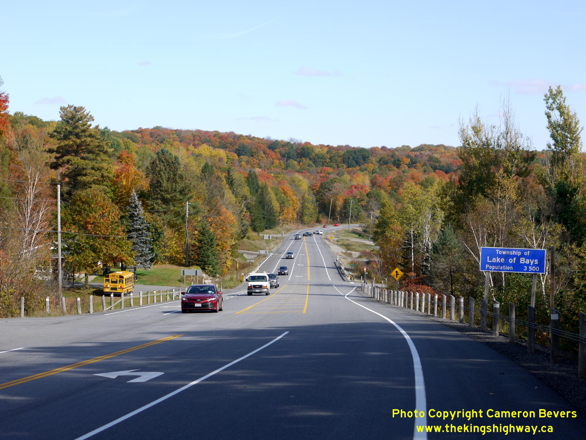

Left - Facing east along Hwy 60 from the Town of Huntsville's eastern limits at Harp Lake Road. At right, Old Hwy 60 (Grassmere Resort Road) can be seen
connecting back to the current route of Hwy 60 at the bottom of this grade at Ballantyne's Creek. See an
Enlarged Photo Here. (Photograph taken on October 8, 2021 - © Cameron Bevers) Right - Lake of Bays Township municipal boundary sign on eastbound Hwy 60 near Grassmere. This was one of several new municipalities created during the widespread amalgamation and municipal restructuring resulting from the formation of the District Municipality of Muskoka in 1971. See an Enlarged Photo Here. (Photograph taken on October 8, 2021 - © Cameron Bevers) 

Left - This gravel lay-by east of Ballantyne's Creek was part of Hwy 60's original alignment prior to the reconstruction of the highway in the early 1960s.
As a result of the reconstruction, Hwy 60 was relocated onto an improved alignment which is visible at left. Prior to reconstruction in the 1960s, Hwy 60 continued
straight ahead past the cemetery and into the woods located on the far side of the present highway. See an
Enlarged Photo Here. (Photograph taken on October 8, 2021 - © Cameron Bevers) Right - The historical alignment of Hwy 60 east of Ballantyne's Creek is much more evident in this photo, which was taken facing west towards Huntsville. A section of abandoned pavement lies a short distance north of the relocated highway. On the far side of the highway, the bypassed former route of Hwy 60 at the cemetery forms a small truck lay-by. In the distance, the Grassmere Diversion and revised grade of Hwy 60 can be seen climbing up into the hills in the background. See an Enlarged Photo Here. (Photograph taken on October 8, 2021 - © Cameron Bevers) 

Left - The abandoned pavement on this former alignment of Hwy 60 disappears into the woods. See an
Enlarged Photo Here. (Photograph taken on October 8, 2021 - © Cameron Bevers) Right - The revised route of Hwy 60 built in the 1960s follows a more gradual horizontal curve. The original 1937 highway route had very poor horizontal geometry and was simply abandoned altogether once the new route of Hwy 60 was completed in 1963. See an Enlarged Photo Here. (Photograph taken on October 8, 2021 - © Cameron Bevers) 

Left - The former alignment of Hwy 60 reemerges from the woods just west of the community of Hillside. Old Hwy 60 now serves as a private driveway. See an
Enlarged Photo Here. (Photograph taken on October 8, 2021 - © Cameron Bevers) Right - Green guide sign for Muskoka Road 8 (Limberlost Road) on eastbound Hwy 60. Limberlost Road mostly follows the route of a long-vanished Ontario Secondary Highway which once extended north from Hwy 60 at Hillside to Interlaken. Known as Hwy 514, the Hillside-Interlaken Highway was the first of two Ontario Secondary Highways known by that route number. Following the jurisdictional transfer of Hwy 514 from the province to the District Municipality of Muskoka in 1972, the Hwy 514 designation was used once again in 1975 on an unrelated highway in Renfrew County. Historically, the Hwy 60 & Hwy 514 Junction was located at the crest of this hill, rather than at the current intersection of Limberlost Road located several hundred metres to the east. See an Enlarged Photo Here. (Photograph taken on October 8, 2021 - © Cameron Bevers) 

Left - Facing west along Hwy 60 from the historical site of the Hwy 514 Junction at Hillside. The seemingly random placement of the Hwy 60 route marker at
right is actually no coincidence - it marks the historical location where Hwy 60 and Hwy 514 once joined together. Apart from a section of old pavement in the woods
north of Hwy 60, there are no other clues that there ever was a highway junction here. See an
Enlarged Photo Here. (Photograph taken on October 8, 2021 - © Cameron Bevers) Right - Approaching the historical site of the Hwy 514 Junction on Hwy 60 at Hillside, facing west. This highway junction would have been rather inconspicuous to westbound motorists. The intersection of Limberlost Road was relocated to the east many years after the transfer of Hwy 514 to the District Municipality of Muskoka in 1972. See an Enlarged Photo Here. (Photograph taken on October 8, 2021 - © Cameron Bevers) 

Left - Facing east along Hwy 60 at the Muskoka Road 8 (Limberlost Road) Junction at Hillside. See an
Enlarged Photo Here. (Photograph taken on October 8, 2021 - © Cameron Bevers) Right - Fingerboard guide signs and Hwy 60 junction sign assembly at the Muskoka Road 8 (Limberlost Road) Junction. See an Enlarged Photo Here. (Photograph taken on October 8, 2021 - © Cameron Bevers) 

Left - Facing west along Hwy 60 at the Muskoka Road 8 (Limberlost Road) Junction at Hillside. Compared to the historical junction of Hwy 60 & Hwy 514 lying
about 300 metres to the west, the relocated intersection of Limberlost Road offers improved sight lines for motorists and separated left and right turn lanes along
Hwy 60. See an Enlarged Photo Here. (Photograph taken on October 8, 2021 - © Cameron Bevers) Right - View of Hwy 60 facing east from the Muskoka Road 8 (Limberlost Road) Junction at Hillside. See an Enlarged Photo Here. (Photograph taken on October 8, 2021 - © Cameron Bevers) 

Left - Facing north along Muskoka Road 8 (Limberlost Road) from the Hwy 60 Junction at Hillside. This newer diversion of Limberlost Road bypassed about 1 km of
the historical route of Hwy 514 north of the Hwy 60 Junction. See an Enlarged Photo Here. (Photograph taken on October 8, 2021 - © Cameron Bevers) Right - Approaching the Hwy 60 Junction on Muskoka Road 8 (Limberlost Road) at Hillside. See an Enlarged Photo Here. (Photograph taken on October 8, 2021 - © Cameron Bevers) 

Left - This scenic view greets motorists heading westbound on Hwy 60 near Hillside, about 8 km west of Dwight. See an
Enlarged Photo Here. (Photograph taken on October 8, 2021 - © Cameron Bevers) Right - Facing east along Hwy 60 towards Dwight from Tally-Ho Winter Park Road. See an Enlarged Photo Here. (Photograph taken on October 8, 2021 - © Cameron Bevers) 

Left - Between Hillside and Dwight, Hwy 60 passes by signs pointing the way to a road called "Old Highway". While there are indeed many sections of Hwy 60 in
this area that were bypassed or abandoned during various highway improvement projects, this road actually isn't one of them. Contrary to what might be suggested by
the intersecting road's name, Hwy 60 has never followed "Old Highway" - it has always continued straight ahead at this intersection ever since Hwy 60 was first
established in 1937. The "old highway" is a reference to the Old Huntsville-Dwight Road, a long-lost pioneer road linking the two communities together. Sections of
the Old Huntsville-Dwight Road fell into disuse in the early decades of the 20th Century and are no longer traversable by traffic. See an
Enlarged Photo Here. (Photograph taken on October 8, 2021 - © Cameron Bevers) Right - View of Hwy 60 about 5 km west of Dwight, facing west. Note the heavy Thanksgiving long-weekend traffic on Hwy 60 heading eastbound towards Algonquin Provincial Park. Hwy 60 intersects with the Old Huntsville-Dwight Road at the bottom of this grade. North of Hwy 60, the Old Huntsville-Dwight Road is now a snowmobile trail. See an Enlarged Photo Here. (Photograph taken on October 8, 2021 - © Cameron Bevers) 

Left - Facing east along Hwy 60 about 5 km west of Dwight. Although the route of Hwy 60 has not substantially changed in this area since 1937, the vertical
profile of the highway was lowered by several metres in places to improve the overall highway geometry. In the 1930s. the highway would have been at the same
elevation as my vantage point. Today, the highway runs through a rock cut. See an
Enlarged Photo Here. (Photograph taken on October 8, 2021 - © Cameron Bevers) Right - Facing west along Hwy 60 towards Huntsville from the Muskoka Road 9 (South Portage Road) Junction, about 3 km west of Dwight. See an Enlarged Photo Here. (Photograph taken on October 8, 2021 - © Cameron Bevers) 

Left - Fingerboard guide signs and Hwy 60 junction sign assembly at the Muskoka Road 9 (South Portage Road) Junction. From the Hwy 60 Junction, Muskoka Road 9
runs along the western side of Lake of Bays towards Baysville. Interestingly, Muskoka Road 9 is one of the few long-distance Muskoka District Roads that was not a
provincial highway at one time or another. Prior to 1972, the DHO maintained a considerable number of Secondary Highways in the District of Muskoka, in addition to
the system of King's Highways. See an Enlarged Photo Here. (Photograph taken on October 8, 2021 - © Cameron Bevers) Right - Facing east along Hwy 60 towards Dwight from the Muskoka Road 9 (South Portage Road) Junction. See an Enlarged Photo Here. (Photograph taken on October 8, 2021 - © Cameron Bevers) 

Left - Facing west along Hwy 60 towards Huntsville at the Boyne Creek Bridge, located about 2 km west of Dwight. See an
Enlarged Photo Here. (Photograph taken on August 6, 2006 - © Cameron Bevers) Right - Southern side of the Boyne Creek Bridge. This single-span concrete rigid frame structure was completed in 1963. See an Enlarged Photo Here. (Photograph taken on August 6, 2006 - © Cameron Bevers) 

Left - Facing east along Hwy 60 towards Dwight at the Boyne Creek Bridge. See an
Enlarged Photo Here. (Photograph taken on August 6, 2006 - © Cameron Bevers) Right - Northern side of the Boyne Creek Bridge on Hwy 60 west of Dwight. See an Enlarged Photo Here. (Photograph taken on August 6, 2006 - © Cameron Bevers) 

Left - View of Hwy 60 approaching Dwight, facing east. See an
Enlarged Photo Here. (Photograph taken on October 8, 2021 - © Cameron Bevers) Right - Facing west along Hwy 60 towards Huntsville from the western entrance to Dwight. See an Enlarged Photo Here. (Photograph taken on October 8, 2021 - © Cameron Bevers) 

Left - Blue community sign on eastbound Hwy 60 at Dwight. This is a newer sign installation, which makes use of both upper and lower-case letters. Prior to
2010, community signs such as this one used block capital letters only. See an
Enlarged Photo Here. (Photograph taken on October 8, 2021 - © Cameron Bevers) Right - Hwy 60 rounds this curve through Dwight, a small waterfront community at the northern tip of Lake of Bays. The highway is set back some distance from the waterfront area. Motorists wishing to access Dwight's waterfront amenities can turn right just ahead at Dwight Bay Road. See an Enlarged Photo Here. (Photograph taken on October 8, 2021 - © Cameron Bevers) 

Left - Hwy 60 passes through the centre of Dwight. Considered by many to be the western gateway to Algonquin Provincial Park, Dwight is the last full-service
community before the park's western gatehouse. Motorists are well-advised to check their fuel levels before leaving Dwight, as there are no gas stations for a
distance of nearly 85 km beyond the Hwy 35 Junction. The next services along Hwy 60 are located in Whitney, beyond Algonquin Park's East Gate. See an
Enlarged Photo Here. (Photograph taken on October 8, 2021 - © Cameron Bevers) Right - Approaching Dwight on Hwy 60, facing west towards Huntsville. The Hwy 35 & Hwy 60 Junction actually lies a short distance east of Dwight. See an Enlarged Photo Here. (Photograph taken on October 8, 2021 - © Cameron Bevers)
Continue on to King's Highway 60 Photos: Dwight to Algonquin Park's West Gate
|
|---|
Links to Adjacent King's Highway Photograph Pages:
Back to Hwy 60 - Historical Photos (1937-1999)
Hwy 60 Photo Index
On to Hwy 60 - Dwight to Algonquin Park's West Gate
Back to King's Highway 59 Photos /
King's Highway 60 History /
Back to King's Highway 61 Photos
Ontario Highway History - Main Menu / Back to List of Highways Website contents, photos & text © 2002-2026, Cameron
Bevers (Webmaster) - All Rights Reserved / Contact Me
|
|---|