
| 
| |
|
|
This page contains historical and present day photos of Ontario's King's Highway 79. All photographs displayed on this page
were taken by the Webmaster (Cameron Bevers), unless specifically noted otherwise. Historical photographs are arranged in approximate chronological order, while
present day photographs (Year 2000 to date) are arranged by location from south to north. Click on any thumbnail to see a larger image!
Please note that all photographs displayed on this
website are protected by copyright. These photographs must not be reproduced, published,
electronically stored or copied, distributed, or posted onto other websites without
my written permission. If you want to use photos from this website, please
email me first for permission. Thank-you!
|
|---|
|
Historical King's Highway 79 Photographs
Above - New channelized right turn ramps at the reconstructed Hwy 7 & Hwy 79 Junction, facing west towards Sarnia. Photo taken on August 12, 1954. (Photo courtesy of Ontario Ministry of Transportation - © King's Printer for Ontario, 1954) |
|---|
|
Present Day King's Highway 79 Photographs
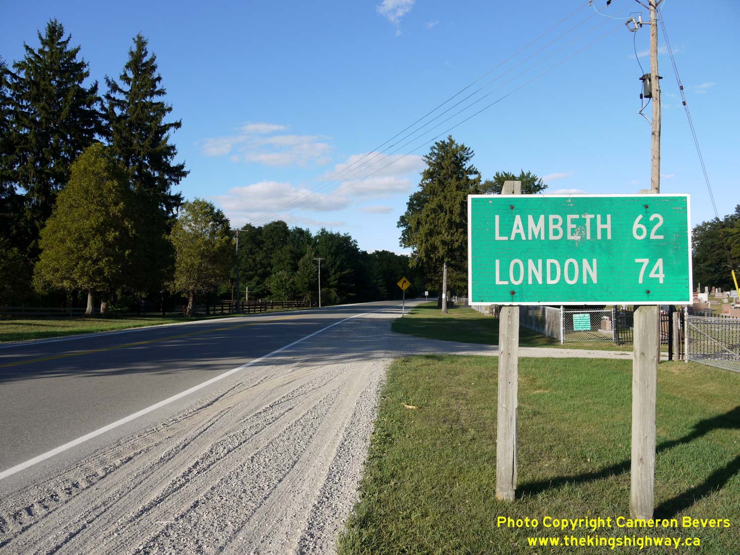

Left - Distance guide sign on eastbound Hwy 2 near the Hwy 79 Junction. Prior to the completion of Hwy 401 through Southwestern Ontario in the 1960s, the
majority of motorists heading eastbound across Ontario from the Windsor area would have passed by signs just like this one on Hwy 2, slowly counting down the miles to
London and other major Ontario destinations. See an Enlarged Photo Here. (Photograph taken on September 10, 2010 - © Cameron Bevers) Right - Approaching the Hwy 79 Junction on Hwy 2 near Bothwell, facing east towards London. See an Enlarged Photo Here. (Photograph taken on September 10, 2010 - © Cameron Bevers) 

Left - Sign marking the junction of Hwy 2 & (Former) Hwy 79 near Bothwell. The entire route of Hwy 79 from Bothwell to Hwy 7 was transferred in 1997 to the
Counties of Lambton and the Municipality of Chatham-Kent. For some reason, Chatham-Kent elected to number their downloaded portion of Hwy 79 as Chatham-Kent Road 16.
Based on the numerous overlay patches on this sign, Chatham-Kent's route number choice has obviously confused a lot of motorists who are looking for Hwy 79.
Neighbouring Lambton County wisely decided to keep the route of former King's Highway 79 numbered as County Road 79. Note that Lambton County Road 79 is essentially
trailblazed along Chatham-Kent Road 16. See an Enlarged Photo Here. (Photograph taken on September 10, 2010 - © Cameron Bevers) Right - Junction of Hwy 2 & Hwy 79 near Bothwell, facing northeast. Although the alignment of Hwy 79 has been "squared up" approaching the Hwy 2 Junction, it is quite likely that this intersection was historically a "Y" junction. Although quite common on Ontario's early highways, the design of "Y" junctions is avoided by highway designers today. This intersection layout creates a situation where drivers have to look far beyond their normal range of neck movement to see approaching traffic. Not surprisingly, "Y" junctions typically have a poor safety record. See an Enlarged Photo Here. (Photograph taken on September 10, 2010 - © Cameron Bevers) 

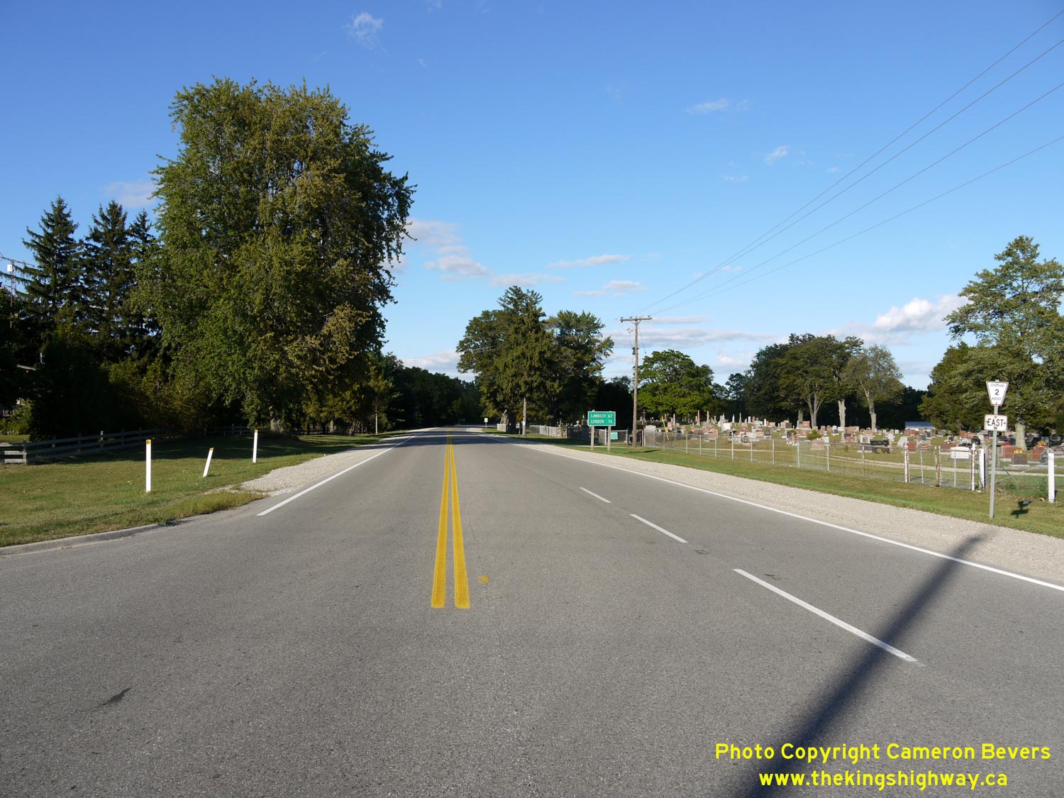
Left - Facing north along Hwy 79 towards Watford from the Hwy 2 Junction near Bothwell. See an
Enlarged Photo Here. (Photograph taken on September 10, 2010 - © Cameron Bevers) Right - Facing south along Hwy 79 approaching the Hwy 2 Junction near Bothwell. Up until 1997, this intersection marked the southern terminus of Hwy 79. See an Enlarged Photo Here. (Photograph taken on September 10, 2010 - © Cameron Bevers) 

Left - Hwy 2 Junction assembly on southbound Hwy 79 approaching the southern terminus of the highway near Bothwell. See an
Enlarged Photo Here. (Photograph taken on September 10, 2010 - © Cameron Bevers) Right - Old fingerboard guide signs at the southern terminus of Hwy 79 at Hwy 2. See an Enlarged Photo Here. (Photograph taken on September 10, 2010 - © Cameron Bevers) 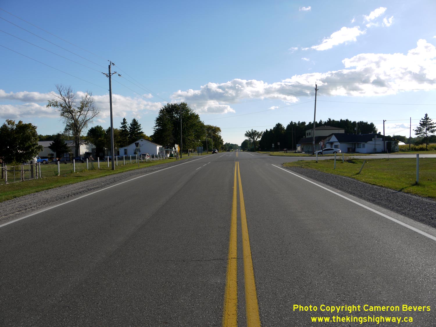
Left - Facing west along Hwy 2 towards Chatham at the Hwy 79 Junction near Bothwell. See an
Enlarged Photo Here. (Photograph taken on September 10, 2010 - © Cameron Bevers) Right - Facing east along Hwy 2 towards London from the Hwy 79 Junction. See an Enlarged Photo Here. (Photograph taken on September 10, 2010 - © Cameron Bevers) 
Above - Sydenham River Bridge on Hwy 79 south of Alvinston. Structure completed in 1957. See an
Enlarged Photo here. (Photograph taken on August 15, 2004 - © Cameron Bevers) 

Left - Facing south along Hwy 79 towards Bothwell at the Sydenham River Bridge. See an
Enlarged Photo here. (Photograph taken on August 15, 2004 - © Cameron Bevers) Right - Facing north along Hwy 79 towards Alvinston at the Sydenham River Bridge. See an Enlarged Photo here. (Photograph taken on August 15, 2004 - © Cameron Bevers) 

Left - Facing west along Old Hwy 22 approaching the Hwy 79 Junction in Watford. Note the large corner diversion at right, which actually served as the through
route for Hwy 22 up until 1947. The superelevated 717-foot radius curve was designed to allow for faster through traffic on Old Hwy 22. The curve diversion at Watford
was built in the early 1930s, in order to bypass an intersection on the original highway's route. See an
Enlarged Photo Here. (Photograph taken on May 4, 2009 - © Cameron Bevers) Right - This corner diversion was built in 1933 to carry through traffic between London and Sarnia. The diversion bypassed a former turn in the route of Hwy 22 located at the north end of Watford. Although this corner diversion once carried both eastbound and westbound traffic, it was re-striped many years ago to permit only westbound traffic bound for northbound Hwy 79. See an Enlarged Photo Here. (Photograph taken on May 4, 2009 - © Cameron Bevers) 

Left - Before the construction of the Watford Diversion in 1933, westbound traffic on Hwy 22 continued through to the stop sign where the highway turned right
onto Watford's Main Street (Hwy 79). See an Enlarged Photo Here. (Photograph taken on May 4, 2009 - © Cameron Bevers) Right - Facing east along Old Hwy 22 towards Strathroy from the Watford Diversion at the Hwy 79 Junction. This former provincial highway alignment carried Hwy 22 traffic from 1927 up until 1947, when a new route was established for Hwy 22 between Hickory Corners and Hwy 7 north of Watford. As a result of the relocation, the highway distance between Sarnia and London was shortened by approximately 8 km. The old route of Hwy 22 via Watford and Strathroy was transferred to Middlesex and Lambton Counties in 1947. See an Enlarged Photo Here. (Photograph taken on May 4, 2009 - © Cameron Bevers) 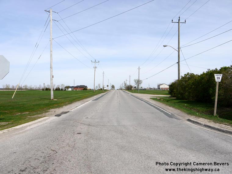

Left - Facing east along Old Hwy 22 (now Lambton Road 39) towards Strathroy from the Hwy 79 Junction in Watford. See an
Enlarged Photo Here. (Photograph taken on May 4, 2009 - © Cameron Bevers) Right - End of the Watford Diversion on Old Hwy 22, facing north along Hwy 79. See an Enlarged Photo Here. (Photograph taken on May 4, 2009 - © Cameron Bevers) 

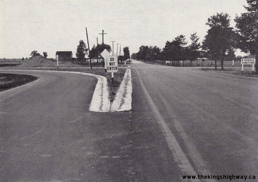
Left - A gas station was built within the traffic island created during construction of the Watford Diversion in the 1930s. The fact that the gas pumps are
situated on the Watford Diversion (Old Hwy 22) side of the island suggests that this gas station has been in operation since before 1947. Had the gas station been
established after 1947 (when Hwy 22 was relocated onto a new route), the gas pumps would have likely been located on the Hwy 79 side of the traffic island. See an
Enlarged Photo Here. (Photograph taken on May 4, 2009 - © Cameron Bevers) Right - A pair of "Do Not Enter" signs have been placed at the end of the Watford Diversion (Old Hwy 22) to discourage traffic from short-cutting down the one-way ramp from southbound Hwy 79. A portion of the original Hwy 22 pavement was removed at the island's bullnose to remove any traces of the former through highway. See an Enlarged Photo Here. (Photograph taken on May 4, 2009 - © Cameron Bevers) 

Left - Facing north along Hwy 79 from the Old Hwy 22 Junction in Watford. Up until 1947, this section of Hwy 79 north of Watford was actually a part of Hwy 22.
During 1947, Hwy 22 was relocated onto a new alignment between the Hwy 7 Junction near Watford and Hickory Corners, allowing through traffic between London and Sarnia
to bypass Strathroy and Watford. Even today, the control city on northbound Hwy 79 is listed as Sarnia, which serves as a hint that historically Hwy 22 once passed
through Watford. See an Enlarged Photo Here. (Photograph taken on May 4, 2009 - © Cameron Bevers) Right - Facing south along Hwy 79 towards the Old Hwy 22 Junction in Watford. The end of the Watford Diversion can be seen emerging beside the gas station on the left. From this intersection, Hwy 79 continues south through Downtown Watford towards Bothwell in the Chatham area. See an Enlarged Photo Here. (Photograph taken on May 4, 2009 - © Cameron Bevers) 
Above - Inscription on a concrete culvert on Hwy 7 & Hwy 79 in Arkona - "THE KING'S HIGHWAY 1937". See an
Enlarged Photo here. (Photograph taken in March, 2003 - © Cameron Bevers) 

Left - Distance guide sign on northbound Hwy 21 near the Hwy 79 Junction. See an
Enlarged Photo here. (Photograph taken on May 4, 2009 - © Cameron Bevers) Right - Distance guide sign on southbound Hwy 21 at Northville, near Port Franks. See an Enlarged Photo here. (Photograph taken on May 4, 2009 - © Cameron Bevers) 

Left - Facing north along Hwy 21 towards the Hwy 79 Junction at Northville. See an
Enlarged Photo here. (Photograph taken on May 4, 2009 - © Cameron Bevers) Right - Green guide sign marking the Hwy 79 Junction on northbound Hwy 21. Up until the late 1990s, Hwy 79 was owned by the province. Ownership of the highway was subsequently transferred to the Counties of Kent and Lambton as part of the mass downloading of King's Highways which took place in Ontario in 1997 and 1998. See an Enlarged Photo here. (Photograph taken on May 4, 2009 - © Cameron Bevers) 

Left - Channelized right turn ramp at the Hwy 79 Junction on northbound Hwy 21. Many of Ontario's King's Highway junctions were reconstructed with channelized
right turn ramps during the 1950s, 1960s and 1970s. The construction of these right turn ramps often improved intersection operations dramatically, particularly for
heavy truck movements. See an Enlarged Photo here. (Photograph taken on May 4, 2009 - © Cameron Bevers) Right - Junction signs at the Hwy 21 & Hwy 79 Junction at Northville. See an Enlarged Photo here. (Photograph taken on May 4, 2009 - © Cameron Bevers) 

Left - Channelized right turn ramp from northbound Hwy 79 to northbound Hwy 21. See an
Enlarged Photo here. (Photograph taken on May 4, 2009 - © Cameron Bevers) Right - Facing south along Hwy 21 towards Forest at the Hwy 79 Junction. The northbound Hwy 79 channelized right turn ramp merges with northbound Hwy 21 at left. This right turn ramp allows vehicles to bypass the stop sign at Hwy 21. This intersection feature is particularly advantageous for heavy trucks. If they had to pass through the intersection and come to a full stop, it would take a considerable amount of time for the trucks to get back up to highway speeds. See an Enlarged Photo here. (Photograph taken on May 4, 2009 - © Cameron Bevers) 

Left - Intersection throat widening at the Hwy 79 & Hwy 21 Junction at Northville. The departing lane at King's Highway junctions is usually flared out to
allow for truck movements. Trucks require a much larger turning radius than regular passenger vehicles. See an
Enlarged Photo here. (Photograph taken on May 4, 2009 - © Cameron Bevers) Right - Facing south along Hwy 79 towards Thedford from the Hwy 21 Junction at Northville. This part of Hwy 79 was historically the original route of Hwy 21. In 1938, a route renumbering took place in this area which relocated Hwy 21 onto its current route via Forest. The old route of Hwy 21 via Thedford was renumbered as Hwy 82. This short highway was ultimately absorbed into the route of Hwy 79 during another highway renumbering which took place in the early 1980s. See an Enlarged Photo here. (Photograph taken on May 4, 2009 - © Cameron Bevers) 

Left - Approaching the northern terminus of Hwy 79 at the Hwy 21 Junction at Northville. Hwy 79 ends its nearly 80 km journey across Southwestern Ontario at
the Hwy 21 Junction. Hwy 79 was one of the longest highways in Southwestern Ontario to be lost entirely during the provincial highway downloading spree of 1997-1998.
See an Enlarged Photo here. (Photograph taken on May 4, 2009 - © Cameron Bevers) Right - Facing south along Hwy 21 towards Forest at the Hwy 79 Junction. See an Enlarged Photo here. (Photograph taken on May 4, 2009 - © Cameron Bevers) 

Left - Facing north along Hwy 21 towards Grand Bend from the Hwy 79 Junction. See an
Enlarged Photo here. (Photograph taken on May 4, 2009 - © Cameron Bevers) Right - Facing south along Hwy 21 approaching the Hwy 79 Junction at Northville. See an Enlarged Photo here. (Photograph taken on May 4, 2009 - © Cameron Bevers)
More King's Highway 79 Photographs Coming Soon!
|
|---|
Links to Adjacent King's Highway Photograph Pages:
Back to King's Highway 78 Photos /
King's Highway 79 History /
On to King's Highway 80 Photos
Ontario Highway History - Main Menu / Back to List of Highways Website contents, photos & text © 2002-2026, Cameron
Bevers (Webmaster) - All Rights Reserved / Contact Me
|
|---|