
| 
| |
|
|
This page contains historical photos of Ontario's King's Highway 7 dating from 1950 to 1969. All photographs displayed on
this page were taken by the Ontario Ministry of Transportation, unless specifically noted otherwise. Historical photographs are arranged in approximate chronological
order. Click on any thumbnail to see a larger image!
Please note that all photographs displayed on this
website are protected by copyright. These photographs must not be reproduced, published,
electronically stored or copied, distributed, or posted onto other websites without
my written permission. If you want to use photos from this website, please
email me first for permission. Thank-you!
|
|---|
|
Page 2: Historical King's Highway 7 Photographs (1950-1969)

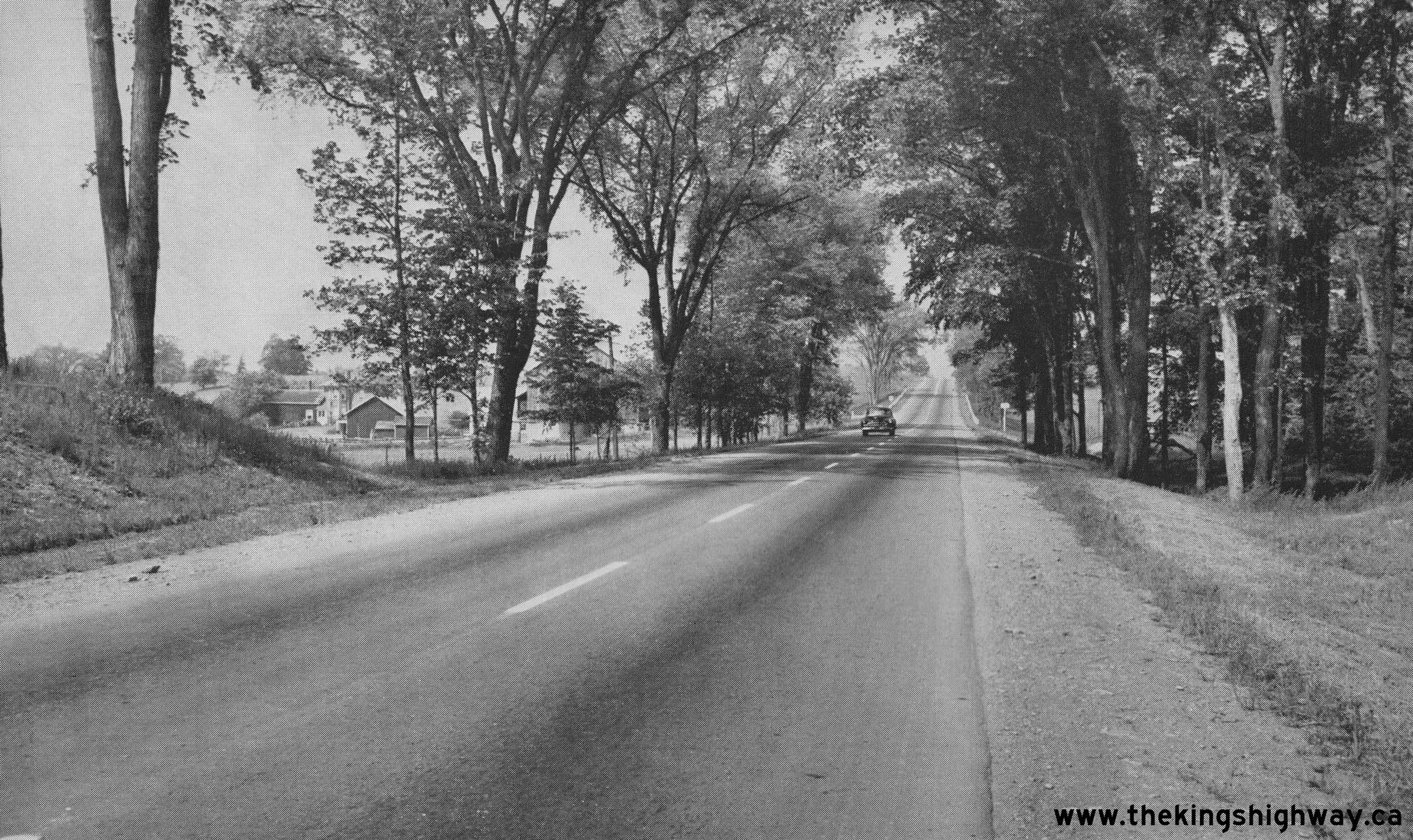
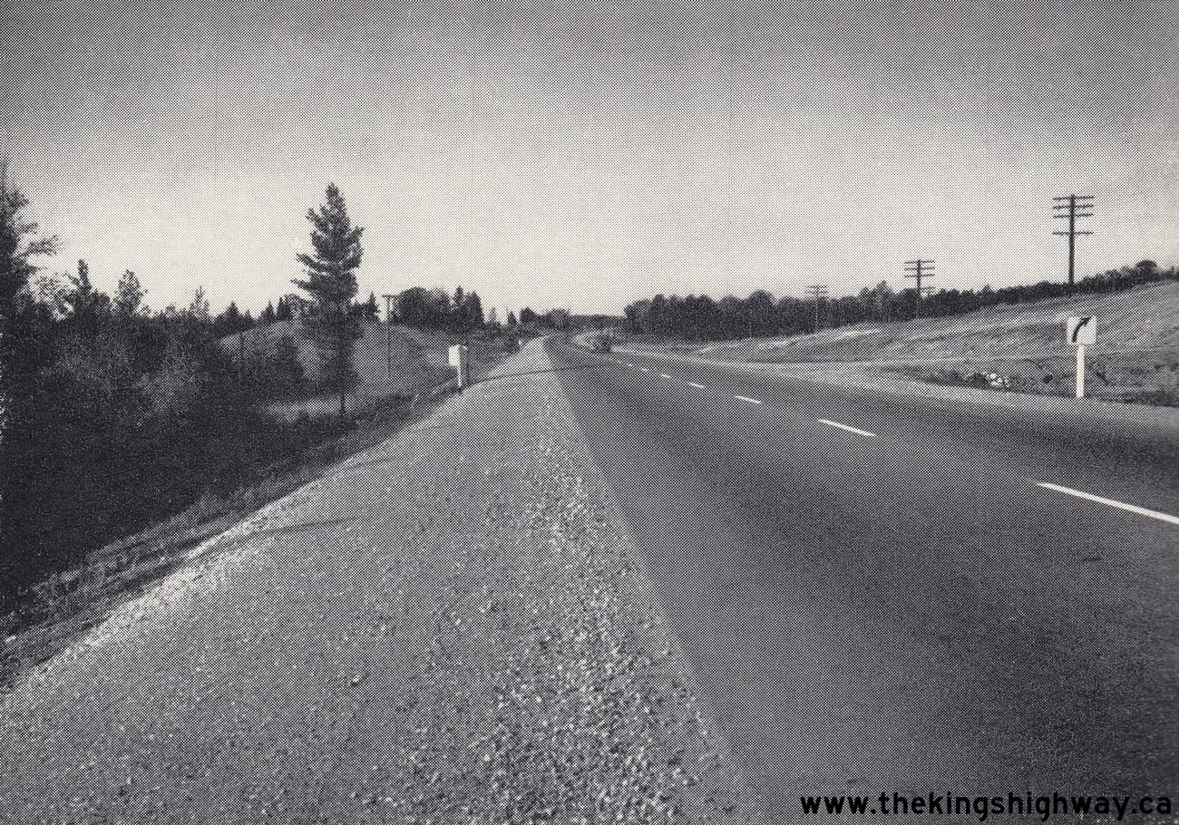
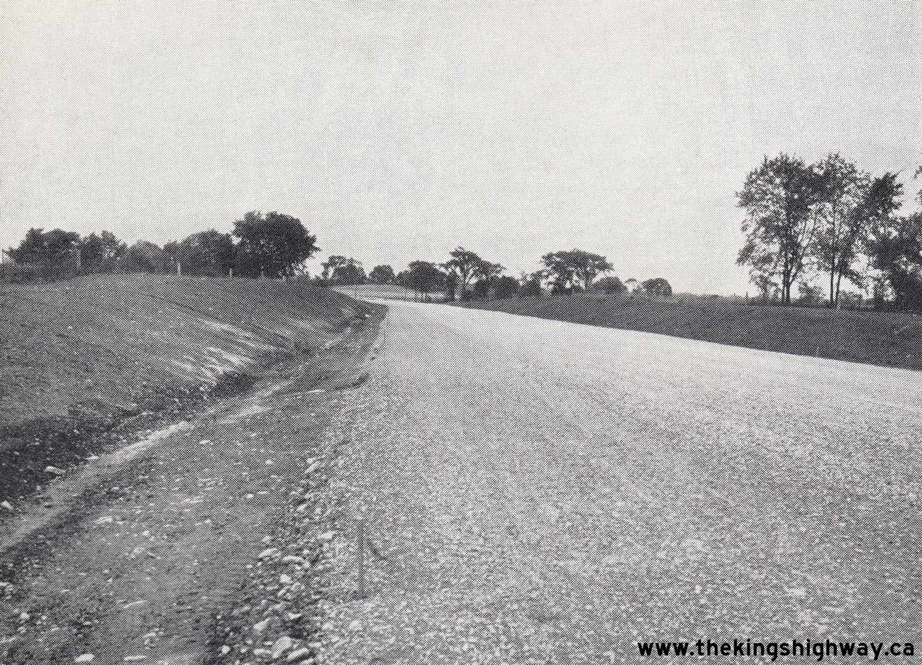
  Left - View of Hwy 7 about 8 3/4 miles west of Norwood in 1950, showing the highway's hot-mix asphalt surface with zone striping. This attractive tree-lined
section of Hwy 7 was gravel-surfaced until after World War II. Although a concrete pavement was constructed along Hwy 7 east of Peterborough in 1937, the concrete
pavement came to an end about 7 miles east of the city. From that point, Hwy 7 continued east towards Norwood as a gravel-surfaced highway. A hot-mix asphalt pavement
was constructed in 1946 from the end of the concrete pavement to Norwood. This paving work was tendered by the Department of Highways of Ontario (DHO) under Contract
#1946-38. These improvements resulted in the completion of a paved highway link between Norwood and Peterborough. See an
Enlarged Photo Here. Photo taken on June 23, 1950. Left - View of Hwy 7 about 8 3/4 miles west of Norwood in 1950, showing the highway's hot-mix asphalt surface with zone striping. This attractive tree-lined
section of Hwy 7 was gravel-surfaced until after World War II. Although a concrete pavement was constructed along Hwy 7 east of Peterborough in 1937, the concrete
pavement came to an end about 7 miles east of the city. From that point, Hwy 7 continued east towards Norwood as a gravel-surfaced highway. A hot-mix asphalt pavement
was constructed in 1946 from the end of the concrete pavement to Norwood. This paving work was tendered by the Department of Highways of Ontario (DHO) under Contract
#1946-38. These improvements resulted in the completion of a paved highway link between Norwood and Peterborough. See an
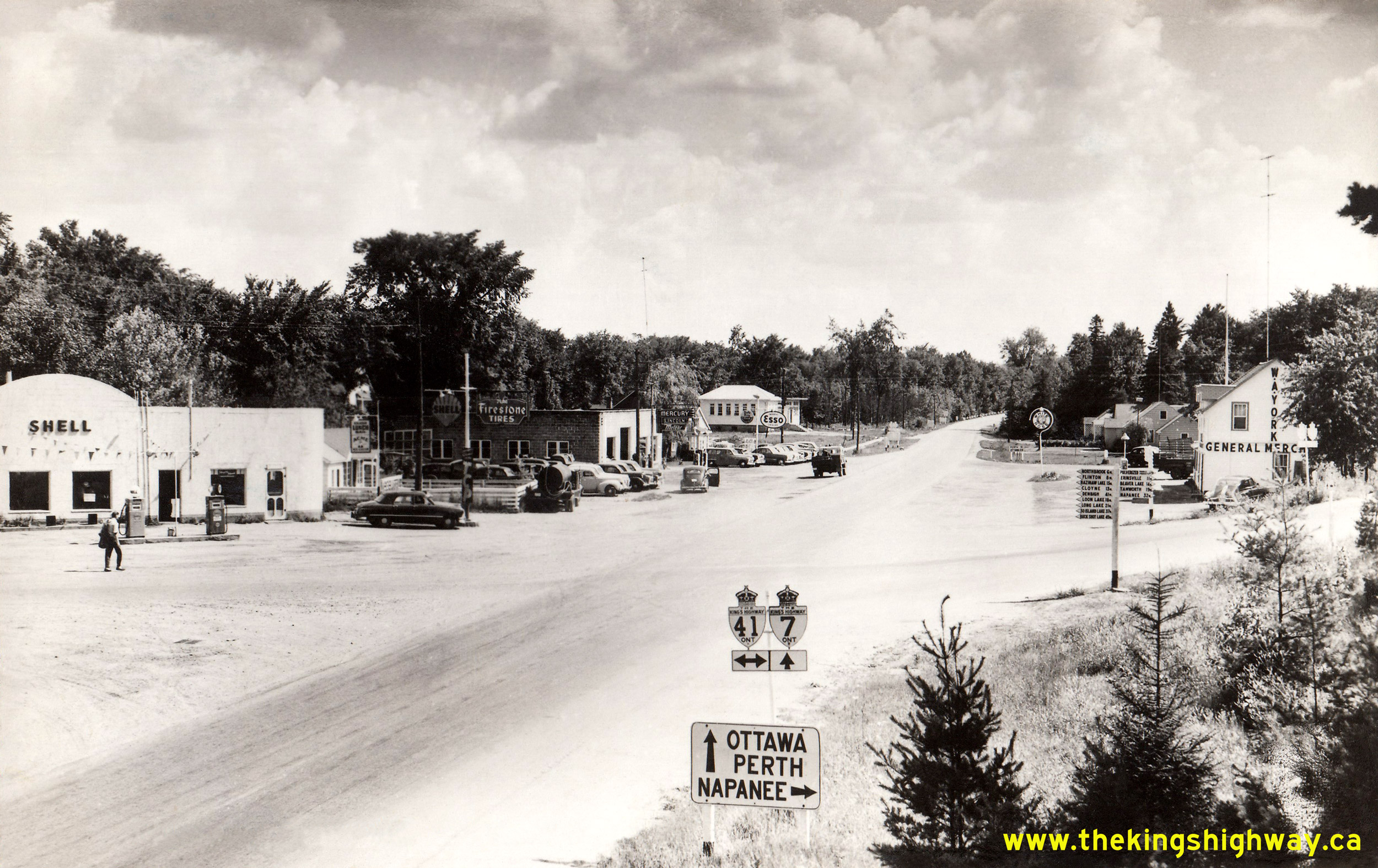
Enlarged Photo Here. Photo taken on June 23, 1950.(Photo courtesy of Ontario Ministry of Transportation - © King's Printer for Ontario, 1950) Right - Circa 1950 postcard view of the Hwy 7 and Hwy 41 Junction at Kaladar. See an Enlarged Photo Here. (Photo courtesy of Canadian Postcard Company Ltd, Toronto) 
Above - Circa 1950 view of the western approach to the Hwy 19 South Junction on Hwy 7 & Hwy 8 in Shakespeare, facing east towards Kitchener. Up until the
early 1960s, Hwy 7, Hwy 8 & Hwy 19 all shared a concurrent overlapped route between Stratford and Shakespeare. As part of a highway renumbering plan carried out
in this area in 1962, the route of Hwy 19 between Shakespeare and Woodstock was renumbered as Hwy 59. The overlapped route of Hwy 19 along Hwy 7 & Hwy 8 between
Stratford and Shakespeare was also discontinued in 1962. See an Enlarged Photo Here. Photo taken
circa 1950. (Photo from Cameron Bevers' historical photograph collection - Original photographer unknown) 
Above - Department of Highways' Roadside Park on Hwy 15 (today's Hwy 7) at Innisville in 1950. This small roadside park was established in 1947 for the
convenience of motorists traveling to and from Ottawa. The park was built between the original highway alignment which ran behind the park to the left and the
relocated highway at right. Although the stone fireplaces were removed many years ago, this roadside park and picnic area is still in operation today on Hwy 7 north
of Innisville. See an Enlarged Photo Here. Photo taken on July 22, 1950. (Photo courtesy of Ontario Ministry of Transportation - © King's Printer for Ontario, 1950) 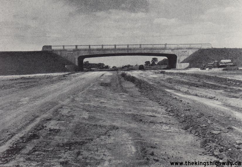
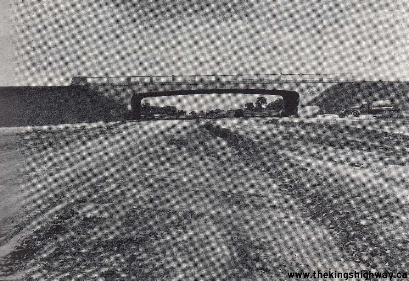
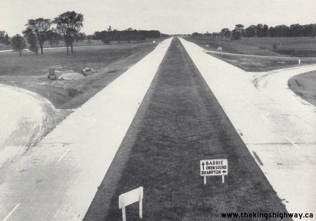
Left - Toronto-Barrie Highway (Hwy 400) under construction in 1950, showing the new Hwy 7 Overpass near Woodbridge. See an
Enlarged Photo Here. Photo taken on August 8, 1950. (Photo courtesy of Ontario Ministry of Transportation - © King's Printer for Ontario, 1950) Right - View of Hwy 400 from the Hwy 7 Overpass, looking north towards Barrie. See an Enlarged Photo Here. Photo taken on October 11, 1951. (Photo courtesy of Ontario Ministry of Transportation - © King's Printer for Ontario, 1951) 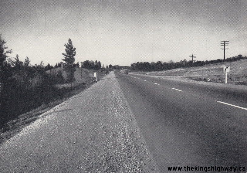

Left - New asphalt pavement and granular shoulders along a reconstructed section of Hwy 7, 5 miles east of Marmora. See an
Enlarged Photo Here. Photo taken on October 10, 1951. (Photo courtesy of Ontario Ministry of Transportation - © King's Printer for Ontario, 1951) Right - Preparation for rock blasting on a diversion of Hwy 7 built by Theirien Construction Company, 9 1/2 miles west of Kaladar. See an Enlarged Photo Here. Photo taken on June 14, 1952. (Photo courtesy of Ontario Ministry of Transportation - © King's Printer for Ontario, 1952) 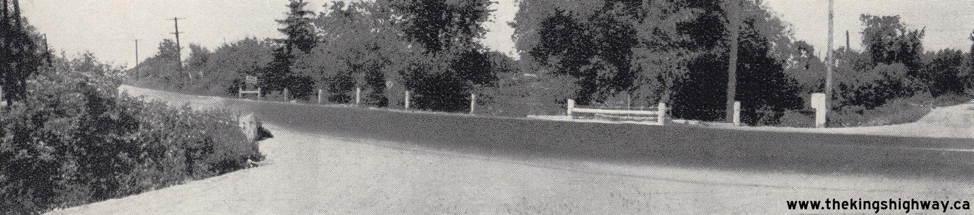 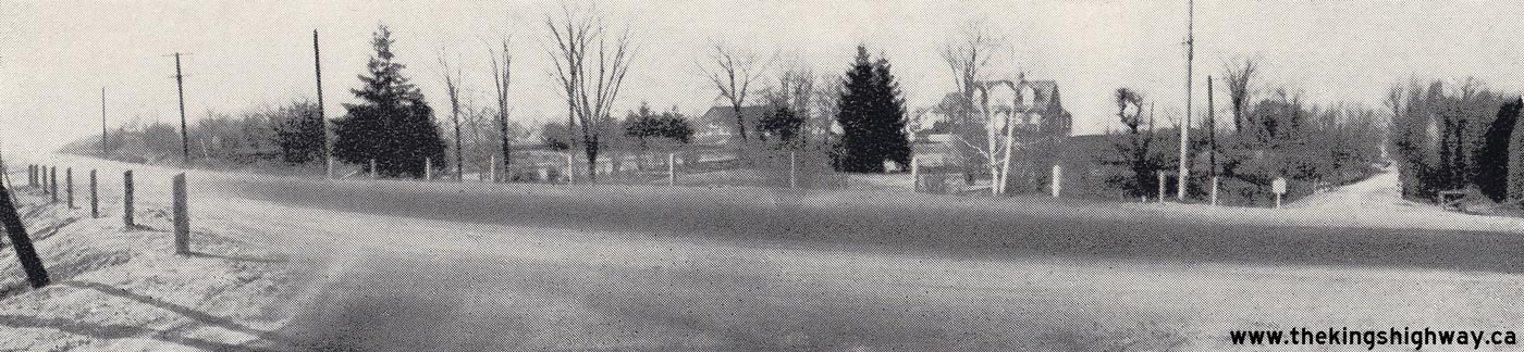
Above Photos - "Before and after" views of the intersection of Hwy 7 & Jane Street in Vaughan Township, located north of Toronto in 1952. Over a five
month period, this intersection had been the scene of 7 motor vehicle collisions, resulting in 4 injuries and 2 fatalities. Improvements were made to the intersection
to improve visibility, including vegetation removal and shoulder widening along Hwy 7. In the five month period following the completion of these improvements, no
collisions were reported at the intersection, See an Enlarged Photo Here (Left) and
Enlarged Photo Here (Right). Photos taken in 1952. (Photo courtesy of Ontario Ministry of Transportation - © King's Printer for Ontario, 1952) 
Above - Zone painting on the new Hwy 400 at the Hwy 7 Cloverleaf, taken shortly after Hwy 400 was officially opened to traffic.
See an Enlarged Photo Here. Photo taken on July 4, 1952. (Photo courtesy of Ontario Ministry of Transportation - © King's Printer for Ontario, 1952) 
Above - DHO maintenance staff doing grass cutting along Hwy 7 & Hwy 12 south of Blackwater in 1952. At that time, many of Ontario's King's Highways did not
have gravel shoulders. The ground was merely graded on a slope away from the pavement and then grassed over. An obvious drawback of this design practice was that the
grass needed frequent cutting. Also, in the event that a motorist needed to pull off of the pavement during an emergency, hidden debris and erosion channels under the
grass presented concealed hazards. As Ontario's Highways were gradually reconstructed throughout the 1950s and 1960s, the gravel shoulder became the preferred
roadside treatment. See an Enlarged Photo Here. Photo taken on July 24, 1952. (Photo courtesy of Ontario Ministry of Transportation - © King's Printer for Ontario, 1952) 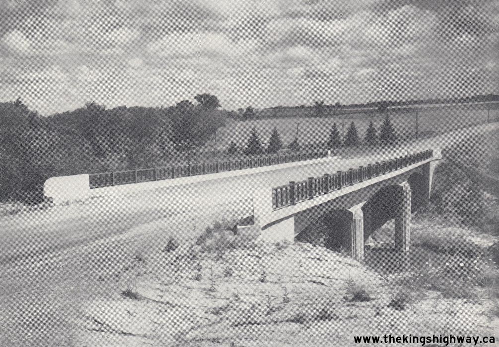
Left - New Nith River Bridge (Rau Bridge) on a partially-completed diversion of Hwy 7 & Hwy 8 at New Hamburg in 1952. This diversion initially only
carried local traffic to a Waterloo County Road (Bleams Road). However, the Rau Bridge was ultimately incorporated into the New Hamburg Bypass, which was completed
in its entirety and opened to traffic in 1957. See an Enlarged Photo Here. Photo taken on July
31, 1952. (Photo courtesy of Ontario Ministry of Transportation - © King's Printer for Ontario, 1952) Right - Paved section of Hwy 7 through a widened rock cut, 5 miles east of the Hwy 37 Junction near Actinolite. See an Enlarged Photo Here. Photo taken in 1953. (Photo courtesy of Ontario Ministry of Transportation - © King's Printer for Ontario, 1953) 
Above - Hwy 400 & Hwy 7 Interchange looking northeast towards Maple in 1953. The present-day site of the Hwy 400 & Hwy 407 ETR Interchange is situated
in the bottom-right corner of this photo, while Weston Road can be seen approaching its intersection with Hwy 7 at left. Compare the 1953 aerial photo of the Hwy 400
& Hwy 7 Interchange in Vaughan shown above with this 2004 Aerial Photo, which I took to
show the unfortunate urban sprawl that has taken place over the past 25 years in this part of York Region. Nearly all of the vacant land seen in the 1953 photo above
has become urbanized. See an Enlarged Photo Here. Photo taken on October 1, 1953. (Photo © Archives of Ontario - Series RG-14-162-2, Box B986, Photo #650-15) 
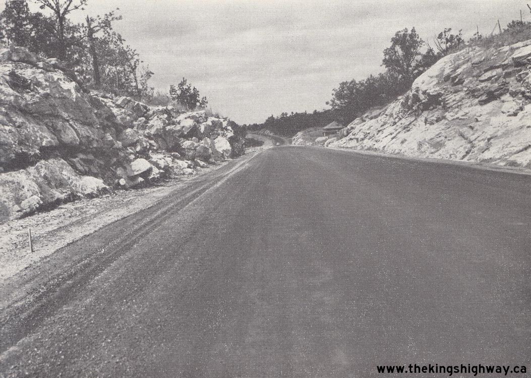
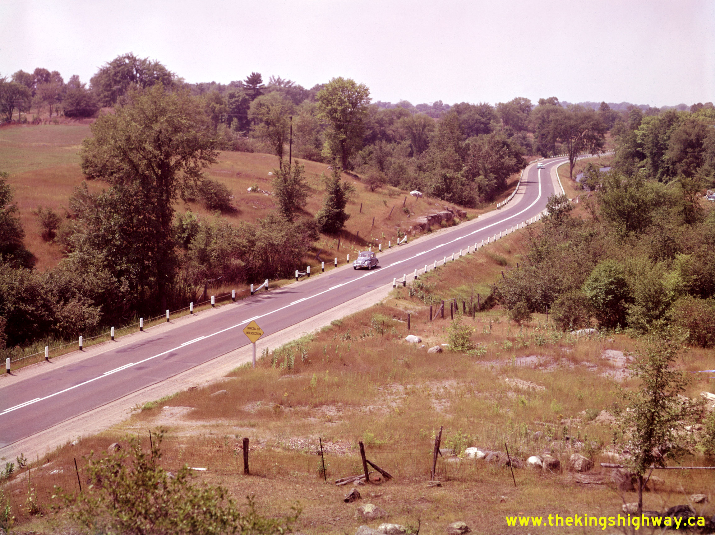
Left - New asphalt surface on Hwy 7, 4 miles east of the Hwy 37 Junction near Actinolite. See an
Enlarged Photo Here. Photo taken on November 18, 1953. (Photo courtesy of Ontario Ministry of Transportation - © King's Printer for Ontario, 1953) Right - Rock fill widening along Hwy 7 at Silver Lake, 18 miles west of Perth. See an Enlarged Photo Here. Photo taken on July 30, 1954. (Photo courtesy of Ontario Ministry of Transportation - © King's Printer for Ontario, 1954) 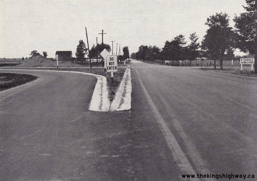

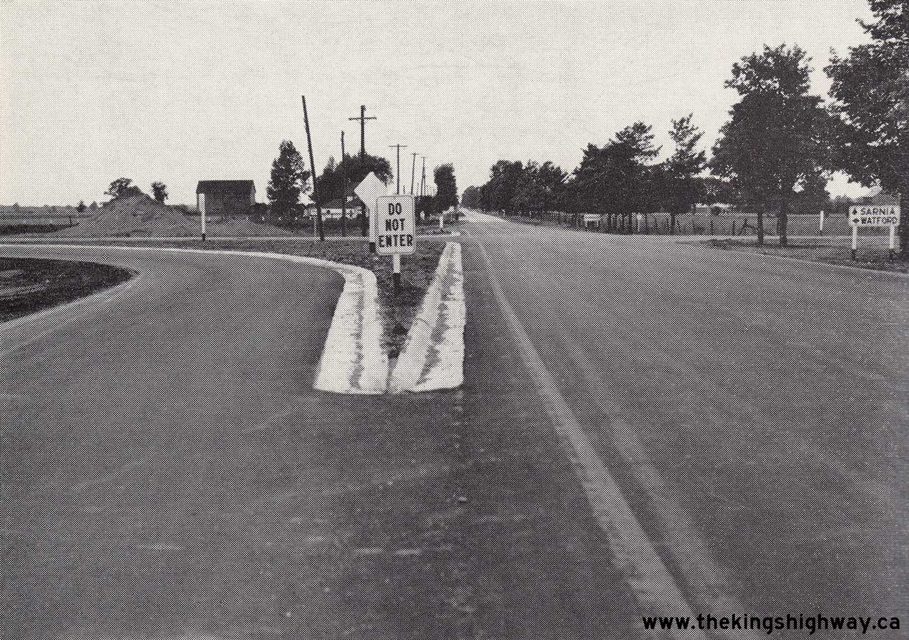
Left - New channelized right turn ramps at the reconstructed Hwy 7 & Hwy 79 Junction, facing west towards Sarnia. See an
Enlarged Photo Here. Photo taken on August 12, 1954. (Photo courtesy of Ontario Ministry of Transportation - © King's Printer for Ontario, 1954) Right - Facing east along Hwy 402 towards the Hwy 7 & Hwy 40 Junction from the Bluewater Bridge Entrance in Point Edward. Even when this photo was taken in the 1950s, it would have been unusual to see three King's Highway shields mounted below a single "JUNCTION" tab such as this. See an Enlarged Photo Here. Photo taken circa 1955. (Photo from Cameron Bevers' historical photograph collection - Original photographer unknown) 
Above - Close-up view of the "JUNCTION" Hwy 402, Hwy 7 & Hwy 40 signs. Small-sized 400-Series Highway markers such as this example for Hwy 402 were
actually rarely seen in the 1950s. Even at that time, the 400-Series Highways were typically signed with the oversized highway markers, which were designed for use on
high-speed highways. Although it isn't very clear in this photo due to the limited resolution, note the example of an early Ontario diagrammatical junction sign in
the background. These simple diagrammatical junction signs used thick black lines with arrowheads to show the layout of highway routes departing from a junction.
The King's Highway route numbers were shown beside the various arrowheads so motorists knew in advance which fork to take at the approaching junction. These
diagrammatical signs began to appear at Ontario's highway junctions in the late 1930s and were used up until the mid-1950s when new types of guide signs were
introduced. Interestingly, this sign directs Hwy 7 traffic to follow Hwy 402, rather than use the actual route of Hwy 7 through Downtown Sarnia. Photo taken circa
1955. (Photo from Cameron Bevers' historical photograph collection - Original photographer unknown) 

Left - Facing north along Wyndham Street (Hwy 6, Hwy 7 & Hwy 24) from Carden Street in Guelph in 1955. See an
Enlarged Photo Here. (Photo courtesy of L. F. Charter) Right - Circa 1955 postcard view of Hwy 8 & Hwy 19 (Ontario Street) in Downtown Stratford, facing east towards the Hwy 7 Junction (Erie Street). See an Enlarged Photo Here. (Photo courtesy of Royal Specialty Sales, Toronto)  Above - Scenery along the Trans-Canada Highway (Hwy 7) near Madoc. See an
Enlarged Photo Here. Photo taken circa 1955. Above - Scenery along the Trans-Canada Highway (Hwy 7) near Madoc. See an
Enlarged Photo Here. Photo taken circa 1955.(Photo © Archives of Ontario - Series RG-65-35, Photo #I-0015089) 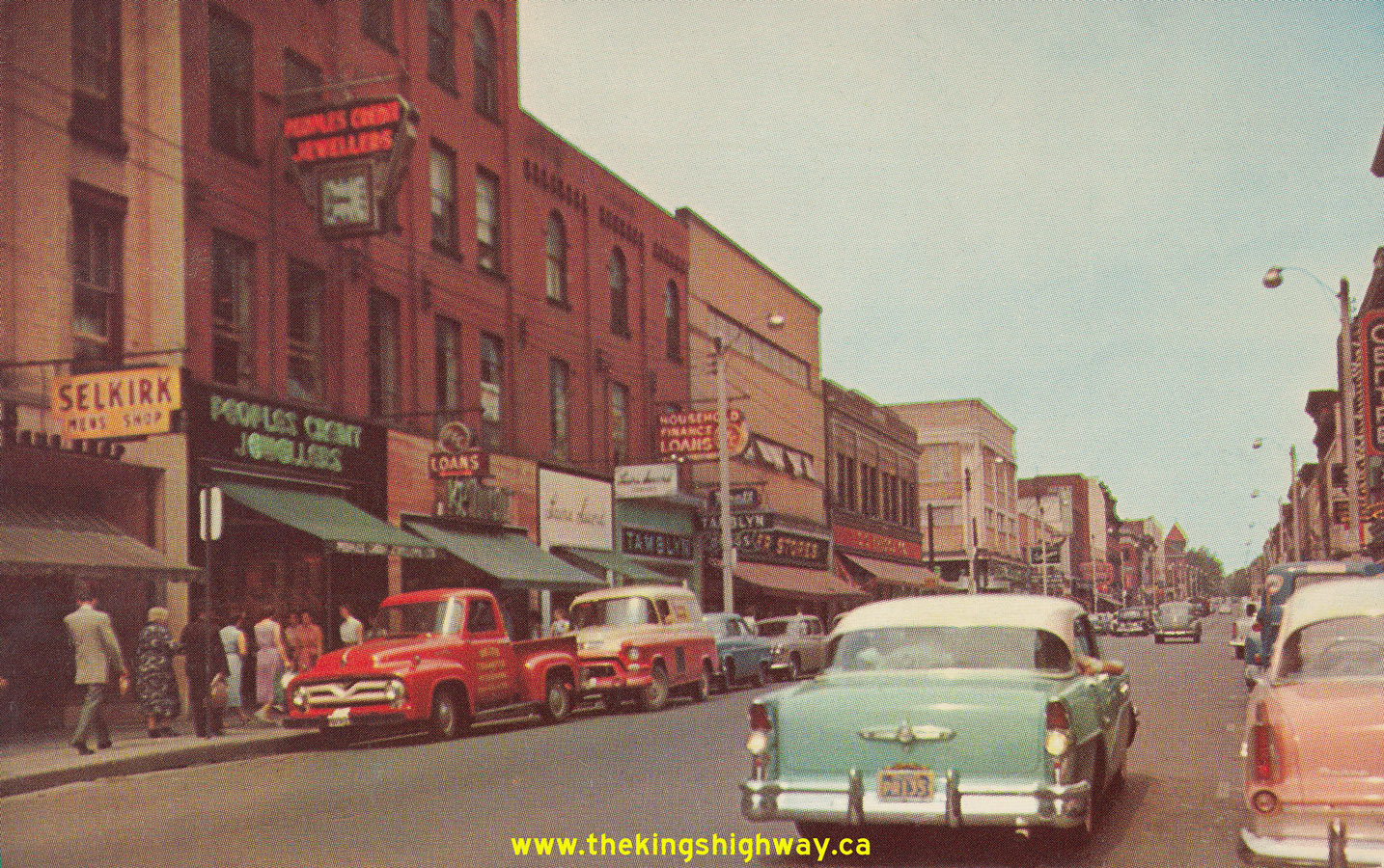 Above - Postcard view of Hwy 7 (George Street) in Downtown Peterborough in 1956, facing north from the Hwy 28 Junction at Charlotte Street. This interesting
photo shows George Street just before the one-way street system was introduced through Downtown Peterborough in the late 1950s. Today, George Street carries
southbound traffic only, while northbound traffic follows adjacent Water Street through the city centre. See an
Enlarged Photo Here. Photo taken in 1956. Above - Postcard view of Hwy 7 (George Street) in Downtown Peterborough in 1956, facing north from the Hwy 28 Junction at Charlotte Street. This interesting
photo shows George Street just before the one-way street system was introduced through Downtown Peterborough in the late 1950s. Today, George Street carries
southbound traffic only, while northbound traffic follows adjacent Water Street through the city centre. See an
Enlarged Photo Here. Photo taken in 1956.(Photo courtesy of Royal Specialty Sales, Toronto) 
Above - Newly-completed Department of Highways of Ontario Stratford District Office (DHO District #3) in 1957. This building stood at 581 Huron Street in
Stratford for nearly 60 years, before being demolished to make way for a new shopping centre in 2013. See an
Enlarged Photo Here. Photo taken in 1957. (Photo courtesy of Ontario Ministry of Transportation - © King's Printer for Ontario, 1957) 
Above - Completed grading on a section of the Lindsay Bypass (Hwy 7 & Hwy 35) in September 1957. See an
Enlarged Photo Here. (Photo courtesy of Ontario Ministry of Transportation - © King's Printer for Ontario, 1957) 
Above - Bells Corners Subway on Hwy 15 (later known as Hwy 7 & Hwy 15) west of Ottawa. See an
Enlarged Photo Here. Photo taken in 1958. (Photo courtesy of Ontario Ministry of Transportation - © King's Printer for Ontario, 1958) 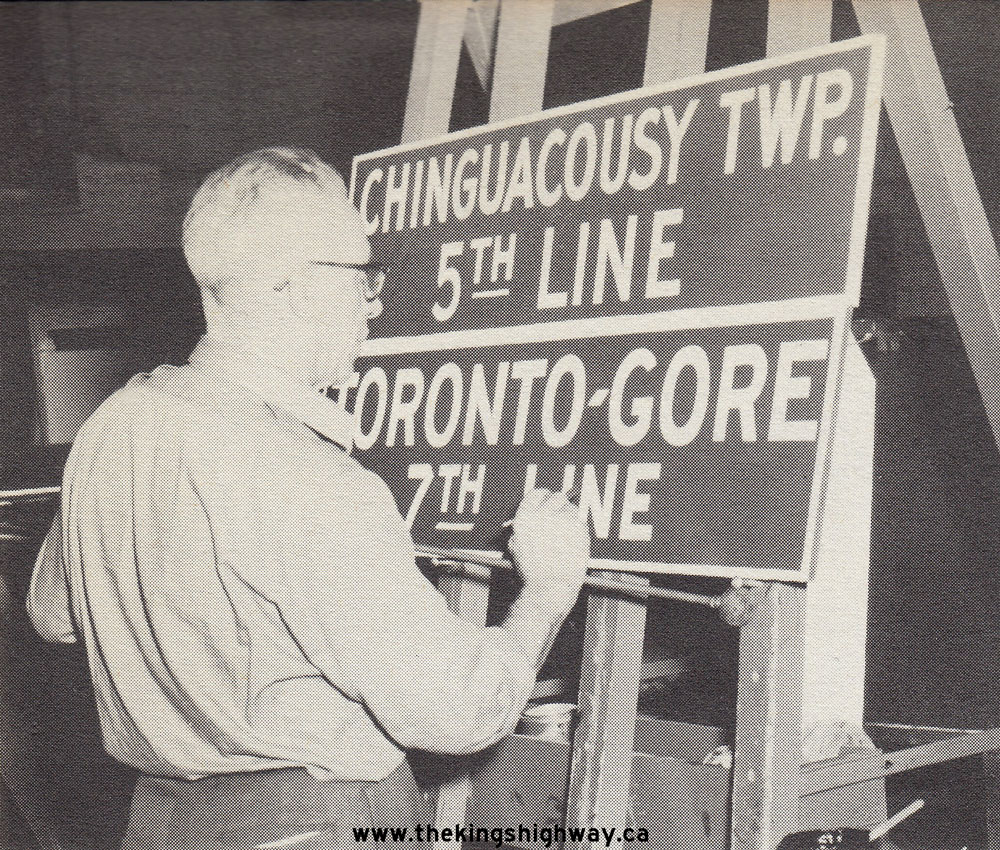
 Left - Toronto District (DHO District #6) sign shop painter David Legault puts the finishing touches on two new guide signs for installation along Hwy 7 east
of Brampton in 1959. The signs are for Chinguacousy Township's 5th Line (known today as Torbram Road) and Toronto Gore Township's 7th Line (known today as Goreway
Drive). See an Enlarged Photo Here. Photo taken on April 14, 1959. Left - Toronto District (DHO District #6) sign shop painter David Legault puts the finishing touches on two new guide signs for installation along Hwy 7 east
of Brampton in 1959. The signs are for Chinguacousy Township's 5th Line (known today as Torbram Road) and Toronto Gore Township's 7th Line (known today as Goreway
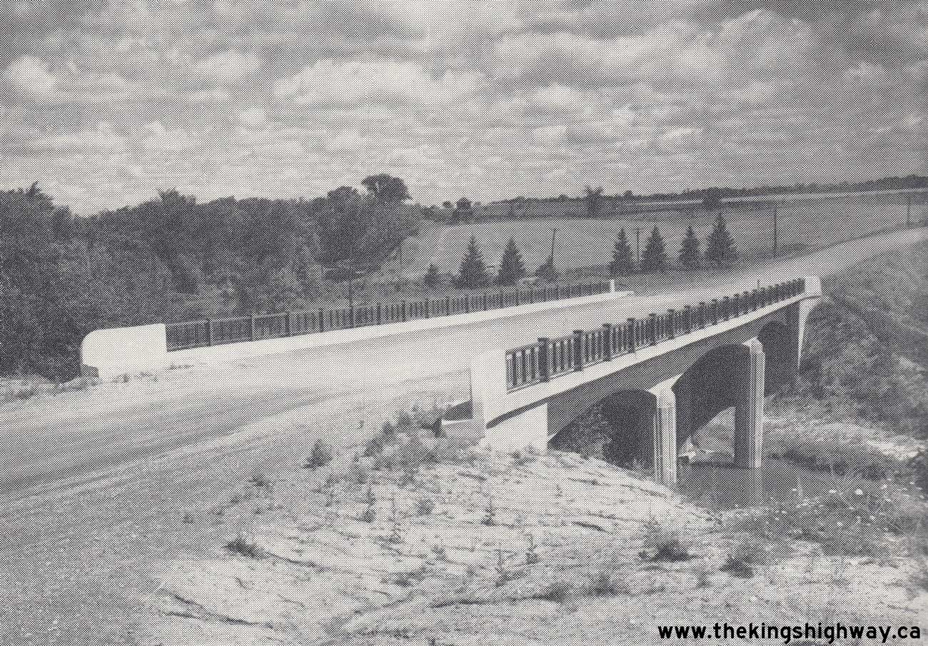
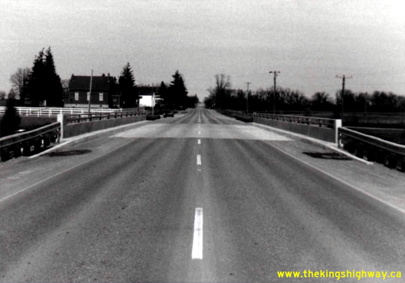
Drive). See an Enlarged Photo Here. Photo taken on April 14, 1959.(Photo courtesy of Ontario Ministry of Transportation - © King's Printer for Ontario, 1959) Right - Completed Scugog River Bridge on the Lindsay Bypass (Hwy 7 & Hwy 35) in 1959, facing west. See an Enlarged Photo Here. (Photo courtesy of Ontario Ministry of Transportation - © King's Printer for Ontario, 1959) 
Above - Circa 1960 postcard view of the western terminus of Hwy 402 at the Bluewater Bridge in Sarnia. This aerial photo shows the western terminus of Hwy 402
before it was rebuilt as a fully controlled-access freeway through Sarnia and Point Edward. The concrete highway approaching from the left is Hwy 7 & Hwy 40 from
Downtown Sarnia. These two routes joined into Hwy 402 at an at-grade intersection just before the Bluewater Bridge Customs Building in the background. This road
configuration remained virtually unchanged for three decades following the completion of the Bluewater Bridge Approach (Hwy 402) through Sarnia in the late 1940s. In
1981, a new interchange was completed at Front Street and the at-grade intersection shown here was subsequently closed off. See an
Enlarged Photo Here. Photo taken circa 1960. (Photograph courtesy of Bert Knechtel) 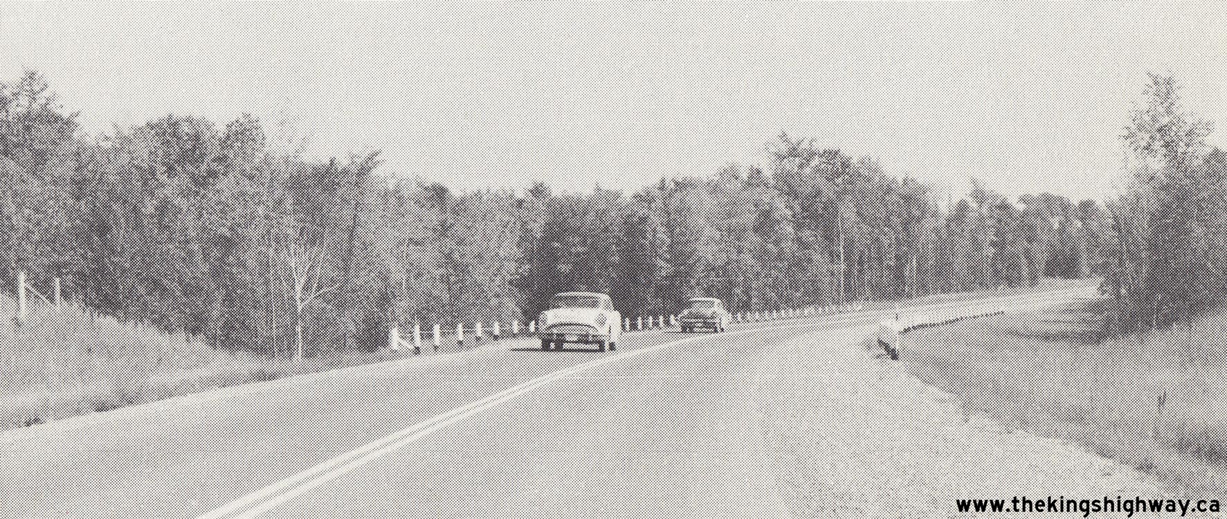 Above - Completed hot-mix asphalt paving and zone striping on Hwy 7 (Formerly Hwy 133) between Peterborough and Fowlers Corners, Contract #1960-116. During
1960, the route of the Trans-Canada Highway (Hwy 133) from Fowlers Corners southerly to the Hwy 28 Junction at Five Mile Corners was renumbered as Hwy 7. See an
Enlarged Photo Here. Photo taken in 1960. Above - Completed hot-mix asphalt paving and zone striping on Hwy 7 (Formerly Hwy 133) between Peterborough and Fowlers Corners, Contract #1960-116. During
1960, the route of the Trans-Canada Highway (Hwy 133) from Fowlers Corners southerly to the Hwy 28 Junction at Five Mile Corners was renumbered as Hwy 7. See an
Enlarged Photo Here. Photo taken in 1960.(Photo courtesy of Ontario Ministry of Transportation - © King's Printer for Ontario, 1960) 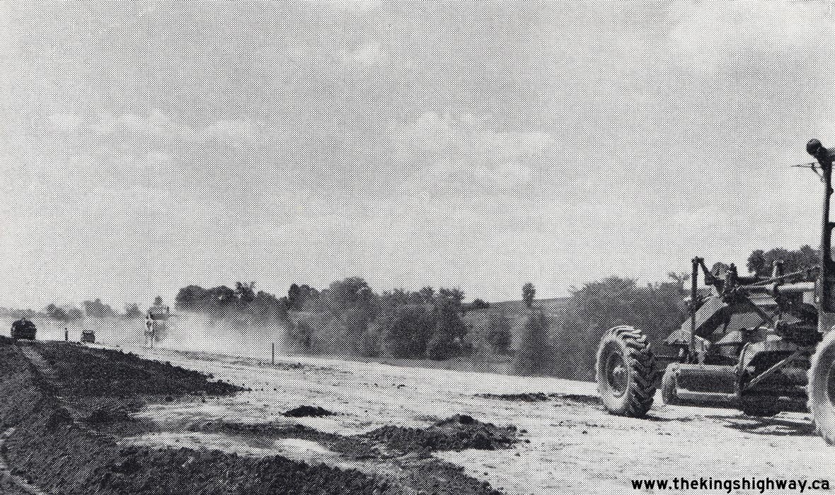
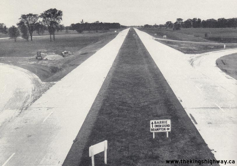
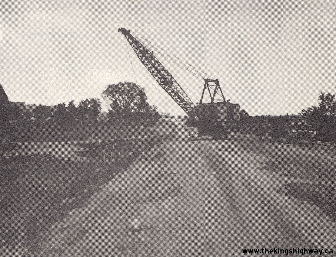
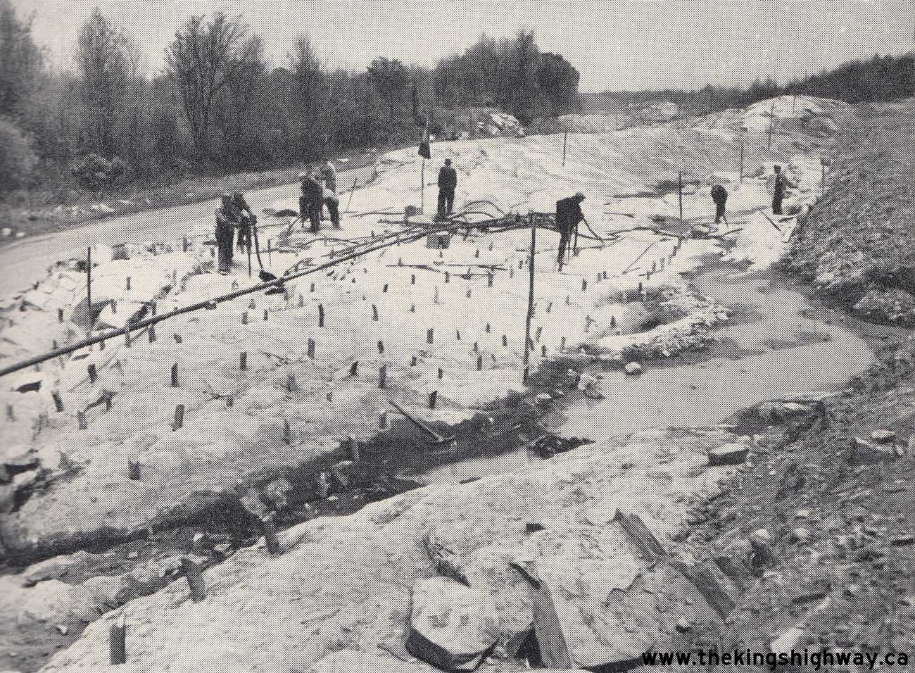
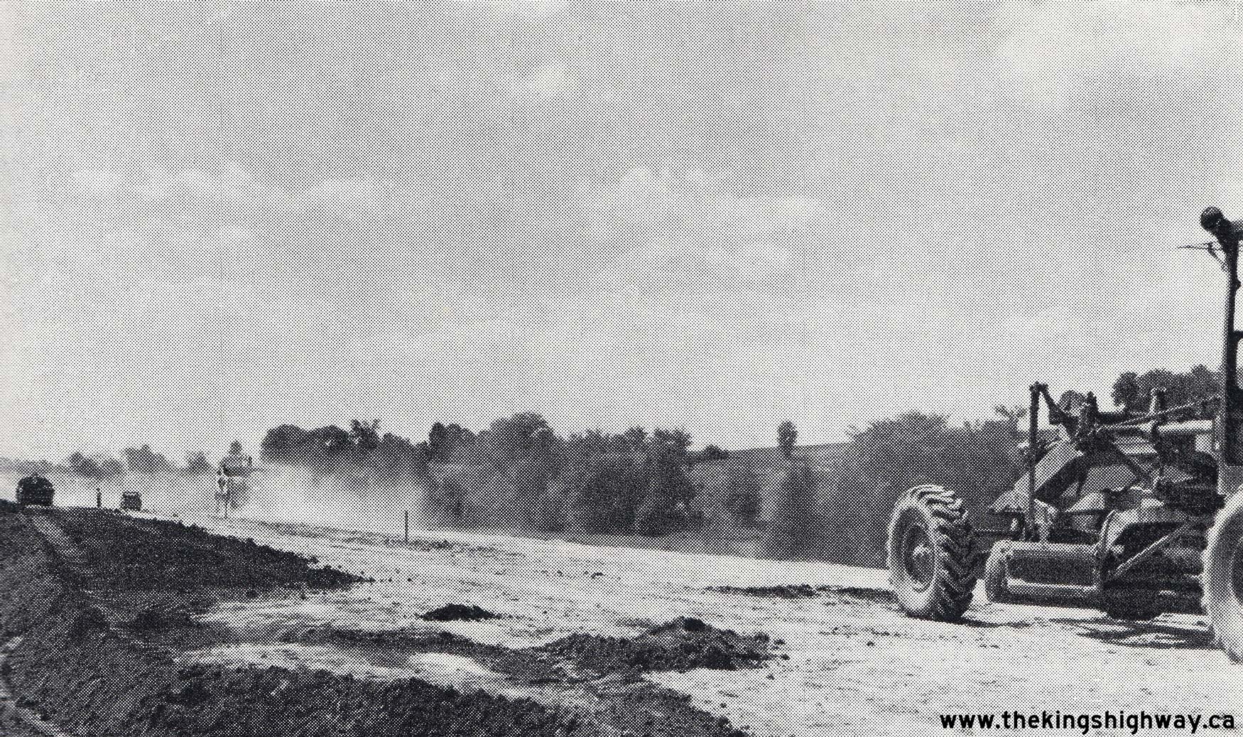
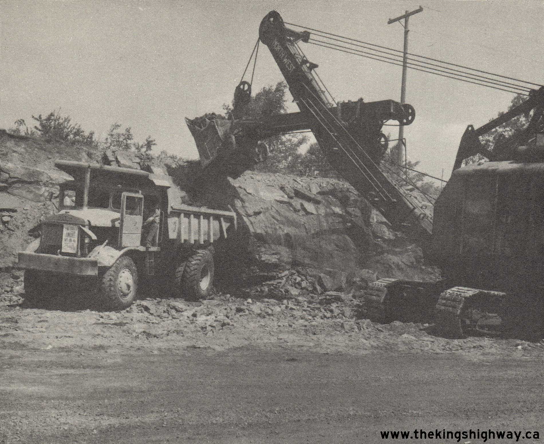
Above - Grading operations underway on the Peterborough Bypass (today's Hwy 7 & Hwy 115) in 1960. See an
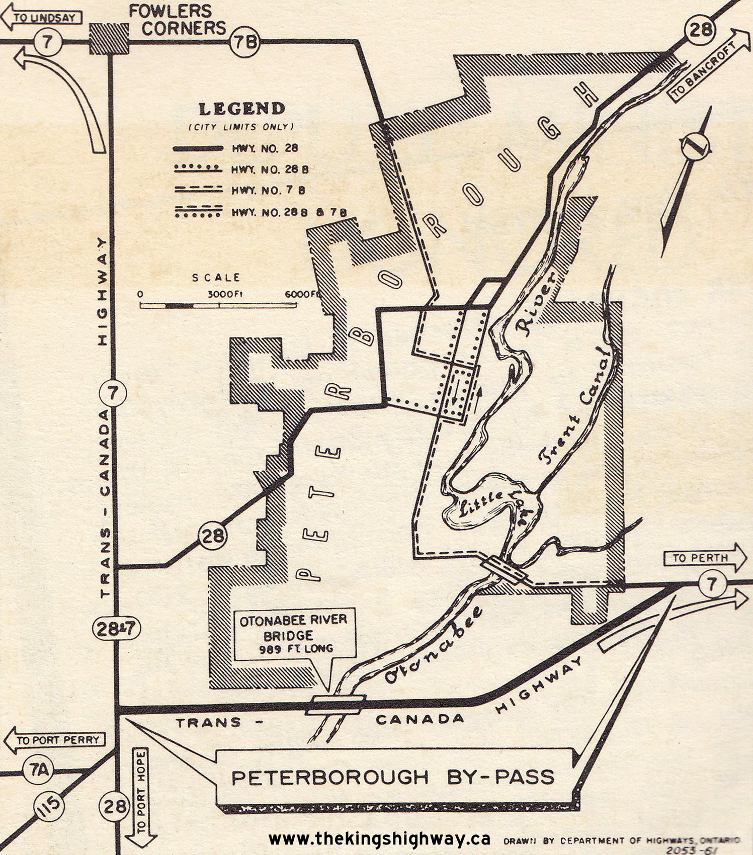
Enlarged Photo Here. (Photo courtesy of Ontario Ministry of Transportation - © King's Printer for Ontario, 1960) 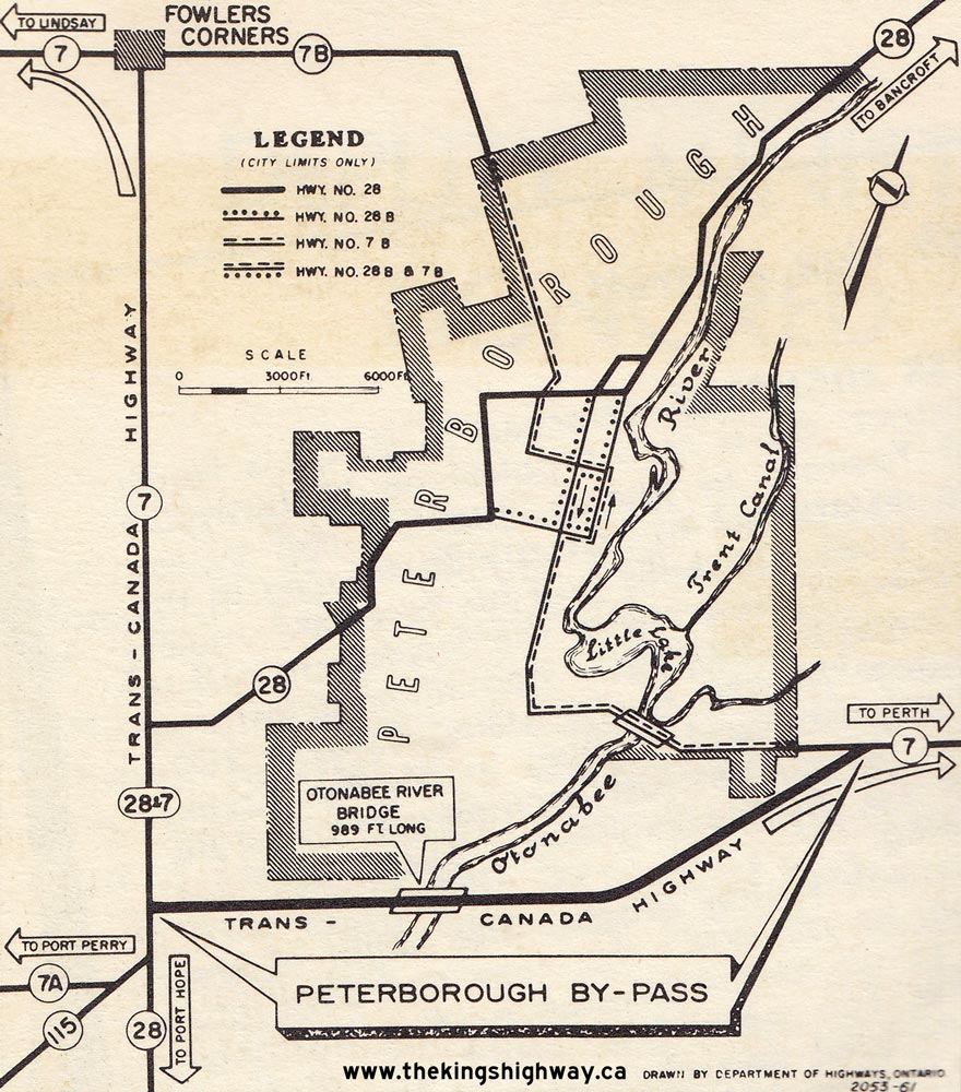 Above - Plan showing the newly-completed Peterborough Bypass in 1961. The 7.2-mile Peterborough Bypass was officially opened to traffic by Highways Minister
Fred M. Cass on September 28, 1961. The new bypass allowed through traffic on Hwy 7 to avoid the awkward route of the old highway through the congested city centre.
The Peterborough Bypass was built at an approximate total cost of $2.8 Million in 1961 Dollars, the equivalent of about $78.3 Million in 2025 Dollars. See an
Enlarged Photo Here. Above - Plan showing the newly-completed Peterborough Bypass in 1961. The 7.2-mile Peterborough Bypass was officially opened to traffic by Highways Minister
Fred M. Cass on September 28, 1961. The new bypass allowed through traffic on Hwy 7 to avoid the awkward route of the old highway through the congested city centre.
The Peterborough Bypass was built at an approximate total cost of $2.8 Million in 1961 Dollars, the equivalent of about $78.3 Million in 2025 Dollars. See an
Enlarged Photo Here.(Photo courtesy of Ontario Ministry of Transportation - © King's Printer for Ontario, 1961) 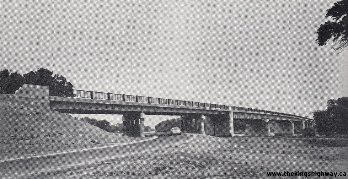
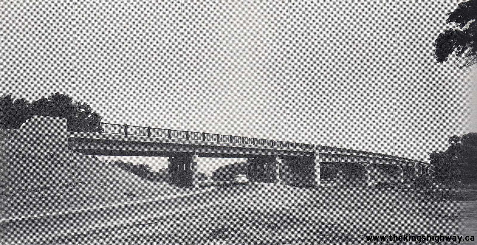
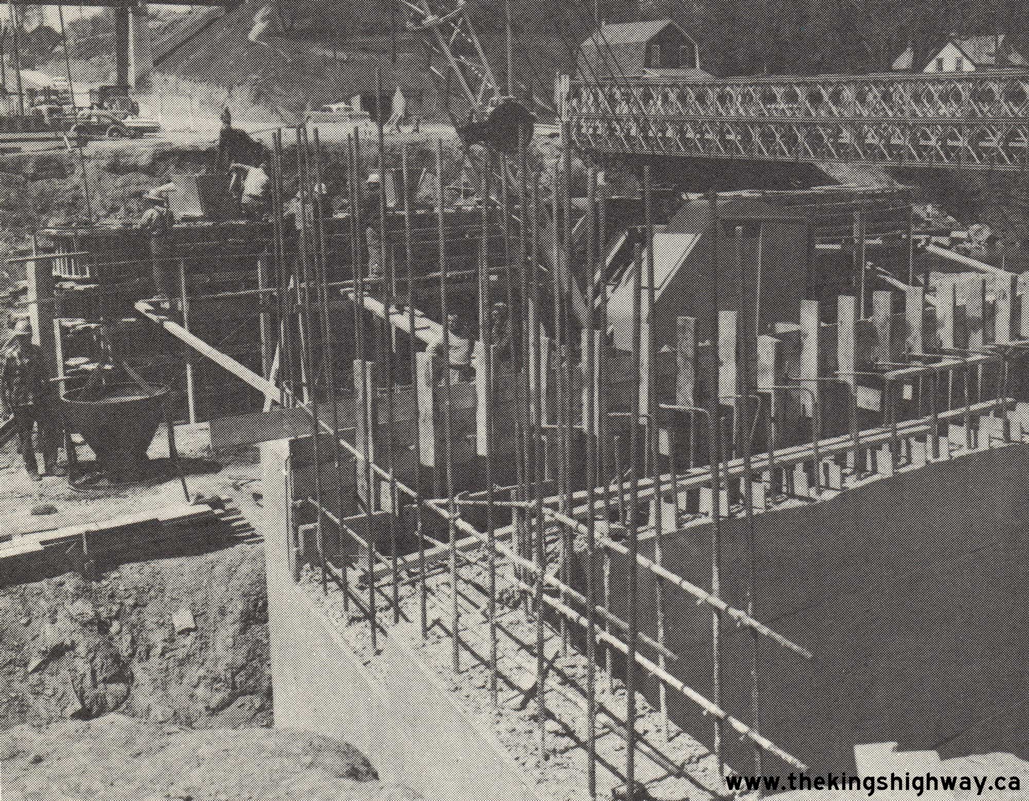
Above - New Otonabee River Bridge on the Peterborough Bypass (today's Hwy 7 & Hwy 115) in 1961. The bridge was built under Contracts #1958-637 (structural
steel) and #1958-640 (concrete substructure and approaches), with both contracts awarded by the DHO in January 1959. The new bridge had a total length of just under
1,000 feet (989 feet) and a vertical clearance over the Trent-Severn Waterway of 22 feet. The bridge was opened to traffic along with the rest of the Peterborough
Bypass in the Fall of 1961. The structure seen here now carries the eastbound lanes of Hwy 7 & Hwy 115 only. A twin structure was built on the north side of the
existing structure in 1982-1983 to carry the westbound lanes of the highway. See an
Enlarged Photo Here. Photo taken in 1961. (Photo courtesy of Ontario Ministry of Transportation - © King's Printer for Ontario, 1961) 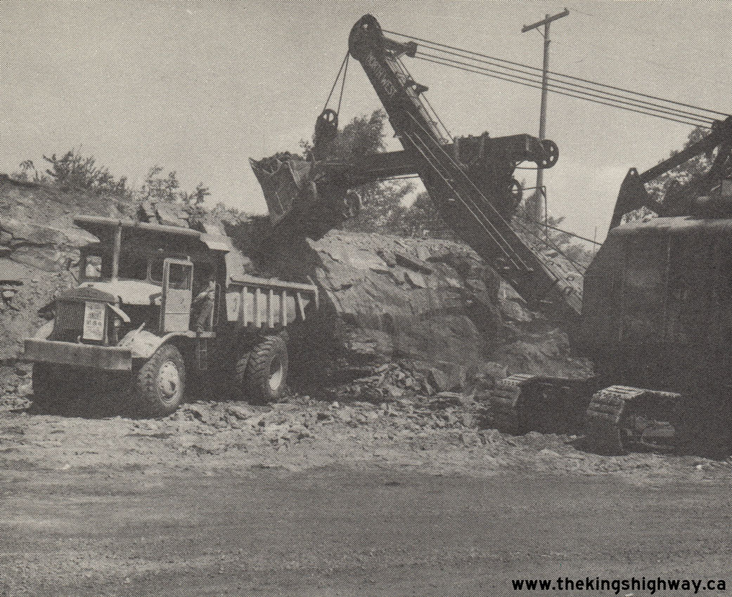
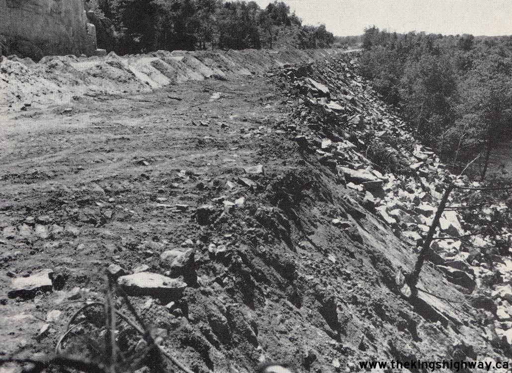
Left - Widening a rock cut on Hwy 7 east of Kaladar, Contract #1961-217. See an
Enlarged Photo Here. Photo taken in 1962. (Photo courtesy of Ontario Ministry of Transportation - © King's Printer for Ontario, 1962) Right - Replacement of the Humber River Bridge on Hwy 7 in Woodbridge, Contract #1961-23. See an Enlarged Photo Here. Photo taken in 1962. (Photo courtesy of Ontario Ministry of Transportation - © King's Printer for Ontario, 1962) 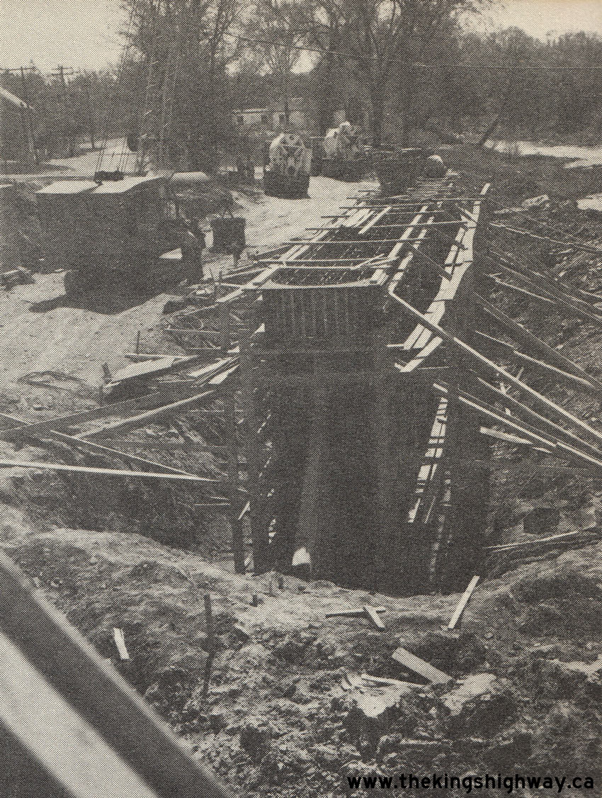
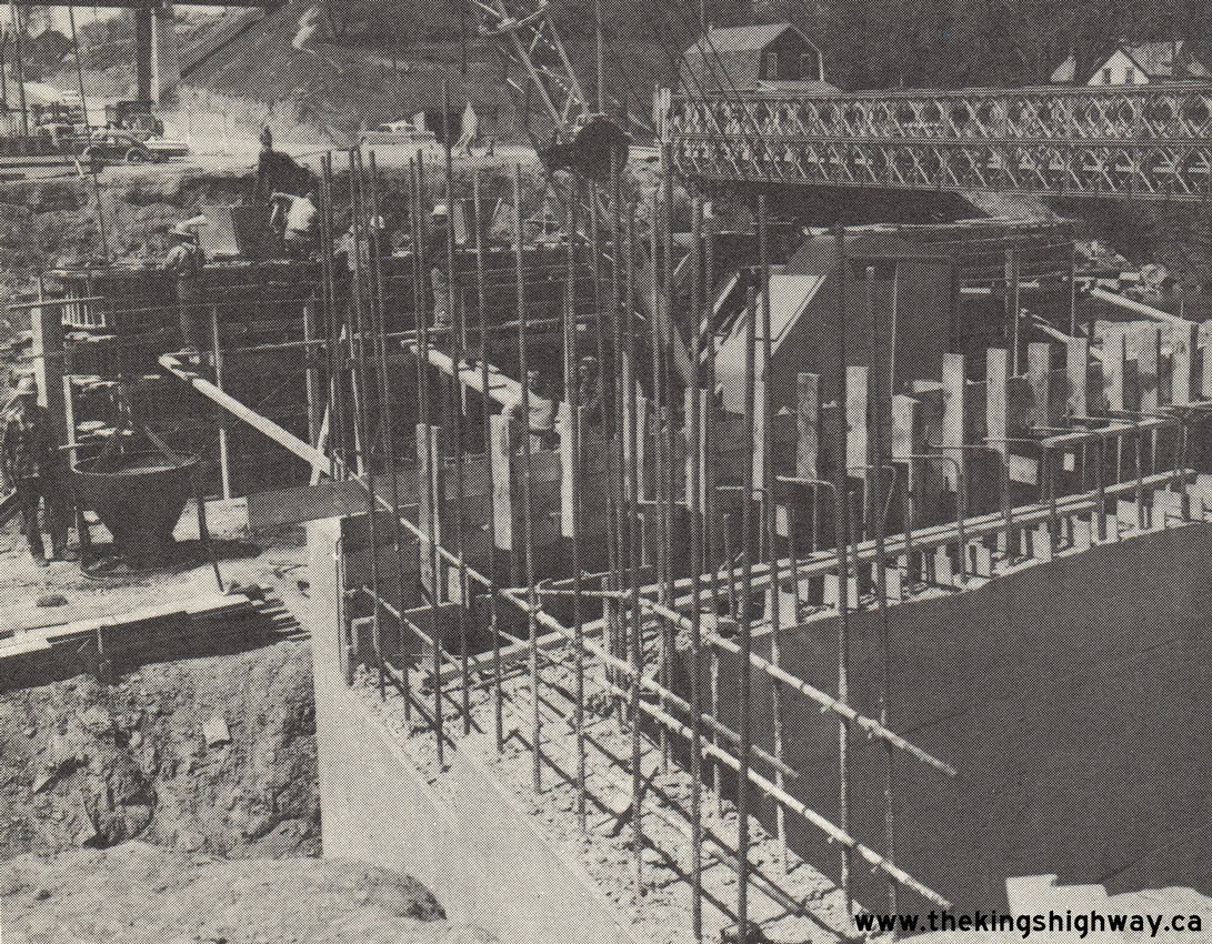
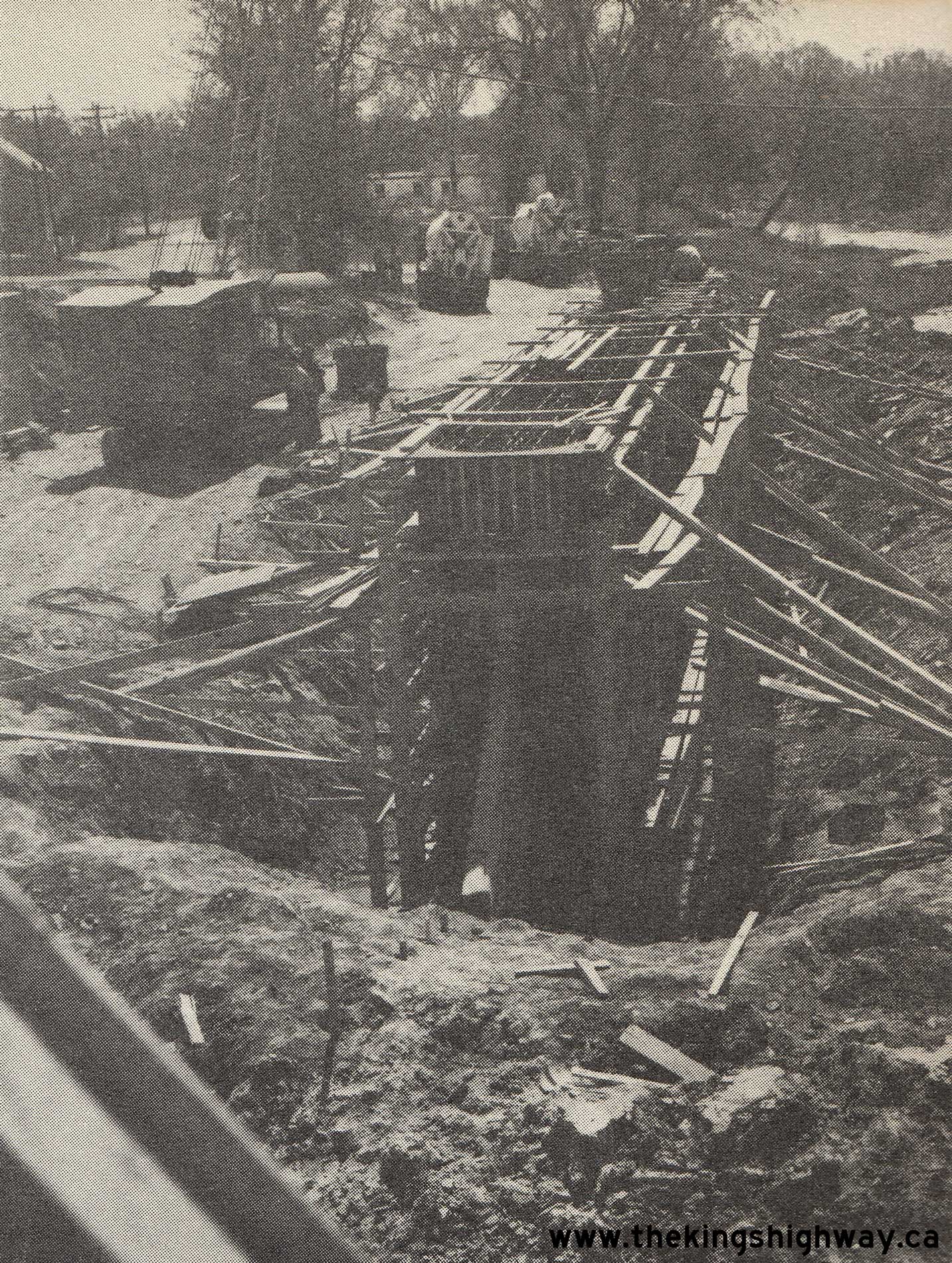
Above - Pier under construction for the new Humber River Bridge on Hwy 7 in Woodbridge, Contract #1961-23. See an
Enlarged Photo Here. Photo taken in 1962. (Photo courtesy of Ontario Ministry of Transportation - © King's Printer for Ontario, 1962) 
Above - Junction of Hwy 402 and Modeland Road (Lucasville Road) east of Sarnia in 1962. This aerial photo of Hwy 402 shows the junction of Modeland Road and the
adjacent Hwy 7 junction, just east of Sarnia (facing east). Modeland Road was later incorporated into the Sarnia Bypass and was designated as Hwy 40 in the mid-1960s.
The at-grade intersection at Hwy 402 was eventually eliminated through the construction of a proper interchange at Hwy 40. In the 1970s, Hwy 402 was extended easterly
from Sarnia towards London and was realigned through the area in the bottom left corner of the photo. The Hwy 402 connection to Hwy 7 seen here was subsequently
removed and is now the site of a shopping plaza. Sarnia's present day "Golden Mile" can be seen along Hwy 7 in the top left corner of this photo. See
an Enlarged Photo Here. Photo taken on November 28, 1962. (Photo © Archives of Ontario - Series RG-14-151-7-16, Photo #3851) 
Above - Sign marking the entrance to the DHO District #3 (Stratford) Office. See an
Enlarged Photo Here. Photo taken in 1963. (Photo courtesy of Ontario Ministry of Transportation - © King's Printer for Ontario, 1963) 
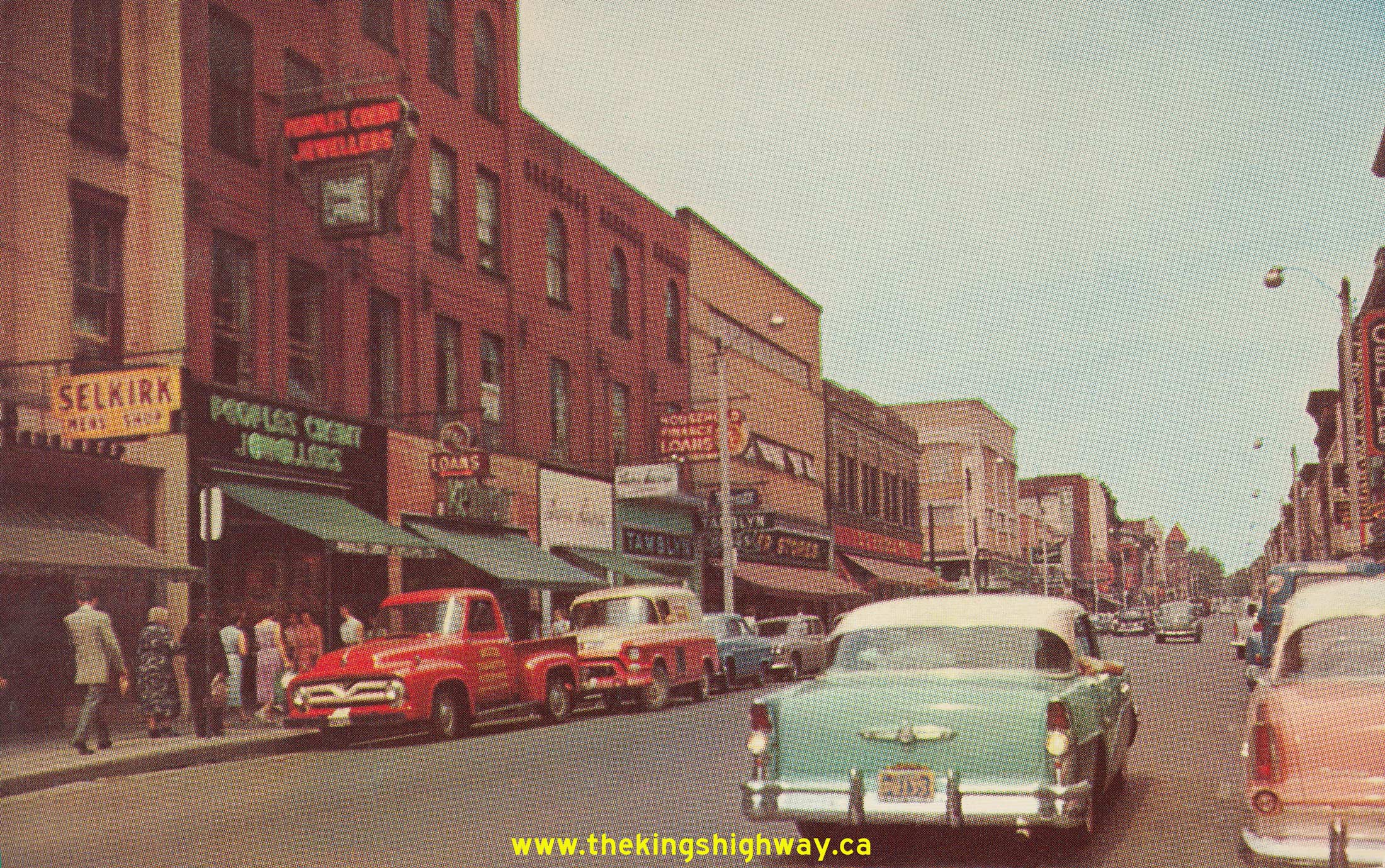
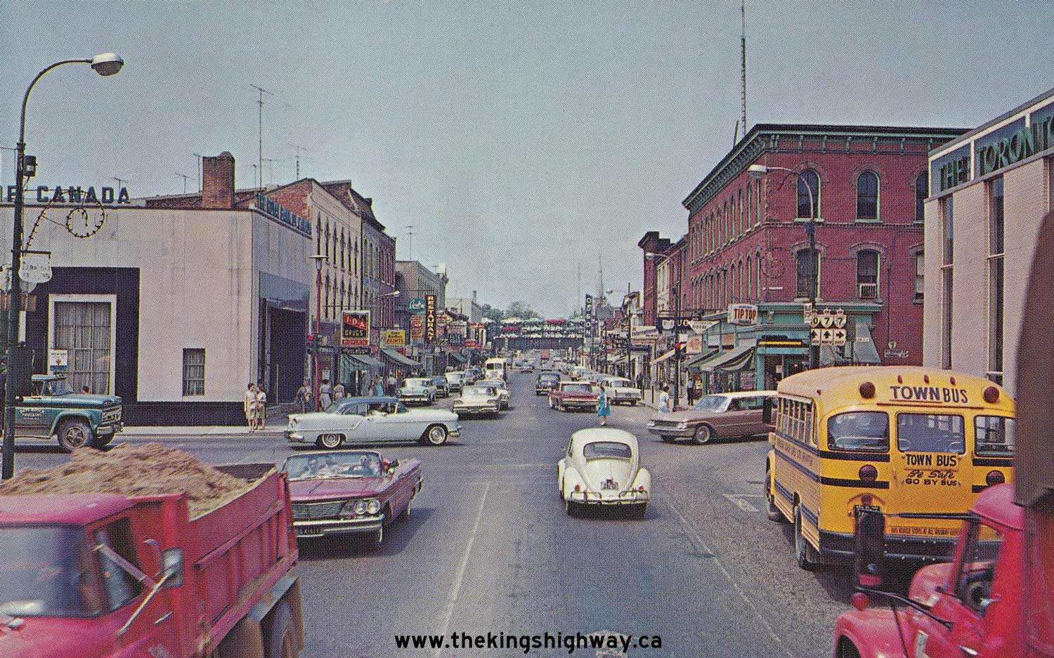
Above - Postcard view of the Hwy 7 & Hwy 10 Junction in Downtown Brampton in 1963, facing north. See an
Enlarged Photo Here. (Photo courtesy of R. Gordon Robinson) 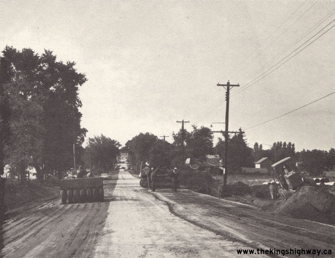
Left - Reconstruction of Hwy 7 through Arkona, Contract #1963-134. See an
Enlarged Photo Here. Photo taken in 1963. (Photo courtesy of Ontario Ministry of Transportation - © King's Printer for Ontario, 1963) Right - Ditch excavation on a reconstructed section of Hwy 7 west of the Hwy 37 Junction near Actinolite, Contract #1963-114. See an Enlarged Photo Here. Photo taken in 1964. (Photo courtesy of Ontario Ministry of Transportation - © King's Printer for Ontario, 1964) 
Above - Facing west along Hwy 7 from Dufferin Street in Concord showing the reconstruction and widening of the highway from two to four lanes, Contract
#1964-95. Continued urban growth along the northern fringe of Metropolitan Toronto prompted the DHO to award several highway widening contracts along Hwy 7 during
the 1960s and early 1970s. See an Enlarged Photo Here. Photo taken in 1964. (Photo courtesy of Ontario Ministry of Transportation - © King's Printer for Ontario, 1964) 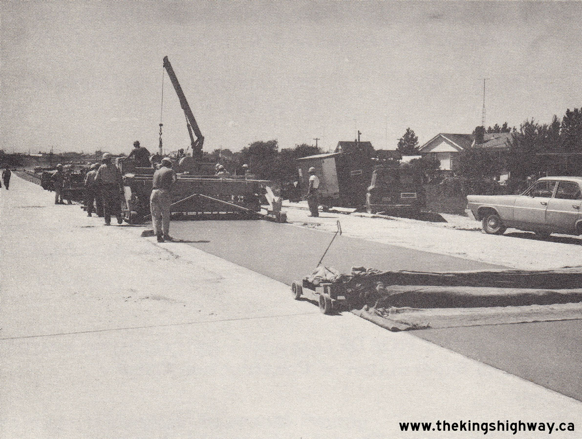 Above - Concrete paving operations underway along a new four-lane section of Hwy 7 near Bathurst Street west of Thornhill, Contract #1964-95. See an
Enlarged Photo Here. Photo taken in 1964. Above - Concrete paving operations underway along a new four-lane section of Hwy 7 near Bathurst Street west of Thornhill, Contract #1964-95. See an
Enlarged Photo Here. Photo taken in 1964.(Photo courtesy of Ontario Ministry of Transportation - © King's Printer for Ontario, 1964)  Above - Postcard view of Hwy 7 & Hwy 8 (Ontario Street) in Downtown Stratford in 1965, facing west towards the Hwy 19 Junction. See an
Enlarged Photo Here. Photo taken in 1965. Above - Postcard view of Hwy 7 & Hwy 8 (Ontario Street) in Downtown Stratford in 1965, facing west towards the Hwy 19 Junction. See an
Enlarged Photo Here. Photo taken in 1965.(Photo courtesy of Mutual Wholesale Stationery Ltd, London) 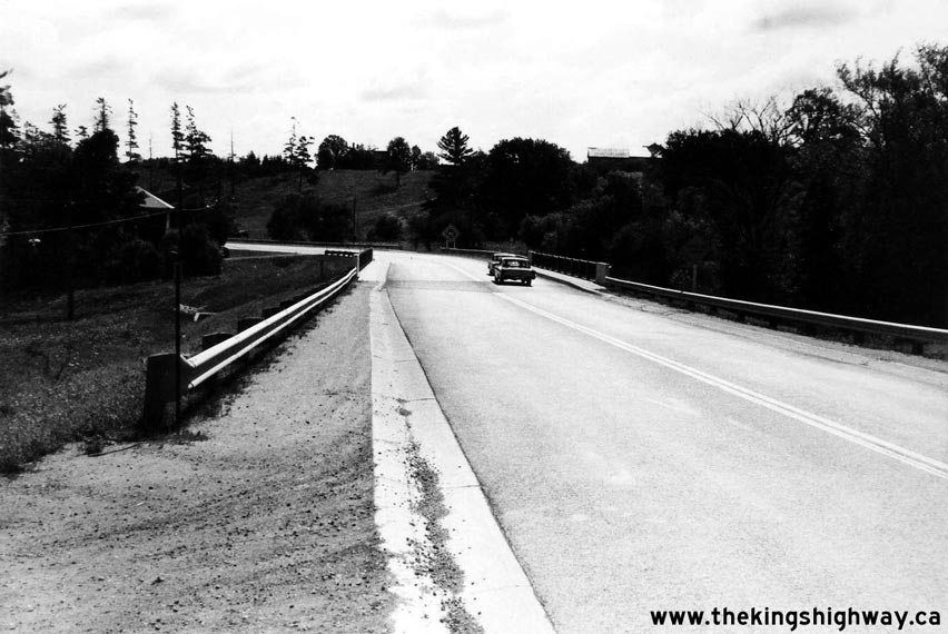
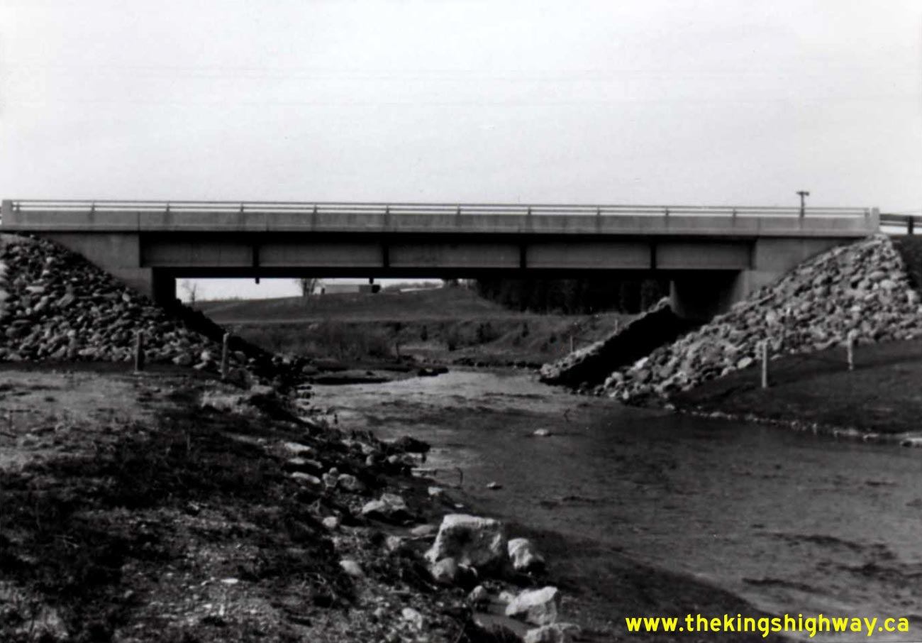
Left - Facing east towards the Silver Creek Bridge on Hwy 7 between Georgetown and Norval. See an
Enlarged Photo Here. Photo taken in August 1966. (Photo courtesy of Ontario Ministry of Transportation - © King's Printer for Ontario, 2014) Right - Silver Creek Bridge on Hwy 7 west of Norval. See an Enlarged Photo Here. Photo taken in August 1966. (Photo courtesy of Ontario Ministry of Transportation - © King's Printer for Ontario, 2014) 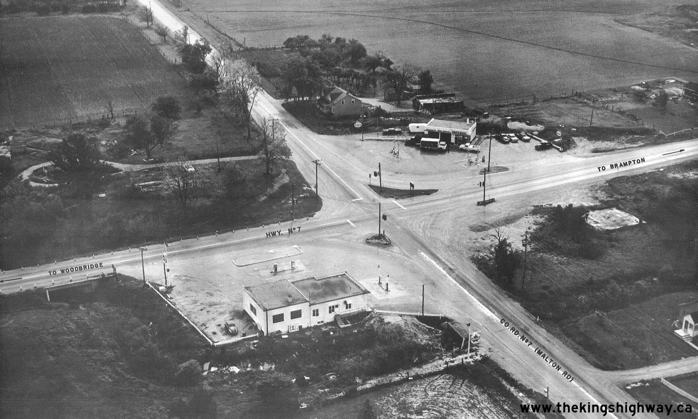

Left - Aerial view of the Hwy 7 & Peel County Road 7 Junction (today's Airport Road) in 1966, facing southwest. This photo shows an old two-lane section of Hwy 7
before it was expanded to four lanes in the early 1970s. See an Enlarged Photo Here. Photo taken
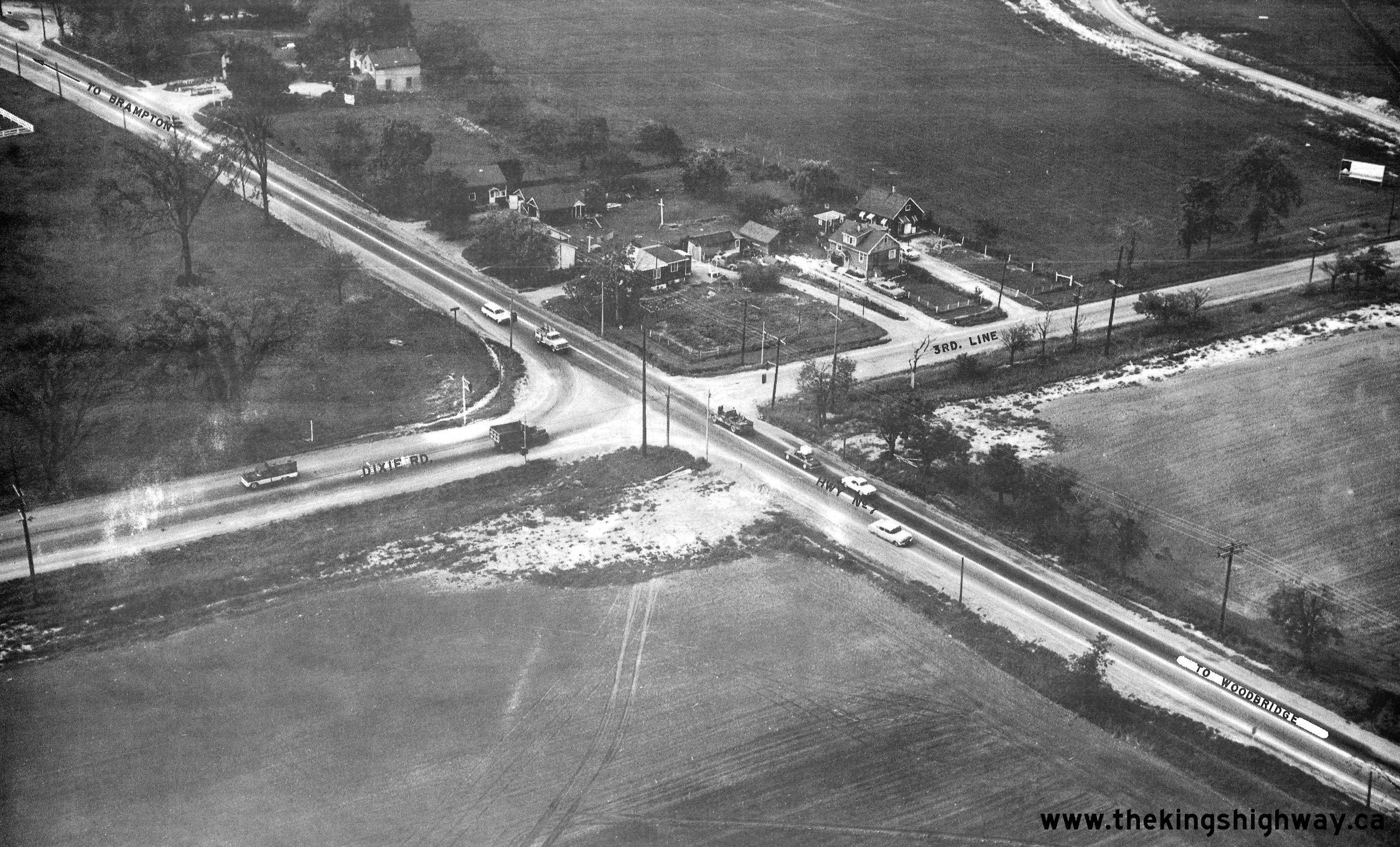
in 1966. (Photo courtesy of Ontario Ministry of Transportation - © King's Printer for Ontario, 2023) Right - Aerial view of the Hwy 7 & Dixie Road Junction between Brampton and Woodbridge in 1966, facing northwest. See an Enlarged Photo Here. Photo taken in 1966. (Photo courtesy of Ontario Ministry of Transportation - © King's Printer for Ontario, 2023) 
Above - Plan of the proposed Kitchener-Waterloo Expressway from 1966, which shows the proposed new highway system (Hwy 7 New, Hwy 8 New and Hwy 85 New) through
the cities along with the proposed interchange locations. The Kitchener-Waterloo Expressway was built between 1965 and 1971 under a three-party agreement between the
DHO and the Cities of Kitchener and Waterloo. Once the vertical alignment of the proposed highway had been established, it was found to be more economical to reverse
some of the grade separations proposed for Guelph Street, Krug Street and East Avenue (today's Weber Street), which were changed from overpasses to underpasses.
However, the proposed overpass at Lexington Road and the proposed underpass at Filsinger Road (today's Westmount Road) were constructed as shown. The
Kitchener-Waterloo Expressway is also known as the Conestoga Parkway. When this partial ring road was first being planned by the two cities, the names Dryden
Boulevard and Henry Sturm Boulevard were also in use. See an Enlarged Photo Here. Plan dated
1966. (Photo courtesy of Ontario Ministry of Transportation - © King's Printer for Ontario, 1966) 

Left - Detour on Hwy 8 (King Street) at the site of the future Kitchener-Waterloo Expressway (Conestoga Parkway), facing south at Dixon Street in 1966. Traffic
on Hwy 8 was temporarily diverted through the Kitchener Interchange in between the Hwy 8 and First Avenue grade separations on the proposed Kitchener-Waterloo
Expressway. See an Enlarged Photo Here. Photo taken in June 1966. (Photo courtesy of Transportation Planning, City of Kitchener) Right - View of the grading work taking place in 1966 for the new four-lane Hwy 8, Contract #1965-311. This view is facing west along Hwy 8 from Third Avenue. The new interchange and overpass at the Kitchener-Waterloo Expressway (Hwy 7 New) can be seen under construction in the background. At the time this photo was taken, all traffic was still using King Street (Old Hwy 8) at right. While the depressed section of Hwy 8 was being constructed at Franklin Street, traffic had to be temporarily staged between Kingsway Drive, King Street and various temporary diversions through the construction site. See an Enlarged Photo Here. Photo taken in June 1966. (Photo courtesy of Transportation Planning, City of Kitchener) 

Left - Kitchener-Waterloo Expressway Overpass construction at Hwy 8 and Hwy 7 (New) in 1966. The bridge piers were only just being poured when this photo was
taken. See an Enlarged Photo Here. Photo taken in June 1966. (Photo courtesy of Transportation Planning, City of Kitchener) Right - Facing west along the new four-lane route of Hwy 8 towards Franklin Street from Third Avenue in Kitchener in 1966. This photo shows the excavation of the future Hwy 8 grade separation at Franklin Street. Through traffic was still using Old Hwy 8 (King Street) at left. See an Enlarged Photo Here. Photo taken in June 1966. (Photo courtesy of Transportation Planning, City of Kitchener) 

Left - Construction of the East Avenue (Weber Street) Underpass on the proposed Kitchener-Waterloo Expressway (Hwy 7 New), facing north near Ross Avenue. See
an Enlarged Photo Here. Photo taken in June 1966. (Photo courtesy of Transportation Planning, City of Kitchener) Right - Facing east along Hwy 8 (King Street) towards the site of the future Kitchener-Waterloo Expressway (Hwy 7 New) from Doon Road. See an Enlarged Photo Here. Photo taken in June 1966. (Photo courtesy of Transportation Planning, City of Kitchener) 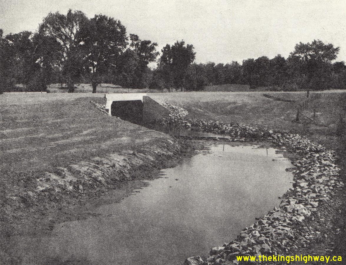
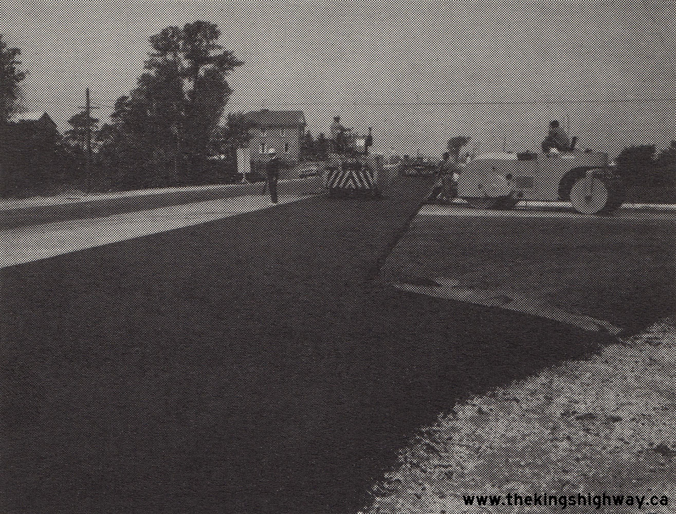 Left - Completed grading and concrete culvert on the Madoc Bypass (Hwy 7 New) in 1966, Contract #1965-114. See an
Enlarged Photo Here. Photo taken in 1966. Left - Completed grading and concrete culvert on the Madoc Bypass (Hwy 7 New) in 1966, Contract #1965-114. See an
Enlarged Photo Here. Photo taken in 1966.(Photo courtesy of Ontario Ministry of Transportation - © King's Printer for Ontario, 1966) Right - Hot-mix paving operations underway on Hwy 7 southwest of Parkhill, Contract #1966-224. See an
Enlarged Photo Here. Photo taken in 1967.(Photo courtesy of Ontario Ministry of Transportation - © King's Printer for Ontario, 1967) 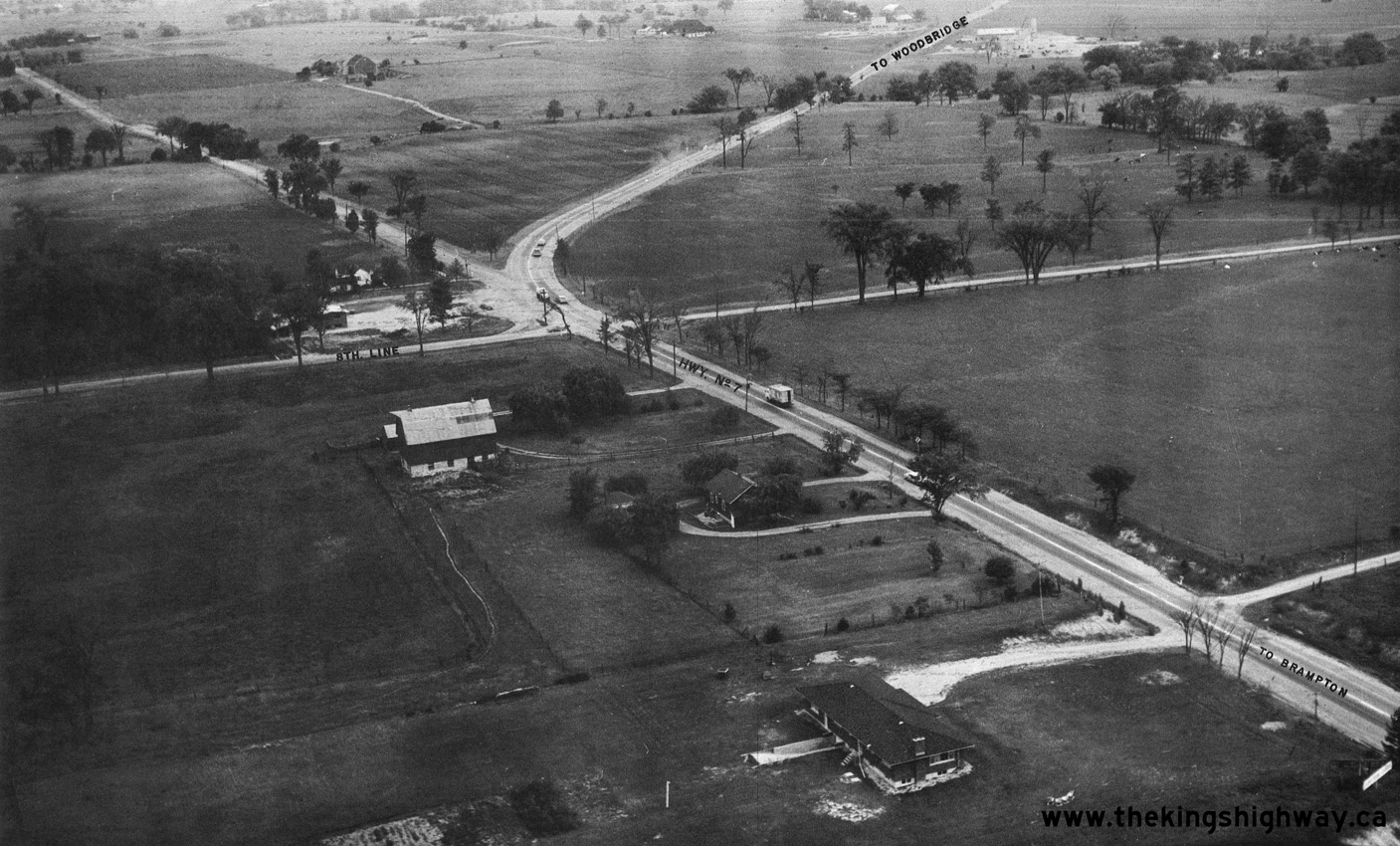

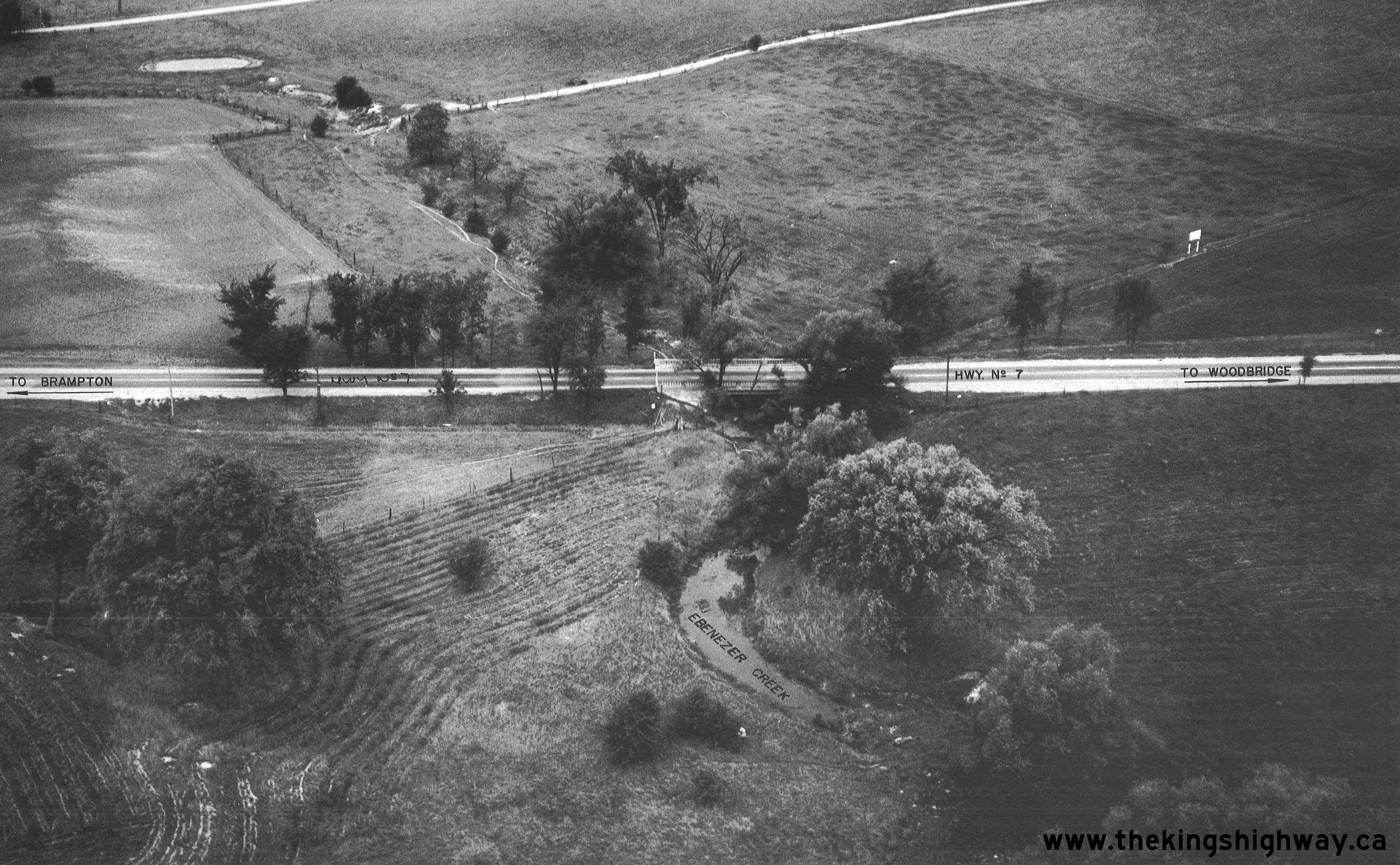
Left - Aerial view of the Ebenezer Diversion on Hwy 7 between Brampton and Woodbridge in 1967, facing east towards the Hwy 50 Junction. Constructed in the
early 1930s, the diversion bypassed the small community of Ebenezer and eliminated two turns in the original route of Hwy 7. However, the highway still had a fairly
sharp curve at 8th Line (today's McVean Drive). During highway improvements carried out in the early 1970s, the curve was realigned and lengthened with a more gradual
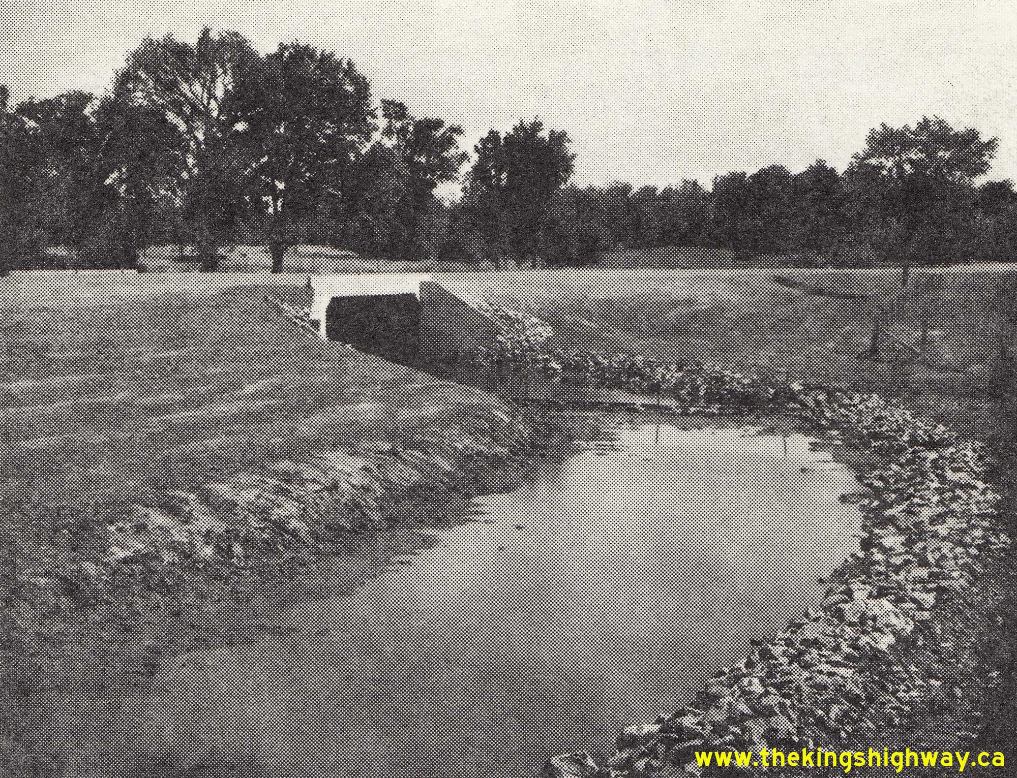
radius. See an Enlarged Photo Here. Photo taken in 1967. (Photo courtesy of Ontario Ministry of Transportation - © King's Printer for Ontario, 2023) Right - Aerial view of the Ebenezer Creek Bridge on Hwy 7, located about 1 mile west of the Hwy 50 Junction. See an Enlarged Photo Here. Photo taken in 1967. (Photo courtesy of Ontario Ministry of Transportation - © King's Printer for Ontario, 2023) 
Above - Aerial view of the Hwy 7 & Hwy 50 Junction at Sunset Corners in 1967, facing southeast towards Toronto. This great photo shows the pre-construction
conditions at this major highway junction between Woodbridge and Brampton. Shortly after this photo was taken, Hwy 7 was expanded to four lanes and the intersection
was rebuilt with right-turn channels on all approaches. Most notable here are the four service stations on each corner. A Fina station occupied the northwest corner,
a British-American (B-A) station occupied the northeast corner, an Esso station occupied the southeast corner and a Texaco station occupied the southwest corner. Out
of these four brands of gasoline retailers, only Esso is still in operation in 2016. All four service stations at the highway junction were demolished to make way for
the widened Hwy 7 in 1971. The only surviving landmarks in this photo are the historic buildings of Sunny Maple Farms in the background, whose barn with the rooftop
sign still remains in place to this day. See an Enlarged Photo Here. Photo taken in 1967. (Photo courtesy of Ontario Ministry of Transportation - © King's Printer for Ontario, 2016) 
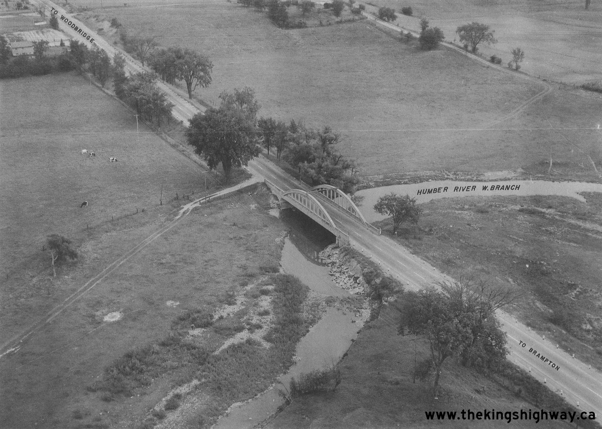
Above - Aerial view of the Humber River West Branch Bridge on Hwy 7 east of Brampton in 1967. This attractive concrete bowstring arch bridge was completed in
1929. Somehow, the bridge managed to escape destruction not only once, but twice. Although it had a vertical clearance of 16 feet, 4 inches (just under 5.0 metres),
it was prone to being struck by over-height vehicles on the highway. During the Summer of 1933, a careless (and probably intoxicated) steam shovel operator
inadvertently left the vehicle's boom extended while it travelled along Hwy 7. As the steam shovel crossed the bridge, the boom struck the top transverse chord which
connected the two outer trusses, causing significant damage to the structure. Since the bridge was only 4 years old at the time of the collision, the damage was
repaired and the structure soon reopened to traffic. Two decades later, the bridge was nearly washed away by the unprecedented, raging floodwaters of Hurricane Hazel
in October 1954. Although the bridge itself somehow survived the storm, the western approach to the bridge was destroyed. Note the rock slabs placed along the
riverbank during the highway's subsequent reconstruction, which were positioned in such a way to combat future erosion. Despite its near destruction on two separate
occasions, the resilient Humber River bowstring arch structure stood until 1971, when it was replaced as part of the expansion of Hwy 7 from two to four lanes between
Brampton and Woodbridge. See an Enlarged Photo Here. Photo taken in 1967. (Photo courtesy of Ontario Ministry of Transportation - © King's Printer for Ontario, 2023) 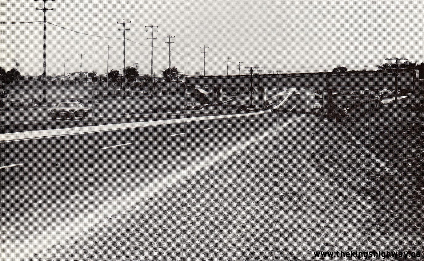

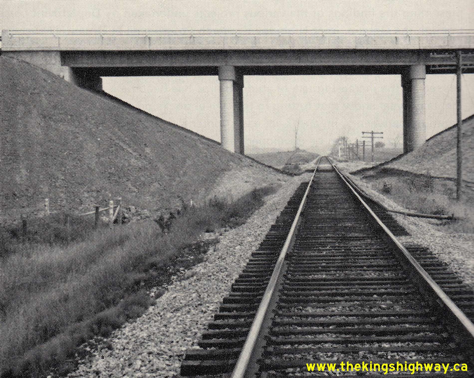
Left - Completed Bells Corners Canadian Pacific Railway (CPR) Subway on Hwy 7 & Hwy 15 (today's Robertson Road) southwest of Ottawa in 1967. Built under
Contract #1965-168, this impressive new railway subway accommodated a four-lane divided highway on a vastly-improved alignment. The previous CPR Subway on Hwy 7 &
Hwy 15 at Bells Corners was on a crooked alignment, as seen in this 1958 Photo. By the early
1960s, the subway's already limited vertical clearance was reduced further to only 13 feet, 3 inches (just over 4.0 metres), due to asphalt pavement overlays. Until
the new four-lane Bells Corners Subway was completed in 1966, the limited vertical clearance of the old subway prevented larger transport trucks from using Hwy 7
& Hwy 15 through this area. See an Enlarged Photo Here. Photo taken in 1967. (Photo courtesy of Ontario Ministry of Transportation - © King's Printer for Ontario, 1967) Right - Hot-mix asphalt resurfacing along Hwy 7 & Hwy 8 at the eastern entrance to Stratford. See an Enlarged Photo Here. Photo taken in 1967. (Photo courtesy of Ontario Ministry of Transportation - © King's Printer for Ontario, 1967) 

Left - Aerial view of the reconstruction of Hwy 8 approaching the Kitchener Interchange at Hwy 7 New, Contract #1965-311. Under this contract, about 1 1/4
miles of Hwy 8 was reconstructed as a freeway from the end of the Freeport Diversion near King Street and Fergus Avenue westerly to the proposed interchange with the
Kitchener-Waterloo Expressway. New interchange ramps at Hwy 8 and Block Line Road (today's Fairway Road) were built under this contract, along with the new structures
at Franklin Street, East Avenue (today's Weber Street), First Avenue (today's Eckert Street) and the grade separation between Hwy 7 New and Hwy 8 at the Kitchener
Interchange. The total cost of this reconstruction work was just over $4 Million in 1965 Dollars, the equivalent of about $38 Million in 2023 Dollars. See an
Enlarged Photo Here. Photo taken in July 1967. (Photo courtesy of Ontario Ministry of Transportation - © King's Printer for Ontario, 1967) Right - Aerial view of the construction of the Kitchener-Waterloo Expressway (Hwy 7 New & Hwy 8 New), facing east from the intersection of Courtland Avenue (Mill Street) and Henry Sturm Boulevard. Courtland Avenue was subsequently extended and constructed on a new alignment through the interchange area, so the route of Courtland Avenue (Mill Street) seen in this photo is actually known as Vanier Drive today. In this photo, the new right-of-way for the Kitchener-Waterloo Expressway has been partially graded east of Courtland Avenue, with the new pedestrian overpass between Dixon Street and Boniface Avenue seen under construction in the centre of the photo. In the far background, the three underpass structures approaching the Kitchener Interchange (First Avenue, Hwy 8 and East Avenue) were nearing completion, except for final paving. See an Enlarged Photo Here. Photo taken in July 1967. (Photo courtesy of Ontario Ministry of Transportation - © King's Printer for Ontario, 1967) 

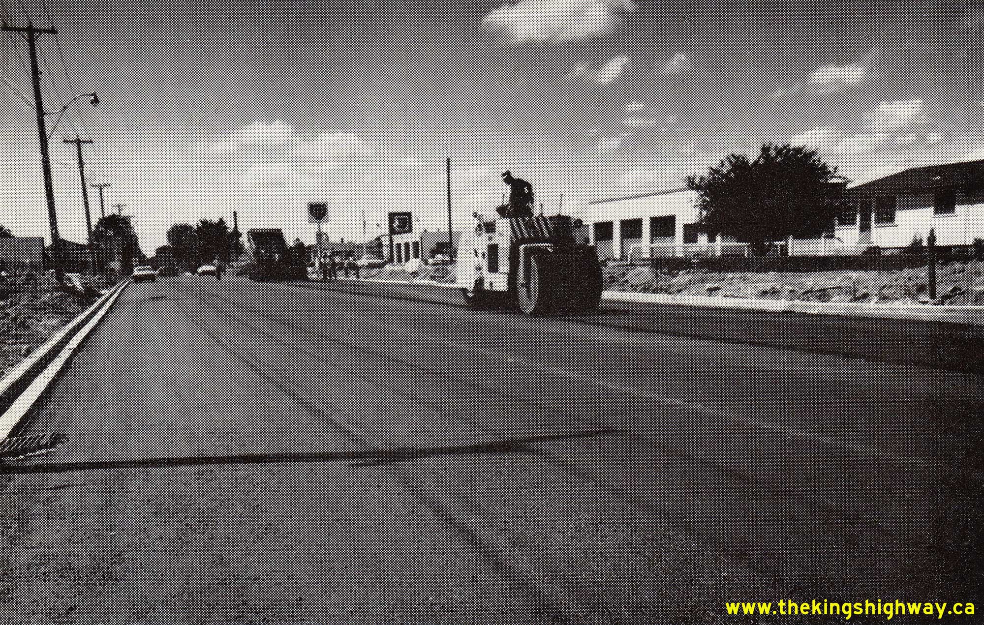
Left - Aerial view of the Kitchener Interchange under construction at the junction of Hwy 7 New & Hwy 8 New. In this photo, King Street (Old Hwy 8) can be
seen coming in from Downtown Kitchener at right, while the Hwy 8 connection to Hwy 401 can be seen approaching from the upper left. The Kitchener-Waterloo Expressway
crosses over at this point, where Hwy 7 & Hwy 8 connect and continue west on a concurrent overlapped route towards Stratford at upper right. See an
Enlarged Photo Here. Photo taken in July 1967. (Photo courtesy of Ontario Ministry of Transportation - © King's Printer for Ontario, 1967) Right - Aerial view of the construction of the Kitchener-Waterloo Expressway (Hwy 7 New), facing west towards the Kitchener Interchange (Hwy 8 Junction) from Montgomery Road. In this photo, advance clearing and grubbing for the new highway can be seen taking place between Montgomery Road and the underpass at East Avenue (today's Weber Street) under Contract #1967-42. Kitchener-Waterloo is one of Ontario's greatest economic success stories, with the cities' population more than tripling since this photo was taken in 1967, from about 120,000 residents to almost 380,000 residents as of the 2021 Census. While there are undoubtedly several reasons for this, the cities' prudent, timely and forward-thinking investments in highway transportation in partnership with the DHO have certainly played a major role in that economic success story. All told, the Kitchener-Waterloo Expressway project cost approximately $225 Million to construct, when adjusted to 2023 Dollars. See an Enlarged Photo Here. Photo taken in July 1967. (Photo courtesy of Ontario Ministry of Transportation - © King's Printer for Ontario, 1967) 

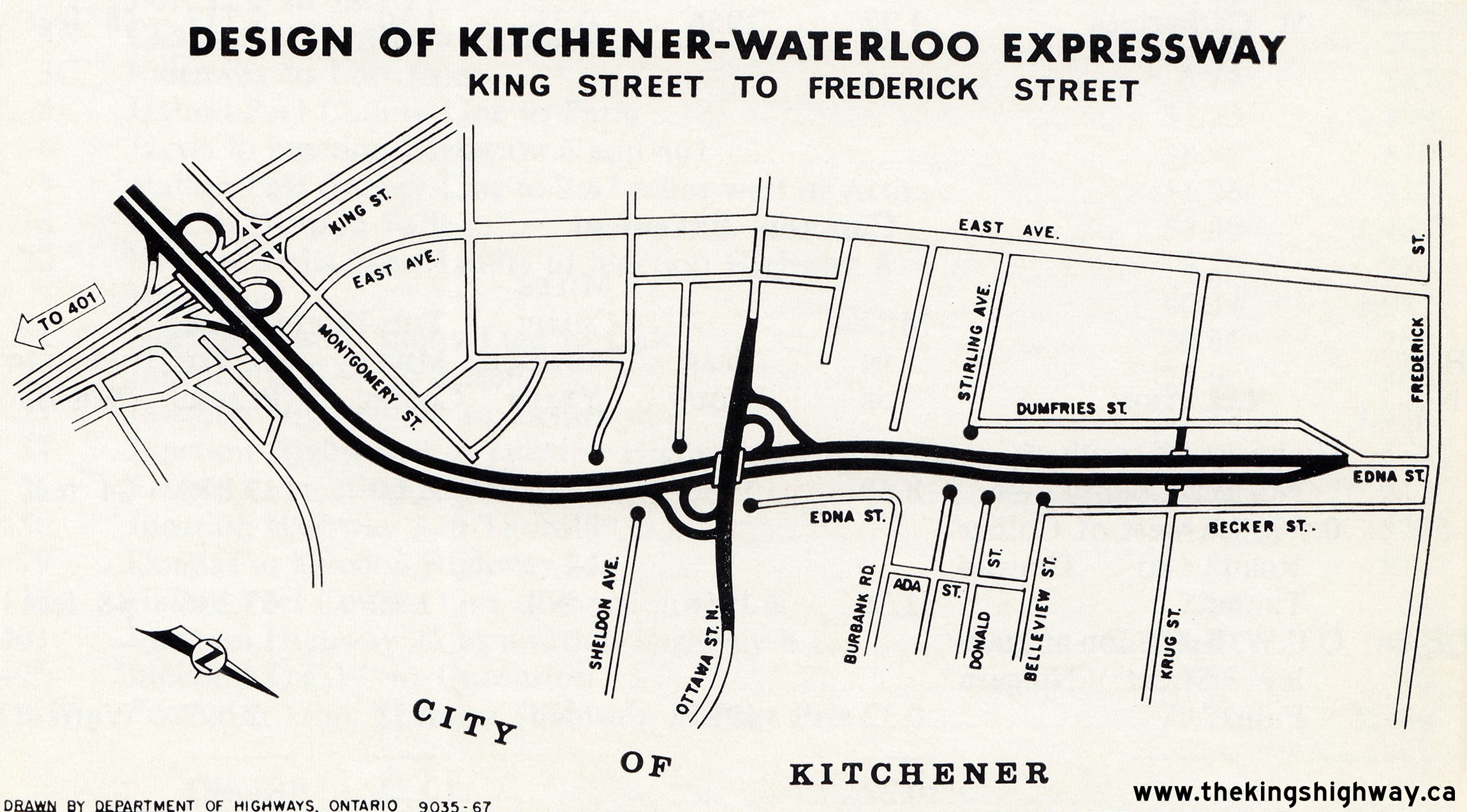
Left - Plan of the Kitchener-Waterloo Expressway (Hwy 7 New & Hwy 8 New) from 1967, which shows the western approach to the Kitchener Interchange where
Hwy 7 and Hwy 8 part ways. Two new interchanges were built as part of this construction work - one at Courtland Avenue and one at Homer Watson Boulevard. A temporary western
tie-in existed at Ottawa Street where the proposed freeway ended, until the next phase of the project extended the freeway westerly to Fischer Road (today's
Fischer-Hallman Road). See an Enlarged Photo Here. Plan dated 1967. (Photo courtesy of Ontario Ministry of Transportation - © King's Printer for Ontario, 1967) Right - Plan of the Kitchener-Waterloo Expressway (Hwy 7 New) from 1967, which shows the eastern approach to the Kitchener Interchange where it connects with Hwy 8. As part of this construction work, a new interchange was built at Ottawa Street. Note the interesting temporary northern tie-in with Edna Street as the proposed freeway connects to Frederick Street. See an Enlarged Photo Here. Plan dated 1967. (Photo courtesy of Ontario Ministry of Transportation - © King's Printer for Ontario, 1967) 
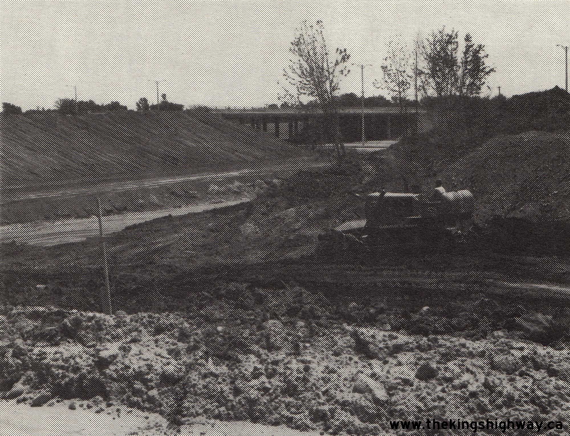
 Left - Hot-mix paving operations underway on Hwy 7 & Hwy 19 southwest of Stratford, Contract #1966-223. See an
Enlarged Photo Here. Photo taken in 1967. Left - Hot-mix paving operations underway on Hwy 7 & Hwy 19 southwest of Stratford, Contract #1966-223. See an
Enlarged Photo Here. Photo taken in 1967.(Photo courtesy of Ontario Ministry of Transportation - © King's Printer for Ontario, 1967) Right - Grading work underway on the Kitchener-Waterloo Expressway (Hwy 7 New) near Montgomery Road, Contract #1967-42. See an
Enlarged Photo Here. Photo taken in 1967.(Photo courtesy of Ontario Ministry of Transportation - © King's Printer for Ontario, 1967) 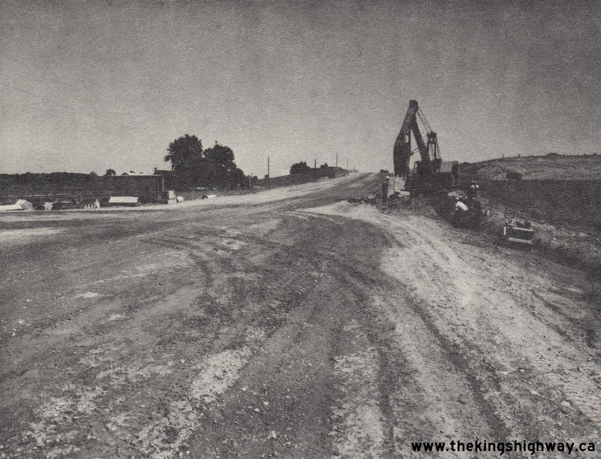
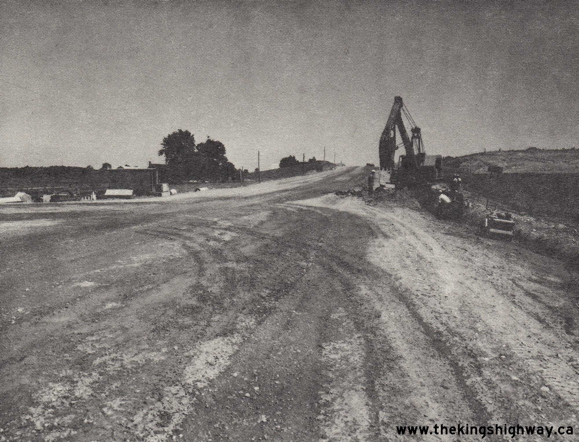
 Left - Reconstruction of Hwy 7 east of Elginfield, Contract #1968-12. See an
Enlarged Photo Here. Photo taken in 1968. Left - Reconstruction of Hwy 7 east of Elginfield, Contract #1968-12. See an
Enlarged Photo Here. Photo taken in 1968.(Photo courtesy of Ontario Ministry of Transportation - © King's Printer for Ontario, 1968) Right - New St. Mary's Bypass (Hwy 7 & Hwy 19) nearing completion, facing west towards the Wildwood Dam, Contract #1967-113. See an
Enlarged Photo Here. Photo taken in 1968.(Photo courtesy of Ontario Ministry of Transportation - © King's Printer for Ontario, 1968) 
 Left - Wildwood Dam on the new St. Mary's Bypass (Hwy 7 & Hwy 19), Contract #1967-113. See an
Enlarged Photo Here. Photo taken in 1968. Left - Wildwood Dam on the new St. Mary's Bypass (Hwy 7 & Hwy 19), Contract #1967-113. See an
Enlarged Photo Here. Photo taken in 1968.(Photo courtesy of Ontario Ministry of Transportation - © King's Printer for Ontario, 1968) Right - Completed St. Mary's Canadian National Railway Overhead on Hwy 7, Contract #1967-113. See an
Enlarged Photo Here. Photo taken in 1969.(Photo courtesy of Ontario Ministry of Transportation - © King's Printer for Ontario, 1969) 

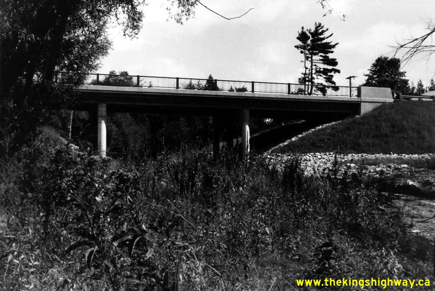
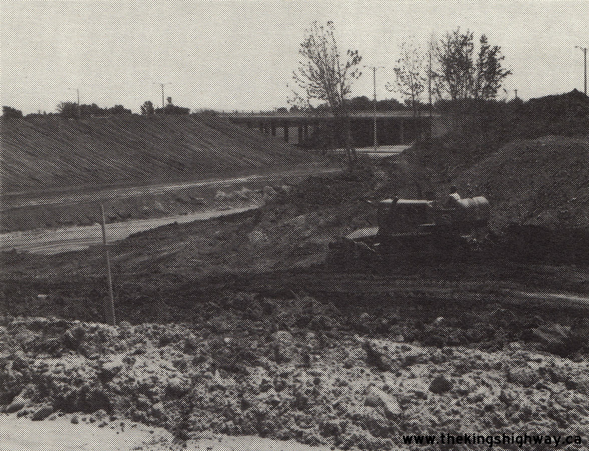
Left - New West Duffins Creek Bridge on Hwy 7 between Markham and Greenwood, facing east towards Brooklin. See an
Enlarged Photo Here. Photo taken in April 1969. (Photo courtesy of Ontario Ministry of Transportation - © King's Printer for Ontario, 2014) Right - New West Duffins Creek Bridge on Hwy 7 east of Markham, Contract #1967-135. See an Enlarged Photo Here. Photo taken in April 1969. (Photo courtesy of Ontario Ministry of Transportation - © King's Printer for Ontario, 2014) 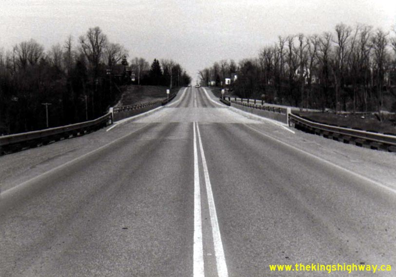
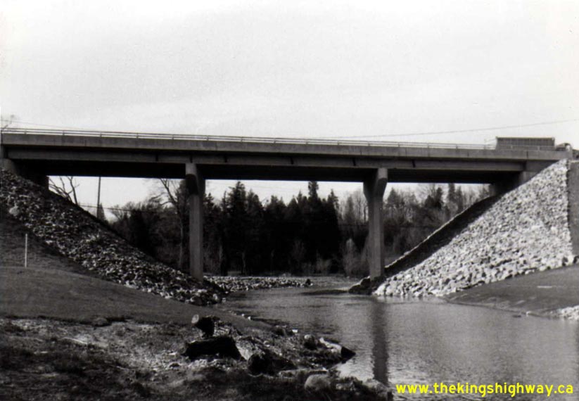
Left - Facing east across the new Little Rouge Creek Bridge on Hwy 7 at Locust Hill east of Markham. See an
Enlarged Photo Here. Photo taken in April 1969. (Photo courtesy of Ontario Ministry of Transportation - © King's Printer for Ontario, 2014) Right - New Little Rouge Creek Bridge on Hwy 7 east of Markham, Contract #1967-100. See an Enlarged Photo Here. Photo taken in April 1969. (Photo courtesy of Ontario Ministry of Transportation - © King's Printer for Ontario, 2014) 
Above - Moodie Drive Interchange under construction on Hwy 7 & Hwy 17 New (now Hwy 417) west of Ottawa, Contract #1969-16. See an
Enlarged Photo Here. Photo taken in 1969. (Photo courtesy of Ontario Ministry of Transportation - © King's Printer for Ontario, 1969)
Continue on to King's Highway 7 Photos: Historical Photos: 1970 to 1979
|
|---|
Links to Adjacent King's Highway Photograph Pages:
Back to Hwy 7 - Historical Photos (1920-1949)
Hwy 7 Photo Index
On to Hwy 7 - Historical Photos (1970-1979)
Back to King's Highway 6 Photos /
King's Highway 7 History /
On to King's Highway 8 Photos
Ontario Highway History - Main Menu / Back to List of Highways Website contents, photos & text © 2002-2026, Cameron
Bevers (Webmaster) - All Rights Reserved / Contact Me
|
|---|