
| 
| |
|
|
This page contains present day photos (Year 2000 to date) of Ontario's Queen Elizabeth Way, arranged by location from Toronto
westerly to Etobicoke Creek. All photographs displayed on this page were taken by the Webmaster (Cameron Bevers), unless specifically noted otherwise. Click on any
thumbnail to see a larger image!
Please note that all photographs displayed on this
website are protected by copyright. These photographs must not be reproduced, published,
electronically stored or copied, distributed, or posted onto other websites without
my written permission. If you want to use photos from this website, please
email me first for permission. Thank-you!
|
|---|
|
Page 12: Present Day Queen Elizabeth Way Photographs (Toronto to Etobicoke Creek)


Left - Present day view of the Queen Elizabeth Way Monument in Toronto. The Monument was moved in 1974 from its former location in the highway median near Park
Lawn Road to a park beside the mouth of the Humber River. (Photograph taken on June 1, 2003 - © Cameron Bevers) Right - Side view of the relocated Queen Elizabeth Way Monument in Toronto. The Monument was completed in 1940, and was moved in 1974 to a park beside Lakeshore Boulevard on the Toronto Waterfront. (Photograph taken on June 1, 2003 - © Cameron Bevers) 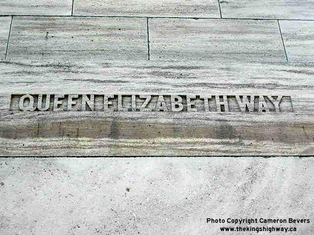

Left - Embossed inscription in the concrete of the Queen Elizabeth Way Monument - "QUEEN ELIZABETH WAY" (Photograph taken on June 1, 2003 - © Cameron Bevers) Right - Close-up of the Wartime inscription on the base of the Queen Elizabeth Way Monument (Photograph taken on June 1, 2003 - © Cameron Bevers) 

Left - Ontario government plaque marking the 50th anniversary of the Queen Elizabeth Way in 1989. Historians will be quick to point out this plaque is
technically incorrect. The "Middle Road" superhighway which later became the Queen Elizabeth Way was actually completed and opened to traffic in 1937. (Photograph taken on June 1, 2003 - © Cameron Bevers) Right - Toronto Historical Board's commemorative plaque on the Queen Elizabeth Way Monument (Photograph taken on June 1, 2003 - © Cameron Bevers) 

Left - The dual busts of King George VI & Queen Elizabeth, along with the regal lion in the foreground, once looked over the entrance to Ontario's grandest
highway. Thankfully, this beautiful Monument was saved from destruction in the 1970s when historians and the public alike pressured the Ontario Government to move the
monument to a new location, rather than demolish it. (Photograph taken on June 1, 2003 - © Cameron Bevers) Right - Sherway Drive in Mississauga used to be a portion of the original Middle Road, prior to its conversion to a superhighway in the 1930s. Beyond the end of Sherway Drive, right in the middle of suburban Mississauga, lies one of Ontario's most attractive bridges. (Photograph taken on June 1, 2003 - © Cameron Bevers) 

Left - The one-lane Middle Road Bridge was the first concrete "bowstring" truss ever built in Ontario. This tiny bridge was still being used by traffic when
the Middle Road was assumed as a provincial highway in 1931. The following year, a new bridge over Etobicoke Creek was built. (Photograph taken on June 1, 2003 - © Cameron Bevers) Right - Historical plaque on the original Middle Road Bridge. Structure completed in 1909. (Photograph taken on June 1, 2003 - © Cameron Bevers) 

Left - Looking west across the Middle Road Bridge. The bridge is now used by pedestrians only. (Photograph taken on June 1, 2003 - © Cameron Bevers) Right - This old alignment of the Middle Road behind Sherway Gardens is still quite visible. (Photograph taken on June 1, 2003 - © Cameron Bevers) 

Left - Side view of the original Middle Road Bridge in Mississauga (Photograph taken on June 1, 2003 - © Cameron Bevers) Right - A new bridge was built in 1932 to carry an improved alignment of the Middle Road over Etobicoke Creek. This bridge still exists as part of a complex structure underneath the busy Queen Elizabeth Way. (Photograph taken on June 1, 2003 - © Cameron Bevers) 

Left - Side view of the Etobicoke Creek Bridge on the QEW. This bridge was built in stages over a number of years, dating back to 1932. The first bridge built
here was the concrete arch bridge. (Photograph taken on June 1, 2003 - © Cameron Bevers) Right - View underneath the concrete arch portion of the Etobicoke Creek Bridge. The bridge was widened over the years, to carry additional traffic lanes. The original Middle Road structure was built in 1932 to carry a four-lane undivided highway. The structure was widened in 1953 to accommodate two additional traffic lanes along with a centre highway median. The six-lane Queen Elizabeth Way structure over Etobicoke Creek was widened again in 1967. (Photograph taken on June 1, 2003 - © Cameron Bevers) 


Left - Old meets new: the original 1930s arch span sits right next to a newer concrete beam structure built in the 1960s to carry the new exit ramps for Evans
Avenue and Hwy 427 in Etobicoke. The Etobicoke Creek Bridge is the oldest highway structure on the Queen Elizabeth Way. (Photograph taken on June 1, 2003 - © Cameron Bevers) Centre - Another view of the Evans Avenue and Hwy 427 ramp bridge and the original 1930s structure. It is very unfortunate that this attractive and historic open spandrel concrete arch bridge is flanked on both sides by ugly concrete beam spans. These newer spans make it almost impossible to appreciate the intricate nature of the Etobicoke Creek Bridge unless the concrete arch superstructure is viewed from below. (Photograph taken on June 1, 2003 - © Cameron Bevers) Right - The Etobicoke Creek Bridge on the QEW actually consists of several concrete arches. This transverse arch was added to the bridge during an early highway widening project in 1953. (Photograph taken on June 1, 2003 - © Cameron Bevers) 
Above - Southern side of Etobicoke Creek Bridge on Queen Elizabeth Way between Toronto and Port Credit (Photograph taken on June 1, 2003 - © Cameron Bevers)
Continue on to Queen Elizabeth Way Photos: Etobicoke Creek to Hwy 403
|
|---|
Links to Adjacent King's Highway Photograph Pages:
Back to King's Highway 427 Photos /
Queen Elizabeth Way History /
On to Secondary Highway 500 Photos
Ontario Highway History - Main Menu / Back to List of Highways Website contents, photos & text © 2002-2026, Cameron
Bevers (Webmaster) - All Rights Reserved / Contact Me
|
|---|