Hwy 15A Sign Graphic Hwy 15A Alt Ottawa Title Graphic Hwy 15A Sign Graphic   

Ontario Highway 15A (Alt) Quick Facts:
  • Years in Existence: 1956-1960
  • Current Status: Decommissioned in 1960
  • Current Names: Richmond Road & Wellington Street
  • Location: Eastern Ontario
  • Counties Served: Carleton
  • Towns Served: Ottawa
  • Western Terminus: Hwy 15 & Hwy 17 - Ottawa
  • Eastern Terminus: Hwy 31 - Ottawa
  • Length in 1960: 10.2 km / 6.3 miles
HWY 15A ALT ROUTE MARKER - © Josh Anderchek
King's Highway 15A (Alt.) Sign
© Josh Anderchek

History of King's Highway 15A (Alt) Ottawa:

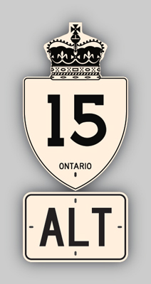
King's Highway 15A (Alt) was created in 1956, when a section of Highway 15 from the intersection of Richmond Road and Carling Avenue near Britannia Heights into Downtown Ottawa was renumbered as Highway 15A (Alt). Prior to 1956, the route of Highway 15 branched into two separate highways at Britannia Heights. The first route of Highway 15 followed Richmond Road and Wellington Street from Britannia Heights into Downtown Ottawa. This section of Highway 15 was renumbered as Highway 15A (Alt). The second route of Highway 15 via Carling Avenue retained its original Highway 15 designation. Highway 15A (Alt) ended at the junction with Highway 31 at the intersection of Wellington Street and Bank Street in Downtown Ottawa. The route of Highway 15A (Alt) was decommissioned in 1960, along with a number of other "scenic" routes that had been established in the Ottawa area during the 1940s and 1950s.


HYPERLINK TO HWY 15A ALT OTTAWA MAP PAGE - © Cameron Bevers


Links to Adjacent King's Highway Pages:


HYPERLINK TO HWY 15 PAGE - © Cameron Bevers             HYPERLINK TO MAIN MENU PAGE - © Cameron Bevers             HYPERLINK TO HWY 15A ALT ASHTON-STITTSVILLE PAGE - © Cameron Bevers


Website contents, photos & text © 2002-2023, Cameron Bevers (Webmaster) - All Rights Reserved  /  Contact Me


Valid HTML 4.01!   Valid CSS!