
| 
| |
|
|
This page contains historical and present day photos of Ontario's King's Highway 127. All photographs displayed on this page
were taken by the Webmaster (Cameron Bevers), unless specifically noted otherwise. Historical photographs are arranged in approximate chronological order, while
present day photographs (Year 2000 to date) are arranged by location from south to north. Click on any thumbnail to see a larger image!
Please note that all photographs displayed on this
website are protected by copyright. These photographs must not be reproduced, published,
electronically stored or copied, distributed, or posted onto other websites without
my written permission. If you want to use photos from this website, please
email me first for permission. Thank-you!
|
|---|
|
Present Day King's Highway 127 Photographs


Left - Approaching Maynooth on Hwy 62, facing north towards the Hwy 127 Junction. See an
Enlarged Photo Here. (Photograph taken on June 30, 2012 - © Cameron Bevers) Right - An older green guide sign marking the Hwy 127 Junction on northbound Hwy 62 in Maynooth. At some point, the left-turn arrows on this sign were covered over with straight through arrows, presumably to prevent confusion with the adjacent Peterson Road intersection. Peterson Road turns left from Hwy 62 immediately south of the signpost location. If the straight through arrows were not in place, some motorists might mistakenly turn down Peterson Road while seeking Hwy 127. See an Enlarged Photo Here. (Photograph taken on June 30, 2012 - © Cameron Bevers) 

Left - An older green guide sign marking the turn-off to Hwy 127 from Hwy 62 in Maynooth. Algonquin Provincial Park is marked on the guide sign as a
destination along Hwy 127. Although this is a very logical "control city" to use for northbound Hwy 127, it is very unusual to see a location other than a community,
international bridge or out-of-province destination identified on an MTO destination guide sign. Typically, provincial parks are signed using blue-and-white
Tourism-Oriented Destination Signs (TODS) or a separate provincial park route marker. See an
Enlarged Photo Here. (Photograph taken on June 30, 2012 - © Cameron Bevers) Right - Approaching the Hwy 127 Junction on Hwy 62, facing north. In 1951, the Maynooth Diversion was completed which eliminated a turn in the route of Hwy 62 at the hamlet's main intersection. Ever since, Hwy 62 has been the through route at this highway junction. See an Enlarged Photo Here. (Photograph taken on June 30, 2012 - © Cameron Bevers) 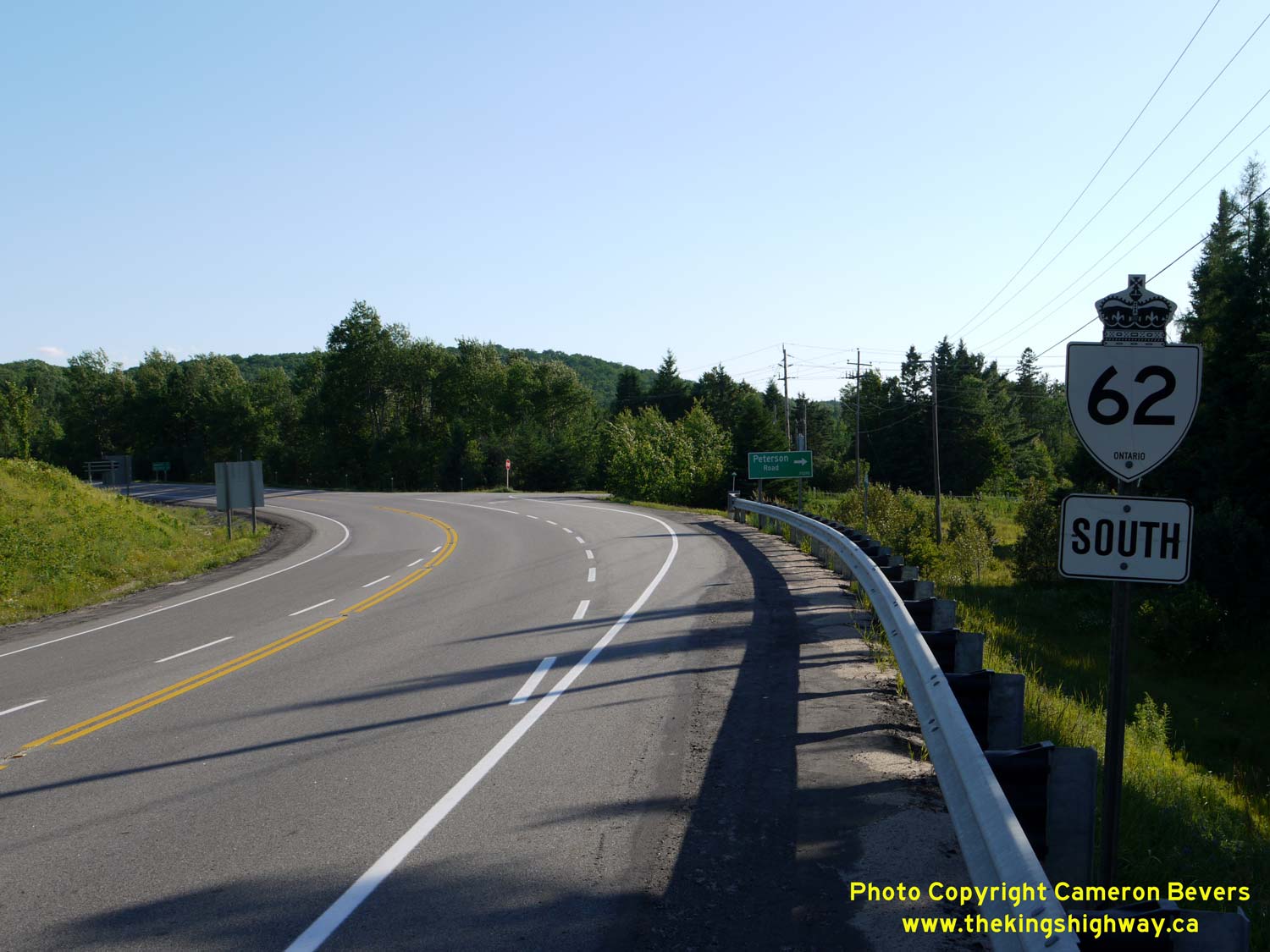

Left - Facing south along Hwy 62 towards Bancroft from the Hwy 127 Junction in Maynooth. See an
Enlarged Photo Here. (Photograph taken on June 30, 2012 - © Cameron Bevers) Right - Junction sign assembly at the Hwy 62 & Hwy 127 Junction in Maynooth. At this junction, provincial ownership of Hwy 62 comes to an end. From this point northerly to Barry's Bay, Hwy 62 is a municipal road. The entire north section of Hwy 62 was transferred to municipalities during the mass highway downloading spree of 1997-1998. See an Enlarged Photo Here. (Photograph taken on June 30, 2012 - © Cameron Bevers) 

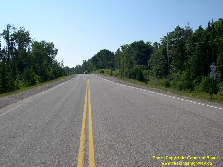
Left - Facing north along Hwy 127 towards Whitney from the Hwy 62 Junction in Maynooth. In 1955, Hwy 127 was established as a new King's Highway along the
eastern side of Algonquin Provincial Park. The new highway connected Hwy 62 in Maynooth to Hwy 60 in Whitney. Although Hwy 127 encroaches close to the Algonquin
Provincial Park boundary in some areas, the highway does not actually pass through the park. See an
Enlarged Photo Here. (Photograph taken on June 30, 2012 - © Cameron Bevers) Right - King's Highway route markers at the Hwy 62 & Hwy 127 Junction in Maynooth. See an Enlarged Photo Here. (Photograph taken on June 30, 2012 - © Cameron Bevers) 

Left - Facing south along Hwy 62 towards the Hwy 127 Junction in Maynooth. When Hwy 62 was first assumed as a King's Highway in 1937, the highway's route
turned left at the main intersection onto Old Hastings Road. The route was revised in 1951, so that Hwy 62 continued straight ahead along the Maynooth Diversion. The
highway then followed a long curve to the left where it joined back up to the Hastings Road on its route south towards Bancroft. See an
Enlarged Photo Here. (Photograph taken on June 30, 2012 - © Cameron Bevers) Right - View of Old Hwy 62 (Old Hastings Road) approaching the Hwy 62 & Hwy 127 Junction in Maynooth. As originally established in 1937, Hwy 62 turned right at this intersection on its route north towards Barry's Bay. However, the turn proved to be problematic for large trucks. The Maynooth Diversion bypassed this section of Hwy 62, allowing through traffic to negotiate the junction more easily. Ownership of the former Hwy 62 alignment through Maynooth was transferred from the DHO to the Townships of Monteagle and Herschel in 1953. See an Enlarged Photo Here. (Photograph taken on June 30, 2012 - © Cameron Bevers) 
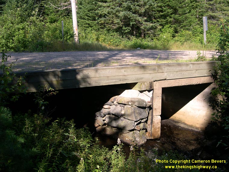
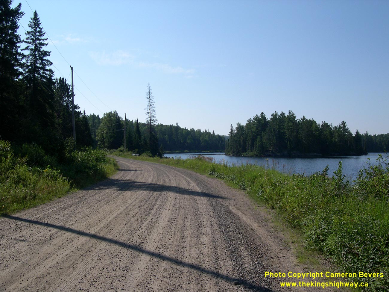
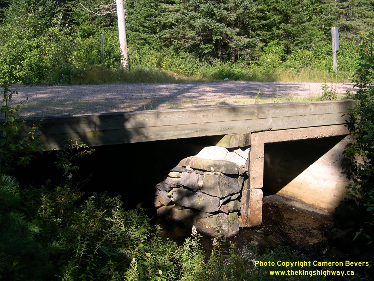
Left - Former alignment of Hwy 127 south of Whitney. This section of Hwy 127 was bypassed by a new, improved highway alignment in the early 1960s. See
an Enlarged Photo here. (Photograph taken on August 5, 2008 - © Cameron Bevers) Right - Old stone and concrete culvert below the former Hwy 127 alignment near Whitney. See an Enlarged Photo here. (Photograph taken on August 5, 2008 - © Cameron Bevers) 
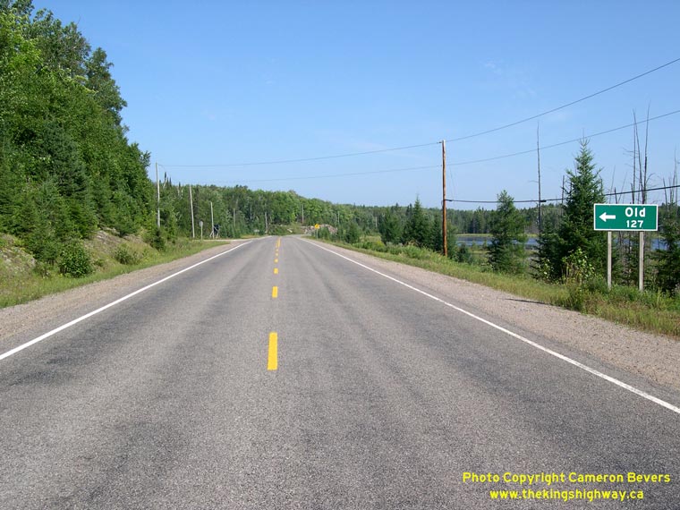
Left - Facing north along the former alignment of Hwy 127 near Whitney. Old Hwy 127 can be seen joining Hwy 60 in the background of this photo. See
an Enlarged Photo here. (Photograph taken on August 5, 2008 - © Cameron Bevers) Right - The current Hwy 127 alignment near Whitney was designed to carry much heavier and faster traffic than its predecessor. See an Enlarged Photo here. (Photograph taken on August 5, 2008 - © Cameron Bevers) 
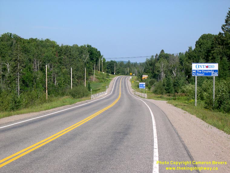
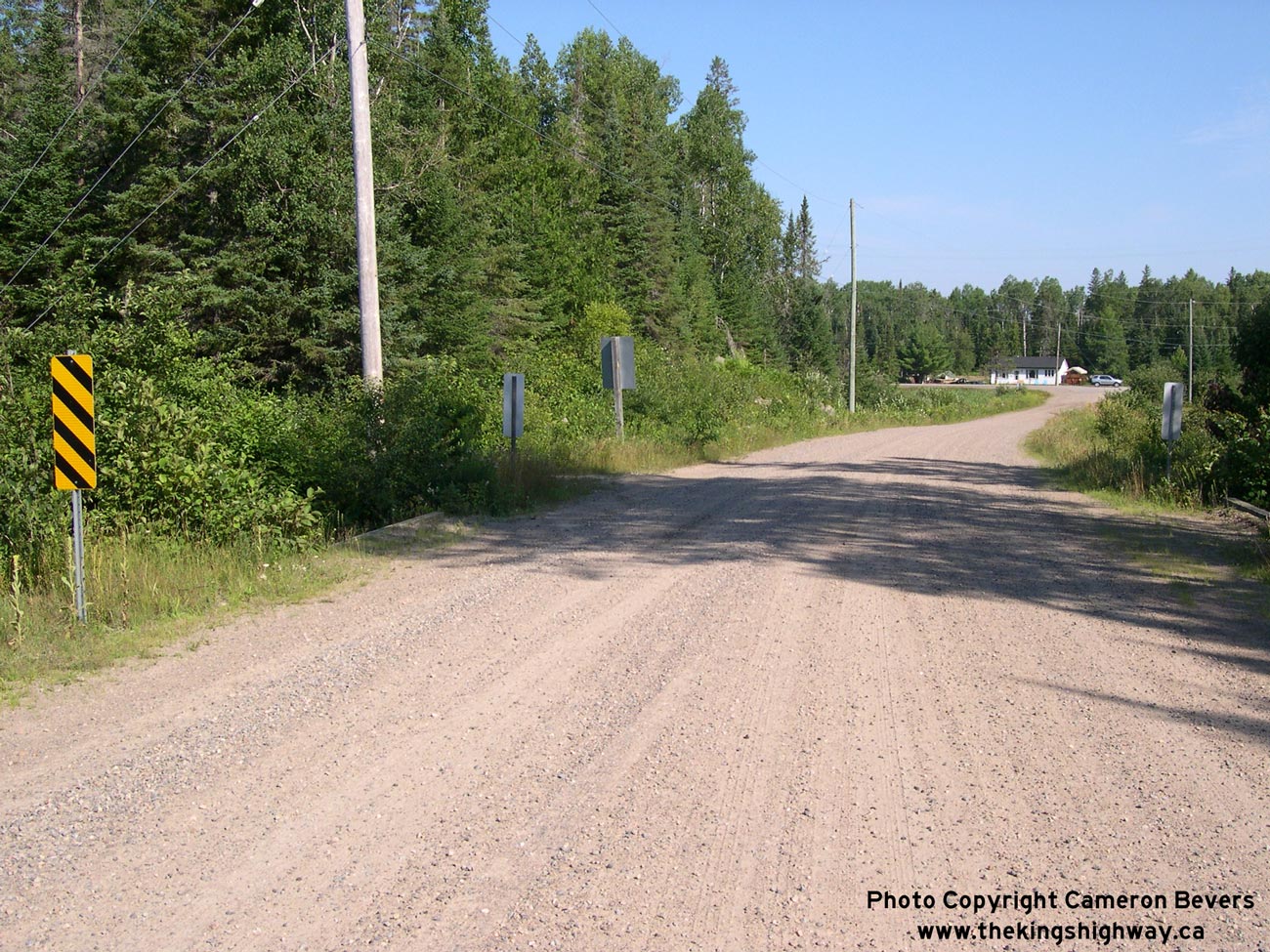
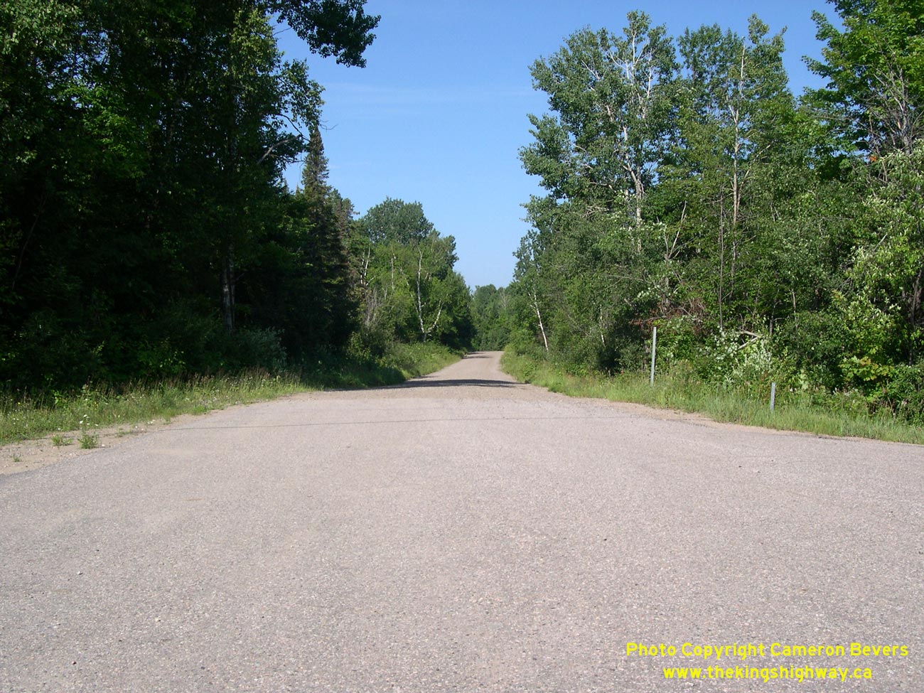
Left - The former alignment of Hwy 127 emerges from the woods south of Whitney. This old, winding section of Hwy 127 provides transportation enthusiasts with a
first-hand look at a 1950s-era Central Ontario King's Highway. Little has changed on Old Hwy 127 since it was bypassed in the 1960s. See
an Enlarged Photo here. (Photograph taken on August 5, 2008 - © Cameron Bevers) Right - Even today, a sign marks the entrance to the former Hwy 127 alignment. The new highway continues north towards the Hwy 60 Junction east of Whitney. See an Enlarged Photo here. (Photograph taken on August 5, 2008 - © Cameron Bevers) 

Left - Facing west along Hwy 60 towards Whitney from the Hwy 127 Junction. These two highways meet at a rural highway junction located about 3 km east of
Whitney. See an Enlarged Photo here. (Photograph taken on August 5, 2008 - © Cameron Bevers) Right - Junction assembly and fingerboard guide signs at the northern terminus of Hwy 127 at the Hwy 60 Junction. See an Enlarged Photo here. (Photograph taken on August 5, 2008 - © Cameron Bevers) 

Left - Distance guide sign on westbound Hwy 60 at the Hwy 127 Junction. Apart from Whitney, there are no other communities between this point and the Eastern
Gate to Algonquin Park. The next major centre along Hwy 60 is Huntsville, although the two small communities of Oxtongue Lake and Dwight exist beyond Algonquin Park's
West Gate. See an Enlarged Photo here. (Photograph taken on August 5, 2008 - © Cameron Bevers) Right - Facing east along Hwy 60 towards Madawaska from the Hwy 127 Junction. Madawaska is another small community on Hwy 60 which lies about 19 km to the east of the Hwy 127 Junction. Generally speaking, the area to the east of Algonquin Provincial Park is a rather sparsely populated region of Ontario. See an Enlarged Photo here. (Photograph taken on August 5, 2008 - © Cameron Bevers) 

Left - Northern terminus of Hwy 127 at the Hwy 60 Junction east of Whitney. See an
Enlarged Photo here. (Photograph taken on August 5, 2008 - © Cameron Bevers) Right - Facing west along Hwy 60 at the Hwy 127 Junction. Note the overhead flashing beacon to alert motorists of the junction. There are very few major intersections along Hwy 60 between Huntsville and Barry's Bay, so this junction might not be expected by motorists, given the nature of the overall highway corridor. See an Enlarged Photo here. (Photograph taken on August 5, 2008 - © Cameron Bevers) 
Left - Destination guide sign on westbound Hwy 60 approaching the Hwy 127 Junction. Although Hwy 127 does not actually go to Bancroft, the route does connect
to Hwy 62 which leads south to Bancroft, and eventually, Belleville. See an Enlarged Photo here. (Photograph taken on August 5, 2008 - © Cameron Bevers) Right - Facing south along Hwy 127 from the highway's northern terminus at the Hwy 60 Junction near Whitney. From here, Hwy 127 continues south for almost 40 km to Maynooth, where it connects to Hwy 62 South to Bancroft. This is the first north-south highway link east of Algonquin Provincial Park. See an Enlarged Photo here. (Photograph taken on August 5, 2008 - © Cameron Bevers) 

Left - Hwy 60 at the Hwy 127 Junction, facing east towards Madawaska. When Hwy 127 was first established as a new King's Highway along the eastern side of
Algonquin Park in 1955, it met Hwy 60 at Poverty Lake just outside of Whitney. As a result of a highway improvement project in the early 1960s, the northernmost
section of Hwy 127 was relocated further to the east, which bypassed the original 1955 highway terminus at Poverty Lake. Since 1962, Hwy 127 and Hwy 60 have met at
this relocated junction. See an Enlarged Photo here. (Photograph taken on August 5, 2008 - © Cameron Bevers) Right - Approaching the Hwy 127 Junction on Hwy 60, facing west towards Whitney. See an Enlarged Photo here. (Photograph taken on August 5, 2008 - © Cameron Bevers)
More King's Highway 127 Photographs Coming Soon!
|
|---|
Links to Adjacent King's Highway Photograph Pages:
Back to King's Highway 126 Photos /
King's Highway 127 History /
On to King's Highway 128 Photos
Ontario Highway History - Main Menu / Back to List of Highways Website contents, photos & text © 2002-2024, Cameron
Bevers (Webmaster) - All Rights Reserved / Contact Me |
|---|