| 
| |
|
|
History of King's Highway 108 (#2):
King's Highway 108 is a major collector highway which links Elliot Lake to Highway 17. Apart from Elliot Lake itself, the highway passes through no communities along
its 42 km route. The highway was originally built as a mine access road after uranium was discovered in the Elliot Lake area. The mine access road was briefly known
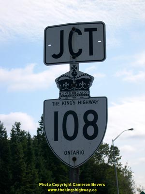
as Secondary Highway 612, but it was re-designated as King's Highway 108 in late 1957. The entire length of Highway 108 was paved in 1957. The highway continues north
from Elliot Lake towards Quirke Lake. Highway 108 eventually turns into Secondary Highway 639, whose route continues north to connect with Secondary Highway 546.
Today, Highway 108 carries very little traffic north of Elliot Lake because most of the uranium mines are now closed. The route of Highway 108 has remained more or
less unchanged since 1957. However, in the late 1990s, a 5.8 km section of Highway 108 through the urbanized area of Elliot Lake was transferred to the municipality.
The section of Highway 108 from Esten Drive South to Timber Road North was transferred from the province to the City of Elliot Lake, effective January 1, 1998. This
section of Highway 108 was subsequently designated as a Municipal Connecting Link by a Minister's Order dated June 9, 1999. Although this section of Highway 108 is
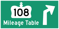
now under the jurisdiction of the City of Elliot Lake, the route is still signed continuously as Highway 108 through town. Highway 108 is a two-lane highway for its entire length between Highway 17 and Quirke Lake. However, the road is built to high standards, so passing lanes appear quite frequently along the highway. The only services located along Highway 108 are in Elliot Lake. The speed limit on Highway 108 is 80 km/h (50 mph), unless posted otherwise. The entire route of Highway 108 is designated as part of the Deer Trail, a scenic highway loop which begins at Serpent River, passes through Elliot Lake and ends at Iron Bridge. This scenic route offers motorists an opportunity to see some of the finest natural scenery in this part of Ontario. Please visit the Highway 108 Mileage Chart page for a list of mileage reference points along Highway 108. 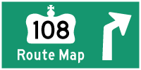
 |
|---|
Additional Information About King's Highway 108 (#2):
King's Highway 108 - Route Information (At Scott Steeves' website: asphaltplanet.ca)
King's Highway 108 - A Virtual Tour (At Scott Steeves' website: asphaltplanet.ca) |
|---|
Links to Adjacent King's Highway Pages: 

Website contents, photos & text © 2002-2024, Cameron
Bevers (Webmaster) - All Rights Reserved / Contact Me |
|---|