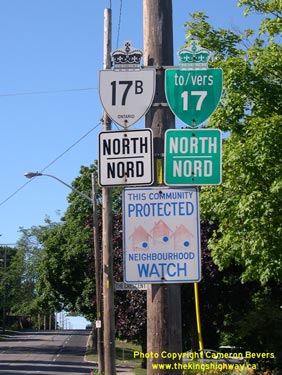
History of King's Highway 17B (Sault Ste. Marie):
This complicated Business Route was first established in 1969, when a new Highway 17 Bypass was opened just to the north of Sault Ste. Marie via Black Road and Second
Line Road. The old Highway 17 alignment through downtown via Trunk Road, Wellington Street, Andrew Street, Cathcart Street, Huron Street, Queen Street, Bay Street,
Church Street, Pim Street and Great Northern Road became Highway 17B. The entire route of Highway 17B was considered to be a Municipal Connecting Link, except for the
section of Great Northern Road between McNabb Street and Second Line Road which remained under the jurisdiction of the Ministry of Transportation for several years
following the completion of the Highway 17 Bypass.
Until 1989, Ministry of Transportation mileage tables listed the Sault Ste. Marie Business Route in two different sections. The traditional Highway 17B "Business
Loop" via Trunk Road, Wellington Street, Pim Street, Church Street and Great Northern Road was 5.7 km in length. A different "Bridge Loop" departed from the
Highway 17B Business Loop at Church Street and Wellington Street, which provided access to both Highway 550B and the Sault Ste. Marie International Bridge on Huron
Street via Wellington Street, Andrew Street, Cathcart Street, Huron Street, Bay Street, Church Street and Pim Street. The "Bridge Loop" of Highway 17B was 6.1 km in
length.
The route of Highway 17B remained more or less unchanged until 1997, when a portion of the route was decommissioned. The Municipal Connecting Link designation of the
north-south leg of Highway 17B via Pim Street and Great Northern Road was repealed under a Minister's Order dated September 18, 1997. In addition, the Municipal
Connecting Link designation was removed from Andrew Street, which had previously formed a connection between the Highway 17B Bridge Loop and Highway 550B. The balance
of Highway 17B retained its Municipal Connecting Link status right up until 2006. On March 29, 2006, a Minister's Order was signed which formally revoked the
Municipal Connecting Link status of all remaining portions of Highway 17B through Sault Ste. Marie.


|