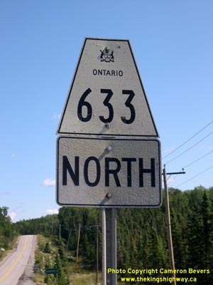
History of Secondary Highway 633:
Secondary Highway 633 is a local highway in the District of Rainy River which connects the small community of Kawene located between Atikokan and Quetico Provincial
Park to Highway 11. The history of Highway 633 dates back to the late 1950s, when the Department of Highways of Ontario (DHO) assumed jurisdiction over the Kawene
Road. A Proposed Highway Plan was prepared in August 1959, which showed this new Secondary Highway east of Atikokan. This plan was registered on November 20, 1959 and
the new highway was formally designated as Secondary Highway 633 by an Order-in-Council, effective October 29, 1959. The new highway was approximately 3.6 miles
(6 km) in length. Highway 633 was initially gravel-surfaced at the time of assumption, but was paved in 1961. A realignment of the highway was cleared and graded for
a distance of approximately 1 mile from Kawene southerly. This work was done to improve the highway's alignment and shorten the distance between Highway 11 and
Kawene. The old alignment of Highway 633 south of Kawene was legally closed to traffic by an Order-in-Council, effective October 21, 1983. The route of Highway 633
remains in Ontario's provincial highway system to this day. Unless posted otherwise, the speed limit on Highway 633 is 80 km/h. There are no services available on
this highway.
|