| 
|  |
|
|
|---|
|
Prologue: Where does that highway go to? I have asked myself
that question many times before, and I'm certain that if you are reading this page, that
you have asked this question too. On this website, you will find out where that highway
goes to, and more importantly, where it came from. This website is dedicated to the history
of Ontario's King's Highways. Ontario has always relied heavily on its roads for development.
From the earliest military and pioneer roads to today's modern freeways, these critical
transportation links have proven to be the key to developing the economic powerhouse that
is today's Ontario. This website looks primarily at the advancements and development of
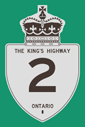
the Ontario provincial highway network since the very first provincial highway (Hwy 2) was
established in 1917.
Most pages on this website are now complete, but there are still several pages under construction. If the specific page that you are looking for is unavailable at the moment, please check back soon. New pages are being added weekly. This historical Ontario roads website will include a brief history of each King's Highway by route number, and will eventually include route maps of former Ontario highway routings since the 1920s. There will also be a photo gallery of old Kings Highway signs, mileage charts, route descriptions, and lots of vintage Ontario road photographs from MTO/Ontario Archives. If you have any older (pre-1990) photographs of Ontario highways or Ontario highway signs, please email me with the details. Enjoy your trip into the past on the Kings Highways of Ontario! |
|---|
Quick Links to Ontario Highways Website Sections:
|
|---|
|
Website contents, photos & text © 2002-2025, Cameron
Bevers (Webmaster) - All Rights Reserved / Contact Me
|
|---|