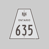
History of Secondary Highway 635:
Secondary Highway 635 was a local highway in the County of Renfrew which once extended from Highway 17 at Rolphton northerly to the inter-provincial bridge across the
Ottawa River to Rapides-des-Joachims, Quebec. Highway 635 was first assumed by the Department of Highways of Ontario (DHO) on February 11, 1960, and was formally
designated as Secondary Highway 635 by an Order-in-Council dated March 10, 1960. The highway was gravel-surfaced at first, but it was paved in 1964. The highway
remained in the provincial highway system until the 1990s, when a review of provincial services concluded that Highway 635 served a local purpose. Accordingly,
Highway 635 was transferred or "downloaded" to the County of Renfrew, effective January 1, 1998. The former highway is now known as Renfrew County Road 635. Unless
posted otherwise, the speed limit on Highway 635 is 80 km/h. Services are available on Highway 17 at Rolphton and in Rapides-des-Joachims, Quebec.
|