Ontario King's Highway 115 Historical Route Maps

Route of King's Highway 115 in 1955, shortly after the new highway opened to traffic. See an Enlarged Map Here.
(Excerpt from the 1955 Official Ontario Road Map - © King's Printer for Ontario, 1955)
|
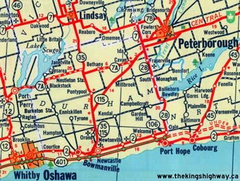
Route of King's Highway 115 in 1961, showing the new concurrent route of Highway 35 & Highway 115 to Newcastle. See an Enlarged Map Here.
(Excerpt from the 1961 Official Ontario Road Map - © King's Printer for Ontario, 1961)
|

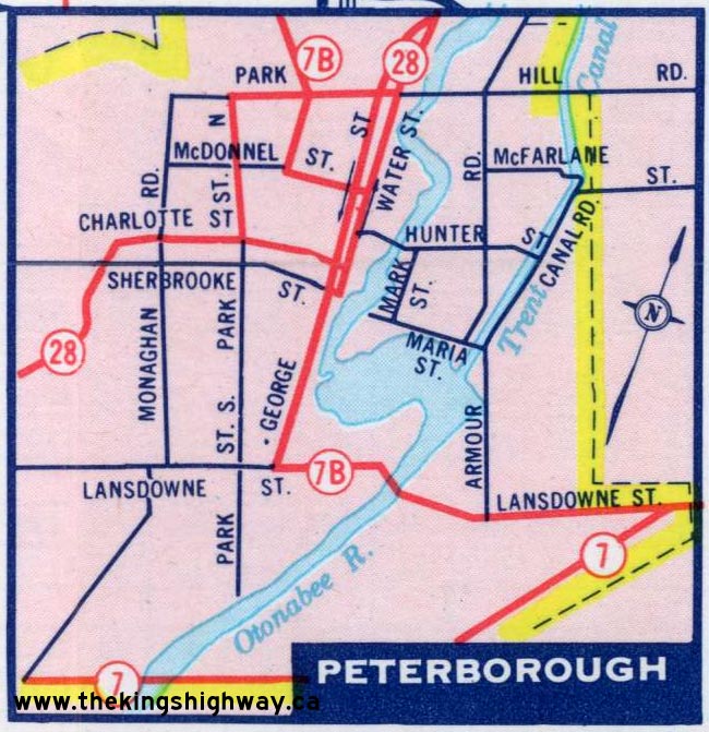
Route of King's Highway 115 in 1969, showing the new extension to Highway 7B in Peterborough. See an Enlarged Map Here.
(Excerpt from the 1969 Official Ontario Road Map - © King's Printer for Ontario, 1969)
|

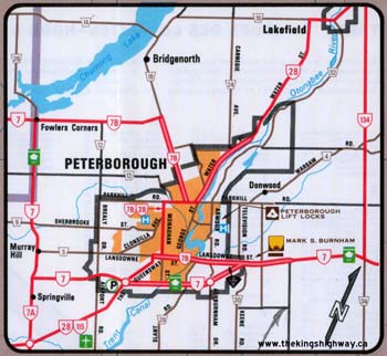
Map of Peterborough in 1971, showing the result of the removal of the King's Highway 115 designation from The Queensway. See an Enlarged Map Here.
(Excerpt from the 1971 Official Ontario Road Map - © King's Printer for Ontario, 1971)
|

Route of King's Highway 115 in 1980, showing the new route of Highway 115 southwest of Peterborough. See an Enlarged Map Here.
(Excerpt from the 1980-1981 Official Ontario Road Map - © King's Printer for Ontario, 1980)
|
Route of King's Highway 115 in 1986, showing the overlapped route of Highway 28 & Highway 115 southwest of Peterborough. See an Enlarged Map Here.
(Excerpt from the 1986-1987 Official Ontario Road Map - © King's Printer for Ontario, 1986)
|

Map showing the route of King's Highway 115 through Peterborough in 1996, just before the route was decommissioned. See an Enlarged Map Here.
(Excerpt from the 1996 Official Ontario Road Map - © King's Printer for Ontario, 1996)
|

Route of King's Highway 115 as it existed prior to 1997.
Map Courtesy of Bing Maps (Retrieved September 30, 2010) - Link to this map at Bing Maps
|

Route of King's Highway 115 as it exists today.
Map Courtesy of Bing Maps (Retrieved September 30, 2010) - Link to this map at Bing Maps
|
|
|---|
Links to Other King's Highway Website Pages:
Website contents, photos & text © 2002-2026, Cameron
Bevers (Webmaster) - All Rights Reserved / Contact Me
|
|---|