Ontario King's Highway 118 Historical Route Maps
Ontario King's Highway 118 Historical Route Maps

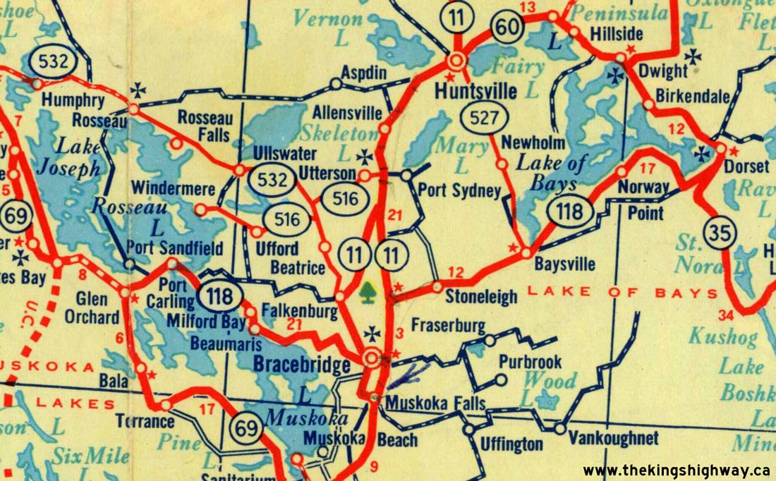
Route of King's Highway 118 as it existed after assumption in 1955. See an Enlarged Map Here.
(Excerpt from the 1956 Official Ontario Road Map - © King's Printer for Ontario, 1956)
|

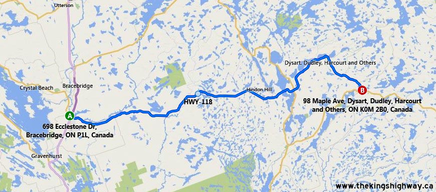
Route of King's Highway 118 as it existed after the highway was truncated in Bracebridge in 1974. See an Enlarged Map Here.
(Excerpt from the 1976 Official Ontario Road Map - © King's Printer for Ontario, 1976)
|

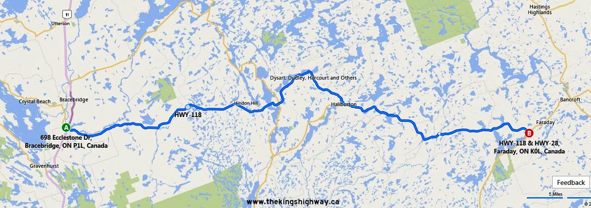
Route of King's Highway 118 as it existed after the extension to Haliburton in 1981. See an Enlarged Map Here.
(Excerpt from the 1982-1983 Official Ontario Road Map - © King's Printer for Ontario, 1982)
|
|
|---|
Links to Other King's Highway Website Pages:
Website contents, photos & text © 2002-2026, Cameron
Bevers (Webmaster) - All Rights Reserved / Contact Me
|
|---|