Ontario King's Highway 25 Historical Route Maps
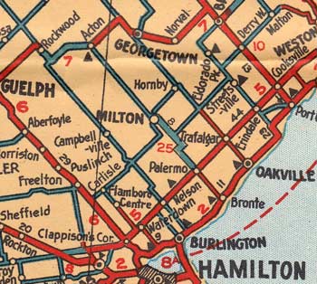
Route of Provincial Highway 25 as it existed after the route was assumed in 1927. See an Enlarged Map Here.
(Excerpt from the 1928 Official Ontario Road Map - © King's Printer for Ontario, 1928)
|

Route of Provincial (King's) Highway 25 as it existed after the route was extended to Highway 2 at Campbell's Corners in 1928. See an Enlarged Map Here.
(Excerpt from the 1933-34 Official Ontario Road Map - © King's Printer for Ontario, 1933)
|
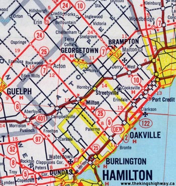
Route of King's Highway 25 as it existed after the route was extended north from Acton to Highway 24 at Ospringe in 1963. See an Enlarged Map Here.
(Excerpt from the 1963 Official Ontario Road Map - © King's Printer for Ontario, 1963)
|

Route of King's Highway 25 as it existed after the route was extended south from Highway 5 at Palermo to the QEW in Oakville in 1970. See an Enlarged Map Here.
(Excerpt from the 1970 Official Ontario Road Map - © King's Printer for Ontario, 1970)
|
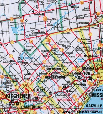
Route of King's Highway 25 as it existed after the route was extended north from Highway 24 at Ospringe to Highway 89 in 1974. See an Enlarged Map Here.
(Excerpt from the 1976 Official Ontario Road Map - © King's Printer for Ontario, 1976)
|
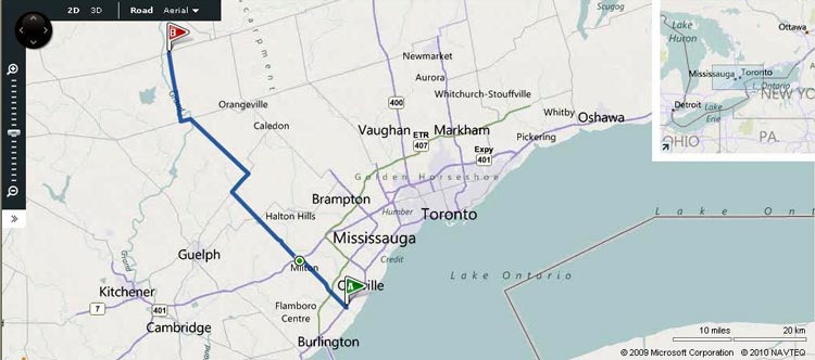
Route of King's Highway 25 as it existed prior to being downloaded in 1997-1998.
Map Courtesy of Bing Maps (Retrieved August 23, 2010) - Link to this map at Bing Maps
|
|
|---|
Links to Other King's Highway Website Pages:
Website contents, photos & text © 2002-2026, Cameron
Bevers (Webmaster) - All Rights Reserved / Contact Me
|
|---|


