Ontario King's Highway 4 Historical Route Maps
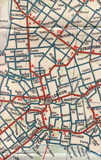
Route of the southern portion of King's Highway 4 as it existed after the extension to Port Stanley. See an Enlarged Map Here.
(Excerpt from the 1931-32 Official Ontario Road Map - © King's Printer for Ontario, 1931)
|
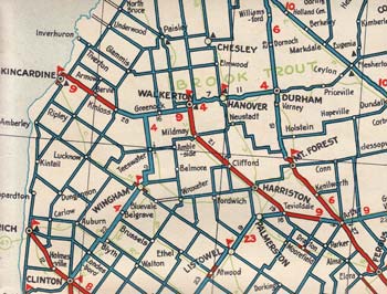
Route of the northern portion of King's Highway 4 as it existed after the extension to Hanover. See an Enlarged Map Here.
(Excerpt from the 1931-32 Official Ontario Road Map - © King's Printer for Ontario, 1931)
|

Route of King's Highway 4 as it existed after the extension to Flesherton in 1934. See an Enlarged Map Here.
(Excerpt from the 1938-39 Official Ontario Road Map - © King's Printer for Ontario, 1938)
|
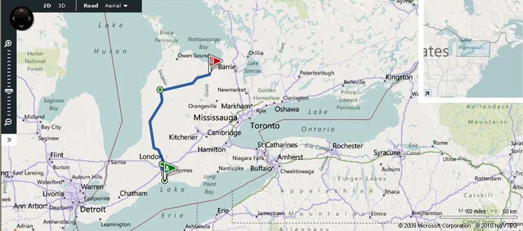
Route of King's Highway 4 as it existed prior to 1997.
Map Courtesy of Bing Maps (Retrieved August 23, 2010) - Link to this map at Bing Maps
|
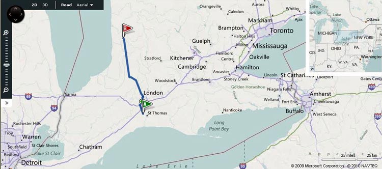
Route of King's Highway 4 as it appears today.
Map Courtesy of Bing Maps (Retrieved August 23, 2010) - Link to this map at Bing Maps
|
|
|---|
Links to Other King's Highway Website Pages:
Website contents, photos & text © 2002-2026, Cameron
Bevers (Webmaster) - All Rights Reserved / Contact Me
|
|---|


