Ontario King's Highway 55 (#1) Historical Route Maps
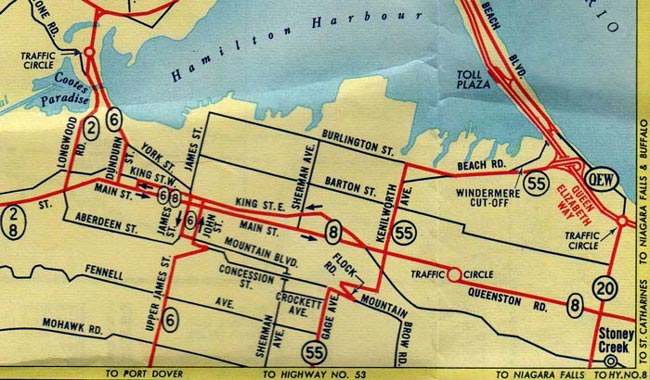
Route of King's Highway 55 (#1) in 1956, showing the old route leading to Downtown Hamilton via the Sherman Cut.
(Excerpt from the 1956 Official Ontario Road Map - Courtesy of King's Printer for Ontario - © 1956)
Route of King's Highway 55 (#1) in 1959, showing the new route leading to the Queen Elizabeth Way.
(Excerpt from the 1959 Official Ontario Road Map - Courtesy of King's Printer for Ontario - © 1959)
Links to Other King's Highway Website Pages:
Back to King's Highway 55 (#1) Page
Ontario Highway History - Main Menu
/
Back to List of Highways
Website contents, photos & text © 2002-2026, Cameron Bevers (Webmaster) - All Rights Reserved /
Contact Me