
| 
|  |
|
|
This page contains present day photos (Year 2000 to date) of Ontario's King's Highway 11, arranged by location from the King's
Highway 61 Junction in Thunder Bay westerly to the King's Highway 17 Junction at Shabaqua. All photographs displayed on this page were taken by the Webmaster
(Cameron Bevers), unless specifically noted otherwise. Click on any thumbnail to see a larger image!
Please note that all photographs displayed on this
website are protected by copyright. These photographs must not be reproduced, published,
electronically stored or copied, distributed, or posted onto other websites without
my written permission. If you want to use photos from this website, please
email me first for permission. Thank-you!
|
|---|
|
Page 33: Present Day King's Highway 11 Photographs (Thunder Bay to Shabaqua)

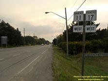
Left - Green guide sign approaching the Hwy 61 Junction marking the route into Downtown Thunder Bay on Arthur Street (Old Hwy 11 & Hwy 17). Up until the
1990s, this sign directed traffic to follow the posted Hwy 11B & Hwy 17B Business Routes into the City Centre along Arthur Street. Thunder Bay discontinued
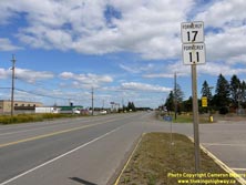
signing Arthur Street as Hwy 11B & Hwy 17B in 1997. Note the "Arthur St." overlay patch covering the old Hwy 11B & Hwy 17B provincial route crowns. (Photograph taken on September 1, 2011 - © Cameron Bevers) Right - Signs marking the former route of Hwy 11 & Hwy 17 along Arthur Street west of Thunder Bay. The new Shabaqua Highway bypassed this section of Hwy 11 & Hwy 17 a few years ago. The former highway route is now signed as a continuation of Thunder Bay's Arthur Street. (Photograph taken on September 1, 2011 - © Cameron Bevers) 

Left - Looking west towards Kakabeka Falls along Old Hwy 11 & Hwy 17 (Arthur Street) at the Neebing River Bridge in Thunder Bay. See an
Enlarged Photo Here. (Photograph taken on August 21, 2003 - © Cameron Bevers) Right - Southern side of the Neebing River Bridge on Old Hwy 11 & Hwy 17 (Arthur Street). The Neebing River Bridge was originally built in the 1920s by the Department of Northern Development as a narrow concrete beam structure. The bridge was extended on both sides to its current width in 1937, when two small concrete rigid frame structures were built on each side of the original bridge. The original 1920s structure can still be seen in the middle. See an Enlarged Photo Here. (Photograph taken on August 21, 2003 - © Cameron Bevers) 
Left - Northern side of the Neebing River Bridge on Old Hwy 11 & Hwy 17 (Arthur Street) in Thunder Bay. See an
Enlarged Photo Here. (Photograph taken on August 21, 2003 - © Cameron Bevers) Right - Signs marking former Hwy 11 & Hwy 17 along Arthur Street near the Hwy 130 Junction west of Thunder Bay. This portion of Old Hwy 11 & Hwy 17 was recently bypassed by the Shabaqua Highway. Part of Old Hwy 11 & Hwy 17 was renumbered as Hwy 130 following the completion of the bypass, while the balance of the old highway was renamed Arthur Street. (Photograph taken on September 2, 2011 - © Cameron Bevers) 

Left - Facing north along Hwy 130 at Rosslyn. The small communities of Rosslyn and Twin City are situated along Hwy 130 and the banks of the Kaministiquia
River. (Photograph taken on September 2, 2011 - © Cameron Bevers) Right - Approaching the intersection of Arthur Street and Twin City Crossroad on Northbound Hwy 130. Until the New Shabaqua Highway opened to traffic, Hwy 130 ended at this intersection at the Hwy 11 & Hwy 17 Junction. When the New Shabaqua Highway opened to traffic and bypassed this area, Hwy 11 & Hwy 17 were rerouted onto the new highway. A section of Former Hwy 11 & Hwy 17 was renumbered as Hwy 130, while the rest of the old highway alignment was renamed Arthur Street. Today, Hwy 130 turns left at this intersection and follows the former route of Hwy 11 & Hwy 17 out to the New Shabaqua Highway, located about 2 km to the west. (Photograph taken on September 2, 2011 - © Cameron Bevers) 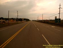
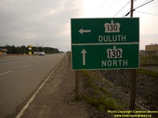
Left - Sunset over Arthur Street (Formerly Hwy 11 & Hwy 17) at the Hwy 130 Junction at Twin City Crossroad, west of Thunder Bay. See an
Enlarged Photo Here. (Photograph taken on September 1, 2011 - © Cameron Bevers) Right - Green guide sign at the Hwy 130 Junction on Arthur Street (Formerly Hwy 11 & Hwy 17), west of Thunder Bay. (Photograph taken on September 1, 2011 - © Cameron Bevers) 

Left - Facing east along Arthur Street (Formerly Hwy 11 & Hwy 17) towards Thunder Bay from the Hwy 130 Junction at Twin City Crossroad. (Photograph taken on September 2, 2011 - © Cameron Bevers) Right - Facing north along Hwy 130 (Formerly Hwy 11 & Hwy 17) from the intersection of Twin City Crossroad and Arthur Street, west of Thunder Bay. (Photograph taken on September 2, 2011 - © Cameron Bevers) 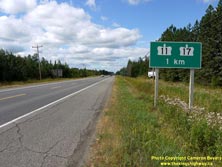
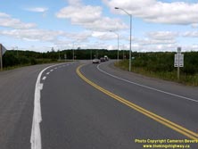
Left - Green guide sign marking the upcoming Hwy 11 & Hwy 17 Junction on Northbound Hwy 130. (Photograph taken on September 2, 2011 - © Cameron Bevers) Right - Approaching the northern terminus of Hwy 130 at the new Hwy 11 & Hwy 17 Junction (Shabaqua Highway) west of Thunder Bay. See an Enlarged Photo Here. (Photograph taken on September 2, 2011 - © Cameron Bevers) 
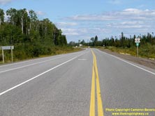
Left - Green guide signs at the northern terminus of Hwy 130 at the Hwy 11 & Hwy 17 Junction west of Thunder Bay. (Photograph taken on September 2, 2011 - © Cameron Bevers) Right - Facing east along the new Shabaqua Highway (Hwy 11 & Hwy 17) from the Hwy 130 Junction west of Thunder Bay. This 12 km diversion of Hwy 11 & Hwy 17 was completed recently, bypassing a section of Arthur Street leading into Thunder Bay. The new route of Hwy 11 & Hwy 17 is almost 2 km shorter than the old highway. See an Enlarged Photo Here. (Photograph taken on September 2, 2011 - © Cameron Bevers) 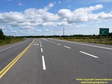

Left - Facing east along Hwy 11 & Hwy 17 at the Hwy 130 Junction west of Thunder Bay. This intersection marks the beginning of the New Shabaqua Highway.
The first 2 km of Old Hwy 11 & Hwy 17 was renumbered as Hwy 130 when the New Shabaqua Highway opened a few years ago. See an
Enlarged Photo Here. (Photograph taken on September 2, 2011 - © Cameron Bevers) Right - Green guide sign marking the turn-off to Hwy 130 on Eastbound Hwy 11 & Hwy 17. (Photograph taken on September 2, 2011 - © Cameron Bevers) 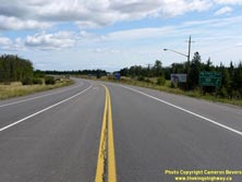

Left - Hwy 11 & Hwy 17 approaching the Hwy 130 Junction, facing east towards Thunder Bay. (Photograph taken on September 2, 2011 - © Cameron Bevers) Right - Green guide sign marking the upcoming Hwy 130 Junction on Eastbound Hwy 11 & Hwy 17. (Photograph taken on September 2, 2011 - © Cameron Bevers) 

Left - Facing east along Hwy 11 & Hwy 17 approaching the Hwy 130 Junction. The original highway to Thunder Bay used to continue straight ahead. See an
Enlarged Photo Here. (Photograph taken on September 2, 2011 - © Cameron Bevers) Right - Rosslyn Truck Scales on Hwy 11 & Hwy 17 just west of the Hwy 130 Junction. This facility has operated continuously since it was built in 1948. See an Enlarged Photo Here. (Photograph taken on September 2, 2011 - © Cameron Bevers) 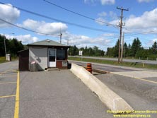

Left - A vintage truck scales stop sign has somehow survived on the exterior wall of the Rosslyn Truck Scale House for decades. See an
Enlarged Photo Here. (Photograph taken on September 2, 2011 - © Cameron Bevers) Right - Facing west along Hwy 11 & Hwy 17 through the town of Kakabeka Falls. The highway briefly widens into an undivided four-lane highway through town. This is the last major town along Hwy 11 & Hwy 17 before the two highways part ways at Shabaqua Corners, about 35 km ahead. See an Enlarged Photo Here. (Photograph taken on September 2, 2011 - © Cameron Bevers) 
Above - Dual Hwy 11 & Hwy 17 route markers in Kakabeka Falls. (Photograph taken on September 2, 2011 - © Cameron Bevers) 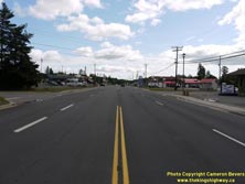
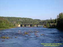
Left - Passing through the town of Kakabeka Falls on Hwy 11 & Hwy 17, facing east towards Thunder Bay. See an
Enlarged Photo Here. (Photograph taken on September 2, 2011 - © Cameron Bevers) Right - Kaministiquia River Bridge on Hwy 11 & Hwy 17 at Kakabeka Falls. When this structure and associated highway diversion was completed in 1958, it bypassed a section of Hwy 17 which ran through Kakabeka Falls Provincial Park. Originally, the highway crossed the Kaministiquia River via a narrow truss bridge that existed immediately upstream of the falls. The highway then passed directly through what is now the park's Riverside Campground. The old Hwy 17 truss bridge continued to serve traffic on a campground access road within Kakabeka Falls Provincial Park for many years after the old highway alignment through the park was bypassed. The old truss bridge was replaced in 2003. See an Enlarged Photo Here. (Photograph taken on August 31, 2006 - © Cameron Bevers) 
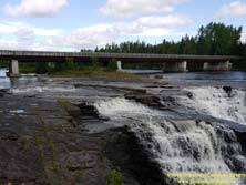
Left - View of Kakabeka Falls beside Hwy 11 & Hwy 17 west of Thunder Bay. The Kaministiquia River drains most of the mountainous highlands located
northwest of Thunder Bay. The river plunges over these scenic falls en route towards Lake Superior. Kakabeka Falls is a "must-see" for travelers visiting the
Thunder Bay area. See an Enlarged Photo Here. (Photograph taken on September 2, 2011 - © Cameron Bevers) Right - Site of the Old Kakabeka Falls Bridge on a former alignment of Hwy 17. A new highway diversion was completed in 1958, bypassing the original route of Hwy 17 across Kakabeka Falls. For many years, the old steel truss bridge carried a provincial park access road, until in was replaced in 2003. See an Enlarged Photo Here. (Photograph taken on September 2, 2011 - © Cameron Bevers) 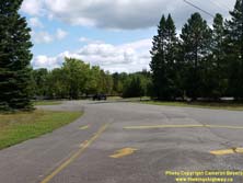

Left - Former alignment of Hwy 17 within Kakabeka Falls Provincial Park, west of Thunder Bay. The old highway curved around towards the Kaministiquia River
Bridge in the background. The current highway alignment crosses the river a short distance upstream of the original highway's route. (Photograph taken on September 2, 2011 - © Cameron Bevers) Right - This superelevated curve is a tell-tale sign of the former Hwy 17 alignment that once passed through Kakabeka Falls Provincial Park. The former Hwy 17 alignment, at right, is now an access road to the Riverside Campground. The former highway was bypassed when the new Kaministiquia River Bridge opened to traffic in 1958. See an Enlarged Photo Here. (Photograph taken on September 2, 2011 - © Cameron Bevers) 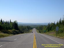

Left - Hwy 11 & Hwy 17 facing east towards Kakabeka Falls, about 6 km south of the Hwy 102 Junction at Sistonen's Corners. See an
Enlarged Photo Here. (Photograph taken on August 31, 2006 - © Cameron Bevers) Right - Approaching Sistonen's Corners on Hwy 11 & Hwy 17, facing west. At this junction, Hwy 11 & Hwy 17 re-joins the alternate highway route through the Thunder Bay area (Hwy 102). These two highways meet again in Thunder Bay, about 40 km to the east. See an Enlarged Photo Here. (Photograph taken on September 2, 2011 - © Cameron Bevers) 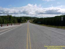

Left - Facing east along Hwy 102 from the Hwy 11 & Hwy 17 Junction at Sistonen's Corners. Motorists approaching Thunder Bay have the option of taking
either Hwy 11 & Hwy 17 or Hwy 102 between Sistonen's Corners and Thunder Bay. Overall, the route of Hwy 102 is more scenic and is actually about 16 km shorter than the
route offered by Hwy 11 & Hwy 17 via Kakabeka Falls. See an Enlarged Photo Here. (Photograph taken on September 2, 2011 - © Cameron Bevers) Right - Distance sign on Eastbound Hwy 102 at Sistonen's Corners, indicating the distance from the Hwy 11 & Hwy 17 Junction to Thunder Bay. See an Enlarged Photo Here. (Photograph taken on September 2, 2011 - © Cameron Bevers) 
Above - Junction sign assembly at Sistonen's Corners marking the western terminus of Hwy 102 at the Hwy 11 & Hwy 17 Junction. (Photograph taken on September 2, 2011 - © Cameron Bevers) 

Left - Approaching the western terminus of Hwy 102 at Sistonen's Corners, west of Thunder Bay. See an
Enlarged Photo Here. (Photograph taken on September 2, 2011 - © Cameron Bevers) Right - Guide sign for Atikokan, Fort Frances and Kenora at the end of Hwy 102 at Sistonen's Corners. Motorists who turn right at the Hwy 11 & Hwy 17 Junction can proceed west towards these destinations. Motorists who turn left here will return to Thunder Bay via Kakabeka Falls. (Photograph taken on September 2, 2011 - © Cameron Bevers) 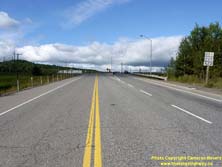
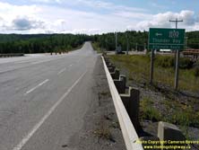
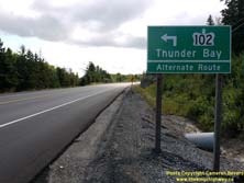
Left - Facing west along Hwy 102 at the Hwy 11 & Hwy 17 Junction. The heavier right-turn movement from Hwy 102 to Westbound Hwy 11 & Hwy 17 is
accommodated via a right-turn channelization. See an Enlarged Photo Here. (Photograph taken on September 2, 2011 - © Cameron Bevers) Right - Green guide sign on Hwy 11 & Hwy 17 marking the turn-off to Hwy 102 at Sistonen's Corners. Note the unusual "Alternate Route" tab under the primary sign. Historically, Hwy 102 was known as Hwy 17A (later Hwy 11A & Hwy 17A). In 1971, the route number was changed to Hwy 102. Although the change in route numbers undoubtedly simplified the signing along the highway corridor, the route number change also erased any trace of what was, up until then, an implied alternate route. See an Enlarged Photo Here. (Photograph taken on September 2, 2011 - © Cameron Bevers) 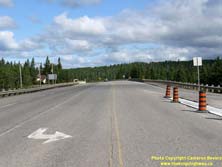

Left - Facing west along Hwy 11 & Hwy 17 from the Hwy 102 Junction at Sistonen's Corners. See an
Enlarged Photo Here. (Photograph taken on September 2, 2011 - © Cameron Bevers) Right - Junction assembly at the western terminus of Hwy 102 at the Hwy 11 & Hwy 17 Junction at Sistonen's Corners. (Photograph taken on September 2, 2011 - © Cameron Bevers) 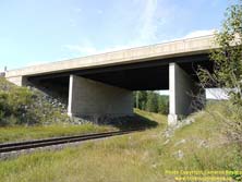
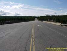
Left - Sistonen's Corners Railway Overhead on Hwy 11 & Hwy 17. This structure lies immediately west of the Hwy 102 Junction. (Photograph taken on September 2, 2011 - © Cameron Bevers) Right - Facing east along Hwy 11 & Hwy 17 towards the Hwy 102 Junction at the Sistonen's Corners Railway Overhead. (Photograph taken on September 2, 2011 - © Cameron Bevers) 

Left - Structure identification number and date stamp (1995) on the Sistonen's Corners Railway Overhead on Hwy 11 & Hwy 17. (Photograph taken on September 2, 2011 - © Cameron Bevers) Right - Southern side of the Sistonen's Corners Railway Overhead on Hwy 11 & Hwy 17 west of Thunder Bay. (Photograph taken on September 2, 2011 - © Cameron Bevers) 
Left - Sistonen's Corners Railway Overhead on Hwy 11 & Hwy 17, facing west towards Shabaqua Corners. (Photograph taken on September 2, 2011 - © Cameron Bevers) Right - Advance guide sign for the Hwy 102 Junction on Eastbound Hwy 11 & Hwy 17 approaching Sistonen's Corners. (Photograph taken on September 2, 2011 - © Cameron Bevers) 
Left - Old timber box culvert under a former alignment of Hwy 11 & Hwy 17 at Sistonen's Corners. (Photograph taken on September 1, 2004 - © Cameron Bevers) Right - Former Hwy 11 & Hwy 17 alignment between Sistonen's Corners and Sunshine. (Photograph taken on September 1, 2004 - © Cameron Bevers) 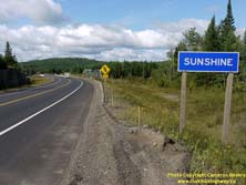

Left - Approaching Sunshine on Westbound Hwy 11 & Hwy 17. Sunshine is the only settlement of any size along the highway between Sistonen's Corners and
Shabaqua Corners. See an Enlarged Photo Here. (Photograph taken on September 2, 2011 - © Cameron Bevers) Right - Matawin River Bridge on Hwy 11 & Hwy 17 in Sunshine, west of Thunder Bay. This three-span steel beam structure was completed in 1991. This bridge replaced a narrow steel through truss bridge that had been built in 1956. Interestingly, the adjacent railway structure is also a truss bridge. (Photograph taken on September 2, 2011 - © Cameron Bevers) 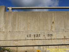
Left - Structure identification number and date stamp (1991) on the Matawin River Bridge on Hwy 11 & Hwy 17 in Sunshine. (Photograph taken on September 2, 2011 - © Cameron Bevers) Right - Facing east along Hwy 11 & Hwy 17 towards Thunder Bay at the Matawin River Bridge in Sunshine. See an Enlarged Photo Here. (Photograph taken on September 2, 2011 - © Cameron Bevers) 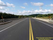

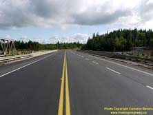
Left - Facing west along Hwy 11 & Hwy 17 towards Shabaqua Corners at the Matawin River Bridge in Sunshine. (Photograph taken on September 2, 2011 - © Cameron Bevers) Right - Facing west along Hwy 11 & Hwy 17 towards Shabaqua Corners at Sunshine Creek. (Photograph taken on August 31, 2006 - © Cameron Bevers) 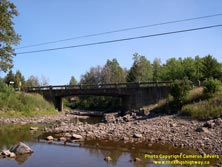

Left - Southern side of the Sunshine Creek Bridge on Hwy 11 & Hwy 17. Structure completed in 1955. (Photograph taken on August 31, 2006 - © Cameron Bevers) Right - Close-up of the concrete bar-and-post handrail on the Sunshine Creek Bridge on Hwy 11 & Hwy 17. (Photograph taken on August 31, 2006 - © Cameron Bevers) 
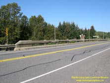
Left - Sunshine Creek sign and bridge on Hwy 11 & Hwy 17 between Sistonen's Corners and Shabaqua Corners. (Photograph taken on August 31, 2006 - © Cameron Bevers) Right - This structure was one of the oldest bridges in the Thunder Bay area that still has its original handrails. However, this bridge was recently reconstructed. (Photograph taken on August 31, 2006 - © Cameron Bevers) 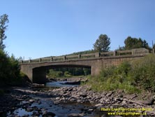

Left - Northern side of the Sunshine Creek Bridge on Hwy 11 & Hwy 17 west of Thunder Bay. See an
Enlarged Photo Here. (Photograph taken on August 31, 2006 - © Cameron Bevers) Right - Facing east along Hwy 11 & Hwy 17 towards Sistonen's Corners at the Sunshine Creek Bridge. (Photograph taken on August 31, 2006 - © Cameron Bevers) 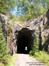

Left - The abandoned Flett Railway Tunnel northwest of Thunder Bay. Admittedly, this tunnel has very little to do with Ontario highways, but it is still an
interesting reminder of our early transportation heritage. The tunnel is noteworthy because a forest access road now uses the tunnel to get past this rocky ridge. The
tunnel is located about 8 km north of Hwy 11 & Hwy 17, on a jolting forest access road which is not suitable for most vehicles. A sturdy off-road vehicle is
strongly recommended if you plan to visit this site. (Photograph taken on August 31, 2006 - © Cameron Bevers) Right - Close-up of the interior of the abandoned Flett Railway Tunnel. While Northern Ontario boasts several railway tunnels, the one near Flett Siding is the only former railway tunnel that one can actually drive though. It is about 300 metres in length. (Photograph taken on August 31, 2006 - © Cameron Bevers) 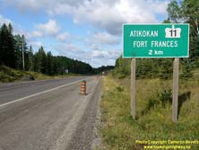
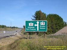
Left - Advance guide sign on Westbound Hwy 11 & Hwy 17 marking the upcoming Hwy 11 turn-off to Fort Frances and Atikokan at Shabaqua Corners. See an
Enlarged Photo Here. (Photograph taken on September 2, 2011 - © Cameron Bevers) Right - Extruded aluminum guide sign at the Hwy 11 & Hwy 17 Junction at Shabaqua, making the Hwy 11 turn-off to Atikokan and Fort Frances. (Photograph taken on August 31, 2006 - © Cameron Bevers) 

Left - Facing west along Hwy 11 & Hwy 17 towards the Hwy 11 turn-off to Fort Frances and Atikokan at Shabaqua Corners. See an
Enlarged Photo Here. (Photograph taken on August 31, 2006 - © Cameron Bevers) Right - Oskondaga River Bridge on Hwy 11 & Hwy 17 at Shabaqua Corners. This single-span steel beam structure was completed in 2003. It replaced a small steel pony truss structure built in 1951. The replacement of the old Oskondaga River Bridge was triggered by a reconstruction of the Hwy 11 Junction, which lies immediately adjacent to the structure. See an Enlarged Photo Here. (Photograph taken on September 2, 2011 - © Cameron Bevers) 

Left - Structure identification number and date stamp (2003) on the Oskondaga River Bridge on Hwy 11 & Hwy 17 at Shabaqua Corners. (Photograph taken on September 2, 2011 - © Cameron Bevers) Right - Hwy 11 turn-off sign at the Hwy 11 & Hwy 17 Junction at Shabaqua Corners. After following a concurrent route since Nipigon, Hwy 11 and Hwy 17 part ways at Shabaqua Corners. The routes of Hwy 11 and Hwy 17 do not join together again west of Shabaqua Corners, although periodic access between these two highways is offered via Hwy 622, Hwy 502 and Hwy 71. (Photograph taken on September 2, 2011 - © Cameron Bevers) 
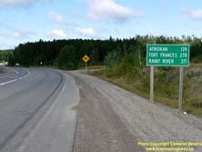
Left - Facing west along Hwy 11 towards Atikokan from the Hwy 17 Junction at Shabaqua Corners. See an
Enlarged Photo Here. (Photograph taken on September 2, 2011 - © Cameron Bevers) Right - Distance guide sign on Westbound Hwy 11 departing the Hwy 17 Junction at Shabaqua Corners. The route of Hwy 11, Ontario's second-longest provincial highway comes to an end at Rainy River 371 km ahead. At Hwy 11's western terminus, a bridge crosses into the United States via Baudette, Minnesota. See an Enlarged Photo Here. (Photograph taken on September 2, 2011 - © Cameron Bevers) 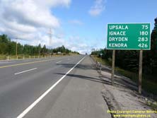
Above - Distance guide sign on Westbound Hwy 17 departing Shabaqua Corners. The Ontario-Manitoba Boundary lies about 475 km ahead. At that point, Hwy 17
ends. The Trans-Canada Highway continues west towards Winnipeg as Manitoba's Hwy 1. See an
Enlarged Photo Here. (Photograph taken on September 2, 2011 - © Cameron Bevers)
Continue on to King's Highway 11 Photos: Shabaqua to Kashabowie
|
|---|
Links to Adjacent King's Highway Photograph Pages:
Back to Hwy 11 - Red Rock Corners to Thunder Bay
Hwy 11 Photo Index
On to Hwy 11 - Shabaqua to Kashabowie
Back to King's Highway 10 Photos /
King's Highway 11 History /
On to King's Highway 12 Photos
Ontario Highway History - Main Menu / Back to List of Highways Website contents, photos & text © 2002-2025, Cameron
Bevers (Webmaster) - All Rights Reserved / Contact Me |
|---|