
| 
| |
|
|
This page contains historical and present day photos of Ontario's King's Highway 148. All photographs displayed on this page
were taken by the Webmaster (Cameron Bevers), unless specifically noted otherwise. Historical photographs are arranged in approximate chronological order, while
present day photographs (Year 2010 to date) are arranged by location from west to east. Click on any thumbnail to see a larger image!
Please note that all photographs displayed on this
website are protected by copyright. These photographs must not be reproduced, published,
electronically stored or copied, distributed, or posted onto other websites without
my written permission. If you want to use photos from this website, please
email me first for permission. Thank-you!
|
|---|
|
Historical King's Highway 148 Photographs
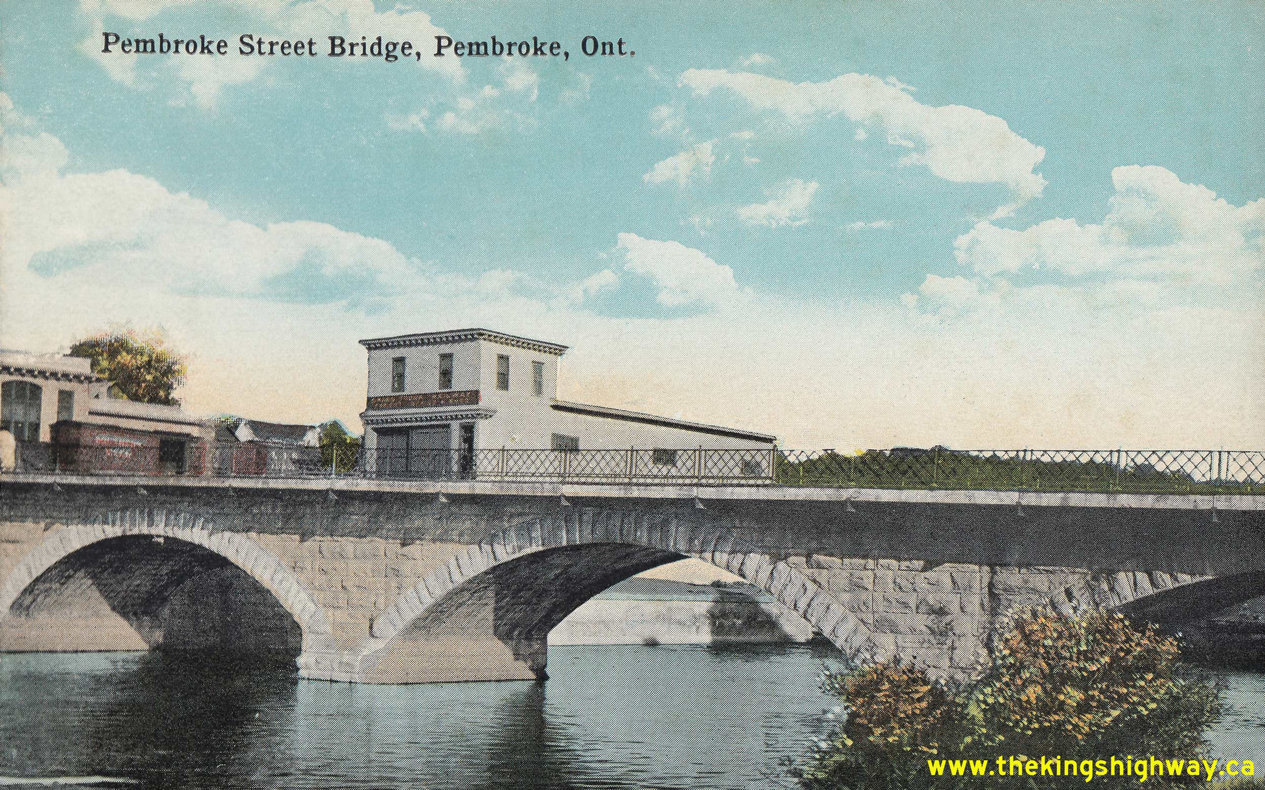
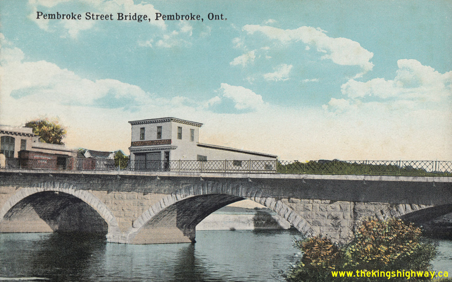  Above - Circa 1925 postcard view of the Muskrat River Bridge on Pembroke Street (Hwy 17, later known as Hwy 148) in Downtown Pembroke. This attractive
Victorian-era stone arch bridge was constructed in 1887. The bridge was widened by the Department of Highways of Ontario (DHO) in 1939. This postcard view shows the
Muskrat River Bridge's original 19th-Century appearance, as it existed prior to the DHO's widening of Hwy 17 during the 1930s. See an
Enlarged Photo Here. Photo taken circa 1925. Above - Circa 1925 postcard view of the Muskrat River Bridge on Pembroke Street (Hwy 17, later known as Hwy 148) in Downtown Pembroke. This attractive
Victorian-era stone arch bridge was constructed in 1887. The bridge was widened by the Department of Highways of Ontario (DHO) in 1939. This postcard view shows the
Muskrat River Bridge's original 19th-Century appearance, as it existed prior to the DHO's widening of Hwy 17 during the 1930s. See an
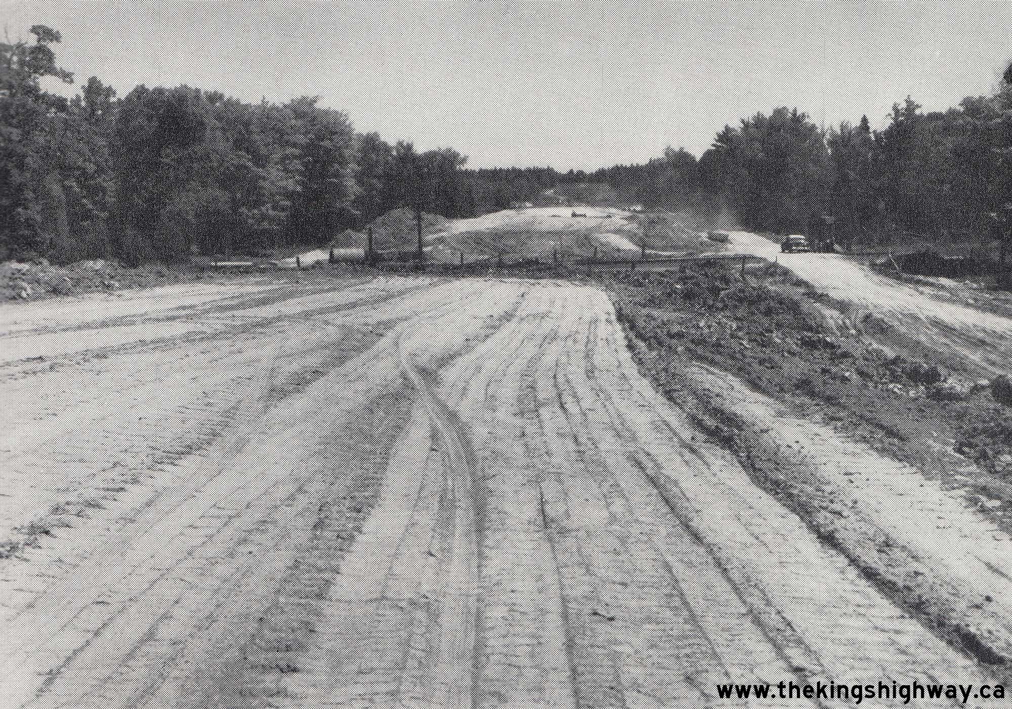
Enlarged Photo Here. Photo taken circa 1925.(Photo from Cameron Bevers' historical photograph collection - Original photographer unknown) 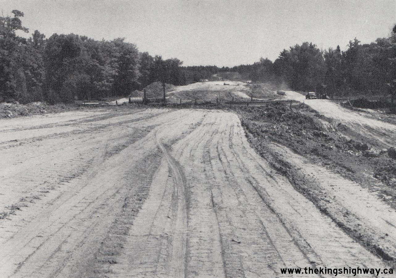 Above - Preliminary grading at Sta. 8+00 for the new Des Allumettes Road (Hwy 62, later known as Hwy 148) under Contract #1955-47, approaching the proposed
Canadian Pacific Railway (CPR) Overhead near Pembroke. The DHO tendered three construction contracts during 1955 to construct about 1 mile of new highway for the
Ontario approach to the proposed Des Allumettes Interprovincial Bridge being constructed by the Government of Canada. See an
Enlarged Photo Here. Photo taken on July 29, 1955. Above - Preliminary grading at Sta. 8+00 for the new Des Allumettes Road (Hwy 62, later known as Hwy 148) under Contract #1955-47, approaching the proposed
Canadian Pacific Railway (CPR) Overhead near Pembroke. The DHO tendered three construction contracts during 1955 to construct about 1 mile of new highway for the
Ontario approach to the proposed Des Allumettes Interprovincial Bridge being constructed by the Government of Canada. See an
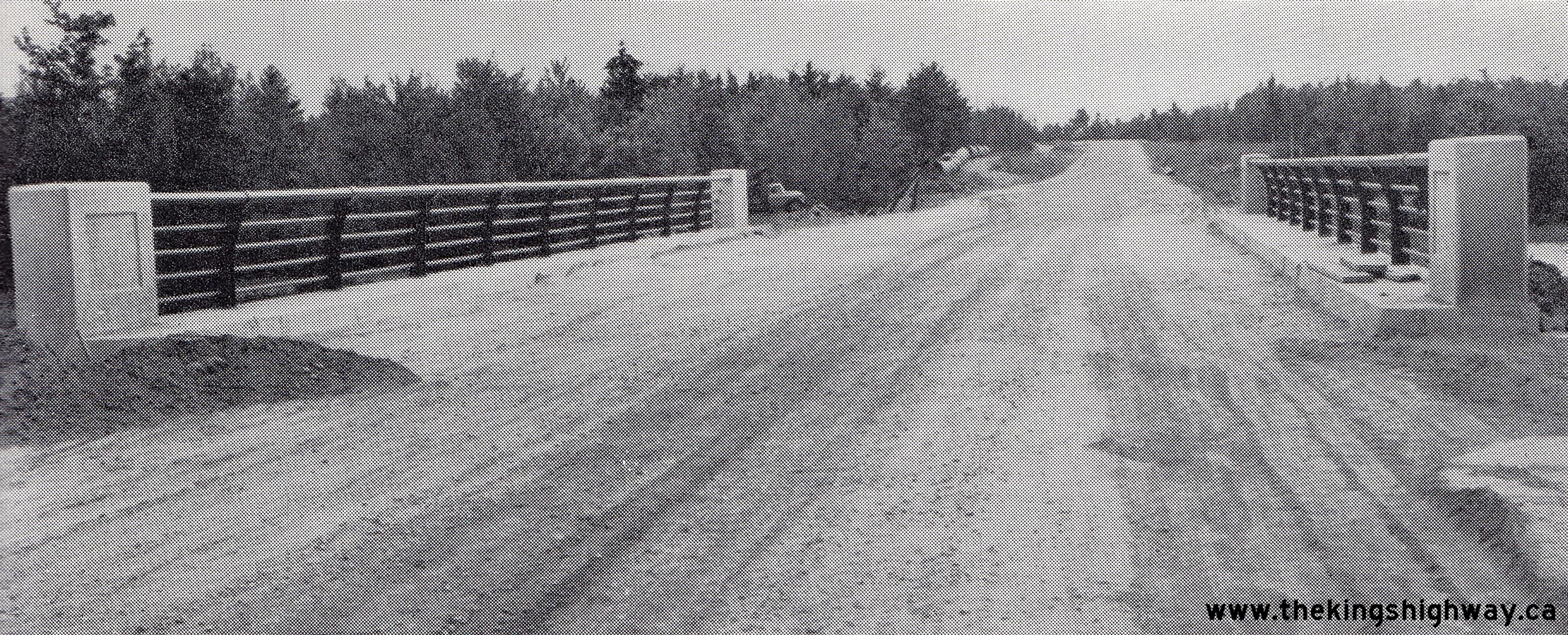
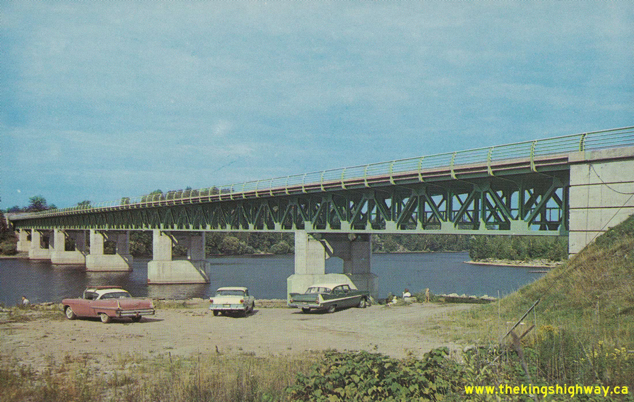
Enlarged Photo Here. Photo taken on July 29, 1955.(Photo courtesy of Ontario Ministry of Transportation - © King's Printer for Ontario, 1955) 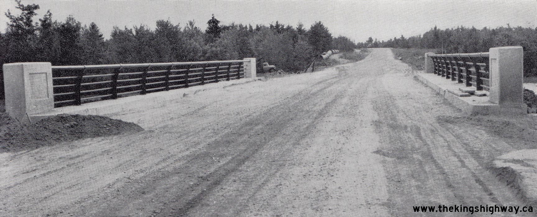 Above - Completed Hazley Bay Bridge on the new Des Allumettes Road (Hwy 62, later known as Hwy 148) east of Pembroke. Constructed under Contract #1955-100,
this was one of two new highway bridges built by the DHO on the Ontario approach to the proposed Des Allumettes Bridge. This proposed interprovincial bridge across
the Ottawa River linked Pembroke, Ontario to Waltham, Quebec. See an Enlarged Photo Here.
Photo taken on August 10, 1956. Above - Completed Hazley Bay Bridge on the new Des Allumettes Road (Hwy 62, later known as Hwy 148) east of Pembroke. Constructed under Contract #1955-100,
this was one of two new highway bridges built by the DHO on the Ontario approach to the proposed Des Allumettes Bridge. This proposed interprovincial bridge across
the Ottawa River linked Pembroke, Ontario to Waltham, Quebec. See an Enlarged Photo Here.
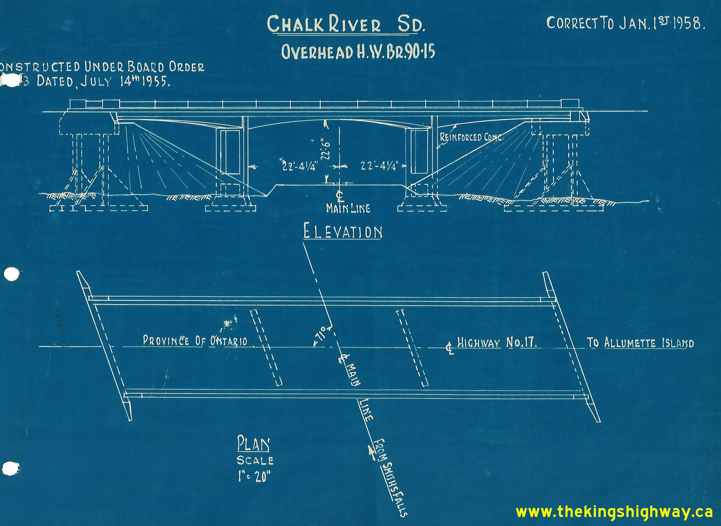
Photo taken on August 10, 1956.(Photo courtesy of Ontario Ministry of Transportation - © King's Printer for Ontario, 1956)  Above - Circa 1958 CPR file drawing of Des Allumettes Road Overhead on Hwy 62 (later known as Hwy 148) southeast of Pembroke, showing as-built elevations.
See an Enlarged Photo Here. Above - Circa 1958 CPR file drawing of Des Allumettes Road Overhead on Hwy 62 (later known as Hwy 148) southeast of Pembroke, showing as-built elevations.
See an Enlarged Photo Here.(Photo from Josh Anderchek's historical photograph collection) 
 Left - Postcard view of the new Des Allumettes Interprovincial Bridge across the Ottawa River on Hwy 62 (later known as Hwy 148) east of Pembroke. The new
highway bridge was built by the Government of Canada and was completed in 1957. Prior to the construction of this bridge, traffic wishing to cross between Ontario and
Quebec had to travel south to the bridge between Chenaux and Portage-du-Fort near Renfrew, or use a ferry service in order to cross the Ottawa River. See an
Enlarged Photo Here. Photo taken circa 1959. Left - Postcard view of the new Des Allumettes Interprovincial Bridge across the Ottawa River on Hwy 62 (later known as Hwy 148) east of Pembroke. The new
highway bridge was built by the Government of Canada and was completed in 1957. Prior to the construction of this bridge, traffic wishing to cross between Ontario and
Quebec had to travel south to the bridge between Chenaux and Portage-du-Fort near Renfrew, or use a ferry service in order to cross the Ottawa River. See an
Enlarged Photo Here. Photo taken circa 1959.(Photo courtesy of C.R Sterling Photos) Right - Postcard view of Pembroke Street (Hwy 17, later known as Hwy 148) in 1959, facing east from Moffat Street in Downtown Pembroke. See an
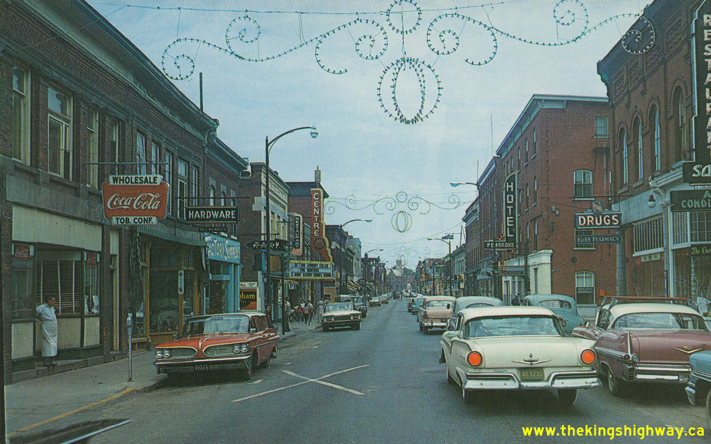
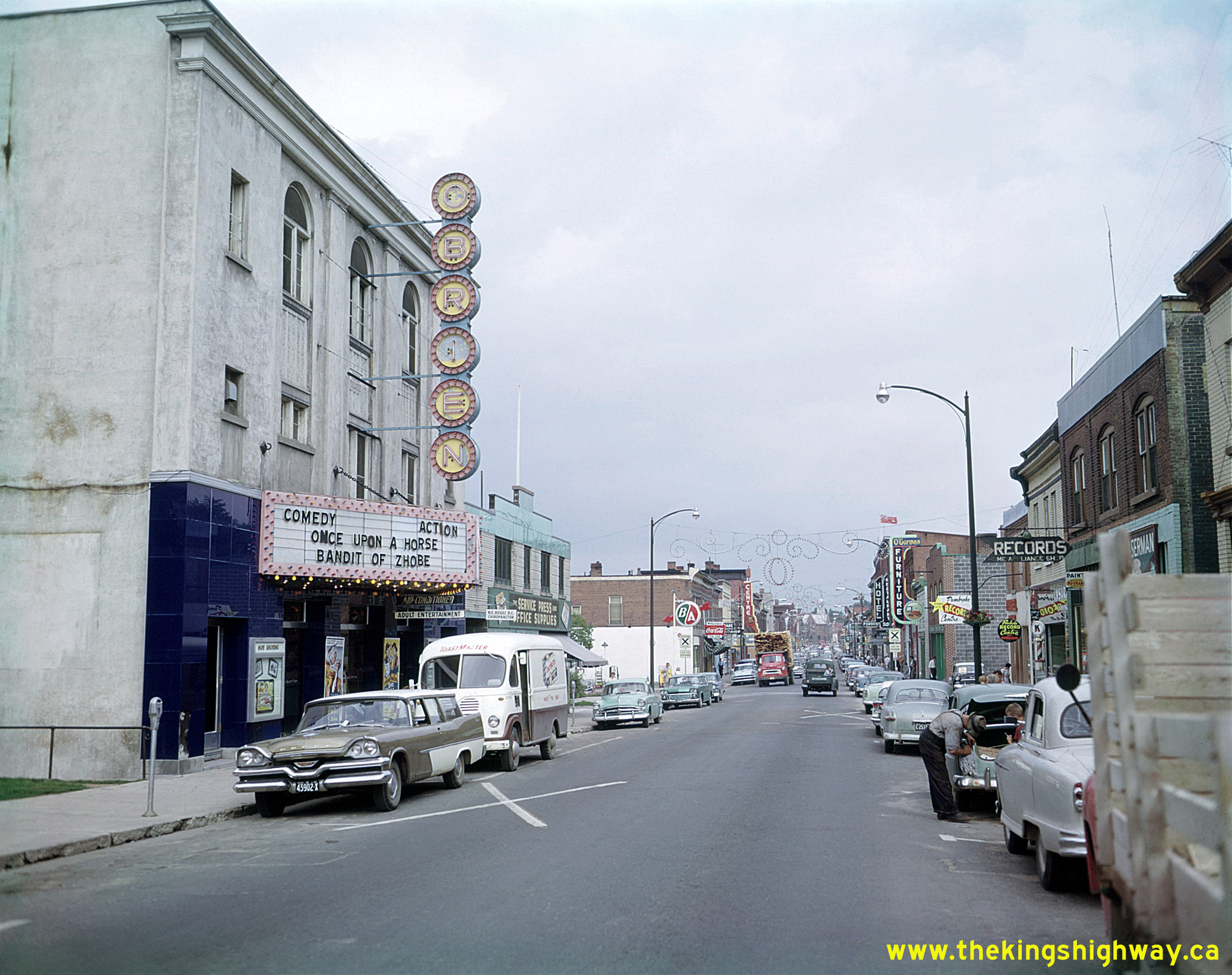
Enlarged Photo Here. Photo taken in 1959.(Photo courtesy of C.R Sterling Photos)  Above - View of Pembroke Street (Hwy 17, later known as Hwy 148) in 1959, facing east towards Agnes Street in Downtown Pembroke. While Hwy 17 served as
Pembroke's main street, it also served as a link in the Trans-Canada Highway and also served as the Ottawa Valley's main through highway. This great photo perfectly
captures daily life in small-town Ontario during the 1950s - busy downtown shops, movie theatres, a downtown gas station and lots of traffic. Over the years, many of
Pembroke's downtown businesses have closed or relocated to suburban shopping centres - a fate not at all uncommon in towns and smaller cities throughout Ontario. It
is interesting to note that the stationery store located beside the movie theatre at left in this photo is still in operation today, although the movie theatre
building beside it has since been demolished. See an Enlarged Photo Here. Photo taken in
1959. Above - View of Pembroke Street (Hwy 17, later known as Hwy 148) in 1959, facing east towards Agnes Street in Downtown Pembroke. While Hwy 17 served as
Pembroke's main street, it also served as a link in the Trans-Canada Highway and also served as the Ottawa Valley's main through highway. This great photo perfectly
captures daily life in small-town Ontario during the 1950s - busy downtown shops, movie theatres, a downtown gas station and lots of traffic. Over the years, many of
Pembroke's downtown businesses have closed or relocated to suburban shopping centres - a fate not at all uncommon in towns and smaller cities throughout Ontario. It
is interesting to note that the stationery store located beside the movie theatre at left in this photo is still in operation today, although the movie theatre
building beside it has since been demolished. See an Enlarged Photo Here. Photo taken in
1959.(Photo © Archives of Ontario - Series RG-65-35, Photo #I-0005681) 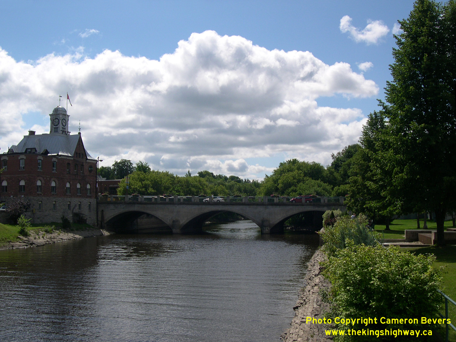
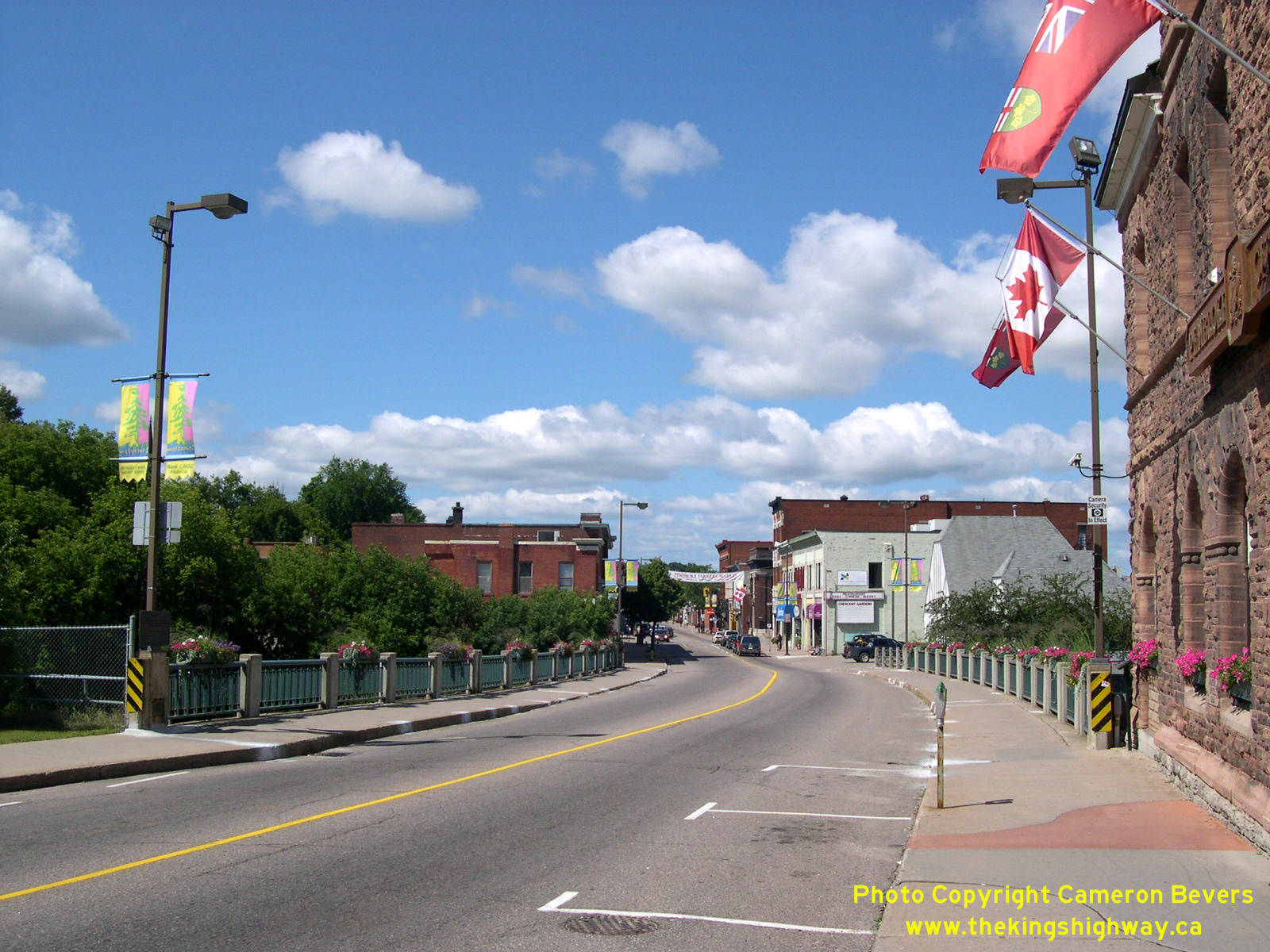
Left - Muskrat River Bridge on Pembroke Street (Old Hwy 17, later known as Hwy 148) in Downtown Pembroke. This three-span closed-spandrel arch bridge was
originally built in 1887. The bridge was later widened by the DHO, after Hwy 17 was extended westerly up the Ottawa Valley towards North Bay in the late 1930s. See an
Enlarged Photo Here. (Photograph taken on August 1, 2004 - © Cameron Bevers) Right - Facing north across the Muskrat River Bridge (Site #29-11) on Pembroke Street (Old Hwy 17, later known as Hwy 148) in Downtown Pembroke. See an Enlarged Photo Here. (Photograph taken on August 1, 2004 - © Cameron Bevers) 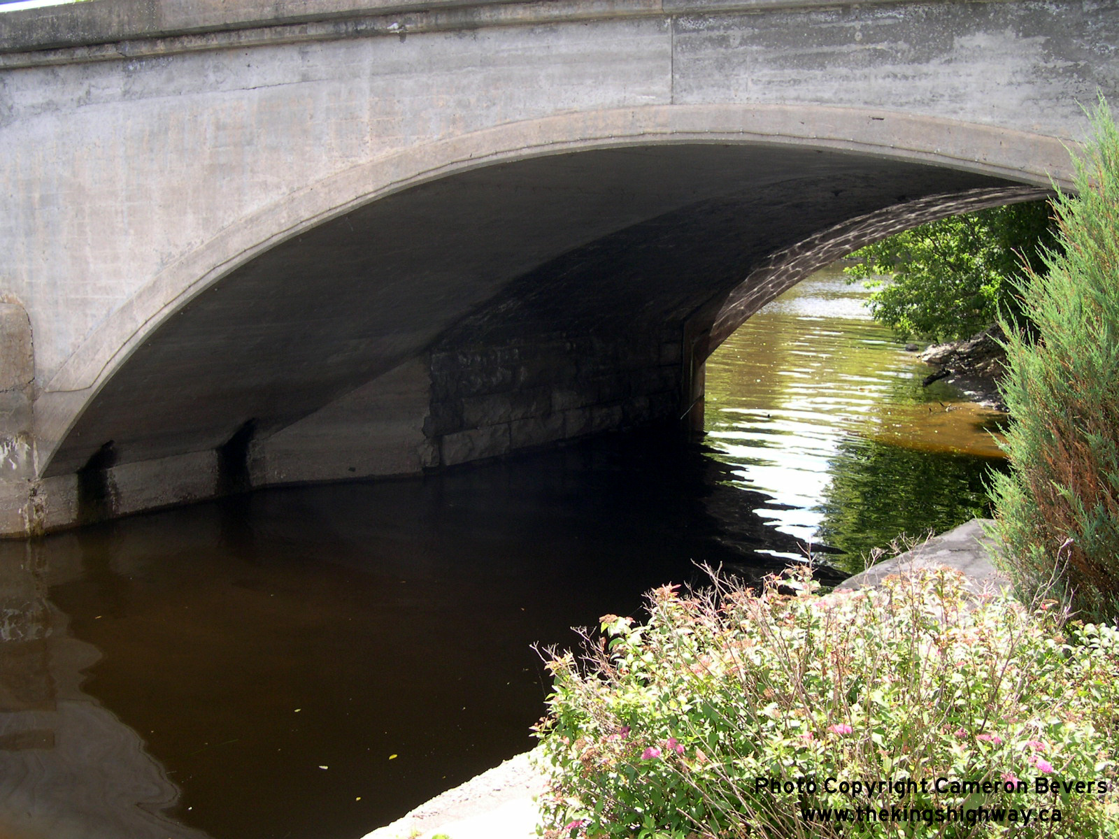
Left - The 19th-Century stone arch bridge across the Muskrat River on Pembroke Street (Old Hwy 17, later known as Hwy 148) was widened to its current width in 1939 by the DHO under
Contract #1939-02. As can be seen in this photo, the original stone bridge was a lot narrower when it was first built in 1887. See an
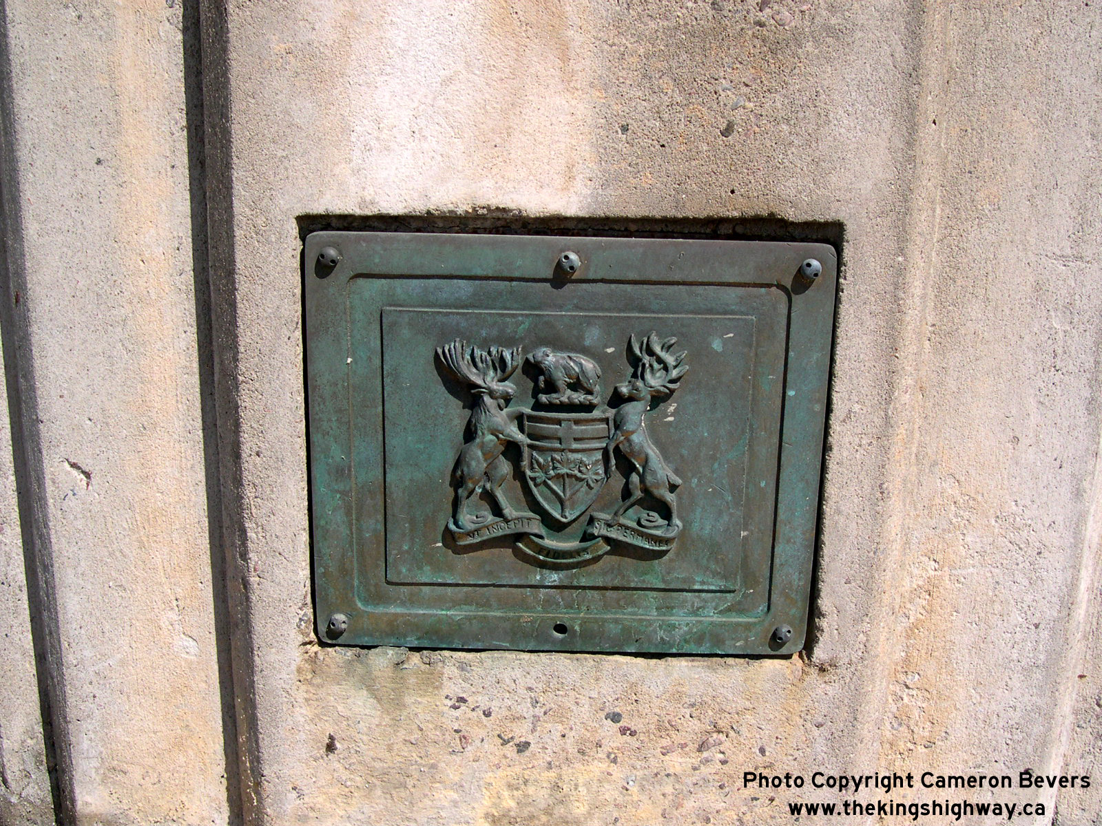
Enlarged Photo Here. (Photograph taken on August 1, 2004 - © Cameron Bevers) Right - Bronze DHO plaque on the Muskrat River Bridge on Pembroke Street (Old Hwy 17, later known as Hwy 148) in Downtown Pembroke. During the 1930s, many DHO-built bridges featured these decorative bronze plaques. Sadly, simple decorative features such as these are rarely incorporated into modern bridge designs. See an Enlarged Photo Here. (Photograph taken on August 1, 2004 - © Cameron Bevers) |
|---|
|
Present Day King's Highway 148 Photographs
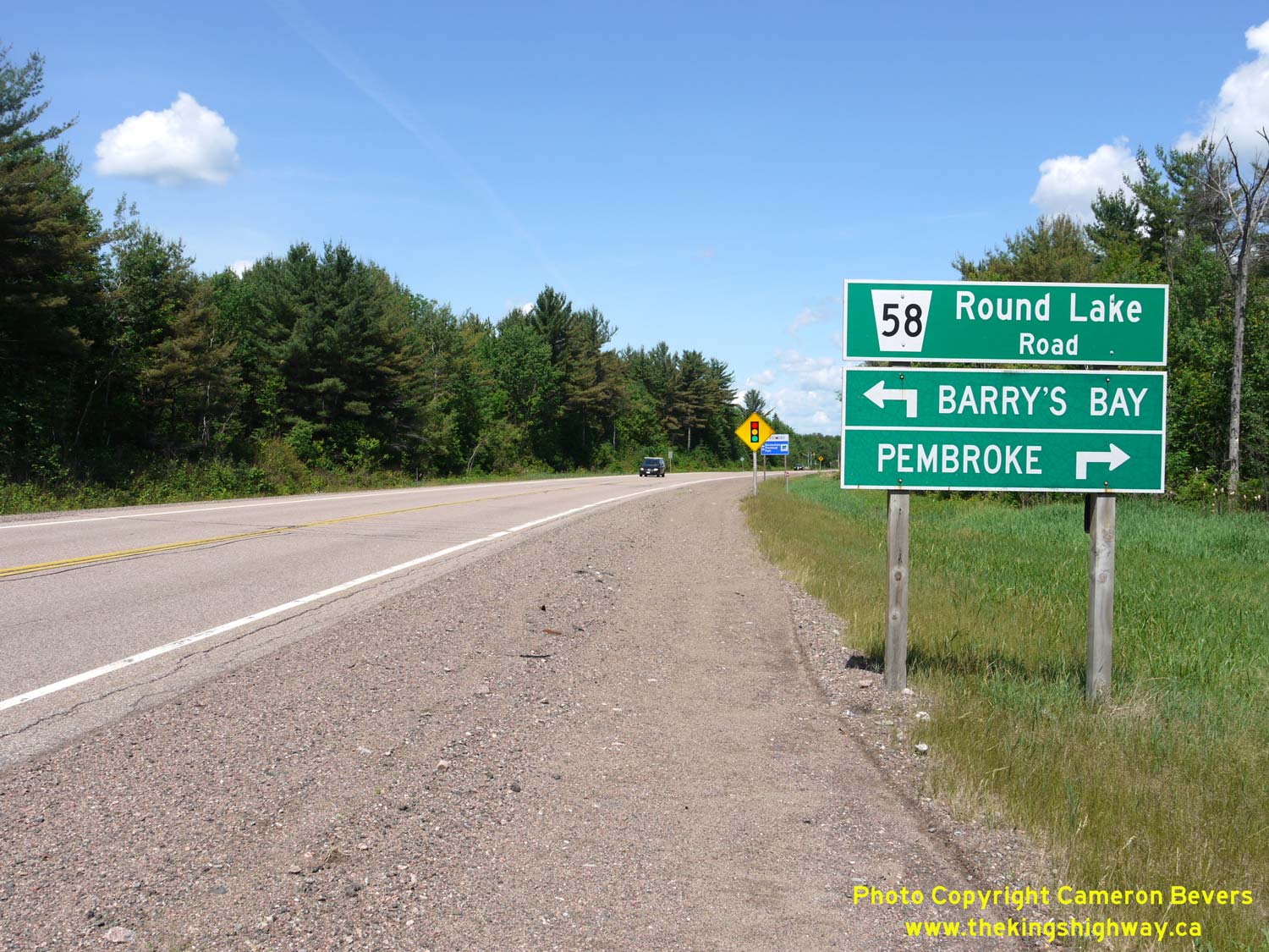
Left - Facing west along Hwy 17 towards Petawawa approaching Round Lake Road (Hwy 62 & Hwy 148) near Pembroke. Up until 1997, Round Lake Road south of the
Hwy 17 Junction was part of King's Highway 62, while north of the Hwy 17 Junction, Round Lake Road was known as King's Highway 148. Both of these provincial highways
were transferred to the County of Renfrew in 1997. Renfrew County renamed the two former highways collectively as Renfrew County Road 58. See an
Enlarged Photo Here. (Photograph taken on June 4, 2010 - © Cameron Bevers) Right - Facing north along Round Lake Road (Hwy 62) towards the Hwy 17 Junction near Pembroke. Prior to 1997, Hwy 62 reached its northern terminus at the Hwy 17 Junction. As a result of highway transfers and government service realignment in the 1990s, provincial ownership of Hwy 62 now ends in Maynooth, located about 130 km to the south. See an Enlarged Photo Here. (Photograph taken on June 4, 2010 - © Cameron Bevers) 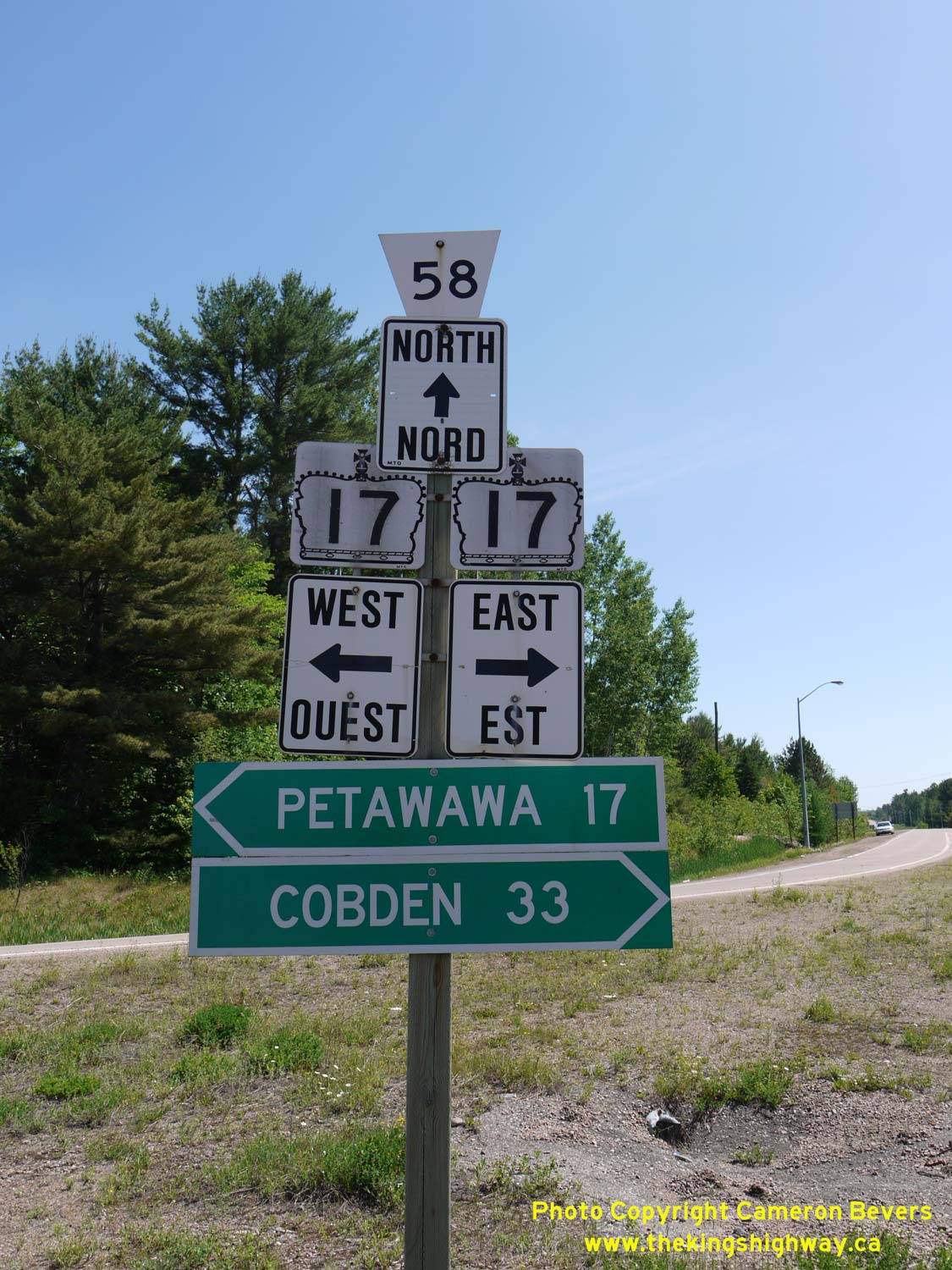
Above - Junction sign assembly at the Hwy 17 and Former Hwy 62 & Hwy 148 Junction near Pembroke. Prior to 1997, the County Road 58 flowerpot route marker
would have been a Hwy 148 provincial crown sign. Jurisdiction over both Hwy 62 & Hwy 148 in this area was transferred from the province to the County of Renfrew,
effective March 31, 1997. See an Enlarged Photo Here. (Photograph taken on June 4, 2010 - © Cameron Bevers) 
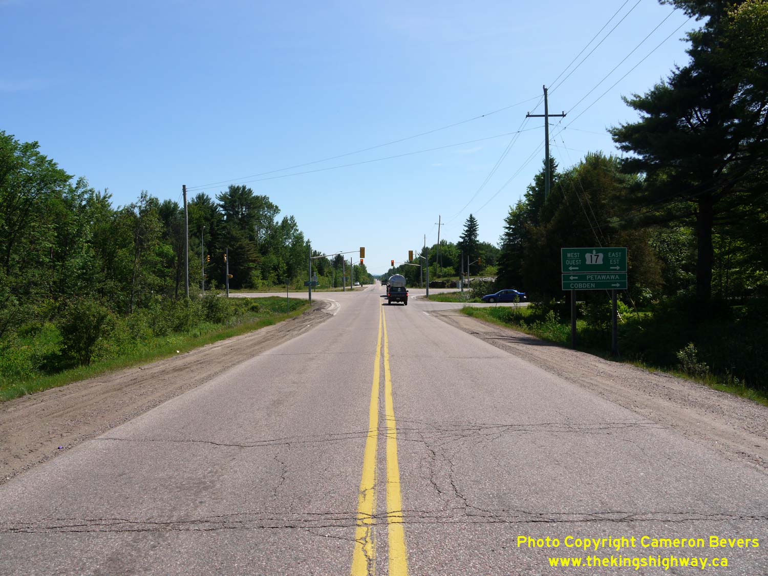
Left - Facing west along Hwy 17 towards Petawawa from the Round Lake Road (Hwy 62 & Hwy 148) Junction. See an
Enlarged Photo Here. (Photograph taken on June 4, 2010 - © Cameron Bevers) Right - Approaching the Round Lake Road (Hwy 62 & Hwy 148) Junction on Hwy 17, facing east towards Renfrew. See an Enlarged Photo Here. (Photograph taken on June 4, 2010 - © Cameron Bevers) 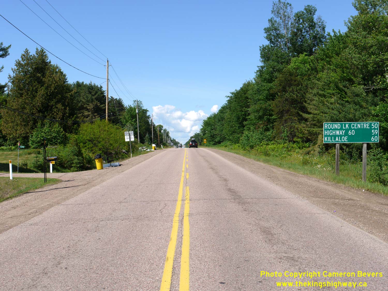
Left - Facing south along Round Lake Road (Hwy 62) from the Hwy 17 Junction. It is interesting to note that the distance guide sign at right lists Hwy 60 as a
destination. This is actually the next highway junction beyond Hwy 17, when heading south out of Pembroke. See an
Enlarged Photo Here. (Photograph taken on June 4, 2010 - © Cameron Bevers) Right - Facing west along Hwy 17 at the Round Lake Road (Hwy 62 & Hwy 148) Junction. See an Enlarged Photo Here. (Photograph taken on June 4, 2010 - © Cameron Bevers) 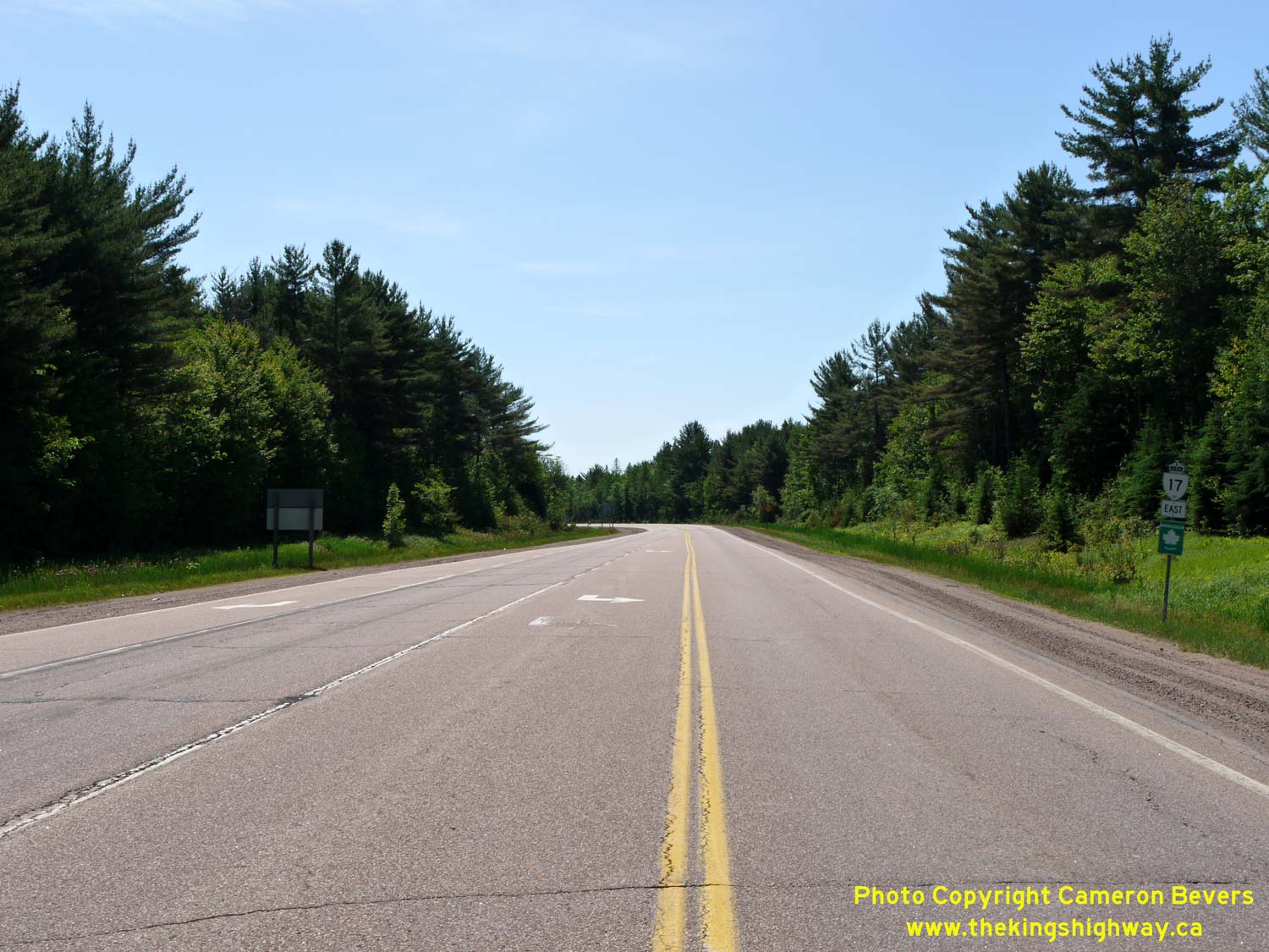
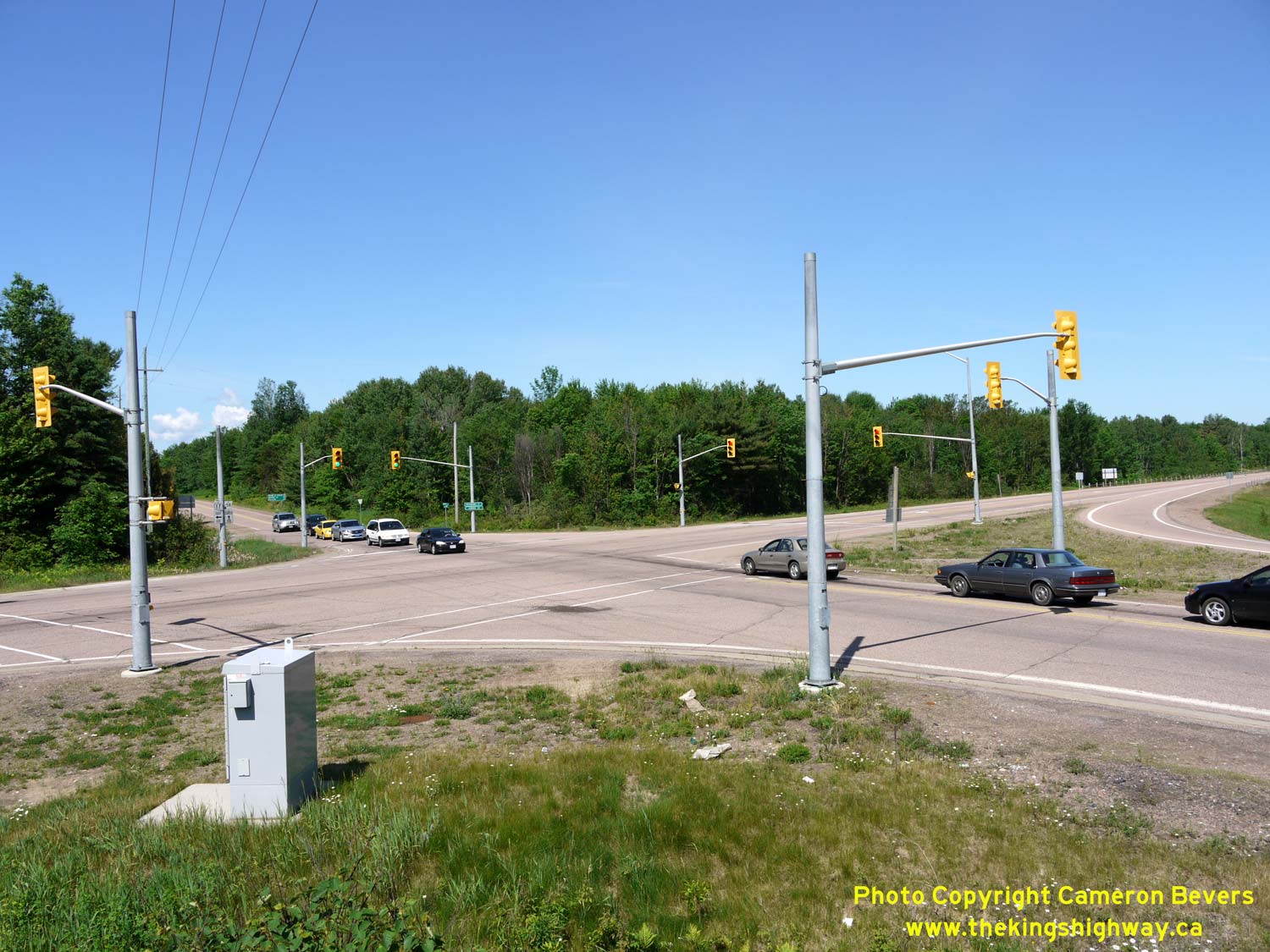
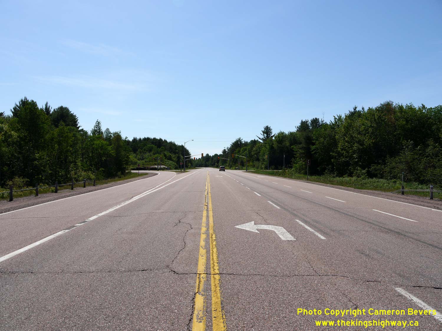
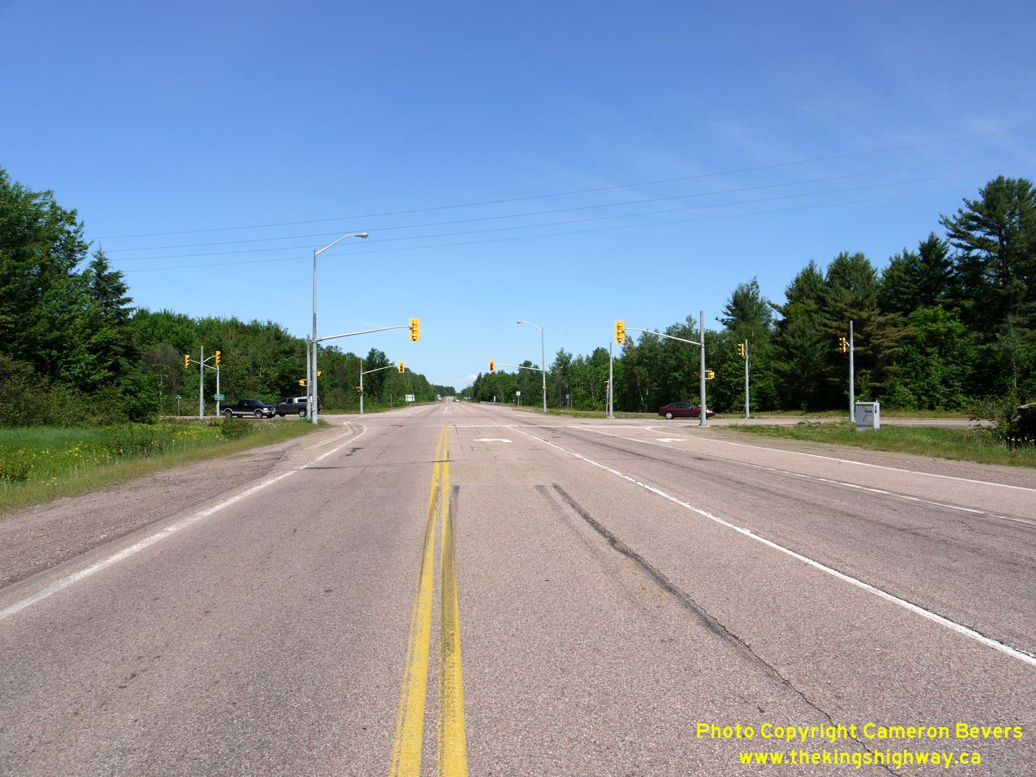
Left - Facing east along Hwy 17 from the Round Lake Road (Hwy 62 & Hwy 148) Junction near Pembroke. See an
Enlarged Photo Here. (Photograph taken on June 4, 2010 - © Cameron Bevers) Right - View of the traffic signals at Hwy 17 and Round Lake Road (Hwy 62 & Hwy 148). See an Enlarged Photo Here. (Photograph taken on June 4, 2010 - © Cameron Bevers) 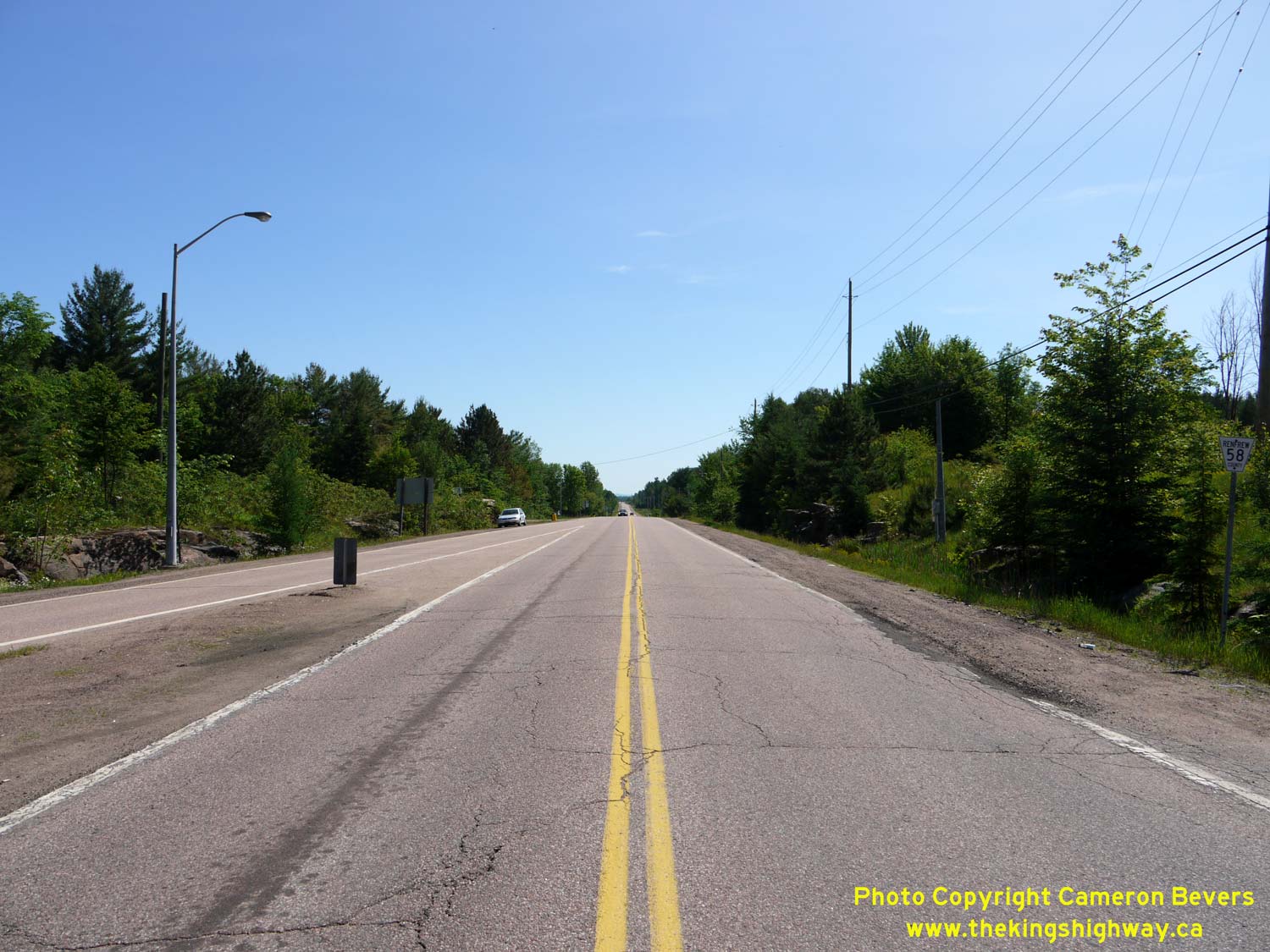
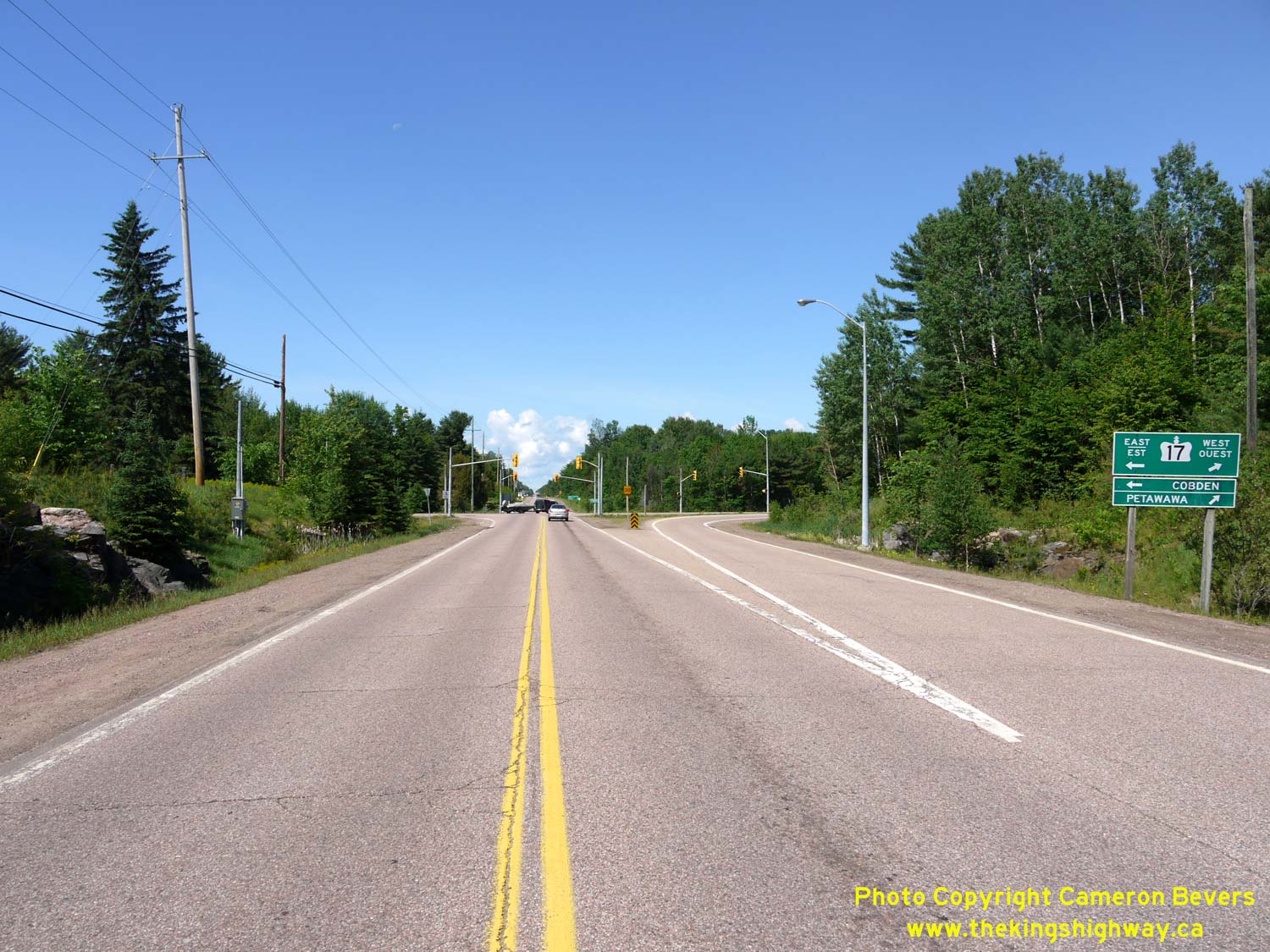
Left - Facing north along Round Lake Road (Hwy 148) from the Hwy 17 & Hwy 62 Junction near Pembroke. Downtown Pembroke lies about 7 km ahead. See an
Enlarged Photo Here. (Photograph taken on June 4, 2010 - © Cameron Bevers) Right - Approaching the Hwy 17 & Hwy 62 Junction on Round Lake Road (Hwy 148) near Pembroke. See an Enlarged Photo Here. (Photograph taken on June 4, 2010 - © Cameron Bevers) 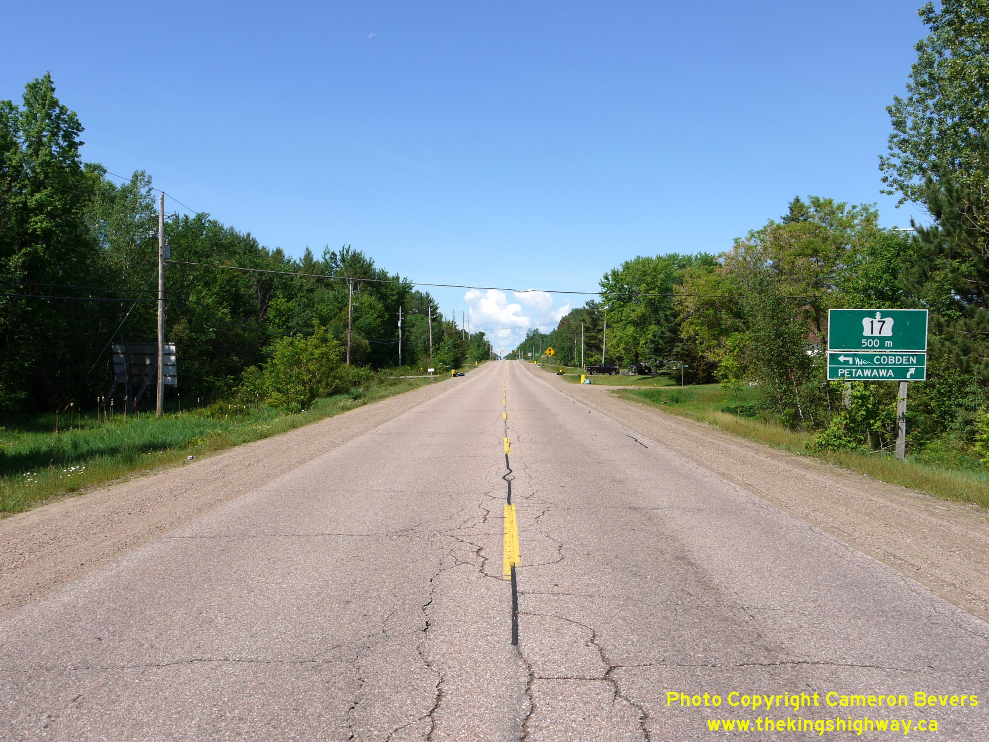
 Left - Green guide sign on westbound Hwy 148 approaching the Hwy 17 Junction west of Pembroke. Prior to 1997, Hwy 148 reached its western terminus at this
highway junction. The section of Hwy 148 between Pembroke and the Hwy 17 Junction was transferred over to municipal control in the late 1990s and is now officially
known as Renfrew County Road 58. Today, the signed route of Hwy 148 ends in Downtown Pembroke at the Hwy 41 Junction. See an
Enlarged Photo Here. Left - Green guide sign on westbound Hwy 148 approaching the Hwy 17 Junction west of Pembroke. Prior to 1997, Hwy 148 reached its western terminus at this
highway junction. The section of Hwy 148 between Pembroke and the Hwy 17 Junction was transferred over to municipal control in the late 1990s and is now officially
known as Renfrew County Road 58. Today, the signed route of Hwy 148 ends in Downtown Pembroke at the Hwy 41 Junction. See an
Enlarged Photo Here.(Photograph taken on June 4, 2010 - © Cameron Bevers) Right - Facing west along Bruham Avenue (Hwy 148) from Lorne Street in Brumsfield. This suburb of Pembroke lies on the western side of Boundary Road within the
Township of Laurentian Valley. The route of Hwy 148 continues west for about 5 km from Brumsfield, where the highway intersects with Hwy 17 & Hwy 62. See an
Enlarged Photo Here.(Photograph taken on June 4, 2010 - © Cameron Bevers) 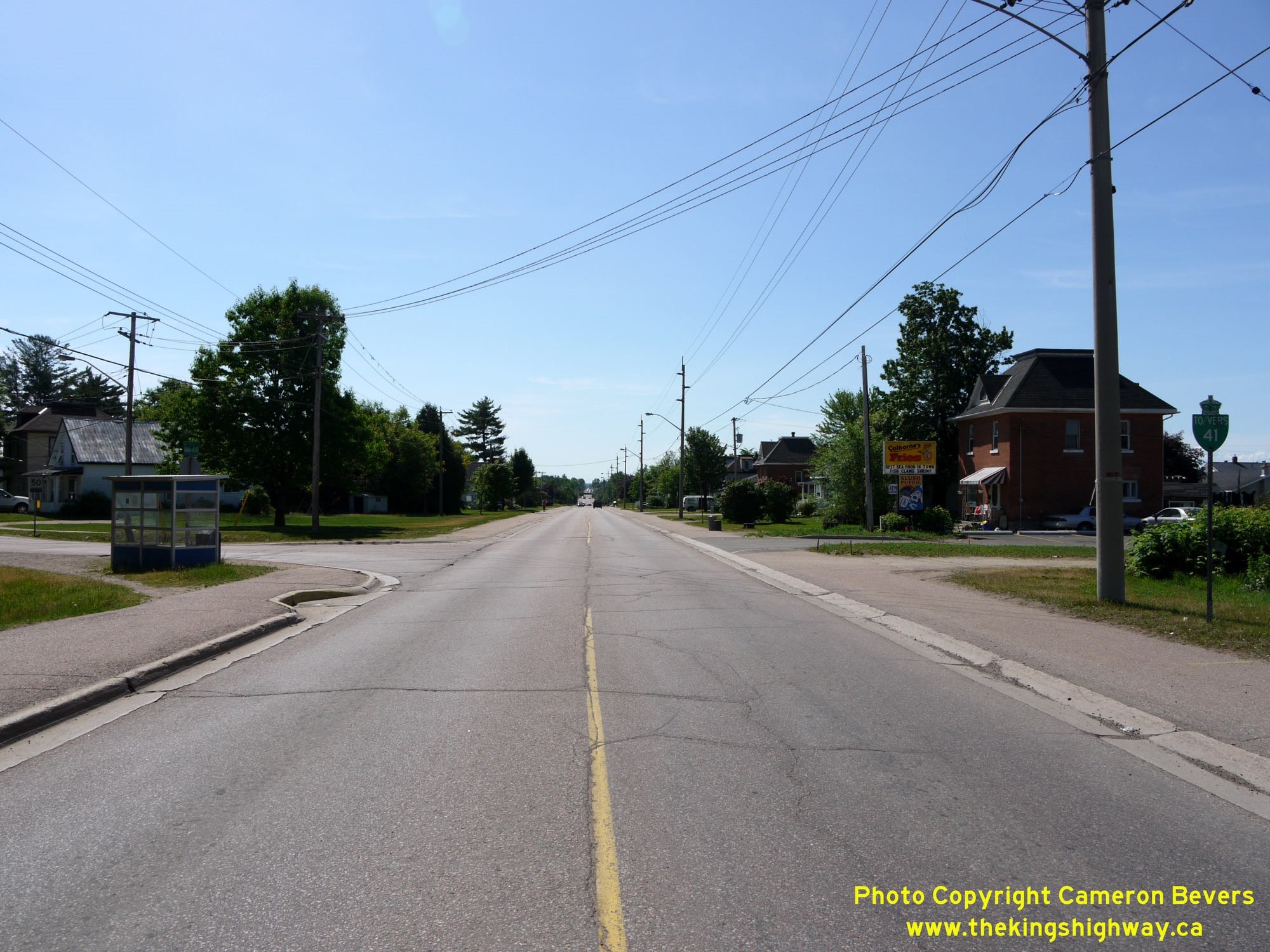
 Left - View of Boundary Road (Old Hwy 41) facing south from Bruham Avenue (Hwy 148). Between 1957 and 1987, Hwy 41 skirted around the western side of Pembroke
via Boundary Road and did not actually enter the city centre. During the 1980s, a new route for Hwy 41 was established (via today's Paul Martin Drive) which led into
Downtown Pembroke. The old route of Hwy 41 via Boundary Road was transferred over to municipal control in 1987. The former route of Hwy 41 via Boundary Road is signed
today with green-and-white "TO 41" trailblazer route markers. See an Enlarged Photo Here. Left - View of Boundary Road (Old Hwy 41) facing south from Bruham Avenue (Hwy 148). Between 1957 and 1987, Hwy 41 skirted around the western side of Pembroke
via Boundary Road and did not actually enter the city centre. During the 1980s, a new route for Hwy 41 was established (via today's Paul Martin Drive) which led into
Downtown Pembroke. The old route of Hwy 41 via Boundary Road was transferred over to municipal control in 1987. The former route of Hwy 41 via Boundary Road is signed
today with green-and-white "TO 41" trailblazer route markers. See an Enlarged Photo Here.(Photograph taken on June 4, 2010 - © Cameron Bevers) Right - Facing west along Bruham Avenue (Hwy 148) from Boundary Road at the western entrance to Pembroke. See an
Enlarged Photo Here.(Photograph taken on June 4, 2010 - © Cameron Bevers) 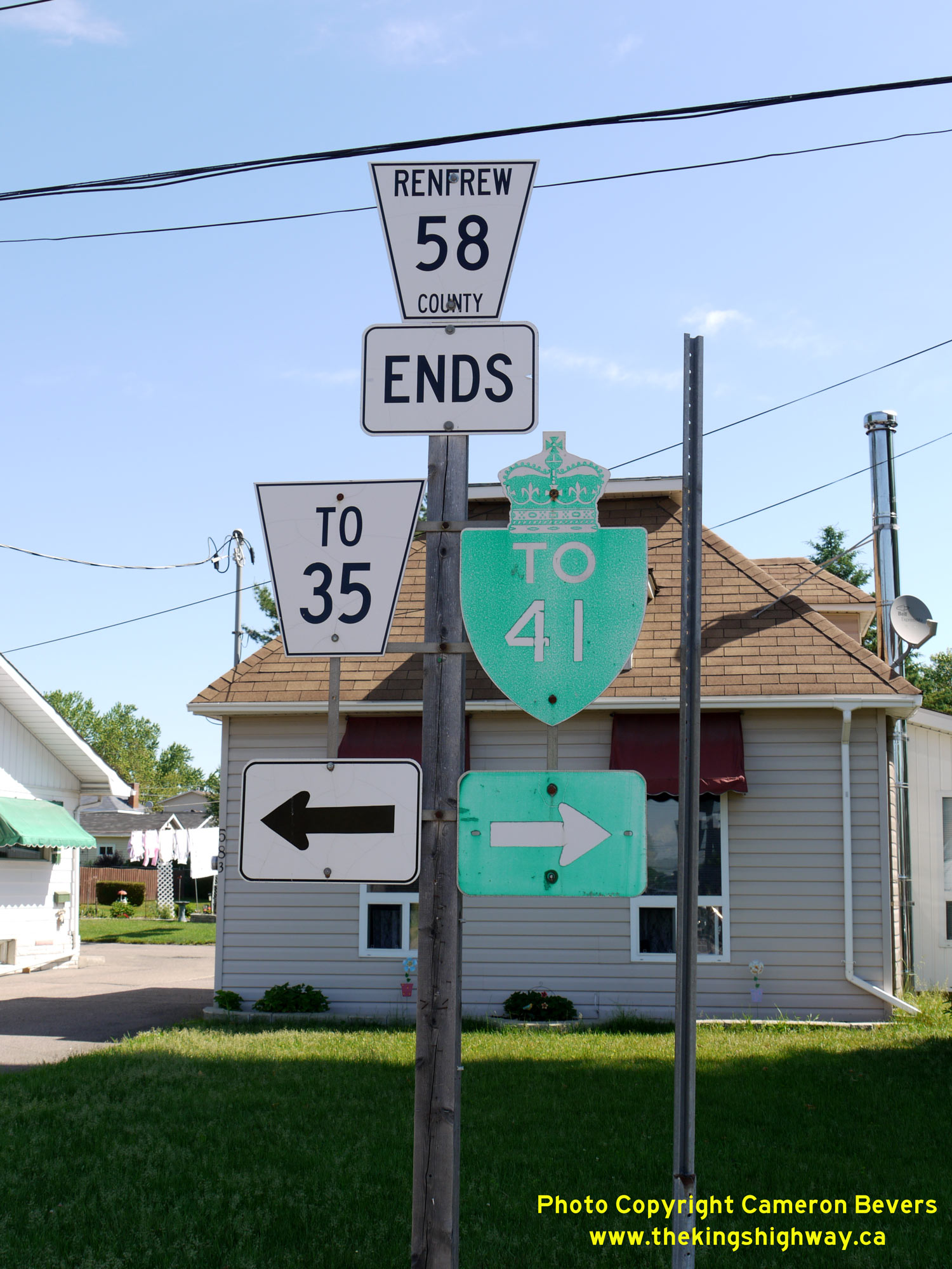
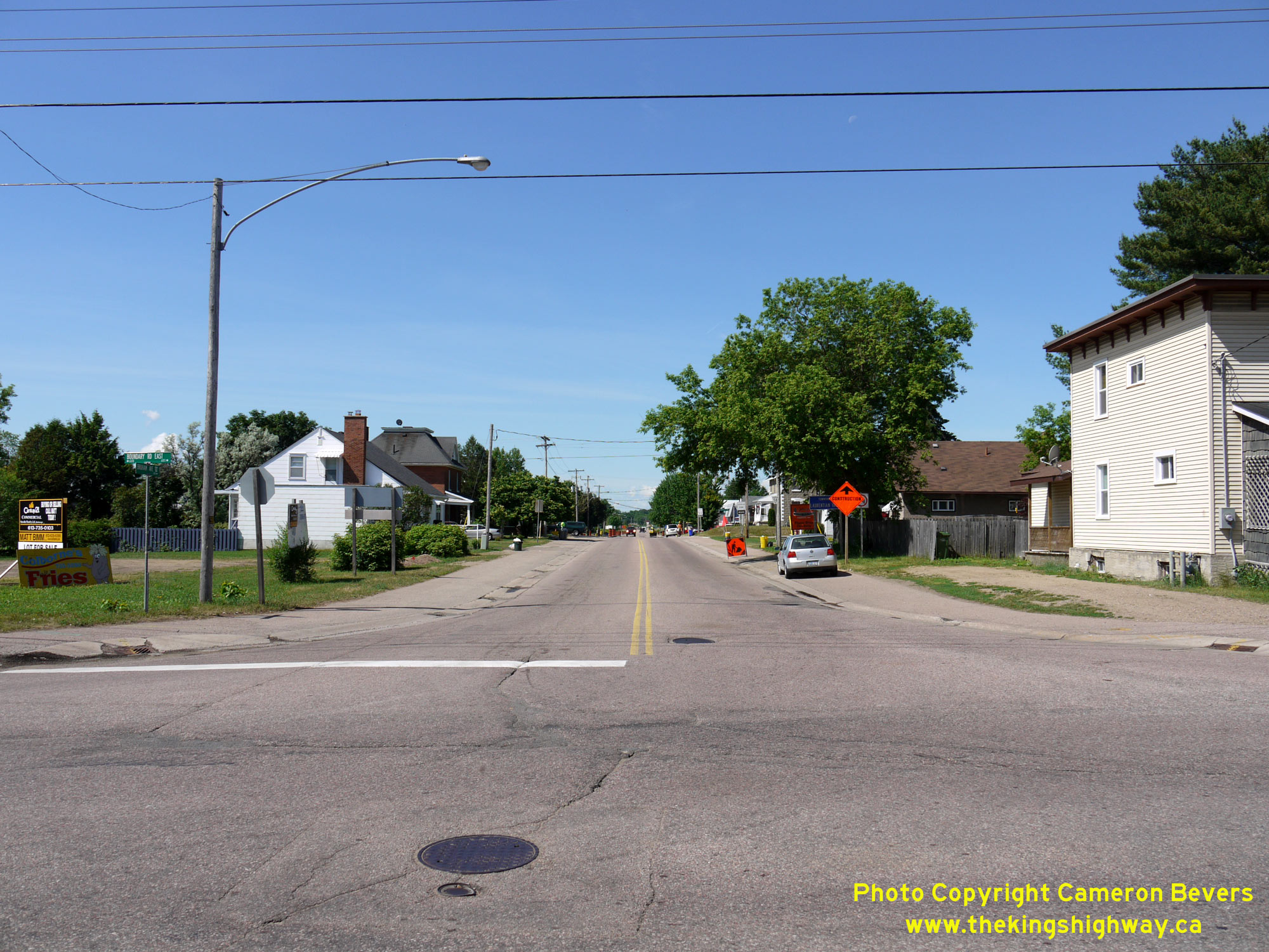
 Left - Junction sign assembly at the intersection of Boundary Road (Old Hwy 41) and Bruham Avenue (Hwy 148) in Pembroke. Since the highway's transfer over
to the municipal tier in the late 1990s, all references to Hwy 148 at this junction have been removed. Historically, Hwy 148 turned left and headed north via Boundary
Road for one block to Trafalgar Street, where the route of Hwy 148 turned right and resumed its easterly trek into Downtown Pembroke. Renfrew County now maintains the
route of Hwy 148 west of Pembroke's City Limits, as a part of County Road 58. East of this point, the route of Hwy 148 is maintained by the City of Pembroke. A very
old "TO 41" trailblazer marker points the way back to Hwy 41 via Boundary Road. See an
Enlarged Photo Here. Left - Junction sign assembly at the intersection of Boundary Road (Old Hwy 41) and Bruham Avenue (Hwy 148) in Pembroke. Since the highway's transfer over
to the municipal tier in the late 1990s, all references to Hwy 148 at this junction have been removed. Historically, Hwy 148 turned left and headed north via Boundary
Road for one block to Trafalgar Street, where the route of Hwy 148 turned right and resumed its easterly trek into Downtown Pembroke. Renfrew County now maintains the
route of Hwy 148 west of Pembroke's City Limits, as a part of County Road 58. East of this point, the route of Hwy 148 is maintained by the City of Pembroke. A very
old "TO 41" trailblazer marker points the way back to Hwy 41 via Boundary Road. See an
Enlarged Photo Here.(Photograph taken on June 4, 2010 - © Cameron Bevers) Right - An older King's Highway 148 route marker in Pembroke. See an
Enlarged Photo Here.(Photograph taken on June 4, 2010 - © Cameron Bevers) 
 Left - View of Boundary Road (Hwy 148) facing north from Bruham Avenue in Pembroke. The historical route of Hwy 148 turned right just ahead at Trafalgar
Street. See an Enlarged Photo Here. Left - View of Boundary Road (Hwy 148) facing north from Bruham Avenue in Pembroke. The historical route of Hwy 148 turned right just ahead at Trafalgar
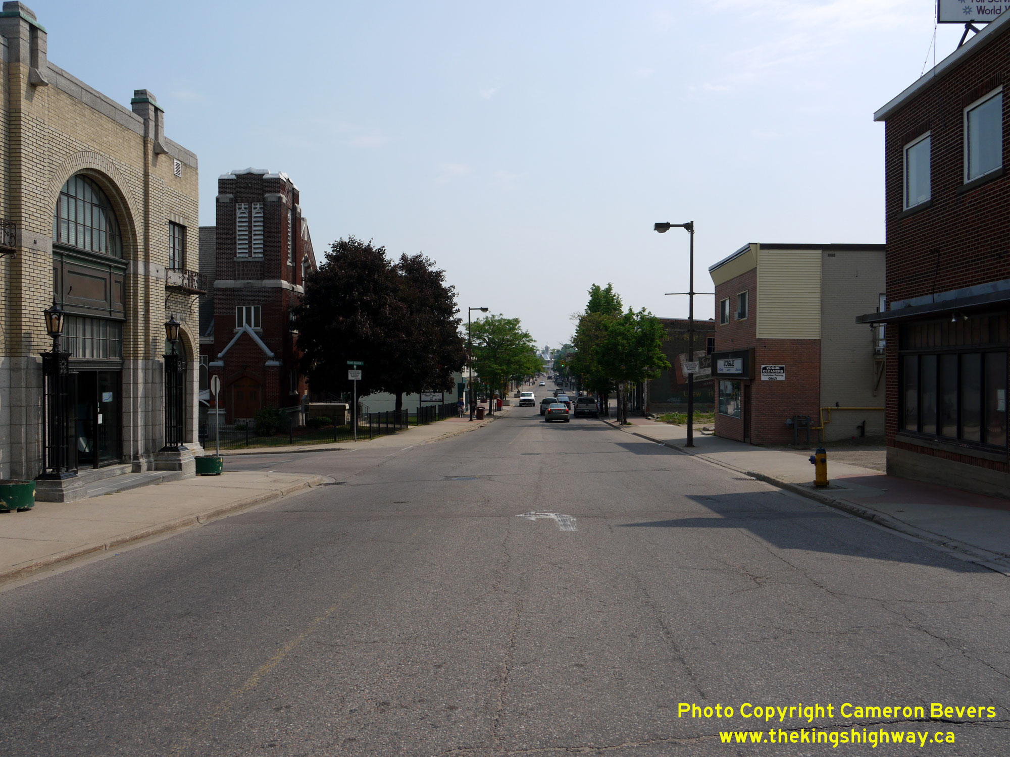
Street. See an Enlarged Photo Here.(Photograph taken on June 4, 2010 - © Cameron Bevers) Right - Facing east along Pembroke Street (Old Hwy 17, later known as Hwy 148) just east of Hincks Street. Pembroke's City Centre lies just ahead. Pembroke is
the largest urban centre in the Upper Ottawa Valley. However, Pembroke's main street now carries a lot less through traffic, as a new bypass route for Hwy 17 was
built around the city during the early 1980s. See an Enlarged Photo Here.(Photograph taken on May 31, 2010 - © Cameron Bevers) 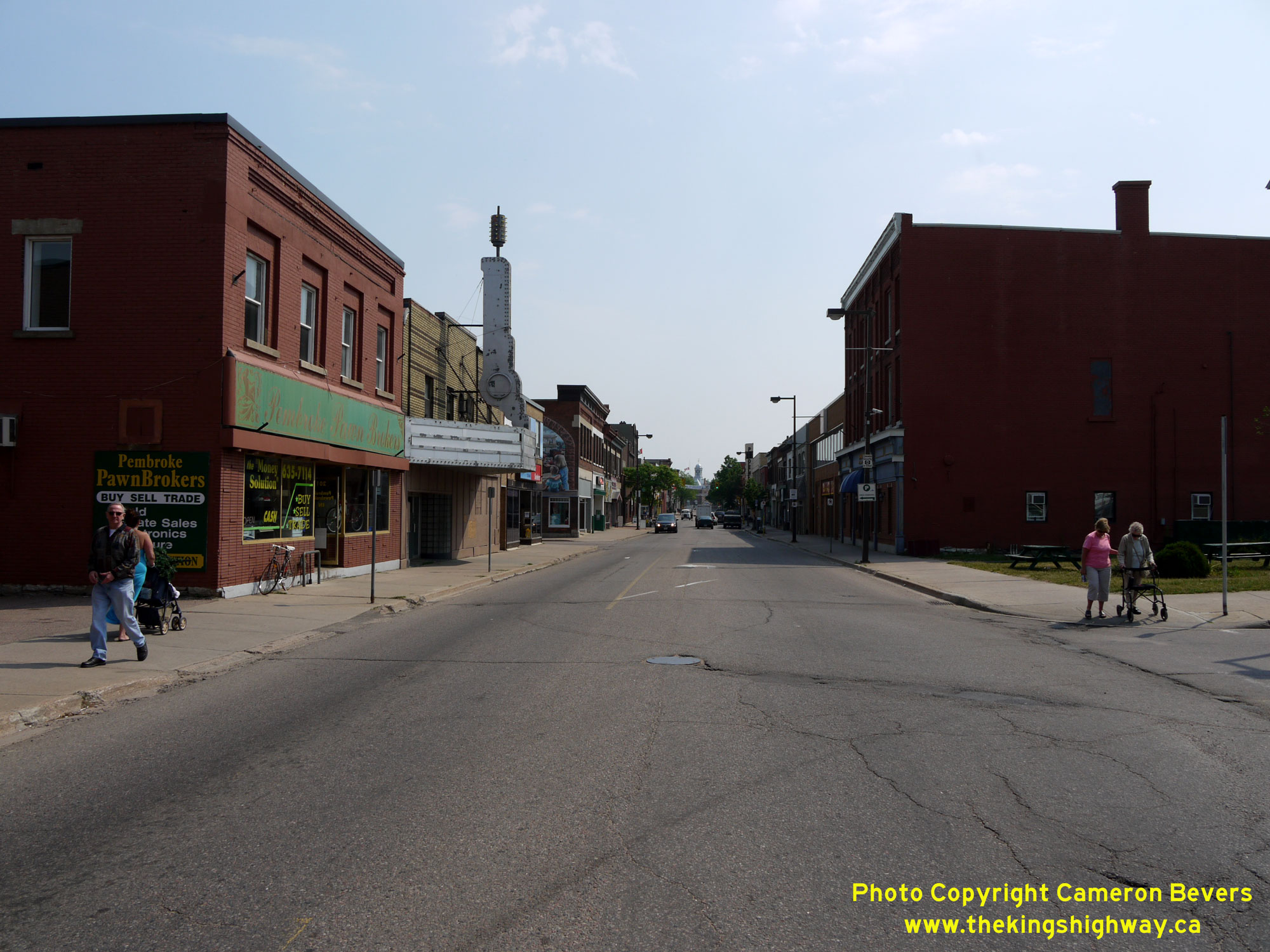
 Left - View of Pembroke Street (Old Hwy 17, later known as Hwy 148), facing east from Moffat Street in Downtown Pembroke. This is the same section of Pembroke
Street shown in this Historical 1959 Photo. Once the Pembroke Bypass (Hwy 17 New) opened in
the early 1980s, through traffic on Hwy 17 no longer had to pass through the city centre. See an
Enlarged Photo Here. Left - View of Pembroke Street (Old Hwy 17, later known as Hwy 148), facing east from Moffat Street in Downtown Pembroke. This is the same section of Pembroke
Street shown in this Historical 1959 Photo. Once the Pembroke Bypass (Hwy 17 New) opened in
the early 1980s, through traffic on Hwy 17 no longer had to pass through the city centre. See an
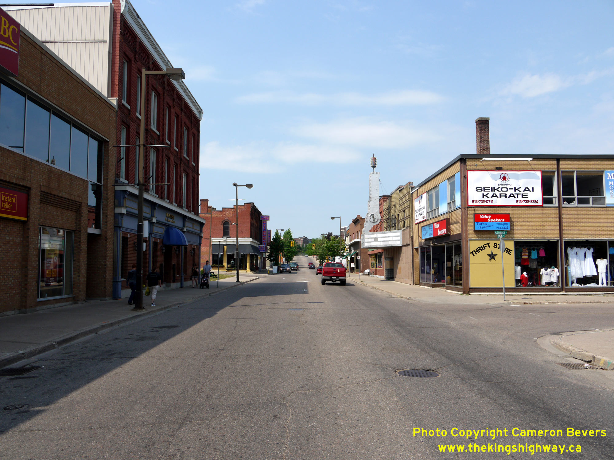
Enlarged Photo Here.(Photograph taken on May 31, 2010 - © Cameron Bevers) Right - Facing west along Pembroke Street (Old Hwy 17, later known as Hwy 148) at Alexander Street in Downtown Pembroke. When compared to the busy main street
photos of yesteryear shown above, today's views of Pembroke's main street are quite disheartening. These types of views are certainly not unique to Pembroke. In fact,
all across Ontario, many smaller towns and cities have struggled to keep their traditional downtown areas vibrant. Note the marquee sign of the former Centre Theatre
on the right-hand side of the street - a historical vestige of much happier times in the city centre. See an
Enlarged Photo Here.(Photograph taken on May 31, 2010 - © Cameron Bevers) 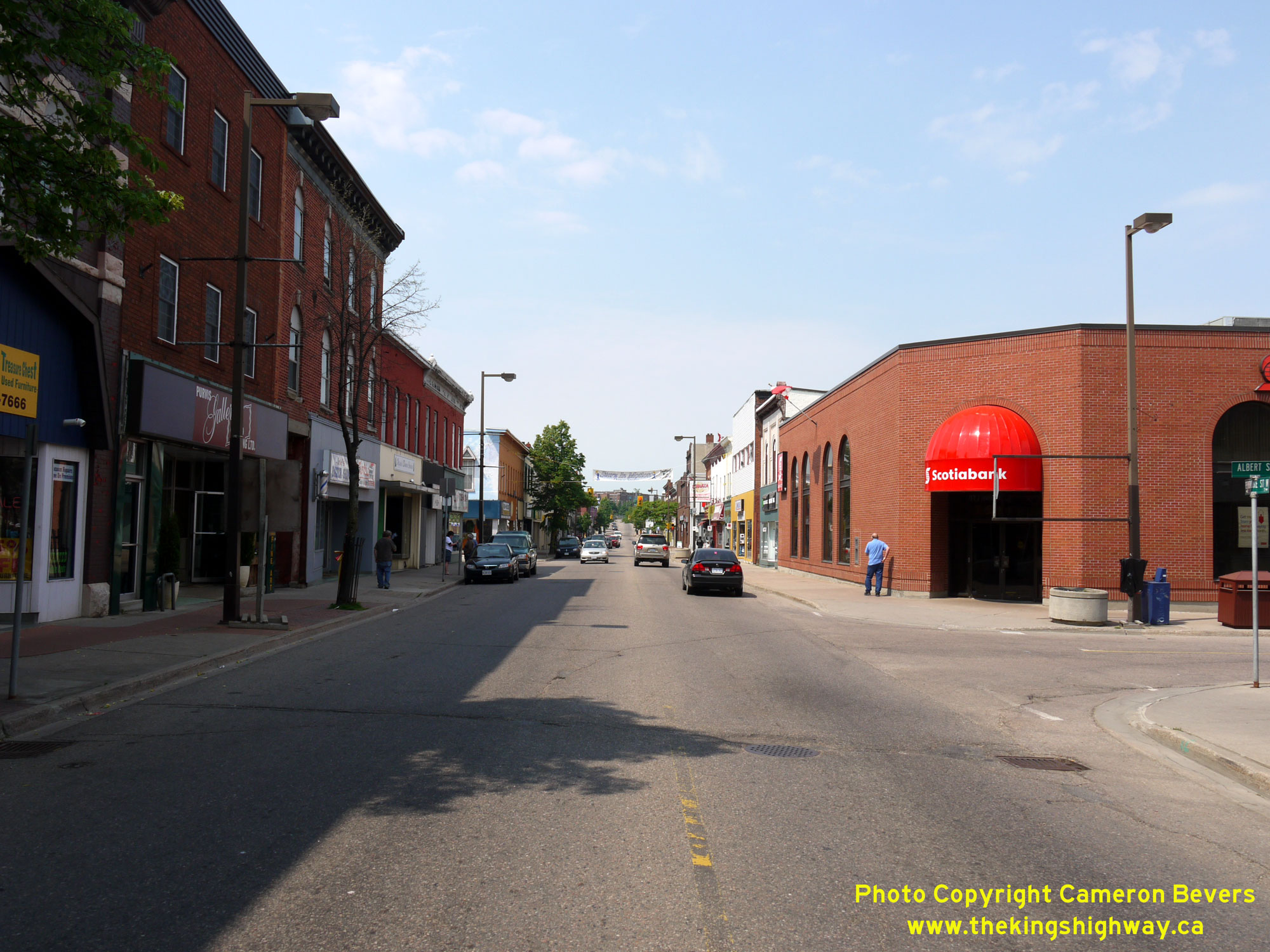
 Left - View of Pembroke Street (Old Hwy 17, later known as Hwy 148), facing west from Albert Street in Downtown Pembroke. See an
Enlarged Photo Here. Left - View of Pembroke Street (Old Hwy 17, later known as Hwy 148), facing west from Albert Street in Downtown Pembroke. See an
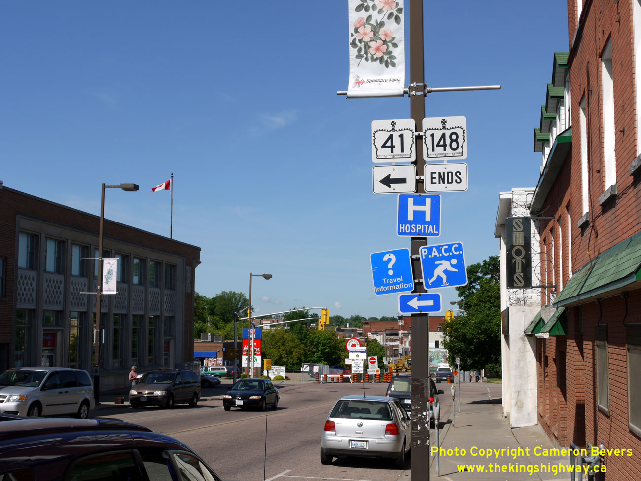
Enlarged Photo Here.(Photograph taken on May 31, 2010 - © Cameron Bevers) Right - Signs marking the Hwy 41 & Hwy 148 Junction in Downtown Pembroke. Up until 1997, Hwy 148 continued west through Downtown Pembroke to join with Hwy 17 & Hwy 62 south of Petawawa. Since 1997, the signed routes of Hwy 41 and Hwy 148 share a common terminus in Downtown Pembroke. See an Enlarged Photo Here. (Photograph taken on June 4, 2010 - © Cameron Bevers). 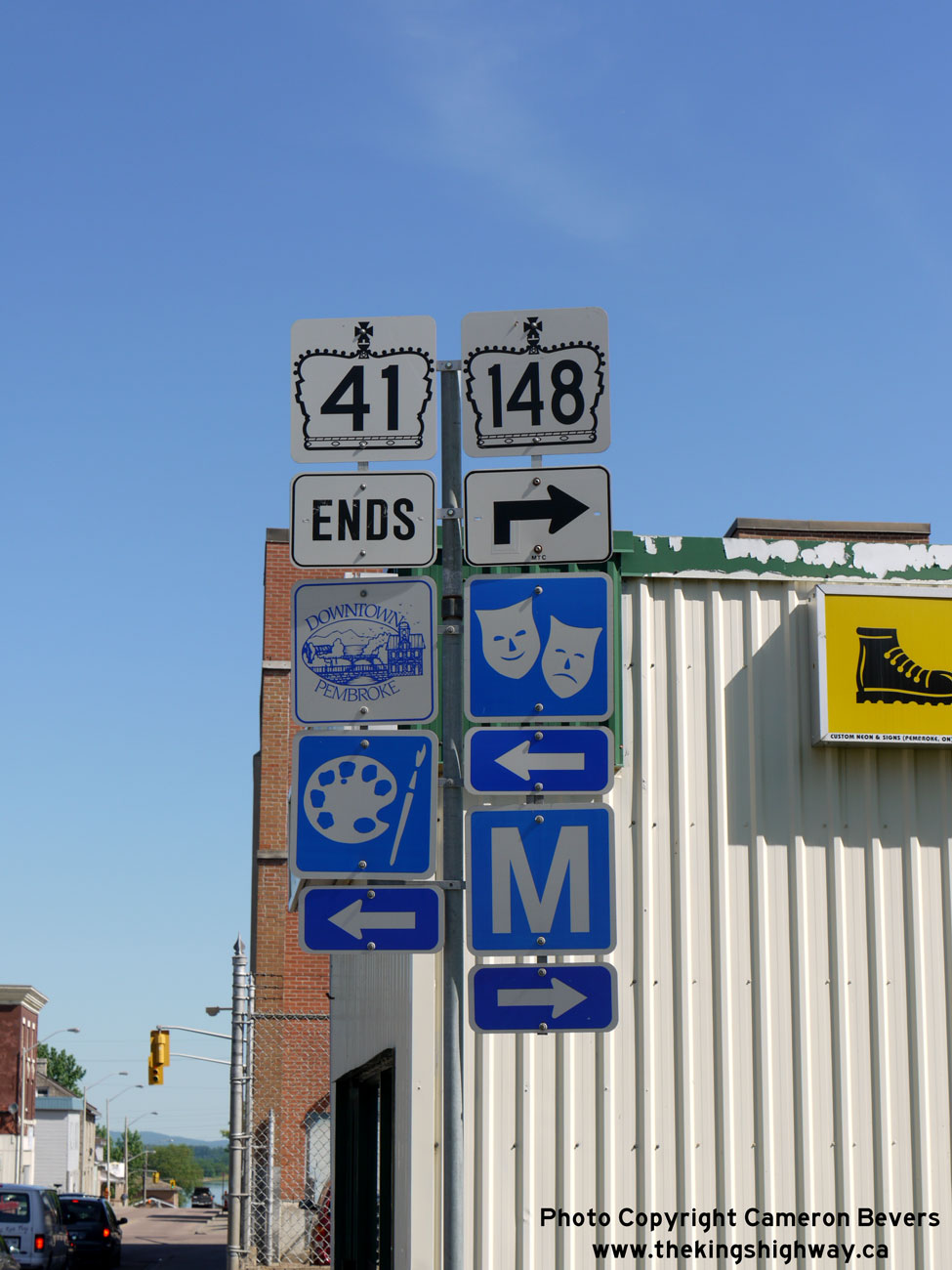
Above - Sign marking the end of Hwy 41 in Downtown Pembroke. The diminutive 6 km route of Hwy 148 begins at the Hwy 41 Junction. Like Hwy 41, the section of
Hwy 148 lying within Pembroke's City Limits is maintained by the municipality. See an
Enlarged Photo Here. (Photograph taken on June 4, 2010 - © Cameron Bevers) 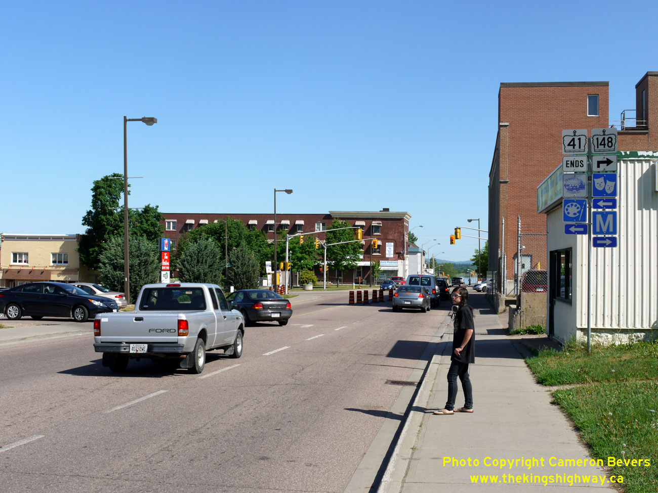
Left - Approaching the northern terminus of Hwy 41 in Downtown Pembroke. Although Hwy 41 is fully signed through Pembroke, the section of Hwy 41
lying north of the Hwy 17 Junction is actually maintained by the municipality. See an
Enlarged Photo Here. (Photograph taken on June 4, 2010 - © Cameron Bevers) Right - Facing east along Hwy 148 approaching the turn-off to Des Allumettes Bridge. At this highway junction, Hwy 148 turns left and continues east towards
the Ontario-Quebec Boundary. Through traffic can continue straight ahead via Renfrew County Road 40 (Old Hwy 17) towards Ottawa. Renfrew County Road 40 ends at the
Pembroke Bypass (Hwy 17 New) about 8 km ahead. See an Enlarged Photo Here.(Photograph taken on June 4, 2010 - © Cameron Bevers) 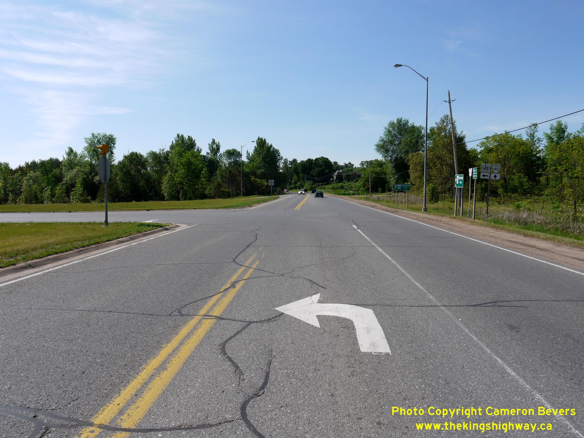
 Left - Facing east at the Hwy 148 turn-off to Des Allumettes Bridge. Prior to the completion of the Pembroke Bypass (Hwy 17 New) in 1982, Hwy 17 continued
straight ahead towards Ottawa. Provincial jurisdiction over Old Hwy 17 between this highway junction and the Hwy 17 New Junction at Meath Hill ended in September
1983, when Old Hwy 17 was transferred over to the County of Renfrew. See an
Enlarged Photo Here. Left - Facing east at the Hwy 148 turn-off to Des Allumettes Bridge. Prior to the completion of the Pembroke Bypass (Hwy 17 New) in 1982, Hwy 17 continued
straight ahead towards Ottawa. Provincial jurisdiction over Old Hwy 17 between this highway junction and the Hwy 17 New Junction at Meath Hill ended in September
1983, when Old Hwy 17 was transferred over to the County of Renfrew. See an
Enlarged Photo Here.(Photograph taken on June 4, 2010 - © Cameron Bevers) Right - Facing west along Hwy 148 towards Pembroke from the turn-off to Quebec. Here, traffic entering Ontario via Des Allumettes Bridge merges in from the
right. See an Enlarged Photo Here.(Photograph taken on June 4, 2010 - © Cameron Bevers) 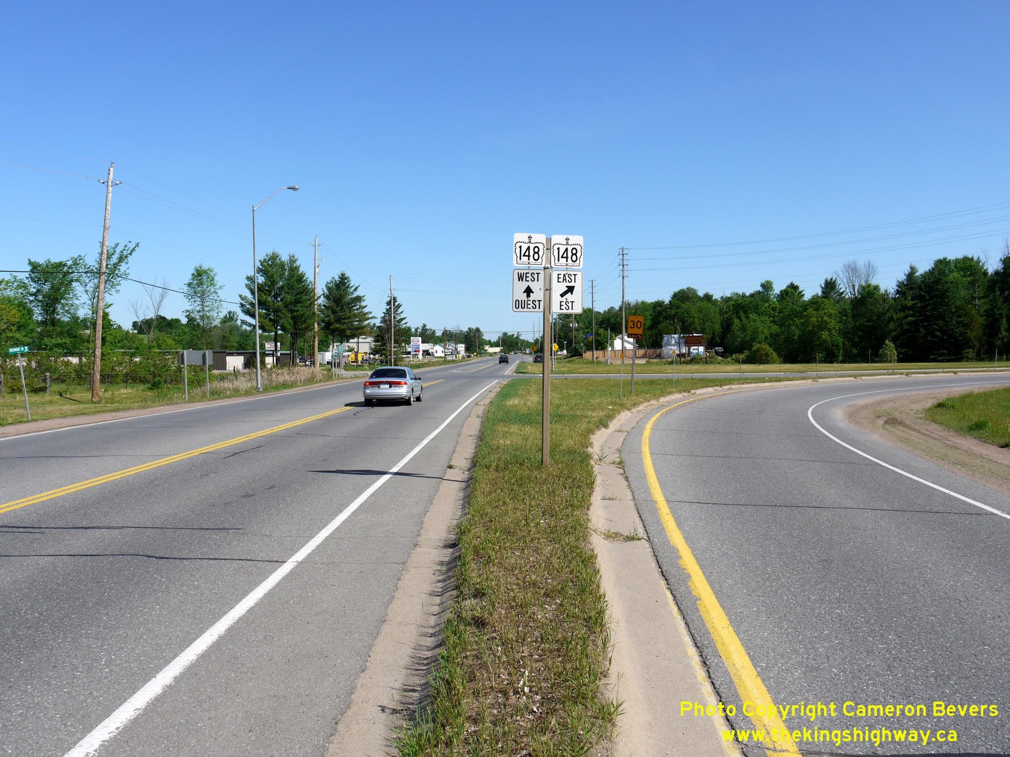
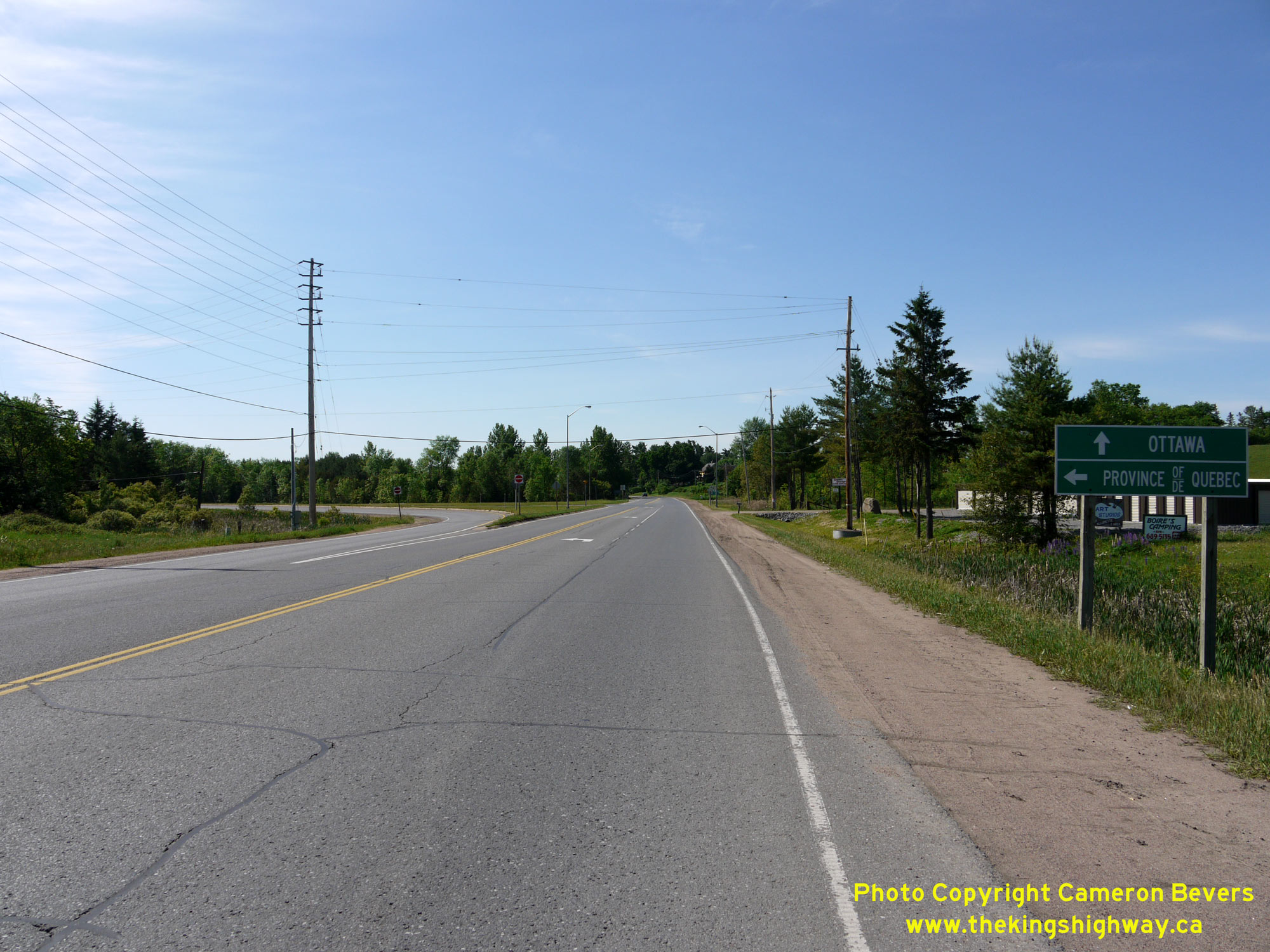
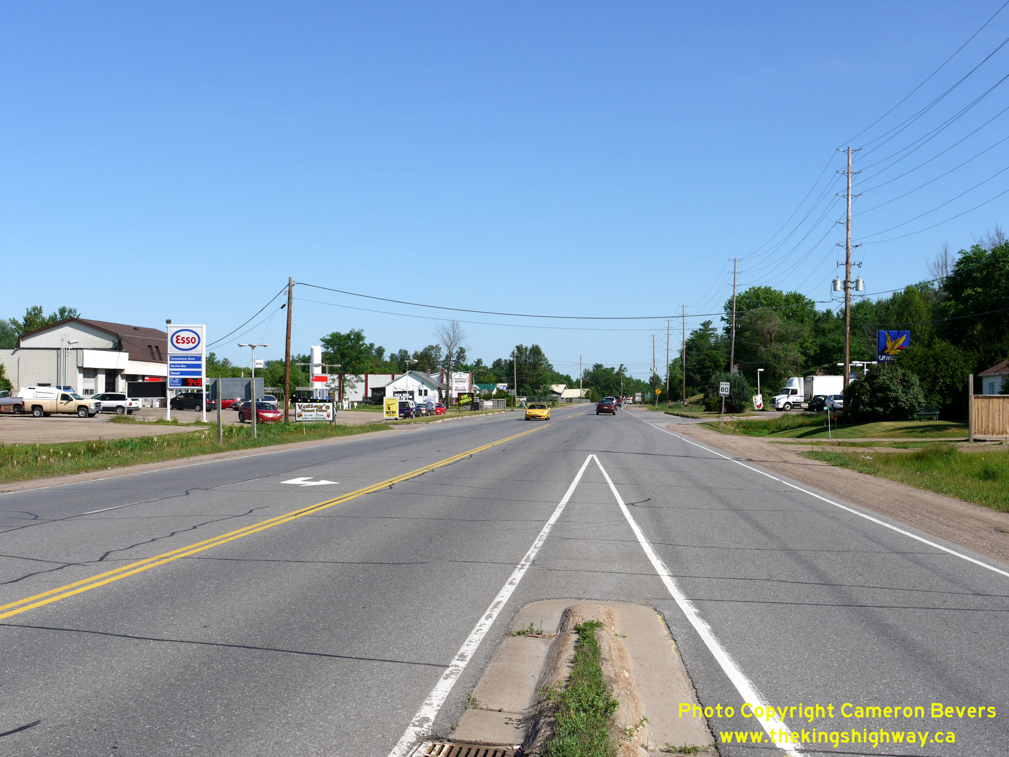
 Left - Junction signs for Hwy 148 approaching the turn-off to Quebec, facing west along Old Hwy 17 (Renfrew County Road 40). This intersection features two
right-turn channelizations, built at a time when this road carried long-distance through traffic across Ontario on the Trans-Canada Highway (Hwy 17). Even today, this
is a fairly busy highway junction, although it no longer carries the proportion of through traffic it once did in decades past. See an
Enlarged Photo Here. Left - Junction signs for Hwy 148 approaching the turn-off to Quebec, facing west along Old Hwy 17 (Renfrew County Road 40). This intersection features two
right-turn channelizations, built at a time when this road carried long-distance through traffic across Ontario on the Trans-Canada Highway (Hwy 17). Even today, this
is a fairly busy highway junction, although it no longer carries the proportion of through traffic it once did in decades past. See an
Enlarged Photo Here.(Photograph taken on June 4, 2010 - © Cameron Bevers) Right - Western terminus of the road to Des Allumettes Bridge east of Pembroke. Traffic reaching this highway junction can either turn right and follow Hwy 148
West into Pembroke, or turn left via Renfrew County Road 40 to reach Hwy 17 East to Ottawa. Motorists bound for Hwy 17 West or Hwy 41 have little choice but to drive
right through Downtown Pembroke, due to the area's road network configuration. See an
Enlarged Photo Here.(Photograph taken on June 4, 2010 - © Cameron Bevers) 
 Left - Distance guide sign on eastbound Hwy 148, facing east towards Des Allumettes Bridge from the Old Hwy 17 Junction. See an
Enlarged Photo Here. Left - Distance guide sign on eastbound Hwy 148, facing east towards Des Allumettes Bridge from the Old Hwy 17 Junction. See an
Enlarged Photo Here.(Photograph taken on June 4, 2010 - © Cameron Bevers) Right - Facing west along Hwy 148 approaching the Old Hwy 17 (Renfrew County Road 40) Junction. Traffic intending to stay on Hwy 148 must keep to the right.
See an Enlarged Photo Here.(Photograph taken on June 4, 2010 - © Cameron Bevers) 
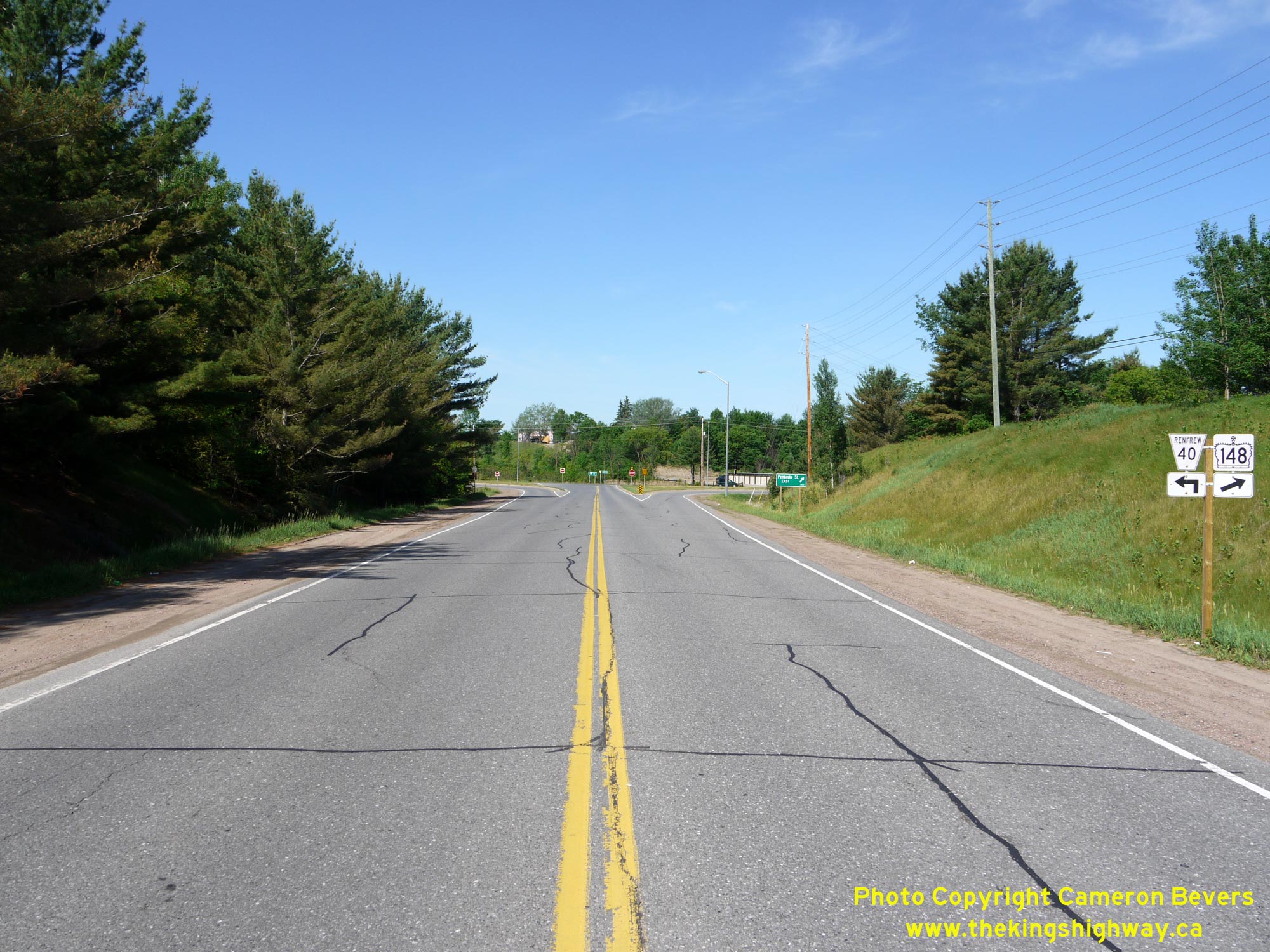
 Left - Destination guide signs along westbound Hwy 148 approaching the Old Hwy 17 (Renfrew County Road 40) Junction near Pembroke. See an
Enlarged Photo Here. Left - Destination guide signs along westbound Hwy 148 approaching the Old Hwy 17 (Renfrew County Road 40) Junction near Pembroke. See an
Enlarged Photo Here.(Photograph taken on June 4, 2010 - © Cameron Bevers) Right - Facing west along Hwy 148 at the Canadian Pacific Railway (CPR) Overhead (Site #29-38) east of Pembroke. See an
Enlarged Photo Here.(Photograph taken on June 4, 2010 - © Cameron Bevers) 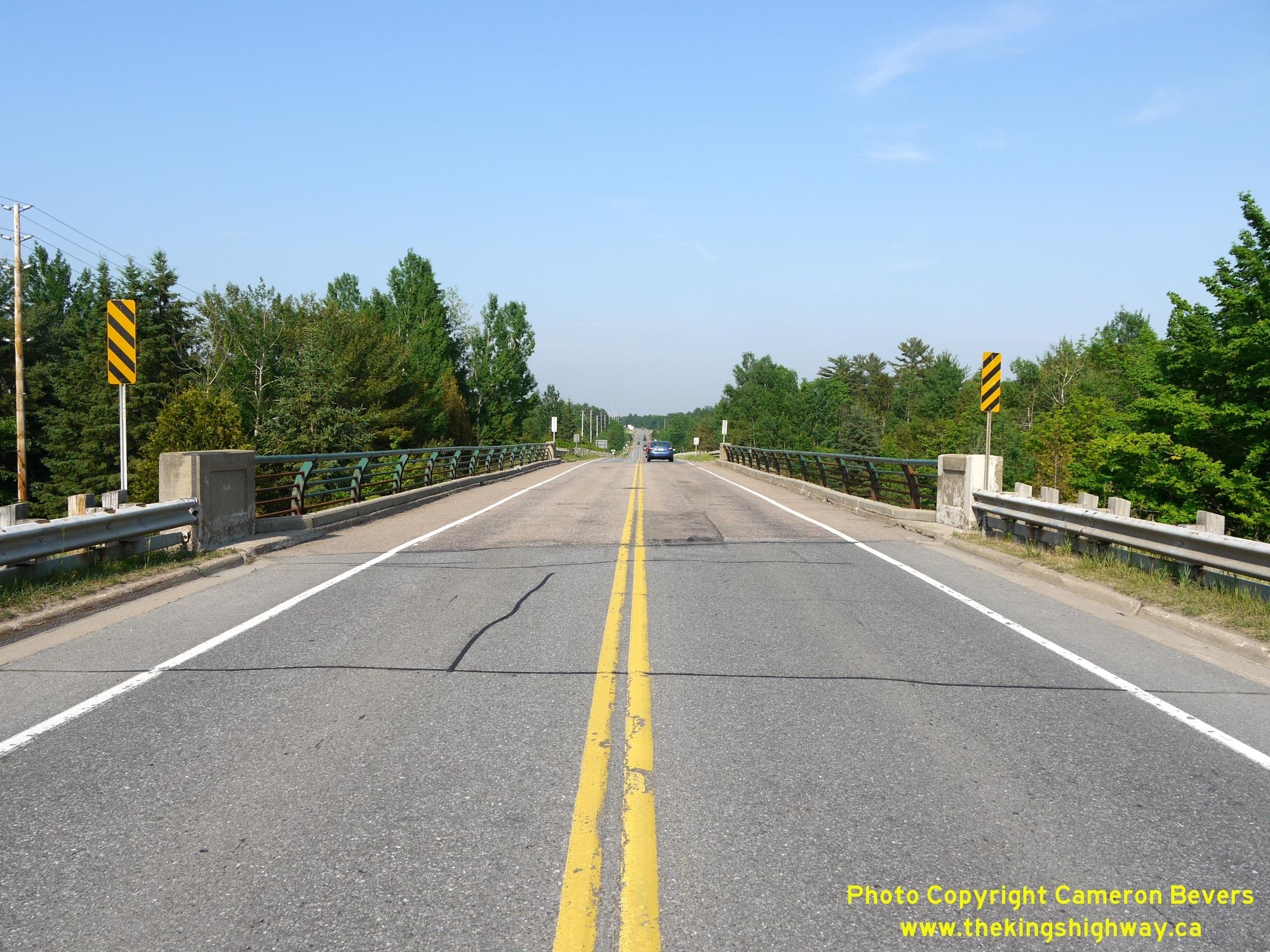
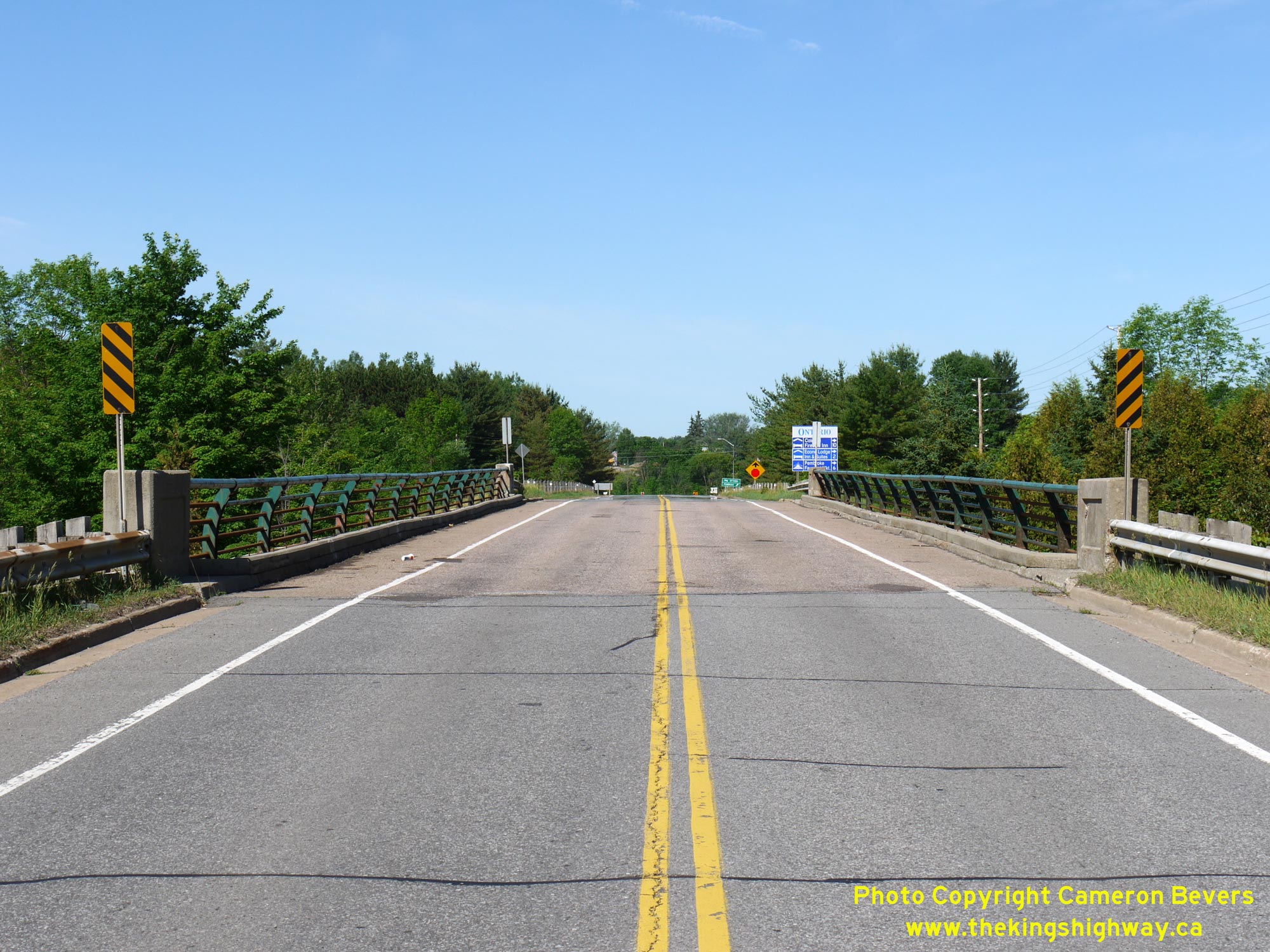
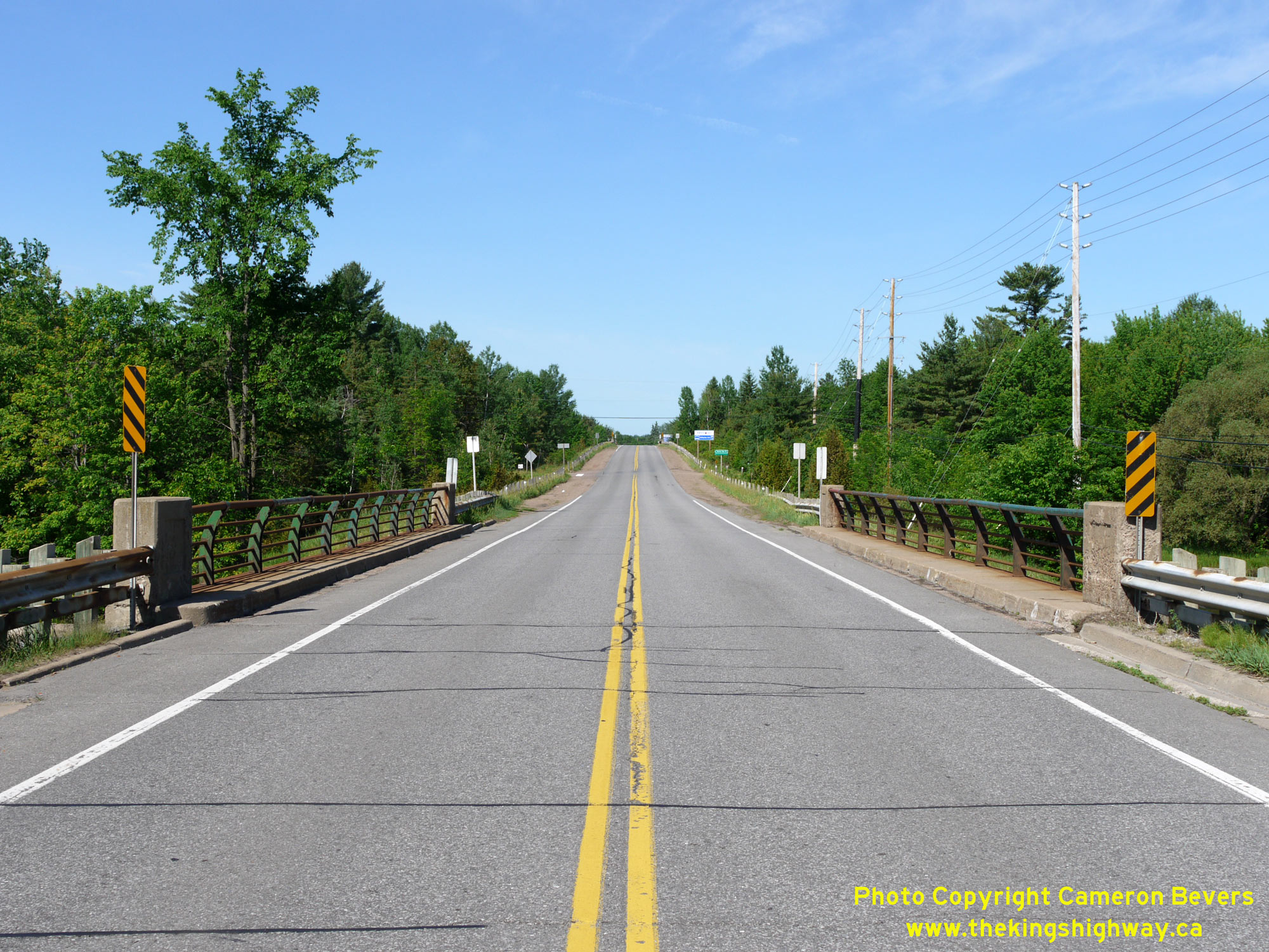
 Left - Facing east along Hwy 148 towards the Ontario-Quebec Boundary across the CPR Overhead east of Pembroke. See an
Enlarged Photo Here. Left - Facing east along Hwy 148 towards the Ontario-Quebec Boundary across the CPR Overhead east of Pembroke. See an
Enlarged Photo Here.(Photograph taken on May 31, 2010 - © Cameron Bevers) Right - Southern side of the CPR Overhead on Hwy 148 near Pembroke. This three-span continuous concrete girder structure was completed in 1956. See an
Enlarged Photo Here.(Photograph taken on May 31, 2010 - © Cameron Bevers) 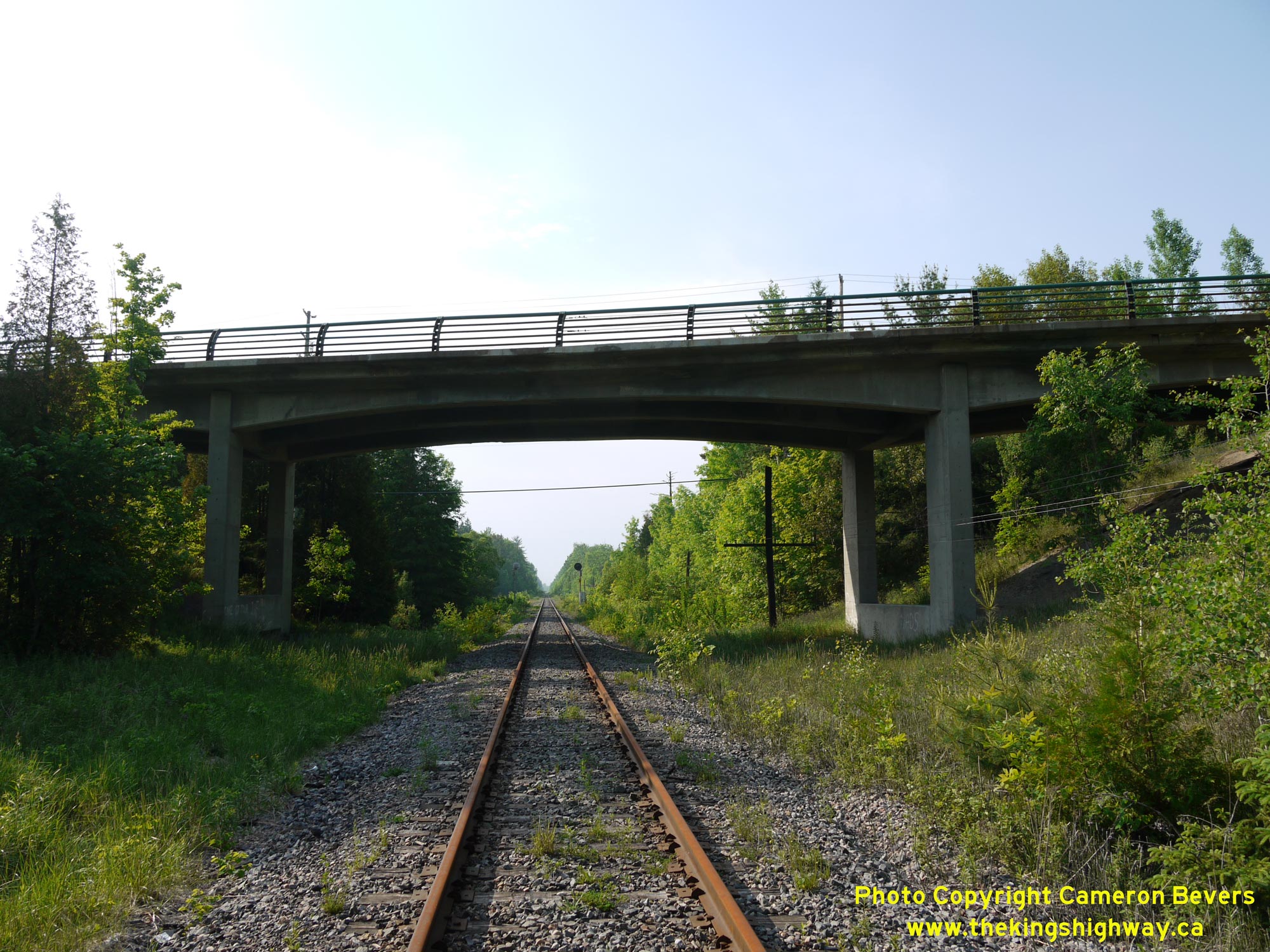
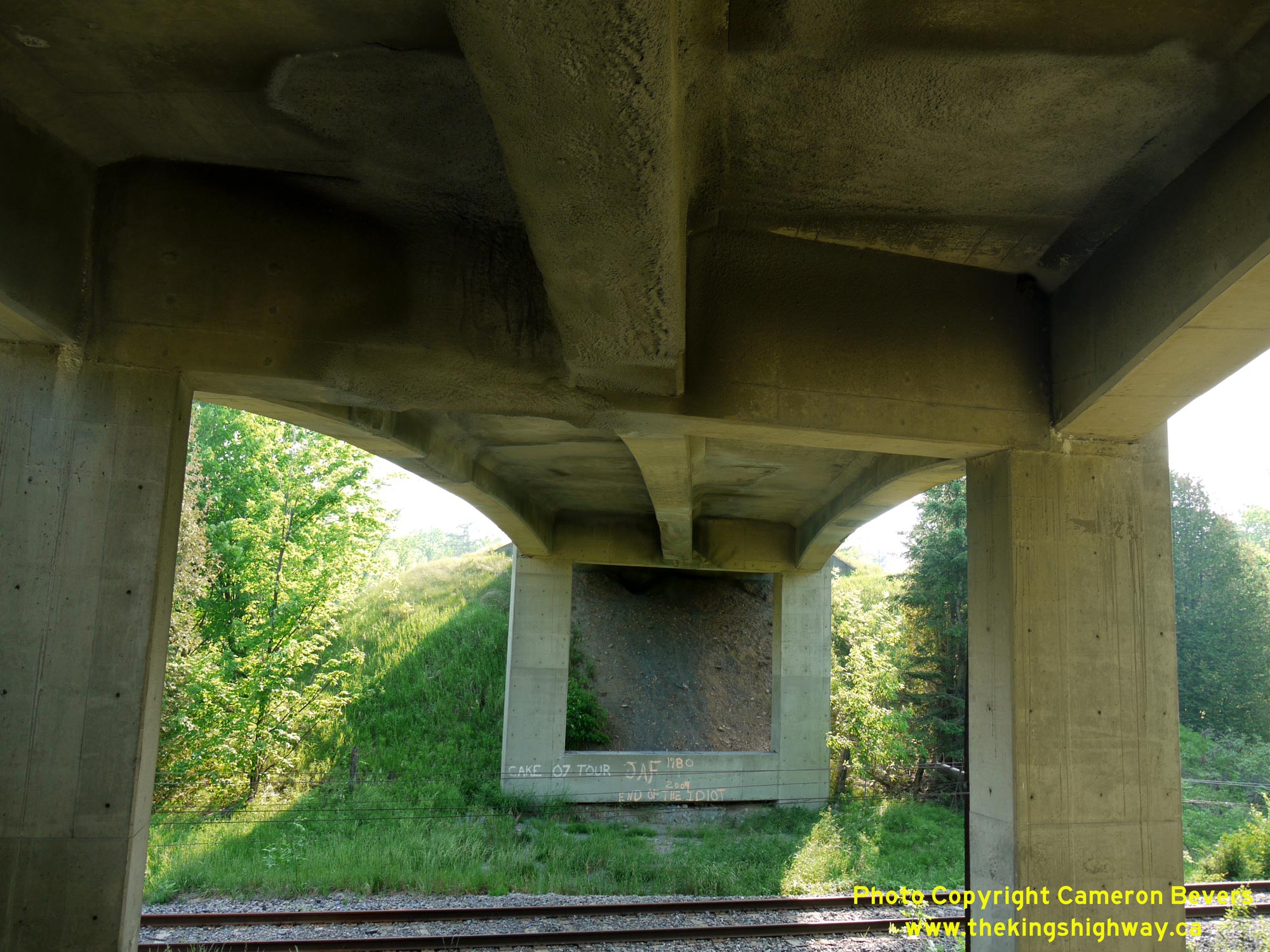 Left - Northern side of the CPR Overhead on Hwy 148 near Pembroke. This railway line was operated in recent years as the Ottawa Valley Railway, but it was
subsequently abandoned. This overhead structure has since been demolished and replaced by an oversized culvert for a recreational trail. See an
Enlarged Photo Here. Left - Northern side of the CPR Overhead on Hwy 148 near Pembroke. This railway line was operated in recent years as the Ottawa Valley Railway, but it was
subsequently abandoned. This overhead structure has since been demolished and replaced by an oversized culvert for a recreational trail. See an
Enlarged Photo Here.(Photograph taken on May 31, 2010 - © Cameron Bevers) Right - View of the cast-in-place concrete girder superstructure of the CPR Overhead on Hwy 148. See an
Enlarged Photo Here.(Photograph taken on May 31, 2010 - © Cameron Bevers) 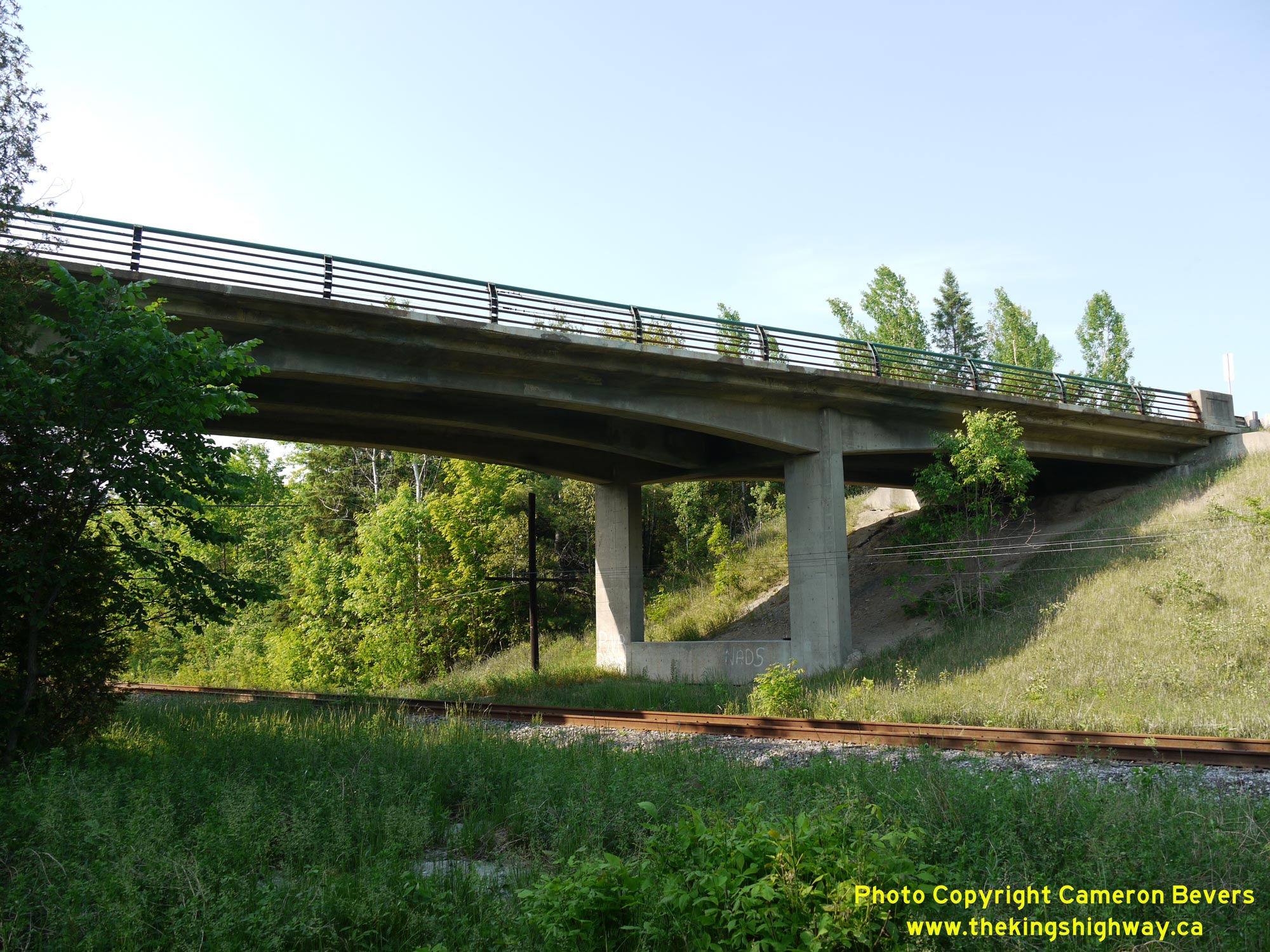
 Left - CPR Overhead on Hwy 148 east of Pembroke. This concrete structure was built under Contract #1955-289 and was completed in 1956. See an
Enlarged Photo Here. Left - CPR Overhead on Hwy 148 east of Pembroke. This concrete structure was built under Contract #1955-289 and was completed in 1956. See an
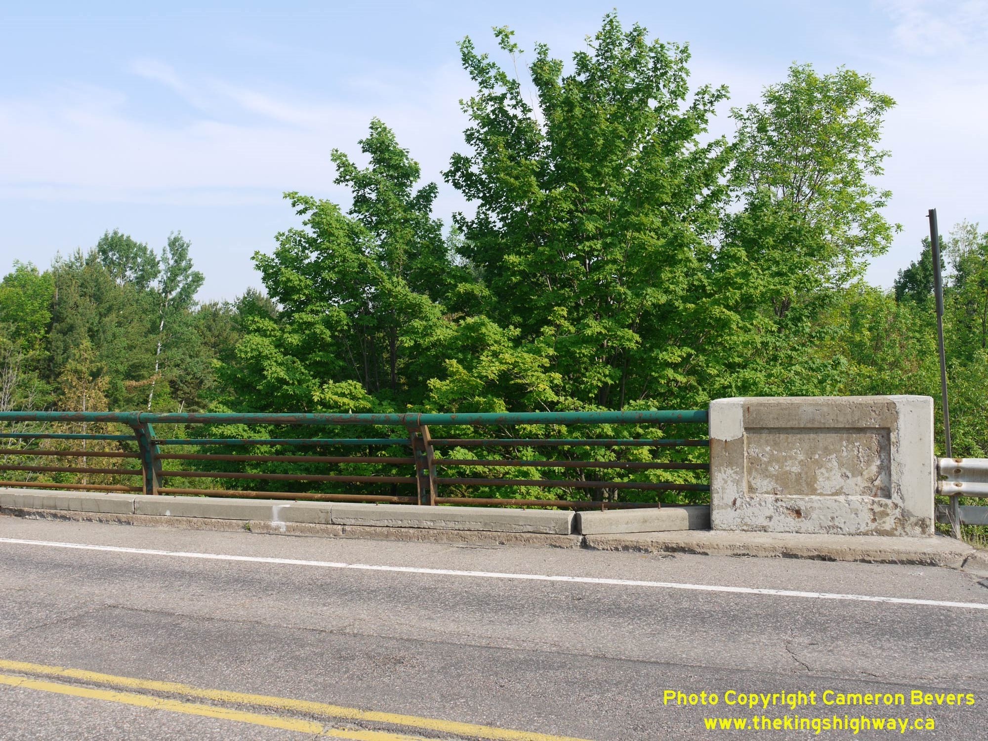
Enlarged Photo Here.(Photograph taken on May 31, 2010 - © Cameron Bevers) Right - Close-up of the steel tube handrail on the CPR Overhead on Hwy 148. Steel tube handrails of slightly varying designs were used extensively by DHO's
Ottawa District (District #9) engineers while designing new highway bridges in this area. Although once ubiquitous within the Ottawa Valley, the steel tube handrail
design was rarely used in other parts of Ontario. See an Enlarged Photo Here.(Photograph taken on May 31, 2010 - © Cameron Bevers) 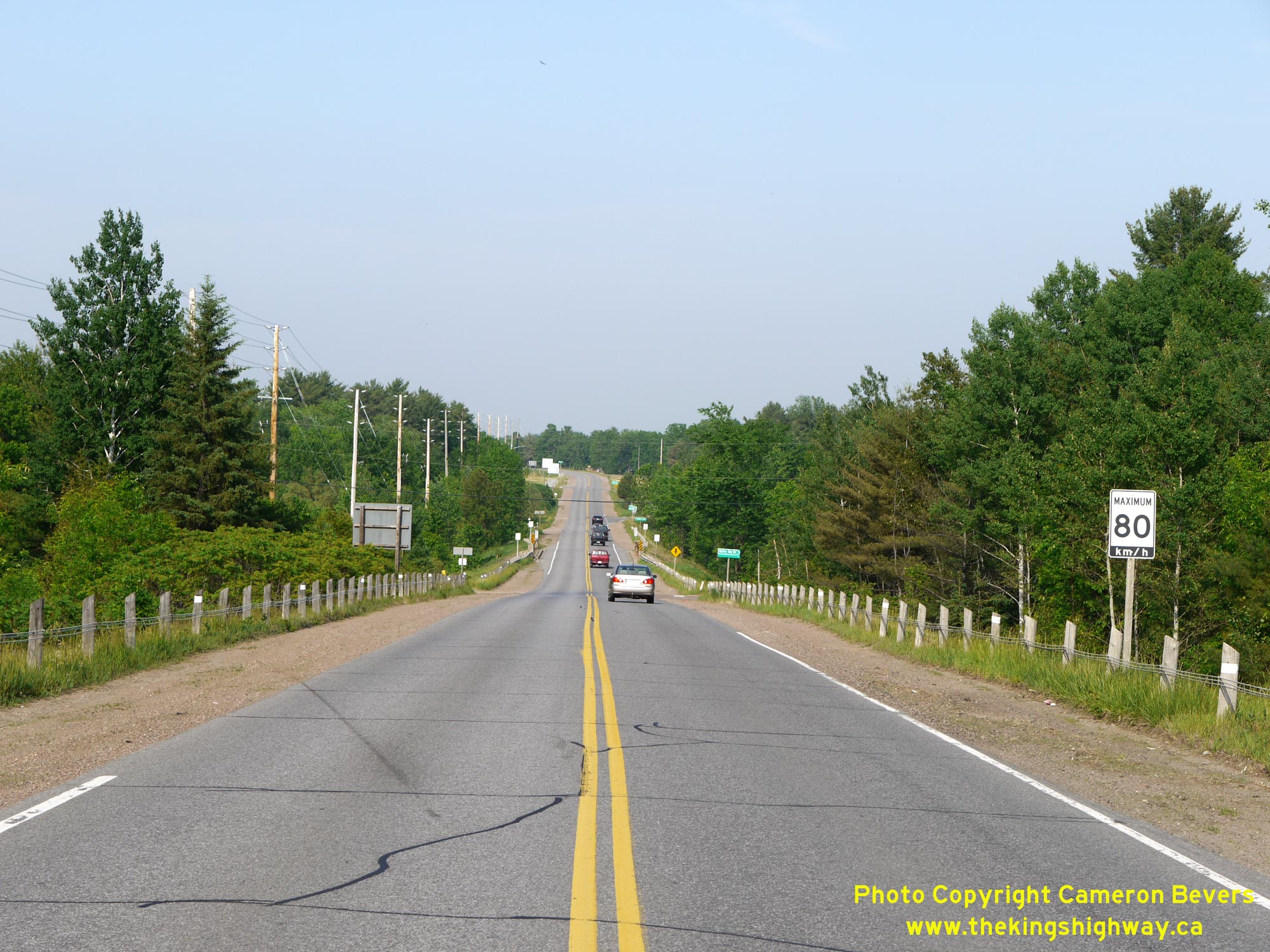
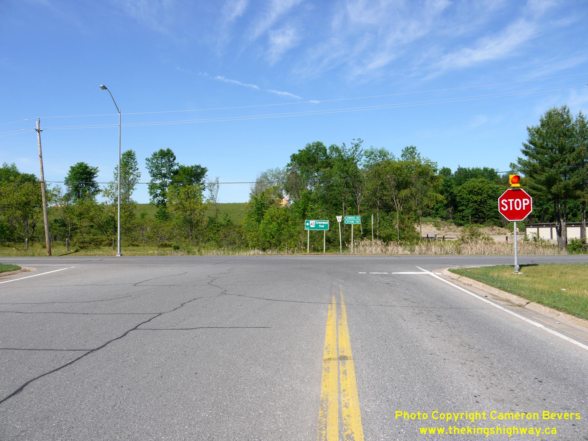
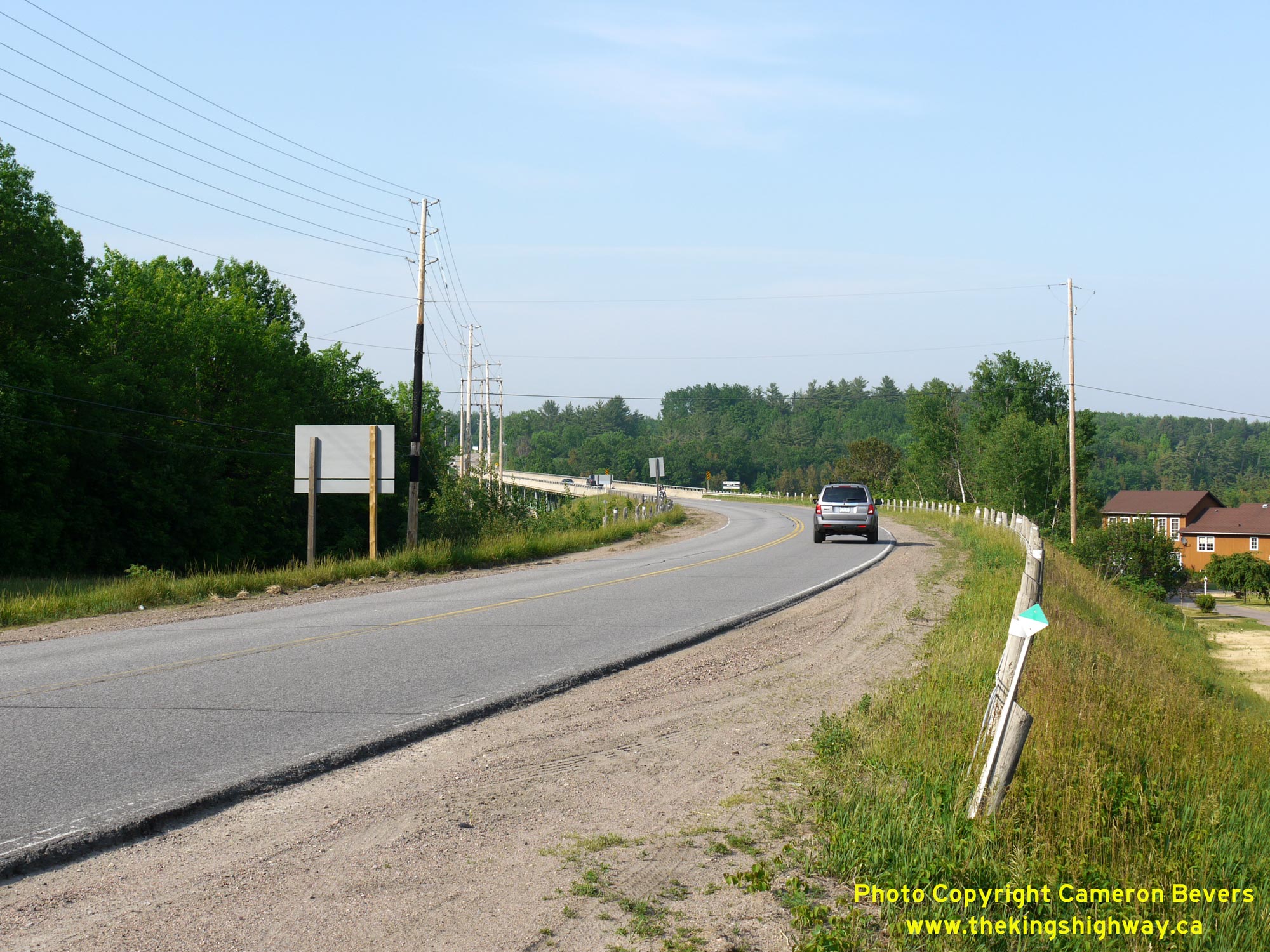
 Left - View of Hwy 148 facing east towards the Hazley Bay Bridge from the CPR Overhead. In May 1955, construction began on the new Des Allumettes Road which
led to the proposed interprovincial bridge between Ontario and Quebec being built by the Government of Canada. About 1 mile of new highway was built on the Ontario
approach to Des Allumettes Bridge by the DHO under Contract #1955-47. When the new interprovincial highway bridge opened in 1957, the route leading to it on the
Ontario side did not initially have a posted route number. In June 1960, it was decided that the route of Hwy 62 would be extended easterly through Pembroke to
connect with the Quebec Boundary via Des Allumettes Bridge. Part of this extension of Hwy 62 involved an overlapped, concurrent route with Hwy 17 through
Downtown Pembroke for a distance of approximately 4 miles. Following the completion of the Pembroke Bypass (Hwy 17 New) in the early 1980s, the route of Hwy 62 via
Pembroke's city centre was renumbered as Hwy 148 in 1984. See an Enlarged Photo Here. Left - View of Hwy 148 facing east towards the Hazley Bay Bridge from the CPR Overhead. In May 1955, construction began on the new Des Allumettes Road which
led to the proposed interprovincial bridge between Ontario and Quebec being built by the Government of Canada. About 1 mile of new highway was built on the Ontario
approach to Des Allumettes Bridge by the DHO under Contract #1955-47. When the new interprovincial highway bridge opened in 1957, the route leading to it on the
Ontario side did not initially have a posted route number. In June 1960, it was decided that the route of Hwy 62 would be extended easterly through Pembroke to
connect with the Quebec Boundary via Des Allumettes Bridge. Part of this extension of Hwy 62 involved an overlapped, concurrent route with Hwy 17 through
Downtown Pembroke for a distance of approximately 4 miles. Following the completion of the Pembroke Bypass (Hwy 17 New) in the early 1980s, the route of Hwy 62 via
Pembroke's city centre was renumbered as Hwy 148 in 1984. See an Enlarged Photo Here.(Photograph taken on May 31, 2010 - © Cameron Bevers) Right - Facing west along Hwy 148 towards Pembroke at the Hazley Bay Bridge. See an
Enlarged Photo Here.(Photograph taken on June 4, 2010 - © Cameron Bevers) 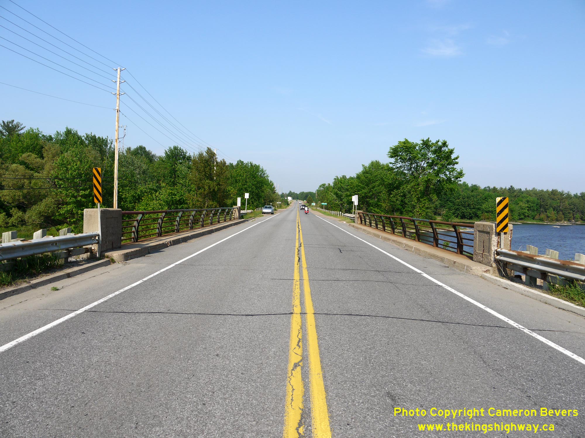
 Left - Facing east along Hwy 148 towards the Ontario-Quebec Boundary at the Hazley Bay Bridge. See an
Enlarged Photo Here. Left - Facing east along Hwy 148 towards the Ontario-Quebec Boundary at the Hazley Bay Bridge. See an
Enlarged Photo Here.(Photograph taken on May 31, 2010 - © Cameron Bevers) Right - Close-up of the unusual steel tube handrails on the Hazley Bay Bridge on Hwy 148. Both DHO-built bridges on the road leading to Des Allumettes
Bridge originally had these handrails. This handrail design also matched those on Des Allumettes Bridge itself. See an
Enlarged Photo Here.(Photograph taken on May 31, 2010 - © Cameron Bevers) 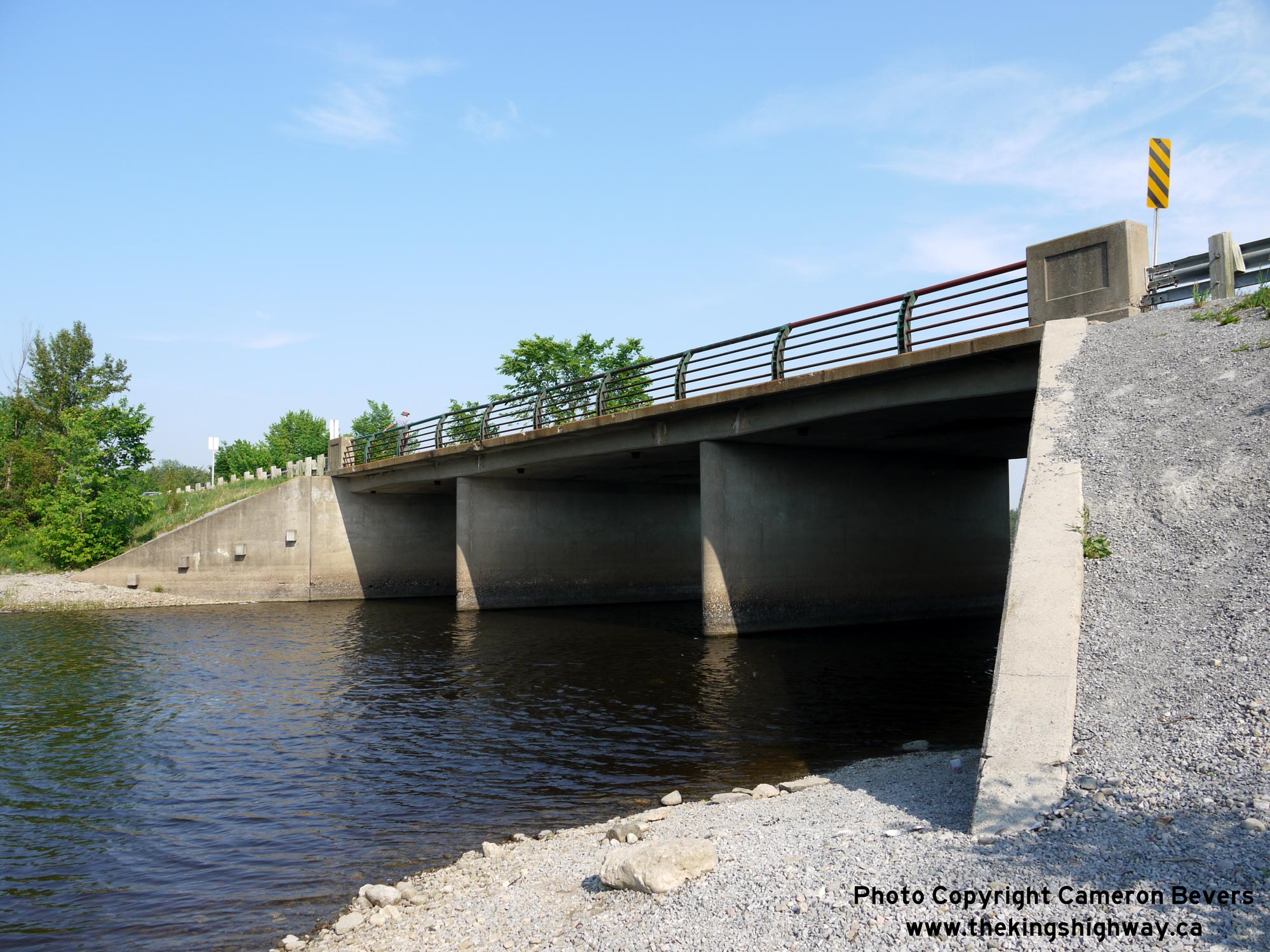
 Left - Northern side of the Hazley Bay Bridge on Hwy 148. This three-span concrete rigid frame structure was built under Contract #1955-100 and was completed
in 1956. See an Enlarged Photo Here. Left - Northern side of the Hazley Bay Bridge on Hwy 148. This three-span concrete rigid frame structure was built under Contract #1955-100 and was completed
in 1956. See an Enlarged Photo Here.(Photograph taken on May 31, 2010 - © Cameron Bevers) Right - Southern side of the Hazley Bay Bridge (Site #29-39) on Hwy 148 east of Pembroke. See an
Enlarged Photo Here.(Photograph taken on May 31, 2010 - © Cameron Bevers) 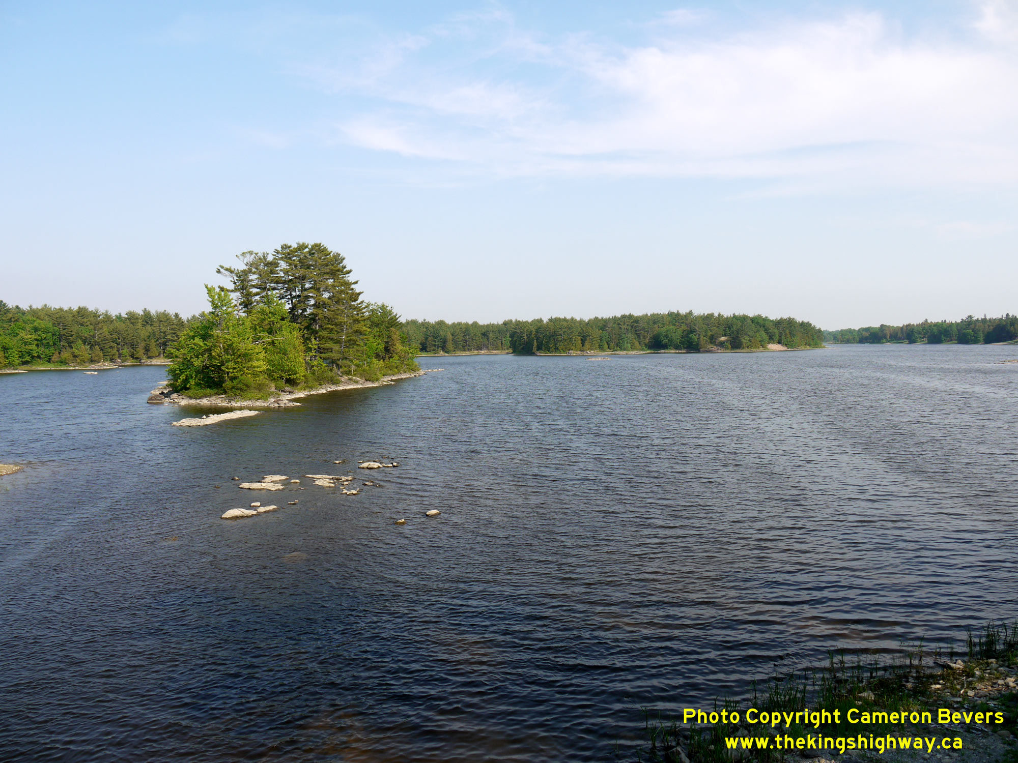
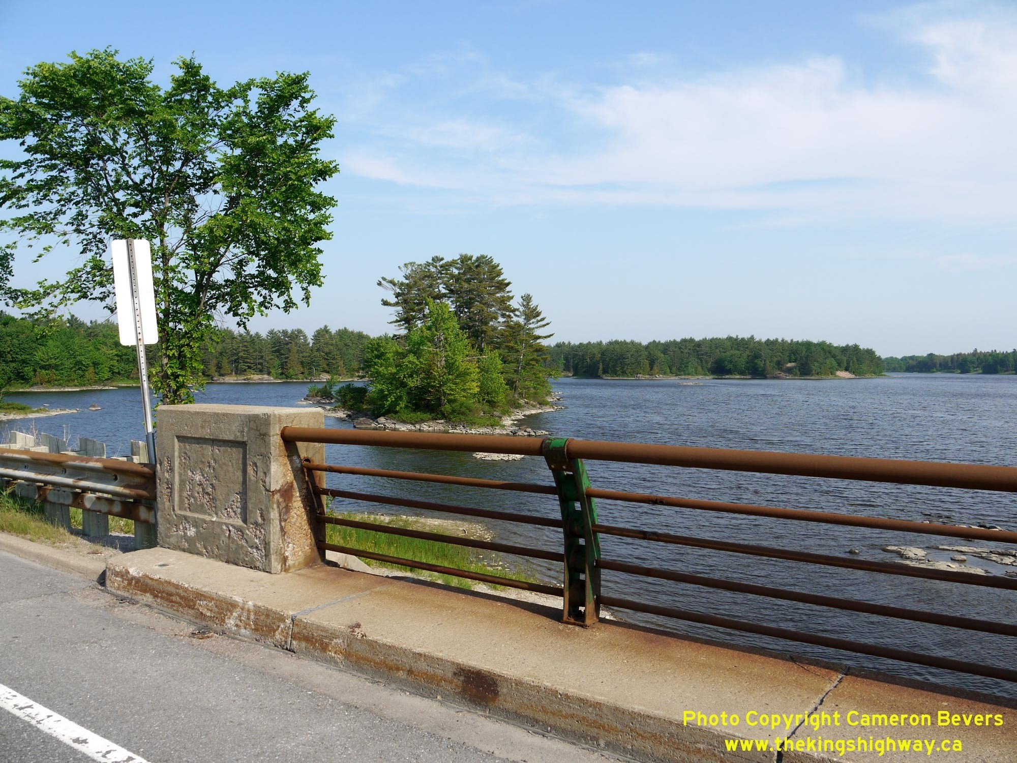
 Left - Scenic view of Hazley Bay from Hwy 148 east of Pembroke. This large bay is almost completely cut off from the main branch of the Ottawa River. See an
Enlarged Photo Here. Left - Scenic view of Hazley Bay from Hwy 148 east of Pembroke. This large bay is almost completely cut off from the main branch of the Ottawa River. See an
Enlarged Photo Here.(Photograph taken on May 31, 2010 - © Cameron Bevers) Right - Western approach to Des Allumettes Bridge on Hwy 148, facing east towards the Ontario-Quebec Boundary. See an
Enlarged Photo Here.(Photograph taken on May 31, 2010 - © Cameron Bevers) 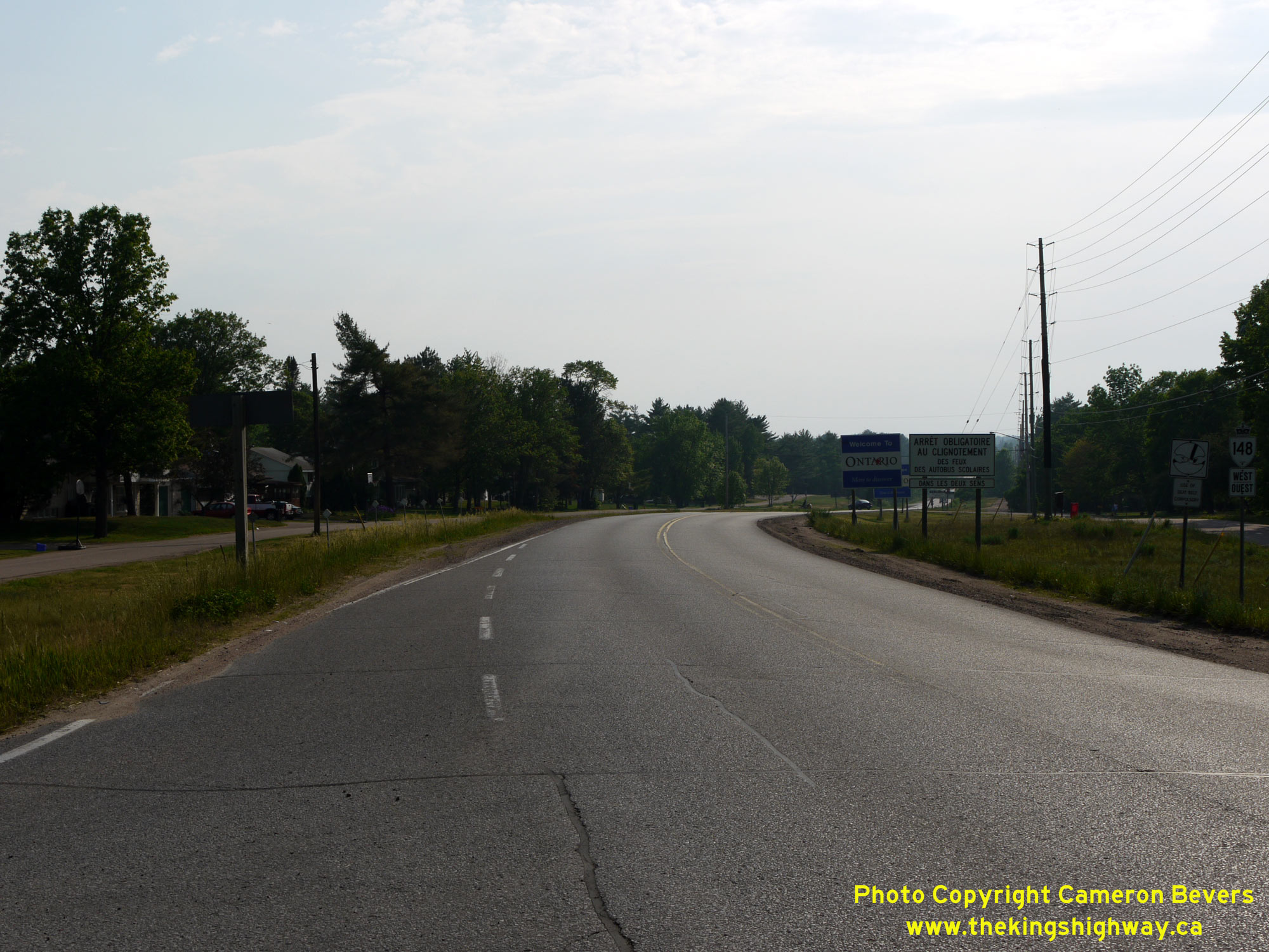
 Left - Facing west along Hwy 148 from Cotnam Street. This is the first intersection along Hwy 148 on the Ontario side of the boundary. Cotnam Street forms a
service road along the northern side of Hwy 148 which provides access to adjacent properties on Cotnam Island. See an
Enlarged Photo Here. Left - Facing west along Hwy 148 from Cotnam Street. This is the first intersection along Hwy 148 on the Ontario side of the boundary. Cotnam Street forms a
service road along the northern side of Hwy 148 which provides access to adjacent properties on Cotnam Island. See an
Enlarged Photo Here.(Photograph taken on May 31, 2010 - © Cameron Bevers) Right - Start of Ontario's Hwy 148 at the western end of Des Allumettes Bridge. See an
Enlarged Photo Here.(Photograph taken on May 31, 2010 - © Cameron Bevers) 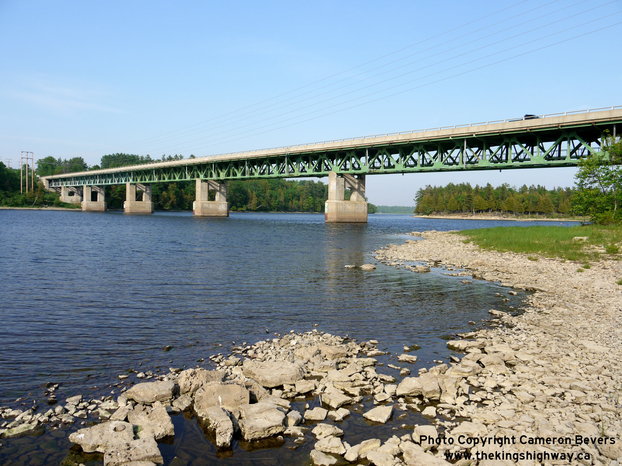
 Left - Northern side of Des Allumettes Interprovincial Bridge over the Ottawa River, which links Ontario and Quebec. See an
Enlarged Photo Here. Left - Northern side of Des Allumettes Interprovincial Bridge over the Ottawa River, which links Ontario and Quebec. See an
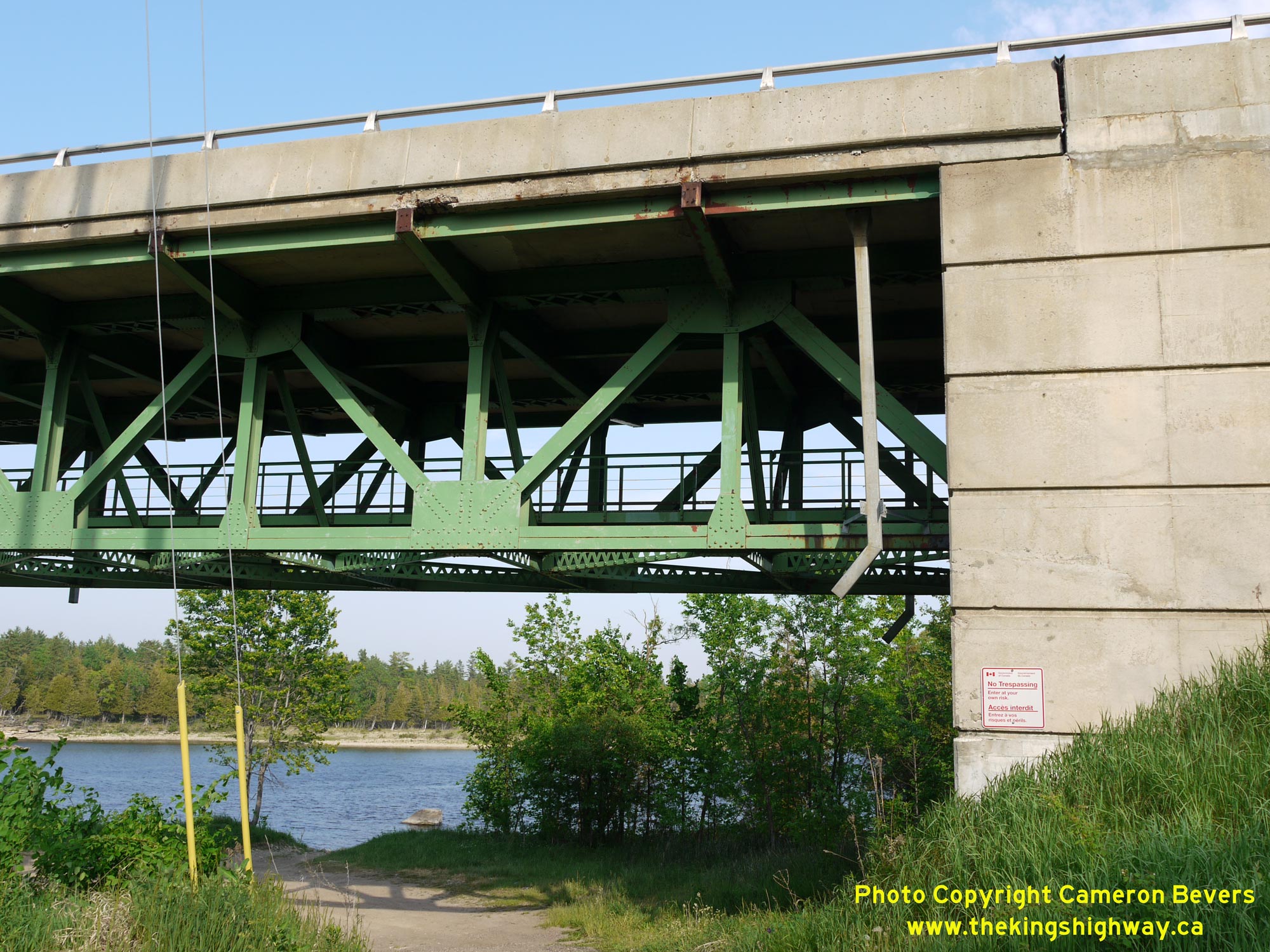
Enlarged Photo Here.(Photograph taken on May 31, 2010 - © Cameron Bevers) Right - View of the deck truss superstructure of Des Allumettes Bridge on Hwy 148. This bridge consists of a Warren-type deck truss with a cantilevered centre
section across the Ottawa River's main navigation channel. Note the catwalk below the deck truss to allow maintenance crews to easily access the underside of the
bridge. See an Enlarged Photo Here.(Photograph taken on May 31, 2010 - © Cameron Bevers) 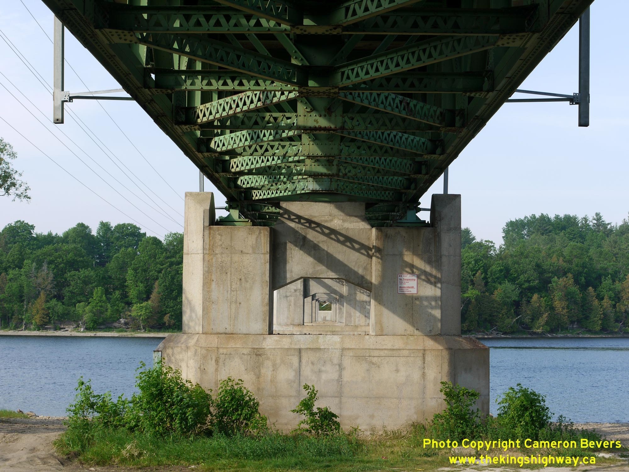
 Left - View looking through the piers of Des Allumettes Bridge from the Ontario side of the bridge. This lengthy seven-span steel deck truss bridge is
supported on six robust concrete piers - four of which are located in-water with two situated on the riverbanks. See an
Enlarged Photo Here. Left - View looking through the piers of Des Allumettes Bridge from the Ontario side of the bridge. This lengthy seven-span steel deck truss bridge is
supported on six robust concrete piers - four of which are located in-water with two situated on the riverbanks. See an
Enlarged Photo Here.(Photograph taken on May 31, 2010 - © Cameron Bevers) Right - Facing east across Des Allumettes Bridge on Hwy 148 towards Waltham, Quebec. See an
Enlarged Photo Here.(Photograph taken on May 31, 2010 - © Cameron Bevers) 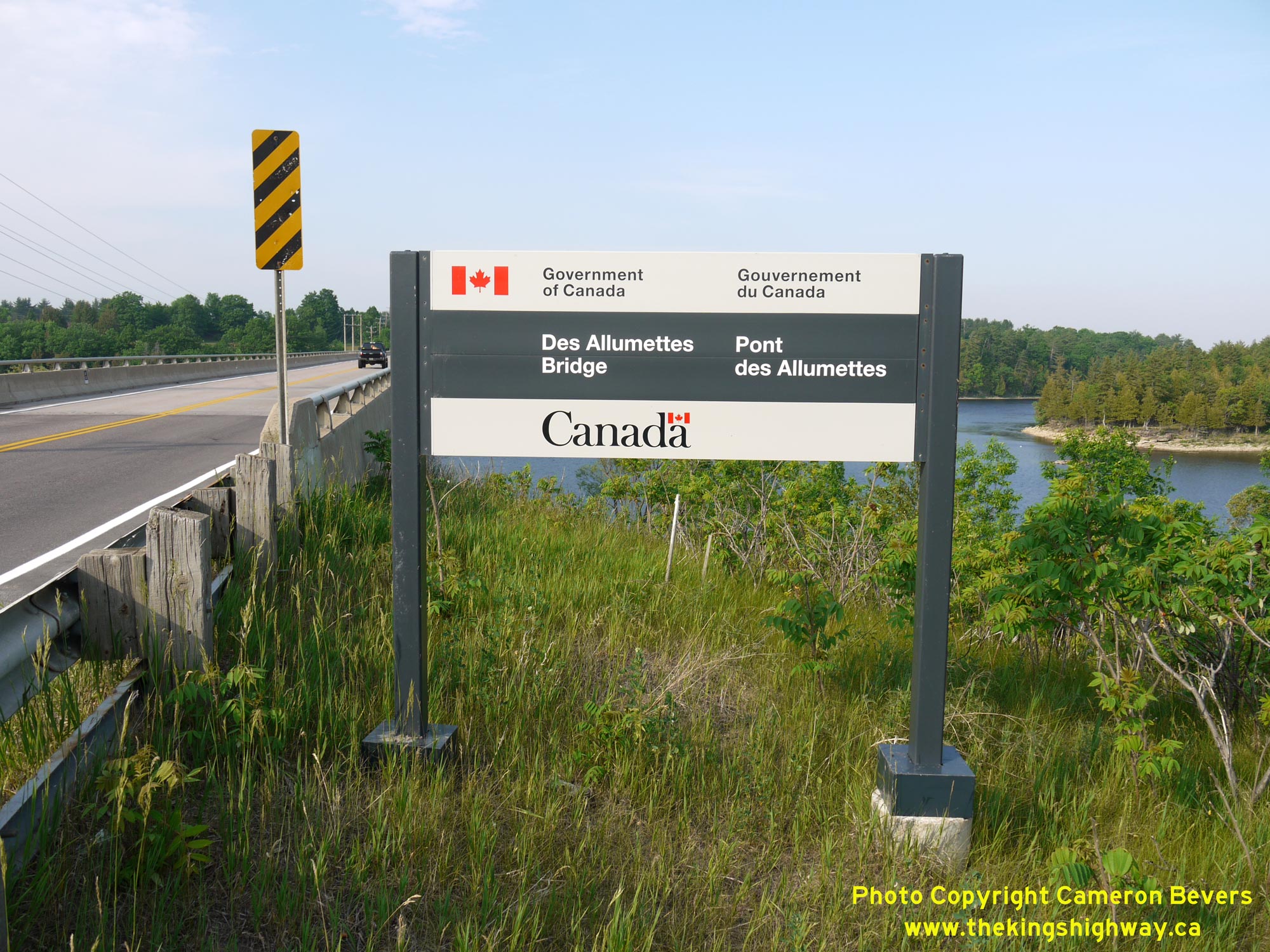
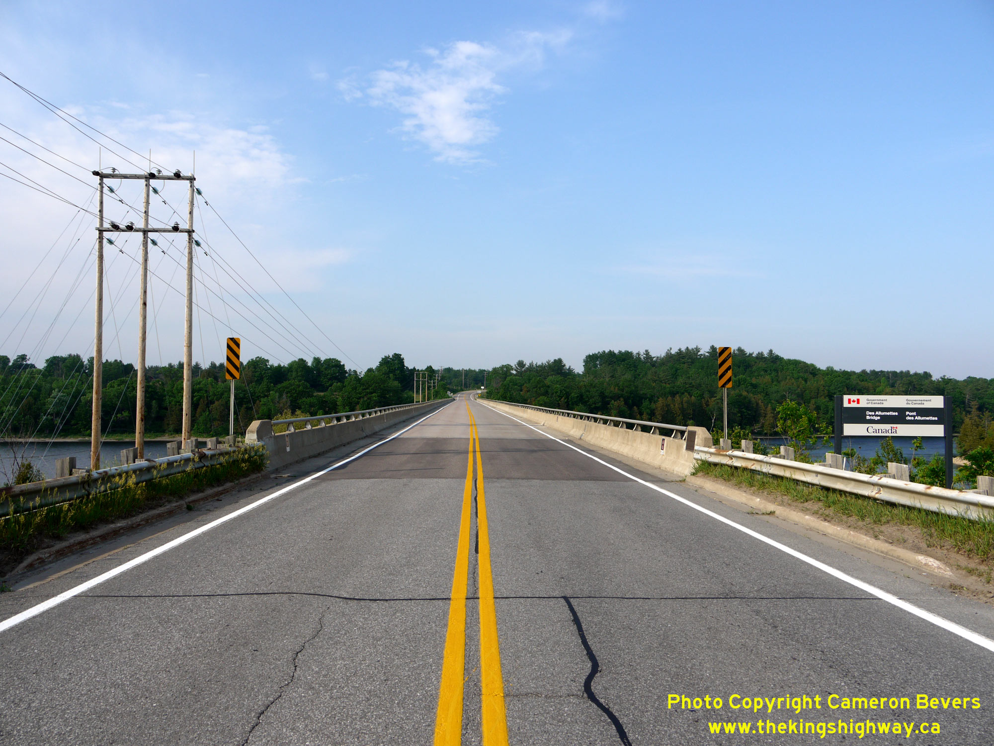
 Left - Close-up of the Government of Canada sign marking Des Allumettes Bridge between Pembroke, Ontario and Waltham, Quebec. See an
Enlarged Photo Here. Left - Close-up of the Government of Canada sign marking Des Allumettes Bridge between Pembroke, Ontario and Waltham, Quebec. See an
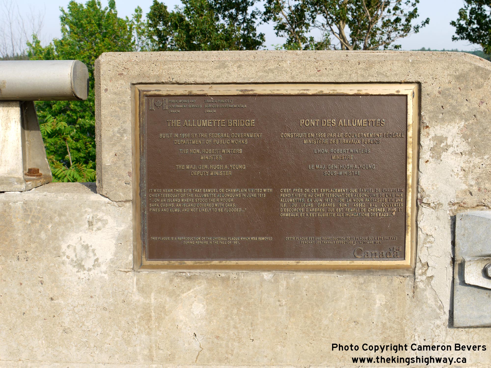
Enlarged Photo Here.(Photograph taken on May 31, 2010 - © Cameron Bevers) Right - Plaque commemorating the initial construction of Des Allumettes Bridge in 1956-1957, and subsequent rehabilitation of the bridge in 1991. This bridge
was replaced with a new structure just a few years after I took these photos in 2010. The new Des Allumettes Bridge was completed in 2015. See an
Enlarged Photo Here.(Photograph taken on May 31, 2010 - © Cameron Bevers) 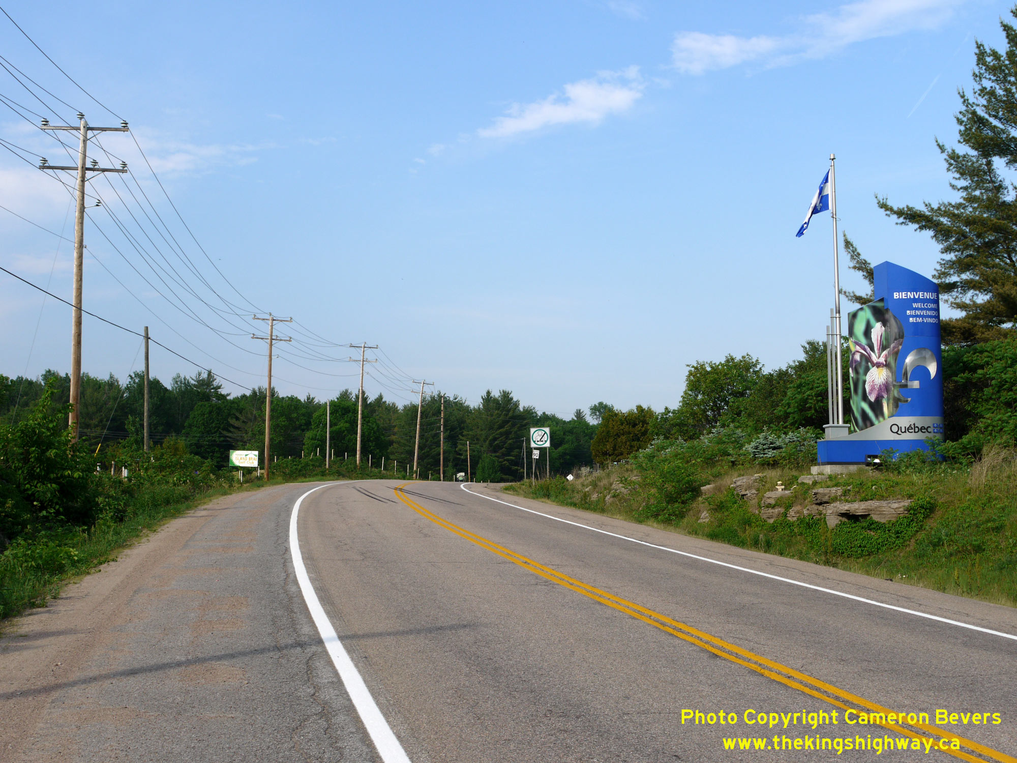
 Left - Welcome to Quebec gateway sign at the eastern end of Des Allumettes Bridge. See an
Enlarged Photo Here. Left - Welcome to Quebec gateway sign at the eastern end of Des Allumettes Bridge. See an
Enlarged Photo Here.(Photograph taken on May 31, 2010 - © Cameron Bevers) Right - Eastern approach to Des Allumettes Bridge on Hwy 148, as seen from the Quebec side of the structure. Quebec's Hwy 148 comes to an end at this bridge.
This long Quebec provincial highway begins in Laval - a northern suburb of Montreal. See an
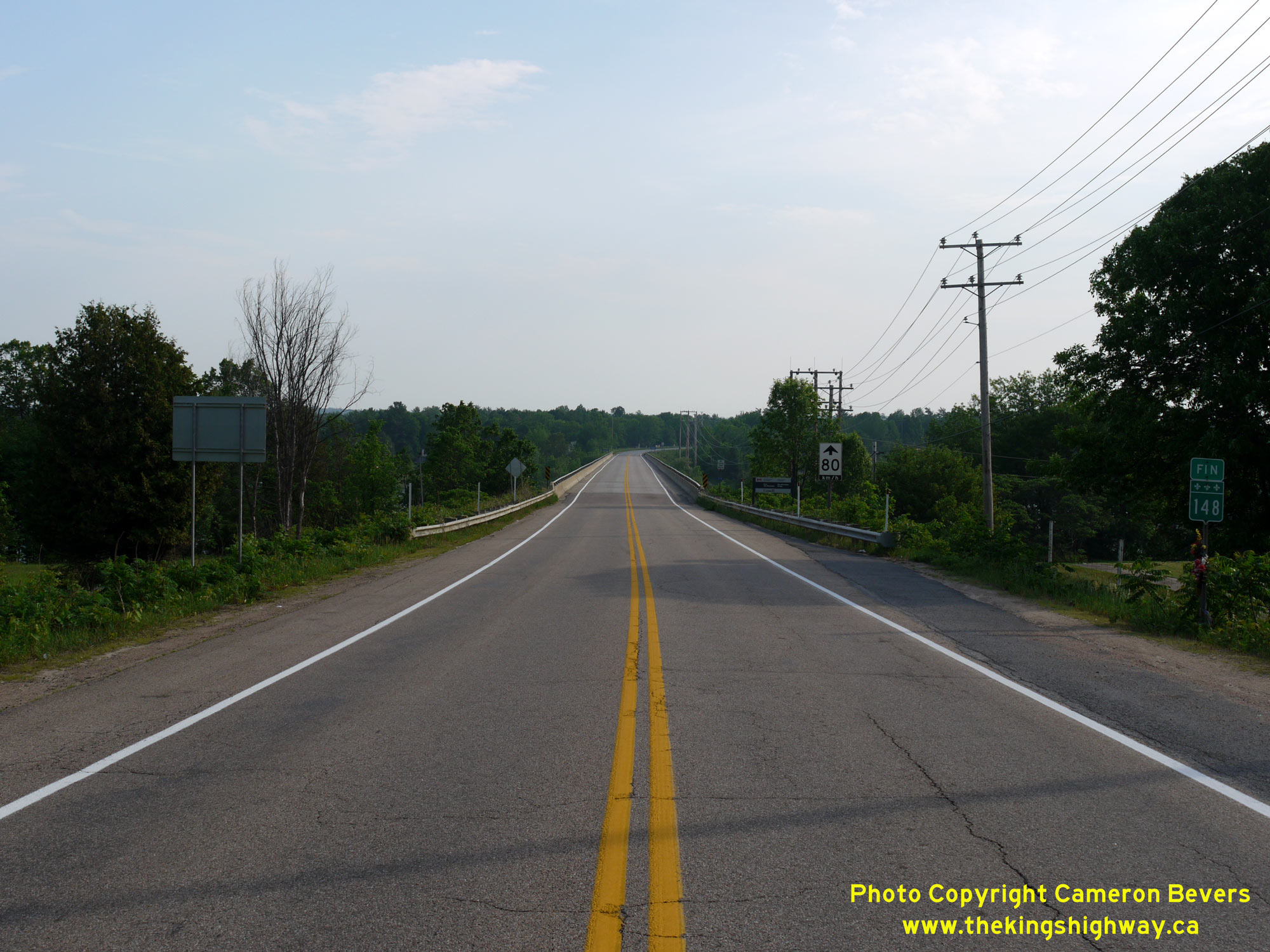
Enlarged Photo Here.(Photograph taken on May 31, 2010 - © Cameron Bevers) 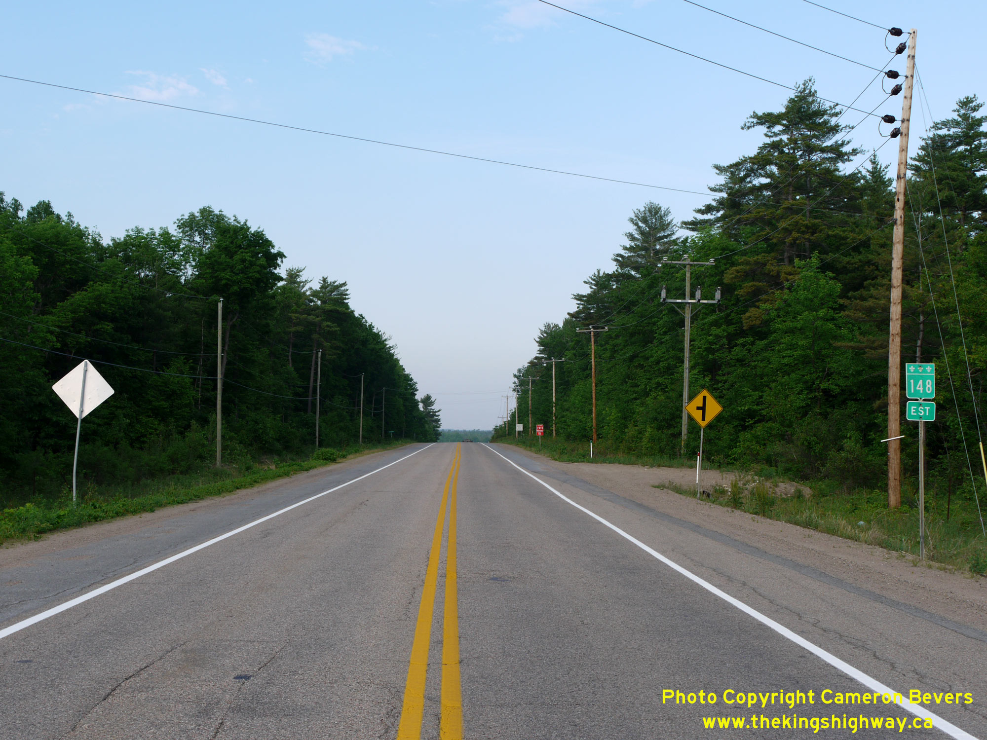 Above - Facing east towards Waltham, Quebec along Hwy 148 near Des Allumettes Bridge. Ultimately, Quebec's Hwy 148 returns to the Ottawa-Gatineau Region along
the northern side of the Ottawa River, although it is a more circuitous route than simply taking Hwy 17 & Hwy 417 from Pembroke to Ottawa. See an
Enlarged Photo Here. Above - Facing east towards Waltham, Quebec along Hwy 148 near Des Allumettes Bridge. Ultimately, Quebec's Hwy 148 returns to the Ottawa-Gatineau Region along
the northern side of the Ottawa River, although it is a more circuitous route than simply taking Hwy 17 & Hwy 417 from Pembroke to Ottawa. See an
Enlarged Photo Here.(Photograph taken on May 31, 2010 - © Cameron Bevers)
More King's Highway 148 Photographs Coming Soon!
|
|---|
Links to Adjacent King's Highway Photograph Pages:
Back to King's Highway 144 Photos /
King's Highway 148 History /
On to King's Highway 169 Photos
Ontario Highway History - Main Menu / Back to List of Highways Website contents, photos & text © 2002-2026, Cameron
Bevers (Webmaster) - All Rights Reserved / Contact Me
|
|---|