
| 
| |
|
|
This page contains present day photos of the former route of Ontario's King's Highway 17 through Sudbury, arranged by
location from the Highway 17 Junction near Coniston westerly to the Highway 17 Interchange west of Sudbury. All photographs displayed on this
page were taken by the Webmaster (Cameron Bevers), unless specifically noted otherwise. Click on any thumbnail to see a larger image!
Please note that all photographs displayed on this
website are protected by copyright. These photographs must not be reproduced, published,
electronically stored or copied, distributed, or posted onto other websites without
my written permission. If you want to use photos from this website, please
email me first for permission. Thank-you!
|
|---|
|
Present Day King's Highway 17 Photographs (Old Route Via Sudbury)
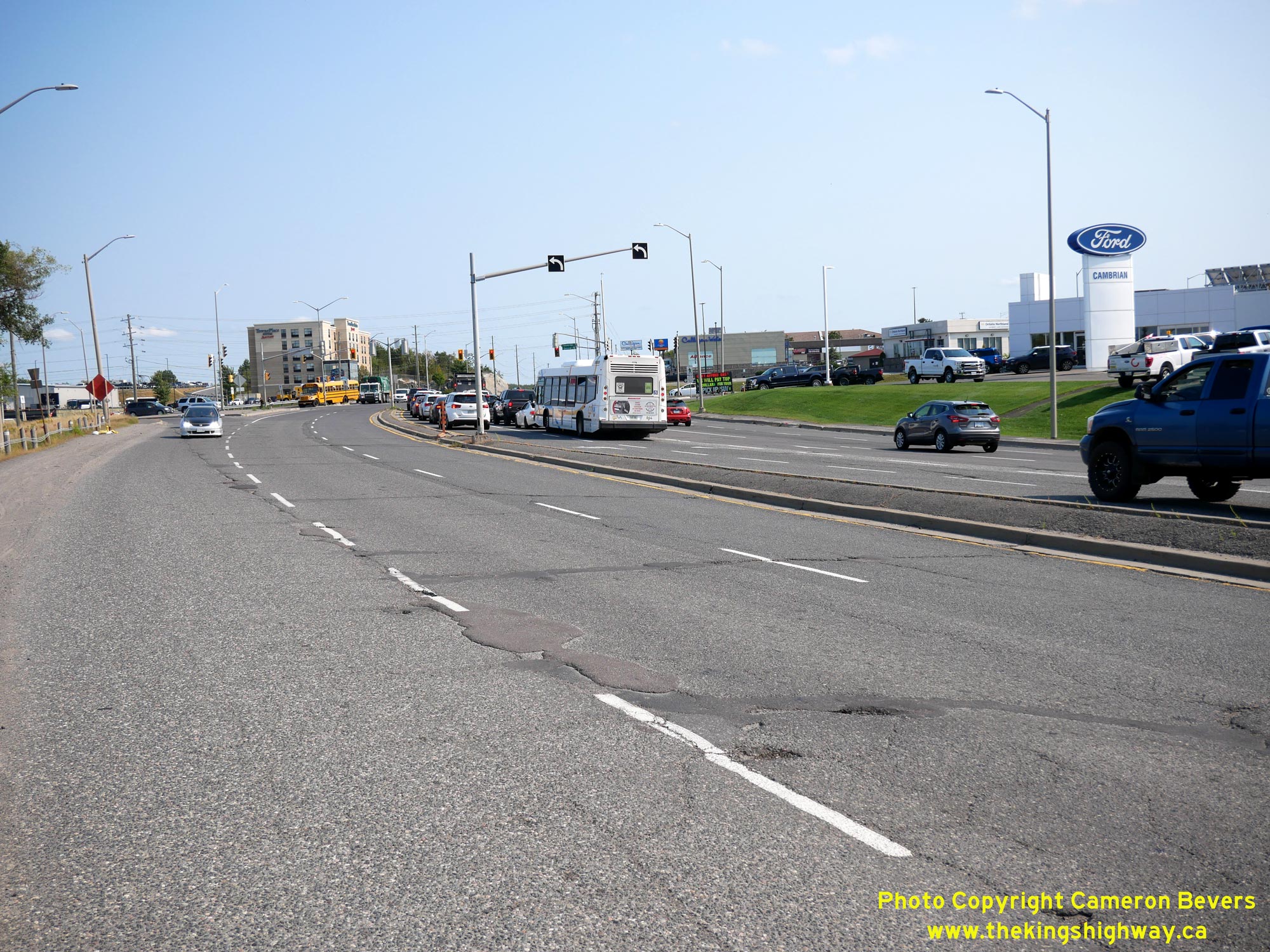
Left - Facing west along Kingsway (Old Hwy 17) approaching the Falconbridge Highway Junction in Sudbury. As the name might suggest, Falconbridge Highway
(today's Sudbury Road 86) is also a former provincial highway. Between 1956 and 1974, Sudbury Road 86 was known as Secondary Highway 541. Like many of the Ontario
Secondary Highways in the Sudbury area, Hwy 541 was transferred over to municipal control after the Regional Municipality of Sudbury was created in the 1970s. See an
Enlarged Photo Here. (Photograph taken on September 9, 2022 - © Cameron Bevers) Right - View of the Falconbridge Highway (Old Hwy 541) Junction on Old Hwy 17, facing east. Historically, Hwy 541 began at this intersection and continued north from Sudbury for about 27 km to the community of Skead, located on the shores of Wanapitei Lake. The highway also provided service to Falconbridge, via a short spur highway (Hwy 541A). See an Enlarged Photo Here. (Photograph taken on September 9, 2022 - © Cameron Bevers) 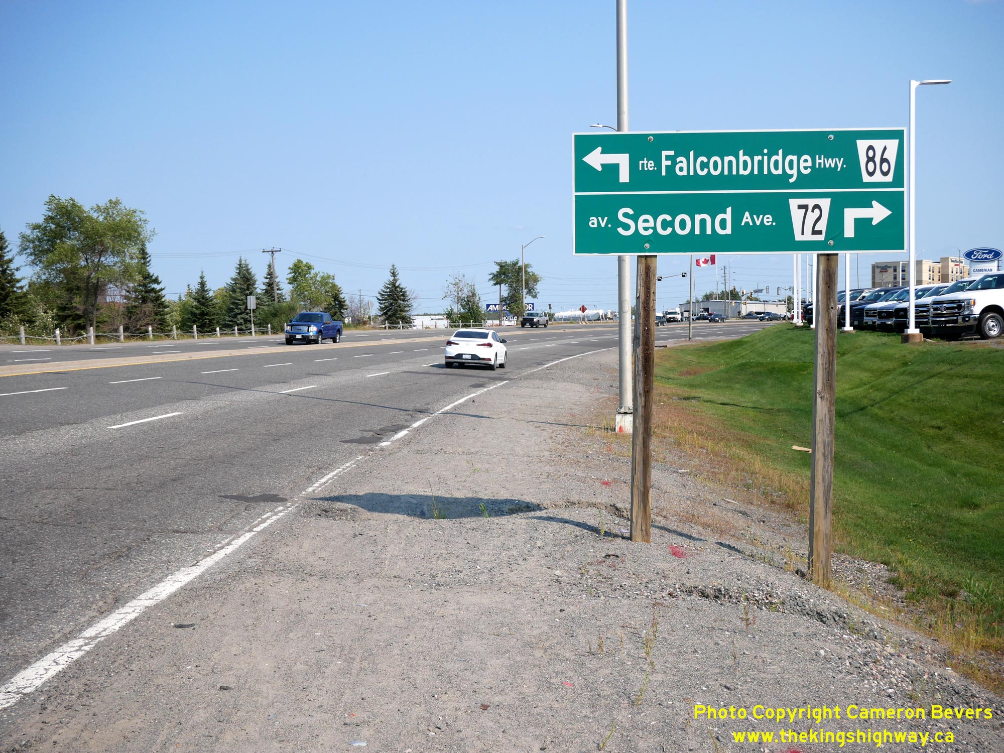
Left - Green guide sign on eastbound Kingsway (Old Hwy 17) approaching Falconbridge Highway. See an
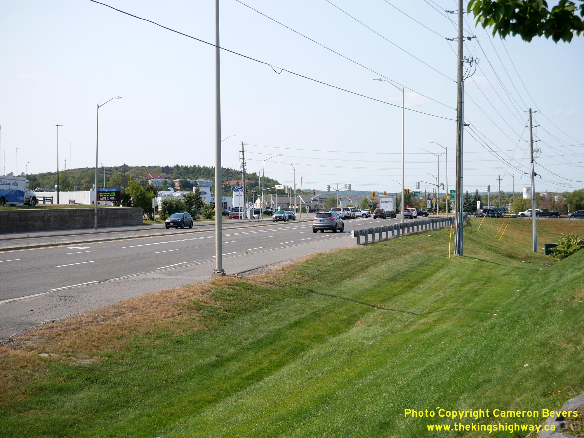
Enlarged Photo Here. (Photograph taken on September 9, 2022 - © Cameron Bevers) Right - View of Kingsway (Old Hwy 17), facing west between Silver Hills Drive and Bancroft Drive. This section of Kingsway is actually a diversion of the original route of Hwy 17. A new highway was constructed from Sudbury to Coniston between 1936 and 1938, which provided for a more direct connection between these two towns on an improved alignment. See an Enlarged Photo Here. (Photograph taken on September 9, 2022 - © Cameron Bevers) 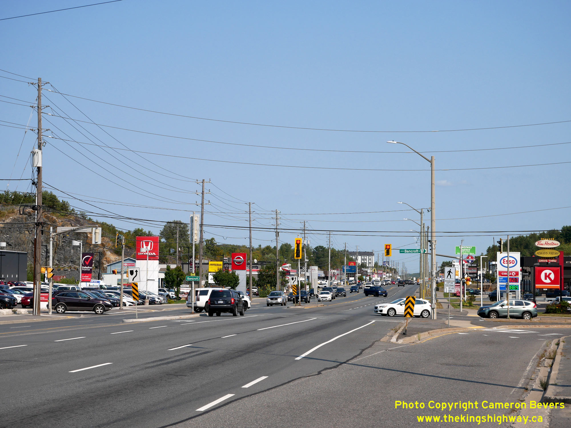
Left - Facing east along Kingsway (Old Hwy 17) at Bancroft Drive in Sudbury. When Hwy 17 was first established as a King's Highway in 1937, it originally
entered Sudbury from Coniston via Bancroft Drive at right. A new 6 1/2-mile diversion was constructed between Sudbury and Coniston under Contract #1936-123, soon
after the Department of Highways of Ontario (DHO) began to take over construction responsibilities for main roads in Northern Ontario. This long diversion between
Sudbury and Coniston was completed in 1938, initially as a gravel-surfaced highway. The new diversion extended the route of Hwy 17 straight ahead via Kingsway, as
opposed to curving to the right onto Bancroft Drive as it did previously. A concrete pavement was constructed along the new Sudbury-Coniston Diversion during the
Summer of 1939, under Contract #1939-94. Provincial jurisdiction over the original route of Hwy 17 via Bancroft Drive ended in August 1941, when it reverted back to
municipal control. See an Enlarged Photo Here. (Photograph taken on September 9, 2022 - © Cameron Bevers) Right - View of Kingsway (Old Hwy 17) facing east towards Bancroft Drive. It is fortunate that the DHO had the foresight in the 1930s to construct a new, straighter highway route between Sudbury and Coniston, as Kingsway has become a very heavily-travelled route in the ensuing decades. Given how winding and indirect the original route of Hwy 17 was via Bancroft Drive, it would have been unthinkable to imagine present day traffic volumes on the old highway route. See an Enlarged Photo Here. (Photograph taken on September 9, 2022 - © Cameron Bevers) 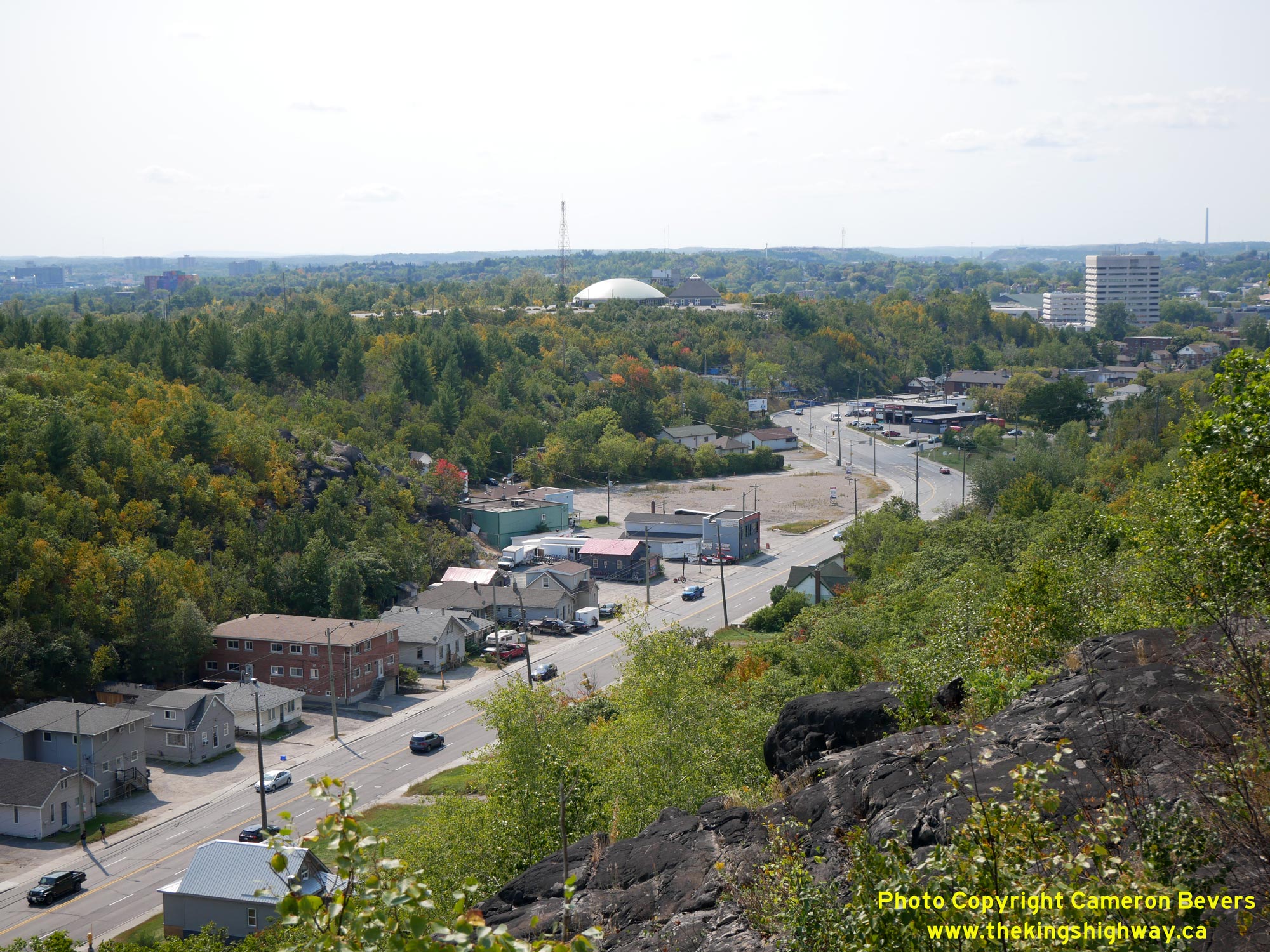
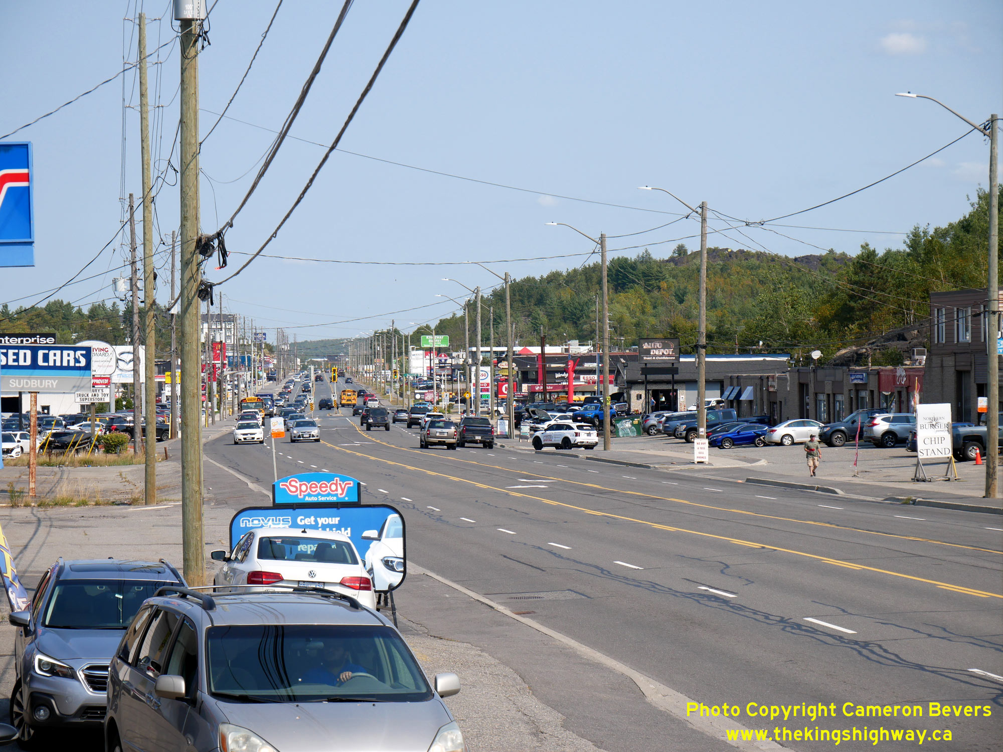
Left - View of Kingsway (Old Hwy 17) approaching Downtown Sudbury, facing west. Kingsway enters Sudbury's City Centre through a narrow valley. See an
Enlarged Photo Here. (Photograph taken on September 9, 2022 - © Cameron Bevers) Right - Facing east along Kingsway (Old Hwy 17) near Cochrane Street in Sudbury. A Hwy 17 Bypass was completed around Sudbury in the mid-1990s, which allowed through traffic to bypass Sudbury entirely. Previously, through traffic on the Trans-Canada Highway competed for space with local traffic along busy Kingsway and other city streets. Considering how big Sudbury is and how busy it can get, it is a little surprising that it took until the 1990s to complete a full bypass around the city. See an Enlarged Photo Here. (Photograph taken on September 9, 2022 - © Cameron Bevers) 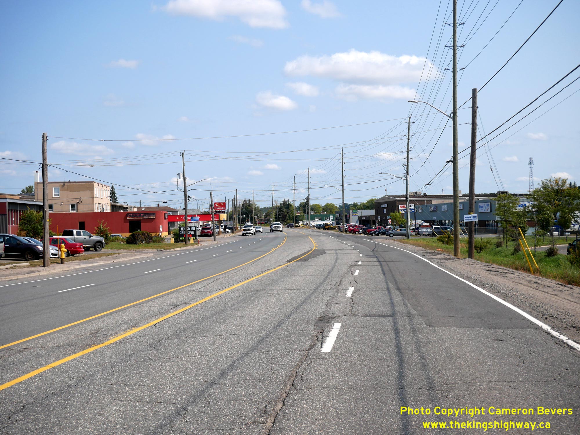
Left - Facing east along Lorne Street (Old Hwy 17) approaching Sutherland Avenue. Up until 1968, the DHO had jurisdiction over Hwy 17 from this point easterly
to the intersection of Martindale Road, where Hwy 17 entered Sudbury and became a Municipal Connecting Link. During the late 1960s, the City of Sudbury's limits were
extended westerly from Martindale Road to the vicinity of Kelly Lake Road. Accordingly, provincial jurisdiction over Hwy 17 was transferred over to the municipality
in 1968. See an Enlarged Photo Here. (Photograph taken on September 9, 2022 - © Cameron Bevers) Right - View of the concrete "singing median" on Lorne Street (Old Hwy 17) approaching Kelly Lake Road in Sudbury. The concrete centre strip has a series of intermittent alternating recessed grooves and raised humps, which provides drivers with an audible warning that their vehicle's tires have encroached over the centreline of the highway. Although once common along Ontario's highways, these features are now becoming quite rare. As traffic volumes on a highway increase, geotechnical engineers will often need to design thicker asphalt pavement structures to accommodate traffic loading requirements. Unfortunately, highways with these singing medians constrain the pavement elevation to a fixed point at the highway's crown, which makes changes to the pavement structure very difficult. See an Enlarged Photo Here. (Photograph taken on September 9, 2022 - © Cameron Bevers) 
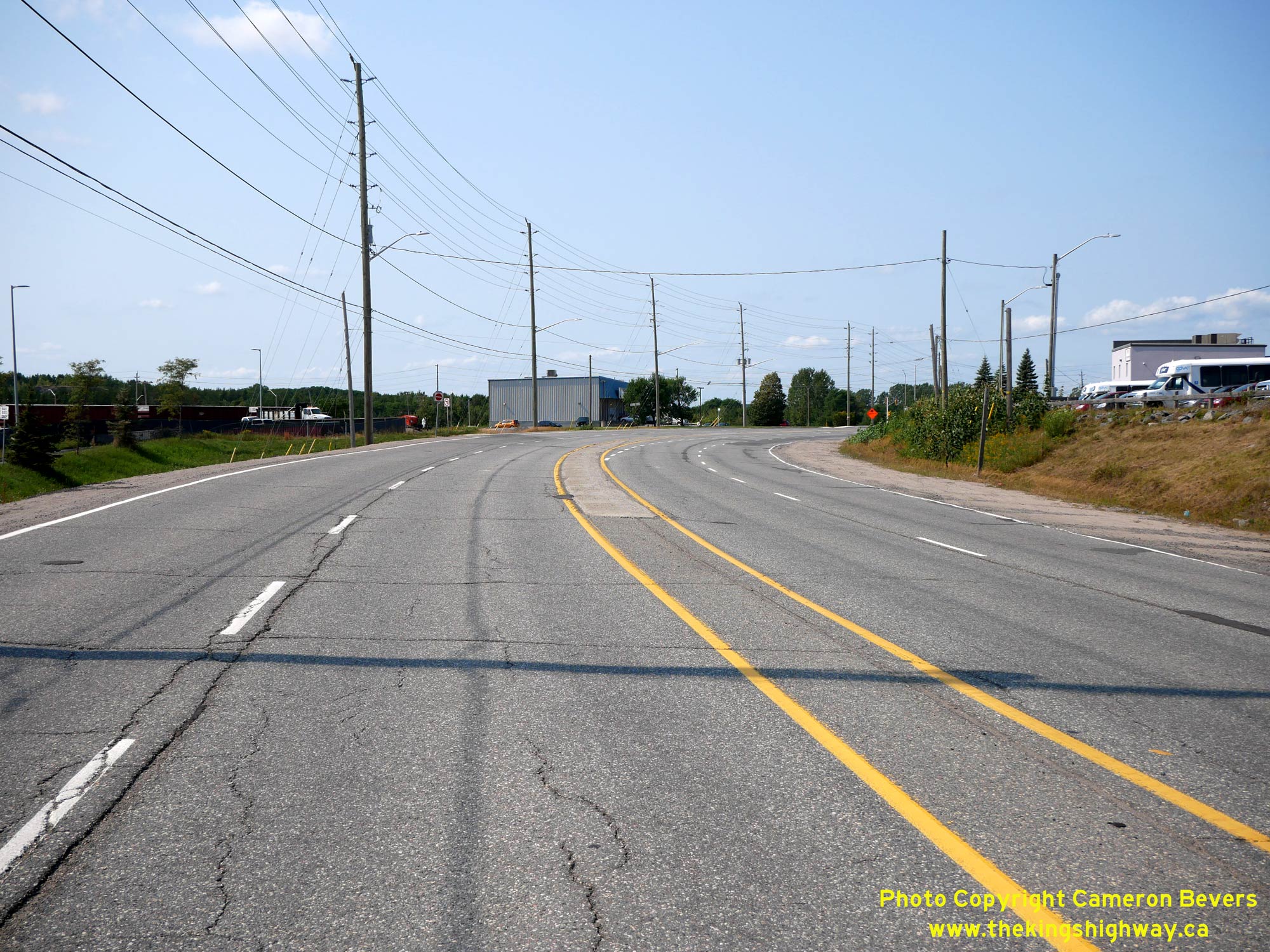
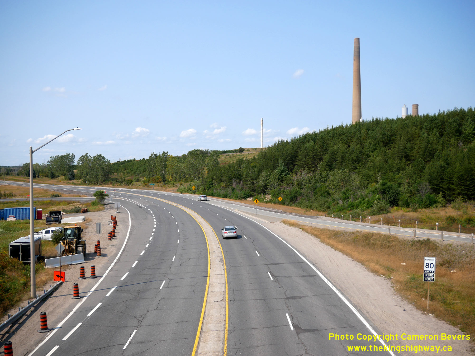
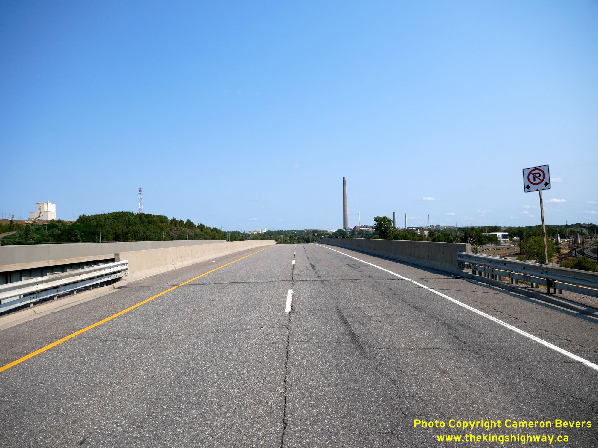
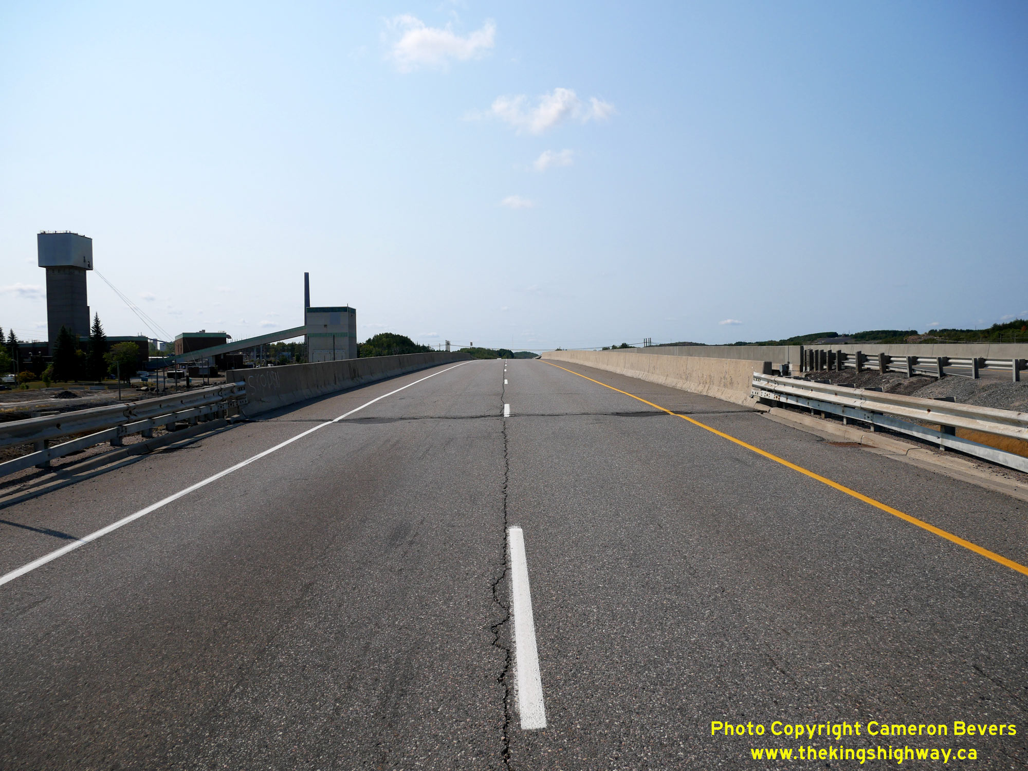
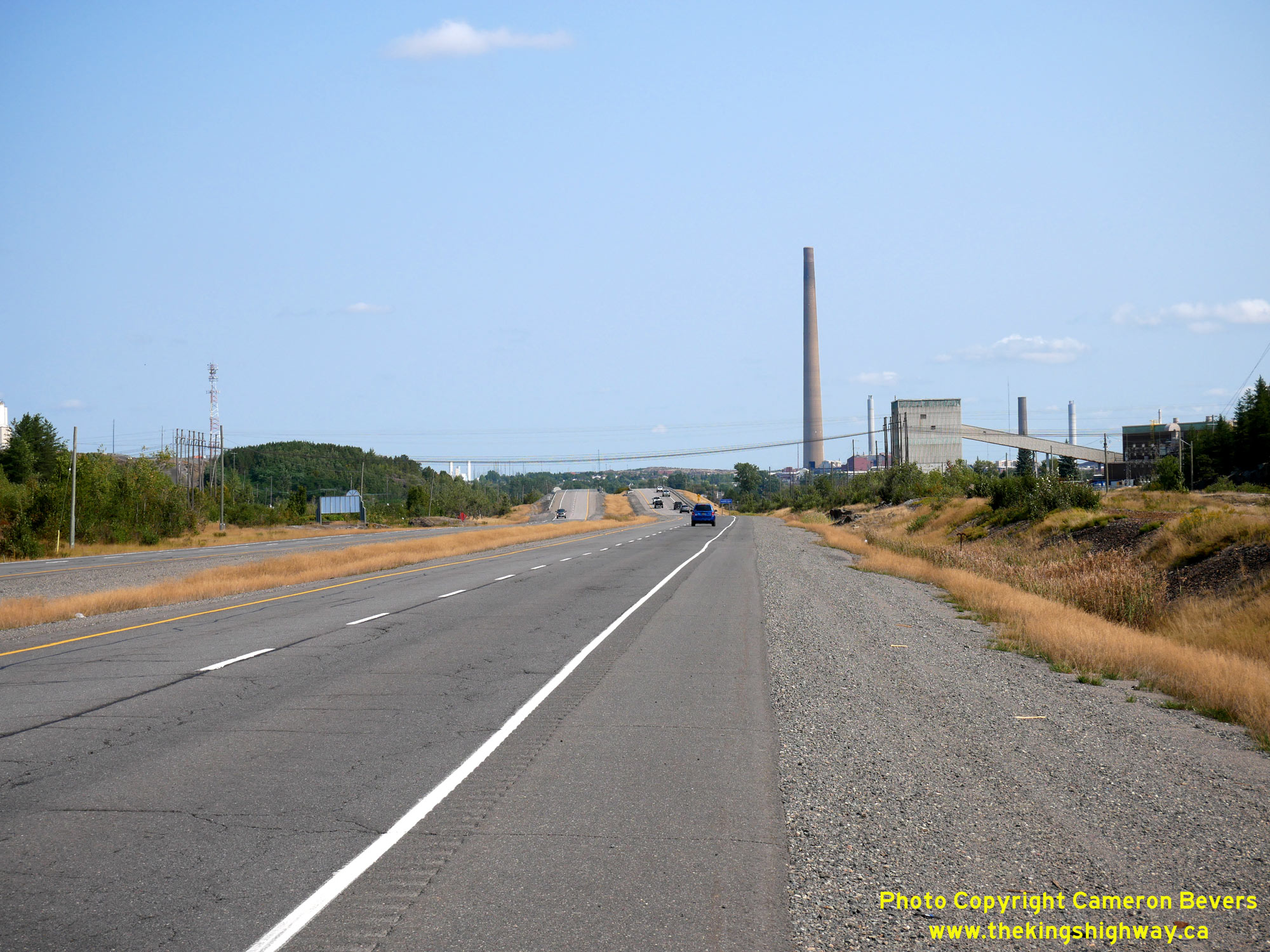
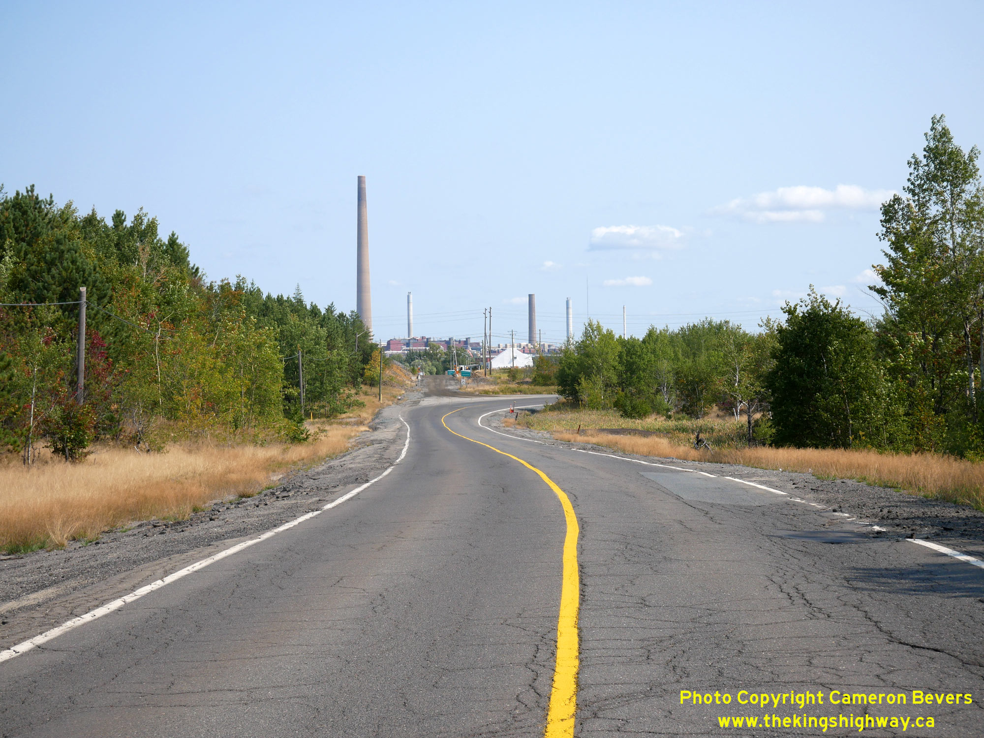
Left - Approaching Kelly Lake Road on Old Hwy 17, facing west towards Copper Cliff. In the background, the Big Nickel Mine Drive Interchange can be seen. This
arterial road was built by the Regional Municipality of Sudbury as a truck bypass route between Hwy 17 (Lorne Street) and Hwy 144 (Elm Street). Until the Sudbury
Northwest Bypass (Hwy 144 New) was completed in 1987, Big Nickel Mine Drive was the only way to access Hwy 144 from Hwy 17 other than to pass right through Sudbury's
City Centre. Copper Cliff's infamous "Superstack" can be seen in the background. Built in the early 1970s, this towering chimney structure reaches a height of 1,250
feet (381 metres). This chimney is reportedly Canada's second-tallest structure, surpassed only by Toronto's CN Tower. The Superstack was made obsolete through modern
pollution control systems and was taken out of service in 2020. The Superstack has been slated for demolition in the years ahead, but for now, is one of the Sudbury
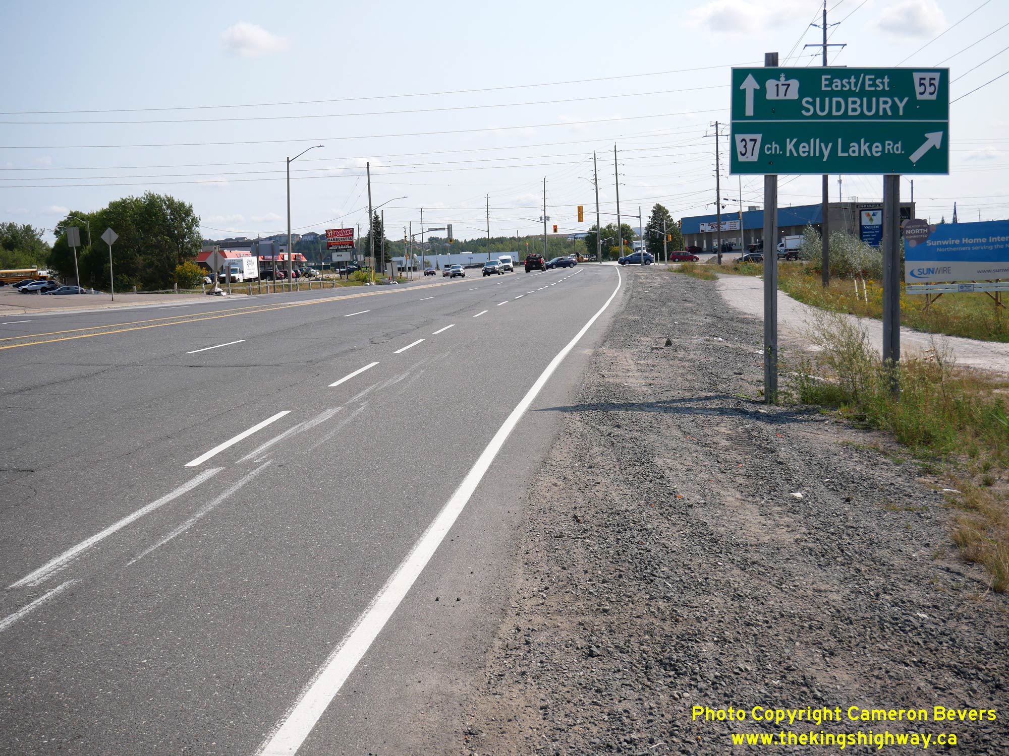
area's most recognizable landmarks. See an Enlarged Photo Here. (Photograph taken on September 9, 2022 - © Cameron Bevers) Right - Green guide sign marking the route of Hwy 17 East on Lorne Street approaching Kelly Lake Road. Until recent decades, Hwy 17 passed right through Sudbury's City Centre. The Sudbury Southeast Bypass (Hwy 17 New) was completed in the mid-1990s, which finally allowed through traffic to bypass Sudbury's busy downtown. Old Hwy 17 through Sudbury is now known as Sudbury Road 55. See an Enlarged Photo Here. (Photograph taken on September 9, 2022 - © Cameron Bevers) 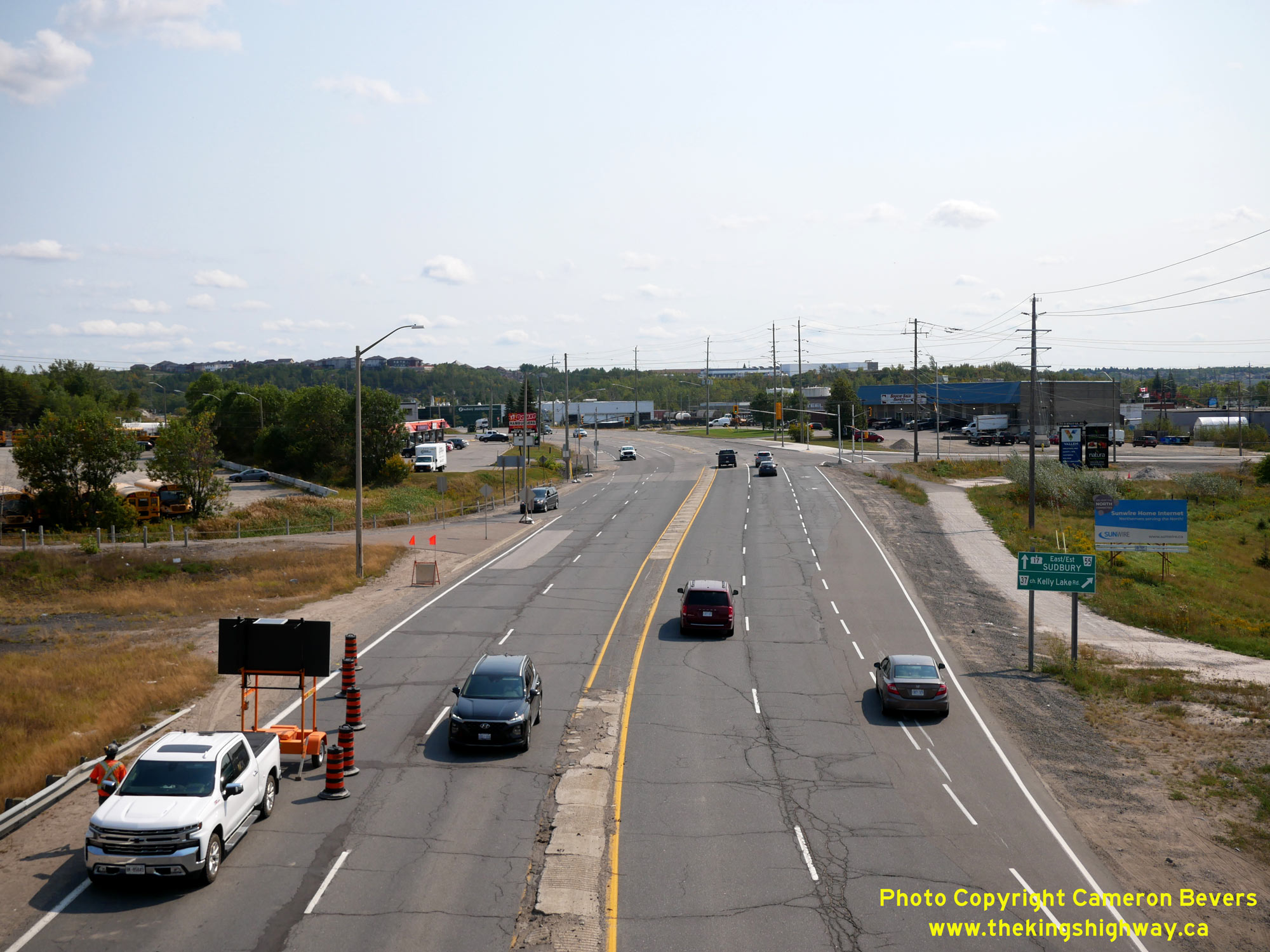
Left - Facing east along Old Hwy 17 towards Kelly Lake Road and Downtown Sudbury from the Big Nickel Mine Drive Overpass. See an
Enlarged Photo Here. (Photograph taken on September 9, 2022 - © Cameron Bevers) Right - View of Old Hwy 17 facing west towards Copper Cliff from the Big Nickel Mine Drive Overpass in Sudbury. See an Enlarged Photo Here. (Photograph taken on September 9, 2022 - © Cameron Bevers) 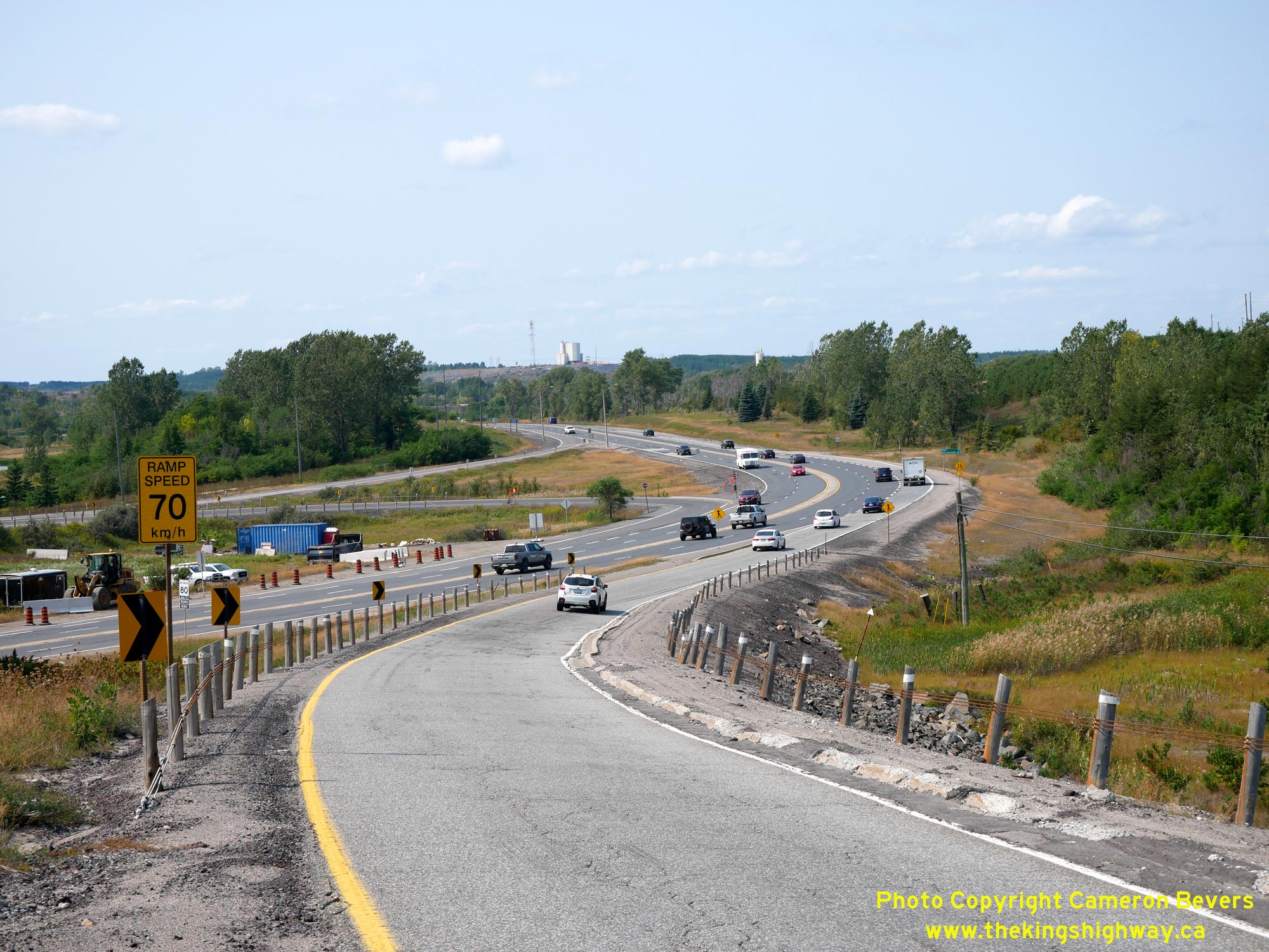

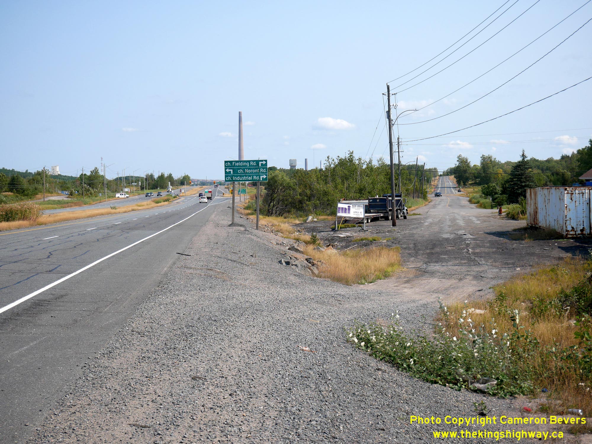
Left - View of Old Hwy 17 curving west towards Copper Cliff from the Big Nickel Mine Drive Interchange. The section of Hwy 17 from Kelly Lake Road westerly to
the Sudbury Southwest Bypass near Lively remained in the provincial highway system up until 1980, when jurisdiction over the route was transferred over to the Regional
Municipality of Sudbury. See an Enlarged Photo Here. (Photograph taken on September 9, 2022 - © Cameron Bevers) Right - Facing east towards Sudbury along Old Hwy 17, just east of Copper Cliff. A concrete ripple strip, more commonly referred to as a "singing median", was constructed along Hwy 17 between Sudbury and Copper Cliff during a reconstruction project carried out in 1965-1966. Previously, this was an undivided four-lane pavement east of the Copper Cliff Railway Subway. The highway was reconstructed with a 4-foot singing median between Sutherland Avenue in Sudbury and Balsam Street in Copper Cliff under Contract #1965-87. See an Enlarged Photo Here. (Photograph taken on September 9, 2022 - © Cameron Bevers) 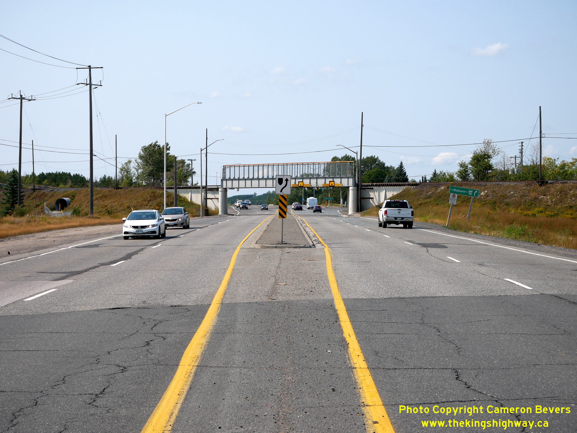
Left - Approaching the Copper Cliff International Nickel Company (INCO) Railway Subway on Old Hwy 17. When this subway was constructed in the late 1930s, it
was proposed that Hwy 17 would be reconstructed as a dual highway west of Sudbury. Accordingly, a centre pier was constructed through the subway on the anticipation of
there being separated eastbound and westbound carriageways on the highway below. INCO was later acquired by Vale in 2006. See an
Enlarged Photo Here. (Photograph taken on September 9, 2022 - © Cameron Bevers) Right - Facing east along Old Hwy 17 from the Copper Cliff Railway Subway. Back in the 1930s, a new highway right-of-way was established for Hwy 17 with a width of 200 feet, in order to construct a proposed dual highway between Sudbury and Copper Cliff. Apart from the completion of the Copper Cliff Subway in 1939, the rest of the dual highway was apparently put on hold due to World War II, after some limited grading work was done. Once the war ended, engineers with the DHO were already exploring possible highway bypass routes around Sudbury. By the time Hwy 17 was expanded to four lanes between Sudbury and Copper Cliff in the early 1950s, it was decided to construct the four-lane highway as a mostly undivided pavement. Owing to the central pier placement of the Copper Cliff Subway, about 1/4 mile of the Copper Cliff to Sudbury Highway had to be built as a dual highway - thus creating Northern Ontario's first four-lane divided highway. See an Enlarged Photo Here. (Photograph taken on September 9, 2022 - © Cameron Bevers) 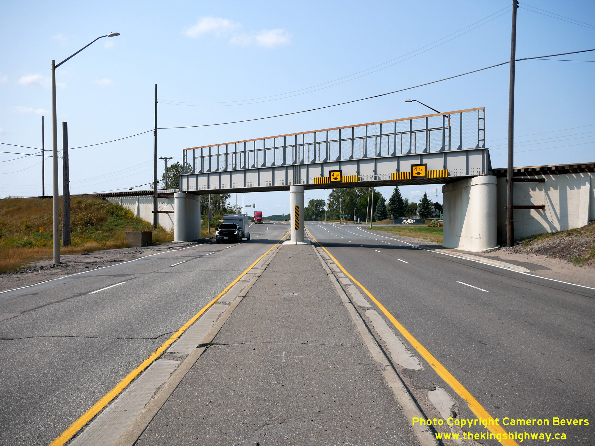
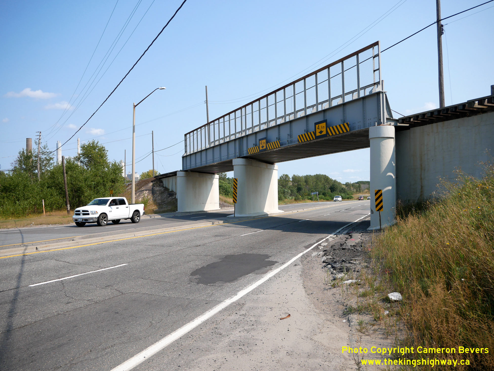
Left - Eastern side of the Copper Cliff Railway Subway (Site #46-116) on Old Hwy 17. This two-span steel plate girder structure was completed in 1939. This
interesting structure featured separate spans across the proposed eastbound and westbound lanes of Hwy 17. For several years, only one side of this subway was
occupied by a highway. It wasn't until the early 1950s that a dual highway was finally completed through the Copper Cliff Subway and all four lanes were opened to
traffic. See an Enlarged Photo Here. (Photograph taken on September 9, 2022 - © Cameron Bevers) Right - Western side of the Copper Cliff Railway Subway. This structure carries a private railway from a nickel mine operated by Vale (formerly INCO) across Old Hwy 17. See an Enlarged Photo Here. (Photograph taken on September 9, 2022 - © Cameron Bevers) 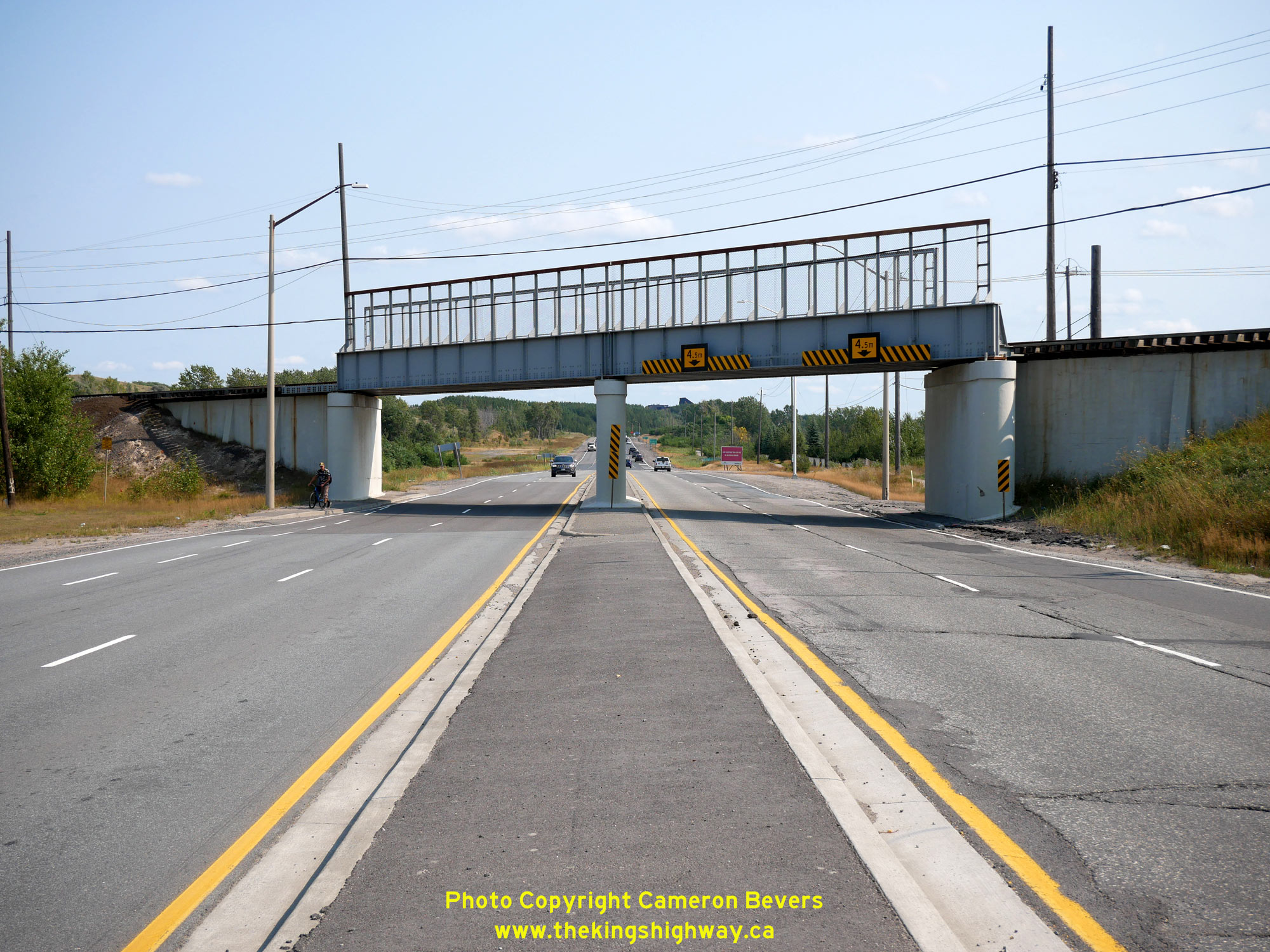
Left - Facing east along Old Hwy 17 approaching the Copper Cliff Railway Subway. The expansion of Hwy 17 between Sudbury and Copper Cliff for a distance of
just over 3 miles commenced during the Summer of 1951, under Contract #1951-48. Grading of this new four-lane route was completed in 1952 with final paving completed
during 1952 and 1953 under Contract #1952-61. The new highway was ultimately built as a mostly undivided highway with a minimum pavement width of 40 feet, except for
a short section of divided highway built in the vicinity of the Copper Cliff Railway Subway. See an
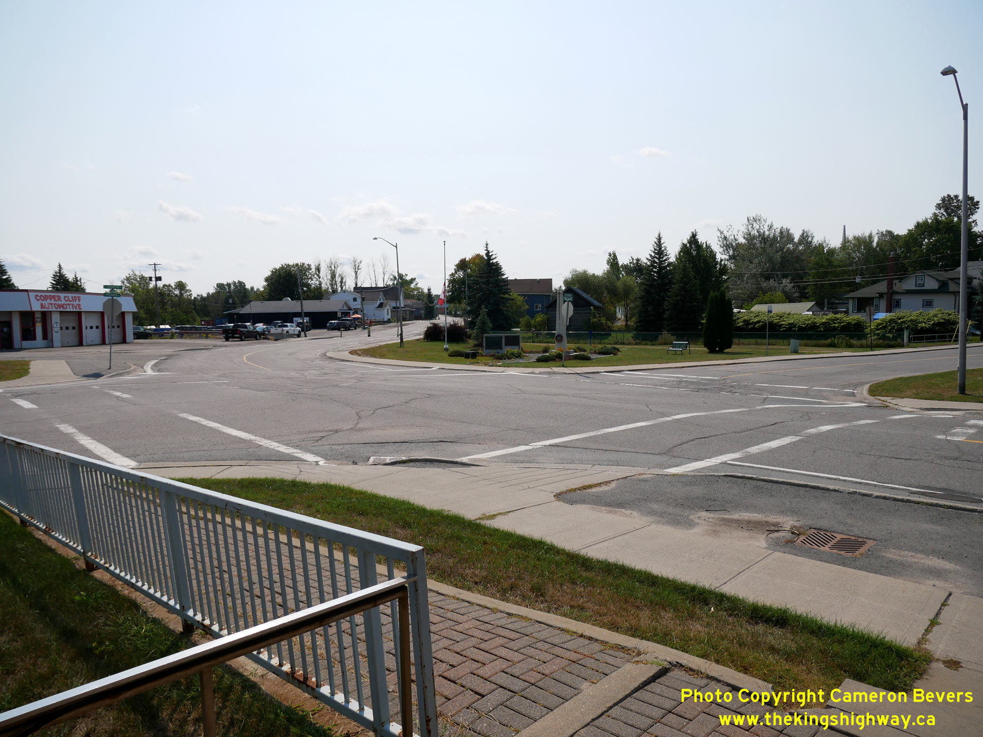
Enlarged Photo Here. (Photograph taken on September 9, 2022 - © Cameron Bevers) Right - View of the intersection of Balsam Street and Power Street in Copper Cliff. From the time Hwy 17 was first established as a King's Highway in 1937 up until 1951, Hwy 17 negotiated this extremely awkward turn in the town centre. A diversion was completed around the southern side of Copper Cliff in 1951, which eliminated this difficult turn on Hwy 17's original route. Note the Canadian flag flying at half-mast at the War Memorial in honour of Queen Elizabeth II, who passed away the day before this photo was taken. See an Enlarged Photo Here. (Photograph taken on September 9, 2022 - © Cameron Bevers) 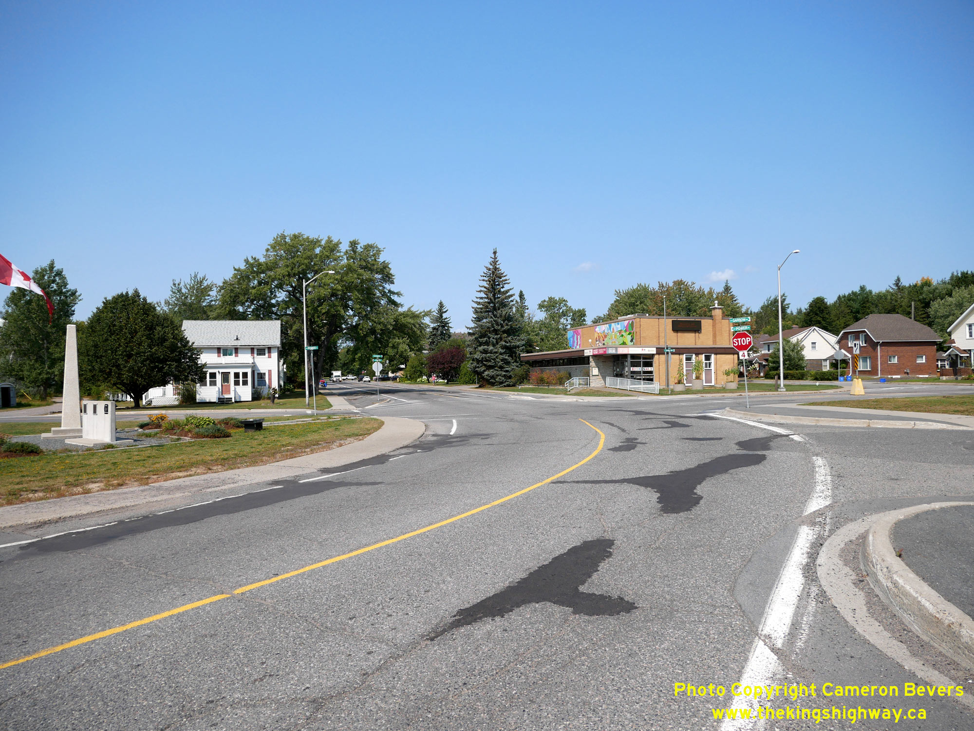
Left - Facing north along Balsam Street (Old Hwy 17) in Copper Cliff approaching Power Street. Historically, motorists bound for Sault Ste. Marie and Blind
River had to turn left onto Power Street from Balsam Street in order to stay on Hwy 17. This awkward intersection required traffic to turn about 130 degrees to
proceed on Hwy 17. See an Enlarged Photo Here. (Photograph taken on September 9, 2022 - © Cameron Bevers) Right - Approaching Balsam Street on Power Street (Old Hwy 17), facing east. Traffic heading for Sudbury once had to turn right from Power Street onto Balsam Street in order to stay on Hwy 17. The new Copper Cliff Diversion provided a more direct through route to Sudbury, which left behind this awkward turn on the original highway's route in Copper Cliff. See an Enlarged Photo Here. (Photograph taken on September 9, 2022 - © Cameron Bevers) 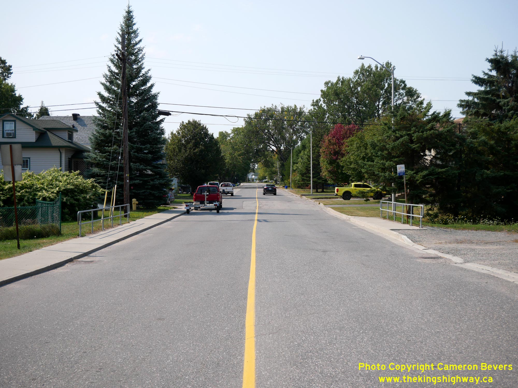
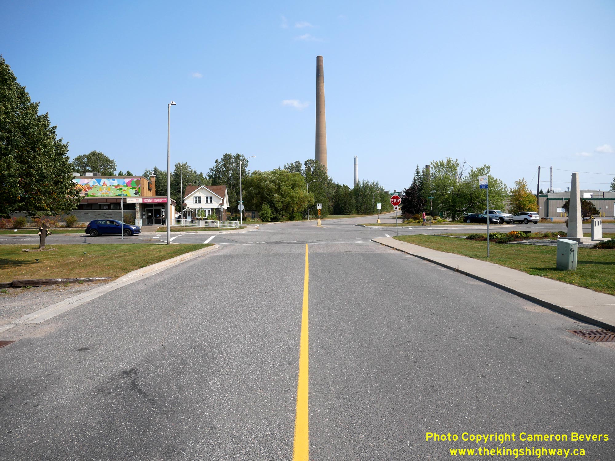
Left - Facing west along Power Street (Old Hwy 17) from Balsam Street in Copper Cliff. Jurisdiction over the bypassed loop of Hwy 17 through Copper Cliff via
Power Street and Balsam Street was transferred from the DHO over to municipal control, effective October 8, 1951. Prior to 1951, this was the main highway to Sault
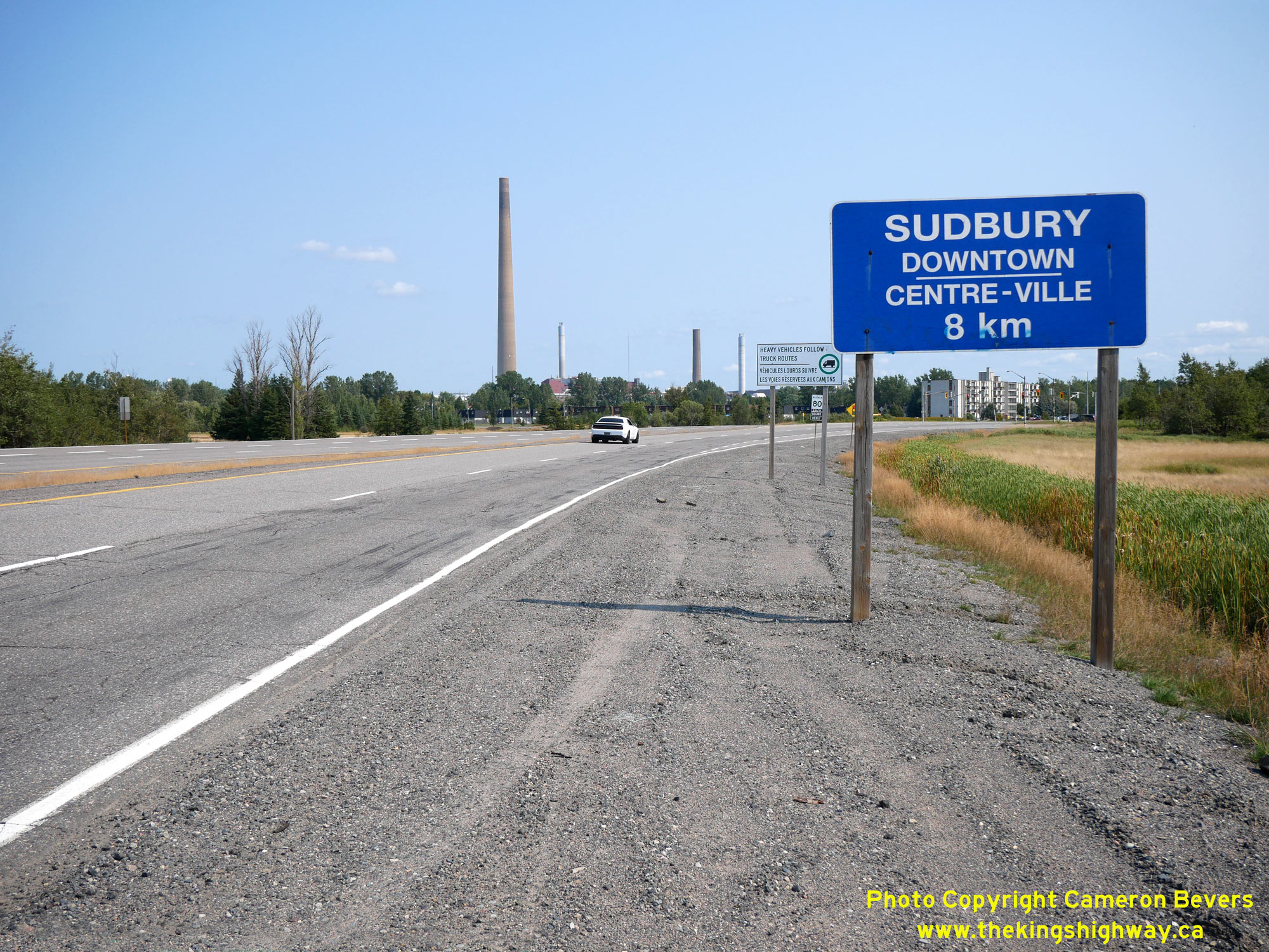
Ste. Marie. See an Enlarged Photo Here. (Photograph taken on September 9, 2022 - © Cameron Bevers) Right - Approaching Copper Cliff on Old Hwy 17, facing east towards Power Street. The blue-and-white guide sign at right provides the distance to Downtown Sudbury. See an Enlarged Photo Here. (Photograph taken on September 9, 2022 - © Cameron Bevers) 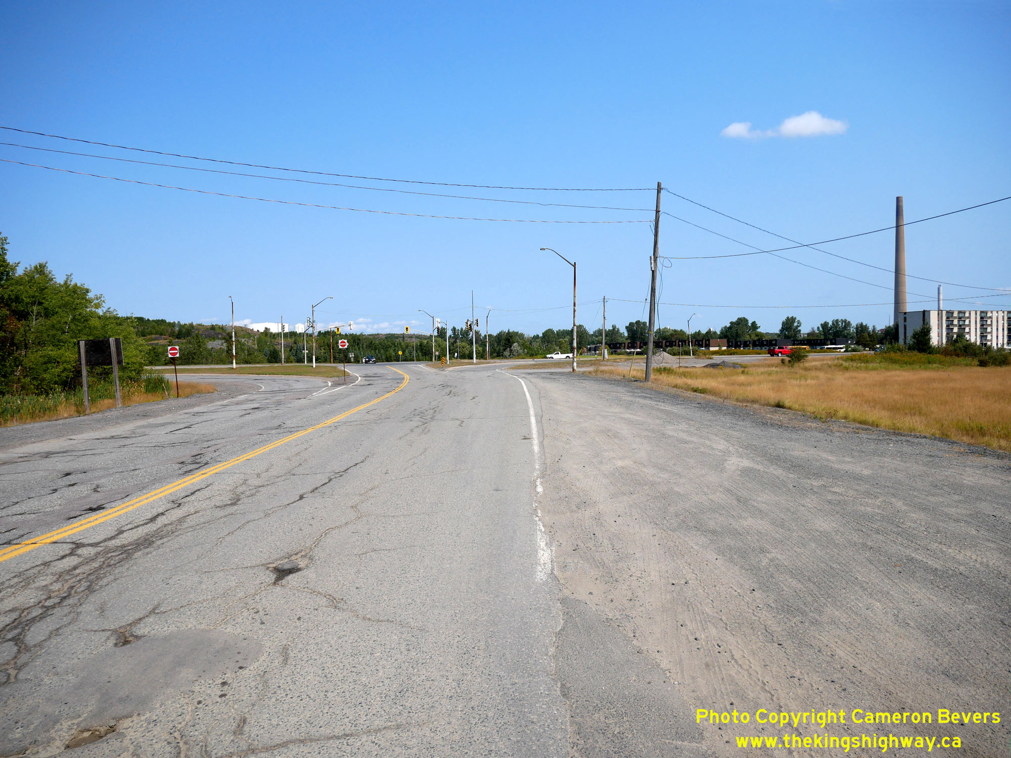

Left - Facing north along Power Street approaching the intersection with Old Hwy 17 (the Copper Cliff Diversion). Historically, Hwy 17 departed from Copper
Cliff on Power Street. In 1951, the first phase of the Copper Cliff Diversion was built, which saw a four-lane highway built between this intersection and the western
approach to Sudbury. This new diversion allowed through traffic to bypass Copper Cliff. As a second phase of the Copper Cliff Diversion, this revised route of Hwy 17
was extended westerly towards Lively on a much-improved alignment. See an Enlarged Photo Here. (Photograph taken on September 9, 2022 - © Cameron Bevers) Right - Power Street (the original route of Hwy 17) enters a mining area south of the relocated highway. After the relocated highway west of Copper Cliff opened to traffic in 1955, the original highway's route was closed to through traffic at the mine entrance. Parts of the old highway are no longer open to public travel. See an Enlarged Photo Here. (Photograph taken on September 9, 2022 - © Cameron Bevers) 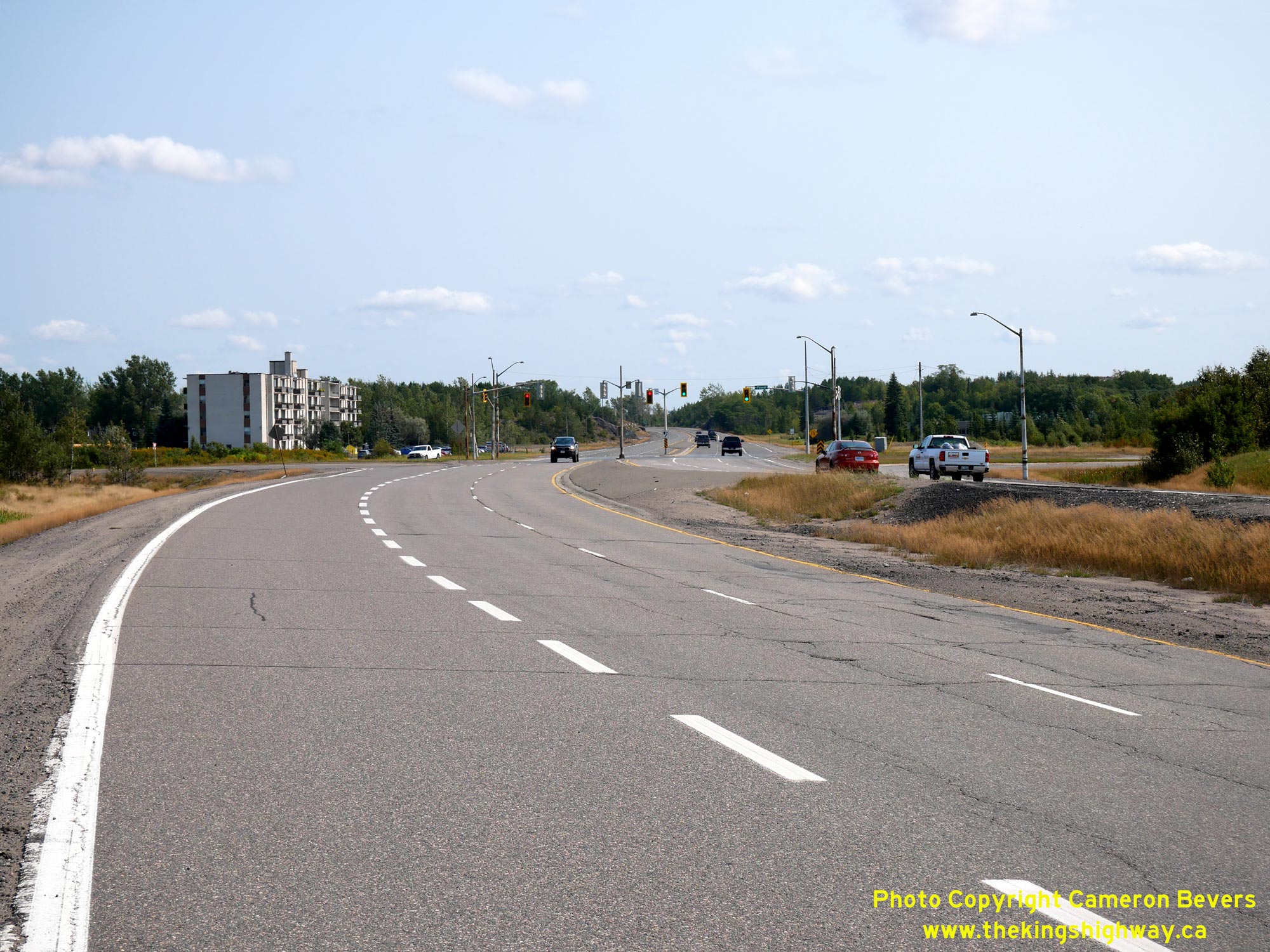
Left - Facing east along Old Hwy 17 approaching Power Street in Copper Cliff. Interestingly, all four legs of this intersection were parts of Hwy 17 at one
time or another. During the 1950s, Hwy 17 was relocated onto an improved alignment in the Copper Cliff area. A 3-mile section of new four-lane highway was built from
Sudbury westerly, which initially came to an end at this intersection. The remainder of the new highway between Copper Cliff and Lively was initially built as a
two-lane highway. Growing traffic congestion along the Hwy 17 corridor by the late 1960s prompted the DHO to expand Hwy 17 through the construction of a twinned
highway. The original highway forms the westbound lanes seen here at left, while a new eastbound carriageway was constructed at right under Contract #1969-207. See an
Enlarged Photo Here. (Photograph taken on September 9, 2022 - © Cameron Bevers) Right - View of the Copper Cliff Diversion (Old Hwy 17), facing west from Power Street towards Lively. Construction on the western portion of the Copper Cliff Diversion was carried out under Contract #1952-31 (grading and culverts) and Contract #1955-219 (hot-mix asphalt paving). The westerly extension of the Copper Cliff Diversion towards Lively was held up partly due to shortages of structural steel required for the construction of a proposed grade separation over the Canadian Pacific Railway (CPR) west of Copper Cliff. See an Enlarged Photo Here. (Photograph taken on September 9, 2022 - © Cameron Bevers) 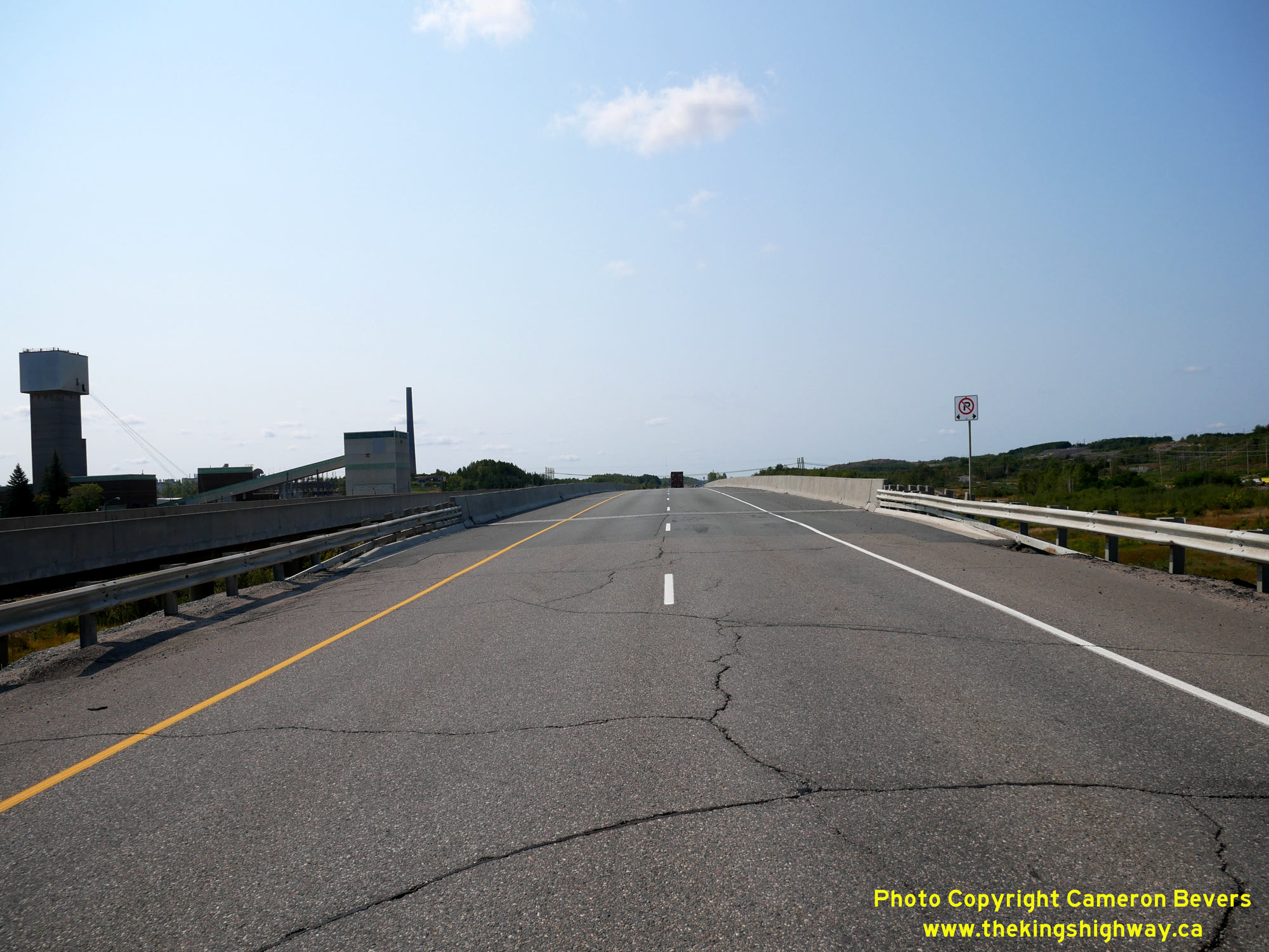
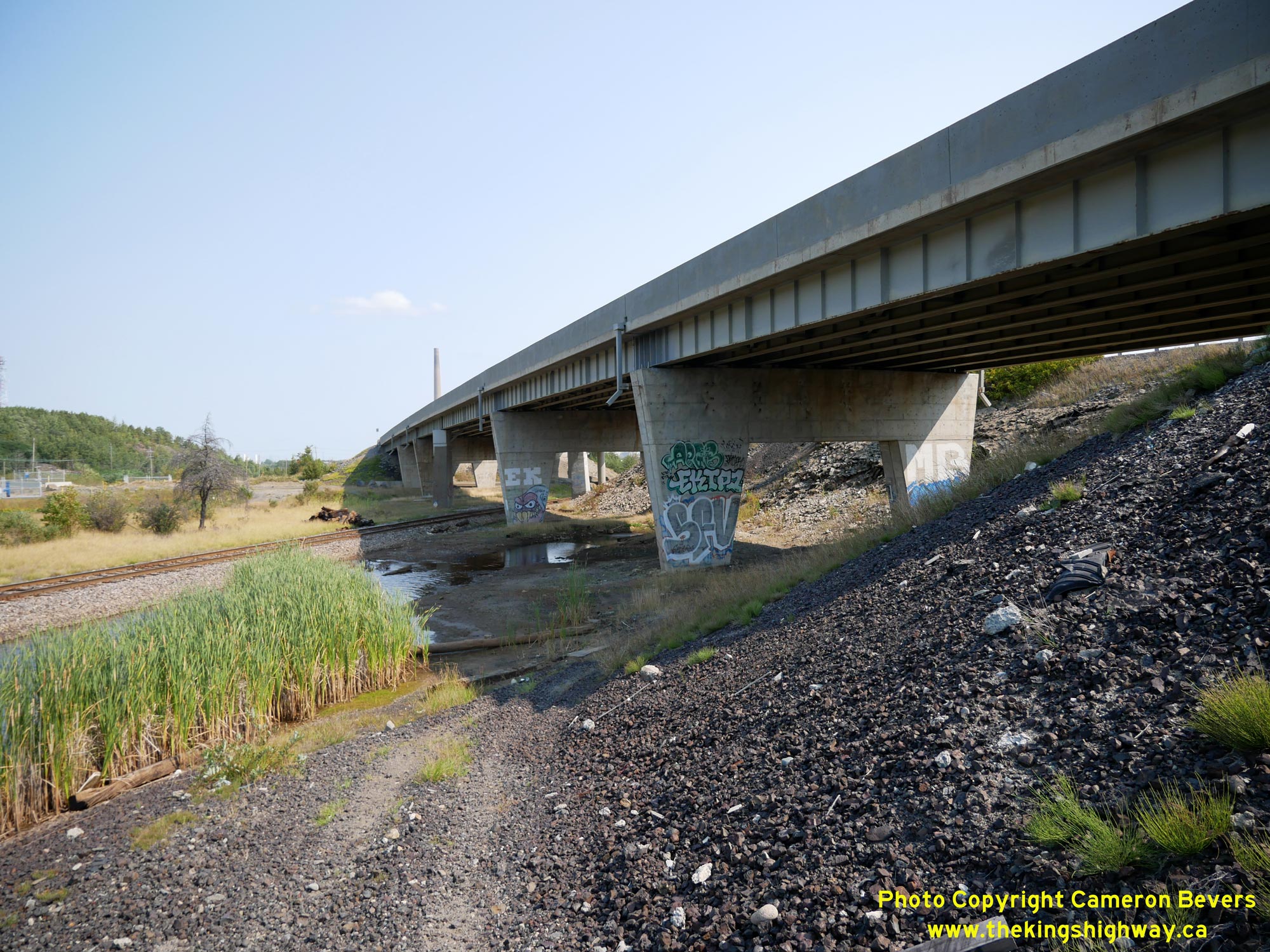
Left - Facing west along the westbound lanes of Old Hwy 17 towards Lively at the Copper Cliff Railway Overhead (Site #46-115). See an
Enlarged Photo Here. (Photograph taken on September 9, 2022 - © Cameron Bevers) Right - Northern side of the Copper Cliff Railway Overhead on Old Hwy 17, located about 1 km west of Copper Cliff. This massive six-span steel plate girder flyover was constructed under Contract #1954-108 (concrete substructure) and Contract #1954-126 (structural steel). The flyover was a key component of the new diversion for the Trans-Canada Highway west of Copper Cliff. Previously, Hwy 17 crossed the Canadian Pacific Railway (CPR) via an at-grade railway crossing south of Copper Cliff on Power Street. The tapered piers used for this structure were quite innovative at the time of construction in the mid-1950s. This tapered pier design was also used for other provincial highway bridges built in later decades. The Copper Cliff Railway Overhead was completed in late 1955. See an Enlarged Photo Here. (Photograph taken on September 9, 2022 - © Cameron Bevers) 
Left - The central pier of the six-span Copper Cliff Overhead straddles the railway. Note the separate structure at right which carries the eastbound lanes of
the highway across the railway. The newer eastbound structure is of a vastly different design when compared to the older westbound structure. Like many Trans-Canada
Highway bridges built in the 1950s, the Copper Cliff Overhead was designed with full-width shoulders. See an
Enlarged Photo Here. (Photograph taken on September 9, 2022 - © Cameron Bevers) Right - Facing east along the westbound lanes of Old Hwy 17 at the Copper Cliff Railway Overhead. See an Enlarged Photo Here. (Photograph taken on September 9, 2022 - © Cameron Bevers) 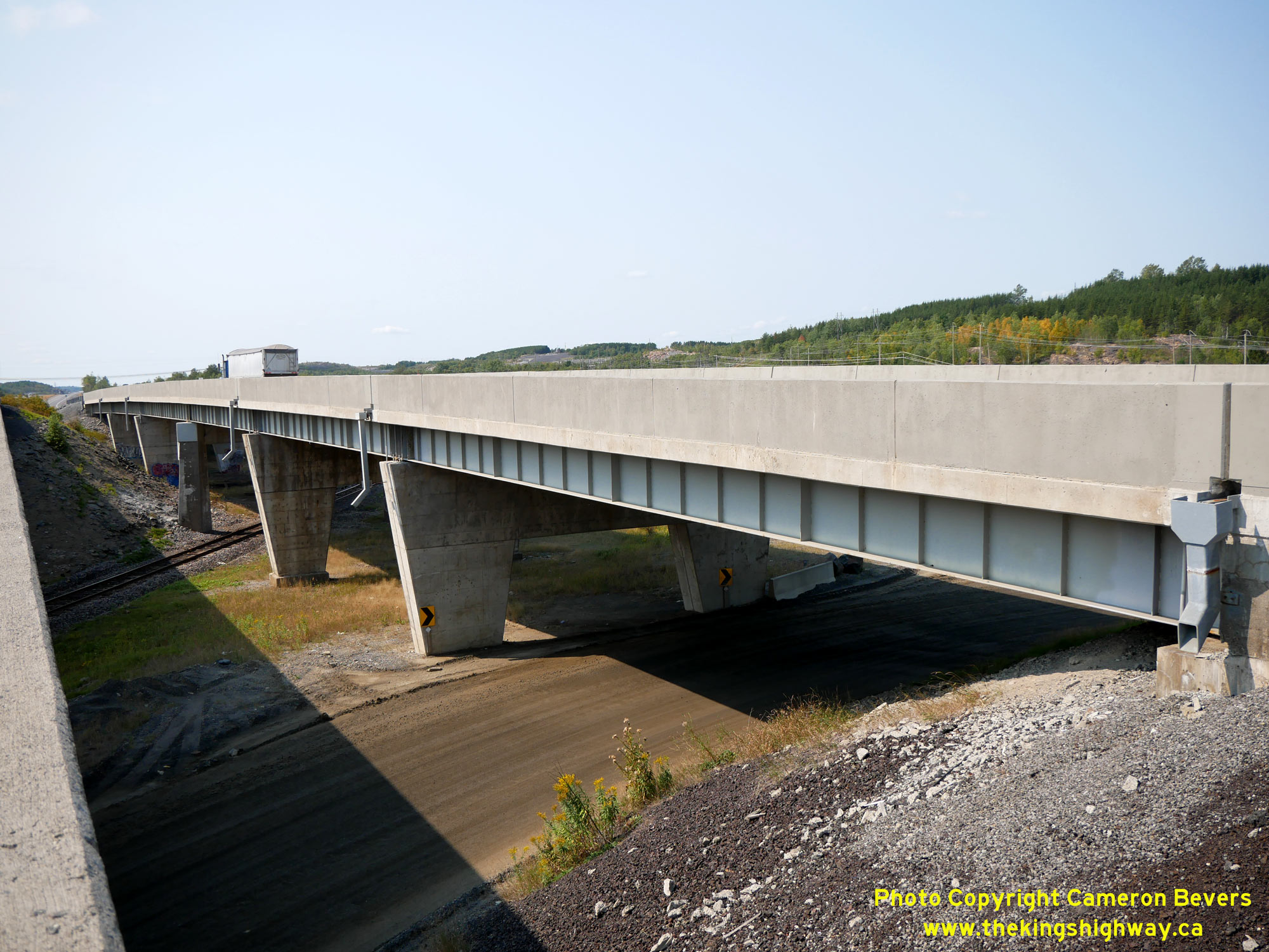
Left - Southern side of the Copper Cliff Railway Overhead on Old Hwy 17, as seen from the newer eastbound structure. See an
Enlarged Photo Here. (Photograph taken on September 9, 2022 - © Cameron Bevers) Right - Northern side of the eastbound Copper Cliff Railway Overhead on Old Hwy 17. This three-span post-tensioned concrete structure was built under Contract #1969-207 and was completed in 1970. See an Enlarged Photo Here. (Photograph taken on September 9, 2022 - © Cameron Bevers) 
Left - Comparison photo showing the length of the original Copper Cliff Overhead, versus the newer eastbound structure which is considerably shorter. See an
Enlarged Photo Here. (Photograph taken on September 9, 2022 - © Cameron Bevers) Right - Facing east along the eastbound lanes of Old Hwy 17 towards Copper Cliff at the Copper Cliff Railway Overhead. See an Enlarged Photo Here. (Photograph taken on September 9, 2022 - © Cameron Bevers) 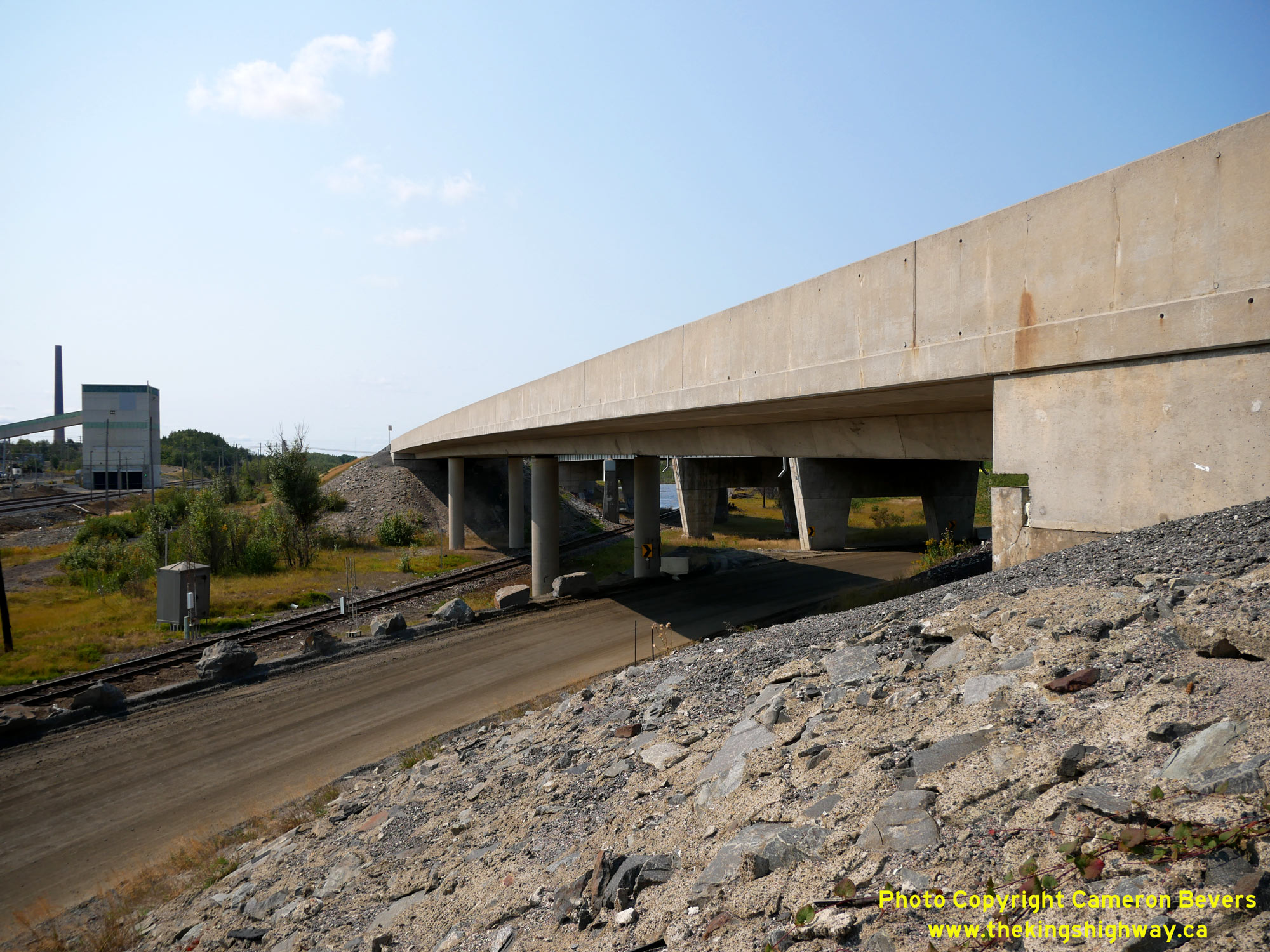
Left - Southern side of the eastbound Copper Cliff Railway Overhead on Old Hwy 17. With the introduction of post-tensioned concrete structures in Ontario
during the early 1960s, engineers were able to design much longer spans than had been previously possible using girder bridges. At skewed railway crossings such as
this one, the multi-span girder structures of yesteryear quickly became a thing of the past. Even though these two bridges were only built about 15 years apart, they
couldn't be more different! See an Enlarged Photo Here. (Photograph taken on September 9, 2022 - © Cameron Bevers) Right - Facing west along the eastbound lanes of Old Hwy 17 towards Lively at the Copper Cliff Railway Overhead (Site #46-115). See an Enlarged Photo Here. (Photograph taken on September 9, 2022 - © Cameron Bevers) 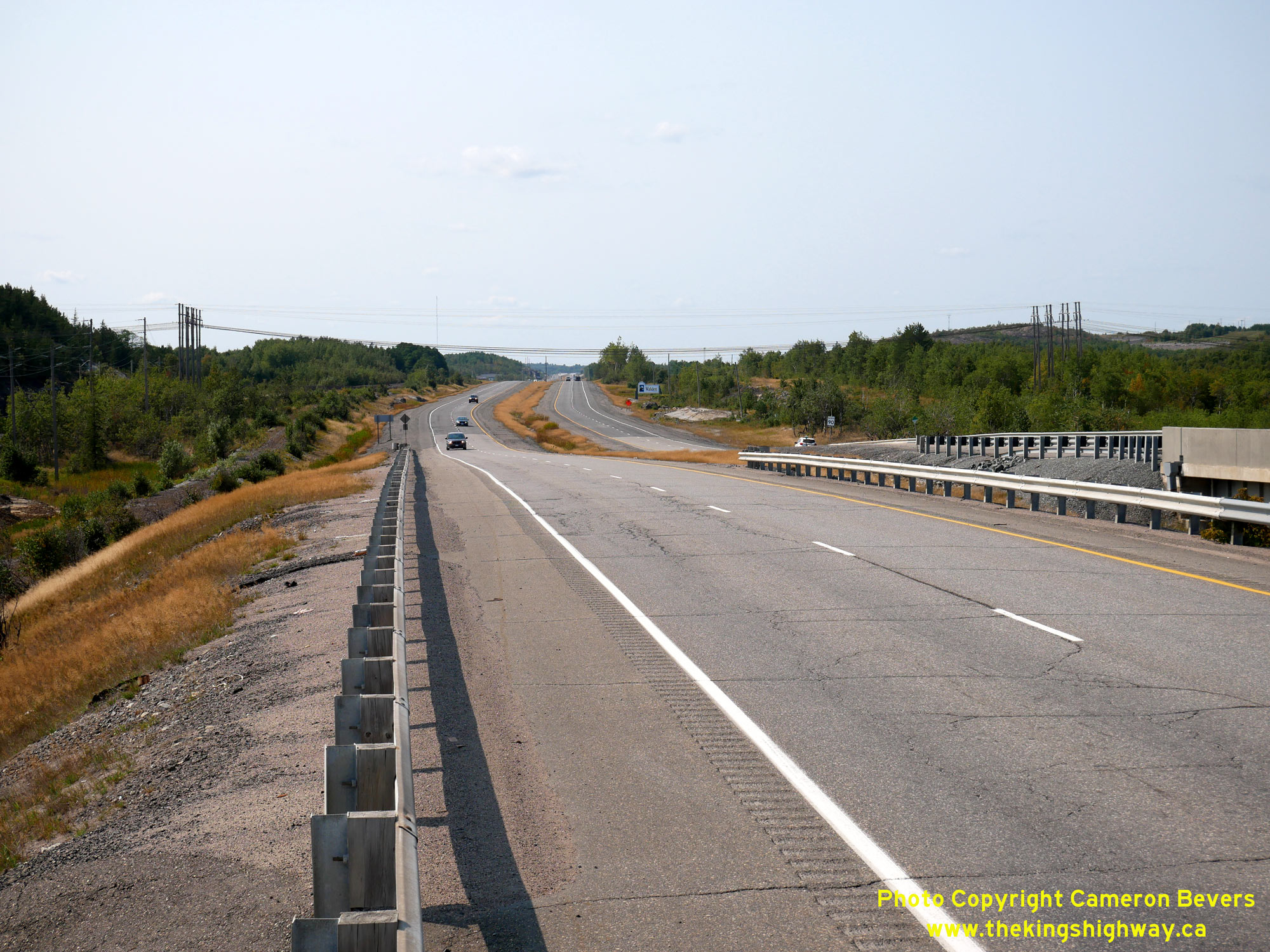
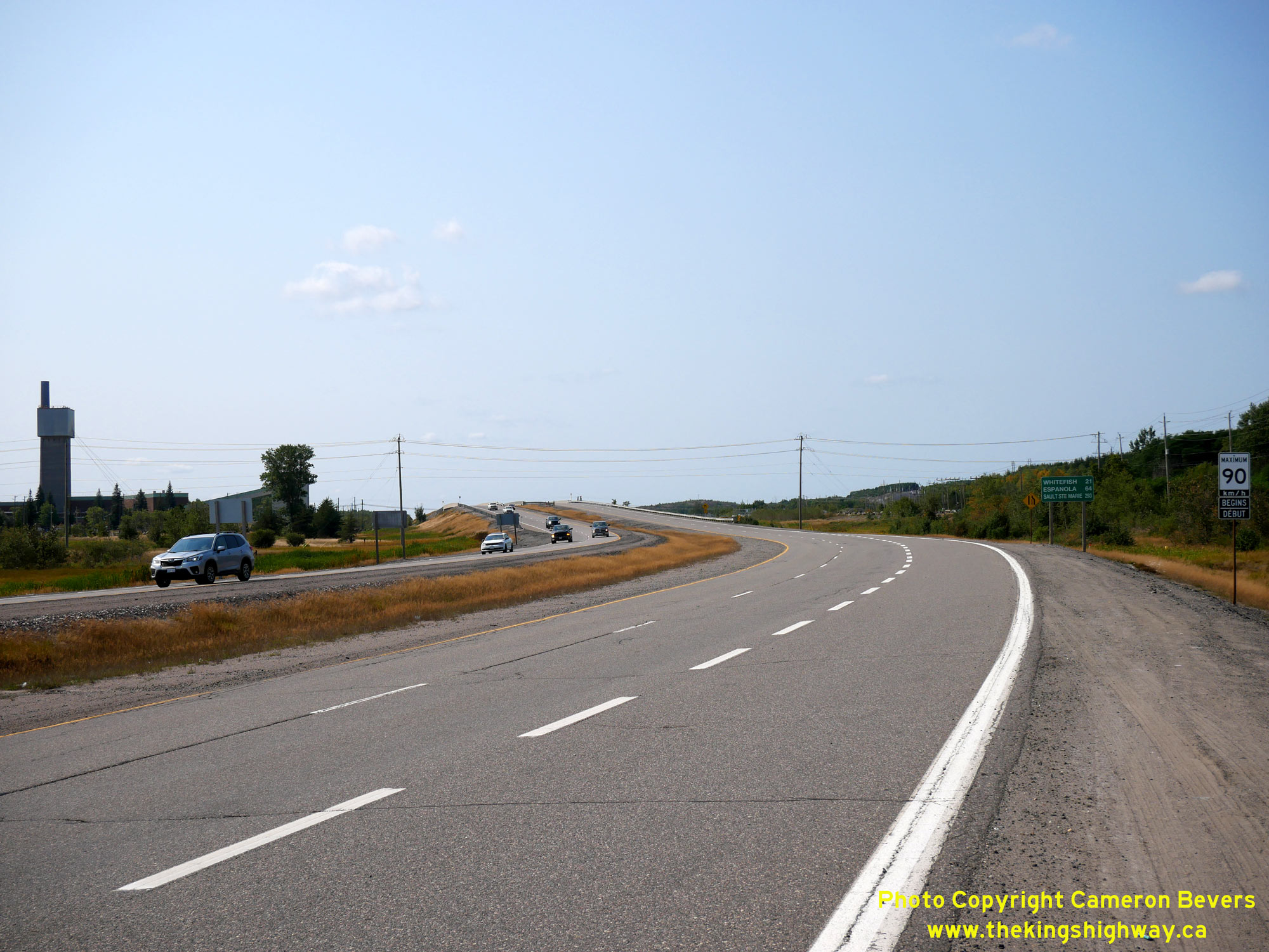
Left - View of Old Hwy 17 facing west towards Lively from the Copper Cliff Railway Overhead. Divided arterial highways are fairly uncommon in Ontario, which
makes this example built in the early 1970s between Copper Cliff and Lively rather noteworthy. More often than not, four-lane highway widening in Ontario is
accompanied by a conversion to a freeway. See an Enlarged Photo Here. (Photograph taken on September 9, 2022 - © Cameron Bevers) Right - Facing east along Old Hwy 17 about 2 km west of Copper Cliff. Although this industrial scene is admittedly rather grim, it should be noted that the Sudbury area is actually much greener now than it once was in decades past. Industrial pollution in the early 20th Century killed much of the vegetation around Sudbury. Better environmental management techniques and Copper Cliff's "Superstack" helped to dissipate harmful emissions. Gone are the barren landscapes of decades past, when areas around Sudbury were almost completely devoid of trees. At one time, a large overhead structure stood here, which carried INCO utilities from a nearby nickel mine across Hwy 17. This structure (Site #46-114) has since been demolished. See an Enlarged Photo Here. (Photograph taken on September 9, 2022 - © Cameron Bevers) 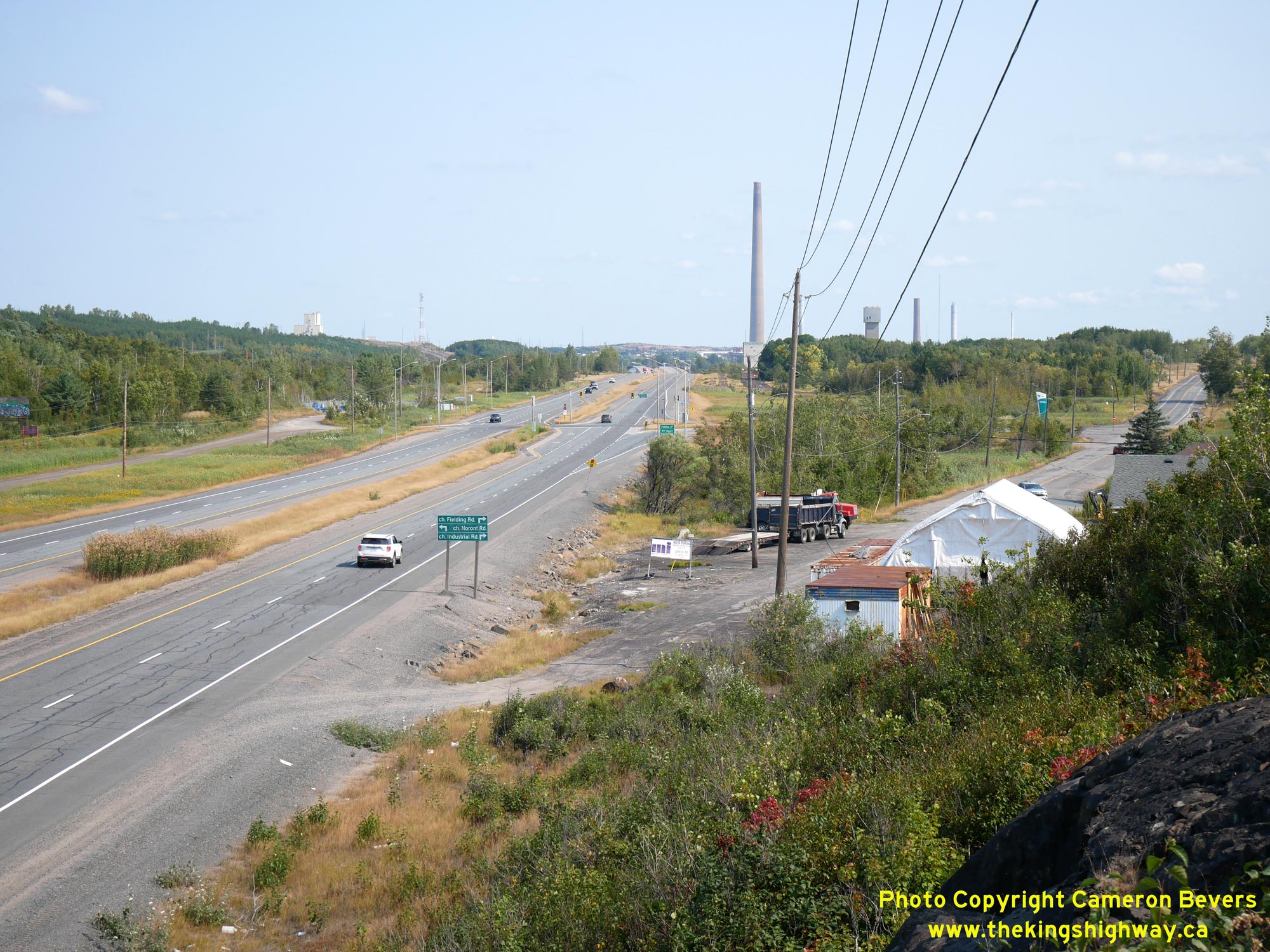
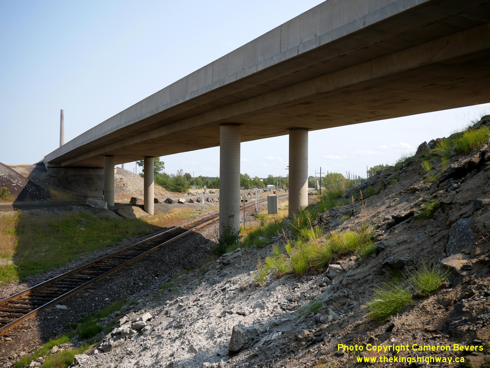
Left - View of Old Hwy 17 approaching Industrial Drive between Lively and Copper Cliff. This view facing east towards Copper Cliff shows the now-closed
original 1937 route of Hwy 17 crossing over the newer Trans-Canada Highway route (the Copper Cliff Diversion). The Copper Cliff Diversion seen here was initially
completed in 1955 as a two-lane undivided highway. The twinned four-lane divided highway from west of Copper Cliff to Lively was completed in 1972, following final
hot-mix asphalt paving under Contract #1971-110. See an Enlarged Photo Here. (Photograph taken on September 9, 2022 - © Cameron Bevers) Right - Facing east along the original route of Hwy 17 from the relocated highway. When Hwy 17 was first established as a King's Highway in 1937, traffic approaching Sudbury from the west used the route at right. A new Trans-Canada Highway route (the Copper Cliff Diversion, at left) was opened in 1955, initially as a two-lane highway. The original highway seen here was transferred over to municipal control effective March 5, 1956. Some sections of the old highway subsequently closed to public travel altogether. This section of the original highway now serves as a private driveway. See an Enlarged Photo Here. (Photograph taken on September 9, 2022 - © Cameron Bevers) 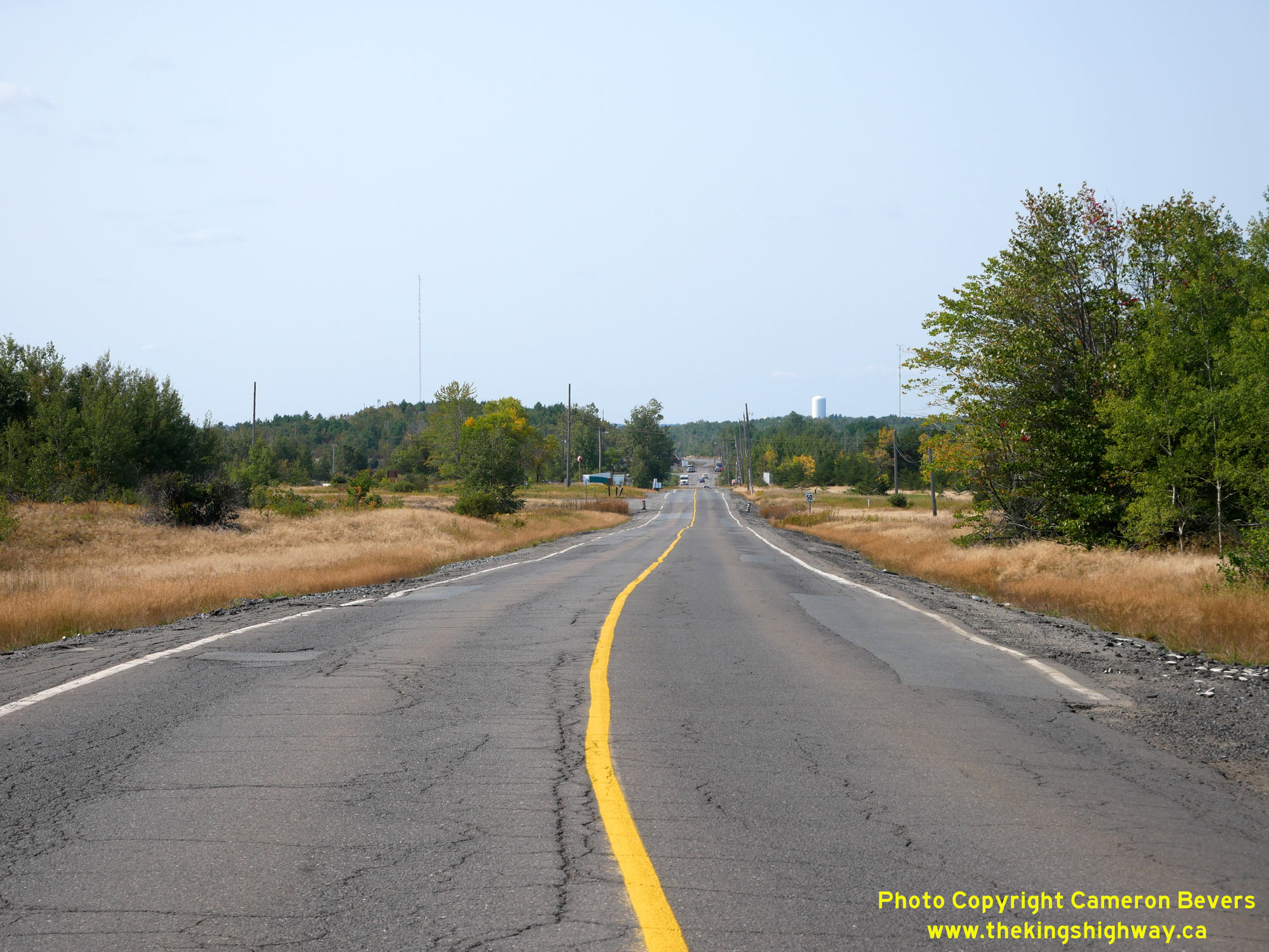
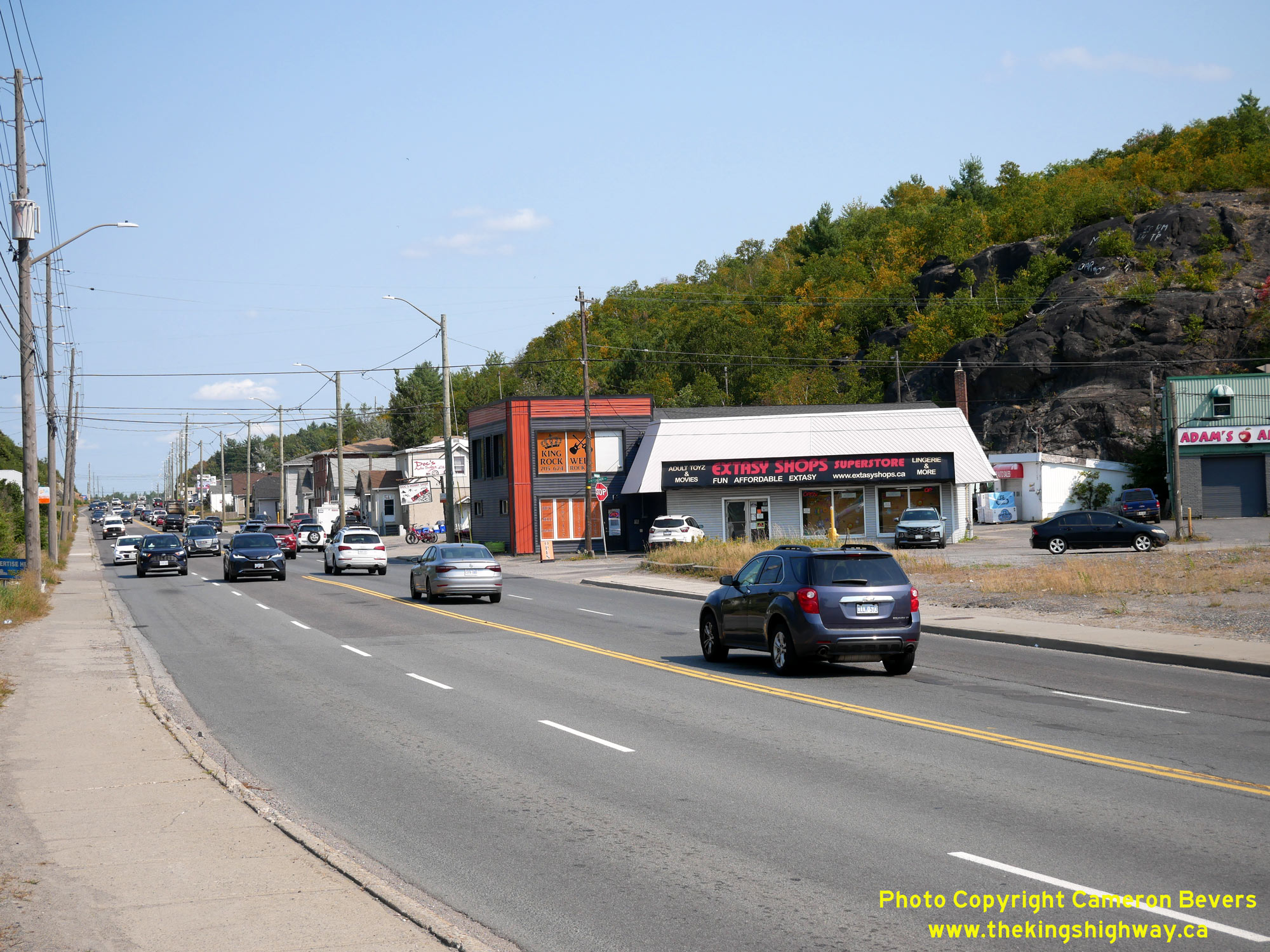
Left - Facing west along the original 1937 route of Hwy 17 (Industrial Drive) between Copper Cliff and Lively. A section of the old highway, about 3 km in
length, was left behind once the Copper Cliff Diversion opened to traffic in 1955. Until the mid-1950s, this was the main highway leading west to Sault Ste. Marie.
See an Enlarged Photo Here. (Photograph taken on September 9, 2022 - © Cameron Bevers) Right - View of Industrial Drive approaching Vale's mining area. At this point, the public road swings to the right and the original 1937 route of Hwy 17 is no longer open to public travel. This abandoned alignment of Hwy 17 emerges again on the far side of the mining area and becomes Power Street into Copper Cliff. See an Enlarged Photo Here. (Photograph taken on September 9, 2022 - © Cameron Bevers) 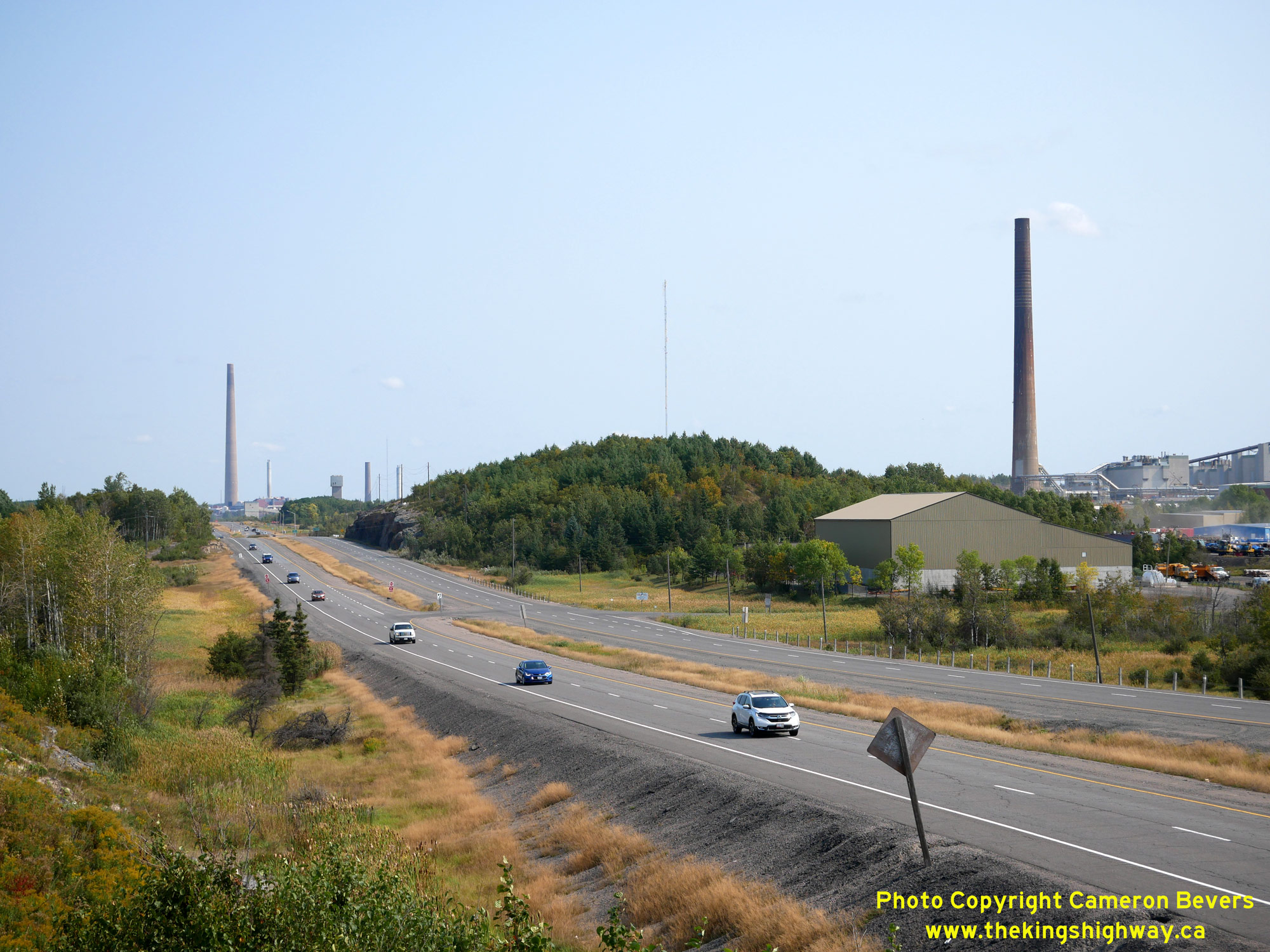
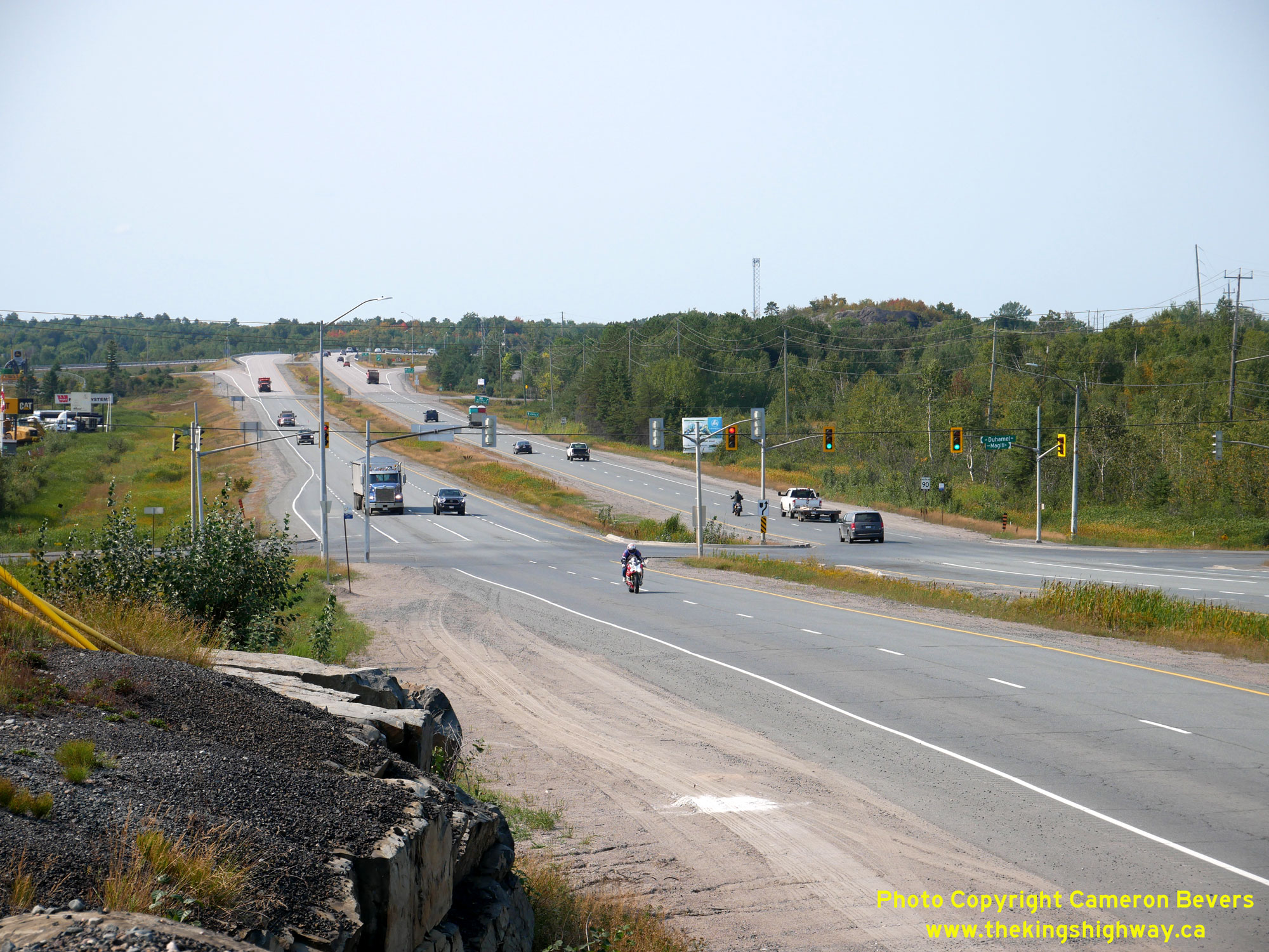
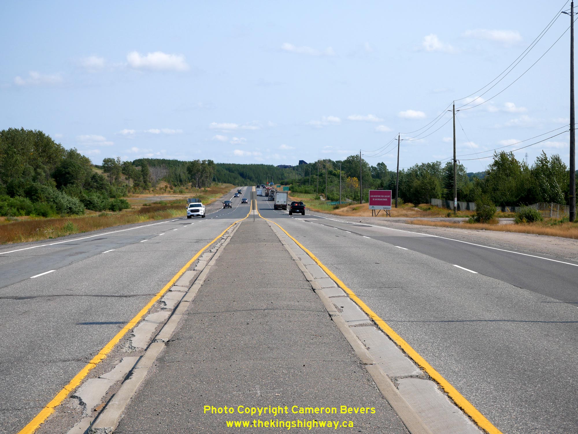
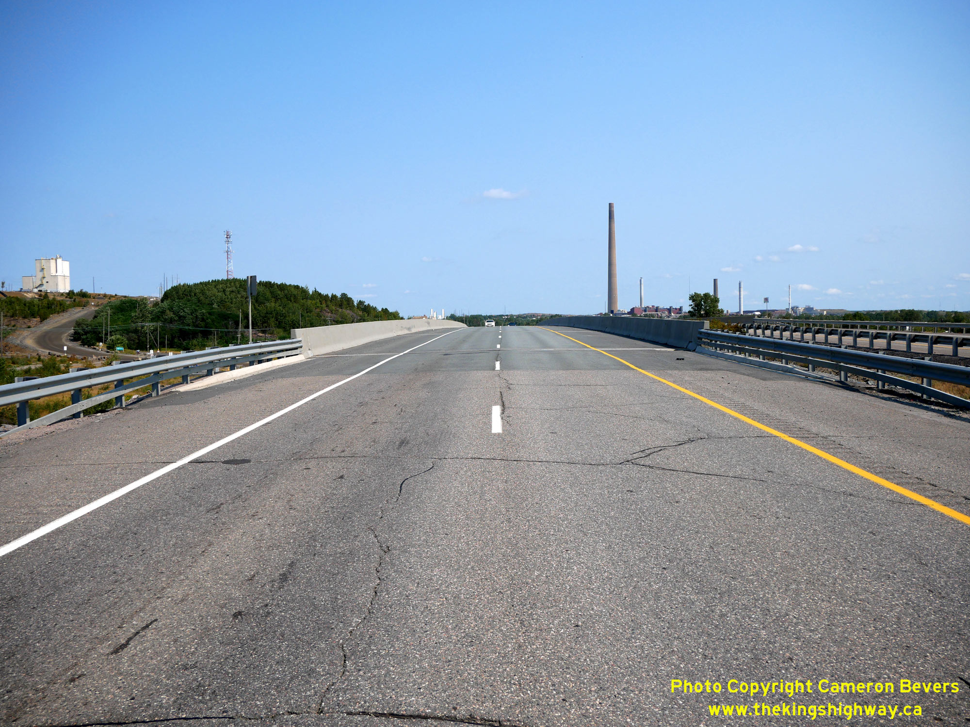
Left - View of Old Hwy 17 near Magill Street, facing west towards Copper Cliff. See an
Enlarged Photo Here. (Photograph taken on September 9, 2022 - © Cameron Bevers) Right - Facing west along Old Hwy 17 towards Lively approaching Magill Street. Beyond Magill Street, Old Hwy 17 connects to the Sudbury Southwest Bypass (the current route of Hwy 17) at a grade-separated interchange. The Sudbury Southwest Bypass initially served as a cut-off route across to Hwy 69. It wasn't until the mid-1990s that the bypass formed a continuous through route to Hwy 17 east of Sudbury near Coniston. See an Enlarged Photo Here. (Photograph taken on September 9, 2022 - © Cameron Bevers) 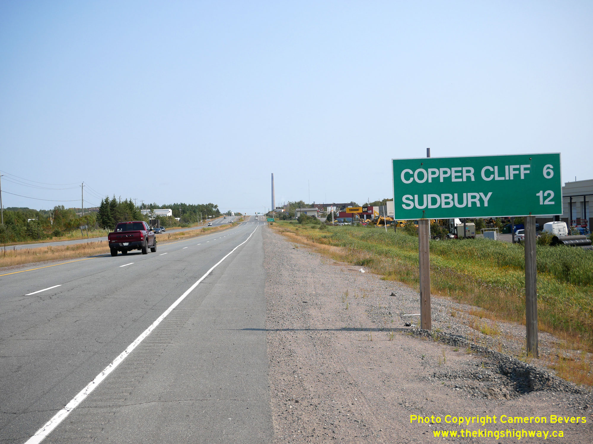
Above - Distance guide sign on Old Hwy 17 facing east near the Sudbury Southwest Bypass (Hwy 17) Interchange. See an
Enlarged Photo Here. (Photograph taken on September 9, 2022 - © Cameron Bevers) |
|---|
Links to Adjacent King's Highway Photograph Pages:
Back to King's Highway 17 Photos /
King's Highway 17 History /
On to King's Highway 18 Photos
Ontario Highway History - Main Menu / Back to List of Highways Website contents, photos & text © 2002-2026, Cameron
Bevers (Webmaster) - All Rights Reserved / Contact Me
|
|---|