
| 
| |
|
|
Please note that in 1952, most of Highway 2A from West Hill to Newcastle was renumbered as Highway 401. Please check the
Highway 401 Photo Pages for present day images of this highway from West Hill to Newcastle.
This page contains historical and present day photos of Ontario's King's Highway 2A (Toronto). All photographs displayed on this page were taken by the Webmaster (Cameron Bevers), unless specifically noted otherwise. Historical photographs are arranged in approximate chronological order, while present day photographs (Year 2000 to date) are arranged by location from west to east. Click on any thumbnail to see a larger image! Please note that all photographs displayed on this
website are protected by copyright. These photographs must not be reproduced, published,
electronically stored or copied, distributed, or posted onto other websites without
my written permission. If you want to use photos from this website, please
email me first for permission. Thank-you!
|
|---|
|
Historical King's Highway 2A (Toronto) Photographs

Above - Original 1930s plan for the new dual highway through Oshawa. This road was initially known as Hwy 2A, but later became a portion of Hwy 401. This
sketch was prepared by the Department of Highways in February 1939 and the plan was approved by Oshawa City Council later that same month. Construction
began on the new dual highway between Toronto and Oshawa before World War II, but shortages of construction materials delayed the completion of many of
the grade separations and interchanges. The partially-completed freeway was unofficially opened to traffic in 1942, despite the fact that many sections
were still under construction. The freeway was formally opened to traffic on December 3, 1947. (Photo courtesy of Ontario Ministry of Transportation - © King's Printer for Ontario, 1939) 

Left - New earth cut and grading underway on Hwy 2A (Hwy 401) approaching the Rouge River. Photo taken on September 29, 1938. (Photo courtesy of Ontario Ministry of Transportation - © King's Printer for Ontario, 1938) Right - Grading for the new Hwy 2A (Hwy 401) west of Whitby, looking east. Photo taken on October 17, 1938. (Photo courtesy of Ontario Ministry of Transportation - © King's Printer for Ontario, 1938) 

Left - Graders at work on Hwy 2A (Hwy 401) east of Pickering Village. Photo taken on October 17, 1938. (Photo courtesy of Ontario Ministry of Transportation - © King's Printer for Ontario, 1938) Right - Completed Hwy 2A (Hwy 401) grading approaching the Rouge River, looking east. Photo taken on September 20, 1939. (Photo courtesy of Ontario Ministry of Transportation - © King's Printer for Ontario, 1939) 
Left - New Hwy 2A (Hwy 401) at West Hill. South side of dual highway facing east. See an
Enlarged Photo here. Photo taken on April 3, 1946. (Photo © Archives of Ontario - Series RG-14-162-2-27, Photo #G62) Right - CN Subway and Albert & Simcoe Street Overpasses at Hwy 2A in Oshawa. See an Enlarged Photo here. Photo taken on August 27, 1946. (Photo © Archives of Ontario - Series RG-14-162-3, Photo #G308) 
Above - Facing west along Hwy 2A (Hwy 401) from the Simcoe Street Interchange in Oshawa. Photo taken on October 8, 1946. (Photo courtesy of Ontario Ministry of Transportation - © King's Printer for Ontario, 1946) 

Left - Construction of steel frame for the new Thickson Road Overpass on Hwy 2A (Hwy 401) between Whitby and Oshawa. Photo taken on October 8, 1946. (Photo courtesy of Ontario Ministry of Transportation - © King's Printer for Ontario, 1946) Right - Concrete paving machines in operation on Hwy 2A (Hwy 401) east of Brock Street in Whitby (1946) (Photo courtesy of Ontario Ministry of Transportation - © King's Printer for Ontario, 1946) 
Above - Facing east along Hwy 2A (Hwy 401) from the Simcoe Street Overpass in Oshawa, showing 3 of 4 lanes paved. Photo taken on October 8, 1946. (Photo courtesy of Ontario Ministry of Transportation - © King's Printer for Ontario, 1946) 
Above - Looking east along Hwy 2A (Hwy 401) near the Thickson Road Interchange near Whitby. See an
Enlarged Photo here. Photo taken on October 8, 1946. (Photo © Archives of Ontario - Series RG-14-162-3, Box A1367, Photo #6496) 
Above - Facing west towards the western terminus of the Toronto-Oshawa Highway (Hwy 2A) at the Highland Creek Overpass in 1948. Just beyond the bridge, the
freeway ends and Hwy 2A merges with Kingston Road (Hwy 2). Photo taken on August 4, 1948. (Photo courtesy of Ontario Ministry of Transportation - © King's Printer for Ontario, 1948) 
Above - Facing east towards Oshawa along Hwy 2A (Hwy 401) approaching the Whitby Interchange at Brock Street in 1948. See an
Enlarged Photo here. Photo taken on August 4, 1948. (Photo courtesy of Ontario Ministry of Transportation - © King's Printer for Ontario, 1948) 
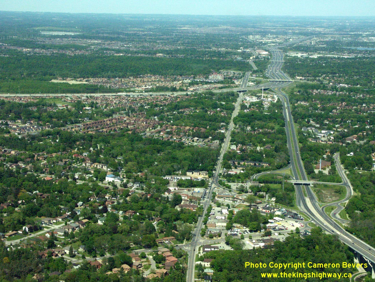
Above - Aerial view of Hwy 401 in 1956 facing west from the Lansing Road Interchange (today's Port Union Road) in Scarborough. This photo shows the start of
the Toronto Bypass in the background and the old bypassed portion of Hwy 2A leading to Hwy 2 (Kingston Road). Compare this view of the highway in 1956, with this
recent aerial photo showing the area as it appears today. (Photo courtesy of Ontario Ministry of Transportation - © King's Printer for Ontario, 1956) 
Above - Ramp to the westbound Toronto Bypass (Hwy 401), at the Hwy 2A & Hwy 401 Interchange in Scarborough. Photo taken on November 19, 1956. (Photo courtesy of Ontario Ministry of Transportation - © King's Printer for Ontario, 1956) 
Above - Newly-installed overhead guide signs on westbound Hwy 401 approaching the Lansing Road (now Port Union Road) Interchange in Scarborough in 1957. These
overhead signs were installed only moments before this photo was taken. In fact, the DHO's sign truck can be seen parked on the shoulder just a short distance up the
highway. As Ontario's freeway interchanges became progressively more complex in the 1950s, the DHO made increasing use of overhead signs to provide positive guidance
to motorists approaching major decision points such as this. This photo is also rather noteworthy in that it was the very first highway photo published on the front
cover of the Department's long-running monthly employee news bulletin "DHO News" in May, 1957. Photo taken on April 10, 1957. See an
Enlarged Photo Here. (Photo courtesy of Ontario Ministry of Transportation - © King's Printer for Ontario, 1957) 

Left - Overhead signs marking Hwy 2 and Hwy 401 (the Toronto Bypass) at the Hwy 2A & Hwy 401 Interchange in Scarborough in 1957. This interesting photo
shows some of Ontario's earliest overhead freeway junction signs. Although these overhead guide signs may seem relatively simple when compared to our freeway signs
today, these early experiments in overhead guide sign installation ultimately led to the development of the freeway sign standards that are in use today. The
westbound "exit" of Hwy 401 to the Toronto Bypass (which was a newer extension of Hwy 401) was particularly counterintuitive to motorists. Heading westbound, the
apparent "through highway" at this interchange was actually an exit from Hwy 401 onto a different route (Hwy 2A). These overhead guide signs helped to convey the
message that by continuing straight ahead, motorists would end up on Kingston Road (Hwy 2) and that one had to keep right at the fork to stay on Hwy 401. Photo taken
on May 13, 1957. (Photo courtesy of Ontario Ministry of Transportation - © King's Printer for Ontario, 1957) Right - Eastern terminus of the Toronto Bypass (Hwy 401) at Hwy 2A in Scarborough, facing west near the Lansing Road Interchange (today's Port Union Road). When the new Toronto Bypass section of Hwy 401 was built in the mid-1950s, it left behind a short 2-mile section of the original Toronto-Oshawa Highway (Hwy 2A). When it was first completed in 1947, the Toronto-Oshawa Highway (Hwy 2A) continued straight ahead to join Hwy 2 (Kingston Road) at West Hill. During the early 1970s, this confusing interchange was reconfigured so that Hwy 401 became the "through highway" at the interchange and Hwy 2A became the exiting highway. The old interchange configuration seen here likely caught many early Hwy 401 motorists by surprise heading westbound, when they discovered (most likely too late) that they were supposed to keep right at the fork to stay on Hwy 401. Although the new overhead signing helped, the revised interchange at Hwy 2A & Hwy 401 built in the 1970s was more in keeping with motorists' expectations. Photo taken on May 13, 1957. (Photo courtesy of Ontario Ministry of Transportation - © King's Printer for Ontario, 1957) |
|---|
|
Present Day King's Highway 2A (Toronto) Photographs

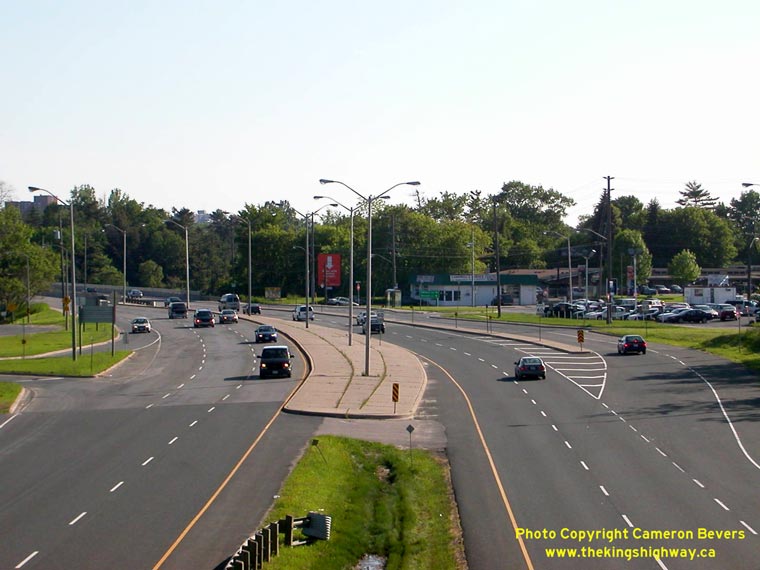
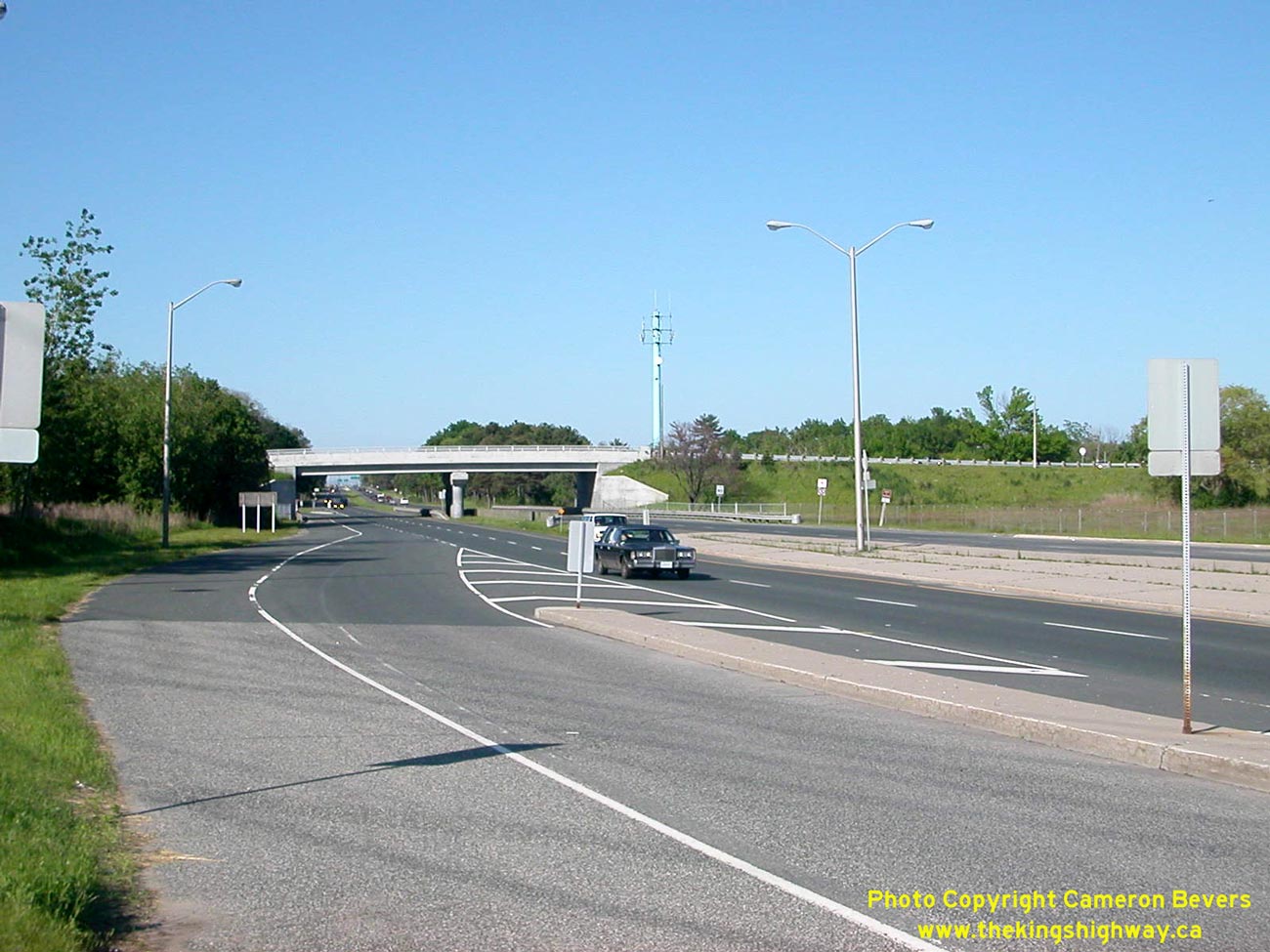
Left - Aerial view of the Port Union Road Interchange on Hwy 401 in Toronto, facing west. Note the adjacent interchange with Hwy 2A in the background, and
Kingston Road (Hwy 2) at right. See an Enlarged Photo here. (Photograph taken on May 30, 2004 - © Cameron Bevers) Right - Aerial view of Hwy 2A facing east from Highland Creek towards Hwy 401 and Port Union Road. Note the narrow width of this 1940s era divided highway compared to the current width of Hwy 401. Up until the 1970s, Hwy 401 was of a similar design all the way out to Oshawa. Between 1972 and 1980, Hwy 401 was widened from four to six lanes between Morningside Avenue in Toronto and Ritson Road in Oshawa. Kingston Road (Hwy 2) can be seen paralleling Hwy 2A in this photo. See an Enlarged Photo here. (Photograph taken on May 30, 2004 - © Cameron Bevers) 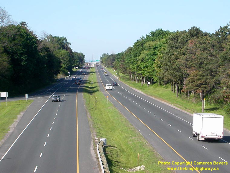
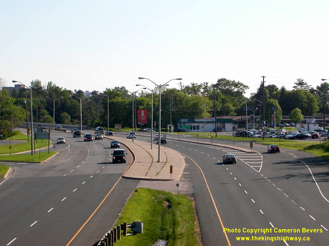
Left - Looking east towards Oshawa along Hwy 2A from Highland Creek (Lawson Road) Overpass. This short but interesting section of highway has changed very
little since it officially opened in 1947. This unspoiled divided highway provides a rare view of what a 1940s Ontario freeway looked like. See an
Enlarged Photo here. (Photograph taken on June 15, 2003 - © Cameron Bevers) Right - Looking west along Hwy 2 & Hwy 2A from Highland Creek (Lawson Road) Overpass. See an Enlarged Photo here. (Photograph taken on June 15, 2003 - © Cameron Bevers) 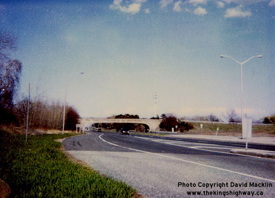

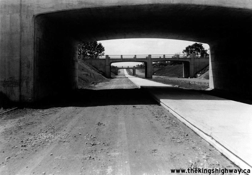
Left - Old Highland Creek Overpass on Hwy 2A. This original structure was completed in 1947. (Photograph taken in 2000 - © David Macklin) Right - New Highland Creek Overpass on Hwy 2A. The original 1947 structure was replaced in 2000. See an Enlarged Photo here. (Photograph taken on June 15, 2003 - © Cameron Bevers)
Continue on to Highway 401 (Highway 2A) Photos: Hwy 401 Photo Index
More King's Highway 2A Photographs Coming Soon!
|
|---|
Links to Adjacent King's Highway Photograph Pages:
Back to King's Highway 2 Photos /
King's Highway 2A Toronto History /
On to King's Highway 3 Photos
Ontario Highway History - Main Menu / Back to List of Highways Website contents, photos & text © 2002-2026, Cameron
Bevers (Webmaster) - All Rights Reserved / Contact Me
|
|---|