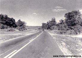
|
Present Day King's Highway 2S Photographs
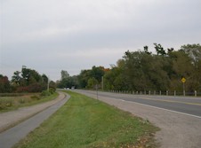

Left - Thousand Islands Parkway near Gananoque, facing east towards Brockville. The south roadway is now used for two-way traffic. The north roadway has been
temporarily utilized in the past for staging purposes, but has not regularly carried highway traffic since it was initially built in the late 1930s. The former north
roadway is now used as a bicycle and walking trail.
(Photograph taken on October 9, 2004 - © Cameron Bevers)
Right - Side view of old culvert on Hwy 2S (Thousand Islands Parkway) near Gananoque.
(Photograph taken on October 9, 2004 - © Cameron Bevers)
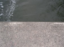

Left - Inscription on culvert on Thousand Islands Parkway - "THE KING'S HIGHWAY 1938".
(Photograph taken on October 9, 2004 - © Cameron Bevers)
Right - View of old DHO culvert from former westbound lanes of Hwy 2S.
(Photograph taken on October 9, 2004 - © Cameron Bevers)
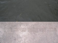

Left - Inscription on culvert on Hwy 2S near Gananoque - "THE KING'S HIGHWAY 1938".
(Photograph taken on October 9, 2004 - © Cameron Bevers)
Right - Side view of old 1930s DHO culvert on the Thousand Islands Parkway near Landon Bay.
(Photograph taken on October 9, 2004 - © Cameron Bevers)
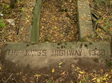

Left - Culvert inscription on Thousand Islands Parkway (Hwy 2S) "THE KING'S HIGHWAY 1938".
(Photograph taken on October 9, 2004 - © Cameron Bevers)
Right - Twin steel through truss bridges over Landon Bay on the Thousand Islands Parkway (Old Hwy 2S & Hwy 401) east of Gananoque. Both structures were
completed in 1940.
(Photograph taken on October 9, 2004 - © Cameron Bevers)
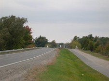

Left - Facing west towards the twin Landon Bay Bridges on the Thousand Islands Parkway.
(Photograph taken on October 9, 2004 - © Cameron Bevers)
Right - Facing east across the south Landon Bay span on the Thousand Islands Parkway.
(Photograph taken on October 9, 2004 - © Cameron Bevers)
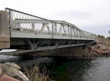

Left - Side view of Landon Bay Bridge on Thousand Islands Parkway (Old Hwy 2S).
(Photograph taken on October 9, 2004 - © Cameron Bevers)
Right - Thousand Islands Parkway facing west across the south Landon Bay span.
(Photograph taken on October 9, 2004 - © Cameron Bevers)
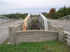

Left - Concrete railing between the twin Landon Bay Bridges on Thousand Islands Parkway.
(Photograph taken on October 9, 2004 - © Cameron Bevers)
Right - View of twin Landon Bay Bridges, facing west towards Gananoque.
(Photograph taken on October 9, 2004 - © Cameron Bevers)


Left - Looking underneath the southern Landon Bay Bridge, which still carries the highway.
(Photograph taken on October 9, 2004 - © Cameron Bevers)
Right - Looking underneath the northern Landon Bay Bridge, which now carries only the bicycle path. This structure is not as well maintained as the south span,
but it no longer carries any traffic.
(Photograph taken on October 9, 2004 - © Cameron Bevers)
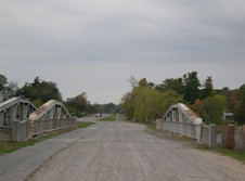

Left - The north Landon Bay structure used to carry the westbound lanes of Hwy 2S & Hwy 401
(Photograph taken on October 9, 2004 - © Cameron Bevers)
Right - The Thousand Islands Parkway passes through some of the most rugged country seen in the southern portion of Ontario. There were many rock cuts made
during the highway's construction in the late 1930s. Instead of hauling the granite boulders away for dumping, thoughtful highway designers incorporated the boulders
into this unique railing on the Landon Bay Bridge approach.
(Photograph taken on October 9, 2004 - © Cameron Bevers)
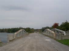

Left - Facing east towards Ivy Lea at the north Landon Bay Bridge.
(Photograph taken on October 9, 2004 - © Cameron Bevers)
Right - View of truss bridge design at Landon Bay. Structure completed in 1940.
(Photograph taken on October 9, 2004 - © Cameron Bevers)
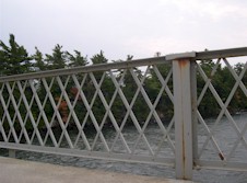

Left - Typical railing design of 1930s and early 1940s Department of Highways-built steel bridges.
(Photograph taken on October 9, 2004 - © Cameron Bevers)
Right - Large 1930s concrete culvert under the Thousand Islands Parkway near Ivy Lea.
(Photograph taken on October 9, 2004 - © Cameron Bevers)
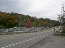

Left - Twin steel through truss bridges over Jones Creek on the Thousand Islands Parkway (Old Hwy 2S & Hwy 401) west of Brockville. Both structures were
completed in 1940.
(Photograph taken on October 9, 2004 - © Cameron Bevers)
Right - Facing west towards the twin Jones Creek Bridges along the Thousand Islands Parkway. Note the abandoned right-of-way for the former westbound Hwy 2S
(Hwy 401) lanes to the right.
(Photograph taken on October 9, 2004 - © Cameron Bevers)
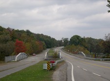

Left - Facing east towards the twin Jones Creek Bridges along the Thousand Islands Parkway.
(Photograph taken on October 9, 2004 - © Cameron Bevers)
Right - A modest but attractive stone railing was constructed between the twin Jones Creek Bridges. It is unfortunate that simple design enhancements like this
stone railing are no longer incorporated into bridge designs today. Such steps can go a long way to beautify an otherwise mundane highway.
(Photograph taken on October 9, 2004 - © Cameron Bevers)


Left - Sign marking Jones Creek on the Thousand Islands Parkway near Brockville.
(Photograph taken on October 9, 2004 - © Cameron Bevers)
Right - Embossed concrete railings on the Jones Creek Bridge on Thousand Islands Parkway.
(Photograph taken on October 9, 2004 - © Cameron Bevers)
More King's Highway 2S Photographs Coming Soon!
| 


