
| 
| |
|
|
This page contains historical and present day photos of Ontario's King's Highway 34. All photographs displayed on this page
were taken by the Webmaster (Cameron Bevers), unless specifically noted otherwise. Historical photographs are arranged in approximate chronological order, while
present day photographs (Year 2000 to date) are arranged by location from south to north. Click on any thumbnail to see a larger image!
Please note that all photographs displayed on this
website are protected by copyright. These photographs must not be reproduced, published,
electronically stored or copied, distributed, or posted onto other websites without
my written permission. If you want to use photos from this website, please
email me first for permission. Thank-you!
|
|---|
|
Historical King's Highway 34 Photographs

Above - Facing south along Hwy 34 one mile north of Alexandria. Photo taken on June 26, 1952. See an
Enlarged Photo Here. (Photo courtesy of Ontario Ministry of Transportation - © King's Printer for Ontario, 1952) 
Above - New asphalt pavement and zone striping on Hwy 34, 2 miles south of Hawkesbury in 1956. Sadly, none of the roadside trees in this scenic 1956 photo
stand today. The trees were all removed during roadside safety improvement projects carried out along Hwy 34 in the late 1950s and early 1960s. Photo taken on
August 7, 1956. (Photo courtesy of Ontario Ministry of Transportation - © King's Printer for Ontario, 1956) |
|---|
|
Present Day King's Highway 34 Photographs


Left - Inscription on a Hwy 34 culvert north of Lancaster - "THE KING'S HIGHWAY 1933". See an
Enlarged Photo Here. (Photograph taken on August 2, 2003 - © Cameron Bevers) Right - Facing south along Hwy 34 towards Lancaster at the Beaudette River Bridge. See an Enlarged Photo Here. (Photograph taken on July 30, 2005 - © Cameron Bevers) 

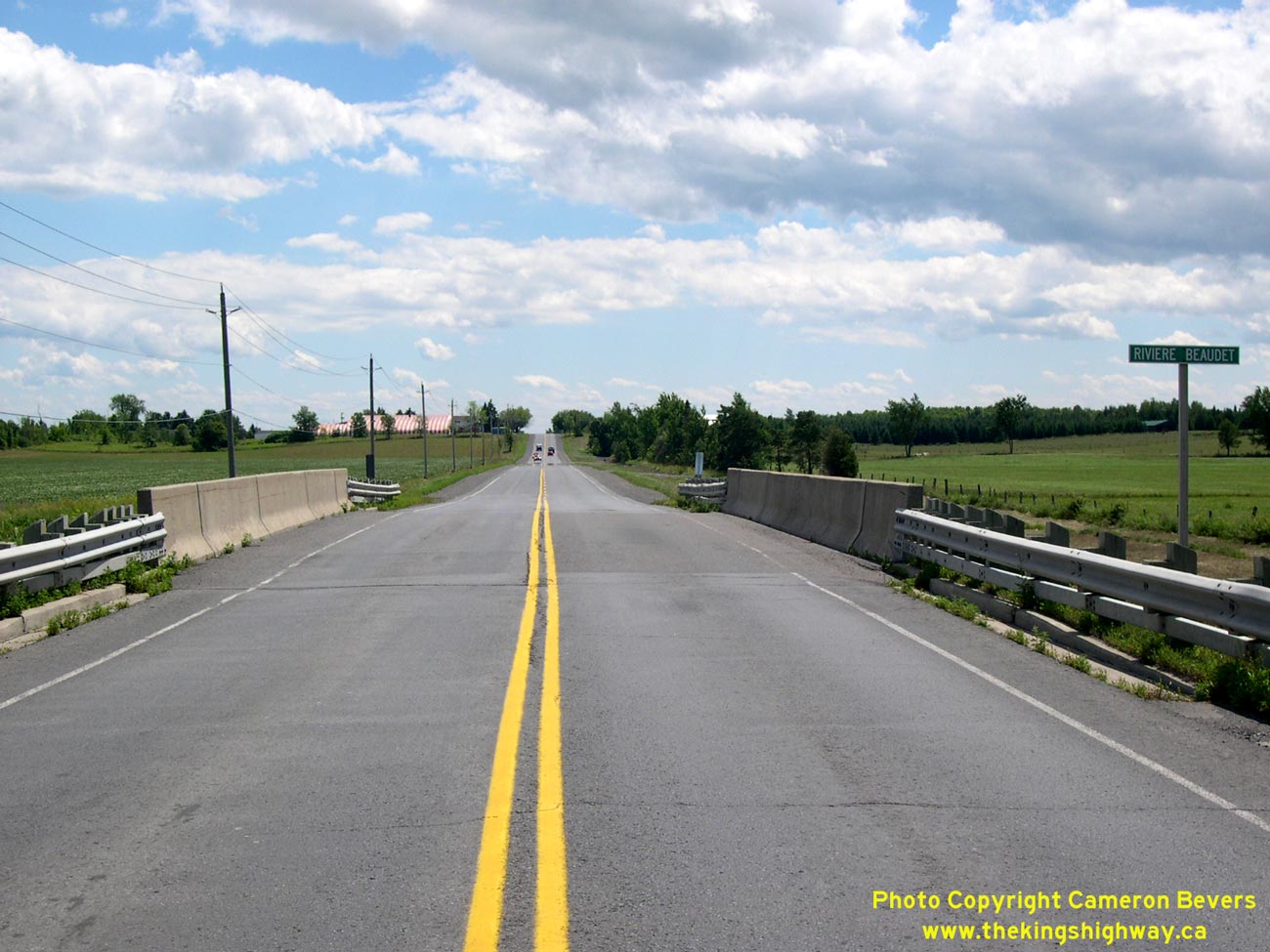
Left - Facing north along Hwy 34 towards Green Valley at the Beaudette River Bridge. See an
Enlarged Photo Here. (Photograph taken on July 30, 2005 - © Cameron Bevers) Right - Western side of the Beaudette River Bridge on Hwy 34 near Green Valley. See an Enlarged Photo Here. (Photograph taken on July 30, 2005 - © Cameron Bevers) 

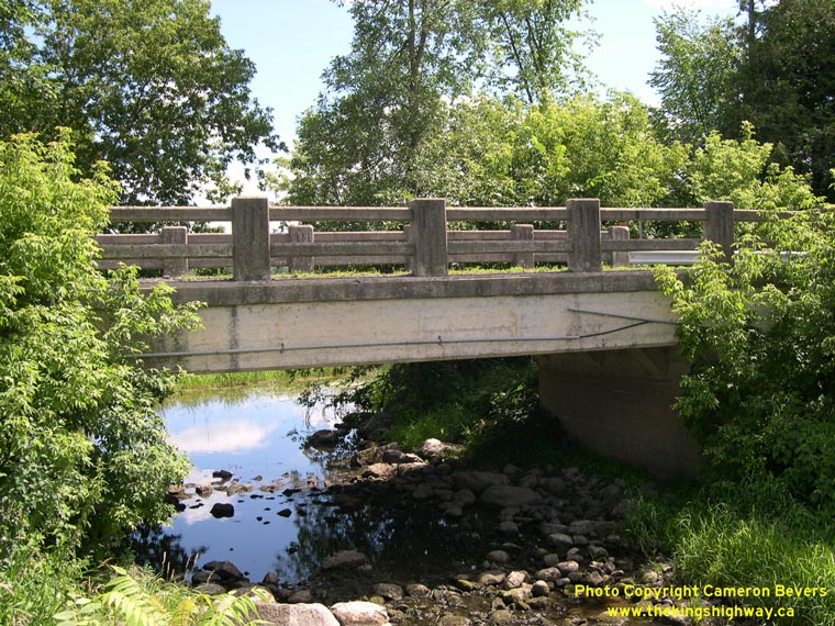
Left - Eastern side of the Beaudette River Bridge on Hwy 34. This single span concrete rigid frame structure was completed in 1934. See an
Enlarged Photo Here. (Photograph taken on July 30, 2005 - © Cameron Bevers) Right - Rigaud River Bridge on a former Hwy 34 alignment at Lochinvar, facing south. See an Enlarged Photo Here. (Photograph taken on July 30, 2005 - © Cameron Bevers) 
Left - The Rigaud River Bridge was constructed by Lochiel Township in 1947, years after the Department of Highways turned this old Hwy 34 alignment over to
them. Even though the bridge was not built by the Department of Highways, this bridge is nevertheless interesting and noteworthy from a historical perspective. Note
the Township Reeve's name (J.W. McLeod) stamped into the concrete. See an Enlarged Photo Here. (Photograph taken on July 30, 2005 - © Cameron Bevers) Right - Side view of the Rigaud River Bridge on the former Hwy 34 alignment at Lochinvar. See an Enlarged Photo Here. (Photograph taken on July 30, 2005 - © Cameron Bevers) 

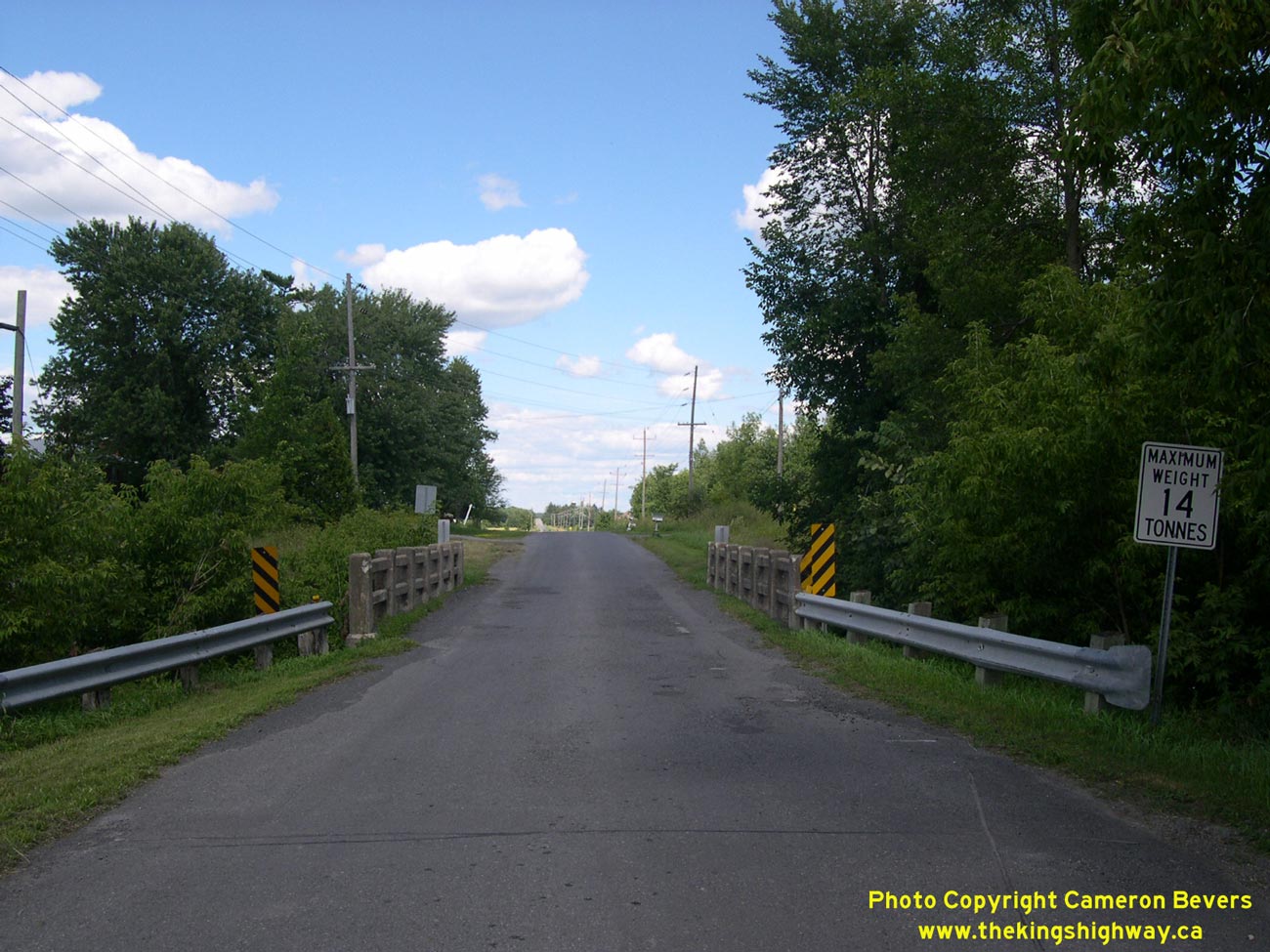
Left - Rigaud River Bridge on the former Hwy 34 alignment at Lochinvar, facing north. See an
Enlarged Photo Here. (Photograph taken on July 30, 2005 - © Cameron Bevers) Right - Facing south across the Hwy 34 Overpass at Hwy 417 near Vankleek Hill. See an Enlarged Photo Here. (Photograph taken on August 3, 2008 - © Cameron Bevers) 

Left - Structure identification number and date stamp (1972) on the Hwy 34 Overpass on Hwy 417. See an
Enlarged Photo Here. (Photograph taken on August 3, 2008 - © Cameron Bevers) Right - Western side of the Hwy 34 Overpass on Hwy 417 south of Vankleek Hill. See an Enlarged Photo Here. (Photograph taken on August 3, 2008 - © Cameron Bevers) 

Left - Facing west along Hwy 417 towards Ottawa from the Hwy 34 Overpass. See an
Enlarged Photo Here. (Photograph taken on August 3, 2008 - © Cameron Bevers) Right - Facing east along Hwy 417 towards Montreal from the Hwy 34 Overpass. See an Enlarged Photo Here. (Photograph taken on August 3, 2008 - © Cameron Bevers) 

Left - Facing north across the Hwy 34 Overpass at Hwy 417. See an
Enlarged Photo Here. (Photograph taken on August 3, 2008 - © Cameron Bevers) Right - The ramp from Southbound Hwy 34 to Westbound Hwy 417 exhibits a rather unusual sign treatment. This ramp is marked with a green "Exit/Sortie" sign, which is very uncommon on a ramp which departs from an arterial highway. This type of sign treatment is generally applied on ramps exiting from freeways, and is not normally used on ramps departing from a surface arterial street or highway onto a freeway. See an Enlarged Photo Here. (Photograph taken on August 3, 2008 - © Cameron Bevers) 

Left - Close-up of the "Exit/Sortie" sign and "Fitch" plastic crash attenuation barrels placed at the ramp gore. These yellow crash attenuation barrels
used to be a rather ubiquitous protective treatment for the ends of guide rails, medians, bridge piers and ramp channels throughout Ontario. However, with
modern advancements in crash protection and attenuation devices, "Fitch" crash attenuation barrels are quickly becoming obsolete. See an
Enlarged Photo Here. (Photograph taken on August 3, 2008 - © Cameron Bevers) Right - Former Hwy 34 alignment (Eldemer Street) south of Hawkesbury. See an Enlarged Photo Here. (Photograph taken on July 30, 2005 - © Cameron Bevers) 
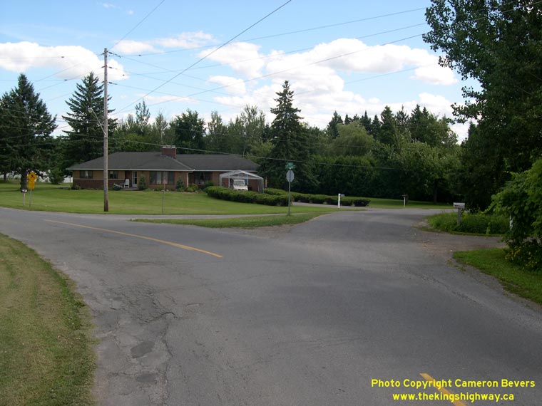
Left - Old 1921-dated culvert on the former Hwy 34 alignment south of Hawkesbury. See an
Enlarged Photo Here. (Photograph taken on July 30, 2005 - © Cameron Bevers) Right - Odd "Y" junction on the former Hwy 34 alignment (Eldemer Street) south of Hawkesbury. See an Enlarged Photo Here. (Photograph taken on July 30, 2005 - © Cameron Bevers) 

Left - Facing east along Hwy 17 towards Montreal at the Hawkesbury Interchange. See an
Enlarged Photo Here. (Photograph taken on July 30, 2005 - © Cameron Bevers) Right - Approaching the Hawkesbury Interchange at Hwy 17 & Hwy 34, facing south towards Vankleek Hill. See an Enlarged Photo Here. (Photograph taken on July 30, 2005 - © Cameron Bevers) 

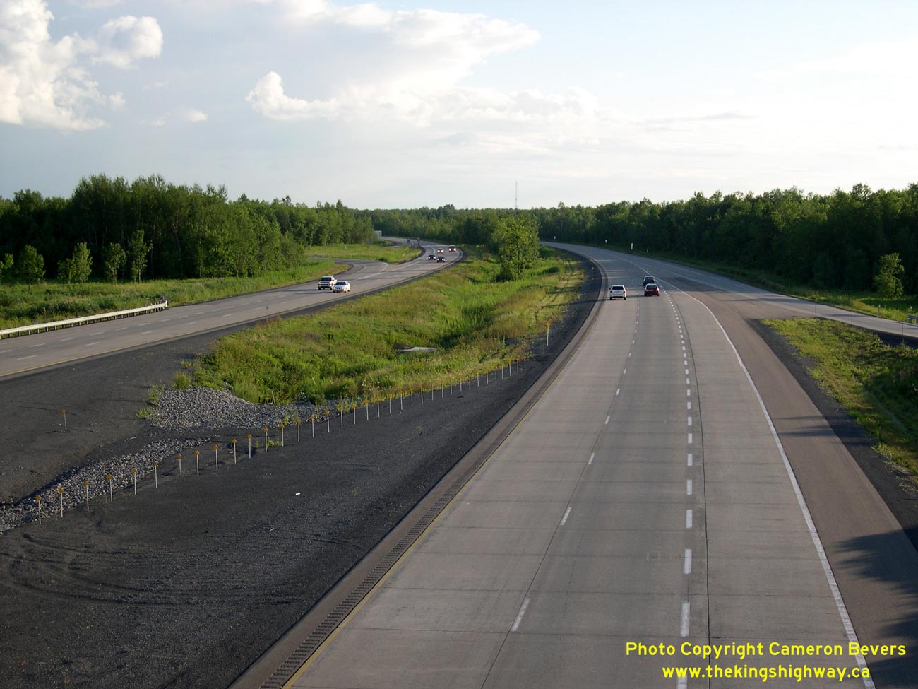
Left - Facing north along Hwy 34 approaching the Hwy 17 Overpass. This single span concrete rigid frame structure was completed in 1956. See an
Enlarged Photo Here. (Photograph taken on July 30, 2005 - © Cameron Bevers) Right - View of Hwy 34 facing south towards Vankleek Hill from the Hwy 17 Overpass. See an Enlarged Photo Here. (Photograph taken on July 30, 2005 - © Cameron Bevers) 

Left - View of Hwy 34 facing north towards Hawkesbury from the Hwy 17 Overpass. See an
Enlarged Photo Here. (Photograph taken on July 30, 2005 - © Cameron Bevers) Right - Ramp to and from westbound Hwy 17 at Hwy 34 in Hawkesbury. See an Enlarged Photo Here. (Photograph taken on July 30, 2005 - © Cameron Bevers) 

Left - Green guide sign marking the entrance ramp to Hwy 17 West at the Hawkesbury Interchange. See an
Enlarged Photo Here. (Photograph taken on July 30, 2005 - © Cameron Bevers) Right - Ramps to and from eastbound Hwy 17 at Hwy 34 in Hawkesbury. See an Enlarged Photo Here. (Photograph taken on July 30, 2005 - © Cameron Bevers) 

Left - Guide sign marking the entrance ramp to Hwy 17 East on northbound Hwy 34 at the Hawkesbury Interchange. See an
Enlarged Photo Here. (Photograph taken on July 30, 2005 - © Cameron Bevers) Right - Exit sign for Hwy 34 on eastbound Hwy 17 at the Hawkesbury Interchange. See an Enlarged Photo Here. (Photograph taken on July 30, 2005 - © Cameron Bevers) 

Left - Structure identification number and date stamp (1981) on the Hwy 17 Overpass at Hawkesbury. This date refers to the last major reconstruction date, not
the initial construction date of the bridge. See an Enlarged Photo Here. (Photograph taken on July 30, 2005 - © Cameron Bevers) Right - Close-up of the ramps at the Hawkesbury Interchange on Hwy 17, facing east towards Montreal. This section of the Hawkesbury Bypass is essentially an undivided freeway. See an Enlarged Photo Here. (Photograph taken on July 30, 2005 - © Cameron Bevers)
More King's Highway 34 Photographs Coming Soon!
|
|---|
Links to Adjacent King's Highway Photograph Pages:
Back to King's Highway 33 Photos /
King's Highway 34 History /
On to King's Highway 35 Photos
Ontario Highway History - Main Menu / Back to List of Highways Website contents, photos & text © 2002-2026, Cameron
Bevers (Webmaster) - All Rights Reserved / Contact Me
|
|---|