
| 
| |
|
|
This page contains historical and present day photos of Ontario's King's Highway 36 from Lindsay to Bobcaygeon. All photographs
displayed on this page were taken by the Webmaster (Cameron Bevers), unless specifically noted otherwise. Historical photographs are arranged in approximate
chronological order, while present day photographs (Year 2000 to date) are arranged by location from south to east. Click on any thumbnail to see a larger image!
Please note that all photographs displayed on this
website are protected by copyright. These photographs must not be reproduced, published,
electronically stored or copied, distributed, or posted onto other websites without
my written permission. If you want to use photos from this website, please
email me first for permission. Thank-you!
|
|---|
|
Page 1: Historical King's Highway 36 Photographs
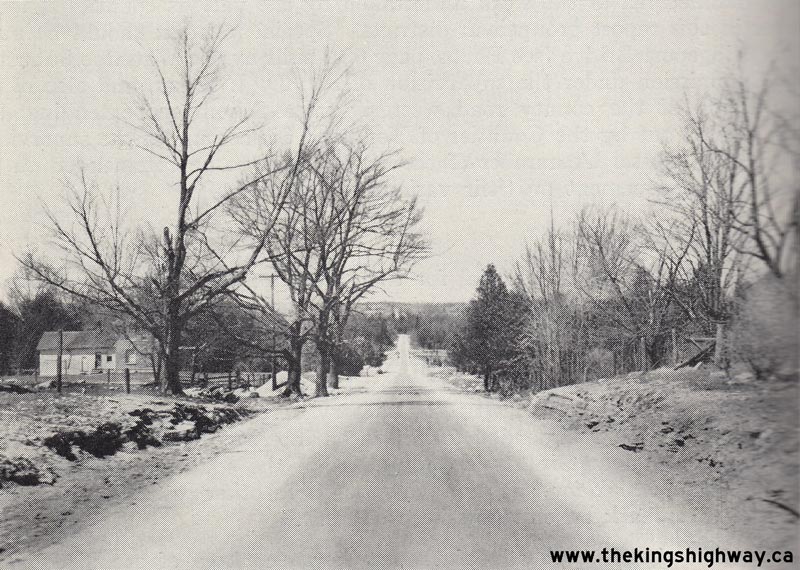
Above - Retread pavement on Hwy 36, 1 mile south of Bobcaygeon (1934) (Photo courtesy of Ontario Ministry of Transportation - © King's Printer for Ontario, 1934) 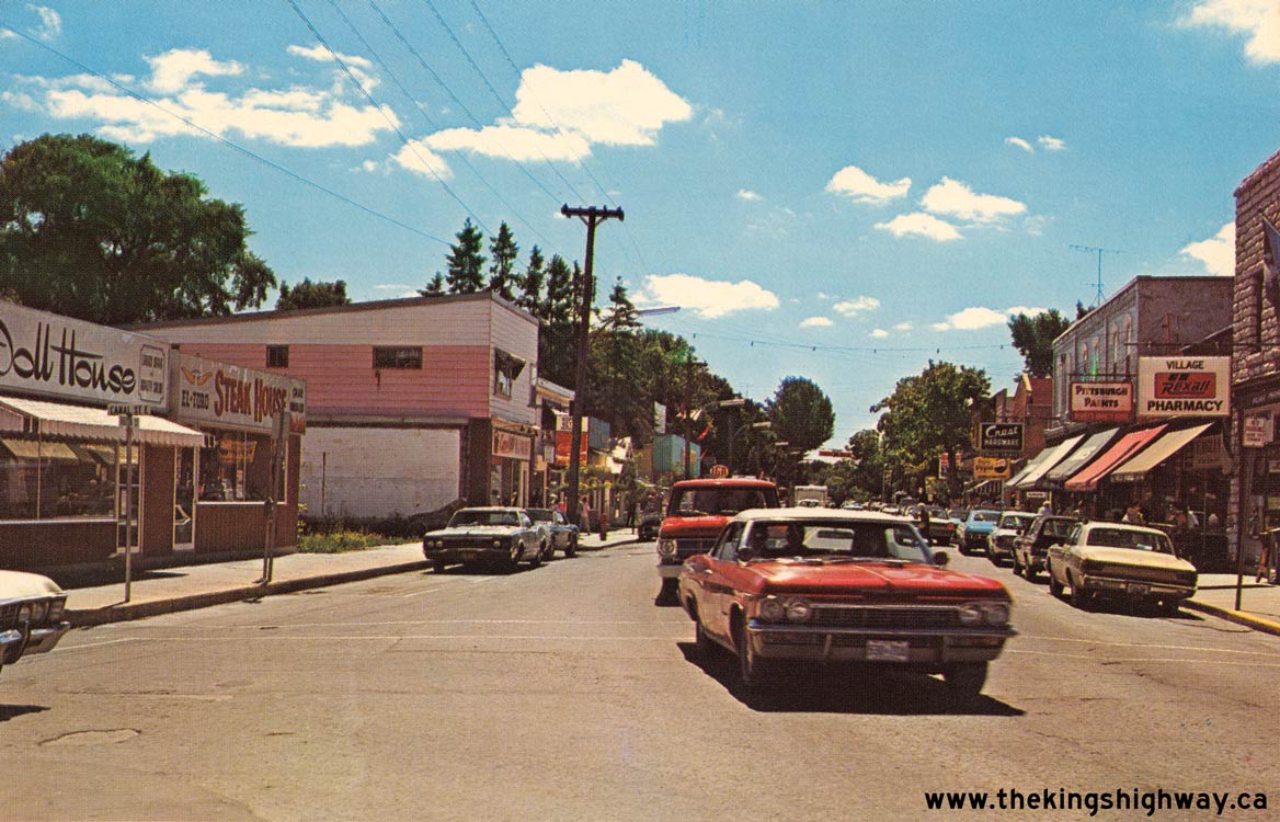
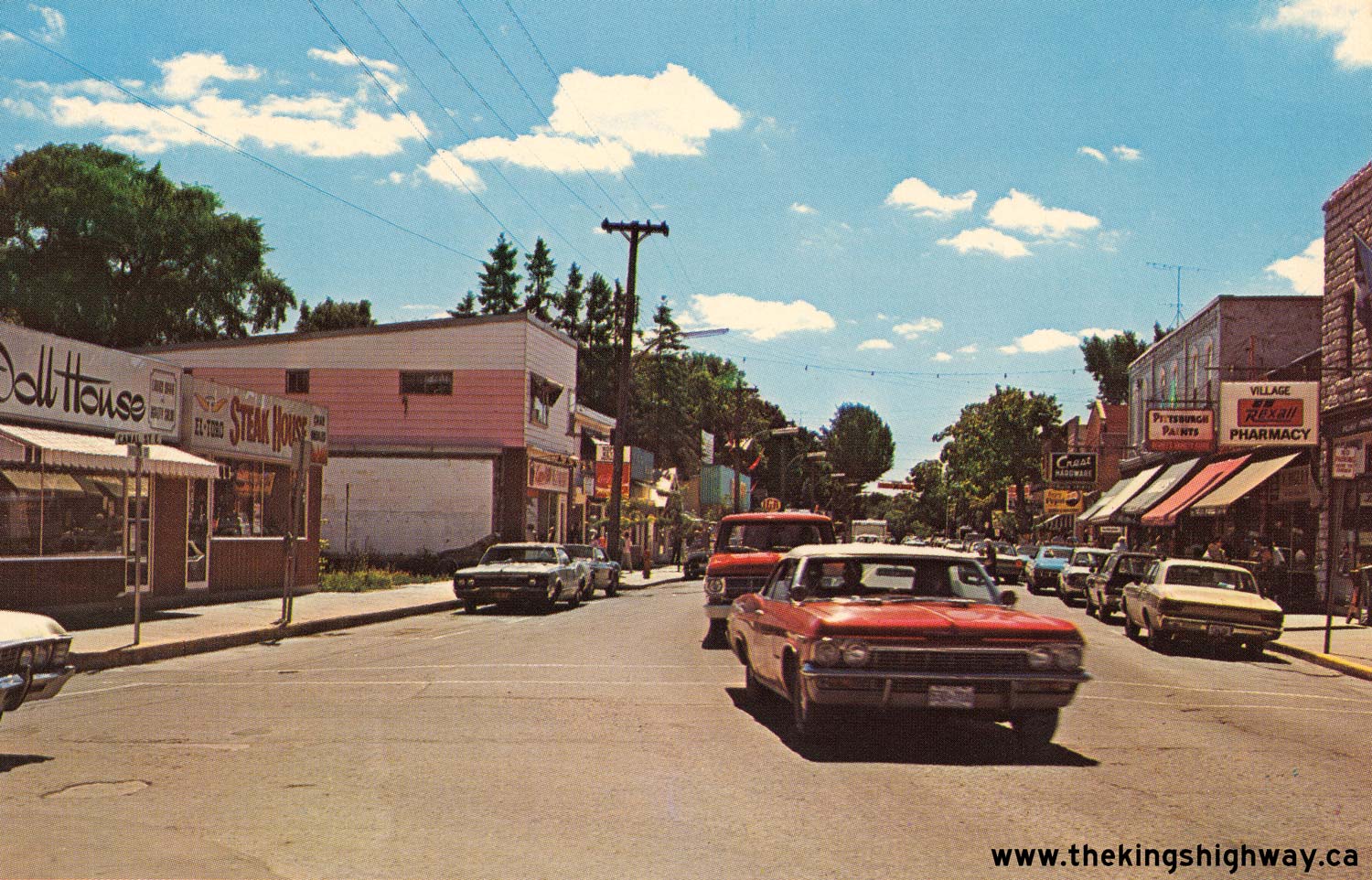
Above - Circa 1972 postcard view of Hwy 36 (Bolton Street) in Downtown Bobcaygeon, facing south towards Lindsay. In 1973, construction began on a new Hwy 36
Bypass around the eastern side of Bobcaygeon. When the bypass opened to traffic in 1974, Hwy 36 was relocated from its old route through Downtown Bobcaygeon out onto
the new bypass. See an Enlarged Photo Here. (Photo courtesy of Ray Carpenter - Peterborough Airways Ltd.) |
|---|
|
Present Day King's Highway 36 Photographs (Lindsay to Bobcaygeon)


Left - Approaching the Hwy 36 Junction on Hwy 7, facing east towards Peterborough. The route of Hwy 36 begins at Hwy 7 just east of Lindsay and heads
northeasterly towards Bobcaygeon, before turning east towards Hwy 28 at Burleigh Falls. See an
Enlarged Photo Here. (Photograph taken on October 10, 2010 - © Cameron Bevers) Right - Facing west along Hwy 7 towards the Ops Township Canadian Pacific Railway Overhead from the Hwy 36 Junction. See an Enlarged Photo Here. (Photograph taken on October 10, 2010 - © Cameron Bevers) 

Left - Facing east along Hwy 7 at the Hwy 36 Junction east of Lindsay. Prior to the downloading of Hwy 36 in 1998, this was the only provincial highway
junction along Hwy 7 between Lindsay and Peterborough's Hwy 7B Junction at Fowlers Corners. (Photograph taken on October 10, 2010 - © Cameron Bevers) Right - A right-turn channelization was constructed at the Hwy 7 & Hwy 36 Junction to serve the predominant right-turn movement coming southbound on Hwy 36 from Bobcaygeon and the Kawartha Lakes Cottage Country. (Photograph taken on October 10, 2010 - © Cameron Bevers) 

Left - Facing west along Hwy 7 towards Lindsay approaching the Hwy 36 Junction. (Photograph taken on October 10, 2010 - © Cameron Bevers) Right - Facing north along Hwy 36 towards Bobcaygeon from the Hwy 7 Junction east of Lindsay. The entire 73 km route of Hwy 36 was transferred from the province to the Counties of Victoria and Peterborough in the late 1990s. Since 1998, Hwy 36 has been under municipal jurisdiction. After Victoria County was incorporated as the City of Kawartha Lakes in 2001, the section of Hwy 36 within Victoria County was renamed Kawartha Lakes Road 36. (Photograph taken on October 10, 2010 - © Cameron Bevers) 

Left - Southern terminus of Hwy 36 at the Hwy 7 Junction east of Lindsay. Most traffic on southbound Hwy 36 turns right at this junction, so a
right-turn channelization was constructed to serve this predominant movement. Up until the late 1950s, Hwy 36 ended in Downtown Lindsay at the corner of Kent Street
and Lindsay Street. The completion of the Lindsay Bypass in 1958 resulted in the relocation of Hwy 36 onto a new alignment east of town, and consequently, a relocated
southern terminus at Hwy 7. (Photograph taken on October 10, 2010 - © Cameron Bevers) Right - Turn-off green guide sign for the Hwy 7 Junction on southbound Hwy 36 east of Lindsay. The predominant south-to-west movement is shown on the sign with an angled right arrow to indicate that it is a channelized right-turn ramp. (Photograph taken on October 10, 2010 - © Cameron Bevers) 

Left - Flowerpot route marker indicating the end of Kawartha Lakes Road 36 (Former Hwy 36) at the Hwy 7 Junction east of Lindsay. In all likelihood, the
"Hwy 36 Ends" sign was placed above the two Hwy 7 crowns when this highway was still under provincial control, but was moved to its current location after the highway
was downloaded to the municipality in 1998. (Photograph taken on October 10, 2010 - © Cameron Bevers) Right - Distance sign on northbound Hwy 36 just north of the Hwy 7 Junction near Lindsay. Hwy 36 follows a generally northeasterly route towards Burleigh Falls, via Bobcaygeon. Distances to Bancroft are also provided along Hwy 36, since the highway offered a comparable route between Lindsay and Bancroft to the better-known Hwy 7 and Hwy 28 route. (Photograph taken on October 10, 2010 - © Cameron Bevers) 

Left - Green guide sign marking the upcoming Hwy 7 Junction on southbound Hwy 36 east of Lindsay. (Photograph taken on October 10, 2010 - © Cameron Bevers) Right - Distance sign on eastbound Hwy 7 at the Hwy 36 Junction. It is 37 km to Peterborough from this junction. See an Enlarged Photo Here. (Photograph taken on October 10, 2010 - © Cameron Bevers) 

Left - Facing east along Hwy 7 towards Peterborough from the Hwy 36 Junction east of Lindsay. (Photograph taken on October 10, 2010 - © Cameron Bevers) Right - Facing west along Old Hwy 7 (Golden Mile Road) from the start of the Ops Township Diversion east of Lindsay. Hwy 36 can be seen joining into the Hwy 7 Diversion at the traffic signals in the background. See an Enlarged Photo Here. (Photograph taken on October 10, 2010 - © Cameron Bevers) 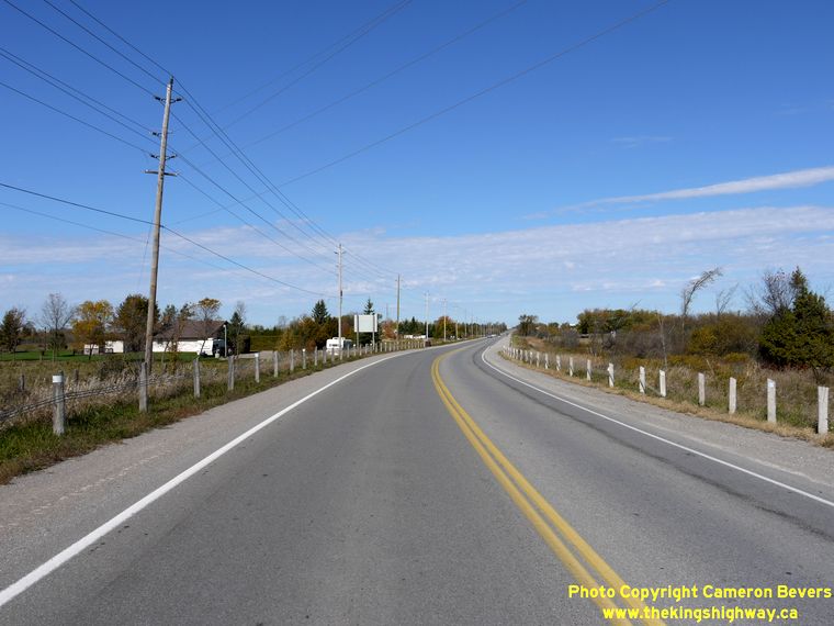

Left - Facing north along Hwy 36 towards Bobcaygeon, north of the Hwy 7 Junction. This section of Hwy 36 is comparatively new. When the route of Hwy 36 was
first established in 1931, the route began in Downtown Lindsay at the intersection of Lindsay Street and Kent Street (Hwy 7). The awkward route of Hwy 36 through
Downtown Lindsay was very difficult for trucks to navigate. As part of the Lindsay Bypass construction in the late 1950s, Hwy 36 was relocated onto a new alignment
along the eastern side of Lindsay. As a result, nearly 1 km of Hwy 36 through Lindsay was renumbered as Hwy 36B. See an
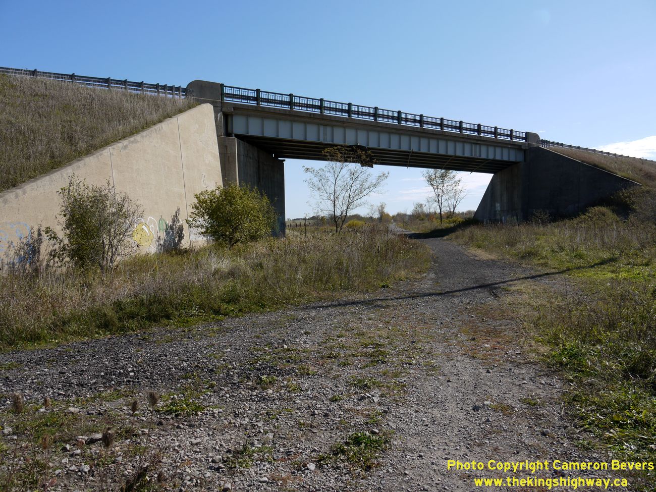
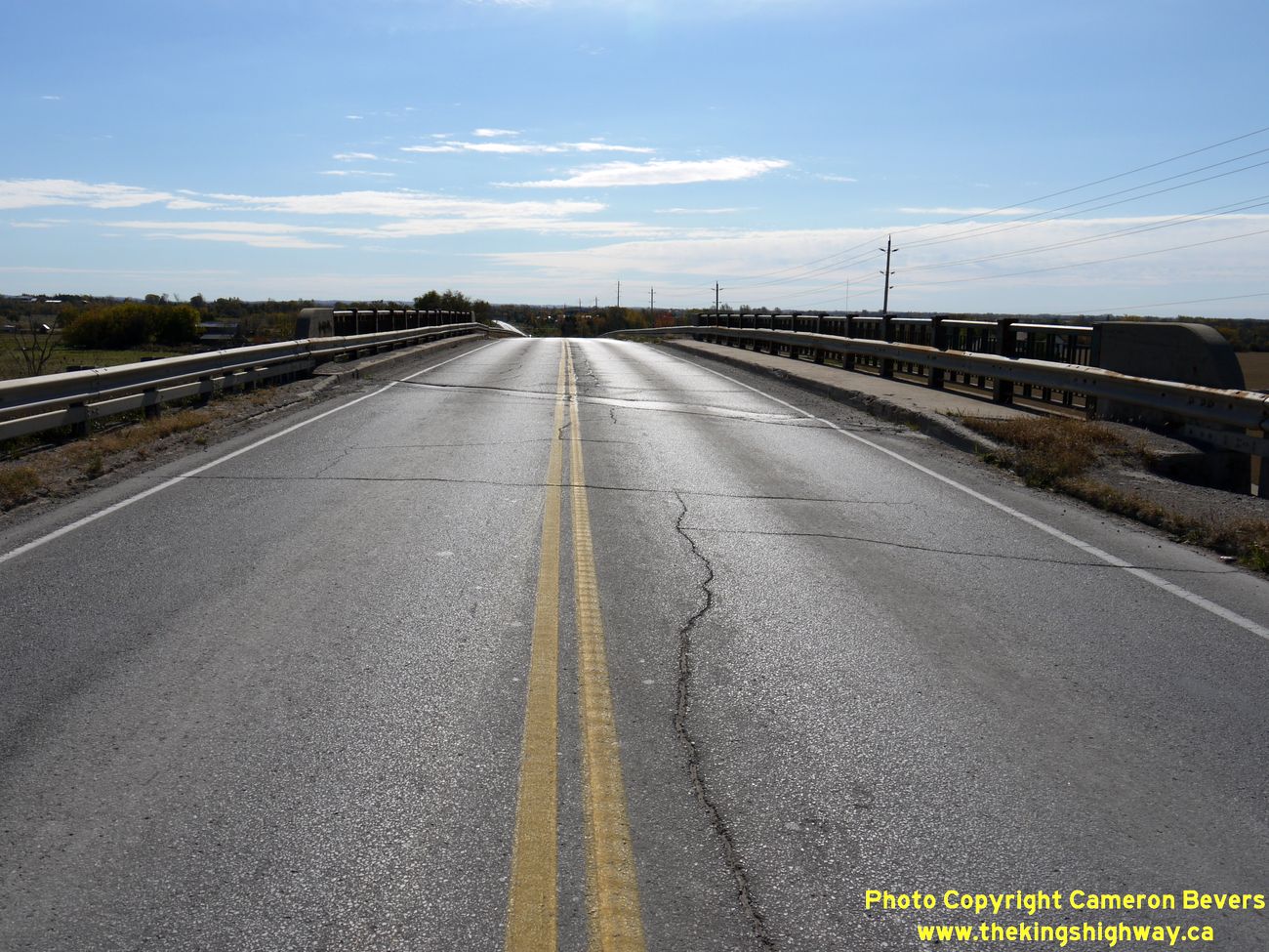
Enlarged Photo Here. (Photograph taken on October 9, 2010 - © Cameron Bevers) Right - East Lindsay Bypass Railway Overhead on Hwy 36 south of Lindsay. This bridge spanned the former Canadian National Railway line leading into Lindsay. See an Enlarged Photo Here. (Photograph taken on October 9, 2010 - © Cameron Bevers) 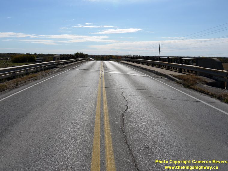
Left - Facing south along Hwy 36 across the East Lindsay Bypass Canadian National Railway Overhead. See an
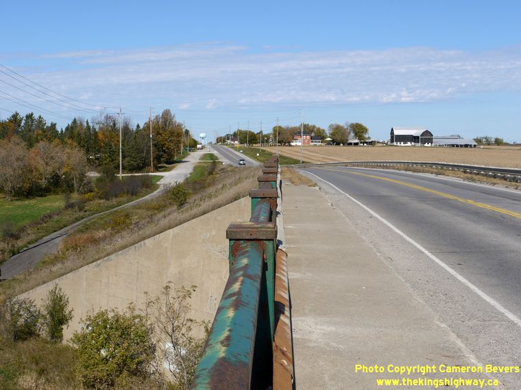
Enlarged Photo Here. (Photograph taken on October 9, 2010 - © Cameron Bevers) Right - Facing north from the top of the East Lindsay Bypass Railway Overhead on Hwy 36. At left, an old road alignment leads to the site of a former at-grade railway crossing. The route of Hwy 36 was constructed off of alignment, presumably to allow access to remain for a number of properties located on the western side of the new East Lindsay Bypass. See an Enlarged Photo Here. (Photograph taken on October 9, 2010 - © Cameron Bevers) 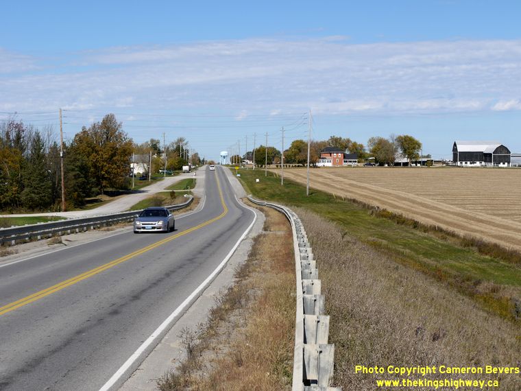
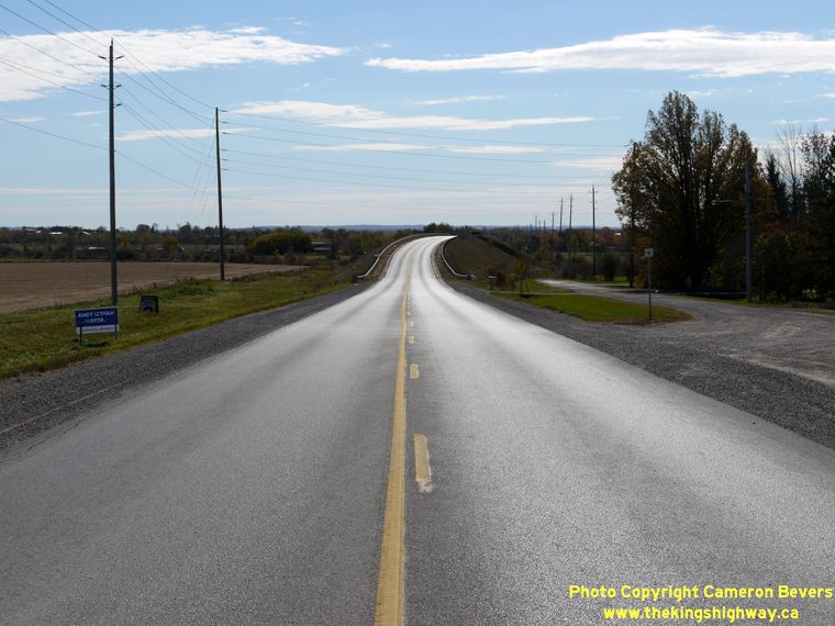
Left - The new alignment of Hwy 36 north of the railway overhead is quite evident in this photo. At left, the old road alignment is still in use as local
service road, for access to driveways on the western side of the highway. See an Enlarged Photo Here. (Photograph taken on October 9, 2010 - © Cameron Bevers) Right - Facing south along Hwy 36 towards the East Lindsay Bypass Railway Overhead. Hwy 36 comes to an end at Hwy 7 about 2 km to the south. See an Enlarged Photo Here. (Photograph taken on October 9, 2010 - © Cameron Bevers) 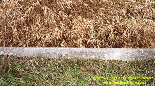
Above - Culvert inscription on Cheese Factory Rd (Old Hwy 36) north of Lindsay - "THE KING'S HIGHWAY 1936" (Photograph taken in October 2002 - © Cameron Bevers)
Continue on to King's Highway 36 Photos: Bobcaygeon to Burleigh Falls
|
|---|
Links to Adjacent King's Highway Photograph Pages:
Back to King's Highway 35 Photos /
King's Highway 36 History /
On to King's Highway 37 Photos
Ontario Highway History - Main Menu / Back to List of Highways Website contents, photos & text © 2002-2026, Cameron
Bevers (Webmaster) - All Rights Reserved / Contact Me
|
|---|