
| 
| |
|
|
This page contains present day photos of the former route of Ontario's King's Highway 3 through Essex & Leamington,
arranged by location from the Highway 3 Junction east of Windsor easterly to the eastern end of the Leamington Bypass. All photographs displayed on this page were
taken by the Webmaster (Cameron Bevers), unless specifically noted otherwise. Click on any thumbnail to see a larger image!
Please note that all photographs displayed on this
website are protected by copyright. These photographs must not be reproduced, published,
electronically stored or copied, distributed, or posted onto other websites without
my written permission. If you want to use photos from this website, please
email me first for permission. Thank-you!
|
|---|
|
Present Day King's Highway 3 Photographs (Old Route Via Essex & Leamington)


Left - Facing west along Hwy 3 towards Windsor from the western end of the Essex Bypass. From this point westerly to the Hwy 401 Interchange in Windsor, Hwy 3
is primarily an undivided four-lane highway with a two-way centre left turn lane. See an
Enlarged Photo Here. (Photograph taken on August 1, 2019 - © Cameron Bevers) Right - Start of the Essex Bypass (Hwy 3 New), facing east towards Leamington. During the 1970s and early 1980s, a complete relocation of Hwy 3 took place from this point easterly to the Leamington area. The new route of Hwy 3 was built as a Controlled-Access Highway (CAH), with access to the highway prohibited other than at major intersections. The westernmost part of the Essex Bypass was constructed as a four-lane divided highway. See an Enlarged Photo Here. (Photograph taken on August 1, 2019 - © Cameron Bevers) 

Left - View of Old Hwy 3 facing east towards Maidstone from the Essex Bypass. Several miles of Hwy 3's original route was bypassed in 1971 when the Essex
Bypass was completed around Maidstone and the Town of Essex. Interestingly, the former route of Hwy 3 was assigned a non-posted 7000-Series Highway designation
(Hwy 7134) rather than numbered as a Hwy 3B Business Route, which was the common practice for numbering bypassed highways at that time. This was likely done
thoughtfully, to avoid confusion with this route and Windsor's Hwy 3B route, which intersected with Hwy 3 at Howard Avenue about 6 miles to the west. See an
Enlarged Photo Here. (Photograph taken on August 1, 2019 - © Cameron Bevers) Right - This bypassed section of Hwy 3 lies just west of the tie-in to the Essex Bypass (Hwy 3 New). Known today as "Service Road", it provides access to a number of homes which lie between the Essex Bypass and the old route of Hwy 3 at the western entrance to Maidstone. See an Enlarged Photo Here. (Photograph taken on August 1, 2019 - © Cameron Bevers) 

Left - View of Old Hwy 3 facing west towards the tie-in with the Essex Bypass. Old Hwy 3 comes to an end here, as does the Essex Bypass. From here, traffic can
turn right and proceed westerly towards Windsor along the original route of Hwy 3, or turn left and head towards Leamington via the Essex Bypass (Hwy 3 New). See an
Enlarged Photo Here. (Photograph taken on August 1, 2019 - © Cameron Bevers) Right - Facing west along Old Hwy 3 from the former Michigan Central Railway (MCR) crossing near Maidstone. During the late 1930s, the Department of Highways of Ontario (DHO) acquired additional property along the southern side of Hwy 3 and undertook grading operations for the construction of a new dual highway between Maidstone and Windsor. This dual highway was graded and drainage culverts installed from Huron Church Line Road in Windsor easterly to Maidstone under Contract #1937-70. For some reason, concrete pavement was only laid along the dual highway from Huron Church Line Road to a point just beyond the Hwy 3B Junction at Howard Avenue. East of the Hwy 3B Junction, Hwy 3 narrowed back down to a two-lane undivided pavement. The remainder of the south carriageway to Maidstone was never completed. The original route of Hwy 3, which would have formed the north carriageway of the proposed dual highway, carried both directions of highway traffic into Windsor from the Maidstone area on a two-lane pavement until well into the 21st Century. See an Enlarged Photo Here. (Photograph taken on August 1, 2019 - © Cameron Bevers) 

Left - Facing east along Old Hwy 3 at the western entrance to Maidstone. Note the grading at right for a second (eastbound) carriageway of a proposed dual
highway which was commenced between Windsor and Maidstone in the 1930s, but was never actually completed to its ultimate length. For reasons which may never be known,
pavement was never laid along the graded south carriageway much beyond the Hwy 3B Junction in Windsor. It is possible that the project failed to proceed further due
to the outbreak of World War II in 1939. See an Enlarged Photo Here. (Photograph taken on August 1, 2019 - © Cameron Bevers) Right - View of the proposed dual highway as seen from the highway's future centre median at the western entrance to Maidstone. Note the distance of the south roadside ditch line at left, which was graded in 1937 to accommodate stormwater runoff from the dual highway's south carriageway. The south carriageway, which would have ultimately carried all eastbound traffic on Hwy 3, was never completed or put into service. See an Enlarged Photo Here. (Photograph taken on August 1, 2019 - © Cameron Bevers) 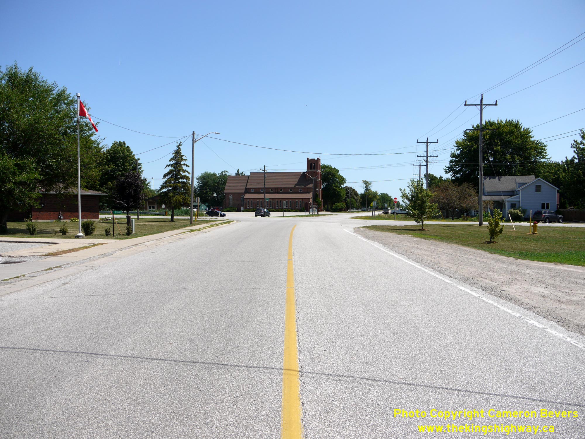
Left - Approaching the Former Hwy 114 Junction at Malden Road on Old Hwy 3 in Maidstone, facing east. Although it might not look like a major highway junction
today, this intersection was once a key decision point in the provincial highway system. Until 1929, Hwy 2 & Hwy 3 both followed Huron Church Road concurrently
out of Windsor to Maidstone, where the two highways parted ways at this intersection. Traffic could either turn left onto Malden Road (Hwy 2) towards Tilbury,
Chatham and London or continue straight ahead via Talbot Road (Hwy 3) to Leamington, Blenheim and St. Thomas. Over the years, Malden Road has been known by several
different highway numbers, with the most recent designation being Hwy 114. See an
Enlarged Photo Here. (Photograph taken on August 1, 2019 - © Cameron Bevers) Right - Facing west along Old Hwy 3 towards Windsor from Malden Road (Formerly Hwy 114) in Maidstone. See an Enlarged Photo Here. (Photograph taken on August 1, 2019 - © Cameron Bevers) 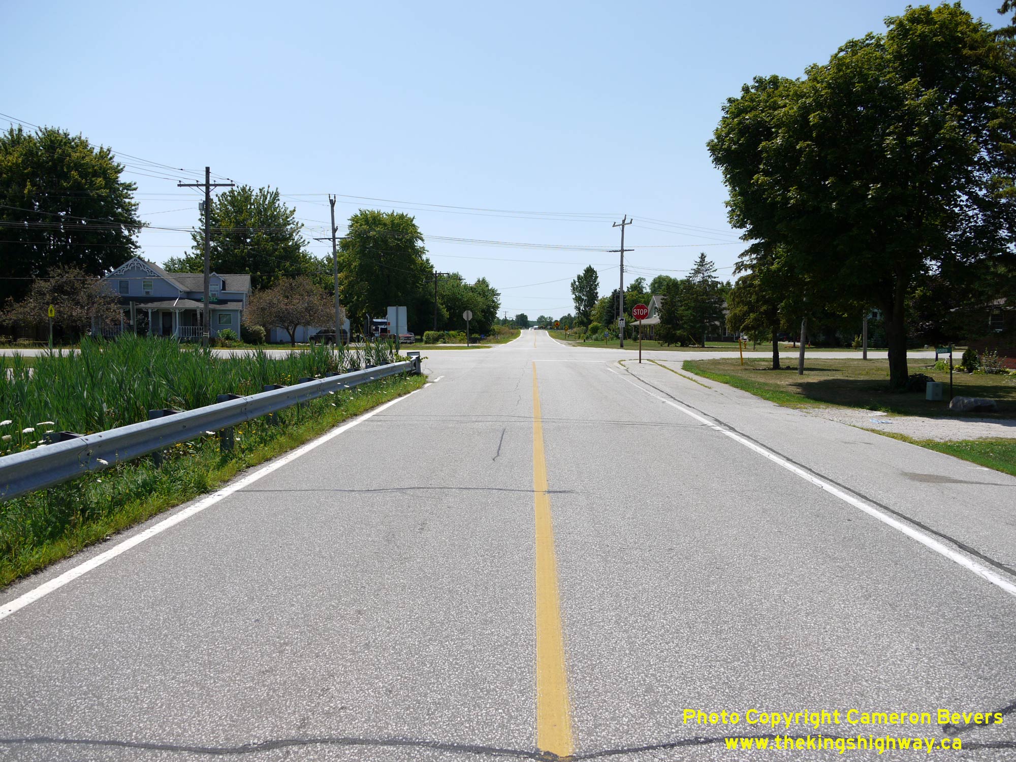
Left - Southern terminus of Former Hwy 114 at the Old Hwy 3 Junction in Maidstone. Early motorists arriving in Maidstone on Hwy 2 in the 1920s could turn right
at this intersection and continue west towards Windsor via Hwy 2 & Hwy 3, or turn left and head east on Hwy 3 towards Leamington. See an
Enlarged Photo Here. (Photograph taken on August 1, 2019 - © Cameron Bevers) Right - Facing north along Former Hwy 114 (Malden Road) from the Old Hwy 3 Junction in Maidstone. This highway has been renumbered several times over the years due to various changes in highway routings through Essex County. This highway was originally known as Hwy 2 (1925-1929), then Hwy 2A (1929-1931), then Hwy 3A (1931-1938), then Hwy 98A (1938-1953) and finally, Hwy 114 (1953-1970). Provincial jurisdiction over Hwy 114 ended in June 1970, when ownership of the highway was transferred over to municipalities. See an Enlarged Photo Here. (Photograph taken on August 1, 2019 - © Cameron Bevers) 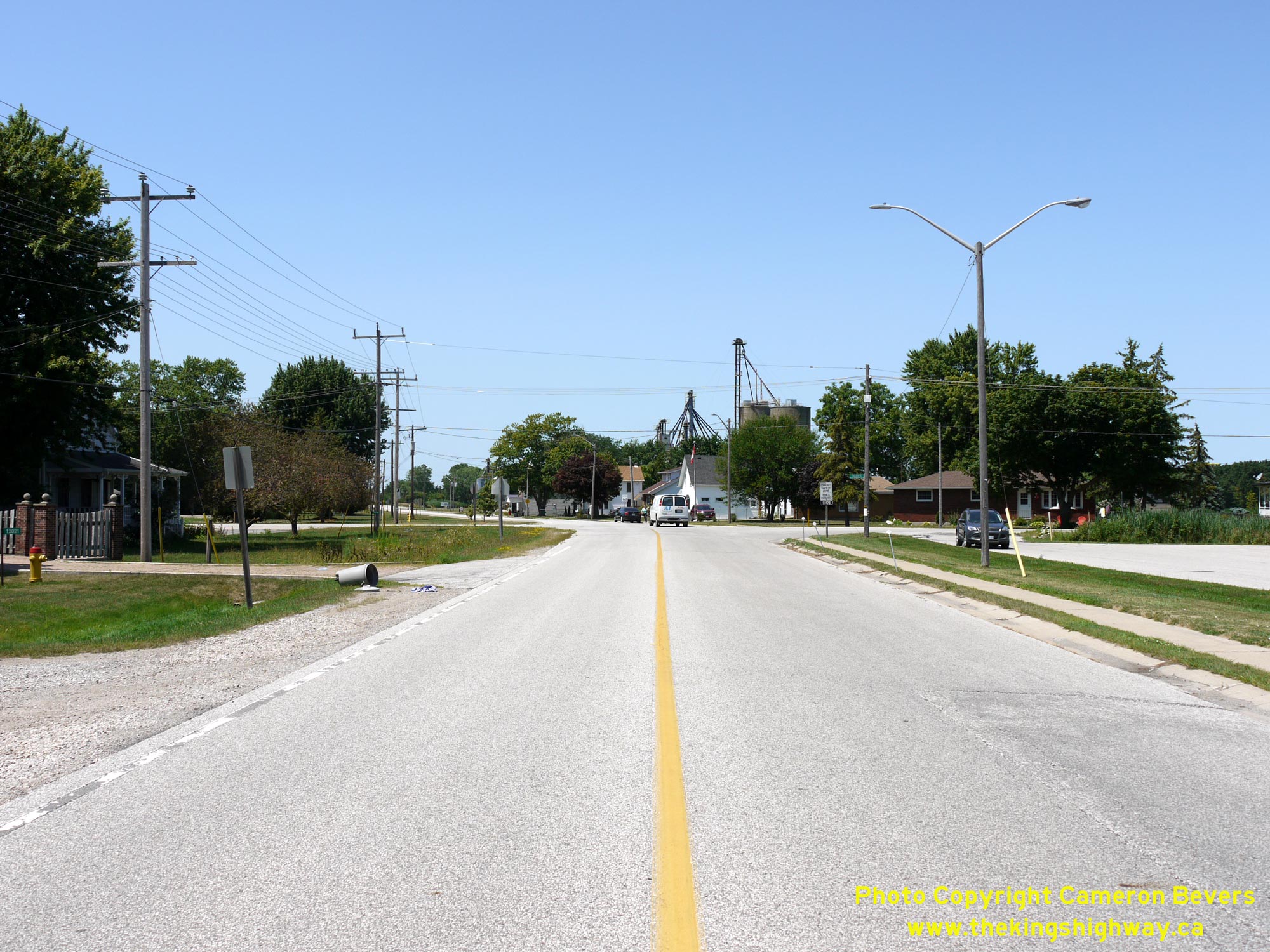
Left - Approaching the Former Hwy 114 Junction at Malden Road in Maidstone, facing west along Old Hwy 3. Back in the 1920s, Hwy 2 & Hwy 3 connected at this
junction and shared an overlapped concurrent route into Windsor from Maidstone. See an
Enlarged Photo Here. (Photograph taken on August 1, 2019 - © Cameron Bevers) Right - Facing east along Old Hwy 3 towards Leamington from the Former Hwy 114 Junction. While Old Hwy 3 may look very empty in this photo, it wasn't always this way. By the late 1960s, about 10,000 vehicles per day rumbled through Maidstone. Construction began on the Essex Bypass (Hwy 3 New) in 1969, under Contract #1969-145. This 6.7-mile diversion bypassed the Town of Essex (not to be confused with the County of Essex, in which the Town of Essex is situated). Final paving of the Essex Bypass was completed under Contract #1970-104, with the diversion being officially opened to traffic in 1971. See an Enlarged Photo Here. (Photograph taken on August 1, 2019 - © Cameron Bevers) 

Left - Facing east along Old Hwy 3 towards the Town of Essex from the eastern entrance to Maidstone. See an
Enlarged Photo Here. (Photograph taken on August 1, 2019 - © Cameron Bevers) Right - Entering Maidstone on Old Hwy 3, facing west towards Windsor. Maidstone is an unincorporated hamlet situated within the Town of Tecumseh. See an Enlarged Photo Here. (Photograph taken on August 1, 2019 - © Cameron Bevers) 

Left - View of Old Hwy 3 facing east towards the Town of Essex near Manning Road. The province retained ownership of Old Hwy 3 for several years after the
completion of the Essex Bypass in 1971. Jurisdiction over the former route of Hwy 3 through Maidstone and the Town of Essex was transferred from the province to the
County of Essex in February 1980. See an Enlarged Photo Here. (Photograph taken on August 1, 2019 - © Cameron Bevers) Right - Facing west towards Maidstone from the western entrance to the Town of Essex. The route of Old Hwy 3 briefly passes through the Municipality of Lakeshore between the Town of Essex and Maidstone, before entering the Town of Tecumseh at the intersection of Manning Road. The traffic signals at Old Hwy 3 and Manning Road are visible in the background, which mark the municipal boundary between Lakeshore and Tecumseh. See an Enlarged Photo Here. (Photograph taken on August 1, 2019 - © Cameron Bevers) 

Left - Entering the Municipality of Lakeshore on Old Hwy 3, facing west. This large municipality was created in 1999 when the Town of Belle River amalgamated
with the surrounding Townships of Tilbury West, Tilbury North, Maidstone and Rochester to create a single municipality. Old Hwy 3 only passes through the extreme
southwestern corner of this municipality. See an Enlarged Photo Here. (Photograph taken on August 1, 2019 - © Cameron Bevers) Right - Essex County Road 34 route marker facing westbound traffic on Old Hwy 3 departing from the Town of Essex. The County of Essex is one of several upper-tier municipalities in Ontario which also has a lower-tier municipality bearing the same name situated within its boundary. However, the County of Essex and the Town of Essex are separate entities. See an Enlarged Photo Here. (Photograph taken on August 1, 2019 - © Cameron Bevers) 

Left - View of the western entrance to the Town of Essex on Old Hwy 3, facing east towards the Town Centre. See an
Enlarged Photo Here. (Photograph taken on August 1, 2019 - © Cameron Bevers) Right - View of the commercial strip along Old Hwy 3 approaching Essex. Despite the urban expansion of Essex in recent years, the former route of Hwy 3 still looks very much like an old King's Highway. Provincial jurisdiction over the former route of Hwy 3 ended in 1980, when ownership of the highway was transferred to the County of Essex and Town of Essex. See an Enlarged Photo Here. (Photograph taken on August 1, 2019 - © Cameron Bevers) 

Left - Facing west along Old Hwy 3 from Hopgood Road in the Town of Essex. See an
Enlarged Photo Here. (Photograph taken on August 1, 2019 - © Cameron Bevers) Right - Facing west along Talbot Street (Old Hwy 3) approaching Maidstone Avenue (Essex County Road 8) in the Town of Essex. Maidstone Avenue is the primary access route into the Town of Essex from the relocated route of Hwy 3 (Essex Bypass). Accordingly, this is heavily trafficked intersection. See an Enlarged Photo Here. (Photograph taken on August 1, 2019 - © Cameron Bevers) 

Left - View of the Essex Railway Station, located just east of Old Hwy 3. This historical railway station was constructed in 1887 on the former Michigan
Central Railway which once passed through the Town of Essex. While admittedly, this railway station has nothing to do with highway history, it is nonetheless an
interesting piece of historical transportation infrastructure. See an Enlarged Photo Here. (Photograph taken on August 1, 2019 - © Cameron Bevers) Right - At one time, the Michigan Central Railway passed in front of the Essex Railway Station. Although passenger rail services were discontinued decades ago, this former railway station was thankfully preserved and restored by local heritage groups. After serving industrial and freight traffic in recent years, the railway was ultimately abandoned with the last of the rails removed in front of the Essex Railway Station in the 2010s. This beautiful building still stands as an important reminder of the area's railway heritage. See an Enlarged Photo Here. (Photograph taken on August 1, 2019 - © Cameron Bevers) 

Left - View of the Essex Town Centre along Talbot Street (Old Hwy 3), facing east from Victoria Avenue. See an
Enlarged Photo Here. (Photograph taken on August 1, 2019 - © Cameron Bevers) Right - Facing west along Talbot Street (Old Hwy 3) from Arthur Street in Downtown Essex. Note the short side-by-side left-turn lanes in place along Talbot Street between Arthur Street and Laird Avenue. These types of lane configurations are undesirable and can actually be very problematic operationally, as they have a tendency to "lock up" during peak times. If a queue develops at one of the left-turn lanes, it can spill back and block the ability of vehicles in the adjacent left-turn lane from completing their turn. This can result in a queue developing in that adjacent lane also. If motorists aren't careful and don't leave any gaps, this can set off a chain reaction where nobody can complete their turn. During a recent road reconstruction project, this intersection was redesigned to allow left turns to Arthur Street only, while left turns to Laird Avenue have now been prohibited outright. See an Enlarged Photo Here. (Photograph taken on August 1, 2019 - © Cameron Bevers) 

Left - View of Old Hwy 3 (Talbot Street) in the Town of Essex, facing east towards Leamington near Gosfield Townline. See an
Enlarged Photo Here. (Photograph taken on August 1, 2019 - © Cameron Bevers) Right - Facing west along Old Hwy 3 towards Windsor at the eastern entrance to the Town of Essex. See an Enlarged Photo Here. (Photograph taken on August 1, 2019 - © Cameron Bevers) 

Left - View of Old Hwy 3 facing east towards Leamington from the eastern entrance to the Town of Essex. Once Old Hwy 3 leaves the urbanized area of Essex, the
highway enters the Town of Kingsville. This is a large and mostly rural municipality. Neither the relocated route of Hwy 3 nor Old Hwy 3 pass through Kingsville's
urbanized town centre, which is actually situated on Hwy 18 (today's Essex County Road 20) west of Leamington. See an
Enlarged Photo Here. (Photograph taken on August 1, 2019 - © Cameron Bevers) Right - View of the Old Essex Bypass (today's Malden Road), facing west from Old Hwy 3. This eastern section of the Essex Bypass was completed in 1971 to intercept traffic on Hwy 3 before motorists headed west into the Town of Essex. This connector road led out to the relocated route of Hwy 3, where the bypass orbited around both the Town of Essex as well as nearby Maidstone. During the construction of the adjacent Cottam Bypass (Hwy 3 New) in the early 1980s, the eastern portion of the Essex Bypass was made redundant. As a result of the completion of the Cottam Bypass in 1983, about 1.8 km of the Old Essex Bypass route was left behind. This once-busy section of Hwy 3 now sits virtually empty. For many years, this eastern portion of the Old Essex Bypass had a 7000-Series Highway designation (Hwy 7185). Note the white transport truck in the distance using the Cottam Bypass (Hwy 3 New). See an Enlarged Photo Here. (Photograph taken on August 1, 2019 - © Cameron Bevers) 

Left - Eastern terminus of the Old Essex Bypass (Hwy 7185) at Old Hwy 3 between the Town of Essex and North Ridge. Until the completion of the Cottam Bypass in
1983, traffic on Hwy 3 would have had to turn right in order to proceed easterly towards Leamington. The Essex Town Centre could be reached via Old Hwy 3 (Hwy 7134)
at left. See an Enlarged Photo Here. (Photograph taken on August 1, 2019 - © Cameron Bevers) Right - Facing east along Old Hwy 3 towards the eastern terminus of the Old Essex Bypass (Hwy 7185). This once-busy highway junction was bypassed in the early 1980s, once the Cottam Bypass (Hwy 3 New) was completed between the Town of Essex and the community of Ruthven, located near Leamington. About 10 miles (16 km) of Old Hwy 3 got bypassed in the early 1980s by the new relocated route of Hwy 3. See an Enlarged Photo Here. (Photograph taken on August 1, 2019 - © Cameron Bevers) 

Left - View of Old Hwy 3 (Hwy 7134) facing west towards the Town of Essex from the Old Essex Bypass (Hwy 7185) Junction. See an
Enlarged Photo Here. (Photograph taken on August 1, 2019 - © Cameron Bevers) Right - Facing east along Old Hwy 3 towards North Ridge from the end of the Old Essex Bypass (Hwy 7185). Note that a westbound left-turn lane still exists here. Until the completion of the new route of Hwy 3 down to the Leamington area in the early 1980s, thousands of vehicles per day would have turned left onto the Essex Bypass at this intersection as they proceeded west along Hwy 3 towards Windsor. See an Enlarged Photo Here. (Photograph taken on August 1, 2019 - © Cameron Bevers) 

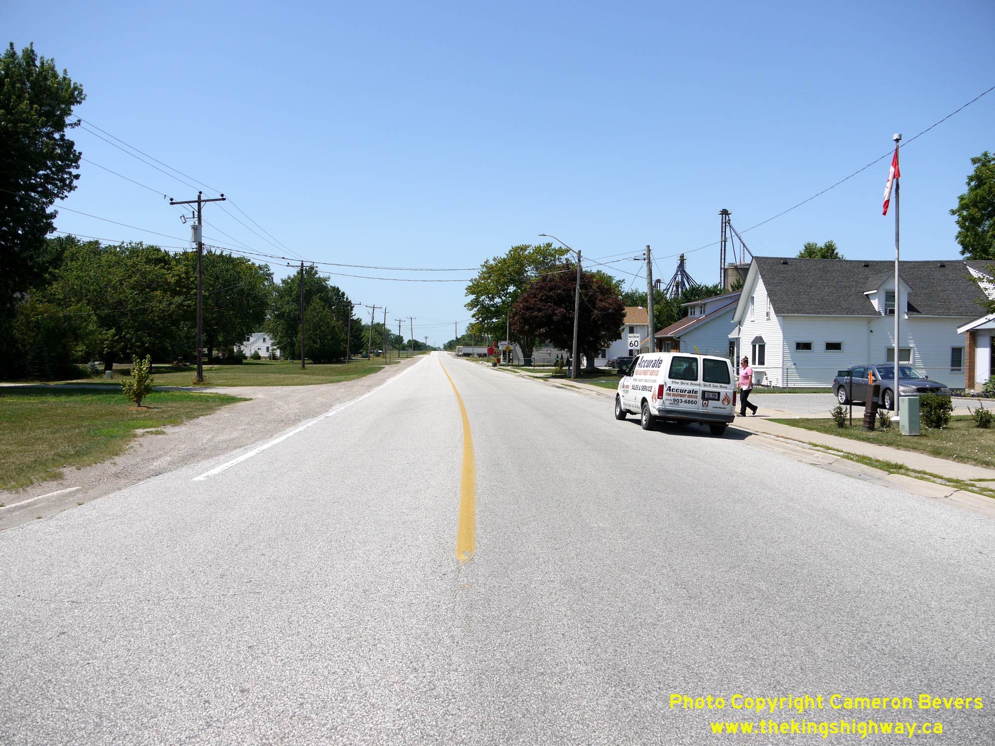
Left - Old Hwy 3 between the Town of Essex and North Ridge is surprisingly developed, even for a former King's Highway. Numerous homes line both sides of the
old highway's route, and most date back to a time when this was still the main highway between Windsor and Leamington. By 1979, this highway was carrying about 7,500
vehicles a day and the frequent driveway access points along the highway created numerous traffic conflict points. See an
Enlarged Photo Here. (Photograph taken on August 1, 2019 - © Cameron Bevers) Right - Approaching North Ridge on Old Hwy 3, facing east. Most of the original route of Hwy 3 through this area only had a 66-foot road allowance, which made the provision of any significant geometric improvements to the corridor very difficult. Note the proximity of the cemetery at right to the edge of the highway pavement. In recognition of these corridor constraints, highway planning studies completed by the DHO during the 1960s recommended the complete relocation of Hwy 3 onto a new alignment through this part of Essex County. See an Enlarged Photo Here. (Photograph taken on August 1, 2019 - © Cameron Bevers) 

Left - Facing west along Old Hwy 3 towards Cameron Side Road in North Ridge. Given the traffic volumes which used the Windsor-Leamington corridor in decades
past, it is actually unthinkable that this road with its narrow lanes, narrow shoulders, lack of turn lanes - not to mention all the utility poles and trees situated
mere inches from the road's edge - was the main highway route between these two major centres right up until the early 1980s. This would have undoubtedly been a very
frustrating and nerve-racking drive at the time! See an Enlarged Photo Here. (Photograph taken on August 1, 2019 - © Cameron Bevers) Right - View of Old Hwy 3 at the Dairy Freez Drive-In Restaurant between North Ridge and Cottam. This nostalgic-looking place has been around for many decades, and is a vestige of yesteryear when Ontario's entrepreneurs harnessed the spending power of the motorist by offering affordable and convenient food services along the King's Highways. In today's era of international fast-food chains offering forgettable meals in bland, cookie-cutter dining rooms, it is really fantastic to see a small family-run independent business succeed as well as Dairy Freez has. As if the busy parking lot didn't give it away, this is a very popular local hangout. Places like this really make travelling The King's Highways fun! See an Enlarged Photo Here. (Photograph taken on August 1, 2019 - © Cameron Bevers) 

Left - Facing west along Old Hwy 3 towards Windsor in North Ridge. After serving in the provincial highway system for 63 years, jurisdiction over Old Hwy 3 was
transferred from the province to the County of Essex in July 1983, once the Cottam Bypass (Hwy 3 New) was completed and opened to traffic. See an
Enlarged Photo Here. (Photograph taken on August 1, 2019 - © Cameron Bevers) Right - View of the eastern entrance to North Ridge on Old Hwy 3, facing west towards Windsor. See an Enlarged Photo Here. (Photograph taken on August 1, 2019 - © Cameron Bevers) 

Left - Western entrance to Cottam on Old Hwy 3, facing east towards Leamington. Although Cottam has a sign marking its urban boundary, roadside development
along Old Hwy 3 has been largely uninterrupted since departing from the Town of Essex. Without these community entrance signs, it would be almost impossible to tell
where one community ends and the next one begins. The excessive roadside development and density of side entrances southeast of Windsor made this section of Hwy 3
function more like a local road, even though it carried long-distance through traffic. For these reasons, the entire route of Hwy 3 was reconstructed on a new
alignment between Maidstone and Leamington during the 1970s and 1980s. See an Enlarged Photo Here. (Photograph taken on August 1, 2019 - © Cameron Bevers) Right - Facing west along Old Hwy 3 towards Windsor from the western entrance to Cottam. During 1920, Hwy 3 became Essex County's very first Provincial Highway. Provincial jurisdiction over the route commenced on June 24, 1920, when the Windsor-Leamington-Wheatley Road was assumed as part of a new Provincial Highway across Southern Ontario. The route was assigned the Hwy 3 designation in 1925, when all of Ontario's Provincial Highways were numbered. The route of Hwy 3 originally extended from Windsor through to Niagara Falls, although the highway's eastern terminus was changed from Niagara Falls to Fort Erie in 1930. See an Enlarged Photo Here. (Photograph taken on August 1, 2019 - © Cameron Bevers) 

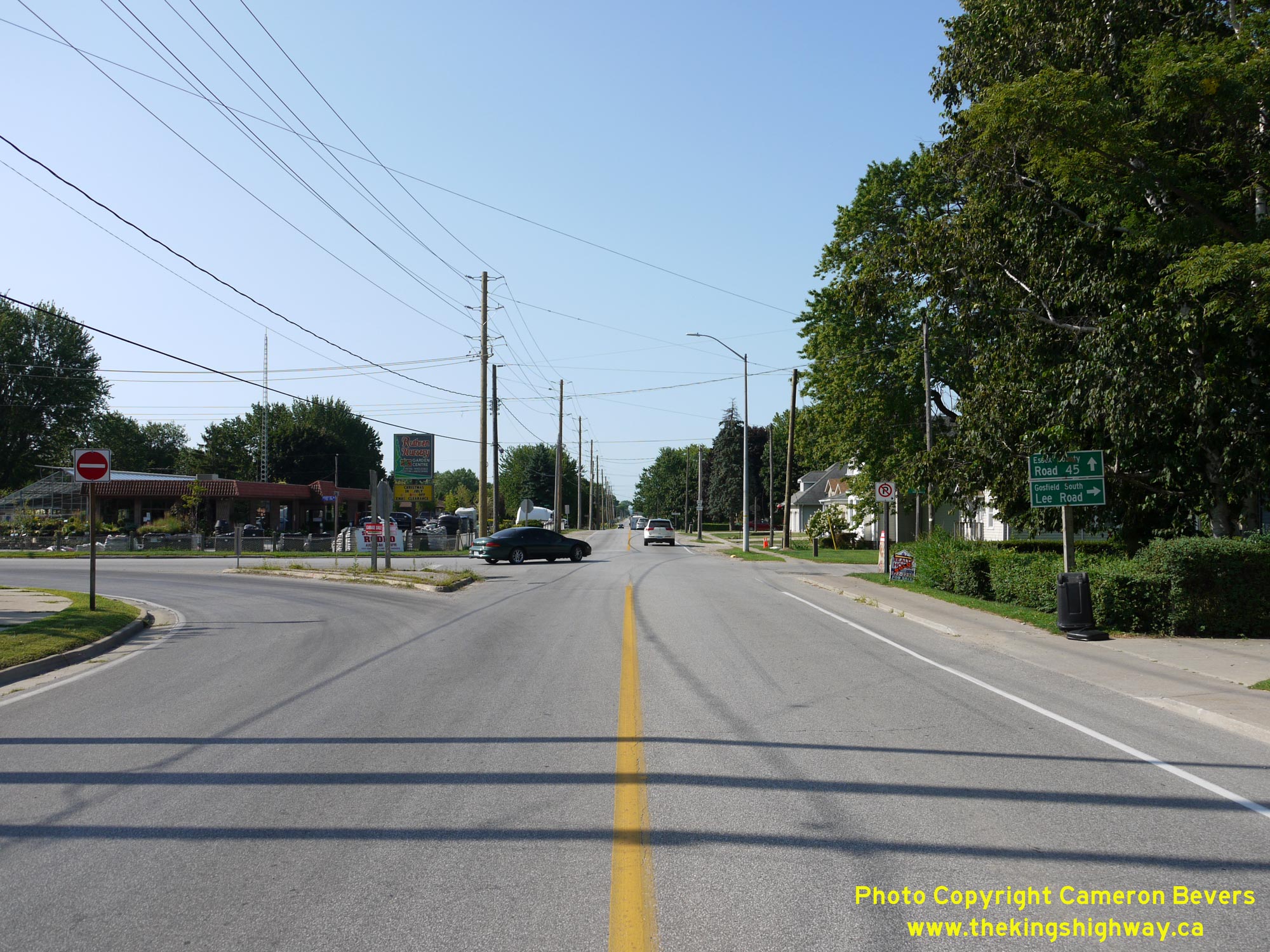
Left - Facing west along Old Hwy 3 towards Windsor from Essex County Road 27 (Belle River Road) in Cottam. See an
Enlarged Photo Here. (Photograph taken on August 1, 2019 - © Cameron Bevers) Right - View of Cottam's village centre approaching Essex County Road 27 (Belle River Road), facing west. See an Enlarged Photo Here. (Photograph taken on August 1, 2019 - © Cameron Bevers) 

Left - View of Old Hwy 3 at the eastern entrance to Cottam, facing west towards Windsor. This unincorporated village is now part of the Town of Kingsville. See
an Enlarged Photo Here. (Photograph taken on August 1, 2019 - © Cameron Bevers) Right - Facing east along Old Hwy 3 towards Leamington approaching Division Road in Cottam. Prior to the construction of the relocated Hwy 3 around Cottam in the early 1980s, this turn-off at Division Road was the main road from Hwy 3 southerly to Kingsville. See an Enlarged Photo Here. (Photograph taken on August 1, 2019 - © Cameron Bevers) 

Left - Facing west along Old Hwy 3 towards Cottam from Essex County Road 29 (Division Road). This once-busy intersection marked the point where traffic heading
north from Kingsville joined traffic heading west from Leamington towards Windsor. Historically, traffic volumes on the section of Hwy 3 west of Division Road were
about double the traffic volumes east of Division Road. See an Enlarged Photo Here. (Photograph taken on August 1, 2019 - © Cameron Bevers) Right - Facing west along Old Hwy 3 towards Leamington from Essex County Road 29 (Division Road). Provincial jurisdiction over Old Hwy 3 ended very quickly after the Cottam Bypass was completed. Old Hwy 3 between the Town of Essex and Ruthven near Leamington was transferred from the province to the County of Essex in July 1983. See an Enlarged Photo Here. (Photograph taken on August 1, 2019 - © Cameron Bevers) 

Left - View of the Cottam Curve on Old Hwy 3, facing east towards Leamington. Located about 3 km east of Cottam, this minor realignment of Hwy 3 took place in
the early 1950s in an effort to improve the radius of this horizontal curve. The new highway at right was constructed in 1951. See an
Enlarged Photo Here. (Photograph taken on August 1, 2019 - © Cameron Bevers) Right - View of the old and new highway curves east of Cottam. The realignment of Hwy 3 under Contract #1951-375 resulted in improved highway geometry. The new curve had a radius of 1,432 feet, while the old curve had a much tighter radius of only 573 feet. Rather than remove the old pavement, the concrete highway was simply left in place along the old Cottam Curve. This pavement was constructed in 1925 under Department of Public Highways of Ontario (DPHO) Contract #1183. Just over 5 miles of concrete pavement was completed along Hwy 3 from the eastern entrance of Cottam to the Olinda Side Road north of Ruthven during 1925. See an Enlarged Photo Here. (Photograph taken on August 1, 2019 - © Cameron Bevers) 

Left - View of the Cottam Curve on Old Hwy 3, facing west towards Windsor. Jurisdiction over the old highway curve was transferred from the province to the
Township of Gosfield North in October 1956. The old bypassed highway now serves as a private driveway. See an
Enlarged Photo Here. (Photograph taken on August 1, 2019 - © Cameron Bevers) Right - Approaching Upcott's Curve on Old Hwy 3, facing east towards Ruthven. In this photo, there are actually two different highway curves, constructed about 30 years apart. A new diversion was constructed at left in the early 1950s to bypass a sharp curve on the original 1920 route of Hwy 3, which can be seen at right. See an Enlarged Photo Here. (Photograph taken on August 1, 2019 - © Cameron Bevers) 

Left - When the new alignment of Hwy 3 was constructed at Upcott's Curve in 1952, a roughly 1/4-mile section of the old highway was left behind. This
interesting view of the original highway gives observers some insights as to what King's Highways looked like prior to World War II, as it is unlikely that much has
changed with this old section of the highway since the 1940s. See an Enlarged Photo Here. (Photograph taken on August 1, 2019 - © Cameron Bevers) Right - View of Upcott's Curve, facing east. Situated inconspicuously at the end of a long tangent, its quite likely that this sharp curve had a dubious safety record. See an Enlarged Photo Here. (Photograph taken on August 1, 2019 - © Cameron Bevers) 

Left - The old curve on Hwy 3 (Upcott's Curve) was particularly hazardous, as it was situated at the end of two long tangent sections of highway. The radius of
this curve was only 300 feet, making it the tightest horizontal curve between Windsor and Leamington. When a concrete pavement was constructed along this section of
Hwy 3 in 1925, the pavement was "banked" or superelevated to permit use by faster traffic. At some point, a thin layer of bituminous material was laid on top of the
concrete slabs, likely in an effort to improve pavement friction on the approach to the curve. See an
Enlarged Photo Here. (Photograph taken on August 1, 2019 - © Cameron Bevers) Right - The transition between tangent and curve approaching Upcott's Curve is rather obvious in this photo. When this pavement was first constructed along Hwy 3 in 1925, the speed limit on rural Provincial Highways was only 25 mph (40 km/h). As motorcars became more and more powerful as the years went by, horizontal curves such as this one which were considered perfectly acceptable for accommodating slower 1920s-era vehicles started to become quite dangerous. Many of these old curves were replaced during highway improvement projects. Drive on any King's Highway in Southern Ontario with a sharp curve on it, and it is likely the road you're seeing is a diversion of an even sharper curve from that earlier era. In some cases, these old curves were obliterated by pavement removal, but in this instance, the curve still exists as a local access road even a century later! See an Enlarged Photo Here. (Photograph taken on August 1, 2019 - © Cameron Bevers) 

Left - Approaching Upcott's Curve facing west. The eastern approach to the curve was closed to through traffic years ago and was overgrown and disused by 2019.
See an Enlarged Photo Here. (Photograph taken on August 1, 2019 - © Cameron Bevers) Right - Former alignment of Old Hwy 3 near Upcott's Curve. Jurisdiction over this bypassed curve was transferred from DHO to the Township of Gosfield South in March 1957. While this road did once form a complete loop, the southern part of the curve was barricaded off just ahead, likely due to a failing culvert below the old highway. See an Enlarged Photo Here. (Photograph taken on August 1, 2019 - © Cameron Bevers) 

Left - Entrance to the Old Upcott's Curve between Ruthven and Cottam, facing west. During a recent road improvement project, the disused portion of pavement
seen here was removed and the area landscaped. Old road alignments which are tangential to the approaching highway can create operational issues, as some drivers may
incorrectly assume that the road continues straight ahead. In more recent decades, bypassed sections of highway like this are usually realigned and screened with
trees, earth berms and other landscaping to avoid this potential problem. See an
Enlarged Photo Here. (Photograph taken on August 1, 2019 - © Cameron Bevers) Right - View of the new and old Upcott's Curves. The old road at left was in use until 1952, when it was bypassed by a new highway curve with an improved radius of 2,865 feet under Contract #1951-375. In addition, the old concrete pavement laid in 1925 was topped off with a new hot-mix asphalt surface from the Town of Essex easterly for 9 miles. Parts of the right-of-way, including the section of Hwy 3 at the revised Upcott's Curve, were also widened out from 66 feet to 100 feet. See an Enlarged Photo Here. (Photograph taken on August 1, 2019 - © Cameron Bevers) 

Left - Facing west along Old Hwy 3 near Olinda Side Road, about 3 km north of Ruthven. See an
Enlarged Photo Here. (Photograph taken on August 1, 2019 - © Cameron Bevers) Right - Approaching the Leamington Bypass (Hwy 3 New) Junction on Old Hwy 3, facing south towards Ruthven. Although Old Hwy 3 was considered to be an east-west oriented highway, the original route of the highway did briefly follow a north-south orientation between Olinda Side Road and Ruthven, including at the point where the highway intersects with the Leamington Bypass (Hwy 3 New). See an Enlarged Photo Here. (Photograph taken on August 1, 2019 - © Cameron Bevers) 

Left - Facing north along Old Hwy 3 towards Olinda from the Hwy 3 New Junction near Ruthven. This former alignment of Hwy 3 was left behind after the
relocation of Hwy 3 onto the Cottam Bypass in the early 1980s. This former highway has been under the jurisdiction of Essex County since 1983. See an
Enlarged Photo Here. (Photograph taken on August 1, 2019 - © Cameron Bevers) Right - Facing west along Hwy 3 New approaching the Old Hwy 3 Junction (today's Essex County Road 34) near Ruthven. At this intersection, the Leamington Bypass (Hwy 3 New) comes to an end. The Cottam Bypass (Hwy 3 New) continues straight ahead. Completed in the early 1980s, the Cottam Bypass was an ambitious highway relocation project which saw Hwy 3 constructed as a new two-lane Controlled-Access Highway for a distance of approximately 16 km from Ruthven to the eastern end of the Essex Bypass. See an Enlarged Photo Here. (Photograph taken on August 1, 2019 - © Cameron Bevers) 

Left - Junction sign assembly facing northbound traffic on Old Hwy 3 approaching the Leamington Bypass (Hwy 3 New) Junction. Traffic can either turn left and
follow Hwy 3 West (Cottam Bypass) towards Windsor, or turn right and follow Hwy 3 East (Leamington Bypass) towards the Hwy 77 Junction. See an
Enlarged Photo Here. (Photograph taken on August 2, 2019 - © Cameron Bevers) Right - Facing north along Old Hwy 3 approaching the Leamington Bypass (Hwy 3 New). By the 1990s, sections of Hwy 3 west of Leamington were carrying more than 10,000 vehicles per day. Many of those vehicles would have had to turn left onto the Cottam Bypass at this intersection in order to continue west towards Windsor. The extension of Hwy 3 New easterly via the Leamington Bypass in the late 1990s relieved traffic pressures on parallel corridors and provided a more efficient through route in the area. See an Enlarged Photo Here. (Photograph taken on August 2, 2019 - © Cameron Bevers) 

Left - Facing south along Old Hwy 3 towards Ruthven from the Leamington Bypass (Hwy 3 New). This section of Hwy 3 was bypassed relatively recently in the late
1990s, when the Leamington Bypass (Hwy 3 New) was opened to traffic. At one time, there would have been significant northbound traffic queues waiting to turn left
towards Windsor via Hwy 3 New (Cottam Bypass). By the time the easterly extension of Hwy 3 New was opened via the Leamington Bypass in 1999, the high traffic volumes
here likely would have overloaded this left-turn lane at peak times. See an Enlarged Photo Here. (Photograph taken on August 2, 2019 - © Cameron Bevers) Right - Facing east along Hwy 3 (Cottam Bypass) approaching the Old Hwy 3 Junction north of Ruthven. At this intersection, Old Hwy 3 (now known as Essex County Road 34) crosses over the relocated route of Hwy 3. For many years, this intersection marked the end of the Cottam Bypass, where the relocated route of Hwy 3 came to an end. In the 1990s, the Leamington Bypass was completed straight ahead, which resulted in the relocation of an additional section of Hwy 3. Curiously, this has resulted in a situation where all four legs of this crossroad intersection have been part of Hwy 3 at one time or another. See an Enlarged Photo Here. (Photograph taken on August 2, 2019 - © Cameron Bevers) 

Left - Facing west towards Windsor along Hwy 3 (Cottam Bypass) from the Old Hwy 3 Junction near Ruthven. A grading contract was awarded for the proposed Cottam
Bypass in the Summer of 1980, under Contract #1980-74. After grading operations were completed in 1982, a follow-up paving contract was awarded. Interestingly, the
Cottam Bypass was originally constructed as a concrete-surfaced highway under Contract #1982-01. It has since been overlaid with a hot-mix asphalt pavement in order
to create a composite pavement structure. See an Enlarged Photo Here. (Photograph taken on August 2, 2019 - © Cameron Bevers) Right - Essex County Road 34 guide sign on Hwy 3 New approaching the Old Hwy 3 Junction. Prior to the completion of the Leamington Bypass in 1999, Hwy 3 arrived at a T-intersection here, where all traffic was directed south onto Hwy 3 via Ruthven. After the Leamington Bypass opened, Hwy 3 was rerouted onto the new bypass, while jurisdiction over the former route of Hwy 3 via Ruthven was transferred from the province to the County of Essex. See an Enlarged Photo Here. (Photograph taken on August 2, 2019 - © Cameron Bevers) 

Left - Junction sign assembly at Old Hwy 3 and the Leamington Bypass (Hwy 3 New). While motorists may be able to infer from the placement of the directional
tabs that west is to the left and east is to the right, it is a better practice to use arrows to help convey this message. See an
Enlarged Photo Here. (Photograph taken on August 2, 2019 - © Cameron Bevers) Right - View of the Leamington Bypass (Hwy 3 New) facing east near the Old Hwy 3 Junction. The Leamington Bypass was constructed in the late 1990s to carry through traffic on Hwy 3 around Leamington's Town Centre. The bypass is approximately 8 km in length and was constructed as a new two-lane Controlled-Access Highway with a limited number of at-grade intersections. See an Enlarged Photo Here. (Photograph taken on August 1, 2019 - © Cameron Bevers) 

Left - Facing north along Old Hwy 3 from Concession Road 3 near Ruthven. The traffic signals at Hwy 3 New (Leamington Bypass) can be seen in the far distance.
See an Enlarged Photo Here. (Photograph taken on August 2, 2019 - © Cameron Bevers) Right - View of Old Hwy 3 at the northern entrance to Ruthven, facing south. Once a rural community situated within the Township of Gosfield South, Ruthven was amalgamated with the former Town of Kingsville along with the Townships of Gosfield North and Gosfield South to create a new expanded Town of Kingsville in 1999. See an Enlarged Photo Here. (Photograph taken on August 2, 2019 - © Cameron Bevers) 
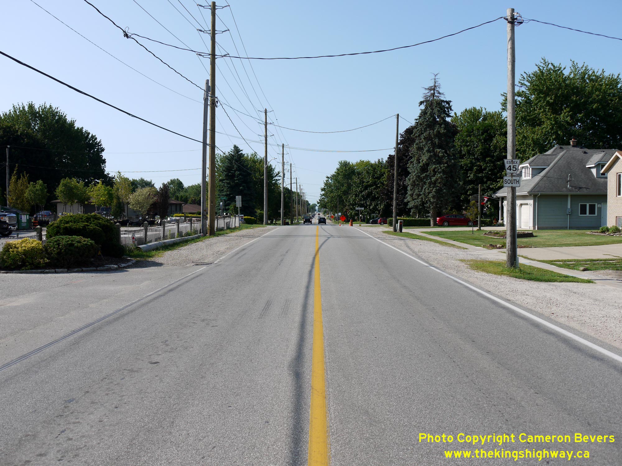
Left - Facing north along Old Hwy 3 at the northern entrance to Ruthven. See an
Enlarged Photo Here. (Photograph taken on August 2, 2019 - © Cameron Bevers) Right - View of the historical junction of Hwy 3 & Hwy 107 at Ruthven, facing south. Between 1937 and 1970, Union Avenue (Essex County Road 45) located straight ahead was a provincially-maintained highway. The route was originally known as Hwy 18B, but it was renumbered as Hwy 107 in 1953. It was one of the shortest King's Highways in the Ontario provincial highway system, with an official length of only 1 mile (1.6 km). The route of Hwy 107 came to an end at Hwy 18, which lies a short distance to the south. Provincial jurisdiction over Hwy 107 ended in June 1970, when ownership of the highway was transferred over to the County of Essex. The route of Hwy 3 turned left at this intersection and resumed its route east towards Leamington up until 1999. A handful of MTO guide signs still stand at this highway junction. See an Enlarged Photo Here. (Photograph taken on August 2, 2019 - © Cameron Bevers) 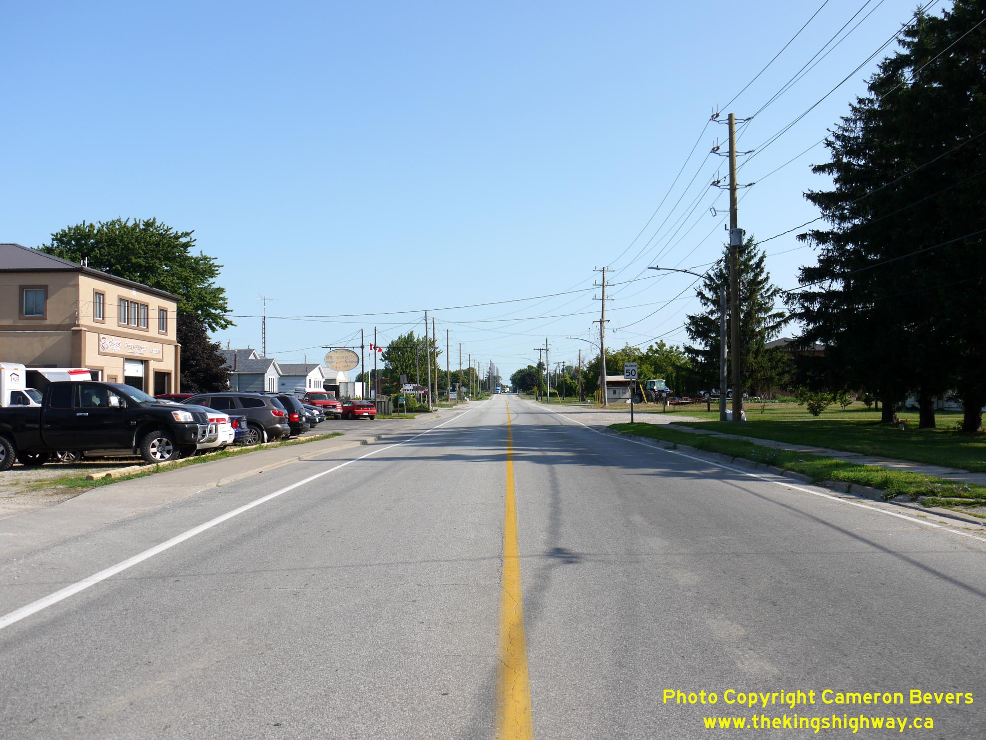
Left - Facing north along Old Hwy 3 from the Former Hwy 107 Junction at Ruthven. See an
Enlarged Photo Here. (Photograph taken on August 2, 2019 - © Cameron Bevers) Right - View of Union Avenue (Former Hwy 107) from the Old Hwy 3 Junction at Ruthven, facing south. Union Avenue very briefly became a section of Hwy 18 in 1997, when the extreme eastern leg of Hwy 18 via Seacliff and Leamington was transferred or "downloaded" to the County of Essex. The route of Hwy 18 temporarily followed Union Avenue before jurisdiction over the remainder of Hwy 18 was transferred from the province to the County of Essex on January 1, 1998. See an Enlarged Photo Here. (Photograph taken on August 2, 2019 - © Cameron Bevers) 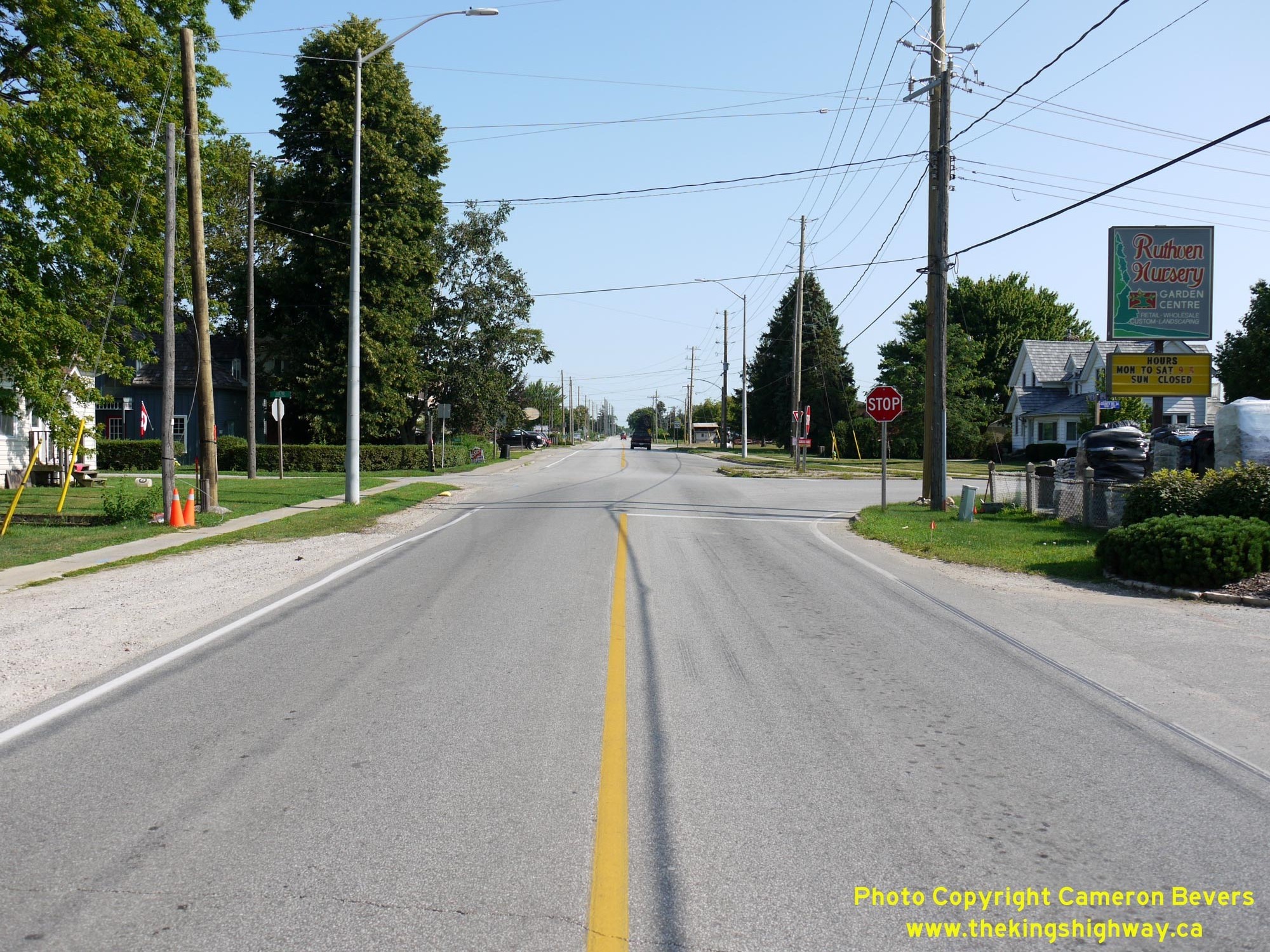
Left - View of the northern terminus of Former Hwy 107 at Ruthven. Since Hwy 3 was considered to be the "through highway" at this intersection, northbound
traffic on Hwy 107 was under Stop-control and had to yield to all traffic approaching on Hwy 3 from the north. Interestingly, this legacy right-of-way control was
left in place even after jurisdiction of Old Hwy 3 was transferred from the province to the County of Essex after the completion of the Leamington Bypass. See an
Enlarged Photo Here. (Photograph taken on August 2, 2019 - © Cameron Bevers) Right - Facing west towards the Former Hwy 107 Junction at Union Avenue on Old Hwy 3 at Ruthven. Prior to 1999, Hwy 3 turned to the right at this intersection and briefly headed north towards Olinda. At the Hwy 3 New Junction (Cottam Bypass), Hwy 3 turned left and resumed its route west towards Windsor. See an Enlarged Photo Here. (Photograph taken on August 2, 2019 - © Cameron Bevers) 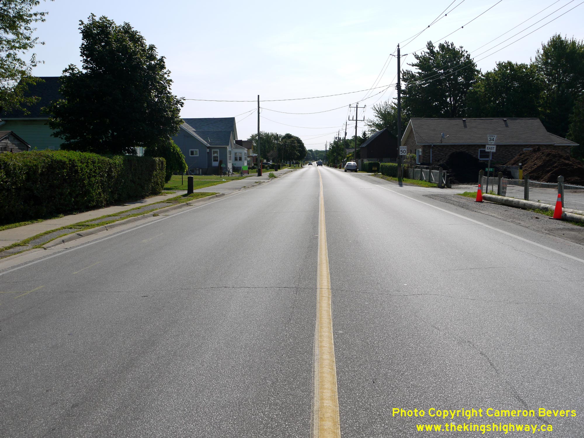

Left - Facing east along Old Hwy 3 towards Leamington from the Former Hwy 107 Junction at Ruthven. See an
Enlarged Photo Here. (Photograph taken on August 2, 2019 - © Cameron Bevers) Right - Distance guide sign on Old Hwy 3 between Ruthven and Leamington. See an Enlarged Photo Here. (Photograph taken on August 2, 2019 - © Cameron Bevers) 

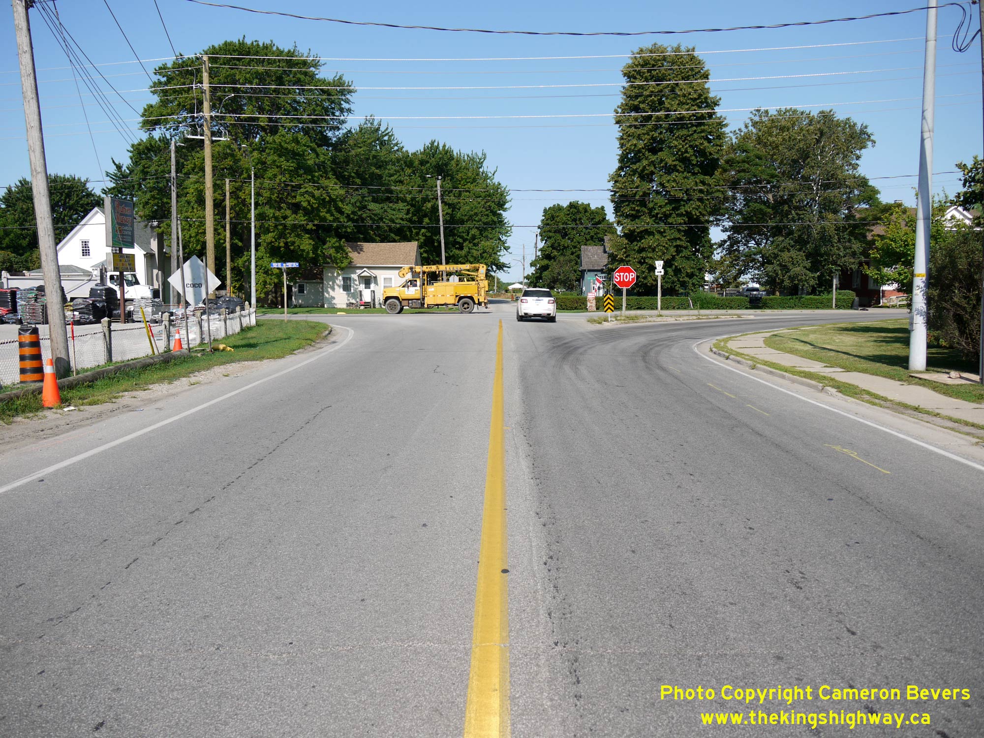
Left - Facing west along Old Hwy 3 approaching the eastern entrance to Ruthven. A freshly-laid section of hot-mix asphalt pavement was constructed here just
before this photo was taken in 2019. The section of Hwy 3 between Olinda and Leamington via Ruthven was the final section of the Windsor-Leamington Provincial Highway
paved during the 1920s. About 5 miles of concrete pavement was constructed in 1926 under Department of Public Highways of Ontario (DPHO) Contract #1292. With the
completion of this construction contract in late 1926, motorists could travel between Windsor and Leamington on a hard-surfaced highway. See an
Enlarged Photo Here. (Photograph taken on August 2, 2019 - © Cameron Bevers) Right - Departing from Leamington on Old Hwy 3, facing west towards Ruthven. Like many of Ontario's former highways in Essex County, there is considerable roadside development along Old Hwy 3. Even though the community of Ruthven is located with the limits of the Town of Kingsville, there is really no discernible break between Leamington and Ruthven due to all the roadside development. Having numerous access points along highways introduces undesirable traffic conflict points and can greatly reduce the efficiency of a highway's operation. It is little wonder that MTO sought to bypass this section of Old Hwy 3 with a new Controlled-Access Highway route for Hwy 3 through this area. See an Enlarged Photo Here. (Photograph taken on August 2, 2019 - © Cameron Bevers) 

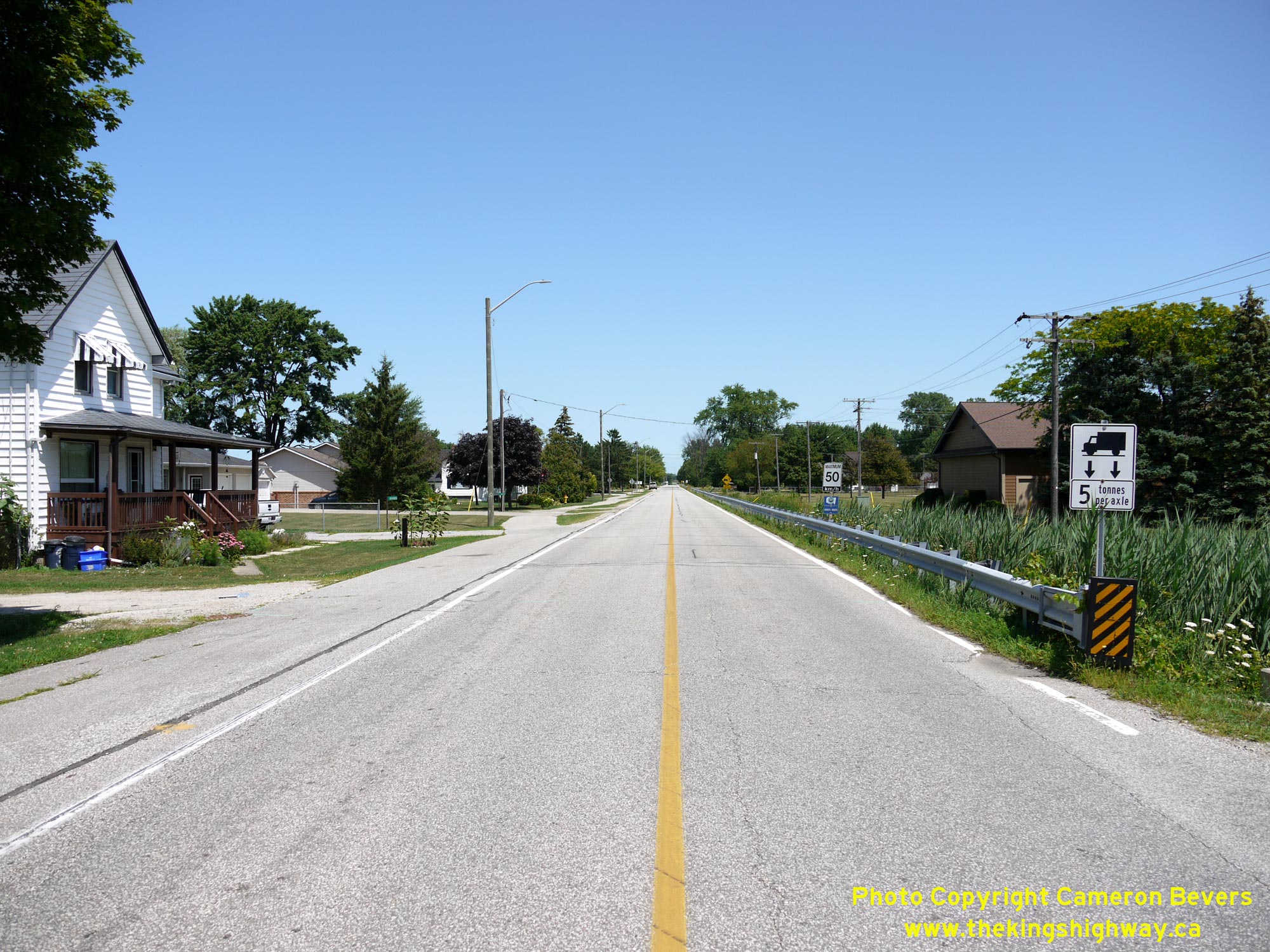
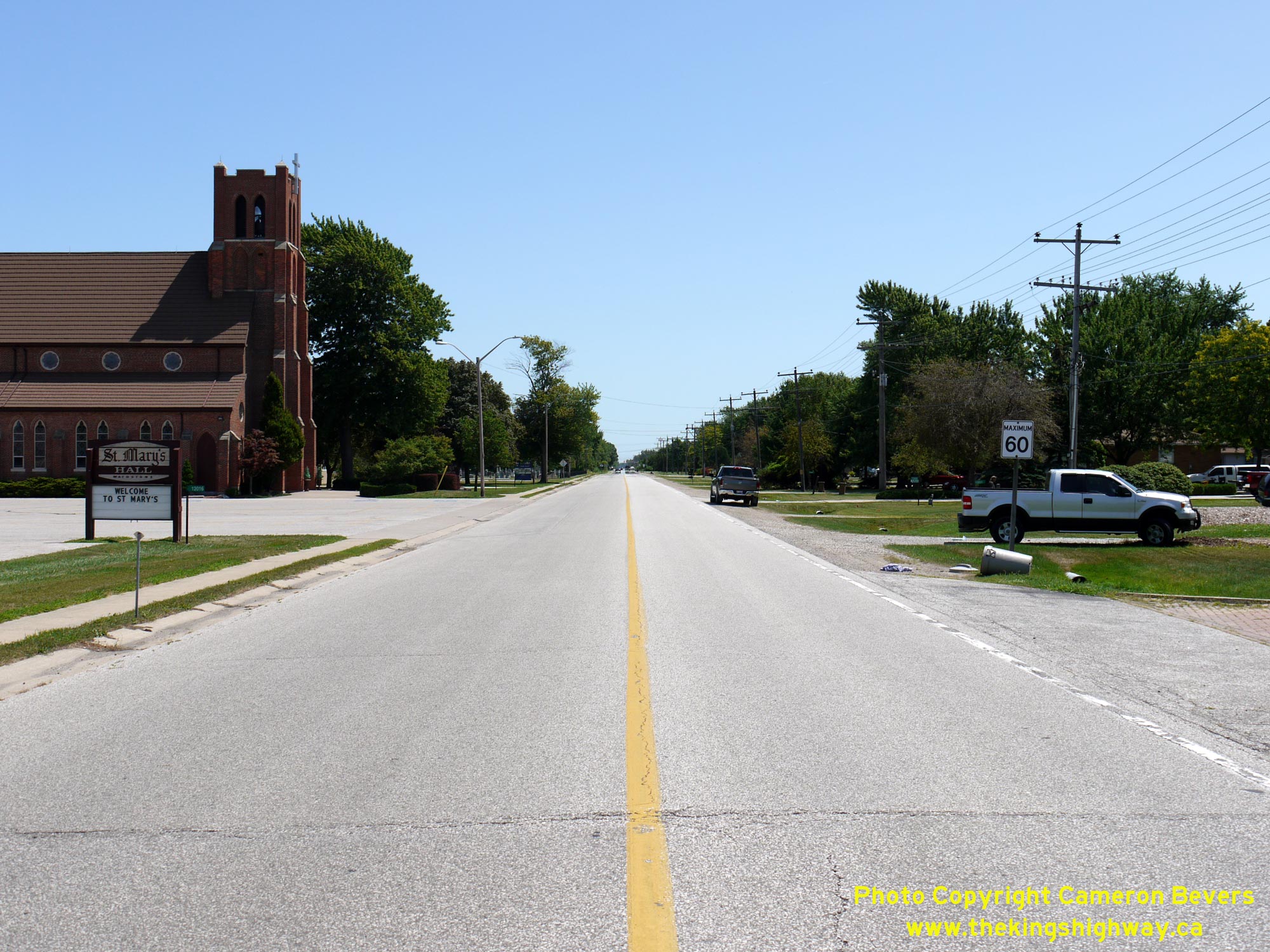
Left - Distance guide sign on Talbot Street (Old Hwy 3) facing west near Armstrong Drive in Leamington. Here, a two-way centre left-turn lane was constructed
to better manage the various turning conflicts at these commercial driveways and accesses. See an
Enlarged Photo Here. (Photograph taken on August 2, 2019 - © Cameron Bevers) Right - This scenic tree-lined section of Talbot Street (Old Hwy 3) near Chestnut Street greets motorists as they enter Downtown Leamington from the west. See an Enlarged Photo Here. (Photograph taken on August 2, 2019 - © Cameron Bevers) 

Left - Approaching Downtown Leamington on Talbot Street (Old Hwy 3) facing east near Chestnut Street. See an
Enlarged Photo Here. (Photograph taken on August 2, 2019 - © Cameron Bevers) Right - Facing west along Talbot Street (Old Hwy 3) from Lutsch Avenue towards Downtown Leamington. See an Enlarged Photo Here. (Photograph taken on August 2, 2019 - © Cameron Bevers) |
|---|
Links to Adjacent King's Highway Photograph Pages:
Back to King's Highway 3 Photos /
King's Highway 3 History /
On to King's Highway 4 Photos
Ontario Highway History - Main Menu / Back to List of Highways Website contents, photos & text © 2002-2026, Cameron
Bevers (Webmaster) - All Rights Reserved / Contact Me
|
|---|