
| 
| |
|
|
This page contains historical photos of Ontario's King's Highway 5 dating from 1919 to 1999. All photographs displayed on
this page were taken by the Ontario Ministry of Transportation, unless specifically noted otherwise. Historical photographs are arranged in approximate chronological
order. Click on any thumbnail to see a larger image!
Please note that all photographs displayed on this
website are protected by copyright. These photographs must not be reproduced, published,
electronically stored or copied, distributed, or posted onto other websites without
my written permission. If you want to use photos from this website, please
email me first for permission. Thank-you!
|
|---|
|
Page 1: Historical King's Highway 5 Photographs (1919-1999)

Above - Facing east across the new Bloor Street Viaduct in Toronto. See an
Enlarged Photo Here. Photo taken on July 14, 1919. (Photo Courtesy of John Bromley) 

Left - Section of new asphaltic concrete pavement on Hwy 5 near Tansley in 1923. A 24-mile section of Hwy 5 was paved with an asphaltic concrete surface
between the Hwy 10 Junction at Cooksville and the Hwy 6 Junction at Clappison's Corners during 1923. This ambitious pavement construction project completed a second
paved highway route between Toronto and Hamilton (via Dundas Street), which complemented the existing Toronto-Hamilton Highway via the Lakeshore Road (Hwy 2). See an
Enlarged Photo Here. (Photo courtesy of Ontario Ministry of Transportation - © King's Printer for Ontario, 1923) Right - Newly-completed Canadian National Railway (CNR) Subway on Hwy 5 (Danforth Avenue) at the eastern entrance to Toronto in 1925. The railway subway shown here was completed in 1924 and the subway approaches were paved with an asphaltic concrete surface in 1925. This project completed a new eastern approach to the City of Toronto, which allowed motorists to easily connect to the Trans-Provincial Highway (Hwy 2) from the city centre via either Danforth Avenue or Kingston Road. See an Enlarged Photo Here. (Photo courtesy of Ontario Ministry of Transportation - © King's Printer for Ontario, 1925) 

Left - Newly-completed Humber River Bridge on Hwy 5 (Bloor Street) at the western entrance to the City of Toronto (1924). (Photo courtesy of Ontario Ministry of Transportation - © King's Printer for Ontario, 1924) Right - Postcard view of the Bloor Street Viaduct on Hwy 5 in Toronto in 1928. Automobile registration in Ontario more than tripled between the years 1919 and 1928. The sudden rise in the popularity of the automobile during the 1920s created a noticeable increase in traffic volumes on all of Ontario's highways, but the increase was especially pronounced on highways near major cities such as Toronto. Compare the traffic volumes on Hwy 5 in the 1928 photo of the Bloor Street Viaduct with the photo shown at the top of this page, which was taken nine years earlier. The abrupt increase in automobile ownership during the 1920s and 1930s put considerable strain on Toronto's major arterial streets, since local traffic was mixed with long distance through traffic heading across the province. It was not until the completion of the Toronto Bypass (Hwy 401) in the 1950s that motorists had a feasible alternate route to Toronto's busy arterial streets. See an Enlarged Photo Here. Photo taken in 1928. (Photo Courtesy of the Valentine-Black Publishing Co.) 
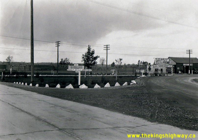
Above - Circa 1928 view of the Hwy 5 & Hwy 10 Junction (Dundas Street and Hurontario Street) at Cooksville, north of Port Credit. This fantastic photo from
the late 1920s shows the junction of these two important Provincial Highways just west of Toronto. In the early days of Ontario's highway system, virtually all
traffic headed to Southwestern Ontario from Toronto flowed through this highway junction. Before construction of superhighways such as the Queen Elizabeth Way and
Hwy 401, the "Dundas Highway" (Hwy 5) was the preferred route to the west for many motorists. Not only was this route very direct, but it also served as a convenient
bypass for the numerous villages and towns along Lake Ontario's northern shoreline, where through traffic was regularly snarled along the old Toronto-Hamilton Highway
(Hwy 2). It wasn't long before enterprising individuals built services such as gas stations and restaurants at Cooksville to cater to the burgeoning clientele of
motorists who passed through this important highway junction. As a footnote to other historical researchers, the original print of this photo at Archives of Ontario
was marked as being circa 1919. Based on the Provincial Highway signs visible in the photo and other improvements made to the highway, it must date between 1925 and
1930. I have dated the photo to approximately 1928. Although not noted on the photo, I believe that this view is facing east along Hwy 5 from Cooksville towards
Toronto. See an Enlarged Photo Here. (Photo © Archives of Ontario - Series RG-14-162-2-64, Box B982) 
Left - New Summerville Bridge on Hwy 5 over Etobicoke Creek, shown shortly after completion in 1929. This interesting structure was built under Contract
#1929-35, with a six-foot removable sidewalk on each side of the 30-foot roadway. The structure was designed this way so that the sidewalks could be relocated to the
outside of the structure in the event that there was a need to widen Hwy 5 to a pavement width of 42 feet in the future. This turned out to be a very prudent and
forward-thinking design decision by the Department of Highways, as the Summerville Bridge was expanded during a highway improvement project just over 20 years later,
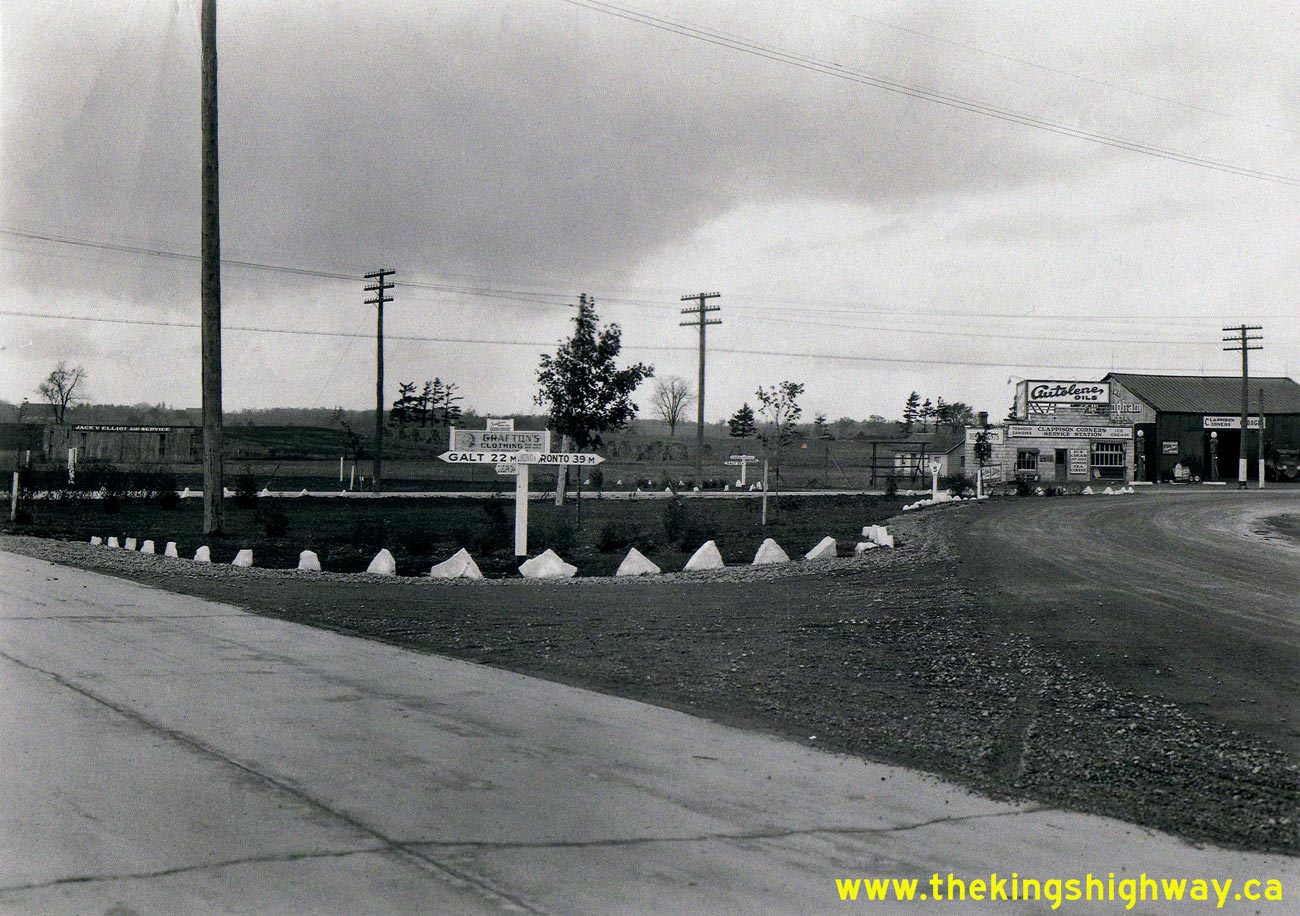
in 1951. See an Enlarged Photo Here. (Photo courtesy of Ontario Ministry of Transportation - © King's Printer for Ontario, 1929) Right - Circa 1930 view of the fingerboard direction signs at the Hwy 5 & Hwy 6 Junction at Clappison's Corners. This photo of Clappison's Corners shows the intersection as it appeared circa 1930. Originally, the Hwy 5 & Hwy 6 Junction was more of a directional "Y" intersection than a proper crossroads. The "Y" favoured the predominant movement between Hamilton and Toronto, as most traffic turned east towards Toronto along Hwy 5 after ascending the Clappison Cut on Hwy 6 from Hamilton. The completion of the new Middle Road Highway (Queen Elizabeth Way) between Toronto and Burlington in 1937 dramatically changed traffic patterns in this area. Since most long-distance through traffic began using the new superhighway, the intersection at Clappison's Corners no longer served the prevailing traffic patterns. Accordingly, the Hwy 5 & Hwy 6 Junction was fully rebuilt in 1951, creating a more conventional four-leg intersection. See an Enlarged Photo Here. (Photo © Archives of Ontario - Series RG-14-162-2-27, Box B984, Photo #19) 
Above - Old St. George Subway on Hwy 5 prior to reconstruction in 1932. (Photo courtesy of Ontario Ministry of Transportation - © King's Printer for Ontario, 1932) 
Above - New St. George Subway on Hwy 5 after completion in 1932. (Photo courtesy of Ontario Ministry of Transportation - © King's Printer for Ontario, 1932) 

Left - Artistic rendering from 1937 of the proposed grade-separated interchange at the Hwy 2 & Hwy 5 Junction located just east of Toronto. This new
interchange replaced a badly-skewed intersection where Hwy 5 (Danforth Avenue) joined Kingston Road (Hwy 2) at the cenotaph in Scarborough Township. The new
interchange was built in 1937-1938 as part of a series of major upgrades to Hwy 2 on the eastern approach to Toronto. The new interchange efficiently distributed
traffic approaching Toronto on Hwy 2 from the east onto the city's arterial road network without the need for any traffic signals. Arthur N. Martin was credited as
the creator of this artistic rendering of the Cenotaph Interchange at the Hwy 2 & Hwy 5 Junction. See an
Enlarged Photo Here. (Photo courtesy of Ontario Ministry of Transportation - © King's Printer for Ontario, 1937) Right - New grade separation at the junction of Hwy 2 & Hwy 5 east of Toronto in 1939. The Cenotaph Interchange was constructed under Contract #1937-116 and completed in 1938. It was the first grade-separated interchange built along the King's Highways east of Toronto and was also the first to have directional ramps, as opposed to a more traditional cloverleaf ramp layout. See an Enlarged Photo Here. Photo taken on November 7, 1939. (Photo courtesy of Ontario Ministry of Transportation - © King's Printer for Ontario, 1939) 

Left - Day view of the Cenotaph Interchange at the junction of Hwy 2 & Hwy 5 east of Toronto. See an
Enlarged Photo Here. Photo taken on September 20, 1939. (Photo courtesy of Ontario Ministry of Transportation - © King's Printer for Ontario, 1939) Right - Night view of the Cenotaph Interchange at the junction of Hwy 2 & Hwy 5, showing the newly-installed highway lighting system. See an Enlarged Photo Here. Photo taken on December 5, 1939. (Photo courtesy of Ontario Ministry of Transportation - © King's Printer for Ontario, 1939) 
Above - Night view of the illuminated Cenotaph Interchange at the junction of Hwy 2 & Hwy 5 in Scarborough Township, facing west towards Toronto. While highway
illumination is a ubiquitous road feature today, there was a time where lighting was an uncommon sight out on our highways. This was one of the first instances where
a highway illumination system was installed at a rural King's Highway junction. See an
Enlarged Photo Here. Photo taken on December 5, 1939. (Photo courtesy of Ontario Ministry of Transportation - © King's Printer for Ontario, 1939) 

Left - Intersection of Hwy 5 (Bloor Street) at Kingsway at the western entrance to Toronto in 1947, showing afternoon rush hour traffic at 4:45 pm. This
interesting photo shows the changing landscape of Toronto's suburbs in Etobicoke Township shortly after World War II. When Hwy 5 was first established in the 1920s,
the province maintained jurisdiction over Hwy 5 all the way to Jane Street, located just east of the Humber River Bridge. As Toronto's suburbs expanded westwards
during the 1930s and 1940s, Hwy 5 ceased to operate as an efficient long-distance through highway within Etobicoke Township and became just another urbanized street.
The Department of Highways of Ontario (DHO) ultimately relinquished its jurisdiction over Hwy 5 through most of Etobicoke in 1954, shortly after the City of
Metropolitan Toronto was created. See an Enlarged Photo Here. Photo taken on June 4, 1947. (Photo courtesy of Ontario Ministry of Transportation - © King's Printer for Ontario, 1947) Right - Nighttime view of the intersection of Hwy 5 (Bloor Street) at Kingsway in Etobicoke Township in 1947. The DHO used this long-exposure photo to identify overnight traffic patterns at this awkward intersection as part of a traffic study. This was certainly an innovative way of capturing the prevailing traffic movements at off-peak times! See an Enlarged Photo Here. Photo taken on June 4, 1947. (Photo courtesy of Ontario Ministry of Transportation - © King's Printer for Ontario, 1947) 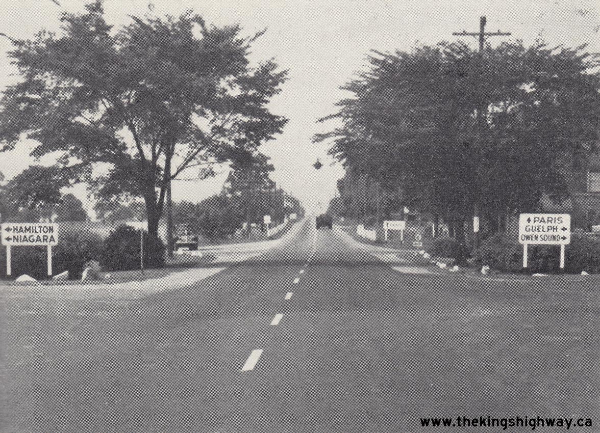

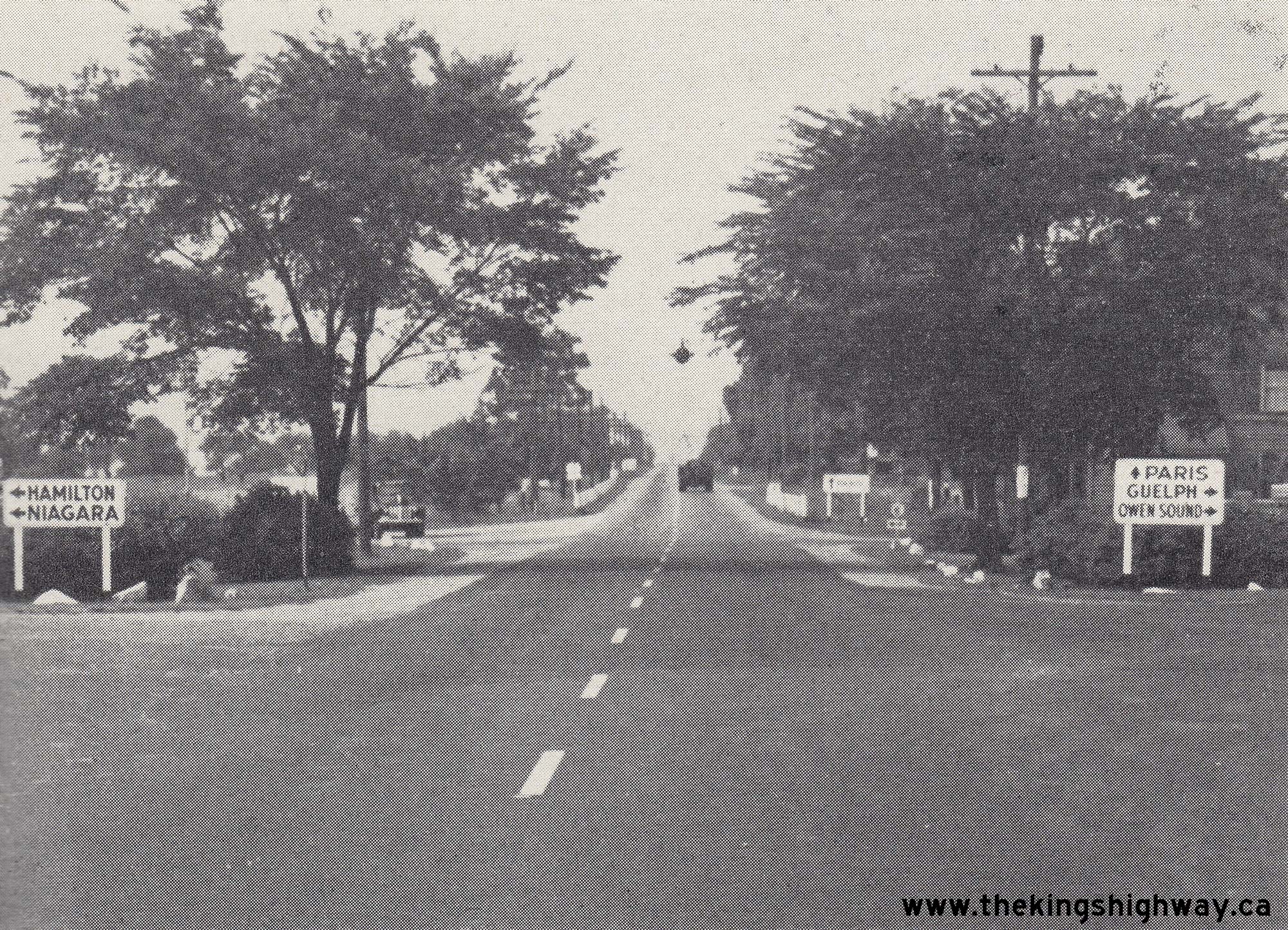
Left - Junction of Hwy 5 & Hwy 6 at Clappison's Corners in 1948, facing west. Note the new large-size destination guide signs approaching the junction.
Once only seen along the Queen Elizabeth Way, these types of destination guide signs were introduced at all major highway junctions beginning in the late 1940s.
Previously, Ontario's highway junctions were marked with so-called "totem pole" signposts, where small fingerboard signs pointed the way to various destinations. The
small text on these fingerboard signs was very difficult to read at a distance and the number of destinations signed at highway junctions often exceeded the amount of
information a motorist could process at critical highway decision points. The development of these larger-sized signs allowed motorists to see highway junctions well
in advance and plan their route accordingly. It proved to be a significant step by the DHO to improve traffic safety at major highway junctions. It is also
interesting to note that Hwy 5 is actually the "through highway" at this junction. Traffic on Hwy 6 had to stop and yield the right-of-way to traffic on Hwy 5. At the
time, Hwy 5 was actually the busier of the two highways, a trend which has reversed rather dramatically since World War II. See an
Enlarged Photo Here. Photo taken on July 21, 1948. (Photo courtesy of Ontario Ministry of Transportation - © King's Printer for Ontario, 1948) Right - Resurfaced section of Hwy 5 showing new zone striping and roadside plantings, 2 1/2 miles west of Clappison's Corners. See an Enlarged Photo Here. Photo taken on November 4, 1955. (Photo courtesy of Ontario Ministry of Transportation - © King's Printer for Ontario, 1955) 
Above - View of the reconstruction of the Hwy 5 & Hwy 8 Junction at Peters Corners west of Dundas, Contract #1955-30. See an
Enlarged Photo Here. Photo taken on November 4, 1955. (Photo courtesy of Ontario Ministry of Transportation - © King's Printer for Ontario, 1955) 

Left - Curb construction for an expansion of Hwy 5 at Cooksville (now part of Mississauga) in 1958. See an
Enlarged Photo Here. (Photo courtesy of Ontario Ministry of Transportation - © King's Printer for Ontario, 1958) Right - New Canadian Pacific Railway (CPR) Overhead under construction on Hwy 5 at Cooksville in 1958. See an Enlarged Photo Here. (Photo courtesy of Ontario Ministry of Transportation - © King's Printer for Ontario, 1958) 

Left - Facing west along Hwy 5 towards Peters Corners at the Spencer Creek Bridge. Photo taken in July 1959. (Photo courtesy of Ontario Ministry of Transportation - © King's Printer for Ontario, 2013) Right - Spencer Creek Bridge on Hwy 5, just east of Peters Corners. Photo taken in July 1959. (Photo courtesy of Ontario Ministry of Transportation - © King's Printer for Ontario, 2013) 

Left - Facing east along Hwy 5 (Dundas Street) at the Hwy 27 Interchange in Toronto in 1971. Note the overhead sign in the background, which was
changed from Hwy 27 to Hwy 427 shortly after this photo was taken. The reconstructed freeway section of Hwy 27 through Toronto was renumbered as Hwy 427 in
early 1972. Photo taken on November 23, 1971. (Photo courtesy of Ontario Ministry of Transportation - © King's Printer for Ontario, 2012) Right - Facing south along Southbound Hwy 27 towards the Queen Elizabeth Way from the Hwy 5 (Dundas Street) Interchange in Toronto. Photo taken on November 23, 1971. (Photo courtesy of Ontario Ministry of Transportation - © King's Printer for Ontario, 2012) 

Left - Facing south along Northbound Hwy 27 towards the Queen Elizabeth Way from Hwy 5 (Dundas Street) in Toronto. Photo taken on November 23, 1971. (Photo courtesy of Ontario Ministry of Transportation - © King's Printer for Ontario, 2012) Right - Facing east along Hwy 5 towards Waterdown at the Spencer Creek Bridge east of Peters Corners. Photo taken on November 15, 1977. See an Enlarged Photo Here. (Photo courtesy of Ontario Ministry of Transportation - © King's Printer for Ontario, 2013) 

Left - Spencer Creek Bridge on Hwy 5, just east of Peters Corners. Photo taken on November 15, 1977. (Photo courtesy of Ontario Ministry of Transportation - © King's Printer for Ontario, 2013) Right - Close-up view of the handrail design on the Spencer Creek Bridge on Hwy 5. This railing was installed during the widening of the Spencer Creek Bridge in the 1950s. The Spencer Creek Bridge was originally built in the 1920s by Wentworth County before the road was assumed by the province as Hwy 5. The original bridge was too narrow for two-way traffic to use, so the bridge was widened in 1954 to provide for an increased roadway width. Photo taken on November 15, 1977. (Photo courtesy of Ontario Ministry of Transportation - © King's Printer for Ontario, 2013) 

Left - Pier construction for the expansion of the Tansley Bridge on Hwy 5 in Burlington in 1978, Contract #1978-31. See an
Enlarged Photo Here. (Photo courtesy of Ontario Ministry of Transportation - © King's Printer for Ontario, 1978) Right - Expansion of the Tansley Bridge on Hwy 5 in Burlington in 1979, Contract #1978-31. See an Enlarged Photo Here. (Photo courtesy of Ontario Ministry of Transportation - © King's Printer for Ontario, 1979) 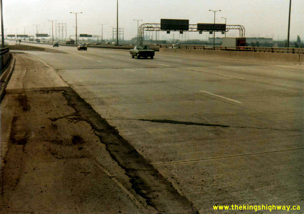

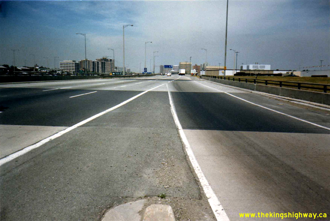
Left - Facing south towards the Queen Elizabeth Way along the northbound Hwy 427 Collector Lanes from the Hwy 5 (Dundas Street) Underpass (Site #37-865) in
1980. During the construction of the complex freeway in the late 1960s, a rigid concrete pavement was laid along Hwy 427. Over the years, an asphalt overlay was
constructed over the original concrete surface in order to create a composite pavement structure. This section of the concrete was topped up with hot-mix asphalt
during a highway rehabilitation project in 2013-2014, under Contract #2011-2042. See an
Enlarged Photo Here. Photo taken on August 27, 1980. (Photo courtesy of Ontario Ministry of Transportation - © King's Printer for Ontario, 2012) Right - View of the Hwy 5 (Dundas Street) Interchange on Hwy 427 in Toronto, facing west towards Mississauga. See an Enlarged Photo Here. Photo taken on August 27, 1980. (Photo courtesy of Ontario Ministry of Transportation - © King's Printer for Ontario, 2012) 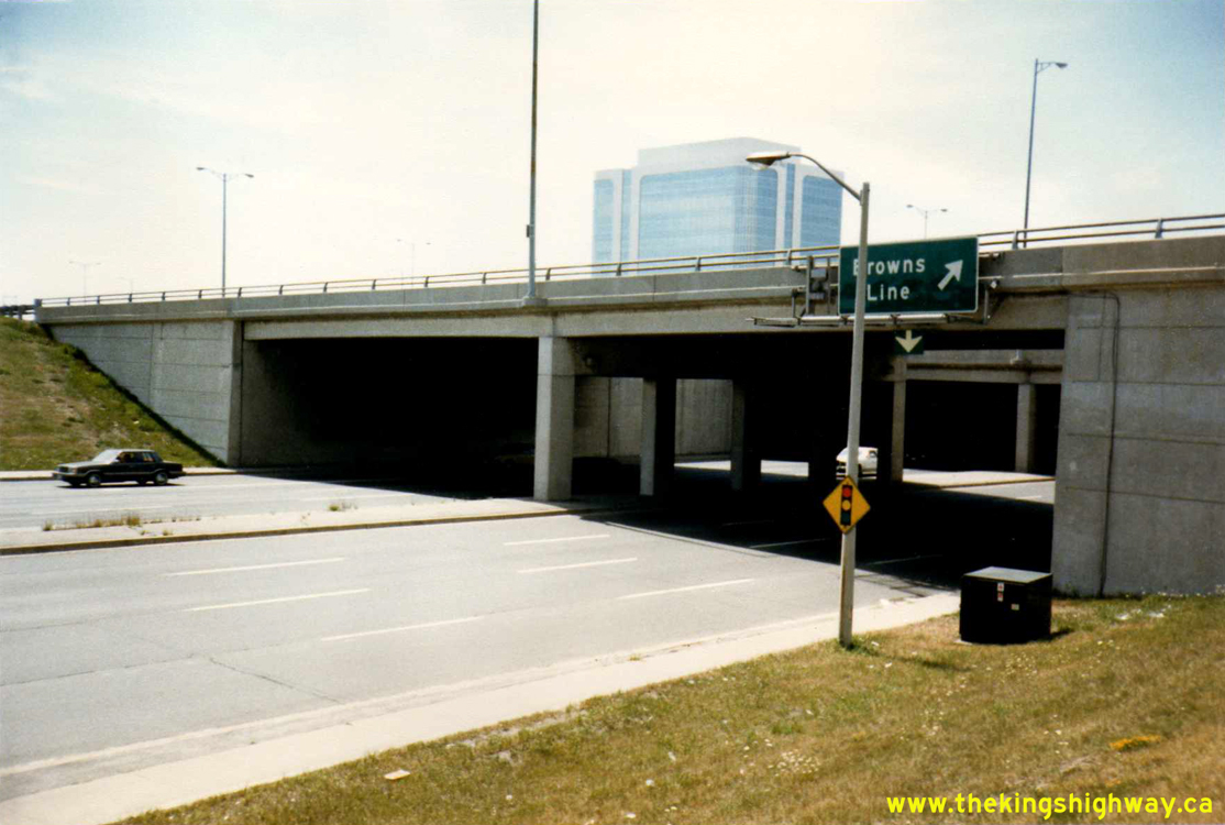
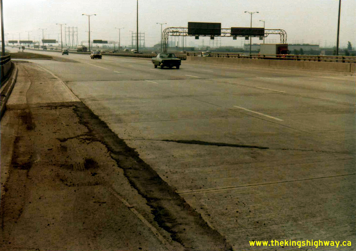
Left - Eastern side of the Hwy 5 (Dundas Street) Underpass (Site #37-865) on Hwy 427 in Toronto. See an
Enlarged Photo Here. Photo taken on August 9, 1985. (Photo courtesy of Ontario Ministry of Transportation - © King's Printer for Ontario, 2026) Right - View of the northbound Hwy 427 Collector Lanes facing north at the Hwy 5 (Dundas Street) Interchange. See an Enlarged Photo Here. Photo taken on August 9, 1985. (Photo courtesy of Ontario Ministry of Transportation - © King's Printer for Ontario, 2026) 

Left - Facing north along Hwy 427 towards Hwy 5 (Dundas Street) from North Queen Street in Toronto. See an
Enlarged Photo Here. Photo taken on August 20, 1991. (Photo courtesy of Ontario Ministry of Transportation - © King's Printer for Ontario, 2014) Right - Facing south along Hwy 427 at the Hwy 5 (Dundas Street) Underpass in Toronto. See an Enlarged Photo Here. Photo taken on August 27, 1996. (Photo courtesy of Ontario Ministry of Transportation - © King's Printer for Ontario, 2014) 

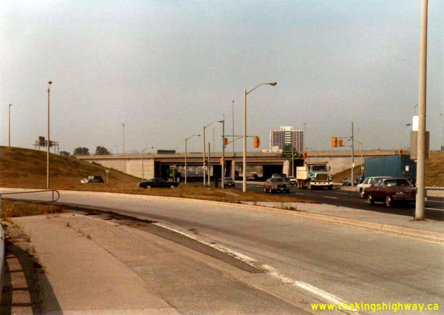
Left - Facing north along Hwy 427 from the Hwy 5 (Dundas Street) Interchange in Toronto. See an
Enlarged Photo Here. Photo taken on October 8, 1997. (Photo courtesy of Ontario Ministry of Transportation - © King's Printer for Ontario, 2014) Right - Facing east along Hwy 5 (Dundas Street) towards the Hwy 427 Interchange in Toronto. See an Enlarged Photo Here. Photo taken on September 22, 1998. (Photo courtesy of Ontario Ministry of Transportation - © King's Printer for Ontario, 2014)
Continue on to King's Highway 5 Present Day Photos: Paris to Waterdown
|
|---|
Links to Adjacent King's Highway Photograph Pages:
Back to King's Highway 4 Photos /
King's Highway 5 History /
On to King's Highway 6 Photos
Ontario Highway History - Main Menu / Back to List of Highways Website contents, photos & text © 2002-2026, Cameron
Bevers (Webmaster) - All Rights Reserved / Contact Me
|
|---|