
| 
|  |
|
|
This page contains historical and present day photos of Ontario's King's Highway 75. All photographs displayed on this page
were taken by the Webmaster (Cameron Bevers), unless specifically noted otherwise. Historical photographs are arranged in approximate chronological order, while
present day photographs (Year 2000 to date) are arranged by location from south to north. Click on any thumbnail to see a larger image!
Please note that all photographs displayed on this
website are protected by copyright. These photographs must not be reproduced, published,
electronically stored or copied, distributed, or posted onto other websites without
my written permission. If you want to use photos from this website, please
email me first for permission. Thank-you!
|
|---|
|
Present Day King's Highway 75 (#1) Photographs

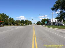
Left - Facing west along Hwy 3 from Currie Road (Former Hwy 75) in Wallacetown. The old verandaed false-fronted store at left really adds to the rural,
yesteryear charm of this section of Hwy 3. Many of the once-important King's Highways through Southwestern Ontario such as Hwy 2, Hwy 3, Hwy 7 and Hwy 22 have fallen
out of favour with motorists, due to the construction of newer, high-speed 400-Series Highways. Those seeking a more leisurely pace will find Hwy 3 from St. Thomas to
Blenheim to be a very pleasant alternate route to Hwy 401. See an Enlarged Photo Here. (Photograph taken on September 13, 2010 - © Cameron Bevers) Right - Approaching Currie Road (Former Hwy 75) on Hwy 3 at Wallacetown, facing east towards St. Thomas. See an Enlarged Photo Here. (Photograph taken on September 13, 2010 - © Cameron Bevers) 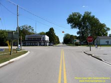
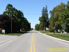
Left - Approaching the historical southern terminus of Hwy 75 at the Hwy 3 Junction at Wallacetown. See an
Enlarged Photo Here. (Photograph taken on September 13, 2010 - © Cameron Bevers) Right - Facing north along Currie Road (Former Hwy 75) from the Hwy 3 Junction at Wallacetown. The DHO assumed ownership of Currie Road between Wallacetown and Dutton in August, 1936. The new highway to Dutton was designated as Hwy 75. This short route was about 4 miles in length and it remained in service for over two decades. Jurisdiction over Hwy 75 was transferred from the province to Elgin County in December, 1957. Former Hwy 75 was subsequently renamed as Elgin County Road 8. See an Enlarged Photo Here. (Photograph taken on September 13, 2010 - © Cameron Bevers) 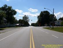
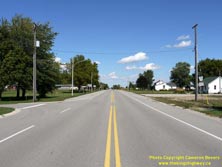
Left - Facing west along Hwy 3 towards Blenheim approaching Currie Road (Former Hwy 75) at Wallacetown. See an
Enlarged Photo Here. (Photograph taken on September 13, 2010 - © Cameron Bevers) Right - Facing east along Hwy 3 towards St. Thomas from Currie Road (Former Hwy 75) at Wallacetown. See an Enlarged Photo Here. (Photograph taken on September 13, 2010 - © Cameron Bevers)
More King's Highway 75 (#1) Photographs Coming Soon!
|
|---|
Links to Adjacent King's Highway Photograph Pages:
Back to King's Highway 74 Photos /
King's Highway 75 (#1) History /
On to King's Highway 76 Photos
Ontario Highway History - Main Menu / Back to List of Highways Website contents, photos & text © 2002-2025, Cameron
Bevers (Webmaster) - All Rights Reserved / Contact Me |
|---|