
| 
|  |
|
|
This page contains present day photos (Year 2000 to date) of Ontario's King's Highway 7, arranged by location from Markham
easterly to Whitby. All photographs displayed on this page were taken by the Webmaster (Cameron Bevers), unless specifically noted otherwise. Click on any thumbnail
to see a larger image!
Please note that all photographs displayed on this
website are protected by copyright. These photographs must not be reproduced, published,
electronically stored or copied, distributed, or posted onto other websites without
my written permission. If you want to use photos from this website, please
email me first for permission. Thank-you!
|
|---|
|
Page 11: Present Day King's Highway 7 Photographs (Markham to Whitby)


Left - An older Hwy 7 junction assembly on Main Street at Hwy 7 in Unionville. (Photograph taken on September 30, 2007 - © Cameron Bevers) Right - Junction assembly on Eastbound Hwy 7 at the Hwy 48 Junction in Markham. (Photograph taken on September 30, 2007 - © Cameron Bevers) 

Left - Green guide signs marking the Hwy 48 Junction on Eastbound Hwy 7 in Markham. As a result of provincial highway downloading over the past two decades,
Hwy 7 is no longer a provincially-owned route through the developed parts of Markham. However, Hwy 48 through Downtown Markham was considered to be a connecting link
under municipal jurisdiction, even prior to the 1997-1998 provincial highway downloading spree. (Photograph taken on September 30, 2007 - © Cameron Bevers) Right - Green guide signs marking the Hwy 48 Junction on Westbound Hwy 7 in Markham. Although Hwy 48 was a connecting link through Markham, Hwy 7 was provincially-owned from the Hwy 48 Junction right through to the Hwy 404 Interchange in Markham up until the late 1990s. (Photograph taken on September 30, 2007 - © Cameron Bevers) 
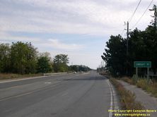
Left - Facing west along Hwy 7 towards Regional Road 69 (Ninth Line) in Markham. Until recently, this intersection marked the boundary of Markham's built-up
area on Hwy 7. With the completion of the Markham Bypass (Donald Cousens Parkway), this urban boundary is likely to change in the years to come, as more parcels of
land are opened up for development. In anticipation of this development, the Ministry of Transportation transferred the section of Hwy 7 between the Hwy 48 Junction
and Donald Cousens Parkway over to York Region in 2007. See an Enlarged Photo Here. (Photograph taken on September 30, 2007 - © Cameron Bevers) Right - Facing east along Hwy 7 near Regional Road 69 (Ninth Line) leaving Markham. This is really the first stretch of rural highway encountered along Hwy 7 since the route entered the Greater Toronto Area in Brampton, 60 km to the west. See an Enlarged Photo Here. (Photograph taken on September 30, 2007 - © Cameron Bevers) 

Left - Distance sign on Eastbound Hwy 7 leaving Markham. After traveling through the densely-urbanized Greater Toronto Area, it must come as a surprise to
motorists when they see that the next major town along Hwy 7 is almost 100 km away. Although Hwy 7 does pass through Brooklin before reaching Lindsay, Brooklin is not
signed as a control city along Hwy 7 since it is now part of Whitby. (Photograph taken on September 30, 2007 - © Cameron Bevers) Right - Facing west along Hwy 7 towards Markham approaching the Markham Bypass (Donald Cousens Parkway). This intersection now marks the official terminus of the provincially-owned section of Hwy 7 in Markham. The section of Hwy 7 through Markham from the Hwy 48 Junction to Donald Cousens Parkway was turned over to York Region in 2007. See an Enlarged Photo Here. (Photograph taken on September 30, 2007 - © Cameron Bevers) 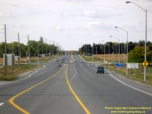
Left - Hwy 7 at the Markham Bypass (Donald Cousens Parkway), facing west. Note that trucks are directed to use the Markham Bypass to reach Hwy 48. The route of
Hwy 48 through Downtown Markham is rather narrow and therefore is not conducive to carrying long-distance truck traffic. See an
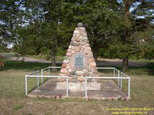
Enlarged Photo Here. (Photograph taken on September 30, 2007 - © Cameron Bevers) Right - Reesor Pioneers Monument on Hwy 7 between Markham and Locust Hill. This stone monument is located in a small roadside park just west of Locust Hill. The roadside park was created in 1930, when Hwy 7 was diverted to the south in order to correct an offset intersection at Reesor Road. See an Enlarged Photo Here. (Photograph taken on September 30, 2007 - © Cameron Bevers) 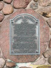
Above - Close-up of the Reesor Pioneers Monument on Hwy 7 between Markham and Locust Hill. Note the acknowledgement of land given by the Department of Highways. (Photograph taken on September 30, 2007 - © Cameron Bevers) 

Left - Facing east along Hwy 7 towards Locust Hill from Reesor Road. A small diversion was built at Reesor Road in 1930 in order to correct a problematic
offset intersection on Hwy 7. (Photograph taken on September 30, 2007 - © Cameron Bevers) Right - Facing west along Hwy 7 towards Reesor Road. Originally, Hwy 7 went straight through where the evergreen stand is located at right. An awkward offset intersection at Reesor Road was realigned in 1930 in order to create a through highway. The land lying between the old and new alignments of Hwy 7 to the east of Reesor Road was turned into a small roadside park. See an Enlarged Photo Here. (Photograph taken on September 30, 2007 - © Cameron Bevers) 

Left - Little Rouge Creek Bridge on Hwy 7 at Locust Hill, facing west towards Markham. (Photograph taken on September 30, 2007 - © Cameron Bevers) Right - The Little Rouge Creek Bridge on Hwy 7 at Locust Hill was constructed in 1967. This structure replaced a narrow bridge constructed by York County in the 1920s, before Hwy 7 was assumed as a new provincial highway between Brampton and Brooklin in 1927. (Photograph taken on September 30, 2007 - © Cameron Bevers) 

Left - Little Rouge Creek Bridge on Hwy 7 at Locust Hill, facing east towards Brooklin. (Photograph taken on September 30, 2007 - © Cameron Bevers) Right - Date stamp (1967) on the Little Rouge Creek Bridge on Hwy 7 at Locust Hill. (Photograph taken on September 30, 2007 - © Cameron Bevers) 
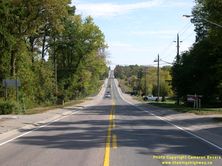
Left - Southern side of the Little Rouge Creek Bridge on Hwy 7 at Locust Hill. (Photograph taken on September 30, 2007 - © Cameron Bevers) Right - Hwy 7 at Green River, facing east towards Brooklin. See an Enlarged Photo Here. (Photograph taken on September 30, 2007 - © Cameron Bevers) 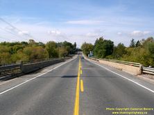
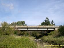
Left - West Duffins Creek Bridge on Hwy 7 at Green River, facing west towards Markham. See an
Enlarged Photo Here. (Photograph taken on September 30, 2007 - © Cameron Bevers) Right - Southern side of the West Duffins Creek Bridge on Hwy 7 at Green River. (Photograph taken on September 30, 2007 - © Cameron Bevers) 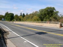
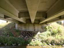
Left - The West Duffins Creek Bridge on Hwy 7 at Green River was built in the 1960s. Prior to the designation of Hwy 7 between Brampton and Brooklin in 1927,
Ontario County (now part of today's Durham Region) constructed a bridge over West Duffins Creek. The 1920s-era bridge built by Ontario County carried Hwy 7 traffic
right up until 1967, when it was replaced by the current Hwy 7 structure seen here. (Photograph taken on September 30, 2007 - © Cameron Bevers) Right - Below-deck view of the concrete beam superstructure of the West Duffins Creek Bridge on Hwy 7 at Green River. (Photograph taken on September 30, 2007 - © Cameron Bevers) 
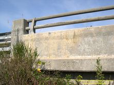
Left - Facing east along Hwy 7 towards Brooklin at the West Duffins Creek Bridge at Green River. See an
Enlarged Photo Here. (Photograph taken on September 30, 2007 - © Cameron Bevers) Right - Date stamp (1967) and structure identification number on the West Duffins Creek Bridge on Hwy 7 at Green River. (Photograph taken on September 30, 2007 - © Cameron Bevers) 

Left - Northern side of the West Duffins Creek Bridge on Hwy 7 at Green River. (Photograph taken on September 30, 2007 - © Cameron Bevers) Right - Hwy 7 at Green River, facing west towards Markham. See an Enlarged Photo Here. (Photograph taken on September 30, 2007 - © Cameron Bevers) 

Left - A hint of fall colours appears along Hwy 7 between Green River and Brougham. See an
Enlarged Photo Here. (Photograph taken on September 30, 2007 - © Cameron Bevers) Right - Facing east along Hwy 7 from Sideroad 14, between Brougham and Greenwood. This section of Hwy 7 was recently widened to 4 lanes. See an Enlarged Photo Here. (Photograph taken on September 30, 2007 - © Cameron Bevers) 

Left - Approaching Greenwood on Hwy 7, facing east. The hilltop community was bypassed by a fairly substantial diversion of Hwy 7 in the early 1930s. See an
Enlarged Photo Here. (Photograph taken on September 30, 2007 - © Cameron Bevers) Right - Start of the Greenwood Diversion on Hwy 7, facing east towards Brooklin. When this section of Hwy 7 was first assumed as a new provincial highway in 1927, the highway ran directly through the hilltop community of Greenwood. However, the steep hills leading into Greenwood proved to be very difficult for trucks to negotiate. In 1931, an improved route for Hwy 7 with reduced grades was completed around the north side of Greenwood. See an Enlarged Photo Here. (Photograph taken on September 30, 2007 - © Cameron Bevers) 
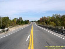
Left - Facing east along the Greenwood Diversion on Hwy 7 towards the East Duffins Creek Bridge. (Photograph taken on September 30, 2007 - © Cameron Bevers) Right - East Duffins Creek Bridge on Hwy 7 at Greenwood, facing east towards Brooklin. (Photograph taken on September 30, 2007 - © Cameron Bevers) 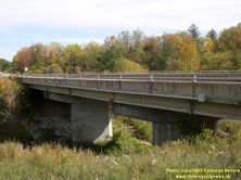
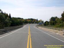
Left - Northern side of the East Duffins Creek Bridge on Hwy 7 at Greenwood. Structure completed in 1972. (Photograph taken on September 30, 2007 - © Cameron Bevers) Right - East Duffins Creek Bridge on Hwy 7 at Greenwood, facing west towards Markham. (Photograph taken on September 30, 2007 - © Cameron Bevers) 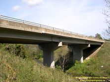

Left - Southern side of the East Duffins Creek Bridge on Hwy 7 at Greenwood. (Photograph taken on September 30, 2007 - © Cameron Bevers) Right - Date stamp (1972) and structure identification number on the East Duffins Creek Bridge at Greenwood. (Photograph taken on September 30, 2007 - © Cameron Bevers) 

Left - The current East Duffins Creek Bridge on Hwy 7 at Greenwood replaced an 84-foot single span concrete arch bridge. The old arch bridge was built by the
Department of Highways during construction of the Greenwood Diversion in 1931. The old Greenwood Bridge was the longest single-span concrete arch bridge ever built
on the King's Highway system at the time. (Photograph taken on September 30, 2007 - © Cameron Bevers) Right - Greenwood Diversion on Hwy 7, facing west towards Markham. (Photograph taken on September 30, 2007 - © Cameron Bevers) 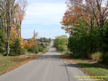
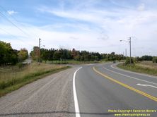
Left - Old route of Hwy 7 through Greenwood, facing east. It has been more than 80 years since through traffic on Hwy 7 last climbed this hill into Greenwood.
In the background, the former highway alignment joins the current route of Hwy 7 at the eastern end of the Greenwood Diversion. See an
Enlarged Photo Here. (Photograph taken on September 30, 2007 - © Cameron Bevers) Right - Eastern end of the Greenwood Diversion, facing west. The old route of Hwy 7 can be seen at left, while the current route of Hwy 7 can be seen at right. See an Enlarged Photo Here. (Photograph taken on September 30, 2007 - © Cameron Bevers) 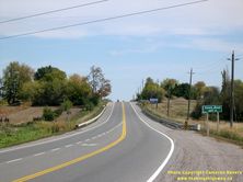
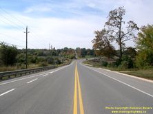
Left - Facing east along Hwy 7 towards Brooklin from the end of the Greenwood Diversion. (Photograph taken on September 30, 2007 - © Cameron Bevers) Right - Facing west along Hwy 7 towards Greenwood from Salem Road. The eastern end of the Greenwood Diversion can be seen in the background, along with the original route of Hwy 7 which continued straight through to Greenwood. The Greenwood Diversion was built in 1931 to eliminate the steep grades leading into Greenwood along the original route of Hwy 7. The section of Hwy 7 from Brougham to Brooklin has been widened to 4 lanes over the past few years. See an Enlarged Photo Here. (Photograph taken on September 30, 2007 - © Cameron Bevers)
Continue on to King's Highway 7 Photos: Whitby to Sunderland Corners
|
|---|
Links to Adjacent King's Highway Photograph Pages:
Back to King's Highway 6 Photos /
King's Highway 7 History /
On to King's Highway 8 Photos
Ontario Highway History - Main Menu / Back to List of Highways Website contents, photos & text © 2002-2025, Cameron
Bevers (Webmaster) - All Rights Reserved / Contact Me |
|---|