
| 
| |
|
|
This page contains historical and present day photos of Ontario's King's Highway 87. All photographs displayed on
this page were taken by the Webmaster (Cameron Bevers), unless specifically noted otherwise. Historical photographs are arranged in approximate chronological order,
while present day photographs (Year 2000 to date) are arranged by location from west to east. Click on any thumbnail to see a larger image!
Please note that all photographs displayed on this
website are protected by copyright. These photographs must not be reproduced, published,
electronically stored or copied, distributed, or posted onto other websites without
my written permission. If you want to use photos from this website, please
email me first for permission. Thank-you!
|
|---|
|
Historical King's Highway 87 Photographs

Above - New pavement and zone markings on Hwy 87, 3 miles west of Harriston. Photo taken on October 15, 1953. (Photo courtesy of Ontario Ministry of Transportation - © King's Printer for Ontario, 1953) 
Above - Facing east towards the new Maitland River Bridge on Hwy 87 one mile west of Harriston, Contract #1955-603. Photo taken on August 15, 1957. (Photo courtesy of Ontario Ministry of Transportation - © King's Printer for Ontario, 1957) 
Above - Circa 1980 postcard view of the Hwy 87 & Hwy 89 Junction on Elora Street (Hwy 9) in Harriston. See an
Enlarged Photo Here. (Photograph courtesy of Barry Schneider) |
|---|
|
Present Day King's Highway 87 Photographs


Left - Maitland River Bridge on Hwy 87 north of Wroxeter. This three-span concrete rigid frame structure was completed in 1952. See an
Enlarged Photo here. (Photograph taken on April 15, 2007 - © Cameron Bevers) Right - Facing west across the Maitland River Bridge on Hwy 87 north of Wroxeter. Prior to the completion of the Wroxeter Bridge in 1952, Hwy 87 crossed the Maitland River on a narrow one-lane truss bridge a short distance to the north. The new diversion across the Maitland River greatly improved the alignment of Hwy 87. The original Hwy 87 alignment was plagued by a particularly dangerous curve near Belmore Line. See an Enlarged Photo here. (Photograph taken on April 15, 2007 - © Cameron Bevers) 

Left - Steel handrail design on the Maitland River Bridge on Hwy 87 north of Wroxeter. See an
Enlarged Photo here. (Photograph taken on April 15, 2007 - © Cameron Bevers) Right - Northern side of the Maitland River Bridge on Hwy 87 north of Wroxeter. See an Enlarged Photo here. (Photograph taken on April 15, 2007 - © Cameron Bevers) 
Left - Facing east along Hwy 87 towards Harriston at the Maitland River Bridge on Hwy 87 north of Wroxeter. See an
Enlarged Photo here. (Photograph taken on April 15, 2007 - © Cameron Bevers) Right - Site of a former railway crossing on an abandoned alignment of Hwy 87 between Wroxeter and Gorrie. The route of Hwy 87 was realigned in 1948 to improve visibility at this badly skewed railway crossing. See an Enlarged Photo here. (Photograph taken on April 15, 2007 - © Cameron Bevers) 

Left - Facing west along Hwy 87 at the Gorrie Diversion. Approximately 2 km of Hwy 87 was relocated onto an improved alignment between Wroxeter and Gorrie
in 1948. See an Enlarged Photo here. (Photograph taken on April 15, 2007 - © Cameron Bevers) Right - Facing east along Hwy 87 towards the site of the former railway crossing on the current highway alignment near Gorrie. The new crossing greatly improved traffic safety, by providing motorists with improved visibility to check for approaching trains. See an Enlarged Photo here. (Photograph taken on April 15, 2007 - © Cameron Bevers) 

Left - An old culvert remains on the abandoned original route of Hwy 87 west of Gorrie. See an
Enlarged Photo here. (Photograph taken on April 15, 2007 - © Cameron Bevers) Right - This culvert bears the inscription "HURON COUNTY HIGHWAY", indicating that it was constructed prior to the Department of Highways' assumption of the Wroxeter-Harriston Road as a King's Highway in 1937. See an Enlarged Photo here. (Photograph taken on April 15, 2007 - © Cameron Bevers) 

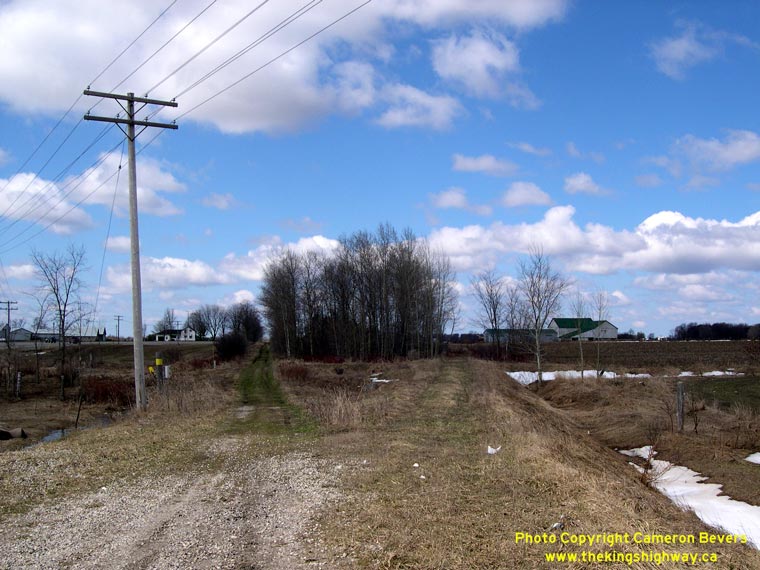
Left - Facing west along Hwy 87 towards Wroxeter, about 3 km east of Gorrie. See an
Enlarged Photo here. (Photograph taken on April 15, 2007 - © Cameron Bevers) Right - Facing west along Hwy 87 about 4 km west of Harriston. See an Enlarged Photo here. (Photograph taken on April 15, 2007 - © Cameron Bevers) 

Left - Facing east along Hwy 87 towards Harriston at the Dredge Creek Bridge. See an
Enlarged Photo here. (Photograph taken on April 15, 2007 - © Cameron Bevers) Right - Concrete bar-and-post handrail on the Dredge Creek Bridge on Hwy 87 west of Harriston. See an Enlarged Photo here. (Photograph taken on April 15, 2007 - © Cameron Bevers) 

Left - Dredge Creek Bridge on Hwy 87 about 2 km west of Harriston. This single span concrete rigid frame bridge was completed in 1956. See an
Enlarged Photo here. (Photograph taken on April 15, 2007 - © Cameron Bevers) Right - Facing west along Hwy 87 towards Wroxeter at the Dredge Creek Bridge near Harriston. See an Enlarged Photo here. (Photograph taken on April 15, 2007 - © Cameron Bevers) 

Left - Southern side of the Dredge Creek Bridge on Hwy 87 west of Harriston. This was one of two new structures built on Hwy 87 west of Harriston during 1956
and 1957. See an Enlarged Photo here. (Photograph taken on April 15, 2007 - © Cameron Bevers) Right - Northern side of the Maitland River Bridge on Hwy 87 west of Harriston. See an Enlarged Photo here. (Photograph taken on April 15, 2007 - © Cameron Bevers) 

Left - Facing west along Hwy 87 towards Wroxeter at the Maitland River Bridge. See an
Enlarged Photo here. (Photograph taken on April 15, 2007 - © Cameron Bevers) Right - Maitland River Bridge on Hwy 87 west of Harriston. See an Enlarged Photo here. (Photograph taken on April 15, 2007 - © Cameron Bevers) 

Left - Southern side of the Maitland River Bridge on Hwy 87. Structure completed in 1957. See an
Enlarged Photo here. (Photograph taken on April 15, 2007 - © Cameron Bevers) Right - Close-up of the steel rigid frame span across the Maitland River on Hwy 87. This bridge design was seldom used in Ontario. In the late 1950s and early 1960s, a small number of these structures were completed on Ontario's Highways, including this fine example near Harriston. See an Enlarged Photo here. (Photograph taken on April 15, 2007 - © Cameron Bevers) 

Left - Facing east along Hwy 87 towards Harriston at the Maitland River Bridge. See an
Enlarged Photo here. (Photograph taken on April 15, 2007 - © Cameron Bevers) Right - Close-up of the concrete bar-and-post handrail on the Maitland River Bridge on Hwy 87 near Harriston. See an Enlarged Photo here. (Photograph taken on April 15, 2007 - © Cameron Bevers) 

Left - Facing west along Hwy 87 towards Wingham from the Hwy 23 (Former Hwy 89) Junction near Harriston. See an
Enlarged Photo here. (Photograph taken on April 15, 2007 - © Cameron Bevers) Right - Facing south towards Palmerston along Hwy 23 (Former Hwy 89) from the Hwy 87 Junction. This intersection was extensively reconstructed in 2007-2008. See an Enlarged Photo here. (Photograph taken on April 15, 2007 - © Cameron Bevers) 

Left - Guide signs at the junction of Hwy 23 and Hwy 87 west of Harriston. Before the highway was downloaded to Wellington County in 1997, Hwy 87 continued
east from this point into Downtown Harriston (concurrently with Former Hwy 89), where it ended at the Hwy 9 Junction. See an
Enlarged Photo here. (Photograph taken on April 15, 2007 - © Cameron Bevers) Right - Facing south along the left turn lane from Hwy 23 North onto Hwy 87 West. Evidently, very few vehicles actually make this turning movement, given the excessive salt and sand deposits that have accumulated on the left turn lane during the recent winter snow clearing operations. See an Enlarged Photo here. (Photograph taken on April 15, 2007 - © Cameron Bevers) 

Left - Guide signs approaching the Hwy 23 and Hwy 87 Junction at Harriston. The Hwy 23 designation was only recently applied to this highway. Until late 2004,
the section of Hwy 23 from Palmerston to Harriston was designated as Hwy 89. The route number was changed in order to simplify provincial highway numbering in this
area. See an Enlarged Photo here. (Photograph taken on April 15, 2007 - © Cameron Bevers) Right - Approaching the Hwy 87 Junction on Hwy 23 (Former Hwy 89) near Harriston. A right turn channel was built at this intersection in the 1960s to facilitate northbound "through traffic" movements on Former Hwy 89 heading towards Harriston. However, traffic heading westbound on Former Hwy 89 from Harriston still had to turn left in order to continue along Hwy 89, since Hwy 87 is actually the through route at this intersection. See an Enlarged Photo here. (Photograph taken on April 15, 2007 - © Cameron Bevers) 

Left - Facing east along Hwy 23 towards Harriston from the Hwy 87 Junction. Until 1997, Hwy 87 shared this short highway section with Former Hwy 89. The
concurrent route of Hwy 87 and Hwy 89 was discontinued when Hwy 87 was downloaded to Wellington County. See an
Enlarged Photo here. (Photograph taken on April 15, 2007 - © Cameron Bevers) Right - Facing west along Hwy 23 (Former Hwy 87 & Hwy 89) towards the Hwy 87 Junction near Harriston. See an Enlarged Photo here. (Photograph taken on April 15, 2007 - © Cameron Bevers) 

Left - View of the Hwy 23 and Hwy 87 Junction and right turn channel prior to reconstruction in 2007-2008. See an
Enlarged Photo here. (Photograph taken on April 15, 2007 - © Cameron Bevers) Right - Facing west along Hwy 23 (Formerly Hwy 87 & Hwy 89) from the western limits of Harriston. See an Enlarged Photo here. (Photograph taken on April 15, 2007 - © Cameron Bevers) 

Left - Facing west along Hwy 23 (Former Hwy 87 & Hwy 89) at the Dredge Creek Bridge in Harriston. See an
Enlarged Photo here. (Photograph taken on April 15, 2007 - © Cameron Bevers) Right - Southern side of the Dredge Creek Bridge on Hwy 23 (Former Hwy 87 & Hwy 89) in Harriston. Structure completed in 1965. See an Enlarged Photo here. (Photograph taken on April 15, 2007 - © Cameron Bevers) 

Left - Facing east along Hwy 23 (Former Hwy 87 & Hwy 89) at the Dredge Creek Bridge in Harriston. See an
Enlarged Photo here. (Photograph taken on April 15, 2007 - © Cameron Bevers) Right - Close-up of the steel handrail design of the Dredge Creek Bridge in Harriston. See an Enlarged Photo here. (Photograph taken on April 15, 2007 - © Cameron Bevers) 

Left - Date stamp (1965) and structure identification number on the Dredge Creek Bridge. See an
Enlarged Photo here. (Photograph taken on April 15, 2007 - © Cameron Bevers) Right - Northern side of the Dredge Creek Bridge on Hwy 23 (Former Hwy 87 & Hwy 89) in Harriston. See an Enlarged Photo here. (Photograph taken on April 15, 2007 - © Cameron Bevers) 

Left - Maitland River Bridge on Hwy 23 (Former Hwy 87 & Hwy 89) in Harriston. Structure completed in 1961. See an
Enlarged Photo here. (Photograph taken on April 15, 2007 - © Cameron Bevers) Right - Northern side of the Maitland River Bridge on Hwy 23 (Former Hwy 87 & Hwy 89) in Harriston. See an Enlarged Photo here. (Photograph taken on April 15, 2007 - © Cameron Bevers) 
Above - Facing west along Hwy 23 (Former Hwy 87 & Hwy 89) towards the Maitland River Bridge in Harriston. This structure is particularly interesting
because it is situated at an intersection between Hwy 23 and a side street. The Maitland River passes directly below the intersection. See an
Enlarged Photo here. (Photograph taken on April 15, 2007 - © Cameron Bevers)
More King's Highway 87 Photographs Coming Soon!
|
|---|
Links to Adjacent King's Highway Photograph Pages:
Back to King's Highway 86 Photos /
King's Highway 87 History /
On to King's Highway 88 Photos
Ontario Highway History - Main Menu / Back to List of Highways Website contents, photos & text © 2002-2026, Cameron
Bevers (Webmaster) - All Rights Reserved / Contact Me
|
|---|