
| 
| |
|
|
This page contains photographs of British Columbia's Highway 395, arranged by location from the Crowsnest Highway (Hwy 3)
southerly to the Canada-United States Border. All photographs displayed on this page were taken by the Webmaster (Cameron Bevers). To view photos of other British
Columbia Highways, please select a highway number listed on the British Columbia Photograph Index
Page. Click on any thumbnail to see a larger image!
Please note that all photographs displayed on this website are protected by copyright. These photographs must not be
reproduced, published, electronically stored or copied, distributed, or posted onto other websites without my written permission. If you want to use photos from this
website, please email me first for permission. Thank-you!
|
|---|
|
BC Highway 395 Photographs: Hwy 3 to Canada-United States Border


Left - Facing east along the Crowsnest Highway (Hwy 3) towards Christina Lake from the Hwy 395 Junction. The town centre lies about 2 km east of the Hwy 395
Junction. See an Enlarged Photo Here. (Photograph taken on June 12, 2017 - © Cameron Bevers) Right - Approaching the Hwy 395 Junction on Hwy 3, facing west towards Grand Forks. See an Enlarged Photo Here. (Photograph taken on June 12, 2017 - © Cameron Bevers) 

Left - Overhead guide sign at the Hwy 395 Junction marking the turn-off to Spokane, Washington. See an
Enlarged Photo Here. (Photograph taken on June 12, 2017 - © Cameron Bevers) Right - Junction sign assembly approaching the Hwy 395 Junction on westbound Hwy 3. Hwy 395 is BC's highest-numbered signed provincial highway. The route continues across the border as US Route 395, which extends south through Washington, Oregon, Nevada and California. See an Enlarged Photo Here. (Photograph taken on June 12, 2017 - © Cameron Bevers) 

Left - Facing south along Hwy 395 from the Hwy 3 Junction near Christina Lake. See an
Enlarged Photo Here. (Photograph taken on June 12, 2017 - © Cameron Bevers) Right - Northern terminus of Hwy 395 at the Crowsnest Highway (Hwy 3) Junction west of Christina Lake. See an Enlarged Photo Here. (Photograph taken on June 12, 2017 - © Cameron Bevers) 

Left - Guide sign at the northern terminus of Hwy 395, showing the distances to destinations on the Crowsnest Highway (Hwy 3). See an
Enlarged Photo Here. (Photograph taken on June 12, 2017 - © Cameron Bevers) Right - Facing west along Hwy 3 towards Grand Forks from the Hwy 395 Junction. See an Enlarged Photo Here. (Photograph taken on June 12, 2017 - © Cameron Bevers) 

Left - Approaching the Hwy 395 Junction on the Crowsnest Highway (Hwy 3), facing east towards Christina Lake. See an
Enlarged Photo Here. (Photograph taken on June 12, 2017 - © Cameron Bevers) Right - Overhead guide sign on eastbound Hwy 3 approaching the Hwy 395 Junction near Christina Lake. See an Enlarged Photo Here. (Photograph taken on June 12, 2017 - © Cameron Bevers) 

Left - Hwy 3 & Hwy 395 route marker assembly on the eastbound Crowsnest Highway. See an
Enlarged Photo Here. (Photograph taken on June 12, 2017 - © Cameron Bevers) Right - Distance guide sign on southbound Hwy 395 showing the distance to Spokane, Washington. The Hwy 395 border crossing is located about 4 km south of the Hwy 3 Junction. See an Enlarged Photo Here. (Photograph taken on June 12, 2017 - © Cameron Bevers) 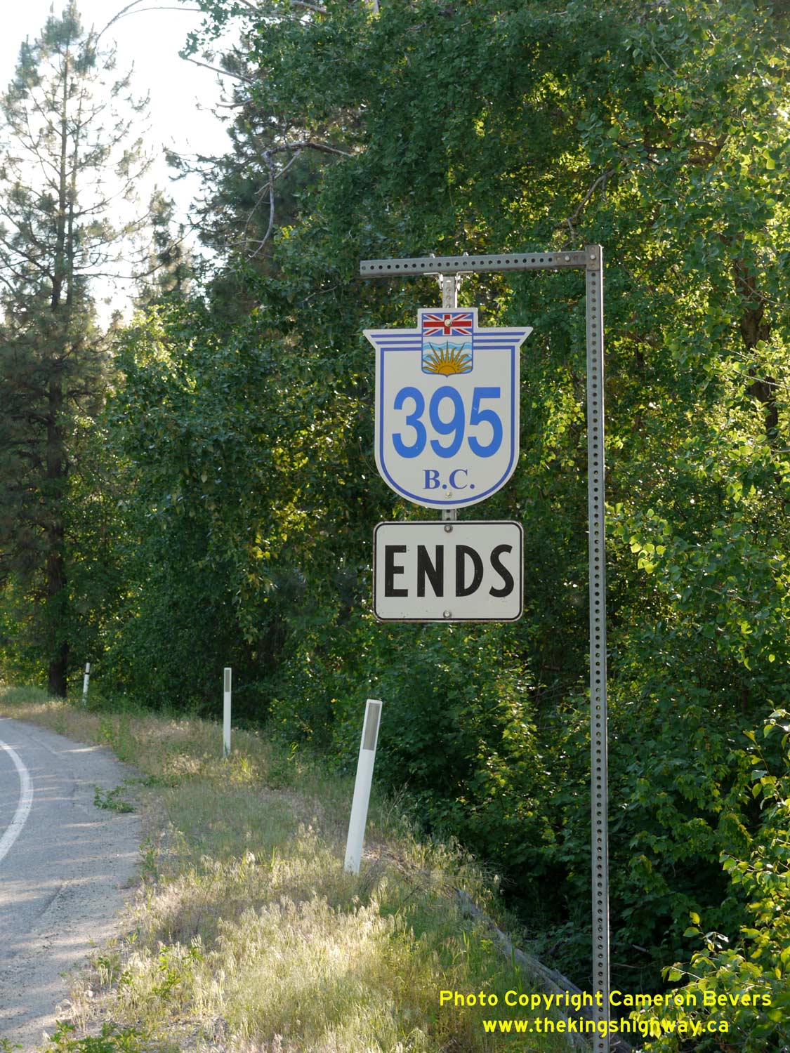

Left - Hwy 395 Ends route marker approaching the highway's northern terminus near Christina Lake, British Columbia. After travelling about 2,100 km (1,300
miles) north from the suburban fringes of Los Angeles, California, Hwy 395 comes to an end at the Crowsnest Highway (Hwy 3) just west of Christina Lake. See an
Enlarged Photo Here. (Photograph taken on June 12, 2017 - © Cameron Bevers) Right - A British Columbia Hwy 395 route marker near the Crowsnest Highway (Hwy 3) Junction. See an Enlarged Photo Here. (Photograph taken on June 12, 2017 - © Cameron Bevers) 

Left - Facing north along Hwy 395 at the Kettle River Bridge. See an
Enlarged Photo Here. (Photograph taken on June 12, 2017 - © Cameron Bevers) Right - Side view of the Kettle River Bridge on Hwy 395 near Christina Lake. See an Enlarged Photo Here. (Photograph taken on June 12, 2017 - © Cameron Bevers) 

Left - View of the Kettle River from Hwy 395, facing west. The river runs through a deep scenic gorge as it approaches Hwy 395. See an
Enlarged Photo Here. (Photograph taken on June 12, 2017 - © Cameron Bevers) Right - Kettle River facing east from the Hwy 395 Bridge. See an Enlarged Photo Here. (Photograph taken on June 12, 2017 - © Cameron Bevers) 

Left - Facing south along Hwy 395 at the Kettle River Bridge near Christina Lake. See an
Enlarged Photo Here. (Photograph taken on June 12, 2017 - © Cameron Bevers) Right - Guide sign on northbound Hwy 395 showing the destinations along the westbound Crowsnest Highway (Hwy 3). See an Enlarged Photo Here. (Photograph taken on June 12, 2017 - © Cameron Bevers) 

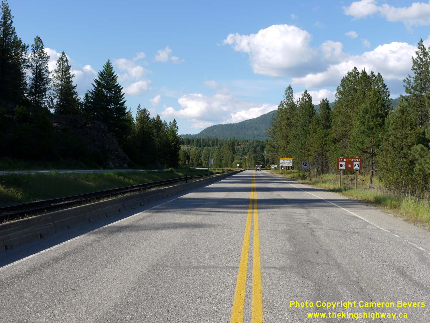
Left - Facing south along Hwy 395 about 500 metres north of the US Border. As the sign at right indicates, the Laurier Border Crossing is not open 24 hours.
The border is only open from 8:00 a.m. to 12 midnight daily. See an
Enlarged Photo Here. (Photograph taken on June 12, 2017 - © Cameron Bevers) Right - Facing north along Hwy 395 about 500 metres north of the US Border. Hwy 395 ends at the Hwy 3 Junction, about 4 km ahead. See an Enlarged Photo Here. (Photograph taken on June 12, 2017 - © Cameron Bevers) 
Left - Welcome to British Columbia sign on northbound Hwy 395 near the Canada-United States Border. See an
Enlarged Photo Here. (Photograph taken on June 12, 2017 - © Cameron Bevers) Right - Facing north along Hwy 395 from the Canada-United States Border near Laurier, Washington. Note the sign at right reminding American motorists that measurements seen along Canadian highways, such as speed limits and distances, are displayed in Metric measurements rather than Imperial measurements. See an Enlarged Photo Here. (Photograph taken on June 12, 2017 - © Cameron Bevers) 
Above - Facing south along Hwy 395 approaching the Canada-United States Border near Laurier, Washington. British Columbia's Hwy 395 ends here, but the route
continues on the other side of the boundary as US Route 395. See an
Enlarged Photo Here. (Photograph taken on June 12, 2017 - © Cameron Bevers) |
|---|
Links to Adjacent BC Highway Photograph Pages:
Back to BC Highway 99 Photos /
British Columbia Highways Photo Index /
Back to BC Highway 1 Photos
Ontario Highway History - Main Menu / Vacation Highway Photos - Main Menue Website contents, photos & text © 2002-2026, Cameron
Bevers (Webmaster) - All Rights Reserved / Contact Me
|
|---|