
| 
| |
|
|
This page contains photographs of British Columbia's Highway 3 (Crowsnest Highway), arranged by location from Grand Forks
westerly to Rock Creek. All photographs displayed on this page were taken by the Webmaster (Cameron Bevers). To view photos of other British Columbia Highways, please
select a highway number listed on the British Columbia Photograph Index Page. Click on any
thumbnail to see a larger image!
Please note that all photographs displayed on this website are protected by copyright. These photographs must not be
reproduced, published, electronically stored or copied, distributed, or posted onto other websites without my written permission. If you want to use photos from this
website, please email me first for permission. Thank-you!
|
|---|
|
Page 7: BC Highway 3 (Crowsnest Highway) Photographs: Grand Forks to Rock Creek


Left - Facing east along the Crowsnest Highway (Hwy 3) towards Grand Forks from the Hwy 41 Junction. The town centre lies about 2 km east of the Hwy 41
Junction. See an Enlarged Photo Here. (Photograph taken on June 12, 2017 - © Cameron Bevers) Right - Approaching the Hwy 41 Junction on Hwy 3, facing west towards Greenwood. See an Enlarged Photo Here. (Photograph taken on June 12, 2017 - © Cameron Bevers) 
Above - A British Columbia Hwy 41 route marker on the westbound Crowsnest Highway (Hwy 3). See an
Enlarged Photo Here. (Photograph taken on June 12, 2017 - © Cameron Bevers) 

Left - Green guide sign marking the Hwy 41 Junction to Danville, Washington. At this point, the Crowsnest Highway (Hwy 3) is less than 2 km from the US Border.
As the sign indicates, the Danville Border Crossing is not open 24 hours. The border is only open from 8:00 a.m. to 12 midnight daily. See an
Enlarged Photo Here. (Photograph taken on June 12, 2017 - © Cameron Bevers) Right - Junction sign assembly approaching the Hwy 41 Junction on westbound Hwy 3. See an Enlarged Photo Here. (Photograph taken on June 12, 2017 - © Cameron Bevers) 

Left - Facing south along Hwy 41 from the Hwy 3 Junction near Grand Forks. Hwy 41 is BC's shortest signed provincial highway, with a total length of just over
1 km. The highway essentially just serves as an access road to the Danville Border Crossing. See an
Enlarged Photo Here. (Photograph taken on June 12, 2017 - © Cameron Bevers) Right - Northern terminus of Hwy 41 at the Crowsnest Highway (Hwy 3) Junction west of Grand Forks. See an Enlarged Photo Here. (Photograph taken on June 12, 2017 - © Cameron Bevers) 

Left - Hwy 3 & Hwy 41 route marker assembly on the eastbound Crowsnest Highway. See an
Enlarged Photo Here. (Photograph taken on June 12, 2017 - © Cameron Bevers) Right - Guide sign on eastbound Hwy 3 approaching the Hwy 41 turn-off to Danville, Washington. See an Enlarged Photo Here. (Photograph taken on June 12, 2017 - © Cameron Bevers) 

Left - Approaching the Hwy 41 Junction on the Crowsnest Highway (Hwy 3), facing east towards Grand Forks. See an
Enlarged Photo Here. (Photograph taken on June 12, 2017 - © Cameron Bevers) Right - Facing west along Hwy 3 towards Greenwood from the Hwy 41 Junction near Grand Forks. See an Enlarged Photo Here. (Photograph taken on June 12, 2017 - © Cameron Bevers) 

Left - Distance guide sign on westbound Hwy 3 near the Hwy 41 Junction. See an
Enlarged Photo Here. (Photograph taken on June 12, 2017 - © Cameron Bevers) Right - This sweeping curve is located on Hwy 3 about 1 km west of the Hwy 41 Junction. See an Enlarged Photo Here. (Photograph taken on June 12, 2017 - © Cameron Bevers) 

Left - West of Grand Forks, the Crowsnest Highway (Hwy 3) leaves the grasslands behind and climbs fairly quickly into the mountains. See an
Enlarged Photo Here. (Photograph taken on June 12, 2017 - © Cameron Bevers) Right - The Crowsnest Highway nearly touches the US Border west of Grand Forks. All of the mountains in the background are located across the border in Washington State. See an Enlarged Photo Here. (Photograph taken on June 12, 2017 - © Cameron Bevers) 

Left - Distance guide sign on westbound Hwy 3 between Grand Forks and Greenwood. See an
Enlarged Photo Here. (Photograph taken on June 12, 2017 - © Cameron Bevers) Right - Distance guide sign on eastbound Hwy 3, located about half-way between Greenwood and Grand Forks. See an Enlarged Photo Here. (Photograph taken on June 12, 2017 - © Cameron Bevers) 

Left - Facing east along Hwy 3 towards Grand Forks from Eholt Summit. The pass lies about 24 km west of Grand Forks. See an
Enlarged Photo Here. (Photograph taken on June 12, 2017 - © Cameron Bevers) Right - Sign marking Eholt Summit on the Crowsnest Highway (Hwy 3), about 25 km west of Grand Forks. The summit is 1,028 metres (3,373 feet) above sea level. See an Enlarged Photo Here. (Photograph taken on June 12, 2017 - © Cameron Bevers) 

Left - Facing west along the Crowsnest Highway (Hwy 3) at Eholt Summit. See an
Enlarged Photo Here. (Photograph taken on June 12, 2017 - © Cameron Bevers) Right - Distance guide sign on westbound Hwy 3 about 29 km west of Grand Forks. See an Enlarged Photo Here. (Photograph taken on June 12, 2017 - © Cameron Bevers) 

Left - Distance guide sign on eastbound Hwy 3, about 13 km east of Greenwood. See an
Enlarged Photo Here. (Photograph taken on June 12, 2017 - © Cameron Bevers) Right - The Crowsnest Highway's western descent from Eholt Summit is fairly gradual. See an Enlarged Photo Here. (Photograph taken on June 12, 2017 - © Cameron Bevers) 

Left - Dusk over the Crowsnest Highway (Hwy 3), about 5 km east of Greenwood. See an
Enlarged Photo Here. (Photograph taken on June 12, 2017 - © Cameron Bevers) Right - The ridge of Eholt Summit can be seen in the distance, as Hwy 3 heads east towards Grand Forks near Greenwood. See an Enlarged Photo Here. (Photograph taken on June 12, 2017 - © Cameron Bevers) 

Left - Facing east along Hwy 3 about 4 km east of Greenwood. See an
Enlarged Photo Here. (Photograph taken on June 12, 2017 - © Cameron Bevers) Right - Facing east along Hwy 3 from Boundary Creek Road near Greenwood. See an Enlarged Photo Here. (Photograph taken on June 13, 2017 - © Cameron Bevers) 

Left - Facing west along Hwy 3 from Boundary Creek Road near Greenwood. See an
Enlarged Photo Here. (Photograph taken on June 13, 2017 - © Cameron Bevers) Right - This abandoned highway tunnel used to carry Hwy 3 below the Kettle River Railway. The railway was ultimately abandoned, and the highway was realigned to bypass the old tunnel. A date stamp above the tunnel arch indicates that it was built in 1913. See an Enlarged Photo Here. (Photograph taken on June 13, 2017 - © Cameron Bevers) 

Left - The fill covering the old highway tunnel at Greenwood was excavated back, exposing the concrete structure underneath the former Kettle River Railway.
The old structure has become quite the canvas for graffiti artists. See an
Enlarged Photo Here. (Photograph taken on June 13, 2017 - © Cameron Bevers) Right - Western end of the Greenwood Tunnel on a bypassed section of the Crowsnest Highway (Hwy 3). Motorists driving the Crowsnest Highway during the early years would have to wait their turn to pass through this narrow one-lane structure. See an Enlarged Photo Here. (Photograph taken on June 13, 2017 - © Cameron Bevers) 

Left - Revised grade of Hwy 3 beside the Greenwood Tunnel. There would have been several sharp curves in the highway while the tunnel was in operation. See an
Enlarged Photo Here. (Photograph taken on June 13, 2017 - © Cameron Bevers) Right - Facing west along the Crowsnest Highway (Hwy 3) from Mineral Street in Greenwood. See an Enlarged Photo Here. (Photograph taken on June 13, 2017 - © Cameron Bevers) 

Left - Facing east along Hwy 3 (Copper Avenue) from Centre Street in Greenwood. See an
Enlarged Photo Here. (Photograph taken on June 13, 2017 - © Cameron Bevers) Right - Facing west along Hwy 3 (Copper Avenue) from Greenwood Street. Downtown Greenwood has many historic buildings which date from the mining boom days of the 1890s. See an Enlarged Photo Here. (Photograph taken on June 13, 2017 - © Cameron Bevers) 

Left - The Crowsnest Highway (Hwy 3) also serves as Greenwood's main street, known as Copper Avenue. Greenwood exploded in size during the 1890s after gold,
silver and copper were discovered in the area. Although it was formally incorporated as a city in 1897, Greenwood nearly became a ghost town after the copper mining
industry declined after World War I. See an Enlarged Photo Here. (Photograph taken on June 13, 2017 - © Cameron Bevers) Right - The main block of Greenwood is particularly photogenic. Victorian-era buildings are rather uncommon in British Columbia, so this well-preserved main block offers an interesting time capsule of buildings from the boom town mining era of BC's interior. The 1955 Chevy Bel Air Wagon, which belongs to the proprietors of the Copper Eagle Bakery, only adds to the nostalgic feel of the town's main street. See an Enlarged Photo Here. (Photograph taken on June 13, 2017 - © Cameron Bevers) 

Left - Greenwood entrance sign on the eastbound Crowsnest Highway (Hwy 3). The brick chimney attached to the sign is intended to serve as a replica of
Greenwood's copper smelter, which in its heyday produced an astonishing quantity of refined, locally-mined copper. At its peak, the BC Copper Company's smelter was
producing 2,000 tons of refined copper per day. The ruins of the actual smelter chimney can be seen at left, just over the tree line. See an
Enlarged Photo Here. (Photograph taken on June 13, 2017 - © Cameron Bevers) Right - Distance guide sign on the westbound Crowsnest Highway (Hwy 3) departing Greenwood. See an Enlarged Photo Here. (Photograph taken on June 13, 2017 - © Cameron Bevers) 

Left - Facing west along the Crowsnest Highway (Hwy 3) towards Rock Creek, departing Greenwood. See an
Enlarged Photo Here. (Photograph taken on June 13, 2017 - © Cameron Bevers) Right - West of Greenwood, the scenery along Hwy 3 begins to change as the forests start to recede and the grasslands make a gradual return. See an Enlarged Photo Here. (Photograph taken on June 13, 2017 - © Cameron Bevers) 

Left - Facing east along the Crowsnest Highway (Hwy 3) about 6 km west of Greenwood, near Boundary Falls. See an
Enlarged Photo Here. (Photograph taken on June 13, 2017 - © Cameron Bevers) Right - Hwy 3 rounds this sweeping reverse curve as it approaches Midway from the east. See an Enlarged Photo Here. (Photograph taken on June 13, 2017 - © Cameron Bevers) 

Left - Midway entrance sign on the westbound Crowsnest Highway (Hwy 3). The Village of Midway is situated about half-way between Greenwood and Rock Creek.
See an Enlarged Photo Here. (Photograph taken on June 13, 2017 - © Cameron Bevers) Right - Approaching Florence Street on Hwy 3, facing west. The Midway Border Crossing is accessible via Florence Street, which connects to Toroda, Washington. The border crossing at Midway is fairly lightly travelled, and is thus only open during regular business hours from 9:00 a.m. to 5:00 p.m. daily. See an Enlarged Photo Here. (Photograph taken on June 13, 2017 - © Cameron Bevers) 

Left - This guide sign at the intersection of Florence Street and Hwy 3 provides directions to major centres along the Crowsnest Highway. See an
Enlarged Photo Here. (Photograph taken on June 13, 2017 - © Cameron Bevers) Right - Distance guide sign on the eastbound Crowsnest Highway (Hwy 3) in Midway. See an Enlarged Photo Here. (Photograph taken on June 13, 2017 - © Cameron Bevers) 

Left - Facing east along Hwy 3 approaching Florence Street in Midway. See an
Enlarged Photo Here. (Photograph taken on June 13, 2017 - © Cameron Bevers) Right - Distance guide sign on the westbound Crowsnest Highway (Hwy 3) in Midway. See an Enlarged Photo Here. (Photograph taken on June 13, 2017 - © Cameron Bevers) 

Left - Facing east along Hwy 3 about 1 km west of Florence Street in Midway. Like many of BC's interior towns, Midway is situated at the bottom of a valley.
See an Enlarged Photo Here. (Photograph taken on June 13, 2017 - © Cameron Bevers) Right - Approaching Midway on the Crowsnest Highway (Hwy 3), facing east. See an Enlarged Photo Here. (Photograph taken on June 13, 2017 - © Cameron Bevers) 

Left - Distance guide sign on eastbound Hwy 3 near the Kettle River Bridge west of Midway. See an
Enlarged Photo Here. (Photograph taken on June 13, 2017 - © Cameron Bevers) Right - A lone rider heads westbound on the Crowsnest Highway (Hwy 3), approaching the Kettle River Bridge. The Crowsnest Highway is filled with scenic vistas such as this one. See an Enlarged Photo Here. (Photograph taken on June 13, 2017 - © Cameron Bevers) 

Left - Northern side of the Kettle River Bridge on the Crowsnest Highway (Hwy 3), about 9 km west of Midway. See an
Enlarged Photo Here. (Photograph taken on June 13, 2017 - © Cameron Bevers) Right - Facing west along Hwy 3 at the Kettle Creek Bridge between Midway and Rock Creek. See an Enlarged Photo Here. (Photograph taken on June 13, 2017 - © Cameron Bevers) 

Left - The Kettle River Bridge on Hwy 3 is a four-span structure, consisting of two steel beam approach spans and a two-span Warren-type deck truss
superstructure. Before the Kettle Valley Railway was abandoned, it passed below this bridge through the approach span in the foreground. Traces of the graded railway
bed can still be seen today. See an Enlarged Photo Here. (Photograph taken on June 13, 2017 - © Cameron Bevers) Right - Approaching Rock Creek on the Crowsnest Highway (Hwy 3), facing west. See an Enlarged Photo Here. (Photograph taken on June 13, 2017 - © Cameron Bevers) 

Left - Distance guide sign on eastbound Hwy 3 departing Rock Creek. See an
Enlarged Photo Here. (Photograph taken on June 13, 2017 - © Cameron Bevers) Right - Facing west along the Crowsnest Highway (Hwy 3) through Rock Creek. See an Enlarged Photo Here. (Photograph taken on June 13, 2017 - © Cameron Bevers) 

Left - At Rock Creek, the Crowsnest Highway connects to Hwy 33. This highway departs from Rock Creek and heads northwesterly to Kelowna. See an
Enlarged Photo Here. (Photograph taken on June 13, 2017 - © Cameron Bevers) Right - Facing east along Hwy 33 towards Midway from the Hwy 33 Junction in Rock Creek. See an Enlarged Photo Here. (Photograph taken on June 13, 2017 - © Cameron Bevers) 
Above - Hwy 3 & Hwy 33 Junction assembly on the westbound Crowsnest Highway in Rock Creek. See an
Enlarged Photo Here. (Photograph taken on June 13, 2017 - © Cameron Bevers) 

Left - Approaching the Hwy 33 Junction on the westbound Crowsnest Highway (Hwy 3) in Rock Creek. From here, motorists can either continue straight ahead via
Hwy 3 towards Osoyoos and Vancouver, or turn right and follow Hwy 33 towards Kelowna and Vernon. Regardless of the route chosen, fill up in Rock Creek - it is a long
way before another gas station is seen. See an Enlarged Photo Here. (Photograph taken on June 13, 2017 - © Cameron Bevers) Right - Facing north along Hwy 33 towards Kelowna from the Hwy 3 Junction in Rock Creek. The Kelowna-Rock Creek Highway (Hwy 33) is a relative newcomer in the British Columbia highway system. When the highway was first opened to traffic in 1970, it reduced the highway distance between Kelowna and Rock Creek by 50 km. See an Enlarged Photo Here. (Photograph taken on June 13, 2017 - © Cameron Bevers) 

Left - Approaching the Crowsnest Highway (Hwy 3) on southbound Hwy 33 in Rock Creek. Due to the adjacent grade on Hwy 3, the intersection is extremely skewed
and inconspicuous - the hydro pole line in the background follows Hwy 3. Accordingly, motorists using this junction should use extra caution. See an
Enlarged Photo Here. (Photograph taken on June 13, 2017 - © Cameron Bevers) Right - Hwy 3 begins its long ascent up the mountainside west of the Hwy 33 Junction in Rock Creek. See an Enlarged Photo Here. (Photograph taken on June 13, 2017 - © Cameron Bevers) 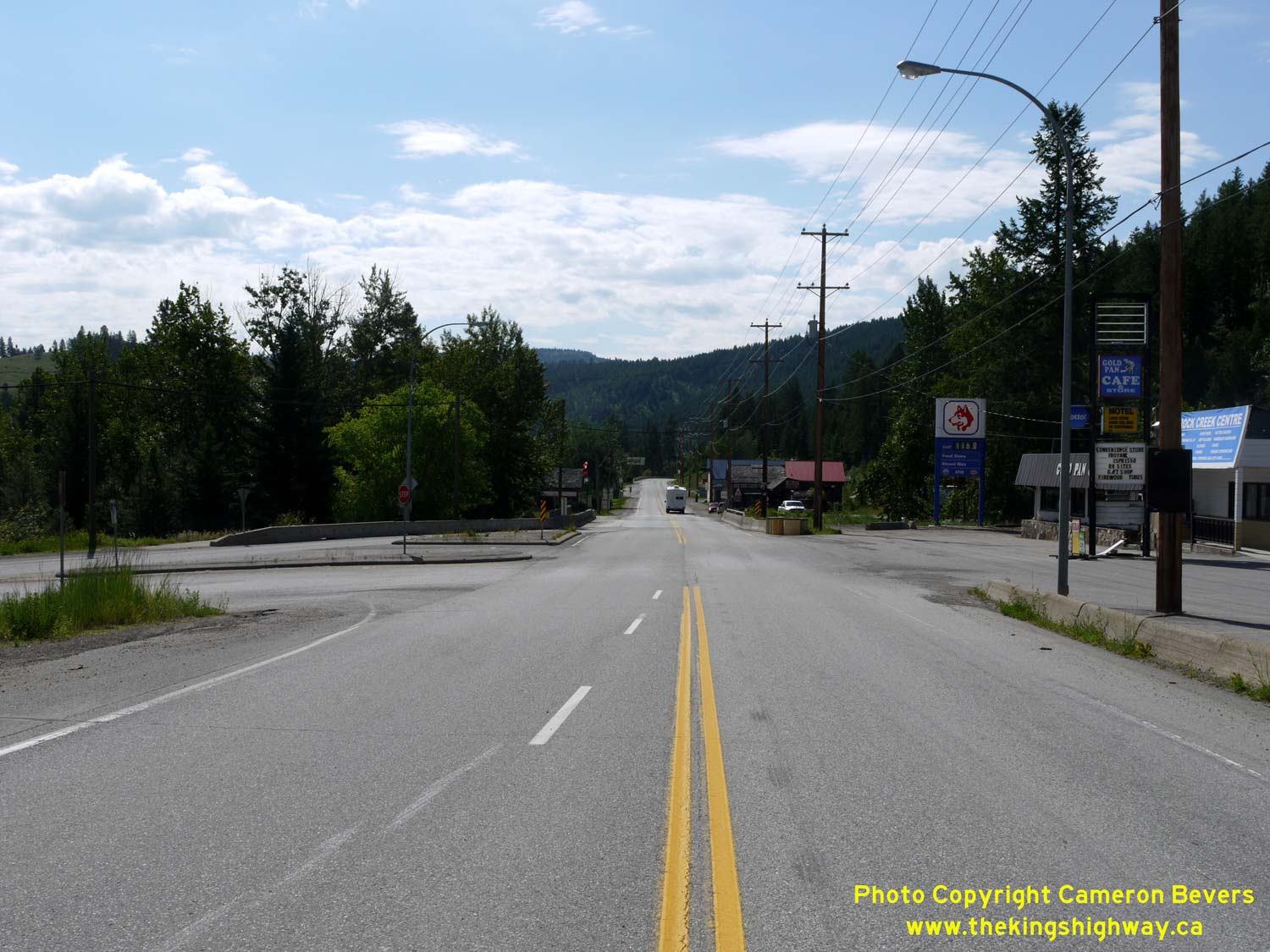

Left - Facing east along the Crowsnest Highway (Hwy 3) at the Hwy 33 Junction in Rock Creek. See an
Enlarged Photo Here. (Photograph taken on June 13, 2017 - © Cameron Bevers) Right - Distance guide sign on the westbound Crowsnest Highway (Hwy 3) departing Rock Creek. Between here and Osoyoos, Hwy 3 climbs quickly towards Anarchist Summit. The elevation of the mountain pass is 1,233 metres (4,045 feet) above sea level. The summit lies about 20 km west of the Hwy 33 Junction. See an Enlarged Photo Here. (Photograph taken on June 13, 2017 - © Cameron Bevers) 

Left - Approaching Rock Creek on the eastbound Crowsnest Highway (Hwy 3). See an
Enlarged Photo Here. (Photograph taken on June 13, 2017 - © Cameron Bevers) Right - Junction assembly for the upcoming Hwy 33 Junction on eastbound Hwy 3 in Rock Creek. See an Enlarged Photo Here. (Photograph taken on June 13, 2017 - © Cameron Bevers)
Continue west along BC Highway 3 from Rock Creek to Osoyoos |
|---|
Links to Adjacent BC Highway Photograph Pages:
Back to BC Highway 1 Photos /
British Columbia Highways Photo Index /
On to BC Highway 3A Photos
Ontario Highway History - Main Menu / Vacation Highway Photos - Main Menu Website contents, photos & text © 2002-2026, Cameron
Bevers (Webmaster) - All Rights Reserved / Contact Me
|
|---|