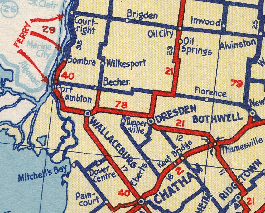
Ontario King's Highway 78 Historical Route Maps
Route of King's Highway 78 as it existed following assumption in 1938. See an
Enlarged Map Here
.
(Excerpt from the 1938-39 Official Ontario Road Map - © King's Printer for Ontario, 1938)
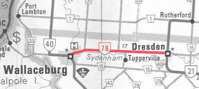
Route of King's Highway 78 in 1968, showing the concurrent routing with Hwy 21 from Dresden to Thamesville.
(Excerpt from the 1968 Official Ontario Road Map - © King's Printer for Ontario, 1968)
Route of King's Highway 78 in the 1990s, shortly before the highway was downloaded.
(Excerpt from the 1990-1991 Official Ontario Road Map - © King's Printer for Ontario, 1990)
Links to Other King's Highway Website Pages:
Back to King's Highway 78 Page
Ontario Highway History - Main Menu
/
Back to List of Highways
Website contents, photos & text © 2002-2026, Cameron Bevers (Webmaster) - All Rights Reserved /
Contact Me