Ontario King's Highway 9 Historical Route Maps
Route of Highway 9 as it existed from 1920 up until 1930. See an Enlarged Map Here.
(Excerpt from the 1930-31 Official Ontario Road Map - © King's Printer for Ontario, 1930)
|

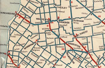
Route of Highway 9 as it existed following the route extensions of 1930 and 1931. See an Enlarged Map Here.
(Excerpt from the 1933-34 Official Ontario Road Map - © King's Printer for Ontario, 1933)
|

Route of Highway 9 as it existed following the route renumbering east of Orangeville in 1937. See an Enlarged Map Here.
(Excerpt from the 1938-39 Official Ontario Road Map - © King's Printer for Ontario, 1938)
|

Route of Highway 9 as it existed following the Newmarket extension in 1965. See an Enlarged Map Here.
(Excerpt from the 1966 Official Ontario Road Map - © King's Printer for Ontario, 1966)
|

Completed route of Highway 9, showing the new section from Schomberg to Holland Marsh completed in 1969. See an Enlarged Map Here.
(Excerpt from the 1970 Official Ontario Road Map - © King's Printer for Ontario, 1970)
|

Route of Highway 9 as it existed prior to 1997.
Map Courtesy of Bing Maps (Retrieved August 16, 2010) - Link to this map at Bing Maps
|
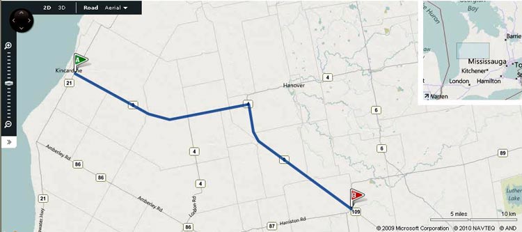
Route of Highway 9 as it appears today (Western Section: Harriston to Kincardine).
Map Courtesy of Bing Maps (Retrieved August 16, 2010) - Link to this map at Bing Maps
|

Route of Highway 9 as it appears today (Eastern Section: Orangeville to Highway 400).
Map Courtesy of Bing Maps (Retrieved August 16, 2010) - Link to this map at Bing Maps
|
|
|---|
Links to Other King's Highway Website Pages:
Website contents, photos & text © 2002-2026, Cameron
Bevers (Webmaster) - All Rights Reserved / Contact Me
|
|---|


