| 
| |
|
|
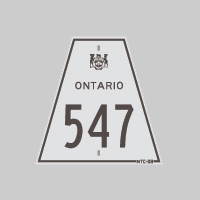
History of Secondary Highway 547 (#1):
The first Secondary Highway 547 was a local highway that served as an access road from Sudbury to Frood Mine. Highway 547 was designated by an Order-in-Council dated
May 9, 1956 and was first depicted on a Preliminary Route Plan dated May 1956. The new highway was originally 1 mile (1.6 km) in length. The route began at the
Sudbury North Limits (near the present-day intersection of Burton Avenue) and continued north to the Frood Mine Entrance. Official Ontario Road Maps issued between
1956 and 1960 suggest that Highway 547 was signed through Sudbury via Frood Road and Lorne Street as far south as Highway 17 (Elm Street). This urban portion of
Highway 547 was not assumed by the Department of Highways of Ontario (DHO), and thus this section remained under municipal jurisdiction. This urban section is not
reflected in the "official" length of Highway 547, which stood at 1 mile throughout the route's short existence between 1956 and 1960. The highway to Frood Mine was
already paved at the time of designation in 1956. The provincially-owned section of Highway 547 was transferred from the province to the City of Sudbury, effective
November 18, 1960. A different, unrelated Highway 547 was established in the Wawa area in 1964.
|
|---|
Links to Adjacent Secondary Highway Pages: Website contents, photos & text © 2002-2025, Cameron
Bevers (Webmaster) - All Rights Reserved / Contact Me |
|---|