| 
| |
|
|
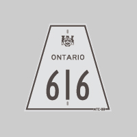
History of Secondary Highway 616:
Secondary Highway 616 was a local highway in the District of Sudbury that provided access from Highway 101 to Palomar, located between Foleyet and Timmins. When the
highway was first established back in the 1950s, Highway 616 was a much longer route. Most of Highway 616 was ultimately incorporated into the route of
Highway 101 in 1960.
Highway 616 was designated by an Order-in-Council dated May 9, 1956, and was first depicted on two Preliminary Route Plans prepared by the Department of Highways of Ontario (DHO) in June 1956. Highway 616 originally began in the District of Timiskaming at Highway 101's western terminus at Warren Lake. From there, the highway extended west for 21 miles into the District of Sudbury towards Palomar. Grading of the final section of Highway 616 was completed to Palomar in late 1956. Paving began on Highway 616 in 1957, when a primed bituminous surface was constructed along the eastern portion of the highway. During 1960, the entire route of Highway 624 leading to Foleyet and a large section of Highway 616 from the Highway 624 Junction east of Palomar to Warren Lake were designated as part of King's Highway 101 by an Order-in-Council. The change in designation and route numbers took place on April 1, 1960. For many years, the bypassed section of Highway 616 leading to Palomar from the Highway 101 Extension was retained in the provincial highway system. However, the route served very limited local traffic in this sparsely-populated region of Ontario. Accordingly, the Ministry of Transportation and Communications (MTC) decided to relinquish its jurisdiction and control over the remaining portion of Highway 616. An Order-in-Council was signed in 1987, which formally removed the provincial highway designation of Highway 616, effective September 30, 1987. Today, the former highway route is known as Horwood Lake Road and an unnamed road leading to Palomar. |
|---|
Links to Adjacent Secondary Highway Pages: Website contents, photos & text © 2002-2025, Cameron
Bevers (Webmaster) - All Rights Reserved / Contact Me |
|---|