Ontario King's Highway 15 Historical Route Maps
Route map of Provincial Highway 15 approaching Ottawa via Base Line Road, as it existed between 1921 and 1926. See an
Enlarged Map Here.
Excerpt from the 1925 Official Ontario Road Map - © King's Printer for Ontario, 1925
|
Route map of Provincial Highway 15 approaching Ottawa via Richmond Road, as it existed after 1926. See an
Enlarged Map Here.
Excerpt from the 1927 Official Ontario Road Map - © King's Printer for Ontario, 1927
|
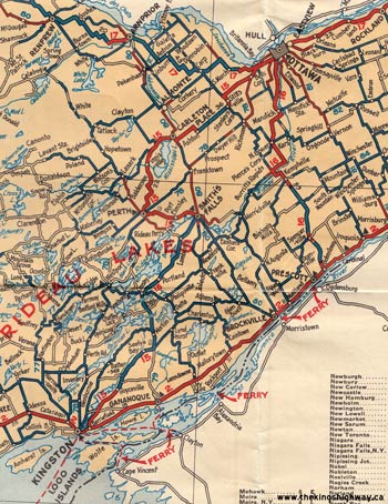
Route map of Provincial Highway 15 between Kingston and Ottawa, as it existed in 1927. See an
Enlarged Map Here.
Excerpt from the 1927 Official Ontario Road Map - © King's Printer for Ontario, 1927
|
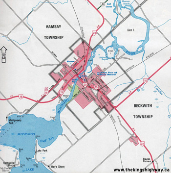
Detailed route map of King's Highway 15 Carleton Place Cut Off as it existed between 1948 and 1953. See an
Enlarged Map Here.
Base map excerpt from the Ontario Transportation Map Series - © King's Printer for Ontario, 1991
Alterations & Additions by Josh Anderchek - © 2023-2026
|

Route map of King's Highway 15 between Smiths Falls and Ottawa via Perth, as it existed in 1961 prior to the extension of Highway 43. See an
Enlarged Map Here.
Excerpt from the 1961 Official Ontario Road Map - © King's Printer for Ontario, 1961
|

Route map of King's Highway 15 between Smiths Falls and Ottawa via Franktown, as it existed in 1962 after the extension of Highway 43 to Perth and the resulting
rerouting of Highway 15 between Smiths Falls and Carleton Place in 1961. Note the overlapped routing with Highway 29 and Highway 7. See an
Enlarged Map Here.
Excerpt from the 1962 Official Ontario Road Map - © King's Printer for Ontario, 1962
|
Route map of King's Highway 15 between Smiths Falls and Carleton Place, as it existed after the route of Highway 15 was truncated at Highway 7 in Carleton Place in
1970. After 1970, the route of Highway 15 no longer entered into the Ottawa area. See an
Enlarged Map Here.
Excerpt from the 1971 Official Ontario Road Map - © King's Printer for Ontario, 1971
|
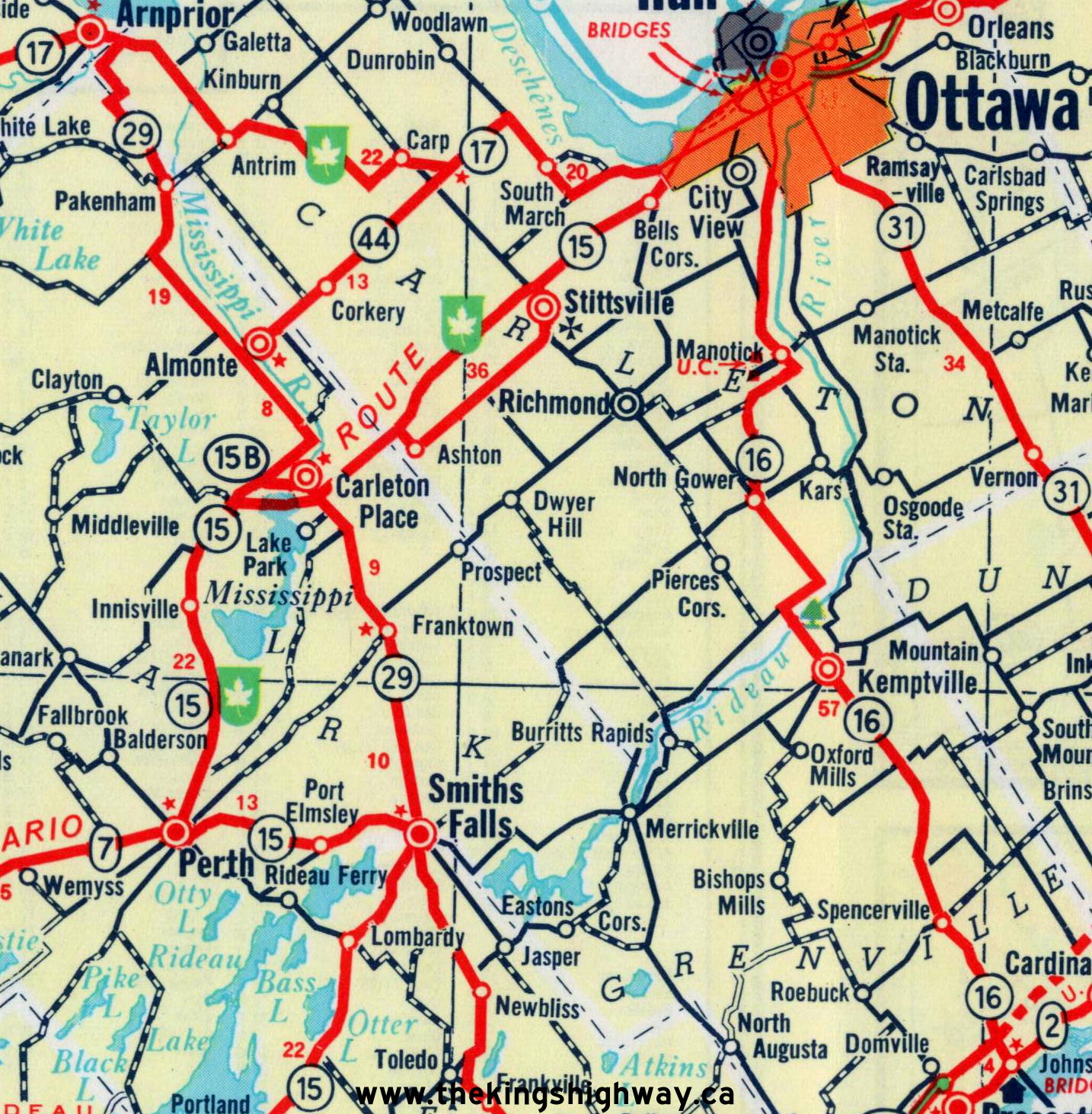
Route map of King's Highway 15 between Smiths Falls and Arnprior, as it existed after the route of Highway 15 was extended north to Arnprior in 1984 via the former
route of Highway 29. This route of Highway 15 remained in effect until the mass highway downloading during the late 1990s. See an
Enlarged Map Here.
Excerpt from the 1986-1987 Official Ontario Road Map - © King's Printer for Ontario, 1986
|

Route map of King's Highway 15 as it exists today. The northern section of Highway 15 from Carleton Place to Arnprior is now a municipal highway, as is the
southernmost section of Highway 15 from Highway 2 at Barriefield northerly to the Highway 401 Interchange. See an
Enlarged Map Here.
Excerpt from the 1999 Official Ontario Road Map - © King's Printer for Ontario, 1999
|
|
|---|
Links to Other King's Highway Website Pages:
Website contents, photos & text © 2002-2026, Cameron
Bevers (Webmaster) - All Rights Reserved / Contact Me
|
|---|